A Walk in the Black Forest (Part 1)

Getting There - Freiburg

It was great to finally see our daughter Robyn, Salim and the girls again - both Aisha and Lina had developed a lot since we last saw them, with 3-year old Aisha chattering away in German and English interchangeably, and Lina now an alert and smiley 6-month old. For the next four weeks, we more or less re-entered the suburban lifestyle, as Salim had found us a one bedroom apartment, five minutes walk from their house in the suburb of Vauban. It was the ideal location - 15 minutes by tram from the heart of the old city and less than 15 minutes walk to the fields, vineyards and forests of the Schönberg hills. The urban-rural interface of this gateway to the Black Forest is something special.

It was also interesting to see how the average Freiburger lives, although I doubt that the residents of Vauban, a sort of high-density, child-friendly and partially car-free eco-village, are very "average". There are more bikes pulling baby-buggies than cars here, the rooves are arrayed with solar panels and the grocery stores are organic. Well, that is the impression of an outsider!


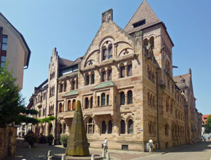
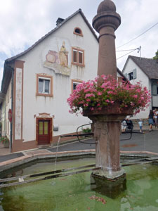
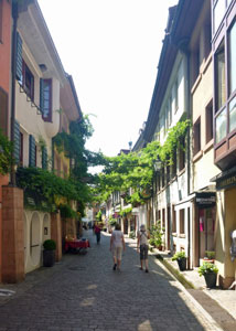
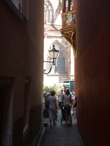
In a Freiburg side alley

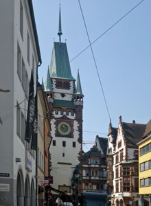
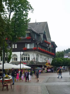
Freiburg streetscape

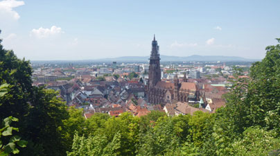
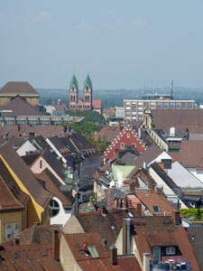
View over the rooves of Freiburg


The bishop's residence


Vineyards and houses of the Dreisam Valley


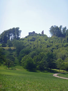
The castle ruins on Schönberg


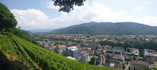
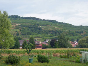
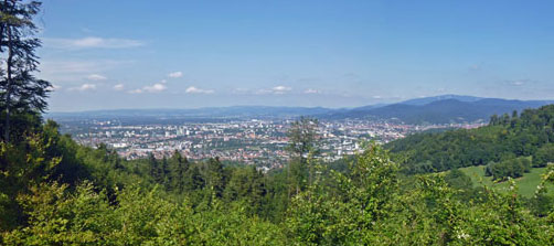
Freiburg beyond the green hills of Schönberg

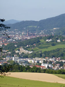
The rural-urban interface of Freiburg

It was, in fact, a great relief not to be constantly on the go for a while and we enjoyed the slower pace of life. For the first two weeks, we were under the influence of the great European heat wave, with temperatures consistently in the mid-30s and higher. Life revolved around water, with trips by bike and tram to pools and lakes, or to the little creek that flows through Vauban, which Aisha and Lina enjoyed immensely.

As the weather cooled, we did a bit more walking. Freiburg is the gateway to the famous Black Forest of Germany - a hikers' paradise, with a vaste network of well-signed wanderwegs (tracks) that take in every corner of it. It was difficult to choose which walks to do and, when walking with little children, the distance one can walk is more limited. Thus, the following section describes a series of short day-walks that we did as an extended family, as we got to know a little more of the picturebook landscapes of this beautiful corner of Germany.


Tower of the Freiburger Münster

Kaiserstuhl (10 km - 310m ascent - 310m descent)

The Kaiserstuhl is an isolated broad and gently-sloping hill of volcanic origin, lying in the plain between the Black Forest and the Rhine River. It is famous for its wines and grapes have been grown on its terraced slopes for over four centuries. Not far from where I grew up as a teenager in the land of Oz, there is another Kaiserstuhl of wine-growing fame, but a much more recent one. It had clearly been named in honour of the one here in Germany and a walk through the original Kaiserstuhl seemed a good thing to do.


A fountain in Wasenweiler

It was a family outing, 11 in all, with the fair Nello and I, our daughter and her family plus assorted cousins and in-laws. It took a lot of organising just to get on the train that took us from Freiburg to the little village of Wasenweiler, our starting point, but we made it.


The slopes of the Kaiserstuhl from Wasenweiler


Hard track for a buggy

From the station, the caravan of walkers, with the grand-children in sling and stroller respectively, headed north through the village streets and up past the old church. The yellow and white diamond track markers pointed us to a short-cut that led us directly uphill through a narrow overgrown gully that tested the driving skills of the stroller pusher and brought us out into the fields above the village.


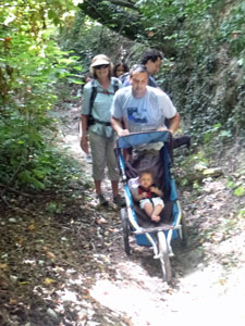
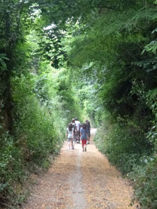
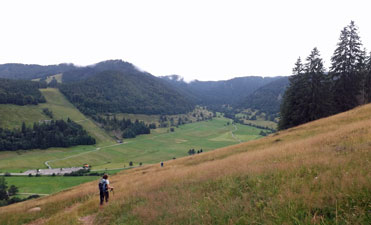
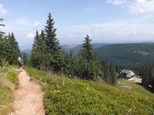
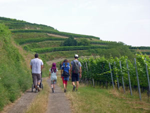
Wandering along the Panoramenweg ....

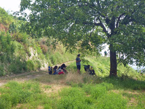
.... with time for a rest in the shade

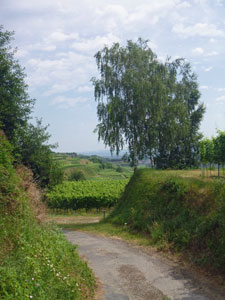
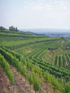
The geometry of the Kaiserstuhl vineyards

From here, we were on the Panoramenweg, a broad dirt track that meandered across the hill-slope between rows of high trellised wine grapes. We stopped from time to time to admire the geometric patterns of the vines, the views out across the valley to the mountains of the Black Forest in the east and the low blue silhouette of the Vosges Mountains in France, to the west.


Road carved into the terraced hill slope


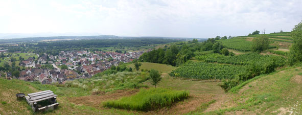
Panorama over Wasenweiler and the Rhine Valley from the "Panoramenweg"

Zig-zagging our way up through the trellises, terrace by terrace, we crossed over a spur that marked the edge of the vineyards and start of the forest. It was pleasant walking down through the cool shade of the dark green broadleafed trees and along the valley of the Mühlbächle, a small stream that babbled its way beneath the canopy.


Path beneath the beech forest


An ancient and deeply eroded pathway

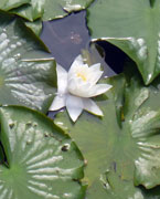
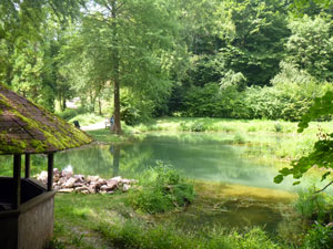
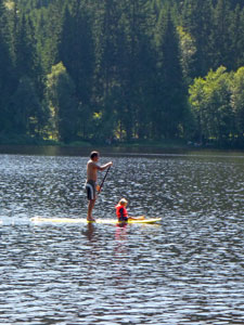
The route brought us out to a beautiful little pond, filled with tadpoles and water beetles (to amuse the children) and bordered by soft lush grass on which to rest. Unfortunately, not for long - the grass was also home to ticks and the discovery of one crawling up a hairy leg sent everyone packing fairly smartly (Lyme's disease is a real risk from tickbite in this part of the world).


The tranquil pond near Liliental

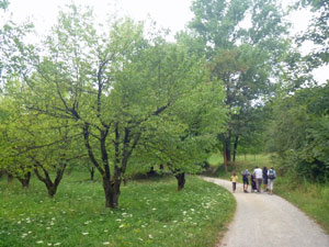
We hastened up to the restaurant in the middle of the forest at Liliental for a bite of lunch and then headed off again, taking a different route. Liliental has a small arboretum and the the road back took us past not-quite-yet giant sequoias and groves of wild cherries, before again entering the natural forest.


Walking through the grove of wild cherries


A luminous section of the forest


Heading back down a deep "hohlweg"

The weather had been slowly closing in since lunch time - the sun was gone and the ominous grey skies of an imminent thunderstorm made the forest a dark and gloomy place, though one I enjoyed walking through. Then, suddenly we were back out on the terraced vineyards of the Kaiserstuhl's southern slopes and heading down a "hohlweg" (a track that had been carved deep into the rich tan soil). Apparently, in days gone by, ox carts were used to transport the grapes down to the valley floor and these risked running away on the steep slopes between terraces. To prevent this, the carts dragged a heavy iron plate as a brake, which over four centuries carved these mini-gorges, up to 10 metres deep, into the hill side - fascinating.


Rain approaching over the Kaiserstuhl vineyards

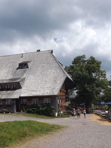
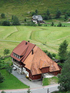
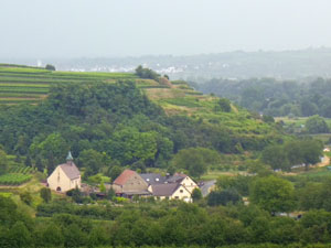
Farm buildings beneath the terraced slopes

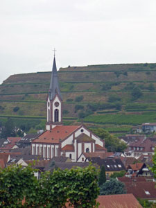
The church at Ihringen

As we made our way through the vineyards, the storm swept by. Luckily we just caught the edge of it with a short burst of big heavy drops before it headed on towards the Rhine River. A short time later, we left the vines to emerge in the outskirts of Ihringen, the next village on the train-line. It was but a short stroll through the streets to reach the station and our train home.

Thus ended our first day-walk in the Freiburg area - a rapid learning curve in the logistics of walking with young children, but an enjoyable outing through both the man-made and natural landscapes of this, the warmest region in Germany (would you believe that I saw a banana tree growing in a yard in the village of Wasenweiler).

Feldberg - Feldsee (10.5 km - 450m ascent - 450m descent)

While in Freiburg, we had a four-day break in the Black Forest, staying at an a holiday flat in the village of Falkau, between the Titisee and the Schluchtsee. The plan was to escape the heat wave, which of course we did, as two of the days were cloudy with showers. However, the first two days were fine, and we spent one of them swimming in and relaxing by the Windgfällweiher, a small lake near the village, surrounded by the forest. The next day was our first serious walk in this beautiful region.


Summer day on the Windgfällweiher


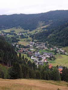
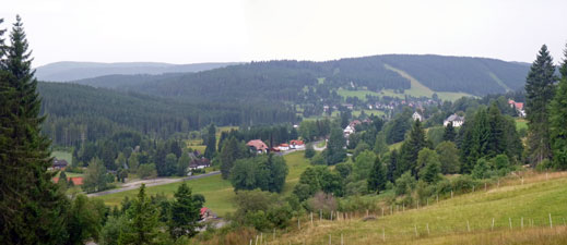
View over Falkau - where we stayed

There is a strong attraction to the highest point of any landscape and at 1493m, Feldberg is the highest point in the Black Forest. It was a short drive from our apartment in Falkau to the cable car station at the base of Feldberg, more a flattened dome than a peak, but offering grand views over the entire Black Forest. It was a family outing and the fair Nello, daughter Robyn, grand-daughter Lina and I soon found ourselves heading uphill in a gondola - the logical choice when one of the walking party is 6 months old and when you have a free ride, courtesy of our Schwarzwaldkarten.


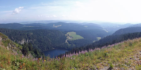
The dark waters of the Feldsee - from the Bismarck Lookout on Feldberg

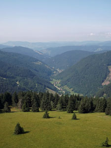
Looking down the Alb Valley


Feldberg hillscape

It was a lovely sunny day with just the breath of a cool breeze when we alighted on the Seebuck, a rounded hill at the east of the Feldberg massif. We made a quick wander over to the Bismarck Monument for the impressive view northwards over the Feldsee, a glacial lake set in a cliff-lined hollow deep below, to the distant hills and forest fading into haze.

Then it was another short walk to a 10-story high viewing tower, where on a clear day you can see the Swiss Alps to the south. It was not a clear day and we contented ourselves with views down the hazy valleys to the nearer ranges, a tapestry of forest and field that was impressive, nonetheless.


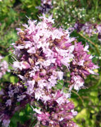
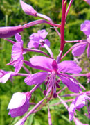
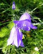
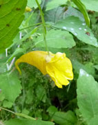
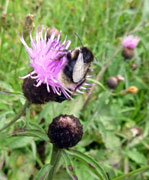
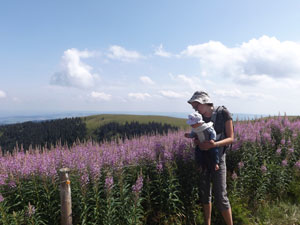
Lina checks out the wildflowers


Here the fair Nello left us. She had injured her foot the week before and it was still swollen, so she headed back down the cablecar to do a short walk from its base to the Feldsee. There she planned to bask in the glorious Black Forest sunshine on the edge of this glacial lake, while Robbo, with Lina in a baby sling, and I did a longer circuit over the Feldberg to join her for a late lunch.

It was a good plan and the three of us headed off to join the long line of walkers crossing this high meadow, down from the Seebuck, past a herd of bell-tinkling cattle and gently up to the summit of Feldberg, a large rounded slab of concrete that ensured many people could stand on the summit at the same time.

Nine out of ten people who have visited this flattened high point of the region then head back down to the cable car and away - which gave us a good chance to head off into wilder and less frequented places. Having completed the "been-there-done-that" part of the walk, we strolled off along a gravel track along the Mittelbuck, a ridge leading westwards on the Feldberg massif.


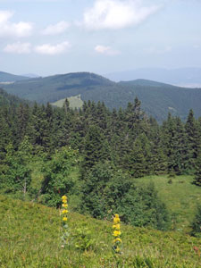
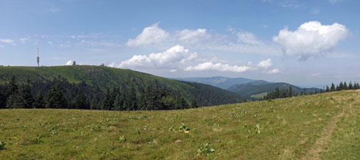
View from the Mittelbuck Ridge back towards the flat summit of Feldberg

Looking out to the north-west across Baldenweger Hut

The crowds rapidly thinned out as we headed away from the main tourist route. It was great ridge walking through thick grassy meadows, with glorious views down the valleys and across to the distant forested slopes - Lina "singing" her own version of the "Sound of Music" and wanting to examine the flowers as we passed (or eat them, as any 6-month old would).


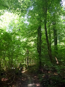
Re-entering the forest

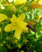
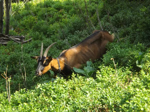
The source of the bell-jangling

Gradually we lost elevation to re-enter the zone of conifers, passing a tinkling of goats feeding amongst the trees, as we zig-zagged our way down to the Baldenweger Hut in its grassy clearing. From here, the track briefly followed the road before cutting into the forest again, where it descended steeply on a root-gnarly footpath, past small waterfalls and beneath the deep shade of the tall conifers.


A small waterfall in the forest


On the way to Raimartihof


Back amongst the tall conifers of the Black Forest

After a while we began to follow the course of the Sägenbach and the babbling brook did its job, singing Lina to sleep as we passed by to reach a broad gravel road. We were now on the route to Raimartihof, an easy route through the forest to reach the 300-year old former Black Forest farm house and now busy restaurant.


Deep in the heart of the Black Forest


The Sägenbach babbles along its course


Raimartihof - a 300 year old farmhouse


A lovely bit of forest near Feldmoor

We by-passed it to head on the few hundred metres more, past the marshy depression of the Feldmoor to climb gently up to the morain holding in the Feldsee. It was a spectacular entry to the site of this lake, its clear water sparkling in the sunshine beneath the cliffs and steep fir-clad slopes of the Feldberg behind. The fair Nello was waiting and we had a pleasant, if belated lunch, on the lakes edge. The area around the Feldsee is probably as close to pristine as you get in this region - if the Black Forest were an oyster, Feldsee would be its pearl.


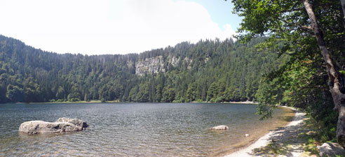
The Feldsee - a beautiful glacial lake backed by the cliffs of Feldberg

Over lunch, the clouds that had started to form continued to roll in and the wind began to blow more strongly - it seemed that the forecast change was on the way. We packed up and headed on to begin the zig-zagging climb out from the Feldsee up a steady but steep rocky track that took us up the side wall of the lake and back to the base of the cablecar. Our circuit was complete just in time, as the cloud dropped to hide the heights of the Feldberg and pockets of cooling mist rolled down the grassy slopes of the massif. It was a great introduction to the landscapes of the Black Forest.


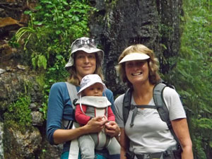
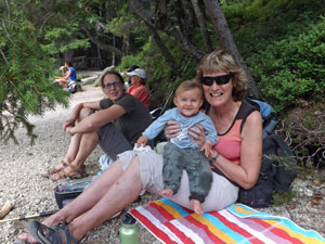
The youngest walker reunited with Grandma

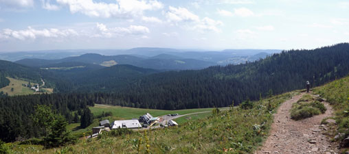
Climbing up from Feldsee to the ski station ....

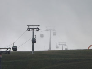
.... to be greeted by an untimely summer fog

I also realised that I had forgotten the exponential increase in logistics needed when doing a longer walk with a baby - Lina had been great, singing, sleeping and looking about, with only one "melt-down", but then who likes their nappy changed in public. Good on you Robbo for showing that you can have young kids and still enjoy the great outdoors - I was filled with fatherly admiration.

Falkau to Titisee (7 km - 250m ascent - 350m descent)

The change in weather that arrived as we were leaving the Feldberg yesterday was here to stay and rain showers rolled through regularly. Still, it was no reason to stay inside all day, so when a bigger than normal patch of clear sky passed over, we headed off from our little apartment in the village of Falkau. Our aim was to walk down to the waterfall on the Haslachbach, a stream that flowed by just behind the house (a converted mill) we were in.

There is a vaste network of walking trails throughout the Black Forest, all well sign-posted, so we just stepped out the gate and followed the sign to the waterfall - first down a quiet lane past the scattered farmhouses of Falkau, then into the forest and along a footpath to the falls. They were small, but formed a pretty setting as the Haslach flowed over a dark rock rib into a tannin-stained pool and then babbled away down a deep gully beneath the tall forest trees.


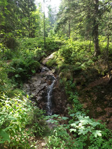
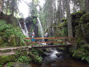
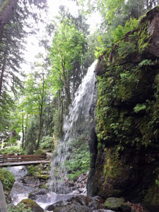
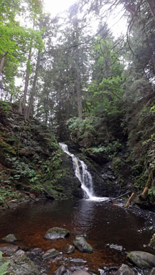
The beautiful setting of the Haslach Falls

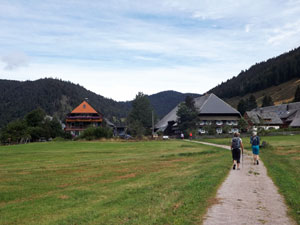
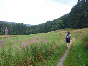
Setting out across the fields of Falkau


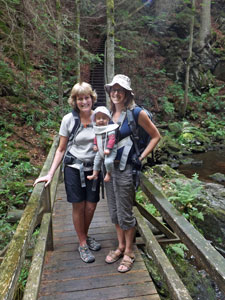
Three generations of walkers


The rocky bed of the Haslachbach

We climbed out on the far side and the weather was still clear - a set of signs offered us the choice of heading back, heading to distant villages or walking to Titisee, the lake that has become a synonym for the Black Forest. Today's walk was going to be "a la carte" and we opted for Titisee. After a short walk through the village streets, the track led us back into the tall conifer forest. The path wound its way along the slope of a ridge amongst the lush green undergrowth, to eventually reach a clearing and a main road.


Beneath the tall Black Forest conifers

We were now at Rotkreuz, a parking place on the ridge top and Titisee was only a few hundred metres away to the north, though hidden behind the dense curtain of trees. Picking up the route that led down and across this steep slope, we wandered beneath the canopy of conifers, catching the odd glimpse of the silver-grey water surface, gridded by the dark silhouettes of tree trunks. The sky was also becoming greyer, and eventually the first drops of rain began to fall as we reached the lake level.

It was a hurried last leg of the walk along the lakeshore shore to reach the shelter of a cafe and a celebratory teutonic-sized slice of Schwarzwalderkirschtorte. Some 25 years ago, the fair Nello and I, with a much younger Robyn, had first visited this part of the world and had also enjoyed a slice of Black Forest cake - it seemed an appropriate re-enactment of good times past.


A wet afternoon in tourist town


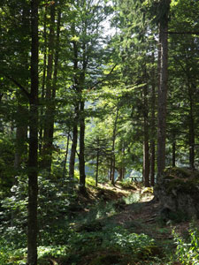
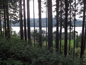
A glimpse of Titisee through the forest

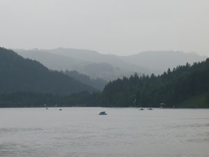
Rain moving in over the Titisee

Titisee is a tourist magnet - if you only have one day in the Black Forest, you would probably come to Titisee. It is a beautiful lake, but for us its beauty was diminished by the degree of tourist infrastructure - just how many shops can make a living selling cuckoo clocks? Still, on a rainy day, it proves nothing to "get on your high horse", so after our coffee and cake, we headed up to the train station to catch a train back to Altglasshofen, from where we had a short walk down alongside the grassy rive of the Haslachbach to our apartment. It had been good to get out on a somewhat bleak day and experience a different side to the Black Forest.

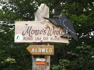
Menzenschwander Falls and the Albtal (6 km - 240m ascent - 240m descent)
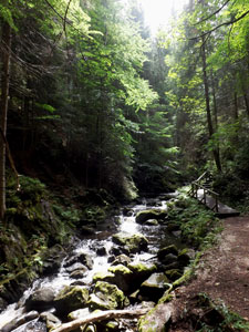
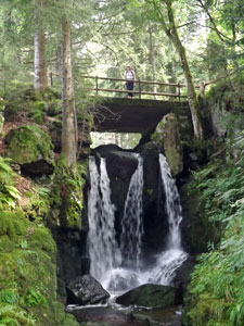
The sky was once again grey but the promised showers seemed to be holding off, so we decided to do another short walk. Robyn scanned a couple of guide books and came up with the suggestion to visit the waterfalls in the Albtal, a valley near the village of Menzenschwand. It took less than 20 minutes by car to reach Menzenschwand, set at the junction of two broad glacial valleys, the Albtal and the Krunkelbachtal. Robbo, with Lina in baby sling like a young koala, the fair Nello and I were soon walking out of the cluster of traditional guesthouses and farmhouses and across the green, green fields. After our visit to tourist-packed Titisee yesterday, we were enjoying the peace and quiet of this more remote valley.


Walking through the fields of Menzenschwand


In the gorge of the Menzenschwander Falls


Robbo, Lina and Nello


The Alb stream below the falls


Water streaming over the gorge walls

We quickly reached the edge of the forest, crossing a bridge over the Menzenschwander Alb to follow a footpath upstream - the first of the falls was already visible ahead. In the course of a few hundred metres, the stream flows down a series of cascades and falls through a narrow 30m deep chasm to culminate in an impressive cluster of waterfalls set amongst mossy boulders and dense forest. We followed these in reverse, wandering slowly upstream and enjoying the cool moist air of these falls - another pearl of the Black Forest.


The upper falls

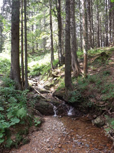
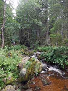
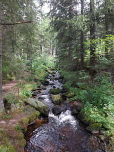
The Albbach above the falls

After the top falls, we continued to follow the west bank of the stream up the valley, crossing more open meadows. The valley curved away to the west, but we followed a different route to begin a steady climb up its eastern flank and back towards the village. The climb took us higher, with expansive views both across the valley and up its length to the distant viewing tower on Feldberg, where we had been two days earlier looking down to this very spot. It made me realise just how compact a landscape this set of interlaced valleys and ridges that comprise the Black Forest is.


Ridge route beneath the fir and pine

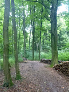
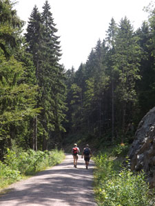
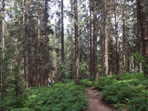
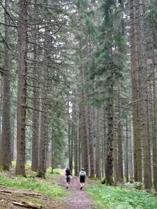
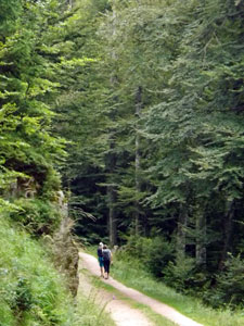
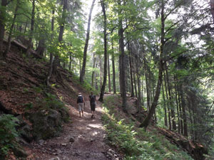
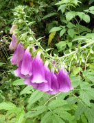
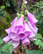
We continued to climb steadily on a gravel road lined with the bright pink bells of digitalis, up into the forest of conifers and broad-leaf trees. In the damp conditions, the resinous scent of fir and spruce wafted richly across our path. It felt good to be here, even though the forest is far from pristine. This was a forestry track and we were clearly in a working forest - albeit one that was selectively logged and not subject to clear-felling.


Crossing a grassy slope high above the Alb Valley


Looking down on Menzenschwand

A little while later we emerged on to a clearing high above the village, with classic views of red rooves, green meadows and tree-clad hillsides. Even on a grey day, the Albtal showed its beauty. Finding a downward-heading track, overgrown with thick grass, we took it to rapidly lose elevation while admiring the views over the junction of the two valleys.


A typical Black Forest house


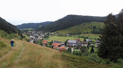
Returning to the village

The track vanished, but we continued on directly down the steeply sloping meadow to regain the "official" path and follow it back into Menzenschwand and our car. It had been a short walk but a very enjoyable and tranquil one. Well-picked Robbo!