Zermatt Day-Walks

Getting There


Our original intention after Iceland was to return to Freiburg and spend another (and our last) week in Europe with our daughter and her family. However, they had an "in-law" family commitment in Berlin, so we looked around for a fitting finale to our travels. The call of The Alps was loud - courtesy of the internet, we made a last minute booking of a little apartment in Zermatt, perhaps one of the most famous of all alpine villages, in the south of Switzerland for a few days of walking beneath the shadow of the Matterhorn. Of all the mountains in the European Alps, the Matterhorn is is probably the most recognisable and evocative.

From the airport at Hamburg, it took a 5-hour trip by train across the length of Germany, followed by three short train trips around and under the mountains of Switzerland. The last, a slow climb up the steep-walled Matter Valley, brought us to Zermatt and the heart of the Pennine Alps. It was evening when we arrived, but the sky was still clear and blue, the air was warm and, from the front of our apartment complex, the Matterhorn, that singular rock pyramid rising to 4480m, looked down on us. We knew in our hearts it was going to be a good few days.


The Matterhorn from our apartment

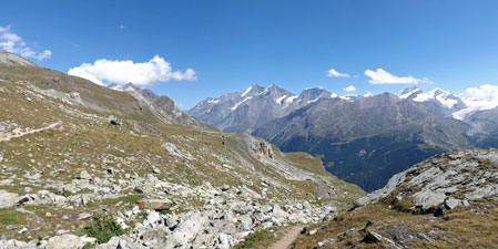
Gornergrat Descent (11.5 km - 50m ascent - 1540m descent)

Having travelled all the way from Iceland to Zermatt in virtually one hit, we had a bit of washing and shopping to do. Hence it was midday by the time we set out for our first walk. We had opted to do the Gornergrat Descent, as it would be an easy half day walk. The name gives away the fact that it is virtually all downhill from the Gornergrat Astronomical Observatory to Zermatt Village. Thus, we caught the cog railway that in 45 minutes wound its way up the steep side of the valley from Zermatt Village (1620m) to the observatory (3135m).


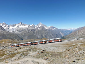
The cog rail train cranks its way up to Gornergrat

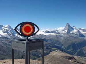
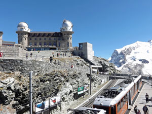
The Observatory on Gornergrat

When we alighted, we were greeted by a magnificent panorama of the snow- and ice-capped 4000m+ peaks backing the Gorner and Grenz glaciers glistening in the sunlight beneath a sky of perfect blue. To the west, the Matterhorn stood out in splendid isolation and turning northwards, the valley of Zermatt was framed by a succession of 4000+m summits that formed its two walls. It was awesome in the true sense of the word to be surrounded by such natural beauty and, in one form or another, it would stay with us all the way down the mountain.


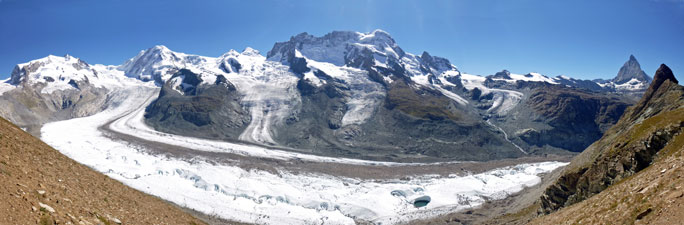
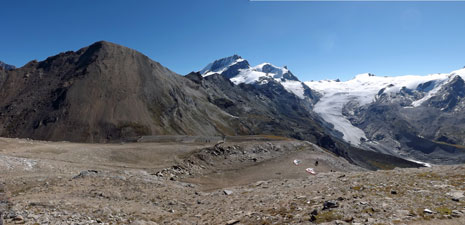
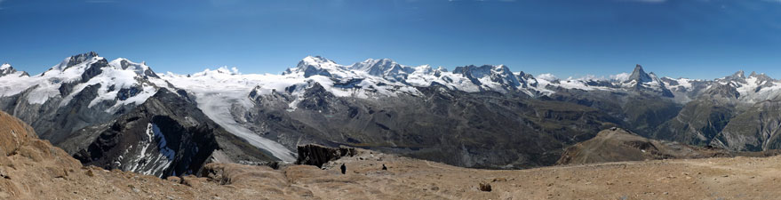
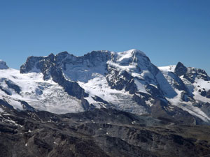
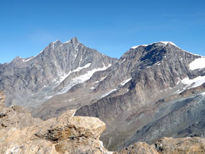
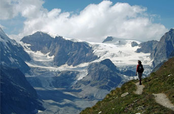
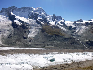
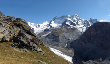
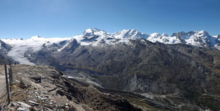
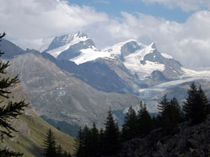
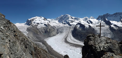
View of the Grenz Glacier flowing down from 4634m Monte Rosa and 4527m Liskamm

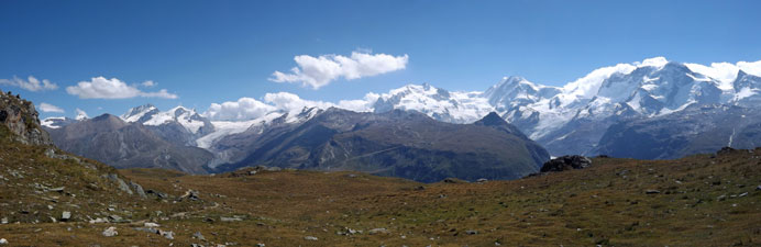
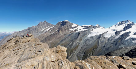
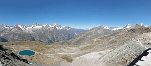
Northerly panorama from Gornergrat


The Matterhorn from Rotenboden


A melt lake on the glacier

We set off, dropping quickly from the Observatory ridge via one of the many braided paths that led downwards toward Rotenboden, with its vistas out over the Riffelsee lakes to the Matterhorn beyond. This is a very popular walking area and we were definitely not alone. We now headed more steeply down towards the dark rocky bluff of the Riffelhorn, which towered over the small plateau holding the lake.


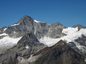
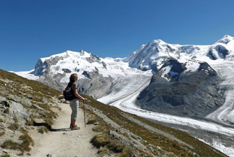
Nello takes in the views of Monte Rosa and the Gorner Glacier

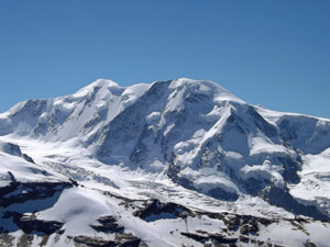
Breithorn rising high above the Gorner Glacier

Nearing the lake, we reached a junction of a track heading off towards Monte Rosa Hut. Originally, I had hoped to head out as far as the glacier face, but time was against us, so we just made a short detour along the steep slope above the glacier to take in the more intimate views of the crevasses, meandering watercourses and bright green lakes in this river of ice, backed by the brilliantly white-capped cirque of summits from Monte Rosa (at 4633m the second highest mountain in the Alps) to Breithorn. Words cannot adequately describe it.


The grand panorama of the Gorner and Grenz Glaciers - with Monte Rosa, Breithorn and the Matterhorn

Resuming the descent, we quickly reached the shores of the Riffelsee, a gentle breeze occasionally rippling its surface to disturb the reflections of the Matterhorn and lesser peaks across the valley. It was the perfect place for a snack and we dallied long in the sunshine, soaking up the warmth and the ambience.


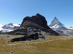
The black face of Riffelhorn

Nello relaxing on the shore of the upper Riffelsee


Alpine meadow near Riffelsee

The descent then continued - on reaching a junction, we opted to keep left, dropping down to a smaller, but equally reflective glacial lake. Below the lakes the crowds thinned out, as most walkers headed to Riffelberg to ride the train down - it was good to feel alone.


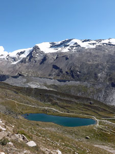
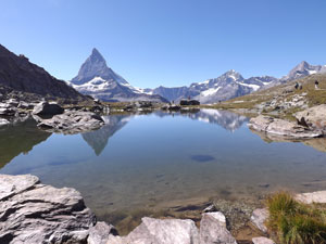
Reflections in the lower Riffelsee

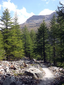
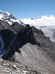
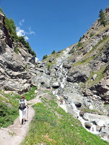
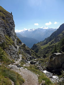
Descending towards the Gorner Canyon

Again a choice of tracks, again we kept left to descend a steep valley that brought us out to the edge of the Gorner Canyon. The glacier had ended higher up, but we could hear the meltwaters rushing down below and look across the the face of Breithorn and the Klein Matterhorn (the little brother).


A wisp of cloud forming on the Matterhorn


View across the canyon towards Breithorn

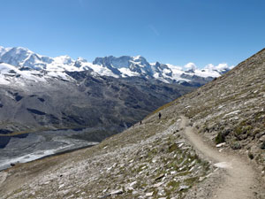
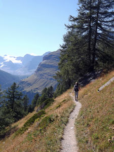
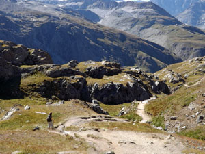
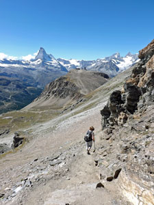
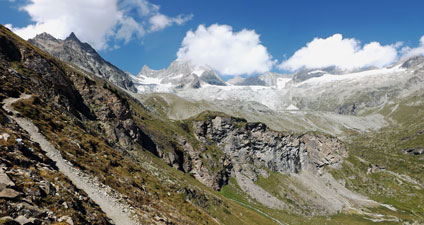
High traverse above the canyon

Leaving the canyon, we traversed a steep grassy slope, scattered with late summer wildflowers, directly across from the Matterhorn. I was beginning to think that there is no escape from the presence of this mountain, though gradually we turned to look at the summits of Gabelhorn, Zinal Rothorn and Weisshorn.


Looking down on Zermatt

At the next junction, we took the middle path to continue our traverse, before descending a rocky path beneath the cliffs of Riffelberg, and heading on towards Riffelalp, passing through forest for the first time (is everything here called Riffel?).


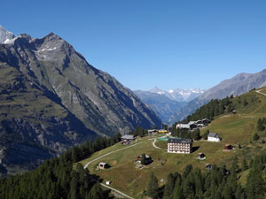
The ski area of Riffelalp


Track beneath the larches

Just before arriving, a narrow footpath headed directly downhill toward the Chämi-Hitta restaurant - we took the steep track to stop off and have a cup of coffee, the late afternoon sun backlighting that enormous crooked pyramid of rock that every restaurant here faces. The Matterhorn verges on the hypnotic. Then it was into the cool shade and dappled light of the larch forest for a long and winding descent of the steep valley walls.


The blueness of the Gorner River gorge

We reached a road and chose left, which led us across a bridge over the narrow but deep gorge of the Gorner River to the traditional, lauze roofed and wooden walled houses of Blatten, an erstwhile isolated village, but now part of the extensive Zermatt ski-fields. As we passed beneath, a high-pitched peep alerted us to the presence of marmots emerging for their evening feed.


Evening light on the Matterhorn


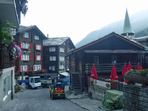
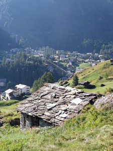
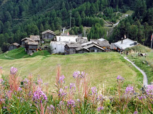
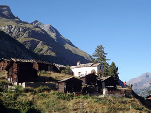
Traditional houses in Blatten

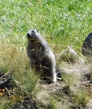
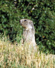
Marmot on high alert

The path now became wider as mountain tracks funnelled in to the valley route home to Zermatt. It wasn't long before we were walking up the stairs to our apartment, still smiling at the incredible weather (moreso after the wind, snow, cloud and rain of Iceland) and still trying to comprehend the hugeness of these mountain landscapes. Our knees may have been a bit sore after 1500m of descending, but we were already looking forward to tomorrow.

Ober Rothorn to Zermatt (13.5 km - 430m ascent - 1920m descent)

It is claimed that, at 3416m, Ober Rothorn is the highest peak in Europe that can be walked up without a mountain guide. It is also claimed that it has one of the finest alpine views in the world. Now there is something worth discovering, moreso because you can start your ascent only a few hundred metres below the summit, from the Unter Rothorn cable car station.

We set off mid-morning to catch the first of three lifts up from Zermatt, the Sunegga cog rail, the Blauherd gondola and, finally, the Unter Rothorn cable car. An hour later we were at Unter Rothorn and, already from this lofty perch at 3100m, the views were incredible beneath the cloudless blue sky. We stopped for a while to watch the parapentists taking off, sweeping down the valley and soaring into the sky high above to hang motionless in the void - one day, one day!


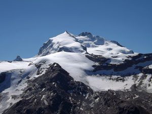
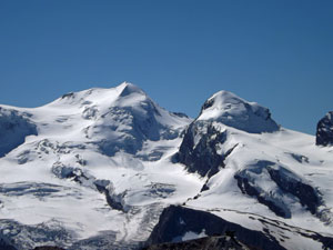
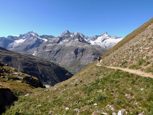
Vista of Monte Rosa, Lisskamm and Breithorn from Unter Rothorn

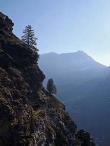
Looking back towards the Unter Rothorn cable car station

We looked above at the relatively inconspicuous bluff of golden-flecked brown schist that was Ober Rothorn and headed off. The track led quickly down a winter ski piste to the Furrgji Saddle, 100m below.


The reddish-brown bluff of Ober Rothorn rises above Furrgji Saddle
with Rimpfischhorn (4159m) and Strahlhorn (4190m) above the Findel Glacier

From here the climb started on what is called Weg zur Freiheit (The Path to Freedom), marked by a series of curious eye-like sculptures that represent the mineral, plant, animal, human and spiritual states. At first the narrow footpath led us gently across the northern slope of Ober Rothorn before commencing a set of zig-zags upwards. It was time to balance breath and motion and get into that trance-like rhythm of high-altitude climbing.

The zig-zags took us up to the northern wall of the bluff, past clumps of cushion plant gardens, before turning westward and continuing steeply onwards. We stopped briefly to look out over the sheer drop down into the Täsch Valley and across to the 4000+m peaks beyond.


The blue eye of the "Weg zur Freiheit" above the Findel Glacier


The final ascent of Ober Rothorn


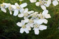
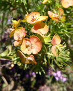
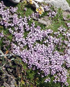
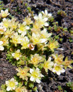
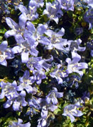
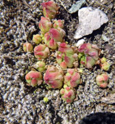
Cushion plants of the Rothorn

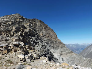
Razor back ridge next to Ober Rothorn

Then it was onwards and upwards, steadily gaining height and passing the "eyes" until finally we crested this massive bluff of glistening schist and reached the red eye of spirituality. In a way the sculptures reflected the reality of the walk, as by the time we reached the top to be surrounded by an incredible 360° panorama of snow-topped peaks, our spirits were uplifted. We sat up there, in the still air, and breathed it all in - simply superb.


View to the north across the golden schist summit of Ober Rothorn

Culminating point of the "Weg zur Freiheit"


The grand panorama of the Pennine peaks from the summit of Ober Rothorn

Peaks of the Pennine Alps - viewed from the Ober Rothorn


The big one - Dufourspitze on Monte Rosa (4634m)

Lisskamm (4527m) above the Grenz Glacier

The Matterhorn (4478m)

Breithorn (4164m)

Castor (4228m) and Pollux (4092m)

Ober Gabelhorn (4063m) and Wellenkuppe (3903m)

South-east face of the Weisshorn (4506m)

Täschhorn (4490m) and Alphubel (4206m)

Zinalrothorn (4221m)


Descent from Ober Rothorn


The beautiful summit of Liskamm

It was hard to break the spell and descend, but time dictated and we retraced our steps back to the Furrgji Saddle, where we were greeted by flock of goats (destroying the illusion that the droppings on the track were a sign of chamois). From the saddle, we changed direction, heading downhill and into the valley to a point where we could see the small green lake, Gruensee.


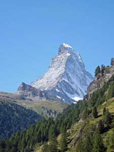
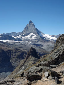
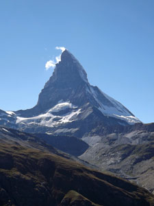
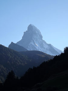
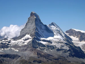
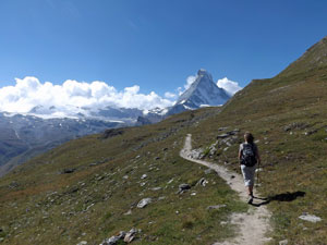
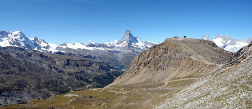
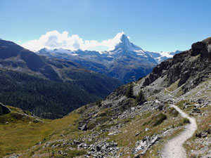
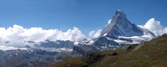
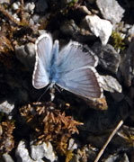
The omnipresent Matterhorn


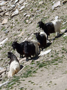
The goats stop to watch us pass
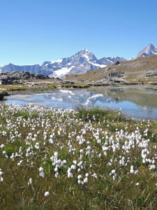
We had originally thought of following the Five Lakes track at this stage, but to be honest, the valley below was scarred with the infrastructure of the ski-fields and criss-crossed by ugly roads. It is sometimes hard to reconcile the incredible natural beauty of this region with the blots of human "development". We decided to stay high, looking down on the green waters of the Stellisee instead of walking by it, and continuing on along a gravel road to Blauherd cable car station.


The Stellisee

Now that's the way to see these mountains

From here, we found a narrow footpath that wound its way down a rocky spur to a fine viewpoint out over the village of Findeln to the Matterhorn beyond. We stopped near wooden carvings of an eagle and a marmot for a panoramic lunchbreak (this was in fact the Marmot Path). Continuing on to traverse the base of a steep cliff, we heard the high pitched calls of a sentinel marmot, but none could be seen. A little later we reached the Sunnegga lift station - it was time for a coffee beneath the shade of a deck umbrella.


The route down the Findel Valley

The Leisee


Houses of Findeln scattered on the valley wall

Over coffee, we decided that we would follow the shortest route back to Zermatt, which from here was via Findeln-Eggen and Winkelmatt. The route took us past the green waters of the Leisee and above the village of Findeln, with its tradition wood and lauze houses scattered over the alpine meadow and backed by the snow-capped peaks. The marmots finally appeared.


Heading into the forest of the Matter Valley

From here, we traversed high above the valley floor to enter the larch forest, where a rocky footpath led us steeply down the slope and along a narrow tree-covered spur. The softness and dappled shade of the larches made for a very pleasant descent, despite the knee-niggling steepness. Reaching a wider track, the descent slowed down as this route followed a gentler zig-zagging course, past a waterfall next to the Gornergrat cog rail bridge and then across the rail line itself to reach Winkelmatt.


The luminous green of the larch


Descending a narrow tree-covered ridge


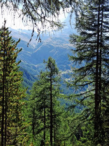
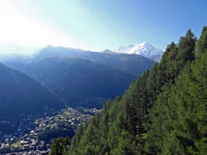
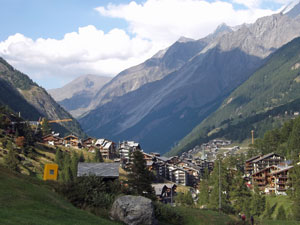
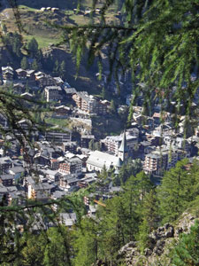
Zermatt between the branches

From here it was but a stroll down through the quiet streets of Winkelmatt, past classic alpine houses with geraniums flowering thickly from balconies, to reach Zermatt and home. It had been another huge descent and, while our spirits were feeling elated, our knees were feeling the strain. I suspect tomorrow, we might just take some R&R in the village itself.

Edelweissweg (or Höhbalmen Circuit) (20 km - 1190m ascent - 1190m descent)

After a lazy day in the village, we were keen to head out again for our last walk in Zermatt. Today we were off to the "wild" side - on the western face of the valley away from skiing infrastructure and away from the crowds - and up to the Höhbalmen Plateau. No lifts this time, we would be walking up to the heights above the village.

Thus we headed off a lot earlier, passing through the still-quiet streets of Zermatt in the crisp shade of the morning. However, once we turned uphill to wind our way through the narrow side-streets, it was not long before we climbed into bright sunlight, as the sun rose slowly above the eastern slopes of the valley. Ahead, we could see the Triftbach, a narrow cleft in the steep green sidewall and our gateway to Höhbalmen. However, first we had to climb up to the Edelweiss Restaurant, sitting on its rocky eyrie 300m above the village - I just about got neck strain looking up at it.


Early morning in Zermatt

The route we followed took us across the rushing waters of the Triftbach on a small wooden bridge and then across the grassy meadows above the village, where marmots piped their warning calls and butterflies warmed themselves in the morning sun. The climb now began in earnest, up a series of short steep zig-zags beneath the larches, alongside tumbling cascades and crashing falls as the stream dropped rapidly down to the valley below, and finally up to the Edelweiss itself.


Morning colour in the Matter Valley

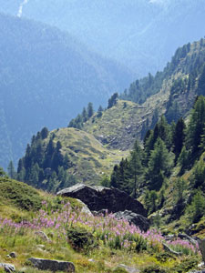
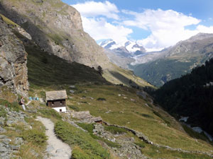
Lauze-roofed hut above Zermatt

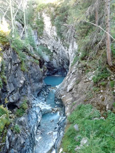
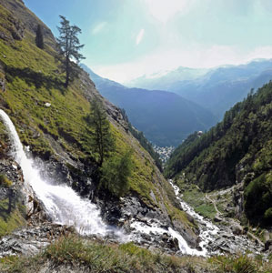
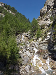
The Triftbach tumbles out of its gorge

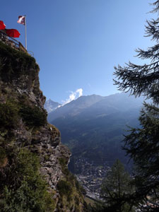
Flag flying on the eyrie of Edelweiss Hut


Trift Gorge silhouette

For the first time here, we had worked up a serious sweat and were now just in shorts and shirts. The restaurant was a good place to cool down a bit, relaxing with a coffee as we took in the superb views from its deck, over Zermatt way below and to the mountains on the far side of the valley.


Looking down on Zermatt from the Edelweiss

Leaving the Edelweiss, we now entered the cleft and the lower valley on what is called the Botanischer Lehrpfad, well-named with its diversity of wildflowers beneath the soft green canopy of the larch. The route was a gentle traverse at first, high above, the valley floor. However, this was rising quickly to meet us and we soon reached the head of the lower valley, where another series of cascades and one large waterfall tumbled down from the heights above.


Reaching the head of the lower valley

A lovely cascade at the head of the lower valley

View down the upper valley

A short set of zig-zags brought us to the top of this and into the upper valley. Beyond we could see the Triftbach babbling its way down from the heights, framed by the green meadows of its steep walls and backed by the rocky peaks of Obergabeln and Zinalrothorn where, for the first time since we arrived, cloud hung around the mountain tops.

We now pushed steadily up the valley, following a path high above the stream, where butterflies flitted from flower to flower along the track edge as we passed. The Trift Valley was a pure delight to walk in and the metres of elevation tumbled away quickly until we suddenly emerged into the small grassy bowl at the head of the valley. The lonely pale pink shape of the Trift Hotel greeted us, dwarfed by the cirque of summits and glaciers that backed it - a magical spot where we lingered for a while.


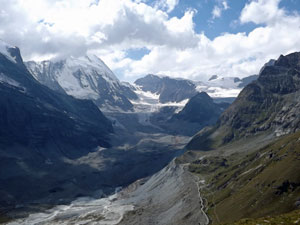
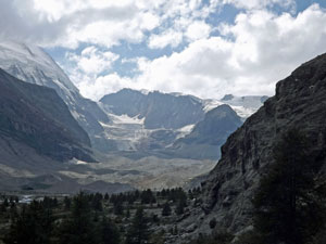
View up the valley to the mountain cirque

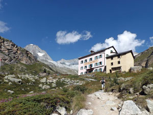
Arriving at the Trift Hotel

Sitting on a lichen-spotted rock and facing down the valley, we could see the bluff green face of Höhbalmen to the south and the track winding its way up to the plateau. It looked a lot steeper than it proved to be and we dallied in the warm morning sunshine before summoning up the energy to tackle it.


View down the Trift Valley


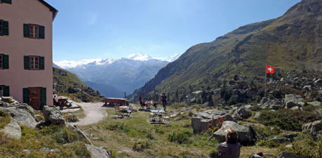
Rest stop at Trift Hotel opposite the slopes of Höhbalmen

Crossing a small stream behind the hotel, we traversed the grassy bowl and began the climb, pausing from time to time to revel in the views of the Gabelhorn, Trift and Rothorn Glaciers, and the increasingly spectacular vistas towards the Täschhorn and other 4000+m peaks on the far side of Zermatt.


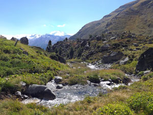
The headwaters of the Triftbach

Looking back at the climb up to Höhbalmen


The grand glacial panorama - the Gabelhorn, Trift and Rothorn Glaciers


View across the Trift Gorge to the far side of the Matter Valley

One last zag and we crested the plateau to see the stony meadows of the Höhbalmen stretching out ahead, steep drop to the left, steep rocky walls to the right. Ahead a couple were sitting in the grass drinking champagne and laughing. "A bit early in the morning", I thought, but on greeting them we discovered that he had just proposed (and she said "yes") - romance in the high Alps! So, congratulations nice British couple - may your life together be long and happy.


Ober Gabelhorn (4063m) and its glacier


Heading across the Höhbalmen - as you-know-what appears

We wandered on a little further to find a spot sheltered from the cool breeze and had our lunch (perhaps 40 years ago we would have had some champers as well, but today it was just water with a dash of staminade). Still, the views of all the snowy peaks, including the Matterhorn, which had just appeared to the south, more than compensated.


Höhbalmen panorama - from Rimpfischhorn to Breithorn


The Matterhorn in all its crooked-hatted glory (from Höhbalmen)

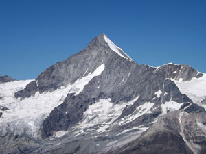
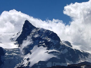
The Klein Matterhorn (3883m) - the little brother

Unfortunately, no ibex or chamois were to be seen, just a flock of mountain sheep. We headed on, reaching the end of the grassy plateau and crossing an area of shaly rocks to reach a long traverse across the steep flank below Wellenkuppe and Gabelhorn peaks. To be honest, I had enjoyed the earlier Matterhorn-free section of the walk, but now this mighty peak had once again taken over the landscape as we traversed high above the cliffs of the Zmuttbach Valley. We were looking directly at its cold, ice-spattered north face - its crooked cap was even more pronounced from here and its hanging glaciers looked even more menacing. I had to admit that it does grab your attention.


Lookng back across the alpine meadows of Höhbalmen

Mountain sheep taking a break


The hanging glaciers of Peak Tyndall

As well as the mighty mountain, the wider views on this traverse were simply superb. Ahead to the Zmutt, Schonbiel and Tiefmatten Glaciers, the former covered with gravel in its lower regions and held by high grey moraines. Behind we could look directly into the distant entry of Gorner gorge and the glacier behind it, framed by the snowy tops of Monte Rosa.


Looking out at the Schonbiel and Tiefmatten Glaciers


Riffelhorn and Liskamm frame the Gorner Gorge


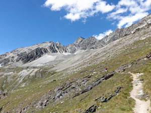
Crossing the slopes below Gabelhorn

View up the gravel-covered Zmutt Glacier
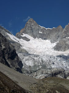
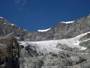
The Arben Glacier

The only downside was that, as we walked, the cool wind picked up and cloud that had built up in Italy began spilling over, enveloping the pyramid of the Matterhorn and occasionally shading out the sun. Eventually, we passed the end of the cliff line far below and began our descent to the Zmuttbach Valley, zig-zagging steeply by a beautiful waterfall on our way.


A superb waterfall backed by the Matterhorn


Larches on the old morain


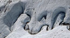
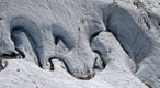
Pondages in the Zmutt Glacier

View back up the Zmutt Valley

The track now began to follow the base of the cliffs, before taking a detour to avoid an area of potential rock-falls. It descended to cross the jumbled boulders of the retreated glacier, where larches now found a home. The Zmuttbach, so small and peaceful looking from above proved to be a raging glacial torrent, whose grey churning waters raced down the steep and rocky river bed. This was a lovely section to walk through, the price being a steep climb back up to the now more stable cliff base.


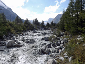
The raging glacial meltwaters of the Zmutt

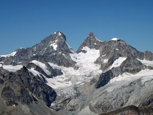
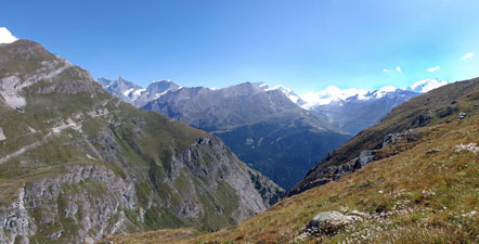
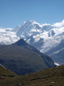
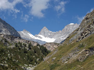
View of Rimpfischhorn, Strahlhorn and Adlerhorn

Our feet were starting to feel tired as we reached the narrow grassy meadows of Chalbermatten, now high above the river. The Matterhorn was now well and truly at our back and the tiny village of Zmutt, its traditional wooden houses tightly clumped in the green pastures beneath the cliffs of Höhbalmen was ahead. The restaurant there was just about to close, but we managed to squeeze in a coffee and a chance to rest our feet.


Trackside cafe at Chalbermatten

Traditional houses of Zmutt

From Zmutt the track widened. This is a popular day-walk and, after a day of pleasant solitude, we found ourselves with other walkers heading home, past a scattering of traditional wooden houses and sheds and beneath the canopy of the larch forest. Behind us, the Matterhorn was generating big plumes and a wall of cloud seemed to be welling up over the ridges from Italy - a change in weather was clearly on the way and we realised that we had indeed been fortunate these last few days. Soon the houses of Winkelmatt came into view, then Zermatt and then our apartment.


The sun breaks through

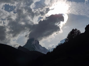
A dark and brooding Matterhorn - the mood changes
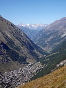
Back to Zermatt

It felt so good to take our boots off and have a cold beer. With 1100m of climbing and the same descending and 20km of walking, this had been the toughest of our three walks in Zermatt. However, it was the best and we couldn't have finished our time here on a higher note if we had planned it.