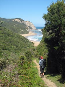
| Great Ocean Walk (Glenaire to The Twelve Apostles) |
|
|
||
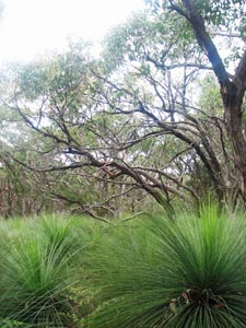
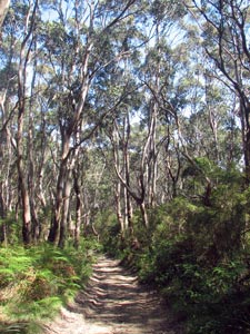
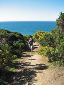
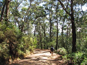
 Path through a forest of gnarly gums |
 |
 |
|
|
 |
||
 |
 |
 |
 |
 |
|
||||
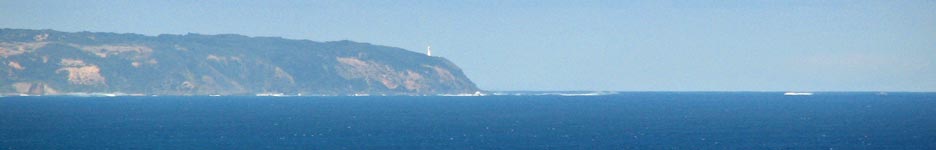
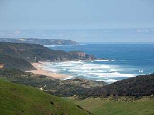
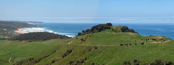
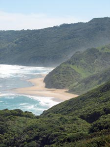
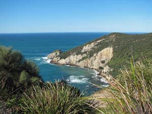
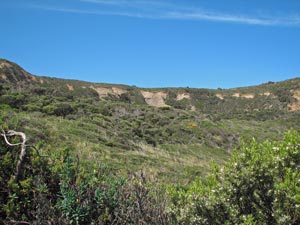
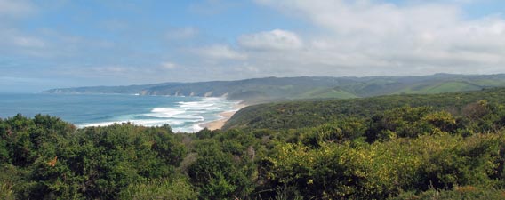 Panorama across the heathlands to Johanna Beach ... |
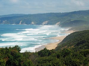 ... and the beach close up |
|||
|
||
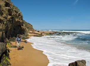
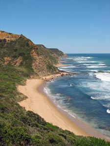
 Back on the beach |
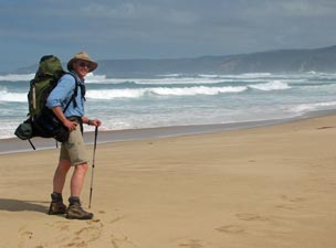
 The fair Nello in meditational beachwalking mode |
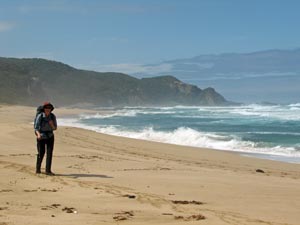
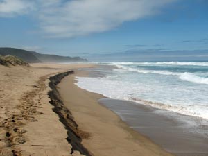 Big seas devouring the sand |
|
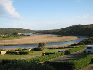
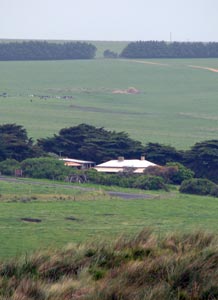
 Johanna Beach from the GOW campsite |
|
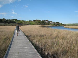
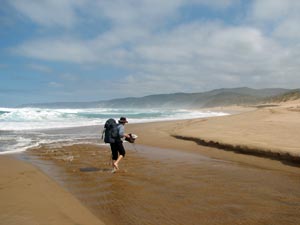 Crossing the mouth of Johanna River |
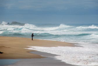 The solitude of the surf fisherman |
|
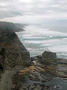
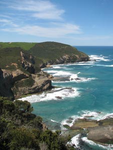
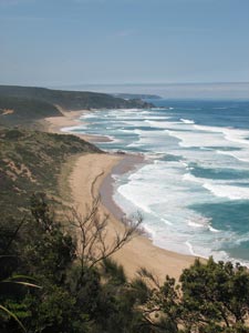
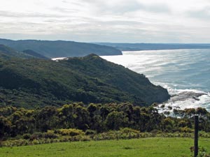
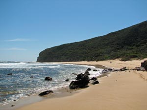
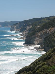 Cliffline west of Johanna Beach |
|
|
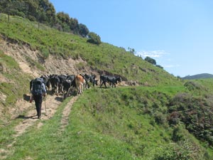 The fair Nello herding a few cattle |
 Looking back to Johanna Beach |
|
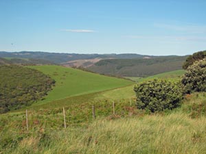
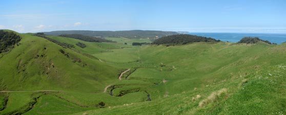 The intense greenness of the Johanna river valley |
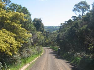
 Bucolic bliss beyond Johanna |
|
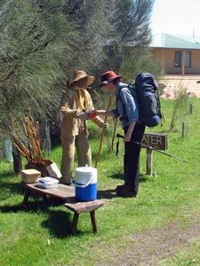 The straw man gives Nello a free cup of water - a nice gesture thanks! |
|
|
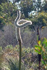
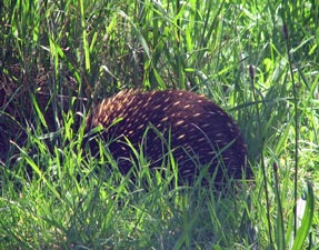 Echidna hunkering down into a spiky ball |
|
|
|||
 Back in the coastal forest |
 Approaching Milanesia Beach from the east |
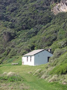 Old settlers hut on Milanesia Creek |
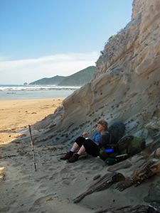 Scroggin break in the shade at Milanesia |
|
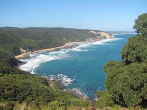 View back toward Milanesia from Bowker Point |
 The track climbing out of Milanesia |
|
||
|
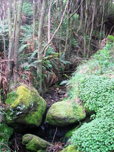 Mossy creek bed crossing the track |
Sadly, crossing Bowker Point, we again lost much of our height, as the well-formed track wound its way around and steeply up and down to cross several dark, ferny creek gullies. This was dense and lush vegetation and ahead, though the ridgeline of Ryan's Den gradually got closer. A long set of wooden steps brought us quickly to the ridge top and just when we though the camp was in sight, the track dropped again to cross one last hidden gully. |
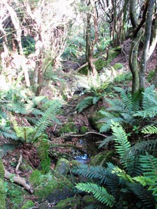 Another fern-filled creek to cross |
|
 |
 |
||
|
|
 |
|
||
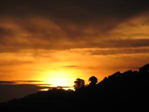
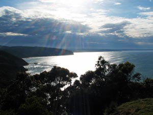
 Morning view westward from Ryan's Den |
 Morning view to the east from Ryan's Den |
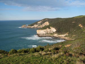
 Cape Volney |
|
||
 Track through the heath of Cape Volney 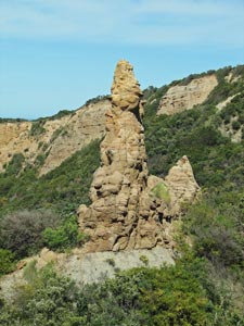 A curious rock pillar near Moonlight Head |
 Looking back eastward across the headland of Ryan's Den |
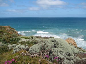
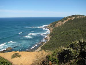 View westward toward Moonlight Head |
|
||
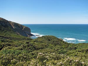 The dense heath between Moonlight Head and Reginald Point |
 Back inland amongst the trees |
|
|
||
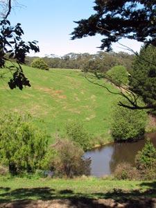 Farm dam in the Otways |
|
|
||
 |
 |
 |
||
|
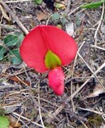
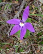
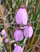
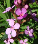
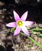
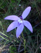
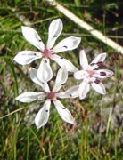
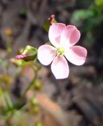
 Blue sun orchid |
||
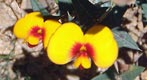
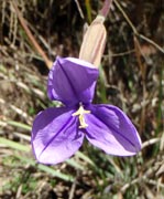
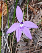
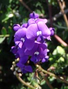
 Blue enamel orchid |
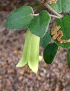
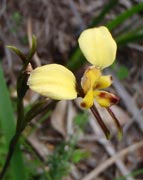
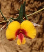
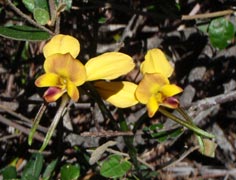 Donkey orchids |
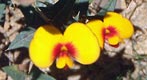
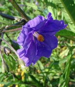
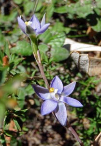
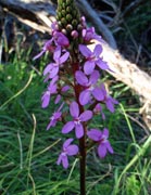
 Mauve enamel orchid |
|
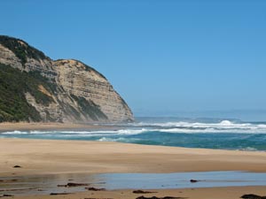
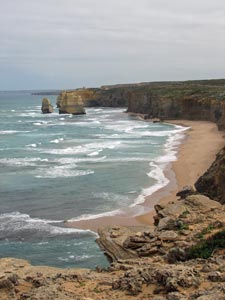
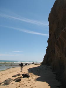 Beneath the sheer cliffs of Wreck Beach |
|
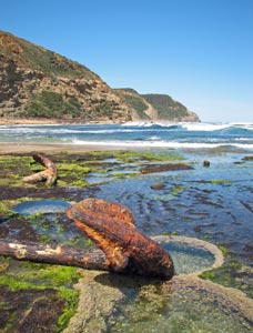 The anchors of the "Marie Gabrielle" |
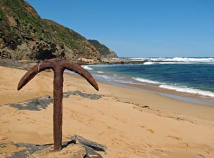 Anchor of the "Fiji" - memorial to the shipwrecks of this coastline |
 As the tide comes in Wreck Beach disappears |
 Jumble of rocks between Wreck Beach and Hell's Kitchen |
|
 View from the GOW campsite at Hell's Kitchen |
|
 Crossing Hell's Kitchen beach |
 The steamy cirque of Hell's Kitchen |
|
|
The late afternoon brought a little bit of relief, so we set out once again, backtracking along the ridge to head northward and join up with the Old Coach Road. From here it was a westward journey along the sandy surface of the historic road across heath covered dunes, dotted with star lilies, pea-flowers, sundews and the odd enamel orchid. To the north lay the pasture covered slopes of the Gellibrand River Valley. |
|
|
 |
 |
||
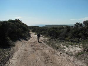
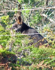
It was a long trudge through the, at times, deep wheel-rutted soft sand on a hot afternoon, but the thought of a hot shower and a cold beer at the end of the day kept us going. The sandy track was criss-crossed with the tracks of various lizards and the odd snake, while several black wallabies watched us pass from their scrubby hides. |
|||
 |
 |
 |
 |
 |
|
||||
|
|
||
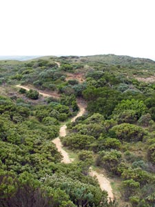 Track winding through the dunes |
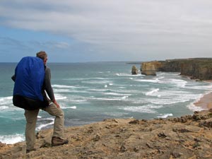
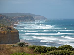
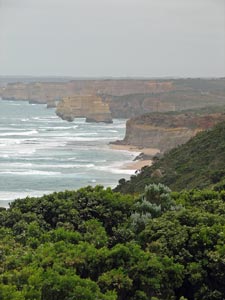 First glimpse of the Twelve Apostles |
 Multi-layered and multi-coloured cliffs |
 Glenample - where the walk once ended |
 At each point the Apostles were closer |
|
|
 The sun returns to brighten up the heath |
 Almost there |
|
|
||
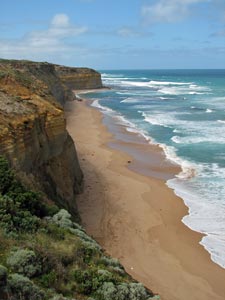 Looking down onto the beach at Gibson Steps |
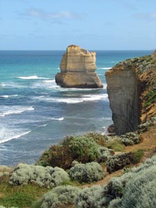 A lone Apostle |
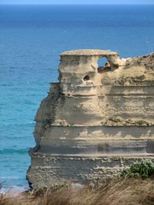 In homage of Meteora |
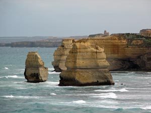 The impressively layered pillars of the eastern Apostles |
 One last glimpse along the coastline of the Shipwreck Coast |
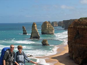 Walk's end - at the Twelve Apostles |
|
||

 Glenaire to Ryan's Den Campsite