| Great South West Walk - The Beach |


Day 1 - Nelson to Lake Monibeong (22.5 km - 70m ascent - 60m descent) |
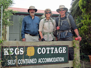
The day dawned still and grey for the start of our Great South West Walk and Canoe adventure. After checking packs and gear, the first task was to drive the car over to the Nelson Canoe Hire place on the opposite shore of the Glenelg River - here it would stay until we paddled back into Nelson in two weeks time. Chris, the owner, kindly drove me back to the Nelson Pub, where the fair Nello and Alan were waiting. We strapped our backpacks on and set off. |
||
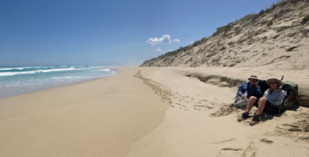
 All ready to go |
 |
 Looking toward Oxbow Lake |
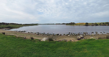
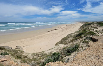
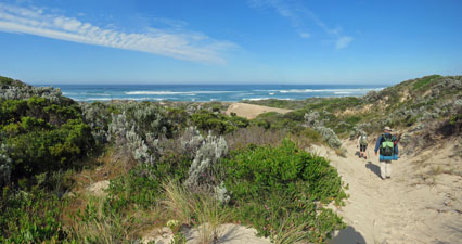
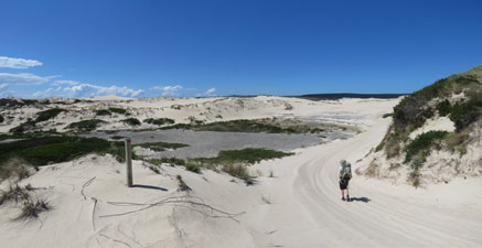
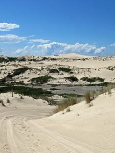
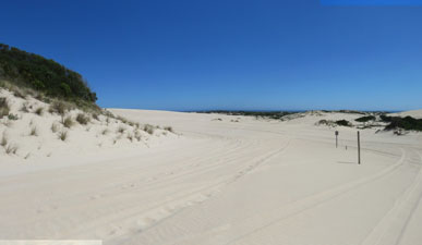
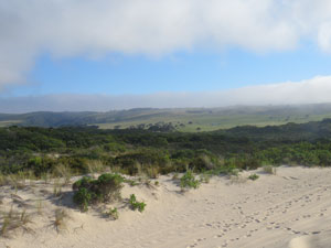
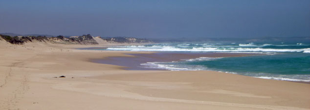
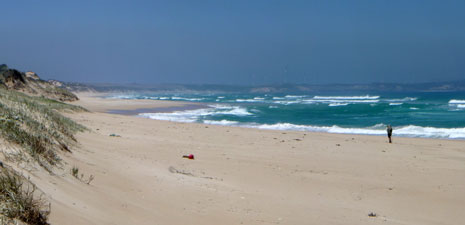
Crossing the grassy verge, we headed south with views down the Glenelg River to the broad waters of Oxbow Lake, a large shallow pocket in the river before it flows out into the Southern Ocean. Quickly joining the asphalt-surfaced Beach Road, we followed it down past the lake, before leaving it to cross the heath-coverd dunes on a well-used foot path. On exiting the dunes, the wide sandy beach of Discovery Bay stretched out into the mists in either direction. |
||
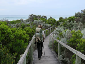 Boardwalk to the beach |
|
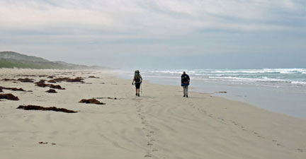 Setting out along Discovery Bay |
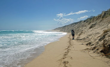
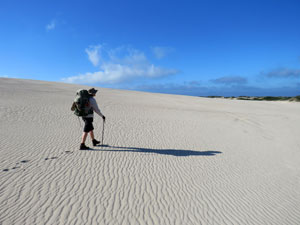
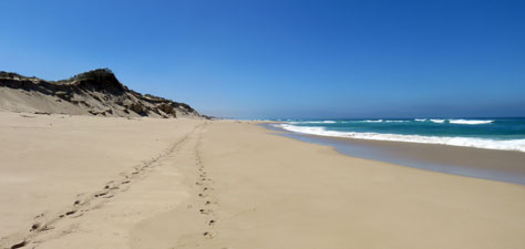
Accompanied by the soft roar of the surf rolling in, in chaotic bands, we turned eastwards and headed down the beach highway. For a hiker, the first steps onto the beach are always filled with trepidation - firm sand is a pleasure to walk on, but the softer it gets the more tiring it becomes .... it was reasonably firm, phew! The wet sand was firm enough for fairly easy walking, which was a relief as a lot of kilometres of beach-walking lay ahead over the next few days. We had actually planned the beach-walking for low tide, but with a 7 cm difference between high and low tides today, it didn't matter all that much. |
 The ghostly shape of Shipwreck Rock |
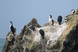 Cormorants on Shipwreck Rock |
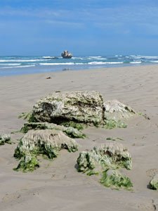 Seawead-draped limestone |
Ahead, the beach faded into the salt mist, as we strode along, breathing in the ion-charged air. The beach was completely ours, apart from the occasional pied oyster-catcher or wheeling gull. The morning cloud band slowly moved on and by the time we reached Shipwreck Rock (I don't know whether it looks like one or caused one), sitting oddly-shaped in the wild surf with its crew of cormorants. |
||
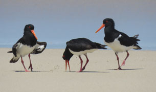
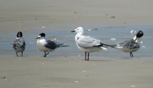
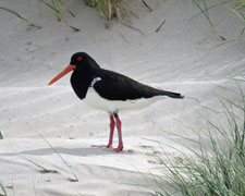 Pied oyster-catcher |
 Route through the coastal rocks |
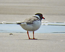 Hooded plover |
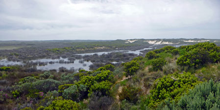
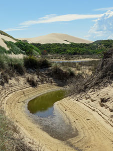
This brought us to another 4 km stretch of isolated beach and morning chats subsided - this was zen time, as we let the sounds of the ocean, the scent of salt-charged air and the solitude of our surrounds lead us on. Passing the now-abandoned campsite at White Sands, we stopped to climb the low fore-dunes and take in the views of Long Swamp, the marshy wetland that paralleled the coast at their rear. |
||
 Wetlands at the back of White Sands |
 The endless beach of Discovery Bay |
|
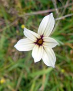
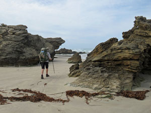
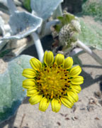
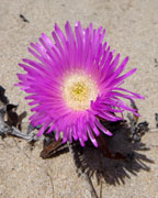
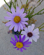
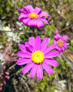
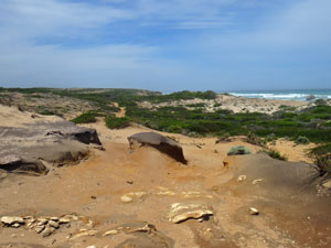
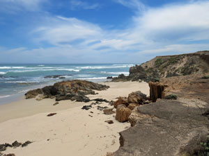
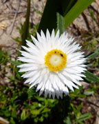
Shortly after, it was the end of beach-walking for a while. The dunes gave way to a long line of low but rugged cliffs and the path led us up on to their rocky tops - a good place for lunch looking back over the long stretch of sand that we had just traversed. Lunch over, we followed the track along the winding interface betwen rock cliff and backing dune - sometimes on hard rock surface, sometimes on powdery sand - as we passed through a landscape of low scrubby heath, brightened by the patches of colour from coastal wildflowers. |
|
 The interface between dunes and cliffs |
 A big sand-blow |
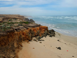 Orange cliffs near McEachern Rocks |
|
Across sandblows, next to rugged orange-tinted cliffs, through sandy hump and hollow, the track took us past the beach obstacles of McEachern Rocks and Noble Rocks. Once past the latter, it led us quickly back to the beach for one last kilometre of zen-walking in a cool breeze - only, was the sand getting softer? Ahead, some figures emerged form the salt mist - a group of locals were collecting pipis from the sandy shallows as the waves rolled in. |
|
|
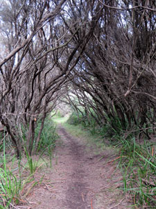
The pipi-hunters had arrived by car, and we followed the path out through the dunes to the car-park. Here, we joined the inland route to Lake Monibeong - a 7 km grassy track that meandered through the vegetation of the back dunes - in parts open and grassy, in parts tunnelling through dense coastal heath. After a while, it reached the edge of the Black Swamp and followed its tea-tree lined perimeter. |
|
|
 |
 |
||

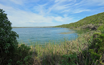 Reed-lined Lake Monibeong |
The cool breeze was rare in this thick and sheltered landward scrub, as we left the swamp to meander through a series of densely-vegetated old dunes. Finally, a glimpse of Lake Monibeong appeared through the branches, and then another, until eventually we were wandering alongside its reed-lined shores. The breeze coming off the lake cooled us down and the tiger snake slithering across the path provided a quick adrenalin rush. |
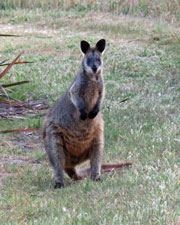 Pretty-faced wallaby |
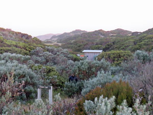
Our last meander away from the lake brought us to the campsite - after 22.5 km and 7½ hours of walking. It was a relief to arrive and even more so to find the food stash and camping gear where we had left them. There is a small wooden jetty on the shore of Lake Monibeong, which enables hot and sweaty walkers to walk out beyond the reeds and and have a swim in its clear cold waters, if they liked. The fair Nello and I did so like - it was superbly refreshing after such a long day's walk. |
||
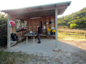
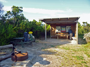 The shelter at Monibeong camp |
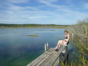 Time for a late afternoon swim |
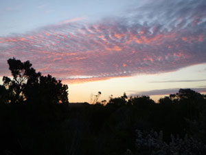 Monibeong sunset |
Thus, with a pretty setting, shelter, tables, plentiful supply of water (groundwater) and even a flush toilet, we had a very pleasant end to our first day on the Great South West Walk. The glorious sunset was just a bonus. |
|

Day 2 - Lake Monibeong to Swan Lake (17 km - 50m ascent - 50m descent) |
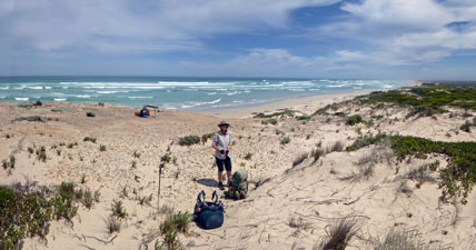
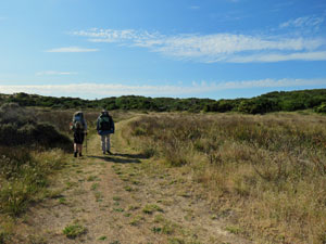
The sun greeted us as we got up, had breakfast and broke camp on the morning of the big beach day. Ahead of us lay a 13½ km walk down the salt-misted sandy strip that lines Discovery Bay. The track to reach the beach was a grassy path that meandered across the low shrubs and grasses of the hinterland to reach the coastal dunes. A short climb into the dense heath, an even shorter descent and slide over the steep sandy lip, and we were back on the beach. Alas, the sand was softer than yesterday - it would be a tiring day. |
|
 Heading out from Lake Monibeong |
 Crossing the dunes to regain the beach |
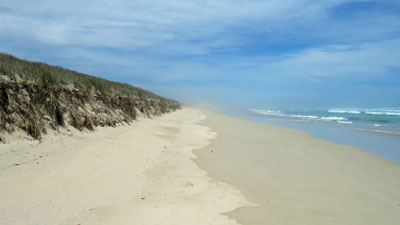
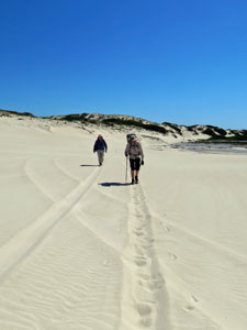
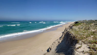
To the west, the rocky prow of Cape Montesquieu jutted seaward - we turned east and set off, low wave-cut dunes with a fringe of marram grass on the left, the rolling surf of the Southern Ocean on the right. Thus it was for the next four hours, as we slowly made our way along. Our pace was being slowed down by the softer sand, not so soft to trudge, but soft enough to to leave deep footprints. These footprints often meandered like a drunken sailor's, as we sought out firmer patches of sand to walk on - usually closer to the water. Today there was only 4 cm and 3 hours difference between high and low tide. |
||
 A glance back to Cape Montesqieu |
 |
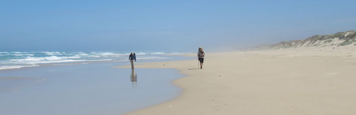
 Single file in the soft sand |
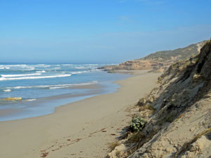
Despite little tidal variation, the long flat beach of Discovery Bay is not as featureless as first appears, with micro-humps and -hollows where a little bit more wave energy would send sea water racing high up the beach. It became an amusement to play "chicken" with the surges. In this game, you can win a hundred times, but lose once and you will walk in wet socks and boots for the rest of the day. I lost once! |
|
 The subtle beauty of sand |
 Rest break on Discovery Bay |
Thus, we headed slowly eastwards towards the never-ending salt-misted horizon. As time passed, the mind drifted to different things - the slow evaporation of clouds to leave a clear blue sky, the moving shades of blue, turquoise and emerald sea, the soft roar of the surf interspersed by the occasional call of a Pacific gull or pied oyster-catcher, the water-rippled patterns and the many shades of tan of the sand. In fact, long-distance beachwalking is an occasion for "walking meditation" - slow the pace, bring the rhythms of breath and step into sync, let the soft roar of the surf calm the mind, breathe in the ion-rich air and breathe out the problems that haunt. Colour, scent and sound become more intense as the mind relaxes and time slows down.
|
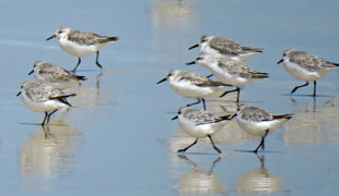
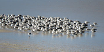
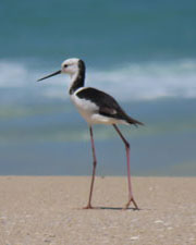
As the time passed, the beach itself undulated in width, from broad expanses over 100m wide to narrow pinches where the bigger waves ran into the sharply-eroded dune edge. The sand itself could be soft or firm, smooth or gritty-shelled. Several times we stopped just to take it all in and watch the antics of displaying pied oyster-catchers, the disdain of Pacific gulls, the scurrying flocks of grey plovers and the rarity of a pair of endangered hooded plovers. |
||
 |
 |
 |
That said, as the kilometres passed, the walking became more tiring and we were greatly relieved to see the gap in the bigger dunes that marked the entrance gully to Swan Lake camp. As we sat at the base of the large pale dunes, a pair of beach buggies whizzed by and out of sight on to the beach, followed a few minutes later by a ranger on foot armed with a high-zoom camera. He told us that the buggie folk were commercial fishermen illegally harvesting pipis - high drama at Discovery Bay. |
||
 Narrow beach near Swan Lake entrance route |
 |
 Heading inland towards Swan Lake camp |
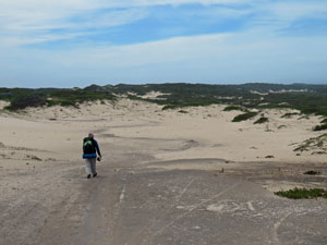
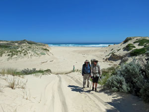
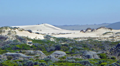
The foot track from the entrance gully led quickly up into the dry white sand of the dunes - a series of hills and ridges of windswept sand. We admired the gentle curves and shapes sculpted by the wind, but not the steady trudge of climbing up and down the soft white sand. One last such climb found us looking down from sandy dune to flatter heathland and the campsite at Swan Lake. |
|
 |
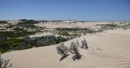
Images of the Discovery Bay dunes
|
 |
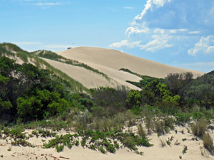 The big dune (70m high) |
 |
 Swan Lake camp site (photo: Alan Laird) |
We quickly found the walkers' shelter and installed ourselves at the table. Swan Lake, itself was a few hundred metres away, so the fair Nello and I set out for our post-walk swim. While shallow and not as aesthetic as Lake Monibeong, its cold clear water was still enough for a refreshing end-of-day soak. Life with a backpack offers simple pleasures. |
||
 |
 Contemplating Swan Lake |
 |
And so passed the second day of our long walk in Victoria's south-west. We went to bed with a little trepidation - the same long beach line awaited us tomorrow and the guide book warned of soft sand and a steeply-sloping narrow shore. Would Discovery Bay still hold the same allure as today? |
|


Day 3 - Swan Lake to The Springs (23 km - 130m ascent - 110m descent) |
There are two ways to get from Swan Lake to The Springs - the inland route, which is longer and takes two days, and the coastal route, which can be done in one very long day, passing along the isolated sandy shore of Discovery Bay ("yet again" some might say). We needed to do this walk in 14 days, so we chose the coast route. It was to be our hardest day of walking. It had been a pleasant night - late-rising moon and no clouds allowing a magnificent display of the Milky Way, constellations and stars. The moon is also mistress of the tides and today high and low tide would almost converge - 1 cm and 1½ hours apart. The day of the dodge tide was approaching (see more tomorrow). |
||
 Low cloud over the hinterland |
 Crossing the rippled dunes of Discovery Bay |
 "Fossilised" buggy tracks |
As we set out, retracing our inward path up into the massive dunes of the Discovery Bay Coastal Park, low misty cloud began to form over the green inland hills. However, the sun still shone brightly on the dunes as we detoured to pick up the beach buggy transit route - a line of diamond signs that led across the wind-rippled sand and down into a narrow gulch to emerge once again on the beach of Discovery Bay. |
|
|
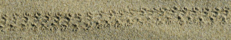
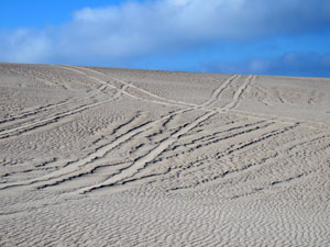
It was an interesting route - apart from fossilised beach buggy tracks and the footprints of humans, many other creatures had left their tracks in the sand - kangaroo, reptiles large and small, birds and beetles. Sand dunes are not a sterile place.
|
|
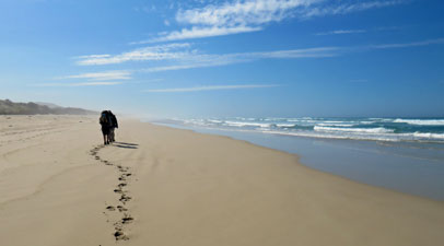
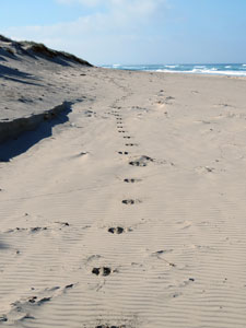
Ahead lay another 13 km of beach-walking (so the sign at the camp said). We turned east yet again and set out. The first thing that we noticed was that the sand was even softer than on previous days, making walking slow and tiring. The second thing we noticed were the footprints of Paul and Nannette. We had crossed paths with Paul and Nanette, bushwalkers from Alice Springs, a couple of times already. They had set out from Portland ten days ago and were on the home stretch of the Great South West Walk. Last night they set up camp on the beach and so were now well ahead of us, leaving only footprints. Now, one way to make soft-sand walking easier is to follow someone elses path, and so, wherever they had not been obliterated by incoming waves, we trod in the prints of Paul and Nanette - thank you, both! |
|
|
 View from the foredunes over Discovery Bay Coastal Park |
 View from the foredunes back up the coast |
The day rolled steadily on, with regular stops to lean against the water-eroded fore dunes and rest - a chance at times to climb up into the dunes and take in the panorama of the massive mobile dune system behind. At other times we were entertained by the scurrying plovers and ever-present pied oyster-catcher (or on this shore-line, the pied pipi-catcher, judging from the number of punctured pipi shells on the beach). The sighting of another rare hooded plover proved a monotony-breaker. |
|
 One last look into the interior of the dune system ...... |
 ..... and back on to the magnificent isolation of the Discovery Bay beach |
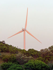
Under a now cloudless sky, the sun shone hotly, but an easterly breeze kept us cool. The long soft-sand trudge continued, motivated by the appearance of Cape Bridgewater out of the sea-mist, our progress measured as it grew longer and clearer and the line of wind turbines on its spine took shape. |
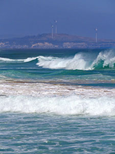 The big seas of the Southern Ocean |
||
 Turbines over Discovery Bay |
 |
 |
|
There were zen periods, but as Alan asked "when does zen end and delirium start?" I had no answer. After 15 km (so my GPS said) and 5½ hours on the beach, we finally reached the exit point, just 1 km from the cliffs of Cape Bridgewater. Climbing steeply over the fore-dunes, we descended into the green hinterland shrubbery to follow a grassy path high above Lake Bridgewater. It felt so good to be walking on firm ground again and our pace noticeably quickened. One glimpse of the lake was all that we got, however, as the track meandered through the dense and still heathland to emerge at the base of the cape. |
||
 View over the hinterland and distant turbines |
 Dense heath near Lake Bridgewater ..... |
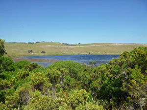 ..... and the lake itself |
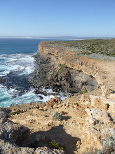
From here, a gentle climb took us up onto the cape, where the track followed the cliff edges along. Even though we were feeling pretty tired from the long beach walk, we could not but be amazed by the ever-changing panorama of the long lines of waves and sweeping sands of Discovery Bay that disappeared into the distant horizon. Did we really walk all that way? |
|
|
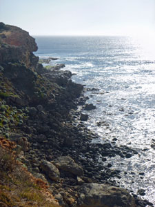
 The cliffs of Cape Bridgewater |
 The long lines of Southern Ocean swell rolls in |
|
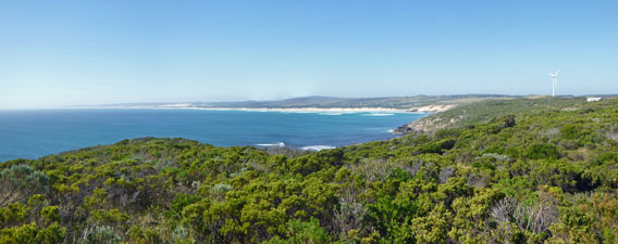 Panorama over the coastal heath to the long sandy beach of Discovery Bay |
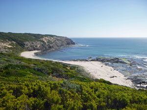 Whites Beach |
Ahead lay the equally impressive views of the rugged cliffs of the cape. Passing Whites Beach, where in 1851 the barque "Marie" sank with all hands, we reached our second food stash, 2 km form the camp, and loaded it into our packs. Ending a 23 km walk with a sudden increase in pack weight is not my idea of fun, but it saved us a lot of work in the long run. We were now exposed to a cold easterly wind that whipped across the cape, but what would you expect when the skyline is a string of giant turbines. |
|
|
Pushing on beneath these objects of Don Quixote's nightmare, we finally reached The Springs campsite and dropped our packs for the last time. Paul and Nanette were already well esconced and we would enjoy their company at this and the next two camp sites. The Springs lies in a protected clearing amongst the dense heath back from the cliffs. There would be no evening swim at this site, but a sponge and bucket behind the rain water tank still left one feeling pretty refreshed. |
|
Tonight, we would sleep to the soft flap of wind on the tent fly and the distant drone of the turbines, but, after such a long and hard day, there was little that was going to keep us awake. Our time on the shores of Discovery Bay were over and tomorrow we would start to explore the capes and headlands of this region. |
|