| Great South West Walk - The Forest |


Day 7 - Portland to Cubby's Camp (19 km - 140m ascent - 120m descent) |
|
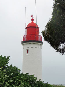
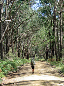
After 24 hours of wild weather, the morning dawned still ..... grey, but still. Having re-assessed the need for some of our gear, we left a small box at the Portland Bay Holiday Park office for later collection and headed off. With four more days of walking, every bit of weight counted. Feeling fitter again after a day off, we quickly regained the Great South West Walk, strolled past Whale Bluff lighthouse, through the suburbs of North Portland and out into the country. |
|
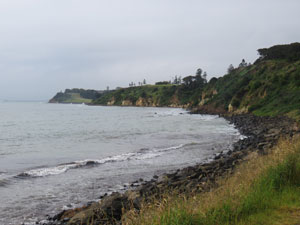 View back towards Whale Bluff |
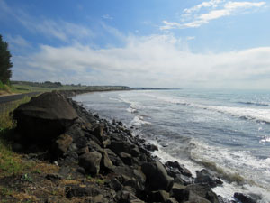 Black basalt boulder breakwater on Portland Bay |
|
On leaving Portland, the track dropped back down towards the beach, this time following it around on a grassy verge behind the black basalt boulders of the long wall protecting the coast from erosion. The time passed quickly and we were soon at the Henty Bay Tourist Park - time for one last coffee and cake before heading out into the wilds for another week. While we enjoyed the coffee, the sun broke through and the sky quickly changed from grey to blue with puffy white clouds - who'd have believed that it would be so this time yesterday. |
|
 The locals watch us pass by |
 Heading inland up the Caledonian Hill Escarpment |
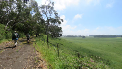
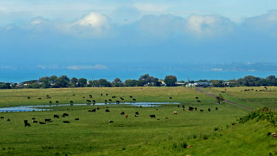
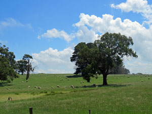
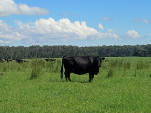
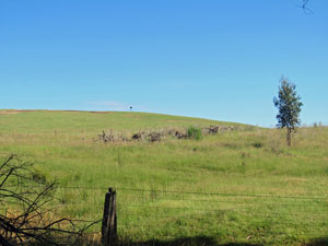
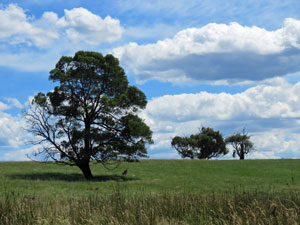
It was time to leave the coast for the last time, as the route now headed inland along an old and disused asphalt road. We passed through a bucolic landscape of green pastures and contented cattle before climbing gently up the escarpment of Caledonian Hill - one last look behind over the pastures to the sea beyond and we entered the forest. |
||
 |
 View over the green pastures and blue bay to hazy Portland |
 |
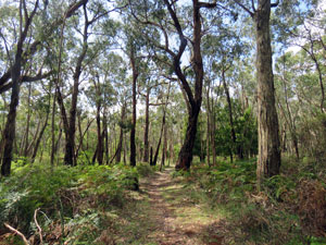
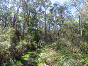
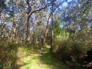
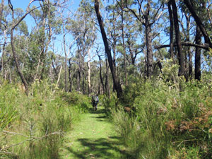
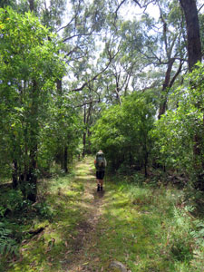 Into the forest on Caledonian Hill |
The birds were singing in the tree-tops as we wandered beneath the leafy canopy to reach Caledonian Hill Road. For a while, this road would be our route, taking us westward for the first time.
|
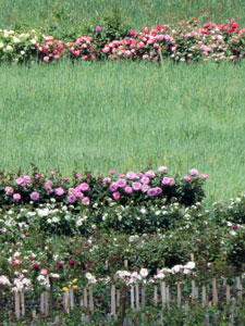 Commercial rose garden |
It was a pleasant stroll, breathing the sweet scent from the commercial rose garden, chatting to the school kids from Bolwarra Primary School as they hung over the fence on their lunch break, or just enjoying the green pastures and contented sheep of Australia Felix. |
||
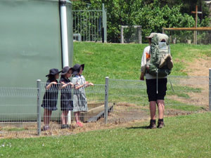 Ex-teacher Nello chatting to the Bolwarra School students |
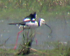
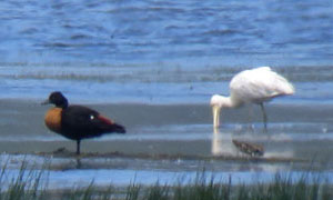
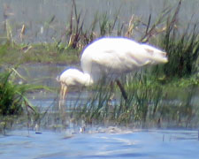
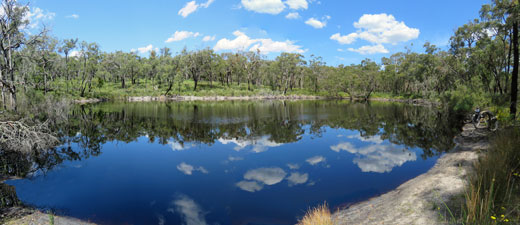
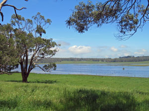 A nice wetland near Bolwarra ..... |
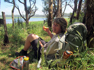 .... time for a lunch break |
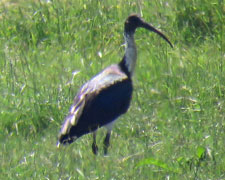
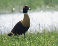
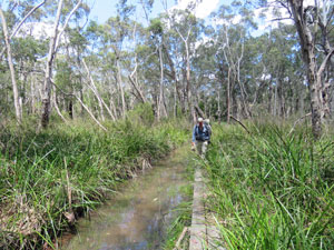
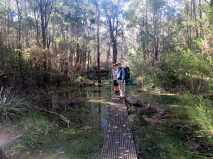
The road changed from asphalt to dirt, before morphing into a foot track that edged past a lovely wetland. It was a good place for lunch, with swans, ducks, spoonbills, ibis and other wetland birds, and strange low mists drifting across the water surface. |
||
 |
 |
 |
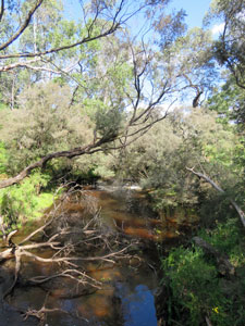
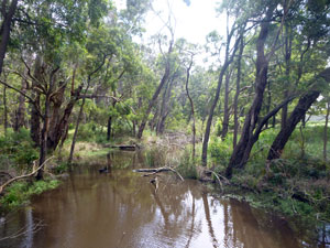 Creek flowing into the wetland |
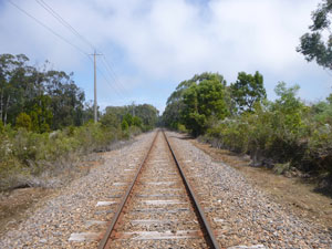 The Portland-Heywood rail line |
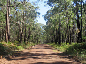
 Heading up a country road |
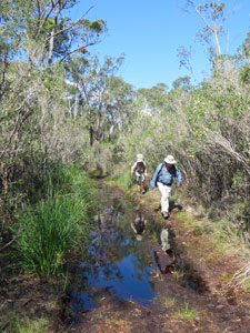
Pushing on, we passed through a boggy section of forest to reach the Portland-Heywood railway line. Here, the track turned north on a narrow dirt road to parallel the line for several kilometres. With the heavy rain just past, there were plenty of puddles and deep pools on the road, forcing us to sidle our way around between water and scrub on several occasions. |
||
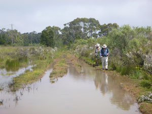 After the storms the road was very wet |
 |
 |
 Site of Blackwood Camp (now abandoned) |
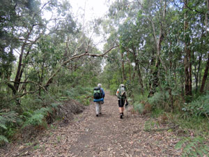
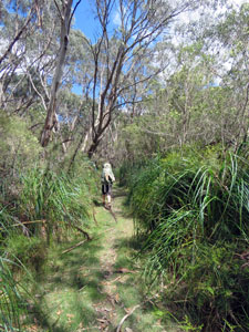
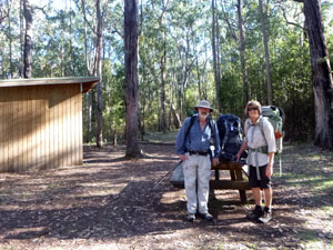
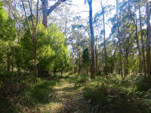
Soon we reached the edge of Cobobboonee State Forest, where the boggy low-lying terrain had forced the track to detour further along the road before reaching ground high enough to head in beneath the tree canopy. We were on the last leg of the day, passing the abandoned Blackwood Camp, to walk for a while along the fringe of forest and pasture and finally turning back into the forest of rough-barked messmates. |
|||
 Entering Cobobboonee Forest |
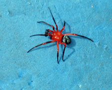 A local spider |
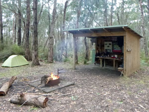 Cubby's Camp |
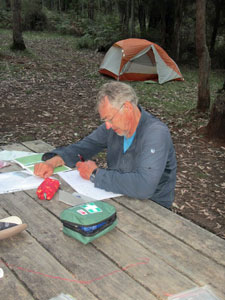
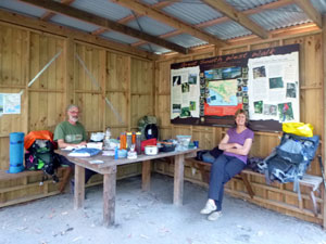
Not long after we reached Cubby's Camp. We have no inkling who Cubby was, but his camp was a pleasant clearing in the forest. It had been a relatively easy day of walking to get here, and quite a varied one, with coast, farmland and forest on the way. With the forest damp from all the rain, it was also a good time for the fair Nello to release the inner pyromaniac and set us a nice fire in the camp fire-place. Sitting around a fire deep in the forest must be one of the most primal of human activities. |
||
|
Day 8 - Cubby's Camp to Cut-Out Camp (14.5 km - 90m ascent - 70m descent) |
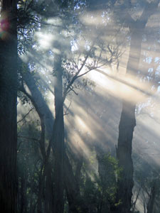
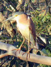
When you wake up in the morning, the last thing you want to see is a leech looping across the inside fly of your tent. Welcome to Cobobbooneee Forest - it is a damp place. Today's walk promised to be a shorter one - a 15km amble through the flat heartland of Cobobboonee. A soft mist had settled over the forest overnight and the filtered light provided a peaceful ambience, as we packed up our dew-damp tents. By the time we set off, it was already starting to evaporate and the sun broke through, dappling its light on the damp forest floor. It promised to be a perfect walking day - temperature in the low 20s, blue sky, fluffy white clouds and trees, lots and lots of trees. |
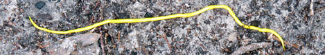
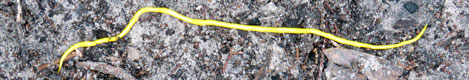
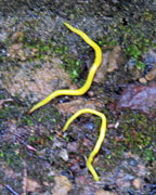 Yellow flatworms |
 Early morning mists at Cubbys Camp (Photo: Alan Laird) |
|
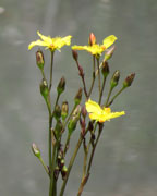
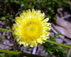
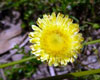
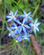
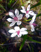
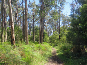
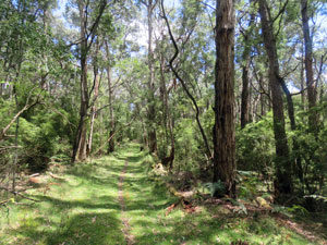
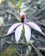
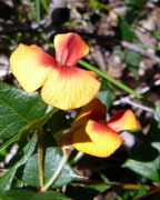
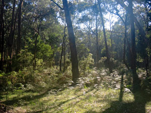
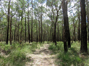
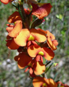
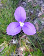
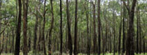
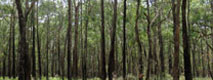
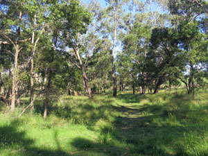
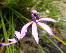
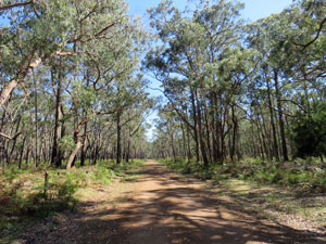
It is hard to describe a walk in which the landscape remains similar from beginning to end. Cobobboonee is a lowland forest, dominated by tall rough-barked messmate eucalypts, with a lush understorey of bracken, grasses and reeds, and a mid-storey of wattles, cherry ballart and assorted tall shrubs. Scattered lilies and daisies and the occasional orchid lined the path. |
|
||
 |
 |
 |
||
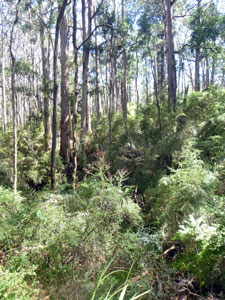
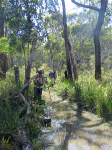
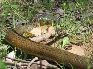
The experience of walking through it is as much aural as visual, with a chorus of forest birds twittering and whistling in the canopy and a chorus of frogs croaking in the wetland ponds ...... and lots of wetland ponds there were after the big rain. Many sections of path had become long, narrow pools. Sidling around them between water and thick bush provided some of the excitement for the day. A large copperhead that slithered across the track, splitting the peleton between the fair Nello and Alan, provided even more. |
||
 From the forest ...... |
 ....to the fields .... |
 .... and back into the forest again |
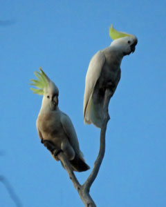
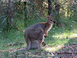
The route led across several of the gravel roads that criss-cross this forest, past features such as Reg's Sinkhole (a large depression in the forest floor) and Wild Dog Creek, which drains one of the many swamps near here. At one road crossing, we disturbed old man emu and his four chicks, sending them loping down the road. A couple more encounters with emu and kangaroo broke up the journey beneath the trees. |
||
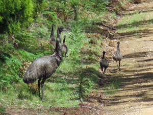 Old man emu and his chicks |
 |
 |
|
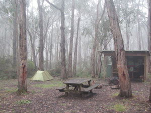
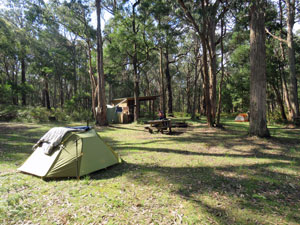
Finally we descended into the valley of the slow-flowing Surrey River and its swampy surrounds, crossing it on Ralph's Bridge, a long wooden footbridge that kept our feet dry - thanks Ralph! A short, sharp climb out of the valley and one last wander beneath the messmates brought us to our overnight destination, Cut-Ot Camp. Cut-Out had a lovely setting - broad, flat grassy area for tents and the usual shelter / table / water-tank / toilet that we had come to appreciate each night. |
|
||
 |
 |
 |
||

|
Ten days ago, Alan and I had hidden our fourth food stash here .... but where? Ten days is a long time for aging brains, and it took a good 10 minutes before Alan applied a bit of logic to get the right bearing and find the stash. I let out a brief sigh of relief.
|
|
With our early arrival, the warm sun quickly dried out our tents and we were able to spend a very relaxing end of day doing a bit of washing, basking in the dappled sunlight and listening to the sounds of the forest. As we did so, a young German hiker walked by - he had set out from Portland this morning and didn't plan to stop until the next camp, 44 km walking in a single day - at that rate he will complete the 250 km circuit in a week. We couldn't work out whether he was super-fit or super-crazy, so I decided to mull over the topic as I leaned against a tree, sipping my coffee. |
|
Day 9 - Cut-Out Camp to Fitzroy Camp (22.5 km - 70m ascent - 80m descent) |
|
There are two camps along the next section of the Great South West Walk, Cobobboonee in 10.5 km distance and Fitzroy, 11.5 km further on. Separately, they made for very short days, but double-staging makes for a very long day. However, you can only spend so much time in the forest - today was going to be a very long day. |
||
 |
 |
 wakey wakey --- time to rise |
|
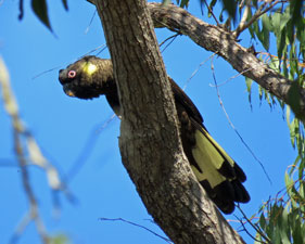
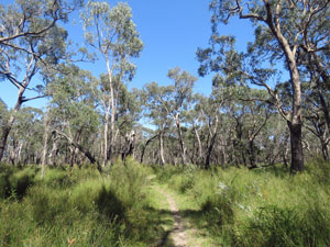
The mournful wail of a black cockatoo checked us out of Cut-Out and we headed quickly down the grassy track beneath a canopy of tall messmates under a clear sky, as the fine weather continued. The first part of the route was flat and quite pleasant walking - the forest open with bright green bracken and grass floor cover. Where low spots held moisture, bracken was replaced by sedges. With the full symphony of forest birds, early morning was a soothing time in the forest. |
||
 The forest ..... |
 ....the forest .... |
 .... and more of the forest |
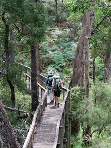
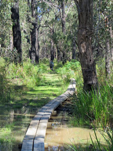
Generally, the landscape was drier than yesterday, with fewer pools along the track. Where there was free water, the Friends of the GSWW had built long sections of boardwalk to keep feet dry. One such boardwalk led us across the lush valley of Scrubbers Creek. Drier sections of the track were dotted with a myriad of small conical ant mounds - fresh diggings after the rain. |
||
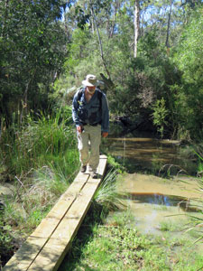 A nice bit of boardwalk |
|
 Another low-lying wet area |
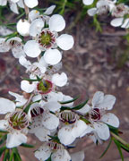
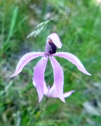
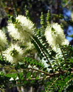
The vegetation gradually changed as we pushed on through the forest, as shrubby banksias and melaleucas appeared in full bloom and mauve flag lilies brightened the greenery. Turning north, we climbed two sets of low sandy tiers, where the diggings of potoroo and echidna became more common. The tall messmates had been replace by stunted brown stringybarks in this poorer soil. Apparently, such heathland-type vegetation occurs from place to place in Cobobboonee. |
|
||
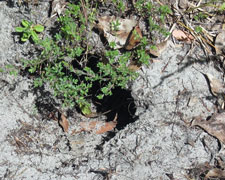 The burrow of a potoroo? |
 |
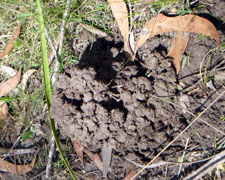 The home of a burrowing crayfish |
|
However, as soon as we crossed Cobobboonee Road, the vegetation changed back dramatically to the tall canopy and lush undergrowth we had come to expect. We also reached the first campsite and stopped to enjoy a restful early lunch. That enjoyment did not last long as the resident mosquitoes smelled blood (or, less poetically but more accurately, carbon dioxide). |
||
 Sunlight dappling the bracken-covered forest floor |
 Another long section of boardwalk |
 An area of younger regenerating forest |
|
We ate quickly, filled up our water bottles from the tank, and pressed on. The day was warming up quickly and the air was still, especially down on the forest floor. Even the chorus of birds had quietened to the occasional twitter in the heat of the afternoon sun. To be honest, somewhere after Cobobboonee Camp, my appreciation of the forest began to fade. |
|
|
 |
 |
||
The sameness of the landscape was seeping in and the section slowly transformed to a long hot trudge beneath the trees. A couple of emus running across the path provided a brief distraction, but it still seemed a long time before we reached the pleasantly sited Fitzroy Camp and were able to drop our backpacks for the last time that day. |
||
 |
 Rest time at Fitzroy Camp |
|
It was a weary trio of walkers that pitched camp, lit a nice fire and settled down to enjoy the still evening air. Comfort at last - at least for a couple of hours until the squadrons of Cobobboonee mosquitoes emerged to drive us into our tents. However, not before the fair Nello put the final touches to her sewing repairs of Alan's shirt, which had begun to disintegrate. Always take an expert seamstress on your long-distance walking trips. |
||
|
Day 10 - Fitzroy Camp to Moleside (22.5 km - 70m ascent - 80m descent) |
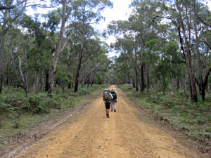
We were up early for our last day of walking on this Great South West Walk adventure - after today, we will be taking to canoes and the thought of no more backpacks from then on would be good motivation for the long stretch ahead. We set off and quickly headed down through the shady forest to cross the Fitzroy River and its lushly vegetated banks on a narrow steel and composite foot bridge (previous wooden versions having been swept away by flood, crunched by falling trees and burnt by bushfires). |
|||
 All ready to leave Fitzroy Camp |
 |
 |
 Crossing the Fitzroy River |
From the Fitzroy, we began a steady climb to the north - the ascent of Mt Vandyke had begun, all 181m of it. As we stopped and turned west short of its grass-domed top, this meant a 70m climb out of the river. Needless to say, the Cobobboonee landscape is a flat one. Still, it was good to see open fields and walk in the green grassy woodland, if ever so briefly, before plunging back beneath the messmate canopy to start a long trek westwards. |
||
 Early morning shade in Cobobboonee |
 Can you spot the trig on might Mt Vandyke |
 Open woodland just below Mt Vandyke |
As the fair Nello commented, early morning is a pleasant time to be in the forest, with cool air, birds singing and dappled shade from an angled sun. That, however, does not last and, as the day warmed up to the low 30s and the sun beat down directly from above, the forest became increasingly stifling. |
||
|
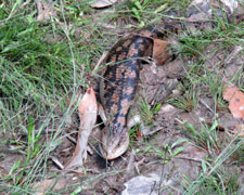
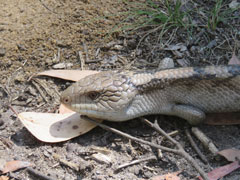
There were diversions - a red-necked wallaby, some flighty emus, a slow-moving blue-tongued lizard and an even slower moving copperhead snake, that obligingly let us take its photo and then watched as we edged by on the track.
There were other diversions, as leeches looped in at almost every rest-stop. Most got a quick flick, but one had a good feed on Alan's leg (I suffered a similar fate at day's end in the campsite). It was curious to see them so aggressive, as this part of the forest seemed drier than previously. The westward push continued as the day passed and, somewhere along the way, we moved from Cobobboonee National Park to Lower Glenelg National Park, eventually reaching open paddocks at the edge of the forest. It was good to be in the open again, with views out over pasture and eucalypt to the distant pine plantations beyond. |
|

From here, the route was almost all downhill, losing height through the lush, bracken-floored messmates to reach The Inkpot, a large sinkhole filled with dark tannin-stained water and lined with black sediment. When the air was still, the surface perfectly reflected sky and cloud and surrounding vegetation. When a breeze lifted to ripple the surface and cool us down, it became a hard place to leave .... but we did.
|
|
|
After a brief wander down the gravel surface of Inkpot Road, we headed slowly down into the forest for a last hot trudge parallelling the course of Moleside Creek. The lovely picnic spot and cascades of the creek did not stop us for long, as our thoughts were focussed on Moleside Campsite, some 500m further on. |

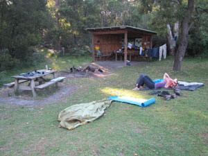 End of a tiring day at Moleside (Photo: Alan Laird) |
 |
 Evening light on the river (Photo: Alan Laird) |
 |
 |
 |
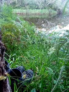 The last resting place of Alan's boots |
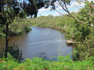
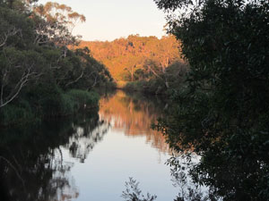
It was a lovely grassy spot high above the languidly flowing Glenelg River. Three tired trekkers put down their backpacks for the last time of the trip and gave each other a round of high-fives at completing almost 200km since leaving Nelson 10 days ago. There was time to clean up and rest tired bodies before the sun set and the mosquitoes emerged. Alan was able to give his boots (that had finally died on the last two days of our walk) a Viking Farewell, propped beneath a shady tree overlooking a peaceful bend in the river). Don't be sad, Alan, they will be happy there. |
|||
Finally, we settled into our tent to dream of the canoe trip to come, as we were serenaded to sleep by the chorus of frogs in the nearby wetland. |
|