| Great South West Walk - The River |


Day 11 - Moleside to Battersby's Camp (20.5 km) |
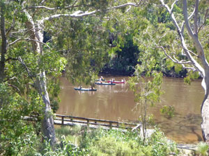
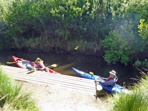
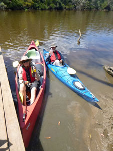
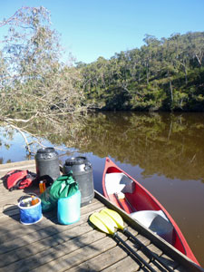
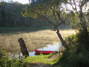
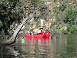
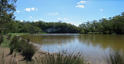
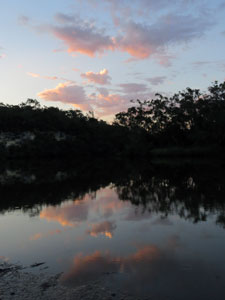
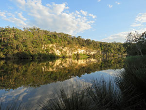
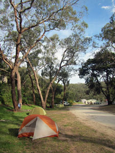
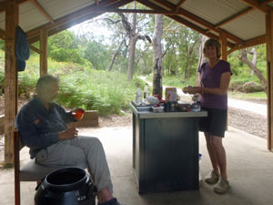
The Glenelg River canoeing part of our Great South West Walk adventure was about to begin, and what a glorious day it was for it - clear blue skies with a few fluffly white clouds. We broke camp and waited for Chris from Nelson Canoe Hire - at the appointed hour of 9am, he arrived with one double canoe and one single kayak, plus the two boxes of food that we had left with him. It took a bit of time to transfer camping gear etc to the water-tight plastic drums and food and valuables to an assortment of dry bags. Then, after the usual river and safety briefing, Chris left us to our devices. |
|
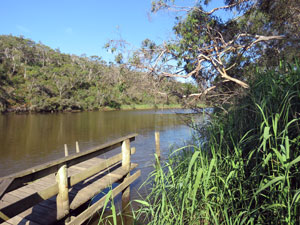
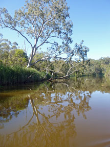
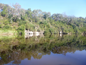
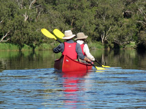
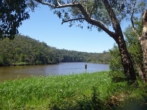
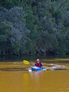
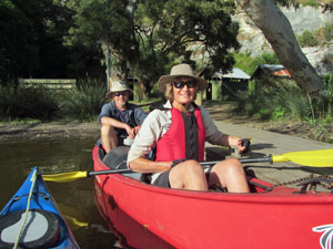
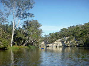
We carried the boats down to the small wooden landing at Moleside Creek, loaded drums and bags, climbed aboard and set off - the fair Nello and I driving the bus (canoe) with the drums and big bags, Alan in the sports-car (aka kayak). A few paddles later, we were out into the slow-flowing waters of the Glenelg River and away. It was just so nice to be on the river, lined with red gums, black wattles and reed beds. It was much better paddling by that vegetation than walking through it with a heavy backpack. It was also high time for a bit of upper body exercise after 10 days of walking. |
|
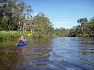
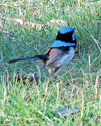
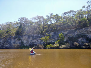
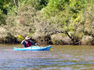 Alan powering along in the kayak |
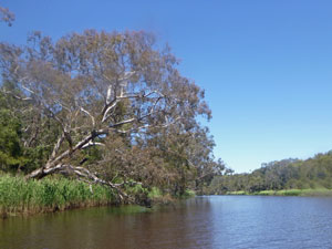 Overhanging river red gum |
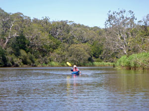 A more sedate section of the river |
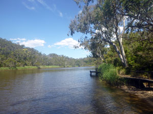
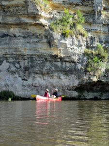
The light head-wind as we paddled up to Wild Dog Bend soon turned to a tail-wind as we paddled down the next reach. Thus, we settled in to the pattern of the day, a steady rhythmic paddle with the wind sometimes friend, sometimes foe. Interestingly, it seemed harder to keep a straight line with a tail wind than with a head wind. A couple more bends and long reaches brought us to Saunders Landing and our first break. I have to admit that, after two hours of sitting on a hard plastic seat, it was my backside that most needed the break. Walking does have that advantage over canoeing. Stops came at regular intervals after that - only 3½ km to reach Pritchards Landing and our lunch stop. Here, we caught up with a group of Melbourne Uni students who had camped at Moleside Canoe Camp (just below our walkers' camp) the previous night. They had started earlier than us and were just leaving. We both had booked Skipworth Springs as our overnight camping spot, but Chris from Nelson Canoes had told us that it was a small and uneven campsite. We decided to check it out when we arrived and re-consider our options. |
||
 The students passing Pritchards Landing |
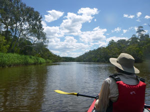 View from the back seat of the canoe |
 Heading down a long reach |
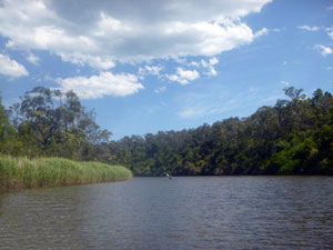
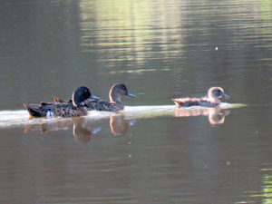
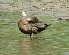
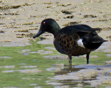
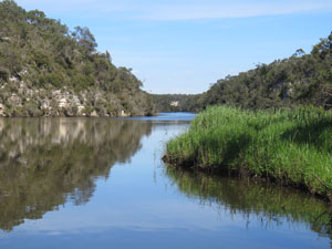
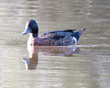
After lunch, the slow rhythmic life on the river continued - a big horse-shoe bend, several long reaches, the rich green tapestry of riverside vegetation as we passed beneath overhanging red gums and by dense reed-beds. Ducks skimmed by low over the water and the occasional cormorant flew past overhead. |
 View to the river from Skipworth Springs
|
 Reed-beds inside, big banks outside |
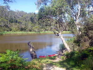 The river at Battersbys Camp |
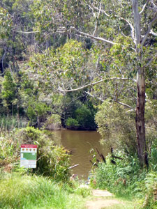
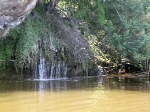
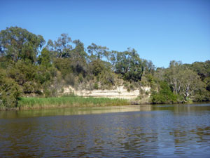
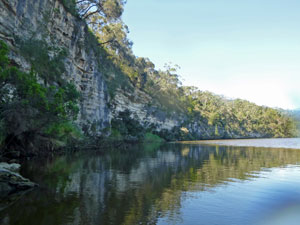
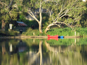
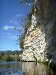
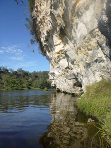
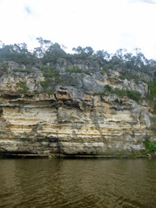
We reached Skipworth Springs at almost the same time as the students, tied up long enough to check out the site - yes, it was too small, yes it was uneven, yes it would be crowded - and decided to exercise option B, a further 4 km paddle to Battersbys. But first we filled our water bottles with legendary Skipworth springwater, flowing out of its tiny channel. The limestone in the river banks was starting to appear and form vertical walls on the big bends. At one, a series of small waterfalls flowed out from the base of the rocks into the river - lovely. |
||
 Mini waterfall at the base of the riverbank |
 View from the jetty at Battersbys |
|
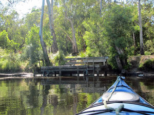
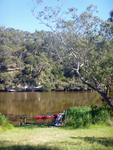
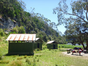
Two more bends and reaches and we arrived at Battersbys, ostensibly a car-camping spot, but with an adjacent walkers' camp of the style we knew and liked. In fact, it was the nicest walkers' camp so far. We pulled up at one of the small wooden jetties to unload our gear, then hauled the boats up on to the narrow mudflat and settled in for some pleasant afternoon relaxation in the warm sunshine and light breeze. |
|
|
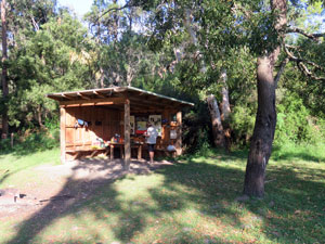 The familiar shelter at Battersbys walkers' camp |
 Jetty through the reeds at Battersbys walkers' camp |
|
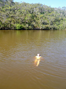
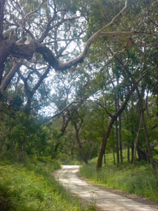
It really was the perfect end to a great day on the river - the walkers' camp had its own little jetty pushing out through the reeds to the deeper parts of the river, just the right place to have a swim in its refreshingly cold water. A short explore of the Great South West Walk track in both directions from Battersbys took me back into hot, still bushland, with few opportunities to see the river itself. We definitely made the right decision to canoe this last section rather than walk it. |
|||
 |
 The Great South West Walk track near Battersbys |
 |
 |
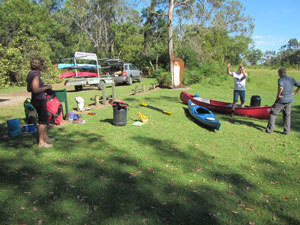
Weight on a canoe being no big issue, a few luxuries had appeared in the food-boxes that we picked up at Moleside and it was time to sample them - chocolate, fresh fruit and a small cask of red wine. As the campsite birds hopped about us, we raised our plastic cups and toasted the river. |
|


Day 12 - Battersbys to Pattersons Camp (13.5 km) |
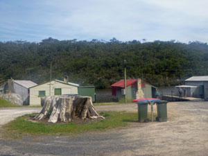
Our good fortune with the weather continued and there was the promise of a hot day, as the early morning mists drifted lazily above the still waters of the Glenelg River. I went down to check the boats and met a local fisherman who said that had been there since 6am without so much as a nibble. He also told me about the history of Battersbys - how before the National Park was declared, there had been a collection of river shacks, where people went to escape the world and fish. Now there are just a few crumbling jetties left. He also mentioned how, this far upstream there is still a strong tidal influence, which explained why the canoe and kayak that we had pulled up onto the muddy edge were now floating from their tethers. I tied kayak to canoe and paddled them 200m down the river to the walkers' camp jetty - it made loading a lot easier. |
|
|
 Ready to go at Battersbys walkers' camp |
 Reflection of a big river red gum |
|

Then we were on our way for a fairly easy day of paddling - 14 km from Battersbys to Pattersons. The river vistas were superb in the still morning air, with reed beds, cliffs and densely vegetated banks reflected on its glassy surface. |
||
 Morning reflections at Battersby |
 |
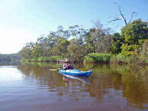 Alan in cruise mode |
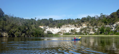
The changes in the landscape continued - at each outside bend, the limestone cliffs seemed that little bit higher and more vertical, while opposite, the inside bends were often flatter with extensive reed beds. Passing a series of camps and picnic spots - Georges Rest, Pop Eye's, Red Gum and Forest Camp North - we finally pulled in to Forest Camp South for our first break and glute relief stop. Early intervention can prevent a sore backside for some. |
||
|
|
|

From Forest Camp, the river made a couple of big U-bends. The wind was now beginning to pick up, helping us on one reach, hindering us on the next. We were becoming adept at reading the moving bands of ripples as gusts passed by. Occasionally, the wind even generated some tiny white-caps. We paddled on to Sapling Creek for lunch and, while there, got talking to another fisherman who had been out on his boat and had caught a dozen bream. He kindly offered us a cold can of Pepsi each, which went down well, as the day was beginning to heat up. |
||
 Rest stop at Forest Camp |
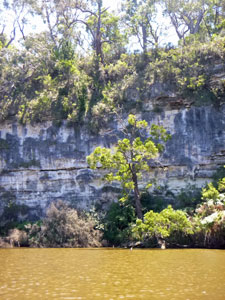 Looking at the limestone cliffs |
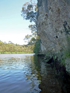 Gliding in the shade of the limestone walls |
The river now was becoming broader and straighter in its hurry to head west, the white limestone cliffs higher and in places undercut. Rounding a gentle curving bend, we spied a cluster of three tin huts on a flat beneath the cliffs - welcome to Pattersons Camp, the oldest on the river and which has been there for over 100 years. The students staying at Skipworth Springs had risen at 5am to beat the heat of the day and were now well esconced at the campsite. |
||
 The river at Pattersons |
 |
 Old tin huts at Pattersons Canoe Camp |
Alan wandered a couple hundred metres up the track and found the walkers' camp, so once again we traded our canoe camp permit for a walkers' camp one and moved in. We had been spoiled by their good facilities, especially the shelter, over the past 12 days and, after all, we are really walkers. It was a lovely spot beneath the river red gums, looking out across the reeds and water to the limestone cliffs. |
||
|
 View from Pattersons Walkers' Camp
|
|
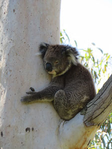
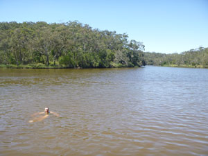
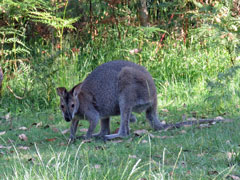
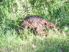
Thus we settled in for a languid afternoon to while away the heat of the day - a couple of swims in the river, from the canoe camp jetty, a nap in the shade, a bit of entertainment from the camp koala and the camp echidna - slowly and peacefully the afternoon passed by. |
 Limestone cliffs opposite Pattersons Camp |
 The pastel shades of a limestone overhang |
 My turn for a spin in the kayak (Photo: Alan Laird) |
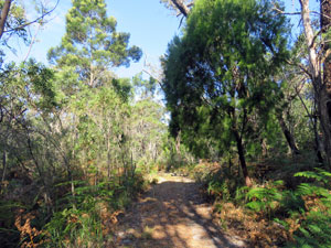
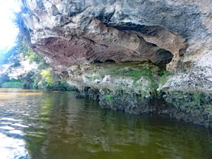
I took the kayak out for a bit of a spin to investigate the jaggedly eroded and undercut cliffs from below and, in the cool of the evening, wandered eastwards along the Great South West Walk foot track as it disappeared into the dense scrubby bush high on the river banks. It didn't seem to be providing many river views in its ramble, but then it does provide this lovely campsite for the walker to relax and enjoy the ambience of the river. |
||
Nonetheless, we were still glad to be canoeing and backpack-free. |
|

Day 13 - Pattersons Camp to Dry Creek (10.5 km) |
Our run of perfect days continued. Across the river, the morning sun lit up the limestone cliffs, reflected in the still water. We wandered back to the canoe camp with our drums and dry bags and loaded up the boats. Today's paddle was an even easier 10 km, as we planned a stop-over to visit the Princess Margaret Rose Caves. |
||
 Limestone cliffs reflected in the river |
 Early morning at Pattersons Canoe Camp |
 Time to leave (Photo: Alan Laird) |
|
It really was a superb morning, as we paddled rhythmically down the ever-widening river, each bend back by increasingly high limestone cliffs. We were now well inside the Glenelg River Gorge.
|
|
On reaching Lasletts Canoe Camp, we tied up to the jetty and stopped for a bit of a break and a bit of nostalgia. Some 20 years ago, the fair Nello and I had camped here with our daughter and her now-husband on our only other visit to this part of the world. It was a pleasant spot. This stretch of the river was also a water-ski zone, obliging us to keep in the transit lane within 15 m of the north bank. Fortunately, there were no ski boats to disturb the morning tranquility, just a couple of fisherman trolling quietly along in their boat. |
|
|
 View from Lasletts Landing |
 |
|
|
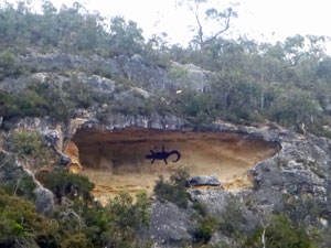
On leaving Lasletts, a long reach brought us to the biggest, whitest cliffs of all, and around the bend, the landing for the caves. We tied up and climbed the paved footpath that wound up to the cliff-top, 60m above the river. Here, in the midst of grassy tree-shaded surrounds was the entrance to the Princess Margaret Rose Caves.
|
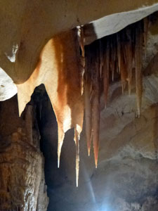 |
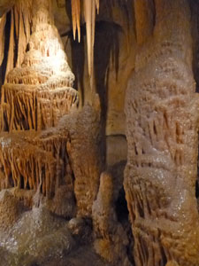
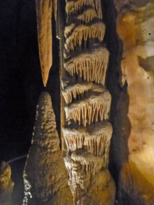
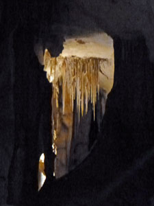
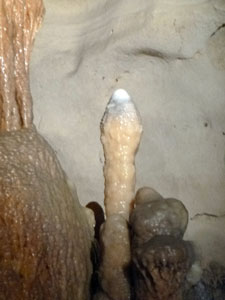
Our first stop at Princess Margaret Rose, however, was the kiosk for a hot coffee and pie (or vegetarian pastie for Alan). Then we joined a tour of the cave itself - dissolved out of a fissure in the limestone by the river some 800,000 years ago to produce a long cavern with water-rippled floor and a roof scalloped by turbulence. Untouched for the first 799,920 years of its history until its discovery in 1936, the steady percolation of water through the limestone rock has created an impressive array of stalagmites, stalactites, helictites, columns, pillars, shawls and flowstones in shades of white, tan and grey. It was well worth visiting, as the following photos will show.
|
 |
|
 |
 |
||


 Dry Creek - welcome to South Australia |
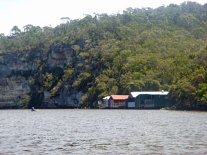
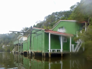
Back down to the river, we hopped back into the boats for a short paddle down-river to our camp for the night. Just over the state border in South Australia, a narrow gully runs down to the Glenelg River between limestone cliffs. Welcome to Dry Creek, home to a small collection of river shacks and, behind them, beneath the red gums, a free camp ground. |
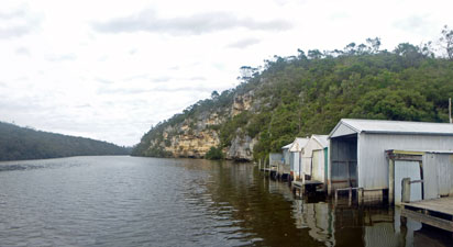
 The river shacks of Dry Creek |
 Dry Creek campsite (Photo: Alan Laird) |
A lady staying at one of the shacks showed us where the camp was and, very generously, loaned us some chairs for our stay. With, a nice shelter, comfortable chairs and table converted from the barbecue surface, we had the equal of our walkers' camps. A Belgian cyclist arrived at much the same time on her way from Melbourne to Adelaide, and we had a pleasant chat with her, as we watched the comings and goings of fishermen and tourists. By sunset, several car-campers had also arrived and the little campsite was full. |
 "Take Me Home Country Road" series #26 |
The hot weather of the day finally broke, as cloud moved in from the west and a gentle light rain began to fall. It will be good to listen to the pitter patter of raindrops on the tent fly, knowing that, tomorrow, we only have a bit over 9 km to paddle before we reach Nelson and complete the circuit of the Great South Coast Walk ..... and Canoe Trip. Mission almost completed. |
|


Day 14 - Dry Creek to Nelson (9.5 km) |
The rainfall over night heralded the arrival of a cooler change for our last day on the river - temperatures in the low 20s and an overcast sky meant for good paddling weather. After saying good-bye to our Belgian cycling friend, returning the chairs and farewelling the friendly river-shack lady, we paddled out from Dry Creek for the run into Nelson. We were lucky enough to be on the end of an outgoing tide and soon the tin shacks and white cliffs of Dry Creek were disappearing behind us. |
Being our last day, our thoughts were already turning to hot showers, freshly brewed coffee and food that had never seen the inside of a dehydrator. There would be no rest stops before Nelson - just an occasional slowing of rhythm to look at the string of river shacks and house-boats that formed the community of Donovans Landing. |
|
|
 Modern day rock art high above the river |
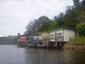 River shacks of Donovans Landing |
 .... and more river shacks |
Then, as the river widened and became more sluggish, we ended our brief visit to South Australia and re-entered Victorian waters and the Lower Glenelg National Park. A long paddle down the broad reach of Taylors Straight and past Simsons Landing took us out of the National Park, where green paddocks began to replace the forest and more river-shacks began to line the banks. |
||
Rounding a bend at the curiously named Isle of Bags, the silhouette of the road bridge over the Glenelg River appeared. All that was left was to paddle beneath it (taking care to look good with finely synchronised strokes) and up to the boat ramp behind the Nelson Kiosk. With a bit of tidal assistance and three pairs of strong arms, we had smoked the last 9.5 km in 1½ hours, and our Great South West Walk (and Canoe) adventure was over. Now, where is that hot shower? |
|
|
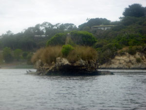 A hazy shot of Bag Island |
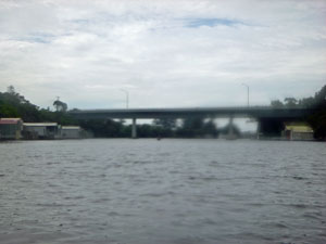 Nelson Bridge (my camera was getting tired too) |
|

Post-script: I cannot close this account of our adventure without acknowledging the imagination and foresight of Bill Golding and Sam Bruton in dreaming it up and the many members of the local community who brought it to fruition. A walk such as this one though, requires continuous upkeep and the Friends of the Great South West Walk deserve well-earned praise for the ongoing maintenance and improvements to tracks, camps and logistics. You have created a marvellous experience for the walker and, in hindsight, the more I reflect on our adventure, the more I appreciate the walk. Yes, I did hear the symphony ..... and it was wonderful. |
|