

| Walking Kyoto |
Getting There |
The weather pattern seemed to be rainy day followed by dry day followed by rainy day ....... Fortunately, so far we were in the right synchrony with this pattern. Thus, the rain poured down on our travel day from Hiroshima to Kyoto - fine for us, sad for the Japanese looking forward to their hanami parties on a Sunday beneath the cherry blossoms. |
|
We reached our hotel in Otsu (a small town 10 minutes by local train out of Kyoto) just after mid-day. It was a good place to stay, on the shores of Lake Biwa and away from the tourist crowds in Kyoto - quiet on a wet Sunday afternoon.
|
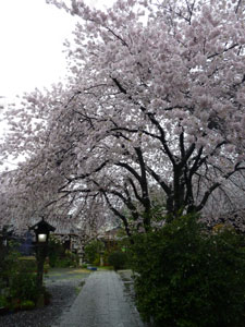
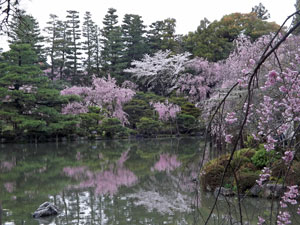
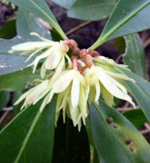
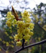
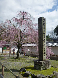
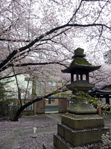
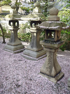
We had come to see the famed cherry blossoms of Kyoto, but Otsu provided us with its own display - from a rich pink boulevard lining the train station to the beautiful courtyard of the small Tenson Shrine (founded in 782 AD), that we stumbled across. It probably only held ten or so old cherry trees, but they formed a complete canopy over the whole courtyard, framing the gates and buildings in a soft pink wrapping. It whet our appetites for our walk in Kyoto tomorrow. |
||
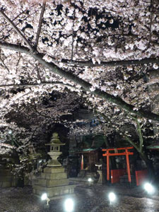 |
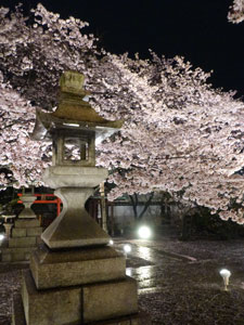
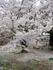
 Cherry blossoms at night in Otsu |
 |
|

Cherry blossom walking (12.5 km) |


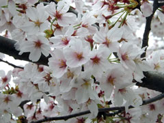
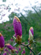
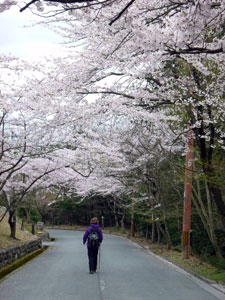
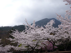
Blossoms fall like rain The rain had finally stopped, though the sky remained grey and out to the north a low fog hung over Lake Biwaki. It was probably not the ideal day for our trip highlight of seeing the cherry blossoms in Kyoto. Peak bloom had occurred two days ago and it had rained ever since, causing many of the petals to fall and some leaves to shoot. That said, from our brief foray around Otsu, a lot of the trees were still sporting fine displays of blossom and pink goes rather well with grey (as any galah will tell you). |
||
Otsu was in fact an excellent base, as we had a choice of the Japan Rail or private Keishin train lines, and the latter would take us directly to the prime cherry blossom spots of Kyoto. Thus we set off, keenly anticipating a day well and truly in the pink.
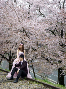
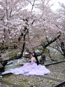
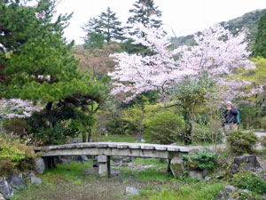
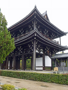
It was but a short time to reach Keage Station and start our cherry blossom walk. Emerging into the street, we found ourselves opposite one of the hotspots, the Keage Incline, a broad raised embankment that formed part of the canal system bringing water from Lake Biwaki. Lined with cherries, it is a favourite spot for wedding photos - we passed four newly married couples as we wandered down between the avenue of blossoms that lined the incline. |
|
|
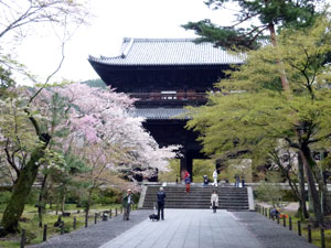 The gateway to Nanzen-ji, a 13th century Buddhist temple |
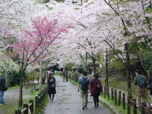 Cherry-lined path in Kyoto |
|
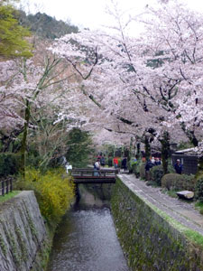
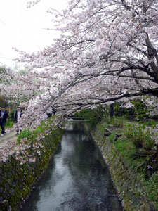
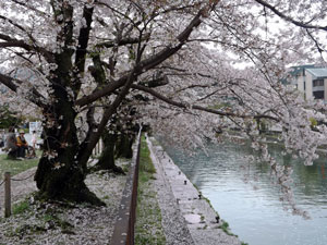
On reaching the Ogazaki Canal, we headed east towards Nanzen-ji, a buddhist temple and then on to what is, arguably, the top cherry spot in Kyoto - Tetsugaki-no-michi (The Philosopher's Path). For almost two kilometres, a footpath follows a narrow canal lined with cherry trees - early in the morning, a few days after the peak, the crowds had thinned and you could almost enter the zen mood that the ancient monks must have had as they strolled down this lane, petals drifting down from the pink-cloud canopy to carpet the ground, float down the canal or end up suspended in the silken web of a spider. It was a lovely part of the walk. |
|||
 |
 |
 |
 |
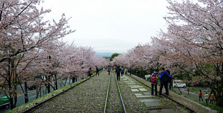
| A walk along The Philosopher's Path | |||
|
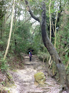
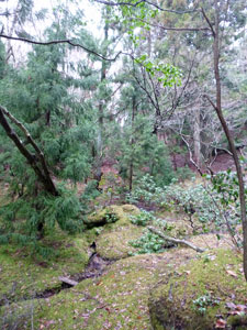
On reaching the end of the path at the Gingaku-ji Temple complex, we decided to head bush and seek greener environs - heading into the forested Higashiyama Mountains that back Kyoto. The path through the tall trees climbed steeply and, in the saturating humidity, we were soon dripping with perspiration.
|
 |
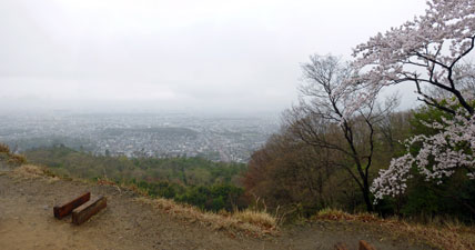
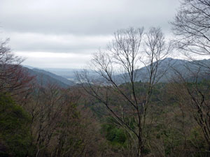
Our plan had been to climb the peak of Daimonji-yama and return though the forest to Nanzen-ji Temple. However, up higher the cloud hid the summit and, not wishing to soak ourselves in sweat for no reward, we settled for plan B, stopping at the Daimonji-yaki site, a cleared area where each year a series of log fires are lit in the form of a giant Japanese character "dai". We stayed for a while at a little shrine in the eye of the dai, to admire the somewhat misty view over Kyoto city. Then taking a shortcut down the "left leg" of the giant dai, we made our way back along a narrow forest path into the residential area of Kyoto. |
|
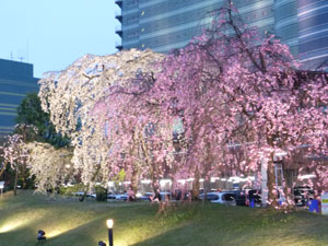
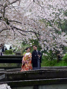
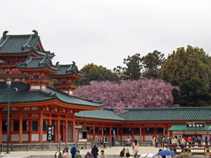
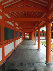
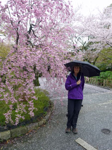
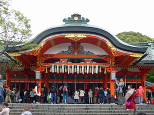
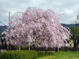
Crossing the Philosopher's Path once again, we next headed to Heian Shrine, following the throng to this shinto edifice, which has a simple beauty in its own right, but which also has magnificent gardens, with waterways, lakes, moss beds, ancient forest trees and manicured shrubberies, highlighted by a display of magnificent weeping cherries. These flower a bit later than the other cherries and were at their peak - it was a superb display. |
|
 In the courtyard of the Heian Shrine |
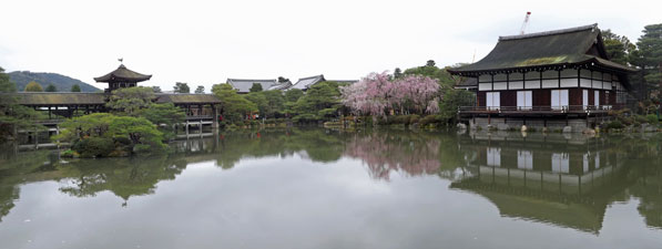 Lakeside pavilions in Heian Shrine |
|
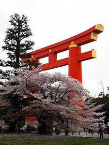
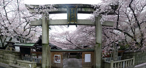
Two more cherry blossom hotspots remained to explore - on leaving the main shrine, we headed south towards the enormous red torii gate that marked its entrance. Passing that we arrived at the Ogazaki Canal, where lines of cherries drooped their blossom over the waters of the canal - another place to sit and watch the locals enjoying the magnificent display. It really is a big event in Japan - the number of photos taken in Kyoto during cherry blossom time must be in the billions.
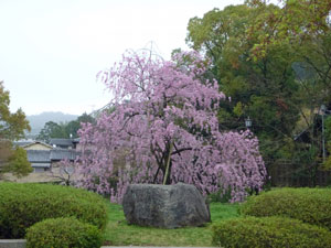
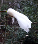
Leaving the canal, we continued southwards to our final destination - Maruyama Park, home of the mother of all cherries, a very large and very old weeping cherry tree that everyone wants to have their picture taken beneath. |
|
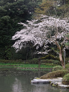

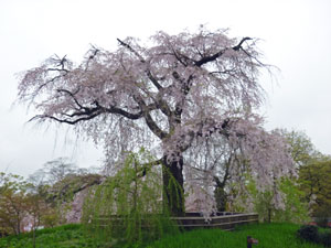 Hitoe hiro higan shidarezakura (the mother of all cherries) |
We approached the park via the grounds of the Chion-in Temple to wander down from the peaceful upper part. Below, the paths were lined with food stalls and the crowds of people were in a festive mood, taking photos of others and selfies (Gen Ys) beneath the falling blossom. Many of the young girls being photographed were wearing traditional kimonos - graduation perhaps? It was a vibrant atmosphere. |
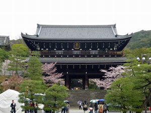 Chion-in Temple |
|
|
|
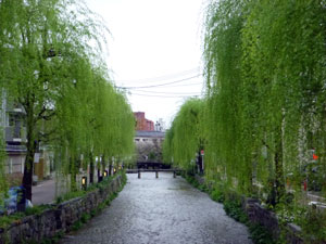
Thus we completed our tour of six top blossom spots and wandered slowly back to the Higashiyama Station to head home to Otsu. As we walked alongside a quiet backstreet canal something seemed out of place. The canal was lined with weeping willows, newly in leaf - the ambience was green, not a blossom to be seen. How nice it looked after a day so completely dominated by pink. |
||
|
Meanders in the Hira Mountains (14 km - 790m ascent - 930m descent) |
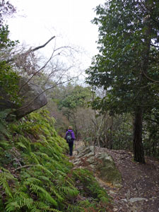
We had spent a day roaming the streets of Kyoto beneath the cherry blossoms and now it was time to explore the wilder side of the Japanese landscape - our target was the Hira Mountains north of the city and, in particular, the Yatsubuchi-no-taki (the 8 Waterfalls Gorge). The early morning showers had cleared and the day promised to be fine, if a little grey and not particularly warm - winter was having one last fling in Japan. With one change of trains, we travelled north by JR between the shore of Lake Biwa and the cloud-capped Hira Mountains to the little town of Omi-takishimo. |
||
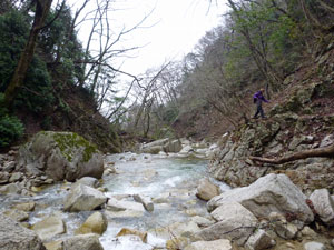
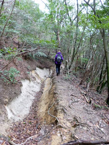
Leaving the station, we caught a taxi for the 9 km trip up to the village of Kuridani, where our walk began. At Kuridani, we realised just what the weather held - an icy wind was streaming down from Siberia. It was cold - beanie-wearing, nose-drippingly cold - as we headed up through the village and into the forest, following a rough road up alongside the clear, rushing waters of the Hachiiki-dani-gawa, the mountain stream that plunges down the gorge to create the eight waterfalls. |
|
|
 Setting out through the laneways of Kuridani |
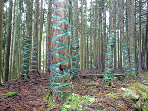 In a strangely gift-wrapped forest |
|
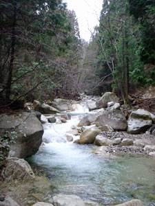
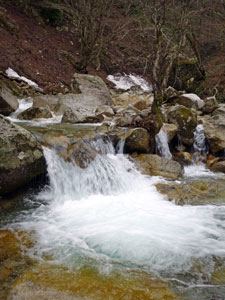
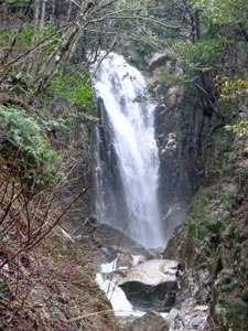
In this lower part it was much gentler, flowing swiftly beneath the dark pines and occasionally splashing over the moss-covered walls of flood mitigation barriers. This all changed when we reached the end of the road - a tricky negotiation of a landslip area set the scene. Then it was on to the first waterfall (Gyodome-no-taki) tumbling over the cream coloured rock. A short section of chain and a bit of rock-scrambling got us around that and on to the second waterfall. |
||
 A bit of chain work |
|
 Gyodome Falls (the first waterfall) |
|
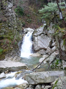
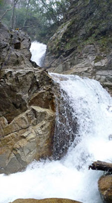
The fair Nello was the first to notice that the chain and steel ladder were on the other side of the stream - we were above a series of high cascades and below the falls (Shoji-no-taki). The volume of water coming down was impressive, too much so in fact, as the one point to cross to reach the chains had water pouring over it just above a big drop. This was probably not surprising, given the rain of the past few days. At the very least, it would have meant wet feet, and at the very most, a wrong step could see you head first in a foaming pool 3m below. Some things are not worth it - we turned back. |
||
 ...but headed back to a calmer crossing ... |
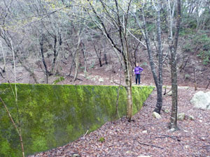
 ... to pass by a landslip .... |
 .... and reach the stream higher up |
|
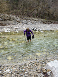
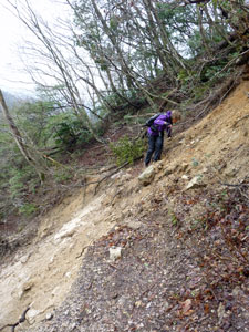
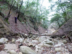
However, I don't like being dictated to by a waterfall. Retreating to a level section of river below the first falls, we took off our boots and socks and waded the icy stream to pick up a different track on the far side. Climbing steeply out of the gorge, we followed it as it edged along the precipitous slopes high above the stream, crossing more landslips where the track had almost disappeared downhill, to regain the Hachiiki-dani-gawa Stream well above the falls that had blocked us - in fact just where the third falls (Osuribachi-taki) slides down through a narrow rock shute. |
||
|
Continuing on, using the chains and footholds provided in tricky places, we climbed as far as the fourth and fifth falls (Kosuribachi-taki and Byobu-no-taki), the latter impressively thundering out of a narrow sheer-walled section of the gorge.
|
|

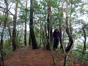
Above us, the fog covered the peaks and, given the poor visibility up higher and the time we had left, we decided to not go any further (this time turning around on our own terms) and retraced our steps to the point where we climbed out of the gorge. From here we turned south to pick up a sealed road near the Gulliver Young Peoples Camp, a place that is probably teeming in summer, but was deserted today. The road wound down out of the hills, but after a while, we needed to part company with it - our route out lay the other side of a long ridge running down from the spine of the Hira Mountains. The track appeared on both my GPS and paper map - easy, wide and with a gentle gradient at first, it soon morphed into a faint piste, clearly not often used and marked by the occasional ribbon, as we picked our way up alongside a shallow stream with steep walled spurs on either side. |
|
 |
 |
 |
 |
 |
At one stage, a small side stream flowed in to the one we were following - it seemed innocuous, but as we later realised that was the route. Finding ourselves with no ribbons to follow, it was time to use the GPS to navigate, rather than just track. However, in a topography of deep creeks and narrow razor-back ridges this was easier said than done. Leaving the creek, we climbed the steep slope of the ridge, slippery with damp leaf litter from the deciduous trees and pines. Reaching the razorback spine of this spur, we were obliged to follow it up (preferable to a steep descent into the next valley). Luckily the understorey was relatively open, but by following the spine, we were being veered even more away from the track. |
||
 Hmmm ... the track isn't in the creek .... |
 .... and its not on the ridge ..... |
 aah, there it is ..... thank you, GPS |
The GPS showed another track coming down the main ridge, so we headed for that and, after crossing the creek gully higher up and climbing the next spur, we reached it. Following it along the main ridge for several minutes brought us to the pass that we would have reached had we not lost the uphill track. It had been a bit of an adventure in the Hira Mountains, but once again confirmed our faith in the GPS. |
||
|
 |
 |
 |
|
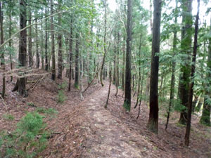
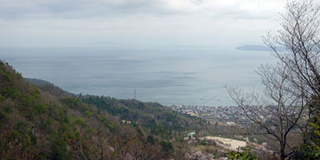
From the pass, the now clear footpath took us down alongside a mossy bog beneath the pines. It was good to be in the lee of the wind, as we had started to chill down on the ridge. The boggy area gradually changed into a tinkling stream, then into a babbling brook, then into a noisy, cascading watercourse, as it picked up the flow from sidestreams. We parted company with it to continue our way down the edge of a deep valley - through the trees we could see the surface of Lake Biwa merging grey with the sky. The path steepened into a rocky descent that brought us to a view point where the Yamamomo-no-taki Falls tumbled out of a cleft in the cliffs (the stream that we had followed had grown large indeed).
|
||||
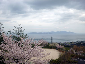 Blossoms over Biwa Lake |
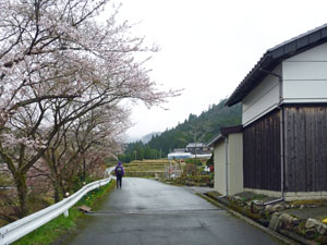
From the falls, a final steep and winding descent on the rocky track brough us to an asphalt road. One final reward awaited for our efforts - the road passed beneath several magnificent groves of cherry trees and the blossoms here were in peak flower. It was a superb way to finish, as we reached Kitakomatsu Station and sat in the warmth of the waiting room for our train as the icy wind whistled about. The walk was meant to be a bit adventurous, but had ended up a bit more adventurous and a bit longer than planned - still the unexpected is often what makes life the most interesting. |
 Blossoms framed by the Hira Mountains |
 |
 Tokushoji Shrine at Kitakomatsu |
|
Due to the lateness of our return, we ended up having one last adventure - peak-time on a Japanese commuter train. Suck in your abs and hold your breath - if everyone does it, we can fit one more person in the carriage. |
||
|
Fushimi-Inari Shrine to Tofuku-ji Temple Walk (5 km)(plus Daigo-ji Temple) |
Our two walks to date had focussed on cherry blossoms and natural landscapes. Today was time for a little bit of culture. Thus we set out, with the cold Siberian air still biting, to visit a couple of Buddhist temples and Shinto shrines. Kyoto has around 1600 temples and 400 shrines, so the choice of which to see can be very hard. We chose three - the Fushimi-Inari Shrine and Tofuku-ji Temple, because these two can be joined with a walk through the forest, and Daigo-ji Temple, which is a world heritage listed site. Having been here for three days, we were feeling like locals and mapped out a route using both JR and the subway system, which would get us from our hotel in Otsu to and from these places. |
||
|
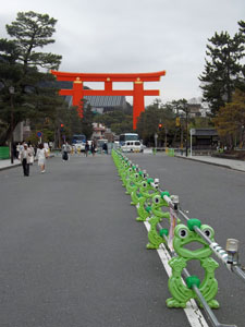
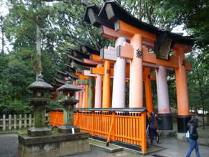
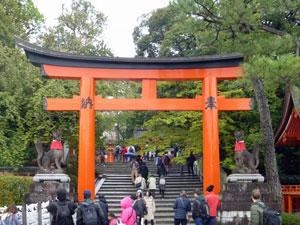
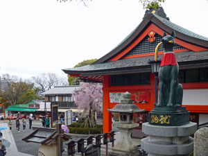
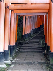
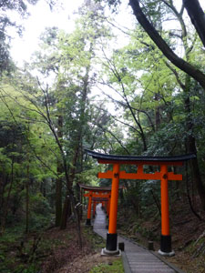
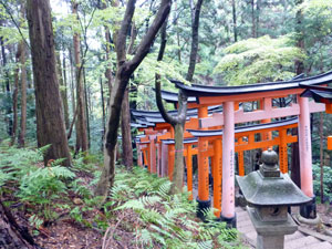
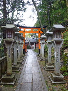
Emerging from Inari Station, we were immediately confronted by a giant red torii gate - the entry to the 9th century Fushimi-Inari Shrine and, as we were to see, torii gates comprise the very heart and soul of the shrine. After checking out the main pavilions (built in 1499 at the base of green-clad Inari Mountain) we followed the crowds around to the back to find a cluster of torii gates, some bright orange-red, others fading pink. This was the start of a wondrous climb up beneath a series of colourful collonades comprising thousands of close-packed torii gates. |
|

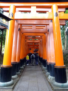 |
Some photos of the torii pathway of Fushimi-Inari
|
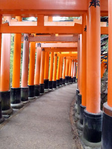 |
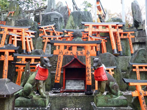
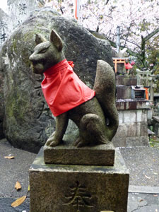
The stone path and steps led us onwards and upwards beneath sets of gates of varying sizes. In between lay small shrines - stone structures covered with miniature red torii gates containing the wishes and prayers of the faithful and invariably several stone statues of a fox, the messenger of the gods whose job, no doubt, was to ensure the delivery of these prayers. Reaching a junction in the paths, we stopped at a teahouse for a break and a chance to take in the views over Kyoto - the sky was lightening up and a watery sun was trying to break through. |
|
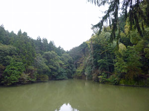 Green pool in the forest |
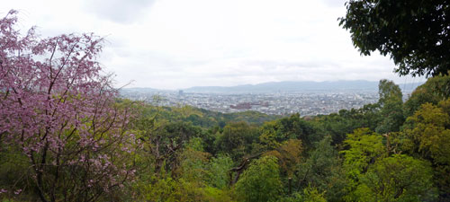 View over the forest to the buildings of Kyoto |
The higher we climbed the thinner became the throng and the upper part of the mountain was a peaceful spot, where torii red contrasted with the shades of dark and light green of this superb forest, as the birds in the canopy sang their approval. This is really a unique shrine. |
|
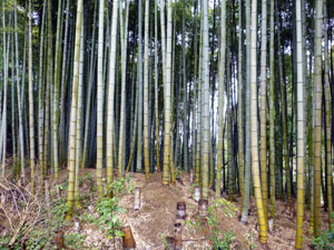
Beginning our descent, once more through series of red torii gates, we passed a small grotto/shrine and left the main path. It would have taken us back to the start, but we turned north to follow a gravel road down alongside a babbling stream through the lush forest and bamboo groves.
The path brought us back into residential Kyoto only five minutes walk from our next destination, Tofuku-ji, a 13th century Buddhist temple that is considered to be one of the great Zen temples. |
|
|
Zen by name, zen by nature - a quiet and peaceful place with ornately simple (if that is possible) wooden pavillions, spacious grounds and gardens, and hardly any tourists. The subtility of the white walled or weathered timber and silver slate rooves contrasted with the bright orange reds of the Shinto shrine. They were a complementary pair and, as we headed back off to Tofuku station to continue our journey, we agreed that it had been an great morning in Kyoto (and hardly a cherry blossom to be seen). |
|
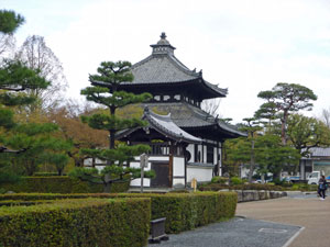 Tofuku-ji, a 13th century Zen Buddhist temple |
 Part of the temple complex |
|
|
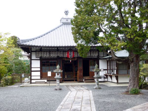
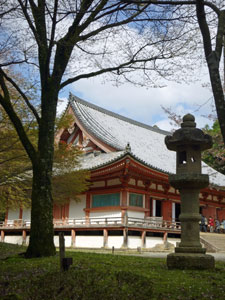
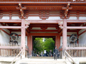
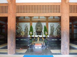
Daigo-ji A train / subway switch brought us to Daigo Station, where we emerged for our second cultural experience - right into the heart of the Daigo Shopping Mall. Its food hall was a good place to have some lunch and watch the locals go about their daily business. It took but a short walk up a slight hill to reach our third cultural destination, the 9th century Daigo-ji Shingon Buddhist temple, a World Heritage listed site. You could see why - behind its imposing entrance gate, lay several walled compounds stretching back up into the hills of Kyoto. Impossible to visit every part, we headed slowly uphill, passing the 16th century Kondo Hall, and the magnificent five-tiered pagoda (Goju-no-tu), built in 951 AD and the oldest remaining building in Kyoto. |
|
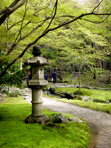
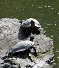
Passing several more pavilions and halls on our gentle uphill climb, we reached the Bentendo Hall and lake - a serene spot, where the red-lacquered hall and arched footbridge reflected in the calm waters of a petal-strewn pond, surrounded by gardens and trees. We sat and soaked up the atmosphere as tortoises sun-baked on rocks on the pond. Yes, I did say that word "sun" - after many days of grey or rainy skies it had finally reappeared. |
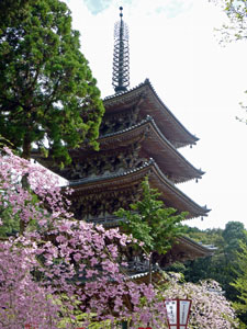 Five-tiered pagoda (completed in 951AD)
|
A wander around the mossy gardens behind the hall beneath the fresh new leaves of the maples (they would look brilliant in autumn), a stop to listen to monks chanting in the Shinnyo Sanmayado Hall, and it was time to go. |
||
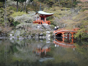 Bentendo Hall |
 |
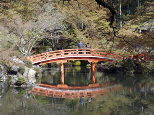 Bridge over Bentendo Pond |
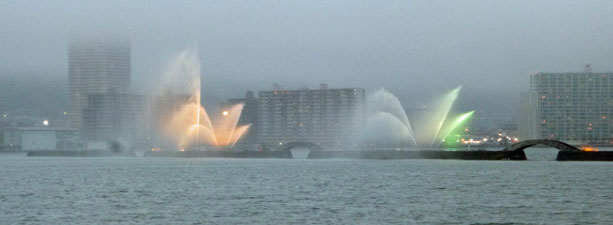
We headed back to Daigo station to complete a subway/JR transit loop back to Otsu. With the sun out and the sky blue, it was time to head down to the shore of Lake Biwa and enjoy the ambience of Japan's largest lake. Our time in Kyoto was over and the mix of cherry blossom, natural landscapes and cultural heritage had made it a very enjoyable time indeed. |
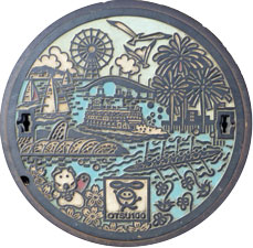 |
Back in Otsu Manhole covers from Otsu |
|
|
|
|
|
