

| Kumano Kodo Pilgrimage Path - part 2 |


Day 4 - Yunomine Onsen to Koguchi (14.5 km - 540m ascent - 530m descent) |
We were back to eating big Japanese breakfasts and this morning one course was an "onsen egg" - an egg naturally cooked in the hot spring waters of Yunomine Onsen, the same waters that I tried to soak in yesterday. I was somewhat pleased to eat this egg, as it proved that I hadn't been a wuss in leaping out of the onsen. Breakfast over, we packed up and headed down to the bus stop. For some reason there is a gap in the Kumano Kodo here - no track for the next couple of kilometres before it recommences at Ukegawa - you can either catch a bus or walk down the main road - we caught the bus along with several other Kodo walkers, disembarking ten minutes later at the new trailhead. |
||
|
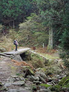
There was one other problem, namely that there had been a landslide in March which had blocked the official route. The Japanese had quickly set up a detour. Thus, instead of climbing directly up a steep ridge, we found ourselves strolling down a sealed forestry road alongside the clear waters of the Uke-gawa River.
|
|
|
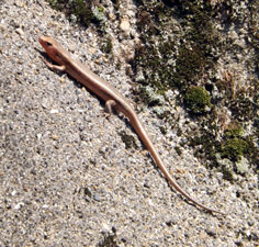
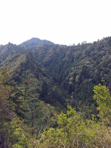
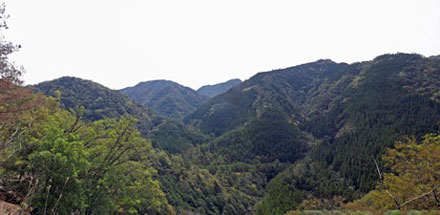
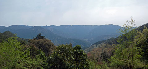
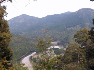
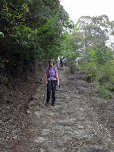
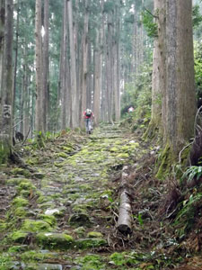
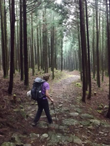
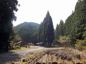
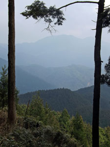
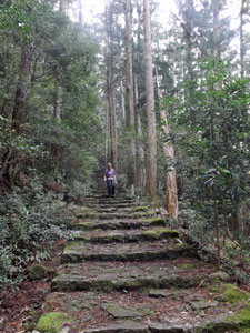
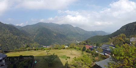
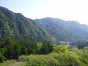
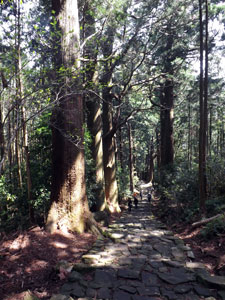
A couple of kilometres later this road turned into the mountains to begin a 6km climb up into the heart of these steep, green-clad ranges. It wasn't difficult, but it still was a steady and relentless uphill grind. The good part was that we were out in the morning sunshine, soaking up the UV and warmth (as were the lizards), and getting great views of the Kii Mountain ranges across the steep valleys. The previous days it had felt like we were within, looking out, now we could see the type of terrain we had been crossing on the pilgrimage track - impressive. |
|
 |
 |
|
|
|
|
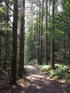
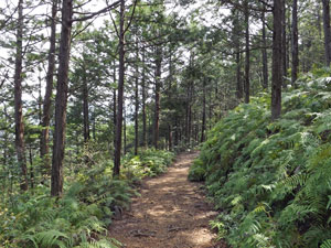
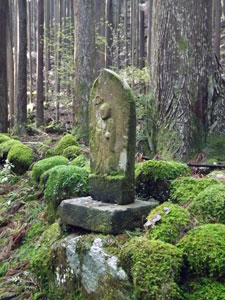
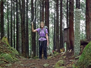
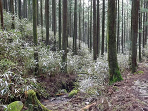
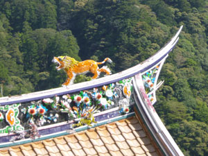
The appearance of a solar-powered roadside toilet marked the junction with the Kumano Kodo. Two fellow trekkers, Ralph and Claire, with whom we had crossed paths on occasion, were already there. We sat down on an adjacent seat to compare notes, enjoy the mountain ambience and have some energy boosting chocolates, before pushing on to rejoin the pilgrimage path. Immediately, we were back under the canopy of tall fir, traversing steep slopes or following razor-backed ridges. It was a lovely spring day and the birds were singing as we passed small shrines and the sites of ancient tea-houses. |
||
|
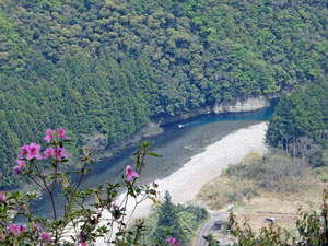
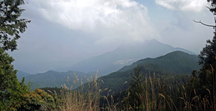
Reaching the flat platform of the former Sakura-jaya Teahouse, we stopped at an adjacent shelter for more modern pilgrims to enjoy lunch overlooking the Koguchi-gawa valley and the blue mountains beyond. A large group of Australian trekkers caught us up as we were eating and we had a pleasant conversation with some of them - the warm weather was making everybody feel sociable again.
|
|

 View over the Koguchi-gawa Valley |
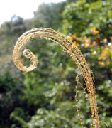
 Fern-covered forest floor |
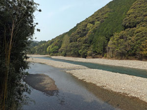
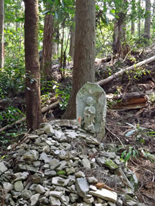
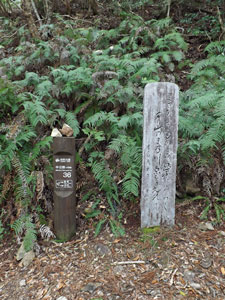
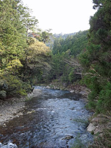
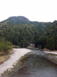
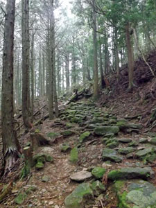
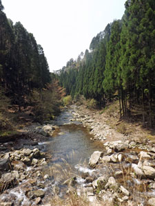
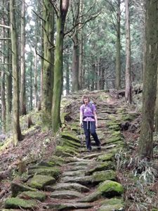
Leaving the teahouse shelter, we commenced the long descent down the spur towards the hamlet of Kowase, passing several stone monuments with inscriptions of Japanese poems carved into them. At times, gaps opened in the canopy to reveal the blue profile of the distant ridges beyond the green cloak of our own ridge. Nearing Kowase, we had great views over a big bend in the Koguchi-gawa River, before following the last few sections of stone cobbles and steps down into the hamlet. |
|
|
 Looking down on Kowase |
 The Koguchi River at Kowase |
|
|
Crossing the bridge over the river, the Kumano Kodo began to follow a road for the final kilometre to our destination, the village of Koguchi. At some point we missed where it left the road, and strode straight on through a short road tunnel and into Koguchi - too bad, we could see the converted school house idyllically set on the edge of the river, that was to be our home for the night. It had been a relatively easy day of walking, with plenty of time to explore the surrounds before the customary hot bath and feast for dinner.
|
|
|
 |
 |
||
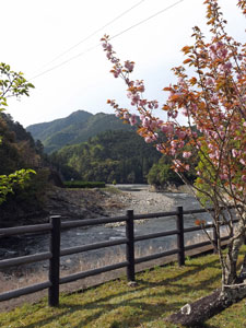
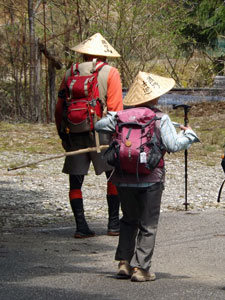
Up until now, we had stayed in small places, but here we were a jolly crowd of trekkers, as all the people we had met on the track ended up in the same place. The magnetism of the Kumano Kodo is clearly expanding, attracting not just Japanese pilgrims, but also people from all over the world who seek the natural beauty of its landscapes and the mystique of its culture. |
|

Day 5 - Koguchi to Nachisan (15.5 km - 950m ascent - 760m descent) |
The rain is never far away in Japan, and especially in the Kii Mountains. Thus, it was probably not a surprise to wake during the night to the sound of heavy rain on the roof and lightning flashes lighting up the rice paper squares of the screen in our bedroom. Fortunately for us, it had passed by morning and the sun was again breaking through the clouds. I say fortunately, because today would be the hardest walking of the path, starting with an 800m climb, and to do that in wet weather gear would have been unbearable. |
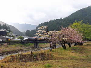 Leaving Koguchi |
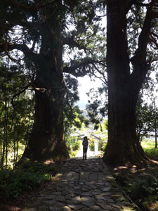
After a hearty breakfast, we collected our lunchtime bento boxes and headed off. It took a few confused moments trying to work out the mud-map for leaving Koguchi, but we found the right bridge to cross and were on our way. The climb started soon after leaving the village, as a series of rough stone steps led us up the spur of a ridge to reach Waroda-ishi Rock, with its carvings of the symbols of the three bodisvarta who, according to legend, meet here to discuss ways to make the world a better place over a cup of tea. We stopped and listened, as the sign suggested, but could not hear anything except the occasional song of a forest bird. Perhaps they have despaired of the modern world. |
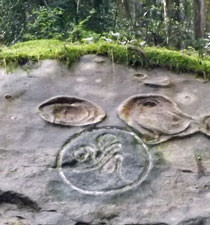 Bodisvarta symbol on Waroda Rock |
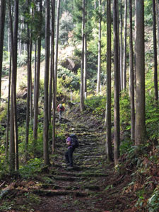 The 800m climb begins |
 Shrine deep in the forest |
 Glimpse of the route ahead |
 The climb continues |
The climb continued, gaining us over 200m of elevation, before flattening out for a relative easy traverse beneath the dark canopy of fir trees to reach the flat platform where once the Nakane pilgrim lodging stood. A modern open-sided pilgrim shelter had replaced it, so we stopped for a drink and an orange. Already, the humidity was making us perspire, so it would be a day to keep the fluid levels up. |
|||
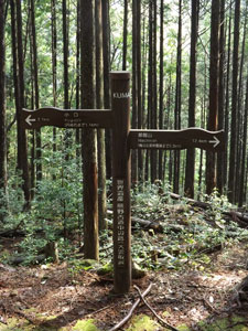 Koguchi west - Nachi east |
 Old moss-covered rock engravings |
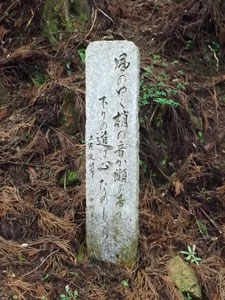 A poem monument |
 Moss covered statue near Kusu-no-kubo |
|
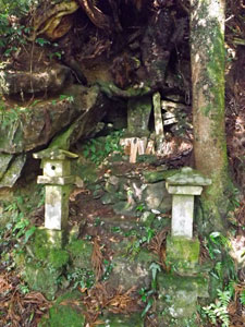
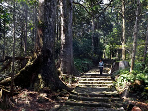
Continuing on, we climbed up past a couple of stone poem monuments to reach another rock-walled platform, where once the Kusu-no-kubo lodging stood. It was the start of a series of such platforms, now reclaimed by moss and trees, where hugato (lodgings) gave the pilgrims a final rest before the big climb to Echizen-toge Pass, at 870m the highest point on the Nakihecho Route. |
||
 |
|
 Nello crests the Echizen Pass |
|
For us there was no final rest. Heading on, the the gradient of the track steepened noticeably as we took on a long ridge directly to climb the last 500m of elevation in a little over two kilometres. It was definitely time to find the balance between rhythm and breath and steadily push our way upwards in a zen state - if perspiration cleanses the soul, by the time we reached the top, I was pure - drenched, but pure. It is hard to describe this climb, and even the 12th century poet, Fujiwara Teika, could but say "This route is very rough and difficult: it is impossible to describe precisely how tough it is", when he reached the top of the Echizen-toge in 1201. |
|||
|
 ... down .... |
 ... down ... |
|
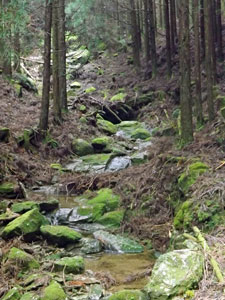
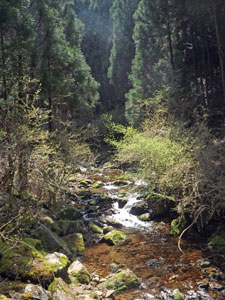
The relief of cresting the pass was somewhat tempered by the steep descent on the far side. However, it was much shorter as it worked down a gully to follow a babbling mountain stream. Another short climb took us over Ishikura-toge Pass, followed by a longer descent on more mossy stone steps.
|
|||
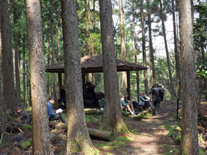
This brought us to a sunny clearing in the forest, on the banks of a stoney-bedded river, where once the Jizo-jaya Teahouse stood. Today it had a shelter, wooden seats and, believe it or not, one of the ubiqitous Japanese vending machines - tin of hot coffee, anyone? What poems would Fujiwara Teika have written of this? Deep in pristine hills Needless to say, it was an ideal place for an early lunch, so we joined an assembly of other pilgrims/trekkers who had come to the same conclusion. |
|||

|
Heading on, we followed a forestry road steadily uphill alongside the mossy banks of the river, before the Kumano Kodo took us on a short-cut across a bamboo lined creekbed. It was pleasant walking after the big climb, as the track meandered and undulated its way through the forest, past Moja-no-deai (the abode of the dead) to reach the start of the last real climb of the day - a series of rough stone cobbles and steps that led us up to Funami-toge Pass. |
|
 Bamboo-lined creekbed |
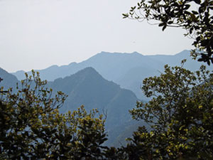
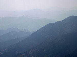 The blue on blue of the Kii Mountains |
|
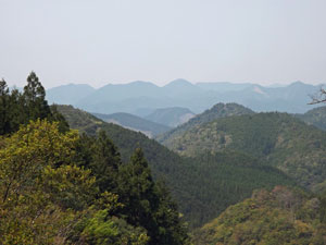
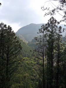
We were now getting glimpses of the mountains through the fir trees, fading blue into the haze, so when we reached the shelter on an open platform where once Noboritate-jaya teahouse stood, we stopped to take in the expansive views over the valleys and mountains. The Kumano Kodo does not give you too many such occasions.
|
||
 Descending from Funami Pass |
From here on, the long descent to Nachisan began, a much gentler gradient than the climb up. We emerged at the Nachi Kogen Park, where the path crossed open grassy fields with another set of superb mountain views. |
|
 |
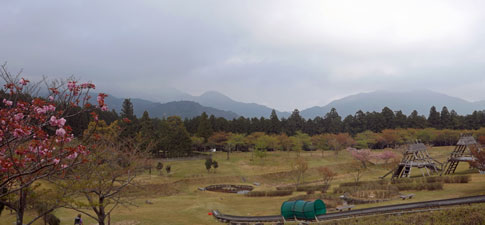 A more open landscape at Nachi Kogen Park |
|
|
|
|
We were rapidly closing in on our destination. All that remained was one last steep set of cobbled steps, that zigged and zagged their way down through tall fir and cypress trees towards the famous shrine of Kumano Nachi Taisha. This has been a place of worship since the 4th century. A sense of anticipation was building up inside us. |
|
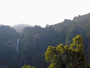
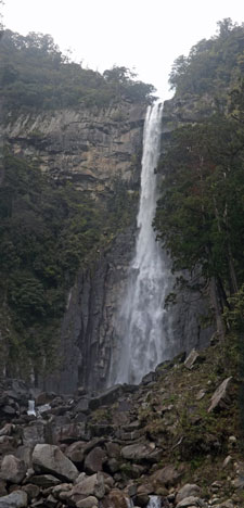
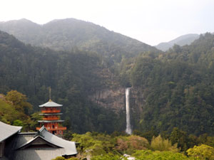 Greeted by the 133m Nachi Falls on arrival |
 Arriving in Nachisan village |
|
|
|
|
|
|
|
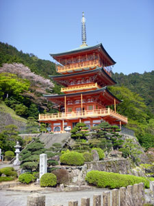
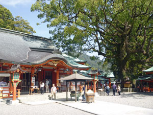
The sound of Nachi-no-otaki, with a drop of 133m, the highest waterfall in Japan, told us we were close. Suddenly, the steps ended and we emerged onto a square surrounded by temples and shrines. To the east, the bright red three-storeyed pagoda framed the falls. Kumano Nachi Taisha has a spectacular setting indeed. |
|
|
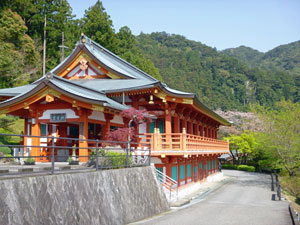
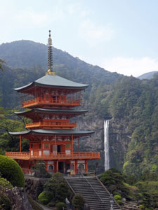 The three-tiered Sanjudo Pagoda and Nachi Falls |
 The steps of Hirou-jinja Shrine at the base of the falls |
|
With a bit of help from the locals, we found our lodgings (in a room with a view of the waterfall) in Nachisan, the village that has arisen to serve the tourists who flock to the shrine. There was enough time left in the day to check out the impressive falls from their base before relaxing with the usual hot bath, beer and 10-course feast. It had been a hard day's walking, but the reward was the spectacular arrival at Nachi Taisha. I could imagine what the pilgrims of yesteryear must have thought at the end of their long journey. |
||
|
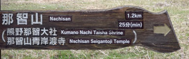
Day 6 - Nachisan to Nachi (8.5 km - 110m ascent - 460m descent) |
It was a bright and sunny morning for our last day on the Kumano Kodo Path. Many people actually end their walk after reaching the shrine at Nachisan, but we decided to press on to Nachi and the coast - after all, it was only another eight kilometres and all downhill. |
|
 Natural landscapes of the Nachi Valley.... |
 .... and the manicured landscapes of Nachisan village |
|
|
|
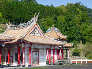
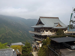
However, firstly it was time to see a bit more of this superb site - revisiting the waterfall to see its 133m drop sparkle in the morning sunlight, climbing back up to visit the three-tiered pagoda, Seigantoji Temple and the actual shrine of Kumano Nachi Taisha. There were few tourists around this early in the morning and the monks were engaged in their morning chants - it was a good time to be here. |
|||
 Richly decorated temple roof |
 Sanjudo Pagoda |
 Waterfall as viewed from the pagoda |
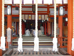
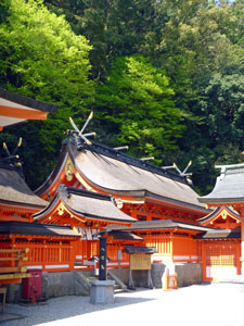 Halls of Nachi Taisha Shrine |
|
|
|
|
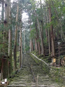
After a cup of coffee, we picked our packs up from the lodgings and headed off. Leaving Nachisan, we descended one of the most revered sections of the path, the Daimon-zaka, a set of 267 stone steps lined with magnificent huge cedars, up to 800-years old. It was a superb forest setting and a great way to finish the path. My one abiding memory of the Kumano Kodo Path will be descending down moss-covered stone steps that seem to disappear into the dark green of the forest, and Daimon-zaka was the best. |
|
 Path beneath the giant cedars |
|
 Silhouettes of the 800-year-old Meteo-sugi cedars |
At the bottom of the steps, we burst into the light from between the "husband-and-wife" cedars, the biggest and oldest of these magnificent trees. Crossing a small stream on a red-arched footbridge, we left the precinct of the shrine and commenced a slow descent along the valley. |
||
 Village in the Nachi Valley |
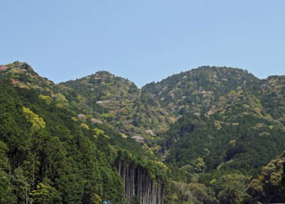 Leaving the green-textured forests |
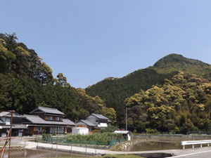 Farm house tucked into the hills |
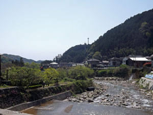
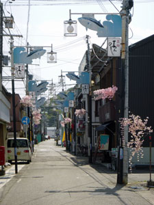
Houses and paddy-fields were framed by hills cloaked in a rich tapestry of lighter and darker greens, as we passed through the quiet streets of a string of villages. Finally, however, we had to join the main road to leave the valley and enter the coastal town of Nachi. The world of the Kumano Kodo was fading and civilisation was rapidly returning as we strolled down past the traffic and shops to the Nachi railway station. |
|
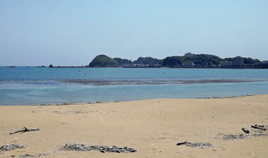
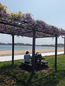
We had an hour before the train to neighbouring Kii-Katsuura, where we were spending the night, so we crossed beneath the tracks to have an early lunch on the beach at Nachi Bay. Sitting under a wisteria-covered pergola beneath a canopy of purple blooms, while looking out onto the curving stretch of deserted sand and calm waters beyond was a good way to finish our six days on the pilgrimage path.
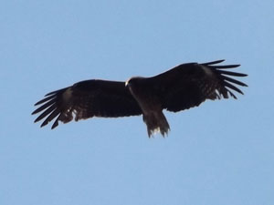
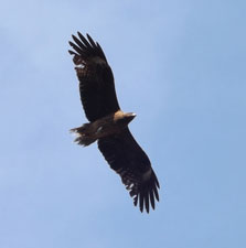
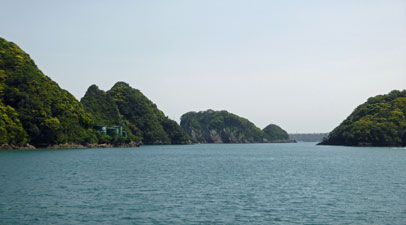
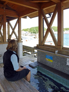
Lunch over, a ten-minute train trip took us into Katsuura, a quiet fishing village set on a bay protected by green-clad islands. Sitting with our feet soaking in a hot spring foot bath as we looked out at the kites soaring high above the fishing boats in the port, we agreed that, in the end, the spirits of the Kumano Kodo had smiled upon us. |
|
|


