
| Southern High Atlas Trek |

Day 1 - Ait Youl to Issomar (17 km - 320m ascent - 220m descent) |
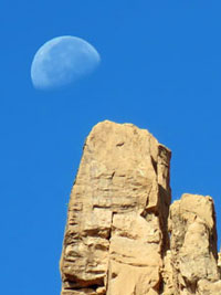 |
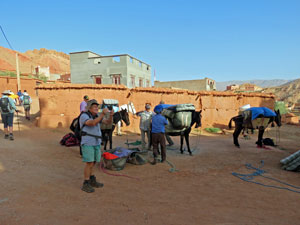
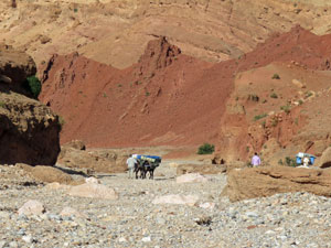
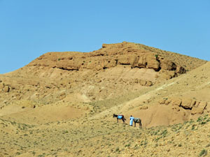
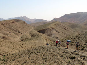
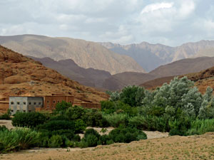
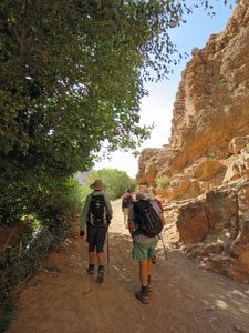
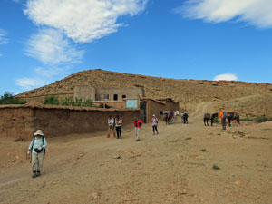
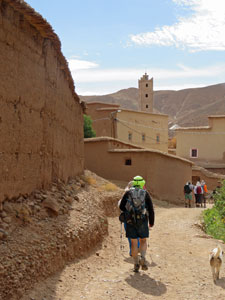
At last it was time for some serious walking - a three day trek in the southern flank of the High Atlas Mountains, staying at isolated Berber villages and with mules for the transport of our food and gear. The mule team arrived at our auberge in Ait Youl at 7.30am, with their six mules, and began loading our bags of overnight gear, food supplies and rugs into soft wicker panniers strapped on the mules' backs. Then with Ibrahim and Muhammad leading, our little convoy of walkers set out from the auberge under a clear blue sky through the village streets. A short distance down the main road, beneath a late-setting moon, we reached a point where a wide rocky side-valley made its way down towards the Dades River. |
|
 Farewell to Ait Youl ..... |
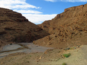
 .... and hello to the dry riverbeds of the Southern Atlas Mountains |
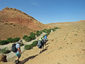
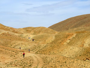
 Heading up into red rock country |
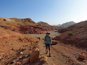 The fair Nello climbing up into the barren hills .... |
 .... where barely a plant grows |
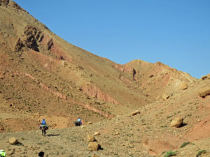
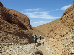
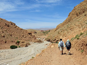
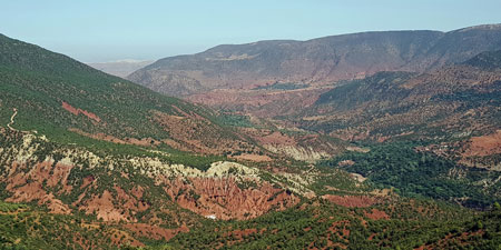
Here we turned to head into the heart of the mountains and, for the next few hours, we would be following a route used by Berber mule traders for centuries to cross the Tamasind plateau. At first, we ambled up the broad stony bed of the dry stream, lined by the brilliant red and brown rock faces of the surrounding rugged hills. |
||
 Following another dry river bed |
 The mule team out in front |
 Following a stream lined with oleanders |
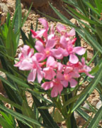
As we climbed higher, the creek bed narrowed into a small gorge, twisting its way between the dry stony hills. For a while, it carried a bit of surface water, making a nice habitat for a row of dense oleanders, which added a splash of green and pink to the tan-colored surrounds. |
||
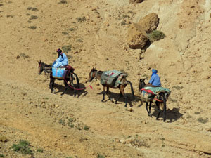 Muhammad and Ibrahim with their mules |
 |
 The final climb up to the pass |
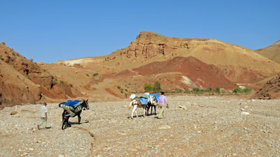
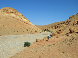
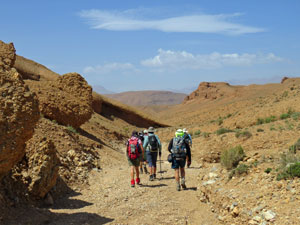
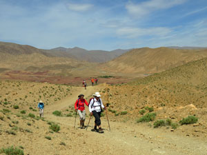
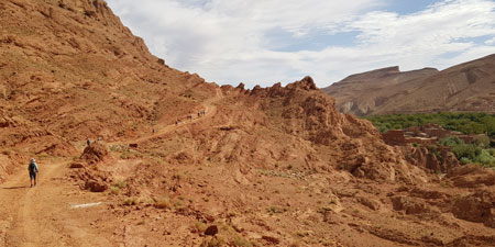
The route continued climbing steadily up into the barren hills of the plateau, where the stony soil supported only a scattering of small prostrate shrubs - thyme and a few other aromatic species. Three of the mules and their two blue-clad drivers were leading the way and it was always reassuring to see the specks of blue appear ahead as we rounded a bend or crossed a ridge. Finally, we reached a pass at 1865m, with superb views ahead and behind. With the temperatures rising, it was also pleasant to be greeted by a brisk cooling wind on the pass. |
 Descent through a small twisting gulch .... |
 .... and past a river bed of white and grey gravel ... |
 .... to reach a small thicket of oleanders |
|
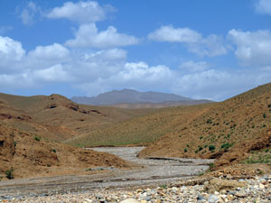
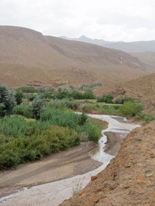
The descent was much quicker, as we headed down a twisting ravine, which gradually widened out into a stony dry river bed. Just after passing its convergence with another dry river bed, water began flowing along the surface through a large grove of oleanders - a great place for lunch. |
|
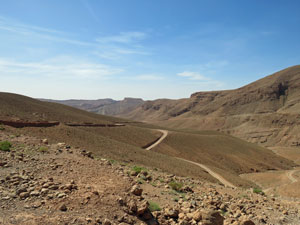
|
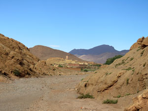
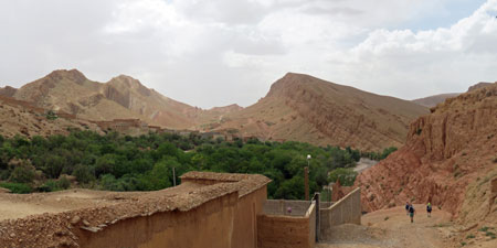 The road winds down into Ait M'Rao village |
|
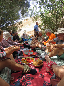
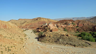
Our mule team had gone on ahead, so that when we arrived we found a shady little picnic site with rugs laid out and mattresses to sit on. Mint teas was served, followed by a delicous Moroccan salad, melon for dessert and time for a short siesta in the shade before heading on. This trek was looking good! While we were having a nap, grey clouds began invading the sky - it was time to move and the guides led us on to continue the descent, finishing with a steep drop through the dusty main road of the village of Ait M'Rao, camouflaged tan-coloured houses against tan-coloured hills. |
||
 Muddy waters of the Mgoun River |
 The river and the mountains |
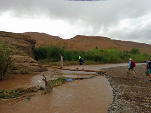
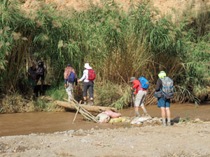
 First crossing of the Mgoun |
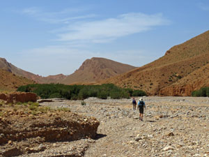
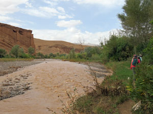
Here we turned to follow the muddy banks of the Mgoun River. There had been a flash flood through here a couple of weeks ago and the damage to the banks was evident. Nonetheless, it was pleasant walking alongside the thick riverside vegetation beside the fast-flowing clay-coloured waters of the river. As we did so, a few drops of rain fell - barely enough to wet the soil they landed on. |
|
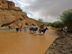
On reaching a point where a rock overhang blocked our passage, it was time to swap boots for sandals for a double wade of the shin-deep stream to get by. Our route then continued to follow the Mgoun past fruit trees and small plantings of corn. Climbing over and along a low riverside cliff, we could see our gite in the distance, with its backdrop of high Atlas mountains. |
|
|
 View over the fertile Mgoun river flats at Issomar |
|
One final push along the reed-lined river's edge and through the lush vegetable, corn and fruit tree plantings on the river flats below the village of Issomar, and a crossing of the river on a single-log bridge brought us to our gite. From its terrace, as we sipped our mint teas, we could look out over the river, lined with reeds and poplars, to the gardens and houses of Issomar and the high peaks beyond. |
|
|
 Second crossing of the Mgoun .... |
 .... to reach our gite for the night |
|
Dinner was a meal of pastas, salads, cheese and fruit, followed by an impromptu concert of Berber music from our team of mule drivers and cooks. With the stars of the Milky Way looking down from the once-again clear sky, it was a great start to our first trek in the mountains of Morocco. |
|
Day 2 - Issomar to Alamdoune (16.5 km - 380m ascent - 270m descent) |
After breakfast on the deck, we set off as the mules were being loaded, dropping back down to the river to re-cross the narrow one-log bridge and head towards the houses of Issomar. For a while, we wandered along the irrigation canal that ran beneath the steep bank and fed water to the vegetable and corn plantings on the fertile flats below. |
||
 Mgoun riverscape |
|
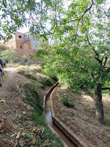 Walk along the irrigation canals |
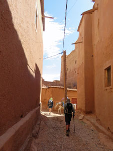
Climbing up into the village streets, we ambled down the length of Issomar, stretched out along the slopes above the river. The villagers were out and about, bringing back basketloads of produce from the gardens, drums of water from the river, repairing rooves, building new houses, running errands with their mules and generally going about their business. Old men sat and watched as we passed - occasionally bonjours and salaams were exchanged. It looked a hard life in these isolated villages.
|
|||
 View over the fields to the mouth of the gorge |
|
 Final river crossing in Issomar |
|
|
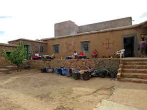
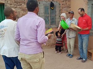
At the end of the village, near the mouth of a deep gorge, we crossed the river on another one-log bridge to angle up the bare ochre-coloured cliff face opposite. This brought us out to the far side of the village and the local primary school, where the teacher invited us in for a meet and greet with the children, to the intrigue and delight of both students and walkers. |
|
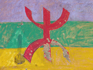 Berber flag |
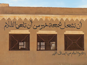 Sign on the school touting the value of education |
|
The climb continued, leaving behind the houses and heading out across the barren plateau on a 4WD track. Like yesterday, a welcome cooling breeze greeted us on the heights, but unlike yesterday, by the time we reached the pass, it had turned into a fierce gusting wind, whistling around our ears and flapping the brims of hats. |
||
|
From the pass, we descended quickly to a dry stony creek bed, to follow it out through a gap in the barren hills. On the other side, on a grassy irrigated flat beneath the shade of an almond grove and sheltered from the brunt of the wind, our lunch awaited. It was a great place to eat (so good that I had a nap and forgot to take a photo). However, on setting out again, we turned west and into the face of the strong gusts, which had by now lost their coolth. |
|
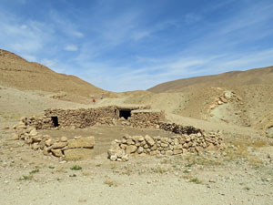
The route now followed a mule trail that climbed steadily up and across the dry stony hills. We passed a couple of stone-walled sheepyards used by nomads - it was hard to imagine the scattering of small herbaceous shrubs here sustaining flocks of sheep. |
||
 Climbing up into the stony hills .... |
 ... past isolate sheep pens .... |
 .... and down to the village of Alamdoune |
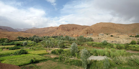
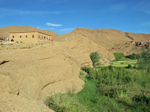
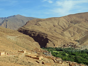
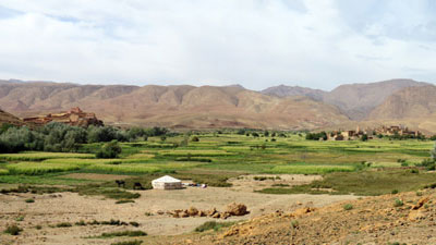
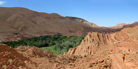
From our high point of 1910m, we commenced the descent towards the village of Alamdoune. What a surprise! In dramatic contrast to the barren hills, the houses of Alamdoune stood out on small rises above a sea of green. The village was an oasis in this desert landscape with fields of waving corn and lucerne, backed by the distant 3000m high peaks of the Mgoun Mountains. |
||
 From the desert to the green oasis of Alamdoune |
|
 What a contrast - the grassy fields of the river flats |
 On the deck of our gite |
 Berber song and drum session |
 Alamdoune glowing red in the light of the setting sun |
Alamdoune was also the location of our gite for the night, which we quickly reached after rock-hopping across a stream lined with reeds and poplars. On arrival, it was time for the usual mint tea on the wind-sheltered deck, enjoying views of the arid hills that we had just crossed. |
||
It had been another day of great hiking in these desert mountains, with several bonuses. The first was a lesson in the farriers trade, when two of our mules had their shoes replaced, the second an amazing sunset from the top of the hill behind the gite and the third, when our Berber drum band and choir introduced the slow rhythmic traditional dance to their performance and we all joined in. |
|

Day 3 - Alamdoune to Boutaghrar (14 km - 50m ascent - 260m descent) |
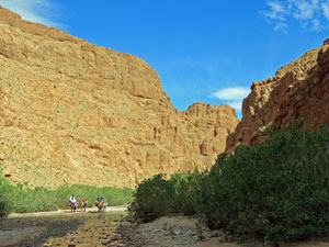
It was a little cloudy when we left for our last day of this trek. The mules were being loaded up in the courtyard of our gite as we set out, Muhammad in the lead, heading down towards the deep cleft in the arid range that marked the entrance to the Agouti Gorge. |
||
 Leaving the gite at Alemdoune |
 Entry to the Agouti Gorge |
 A glimpse back up the dry river bed |
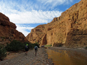
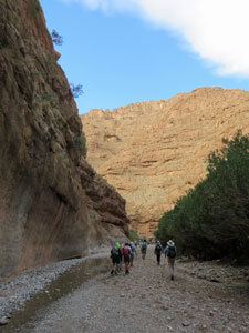
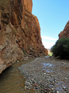
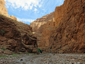
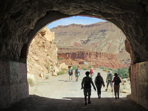
The first 90 minutes of our walk would be through this meandering gorge with its spectacular precipitous red rock walls -it was the highlight of the trek. |
||
 Our mule team on the move |
 Entering the gorge proper ..... |
 ... beneath its sheer red and tan-coloured walls |
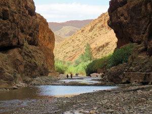
Starting out along the grey stony river bed, the gorge narrowed quickly after the entrance, as each bend produced new and more sensational vistas of the rock walls that locked us in. The further into the gorge we walked, the higher the walls became. Rock-hopping the shallow stream for a while, we reached a point where sandals replaced boots and wading the refreshingly cold water became the route - how good it was. |
|||
 |
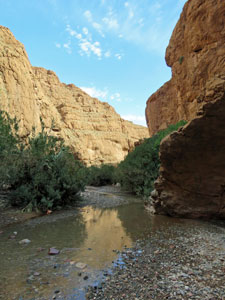 A series of landscapes .... |
 ....in Agouti Gorge |
 |
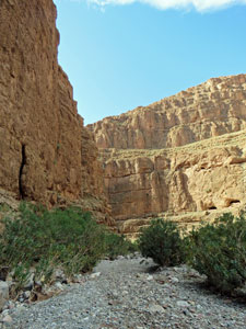
All too soon, one last bend led us to the exit of the gorge - time to put boots back on, as the irrigation canal leading out from the gorge told us we would be back in populated country again. |
||
 Leaving Agouti Gorge |
 A last look back at the gorge |
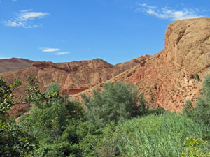 Lushness of the southern end of the gorge |
 Back into civilisation |
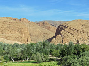
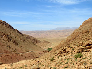
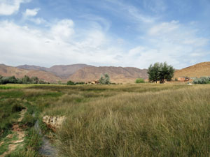
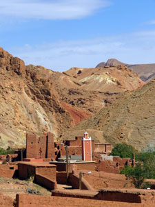
The route took us through the lush green plantations on the Assif El Oati river flats, before climbing up above them with superb views over the greenery to the dry brown hills beyond - this is certainly a land of extremes. Passing the chugging motor of an old water pump, it was on through the dusty streets of Tallemdout village, its mud-rendered buildings stretching along the heights above the river. Once again, the children rushed out to greet us with bonjours and salaams and the occasional request for bonbons or dirham. The women always had a smile and greeting, while the men were a bit more circumspect. On leaving the village, we followed a gravelly 4WD track as it wound across the jagged ochre rock formations higher above the long green thread of the river flats - a stunning landscape. |
 Wondering through the streets of Tallemdout |
 Dusty road above Assif El Oati |
 The green oasis of the El Oati river flats |
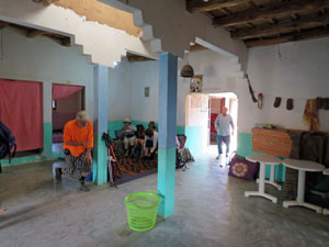
The temperature was rising again as we reached El Hot, the next village, - the tall mud-brick walls of the local casbah offered a welcome place for lunch, the spread laid out in a cool thick-walled room below the rooftop, with its views of the village and fertile river flats. The lunch break lasted a good two hours, as our guide decided we would wait until it was a bit cooler for the afternoon's walk (El Hot was living up to its name). Here, we farewelled our jovial mule drivers and their mules - their good nature and musical talents had helped the camaraderie of the walk. ⵜⴰⵏⵎⵎⵉⵔⵜ (tannemirt), our friends. |
||
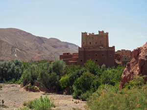 The Kasbah in el Hot |
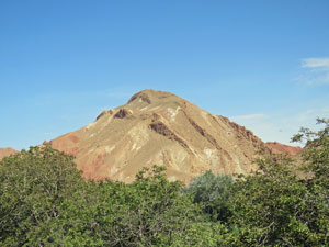 A landscape curious in form .... |
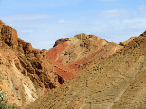 ..... and colour |
When we finally set out, we continued on the dusty road linking the long line of houses above the river, the wind at our backs giving a bit of coolth. Eventually, at the village of Aznag, the dirt road spilled out onto a sealed road, which we followed through a short, but spectacular gorge, to the larger village of Boutaghrar on th banks of the Mgoun River. Our brief exploration of the southern flank of the High Atlas had ended and we checked in to our pleasant traditional courtyard auberge to be reunited with our main baggage. |
||
 View over Aznag to the mountains beyond |
|
 |
This 3-day walk was the tonic we needed and was everything that I had hoped for in a Moroccan trek - striking landscapes, with arid mountains, deep gorges and verdant river flats. Morocco is truly a land of extremes. |
|


Moving On |
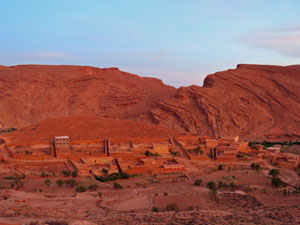
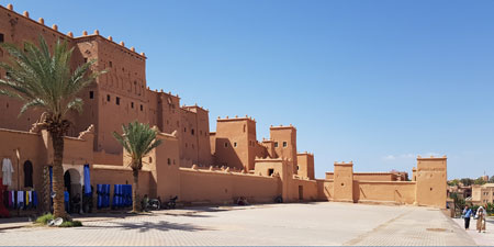
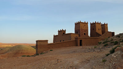
Having completed the Southern High Atlas Trek, it was time to move on to reach the starting point for our next trek in the central part of these mountains. Our minibus set out from Boutaghrar to follow the Mgoun River down its spectacular valley rimmed by rugged peaks and rock outcrops until it joined the Draa River on the wide barren plains of between the High Atlas and the Anti Atlas Mountains. Arriving at the city of Ouarzarzate, the modern gateway to the Southern Sahara, we took time off travel to visit the impressive Kasbah Taourirt, a heritage-listed restored mud-brick fortress that once belonged to the Pasha of Marrakech. Ouarzarzate is also the movie capital of Morocco with two movie studios making several films a year for US and European cinema companies - it could be thought of as Mollywood. |
|
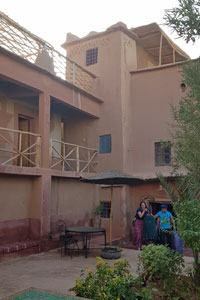
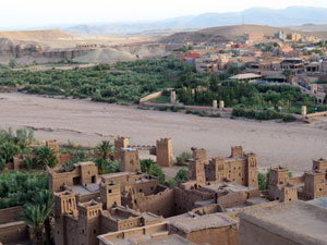
The plain may have been dry, but the Draa River Valley itself was a fertile area. One of the important crops here is roses - used for making oil for the cosmetic and culinary industries and, of course, we were given another opportunity to buy things - this time rose oil products (we left smelling no sweeter than we arrived). Then it was on to Ait Ben Haddou and our accommodation for the night - a traditional riad, traditional in design with its interior courtyard, but modern in function with a swimming pool in that courtyard. It was a great place for a refreshing dip after travelling in the 35C heat. |
||
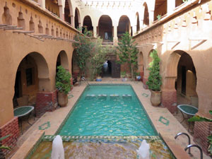 The courtyard of our riad |
 A red and yellow landscape |
 The dry bed of Oued El Malah passes through Ait Ben Haddou |
That evening we took a short walk to explore the reason for Ait Ben Haddou's tourist fame - a well restored and UNESCO World Heritage listed 17th century casbah, built to control the caravan routes between Marrakech and the Sahara. After wandering through the narrow streets lined with the mudbrick houses considered to be classic examples of Moroccan clay architecture, we climbed up to the tower on the rocky hill within the casbah. From here, views extended in all directions to the passes leading to the Anti Atlas and High Atlas Mountains - it was easy to see why this spot was chosen for a fortress. |
|
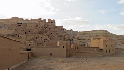 The Kasbah walls and buildings beyond |
 Fortress within Ait Ben Haddou |
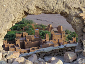 Looking down from a hole in the citadel wall |
 The arid lands beyond the kasbah wall |
 The gates of Ait Ben Haddou |
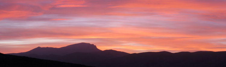
It was also a great spot for some sunset viewing, though unfortunately the hazy cloud on the horizon kept the colours to delicate shades rather than spectacular hues - a good end to the day nonetheless. |
|
 View from the top of the citadel |
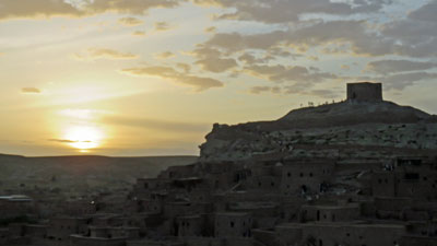 Sunset over Ait Ben Haddou |
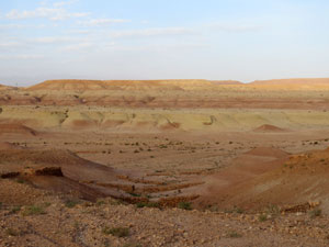
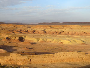
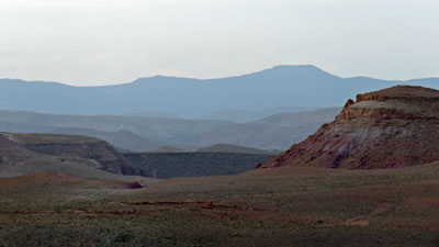
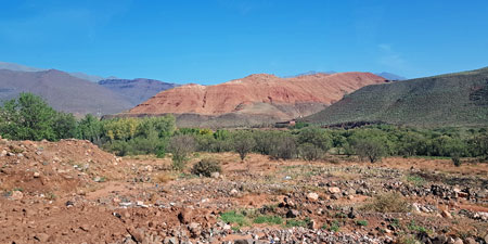
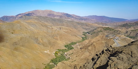
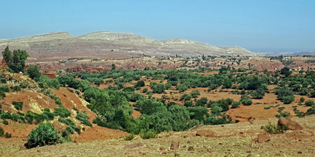
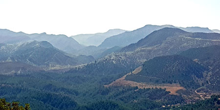
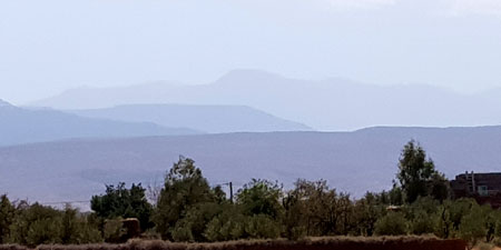
The following day, we set out from Ait Ben Haddou to cross the central part of the High Atlas Mountains, heading up a river valley that cut deep into the mountains before winding up and over a 2200m pass, with its spectacular views and hairy switchbacks. The northern flank of the High Atlas was less arid than the southern flank, with scatterings of juniper and groves of pine, some natural, others planted. As we descended the land became even richer with terrace gardens across steep red earth hills. The photos below give an idea of the changing landscape as we cross from the south-east to north-west side of the mountains. |
|
|
|
Finally, we spilled out onto the plain of Marrakech and turned south to parallel the mountains for a short distance, before turning up another valley system and driving up the narrow road that led us to the mountain town of Imlil. From here we would start our High Atlas Trek. |
|
