| High Atlas Trek - Part 1 |

Imlil to Aremd (2.5 km - 210m ascent) |
We arrived at Imlil around 4pm, clambered out of the minibus, put on our boots and daypacks and set out on our 8-day High Atlas Trek. Today would just be a short hike up to our first night's accommodation in the alpine village of Aremd. Meanwhile a 4WD vehicle would transport our main baggage there. |
||
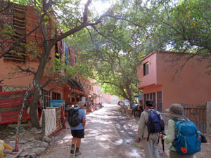 Wandering through the shady streets of Imlil .... |
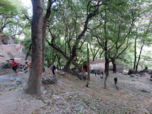 .... beneath shady walnut groves ... |
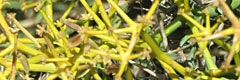
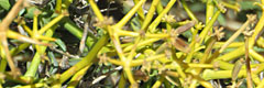
 and open air carpet bazaars |
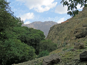
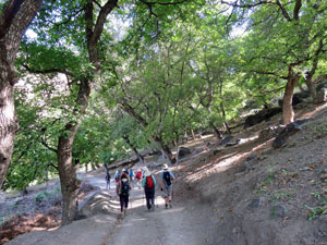
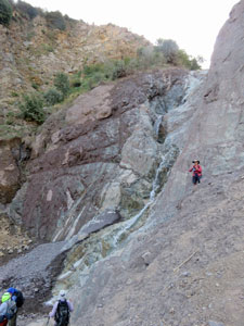
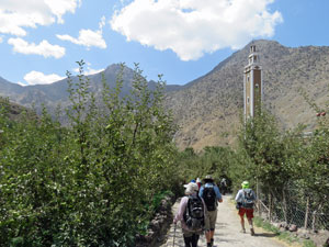
Imlil was a busy little town, full of adventure companies, set deep in a valley surrounded by high mountains. Ibrahim, our guide, was from here and seemed to know everyone in town, greeting them all as we wandered slowly up its streets and on to a foot track that led steeply up, beneath the shade of a grove of walnut trees. |
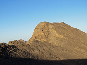
 First glimpse of Toubkal - Morocco's highest peak |
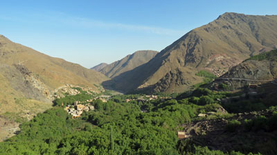
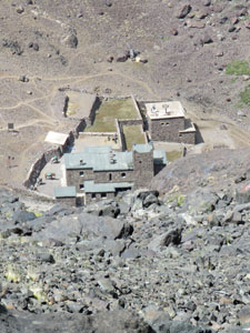
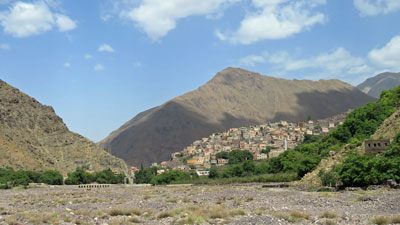
 Aremd .... the gateway to the High Atlas |
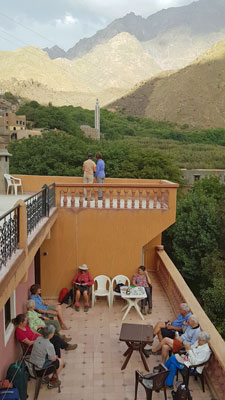 Relaxing on the roof of our gite in Aremd |
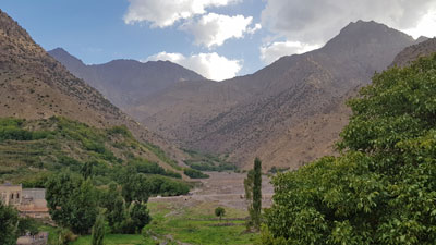
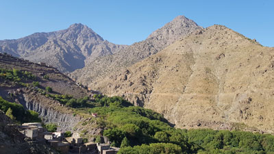
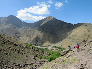
Part way up, we got our first glimpse of Jebl Toubkal, at 4167m the highest peak in Morocco and the aspirational aim of our trek - an impressive rock massif framed by the V-shaped valley walls. The foot pad climbed steadily upwards through the rocky outcrops to reach the very picturesque village of Aremd clinging to a steep mountain flank. Our climbing was over, however, and a short descent brought us to our gite d'etape, a very pleasant and well appointed place, with superb views up the valley to the dominating face of Toubkal, 2300m above us. We could sit on the wide terrace, sip our mint teas and contemplate the climb up in a couple of days time. |
||
 Looking up the river valley towards Toubkal |
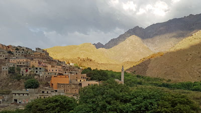 View over Aremd village |
Our cooks from the Southern Atlas trek, Moustache and Ali had also arrived, guaranteeing delicious Moroccan cuisine for the days to come. The trek had indeed started well. |
|
|
Aremd Circuit (8.5 km - 320m ascent - 320m descent) |
|
Our first full day in the High Atlas Mountains was an easy one. After breakfast, we followed Muhammad and a local guide back up to the entry of Aremd village, before heading down along a footpath to the base of Tidli Waterfall. Twenty five metres in height over several drops (so not really tiddly), the water tumbled down a dark rock face, before continuing its way down to the valley far below. |
|
 View over the walnut groves towards Imlil |
 A stroll in the shade of the walnut trees |
|
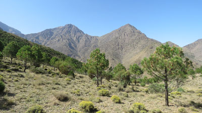
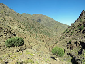
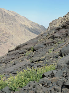
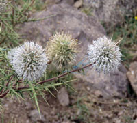
To the west, the views over Imlil town and the road we travelled up yesterday were impressive. Continuing on a contour along a narrow dirt road, we passed beneath a shady terraced walnut grove across from the neighbouring village of Ait Souka. Then it was time to turn off the road and head directly up a small gully to reach the region of dwarf pines higher up the mountain. Leaving the gully, we ascended slowly across the mountain's flank, traversing the slope in the midst of the pines. At the top of this high rise, we had even more impressive panoramic views of the deep valley systems and their scattering of villages. |
||
|
 Pine forest on the middle slopes of the Atlas Mountains |
|

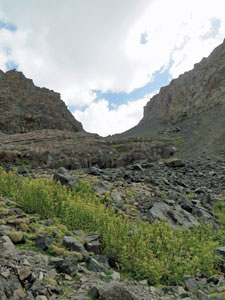
To the east, the top of Toubkal lay half hidden by the nearer peaks. At the base of the mountain in front of us, a deep gully had been etched into the volcanic landscape - a small plateau of basalt rock and low spiky shrubs. Crossing the gully, we then followed a path down through this jumble of massive basalt boulders and into the top end of Aremd. |
|
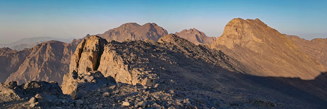
 Panorama from Aremd to Imlil |
 And these are the lesser peaks ... impressive |
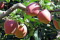
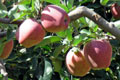
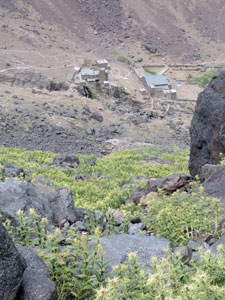
A final descent on the stepped pathways down through the houses of Aremd and out into the apple orchards below brought us to the wide dry river bed. From here it was but a short stroll up the road to our guesthouse, completing this short but interesting circuit. |
||
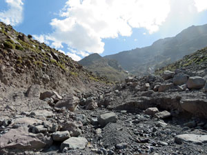 Big boulders in a glacier-carved watercourse |
 Heading back towards Aremd ..... |
 .... and a final stroll through the apple orchards |
We arrived in time for lunch and a free afternoon - time to catch up on correspondence and washing before heading deeper and higher into the mountains. Neldner Refuge was waiting, 1200m above. |
|
Aremd to Neltner Refuge (12 km - 1230m ascent - 0m descent) |
It was the day o the big climb, heading from Aremd 1230m up to Neldner Refuge, situated at 3200m and the base from which the climb of Jebl Toubkal begins. Only 12 of our group of 15 were making the trip up - two had come down with a bout of gastro and one had a cracked rib from a fall a few days ago. Hopefully, by the time we returned, they would be feeling better, but gastro is not a good companion for high altitude. Ibrahim was staying with them, and a new local guide, Lassan, joined Muhammad for the trip up to Toubkal. |
||
 Gravel bed of the Ouaganes Stream - the road to Toubkal |
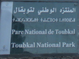 |
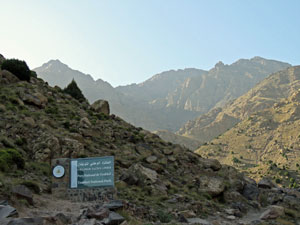 Entering Toubkal National Park |
It was a pleasantly cool morning when we set out from the gite, heading up the road past the apple orchards and across the wide dry stony streambed to reach the beginning of the mule track and the climb proper. |
|
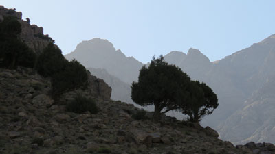 Juniper trees on the barren slopes |
 Heading towards the heartlands of the High Atlas |
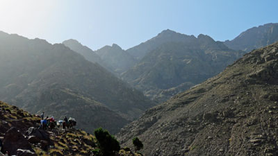
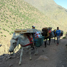
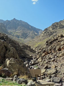
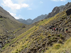
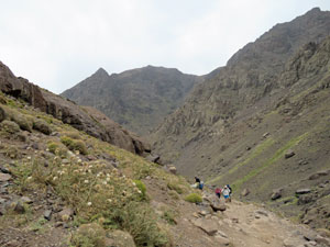
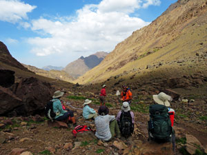
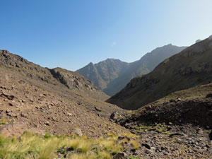
Therein followed a slow and steady climb up through some magnificent mountain scenery. as we entered Toubkal National Park, the valley rapidly narowed and soon the Asif n'Ouagounes stream was flowing far below us. Gradually, we entered a region where juniper trees added a touch of green to the steep and arid slopes - some were centuries old. Ahead to the south, the jagged outline of the northern walls of the Toubkal massif, silhouetted in the morning sun, lured us on. From time to time, we needed to stop and stand aside as mule trains with their wide loads trotted by (note: best stand on the inside of these narrow steep-sided tracks, as a mule on the move stops for no-one). Soon we arrived at the Sufi shrine of Sidi Chamharouch, wedged into the entry of a small ravine and adjacent to a series of cascades, with its cluster of shops selling souvenirs, plus rose oil and candles for the pilgrims that come here to exorcise themselves of their demons (apparently, this is the purpose of the shrine). |
|
Soon we arrived at the Sufi shrine of Sidi Chamharouch, wedged into the entry of a small ravine and adjacent to a series of cascades, with its cluster of shops selling souvenirs, plus rose oil and candles for the pilgrims that come here to exorcise themselves of their demons (apparently, this is the purpose of the shrine). |
||
 Sidi Chamharouch, wedged into its small ravine |
 View back down the valley |
 The white Sufi shrine of Sdi Chamharouch |
|
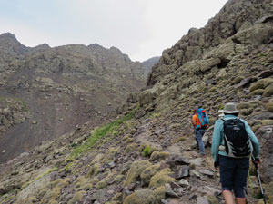
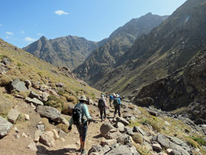
The climb started in earnest after the shrine, with a series of rocky zig-zags that wound up the flank of the broader upper valley of Asif n'Ouagounes. The scenery was magnificent, but the pace of walking glacially slow. Lassan was controlling the pace with consideration for the 1200m climb at a higher altitude and for the fitness levels of all party members. However, it was so slow that we all bunched up like a conga line - frustrating! One of our group referred to it as the "dead pigeon shuffle". |
|
 The big climb begins |
 A quick snack break on the track |
|
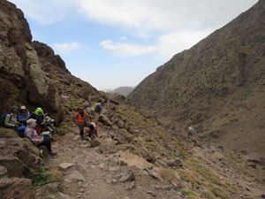
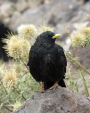
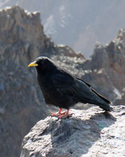
At this elevation, low spiky shrubs and thistles had replaced the junipers as the route followed the valley around into its narrower V-shaped course. We continued the ascent to reach a small stone teahouse (one of several on this mule track). It was a good place to stop and eat our packed lunches accompanied by a flock of sheep and a flock of mountain choughs. |
||
 One of several trackside tea-houses ... |
 |
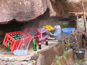 ..... with its DIY drink cooler |
After lunch, the slow amble up the valley, now a patchwork of golden tussock grass, continued. Groups of walkers and mule trains passed in both directions and I got the impression that the refuges were very busy places. |
||
 Crossing the tussock grasslands .... |
 .... as we head up the Upper Valley .... |
 Towards the refuges beneath 3976m Biiguinoussenne Peak |
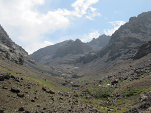
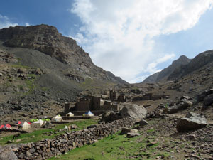
At long last, the refuge complex came into sight surrounded on three sides by the shaded rockfaces and peaks of the 4000m massif. Toubkal, itself, remained hidden above these lesser peaks. Small encampments of tents were scattered on the way up and directly in front of the refuge. |
||
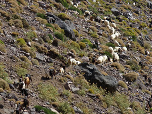
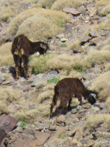 Herds of goats ..... |
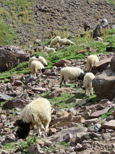 .... and flocks of sheep graze here in summer |
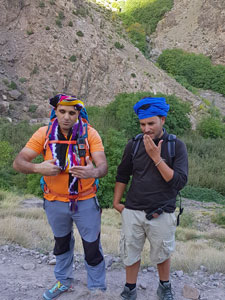 Lassan and Ibrahim - our guides |
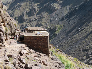
Passing a flock of nomads' sheep and goats, we reached our accommodation - in fact, we weren't staying at Neldner, but at the neighbouring Refuge des Mouflons, a well-appointed two storied stone building that could sleep 100. Climbing Toubkal has become a bucket list item for many trekkers. As expected, there weren't too many spare beds and it was a somewhat noisy place. Our group had its own 16-bunk dormitory, with comfortable mattresses and pillows. Our cooks had already arrived with the mules and our gear, so more excellent Moroccan cuisine was assured. |
||
|
|
|
It had been a day of superb mountain scenery, but now it was time to try and get a good night's sleep - tomorrow we need to be up by 4am to make our assault on the highest peak in North Africa. |
||

|
Climbing Toubkal (8 km - 980m ascent - 980m descent) |
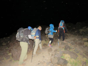
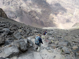
At 4167m, Jebl Toubkal is the highest mountain in Morocco and in all of North Africa. It is also a mountain that can be hiked up without the need for technical equipment which makes it a very popular destination. However, you are required to make the climb with a registered guide. While only 4km away from the Refuge des Mouflons, it is almost 1000m higher, making a day-walk to Toubkal a strenuous one, indeed. Only six of our party of walkers opted to do it. Unfortunately, the fair Nello was not one of them - there was no doubt that she could make it to the top, but her failing knees couldn't have handled the descent on a 25% average slope on a rocky scree-covered track, without giving her a lot of grief. My watch alarm vibrated its call at 3.45am - it was breakfast at 4am, then packed and ready to go by 4.45am. Over two hours of darkness remained, so it was beanies and headlamps on as we headed out into the cold clear Moroccan night, with our guide Lassan in the lead. Moonless it may have been, but the star-filled northern sky was crystal-clear as we crossed the stream behind the refuge and began a steady climb up a steep boulder / scree slope. At least that is what we found out on descending later - for us it was just steps in the beams of our headlamps - a small bubble of light in the dark void. Looking up, several tiny bobbing clusters of light marked the progress of groups that had left before us. |
||
 5 am start to the ascent of Toubkal |
 On the rock scree by dawn |
 The 4030m dome of Toubkal West |
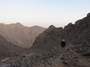
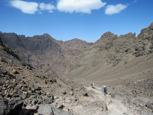
Higher up, the dark silhouettes of two peaks framed the middle of the rounded saddle that we were aiming for. When we reached it, we could see the lights of Marrakech twinkling on the distant plain. The route now deviated eastwards, heading up through a section of huge blocky basalt boulders. The sky was now beginning to lighten as we continued ever upwards in this access valley - a winding rocky track through loose scree - hard walking!
|
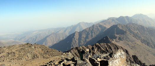
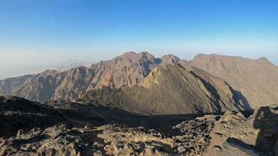
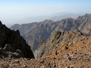
After several false crests, we reached the top of the valley and the edge of the massif at 4000m elevation - keep going forward and you would plunge 900m to the valley below. It was a good place to stop and take in the magnificent panorama - majestic 4000+m peaks, precipitous cliffs and silhouettes of jagged rocks backlit by the early morning sun. |
|
 The eastern ramparts of the High Atlas |
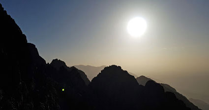 Sunrise on top of the Atlas Mountains |
From here we could look northwards and see the triangular trig on top of Toubkal, still 160m higher and 40 minutes of steep climbing along a jagged-edged ridge. Several conga lines of walkers were already descending the route, as those who raced up to see the sunrise began to make their way down. It would make for a quieter time at the summit for us. |
|
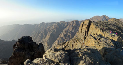
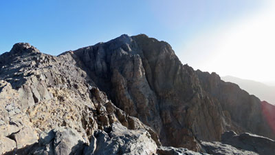 Can you see the trig on Toubkal (4163m) |
 Nearing the summit of Toubkal |
 |
 View south from Toubkal towards 4083m Ras Ouanoukrim |
 |
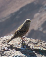
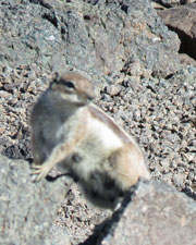
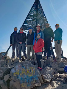
This one last push brought us to our goal, the summit of Toubkal - a glorious spot and glorious weather to spend an hour enjoying the surrounds - warm sun, a light breeze - as we shared Toubkal with the mountain choughs, thrushes, ground squirrels and even a flock of five sheep that apparently wander up each morning to feed on walkers' scraps. |
||
 |
 View to the north of Immouzer (4010m) |
 |
 The precipitous High Atlas landscape |
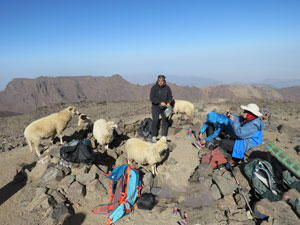 Having a snack with fellow summiteers |
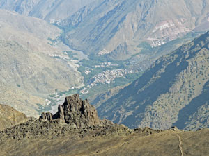 Looking down at Imlil from the summit of Toubkal |
|
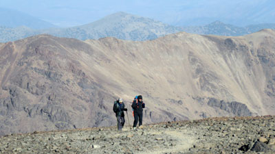
Having taken the obligatory summit group photo, we descended again - 970m in 3 hours with the small loose scree on the hard track making for many a slip and the occasional fall. Still, it was interesting to see those parts of the ascent that we had walked in darkness. |
|
 On the way down again |
 Descent of the boulder scree |
|
 Rocky slopes on the descent |
 Below the pass .... |
 .... and above the valley |
 looking down on Refuge Les Mouflons |
We were back at the Refuge des Mouflons in time for a shower and lunch, followed by a siesta and a chance to compare notes with the three members of our party who had done a shorter walk to a nearby pass. Tonight we would sleep well - our mission had been accomplished. |
|||
  |
Neldner Refuge to Aremd (12 km - 0m ascent - 1230m descent) |
Today we retraced our route 1230m back down the valley to Aremd. Those few words might sum up today's walk, but even though we were on the same track as two days ago, the perspective of a descent is different to the perspective of an ascent and I enjoyed it as much as the climb. The play of shadow and sunlight on the steep valley walls as the 'Ouagounes Stream zig-zagged its way down, the towering peaks ahead, behind, on either side, and the insignificance one feels in the presence of these cathedrals of nature all made this an enjoyable walk. |
||
 Heading down the high valley ..... |
 ... past flocks of sheep on the move ... |
 .... and on down the steep middle valley |
As we descended, we passed a steady stream of walkers heading up to attempt the ascent of Toubkal and some of many mule trains that carry the walkers' gear, as well as the supplies to replenish the refuges. Halfway down, we stepped aside to wait for a large flock of goats and sheep pass by with their shepherds, on the way up to higher pastures. We were leaving, but life in the Western High Atlas was continuing to march to its steady rhythm. |
||
 Farewell Toubkal |
|
 Back down the flat gravelly river bed to Aremd |
All too soon, we were back at Sidi Chamharouch shrine and a chance to sit down and enjoy a cold freshly-pressed orange juice at a trackside teahouse. For the last hour, the group broke up and we walked at our own paces - how pleasant it was to have the freedom to do so and enjoy the surrounds instead of worrying where and when to step with a walkers back just in front of you. Thus we arrived back at our gite at Aremd for an afternoon of washing clothes and doing small chores in the midst of this beautiful landscape. The following day would be a rest day here - time to restore a bit of energy after our 2-day 2200m ascent and descent of Toubkal, before continuing our trek by crossing a high pass into the neighbouring valley system. |
|