| High Atlas Trek - Part 2 |

Aremd to Tizi Oussem (10 km - 520m ascent - 500m descent) |
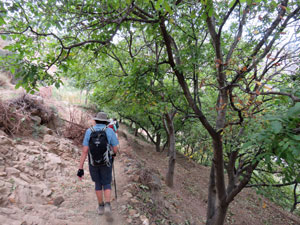
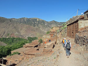
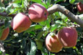
The day to leave Aremd for good was here. It seemed that our time had revolved around this picturesque mountain village for much of the last six days, coming, returning and now leaving again. This time, Ibrahim led us up a sealed road for a bit over a kilometre, high above the village of Imlil and its surrounding apple orchards and walnut groves. To the west lay a high pass and a dirt foot pad led off the road in its direction - it was our route up. The 500m climb up to Tizi Mzik Pass had begun. So too had the conga line, as once again our guides slowed the pace to the point where people began to bunch up. |
|
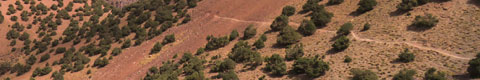
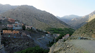 One last look at the mountain village of Aremd ..... |
 ..... before skirting the steep slopes above Imlil |
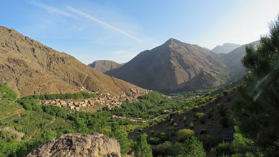
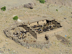
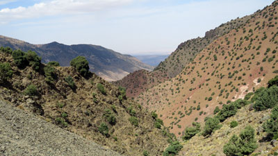
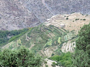
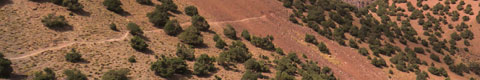
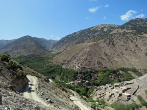
The route itself was a pretty one, traversing up the southern flank of the valley to enter the habitat of the juniper trees. Down below, a flock of goats was just being released from their stone-walled pen for the days high country foraging. |
||
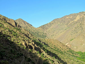 View up towards Tizi Mzik Pass (2480m) |
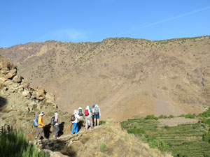 The climb to the pass begins |
 Looking down a goat pen |
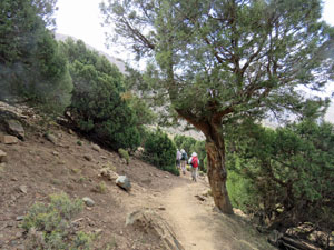
The track up to the pass now steepened and began a series of zig-zags. Finally, Ibrahim allowed some of us to leave the conga and walk ahead at our own pace up to the pass - what a difference it makes to the enjoyment of walking when you can control your own pace and have the space to take in the scenery around rather than backpack in front of you. |
||
 View to the east from Tizi Mzik Pass |
 The mule who stopped for a chat |
 The tea-house on Tiz Mzik |
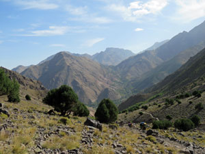
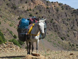
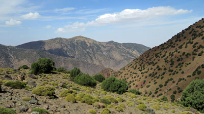
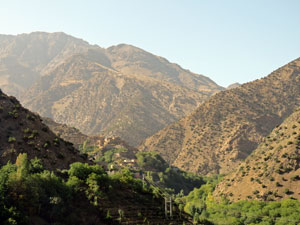
At the top of the 2500m pass, there was a small stone teahouse - time for a freshly-squeezed orange juice for the fair Nello and myself and a chat to our mules, who had arrived a bit before us. As we sipped our juices, we found ourselves looking down on to the juniper-dotted slopes of the Azaden Valley on the far side of the pass. It was a very different landscape to the more rugged upper valleys above Aremd. |
|
|
|
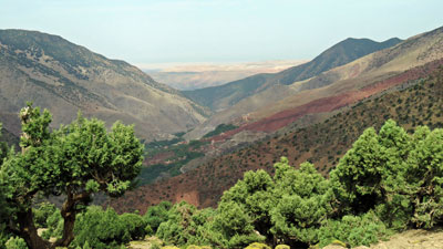
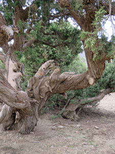
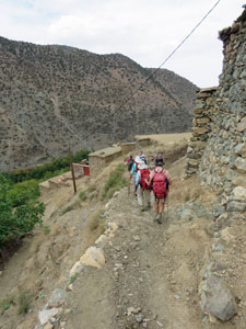
From the pass, it would be another 500m of descent through a beautiful landscape of gnarly old junipers to our overnight accommodation in the village of Tizi Oussem. The descent was in three stages - at first we sidled our way around the higher slope, enjoying the everchanging perspective of the Azaden Valley and its shades of red, green and tan. The walls of the valley directed our gaze to the distant flats of Marrakech beyond. Next, a long set of steep zig-zags led us down through the junipers to the top of the terraced gardens of Tizi Oussem. Finally, we followed the narrow and rocky village pathways to descend between the houses and past an ubiquitous walnut grove to reach our gite d'etape. |
|
 The route down to Tizi Oussem ... |
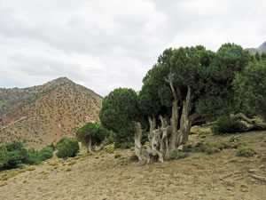 .... passing gnarly old junipers .... |
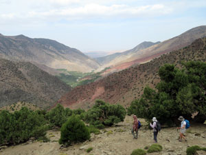 ... with expansive views over the red and ochre valley slopes |
|
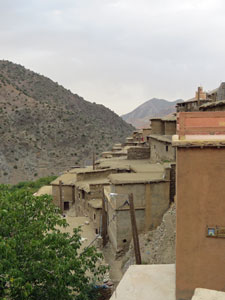
It was an interesting building - we arrived at the top level, but the terrain was so steep that there were another 3 levels below us built into the face of the hill. With a top terrace looking up and down the valley, it was a pleasant place to spend the last night of our High Atlas trek.
|
|
Tomorrow, we would continue down the valley to meet up with our minibus and head on to other parts of this fascinating country. |
|
Tizi Oussem to Tassa Ouirgane (9.5 km - 130m ascent - 590m descent) |
I'd had a hard night in Tizi Oussem - the bouts of gastro that had gradually hit some of the other walkers finally caught up with me. Luckily our room and the toilets were on the same level of this 4-level gite. We headed off around 9.30 am for the last stage of this High Atlas trek, down the Azaden Valley to our waiting bus, some four hous away. |
|
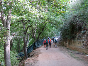
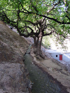
Leaving the gite, we descended quickly through the steep and rocky intervillage tracks that wended past houses clinging to the hillsides and under arches that joined upper and lower buildings. This brought us out along an irrigation canal flowing beneath the walnut terraces. |
|
 Time to leave |
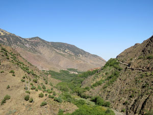 View down the Azaden Valley |
|
The path then led us to the gravel access road to the village - it was to be our initial route down the valley - the views of which were superb, with more villages below surrounded by apple orchards and backed by high mountains. The route, however, was being expanded into a more substantial road and we had to squeeze by some heavy earth-moving and rock-splitting equipment working on this narrow ledge - clouds of dust and huge rocks tumbled down into the valley below as they resumed work after our passing - the picturesque landscape of this part of the valley was being transformed into something more ugly - such is the nature of "progress". |
||
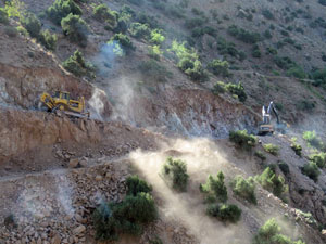 The new road arrives |
 |
 The High Atlas peaks behind Tizi Oussem |
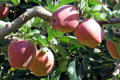
A little later, we left the road to descend through the narrow passages of the next village, Id Issa, passing the terraced apple orchards and sampling their produce - the apple harvest was in full swing in the Azaden Valley. |
|
|
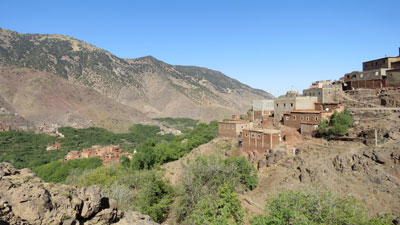 The village of Id Issa on the slopes of the Azaden Valley |
 Strolling through Id Issa |
|

 View back over the gardens of Id Issa |
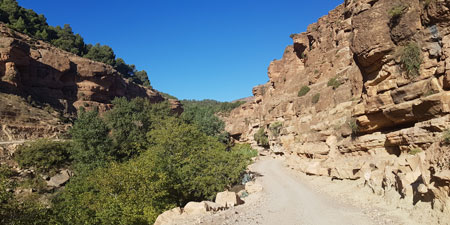
We reached the dry stony bed of the river, only to quickly leave it and wind back up the steep hill to reach the road under construction again. From here it was a 40 minute wander down this part asphalt, part gravel road, high above the steep apple terraces in the narrow gorge below. The scenery may have still had its charm, but it was a bit anti-climactic to end such a great trek by wandering down a main road - especially when your intestines are cramping and your thoughts are centred on where the closest bush or rock on this road might be. |
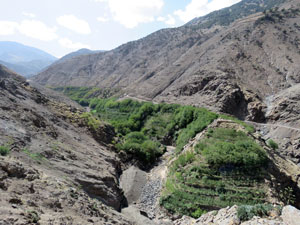 A narrow orchard-terraced gorge in the Azaden Valley |
Still, we did finish up with a pleasant lunch in the shade of almond and walnut trees on the terraces just before the village of Tassa Ouirgane. And with that, our 8-day trekking experience in the High Atlas Mountains of Morocco were over. |
|
Leaving the Atlas |
We finished our High Atlas trek at the village of Tassa Ouirgane in the Azaden Valley and we boarded the minibus there to head on and continue our Moroccan journey. As mentioned, in the previous section, I was in some discomfort with intestinal cramping and gastro, so my attention was not focussed on the trip. However, we did drive down the narrow tree-lined Azaden Valley, spilling out into a broader valley with an expanse of agriculture and orchards, and wound our way up and over a pass on a narrow road with intimidating drop-offs to reach the next valley. This was a drier valley and olives seemed to dominate the landscape. |
On reaching the town of Amizmiz, we stopped for a cold drink and to say farewell to Muhammad, who had been our second guide for the past 12 days. Thanks Muhammad, you were very considerate and knowledgeable and made our trip a pleasant experience. |
|
|
 The rich broad valley west of the Atlas |
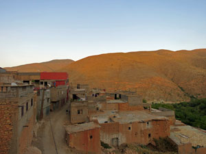 View from the rooftop at Imi n'Tala |
|
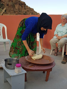
Then it was back up into the winding back-country mountain roads to reach our guesthouse in the village of Imi n'Tala. For me, it was just good to stop bouncing about on the bus and lie down. For others, it was a chance to watch a local Berber lady baking bread in the traditional way and get their hands given the henna treatment. |
|
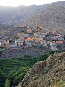
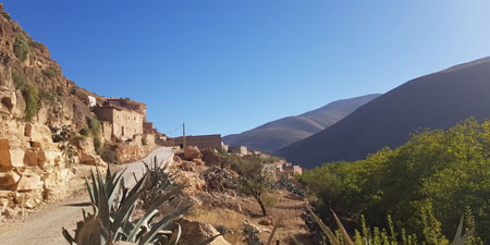 Village of Imi n'Tala ..... |
 ... where a spring flows out of th cliffs to water the gardens |
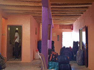 Inside the guesthouse |
 |
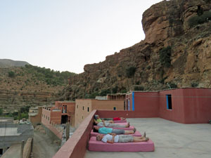 Moroccan rooftops are made for sleeping on a hot night |
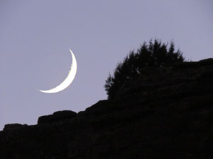
So, as a thin crescent moon set over the cliffs behind this picturesque mountain village, we retired once again. Tomorrow the mountains will be behind us and we will arrive at the sea. I'm looking forward to that. |
||
|