Kangaroo Island Wilderness Trail |


Preamble |
"The best laid plans of mice and men oft go astray .....", a curious saying, but one which I have just come to understand quite well. We had come to Kangaroo island with the plan to "pre-view" the Kangaroo Island Wilderness Trail, a new walking track being developed by the South Australian government in the south-west corner of this island to highlight the remote and wild coastal landscapes and pristine forest habitats that are found here.
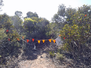
The trail is due to open in September 2016, but there were sufficient brochures and maps to plots its route. The logistics of the exercise were a bit tricky, as I knew that the overnight shelters hadn't been built yet, but we worked out that with a combination of camping, staying at a heritage lighthouse and at some coastal cabins, it could be done. From my reading, the new sections of track had been traced out and were mostly cut to varying degrees, so it would be essentially walkable with the help of a good map and a GPS. Unfortunately, I hadn't counted on "red tape" - when I discussed my plans with the rangers at Flinders Chase Visitor Centre, I discovered that we would not be allowed to walk the new sections due to public liability issues. Control of these areas had been handed over to the contractors until the track was completed and access was "verboten". In a past life I had worked for government agencies, so it didn't come as too much of a surprise - I was just cranky with myself for letting my enthusiasm get the better of my sense of the realistic. Nonetheless, the Park staff were very helpful and area manager, Alison, showed me what parts of the new trail were open and where else to walk to get a feel for the sections that we would miss. Hence, this partial preview describes:-
Thus, we managed to walk a bit less than half of the new trail, but in so doing included most of the different landscapes being showcased by it. So, even though my best-laid plans went astray (or in the original version of Robbie Burns "gang aft a-gley", this page should give a good idea of what is in store for future Kangaroo Island Wilderness Trail walkers. It should certainly whet their appetites. |
|

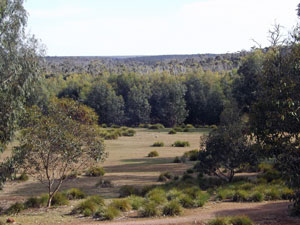
Kangaroo Island Wilderness Trail - The Beginning (Rocky River to Snake Lagoon) |
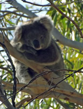
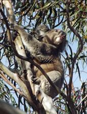
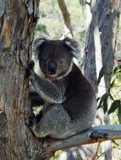
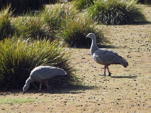
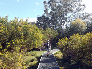
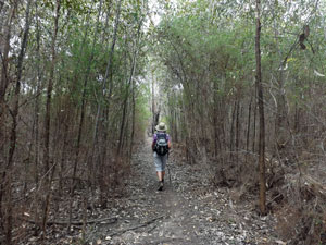
We were up early to begin our partial preview of the Kangaroo Island Wilderness Trail. Area manager Alison had kindly offered me a lift back to Rocky River from Snake Lagoon once I dropped the car off there, and she was calling by our Postman's Cottage at 8 am. Rocky River to Snake Lagoon is the first day's walk of the new trail, although it has long been one of the more popular day-walks in Flinders Chase. When Alison dropped me back, the fair Nello and I had a coffee, put on our relatively light day packs (one advantage of Plan B was that there was no longer any need for a full backpack), bade our farewells to the Cape Barren Geese, night-grumbling koalas and dawn-carolling magpies, and set off. We strode past Mays 19th century homestead and joined the Heritage Trail for one last bit of koala-spotting before it took us to the Rocky River Track. |
 The 19th century Postman's Cottage at Rocky River |
|
 |
|
 |
|
|
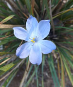
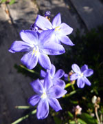
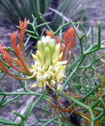
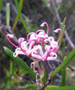
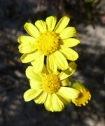
The Rocky River Track (aka Platypus Walk at its start) headed off across the dry grass bed of Black Swamp, along boardwalks where winter water might lie and past the open-grasslands tufted with blue-flowering flag lilies, where flocks of Cape Barren geese grazed the grass down to bowling green fineness. Along the way, we passed several of the long-extinct marsupial megafauna that once roamed these lands - rusty metal silhouettes of them that is. These are part of a particularly good set of interpretive signage, that give the passing walker not only an idea of what used to live here, but of ecological functions such as the role of fire. Flinders Chase was demonstrating its twin roles of conservation and education. |
|
||
|
|
|
  |
|
  |
|
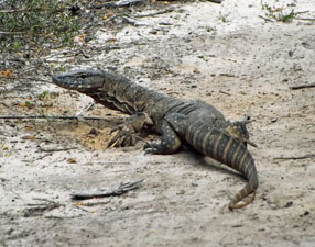
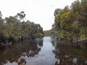
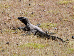
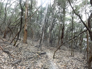
Leaving the waterholes, we left the more touristic parts of the walk to head down the Rocky River. A flat dirt track led us quickly through the tall riverine forest, crossing the odd still pool on wooden bridges and passing the mandatory sand goanna digging holes in the sandy track. The forest birds were singing and we were moving quickly.
|
|
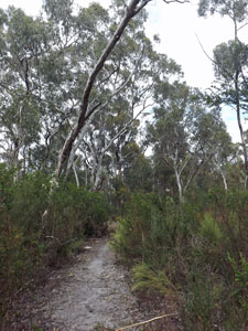
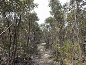
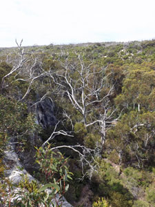
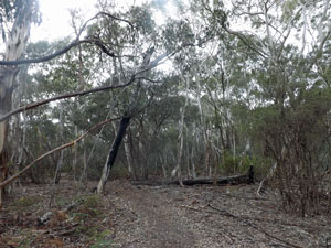
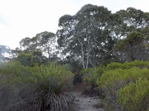
At times the forest was quite closed in, with its thick understorey of prickly acacia and at times more open. Eventually we started to climb gently into a lower mallee landscape, where the narrow track meandered its way through the 3m high scrub. Unbeknown to us, the Rocky River was cutting its way through these low hills to form a deep ravine. We discovered this upon suddenly emerging at a lookout set on a limestone cliff high above the river bed. As the day was warming up and this spot had some good airflow, we stopped for a break. |
|
 Mallee scrub on the low hills |
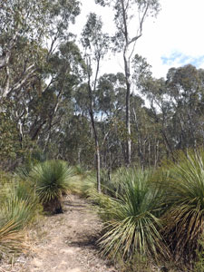
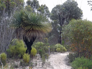
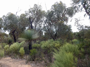 Eucalypt and grass tree woodland |
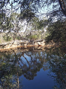
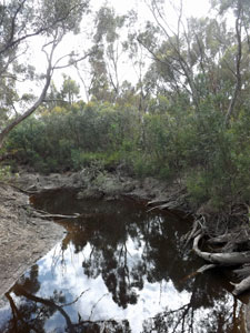
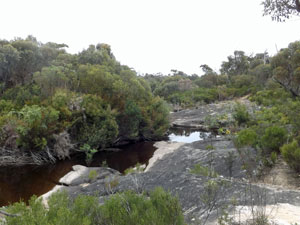
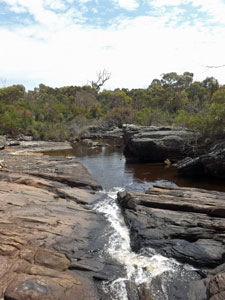
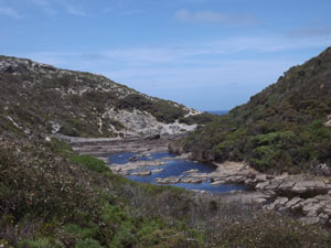
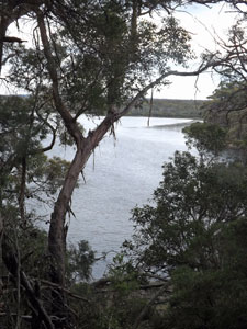
Then it was onward, briefly back into the mallee, but descending into more open woodland, where grass-trees started to dominate the understorey. We had once again reached the level of the river and, suddenly there it was, through a gap in the bush. It was very different here to upstream, as we found ourselves looking at a large limpid pool of water held back by grey rock ribs that crossed the stream bed, with water tumbling down a natural spillway to the rocky river course below. At last we could see where the name came from. |
||
 reflections in a natural pool on Rocky River |
 Walking alongside the river |
|
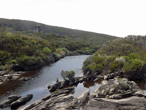
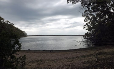
From here, a wander through lower heathland brought us to Snake Lagoon, with its shady campsites along the edge of the lagoon, now a dry open grassland, but occasionally a marshy swamp. Our car was waiting at the campsite where I had left it, so this promised to be a bit more luxurious than our usual hiking camp. |
||
 An impressive twin-trunked grass tree |
 The clearing at Snake Lagoon |
 Lower Rocky River |
|
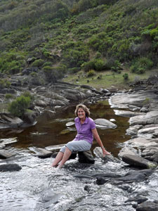
The day was still warm, so after setting up our tent and brewing a cuppa, we headed on down the Snake Lagoon track to Rocky River, where we spent a pleasant time soaking our feet in the rock pools as a banjo frog plunked his one note call. |
|
 The Rocky River heads for the sea .... |
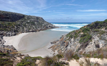 ... to spill out onto a beautiful sandy cove |
|
The Wilderness Trail continues for another half kilometre alongside a series of small cascades as the river zig-zags its way down through the bands of rock ribs that traverse the valley. Eventually, it opens out onto the superb sandy beach at the mouth of Rocky River, from where the new section will eventually take walkers southwards along the cliffs of the Flinders Chase. To get a feel for what this section might be like, the next day we walked a circuit out of Snake Lagoon taking in the coastal cliffs to the north of Rocky River mouth. This is described on the next page. The little bit of track down to the sea also had to wait for the morrow, as the sky was now clouding up and a few almost imperceptible drops of rain began to fall. That was all we would have, but it was a good signal to put our boots back on and head to camp - I believe there is a cold beer in the car-fridge! |
|
Kangaroo Island Wilderness Trail - The Middle (Cape du Couedic to Admirals Arch) |
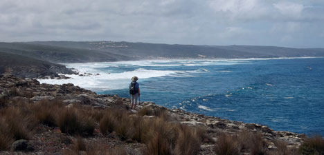
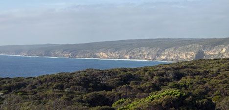
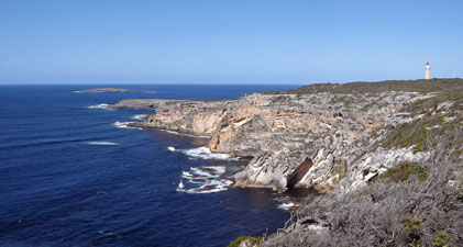
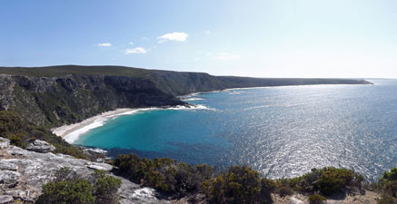
The central section of the Wilderness Trail pivots about Cape de Couedic, which with its lighthouse, the iconic Admirals Arch and Remarkable Rocks is probably the most instantaneously recognisable part of Kangaroo Island. From a lookout near the lighthouse, we could see the line of cliffs stretching northwards along the west coast and, from our brief experience of west coast cliff-walking earlier in the day, this part of the Wilderness Trail will be superb as it heads towards the cape. |
||
 |
|
 |
|
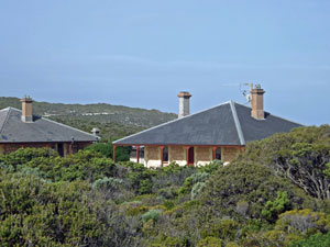
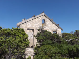
To explore this central area, we based ourselves for a couple of nights at the delightful 100+ year-old lighthouse keepers cottages. There are three of these cottages set amongst the dense heath of the lighthouse precinct, furnished in heritage style - a place where the "here we are at the end of the earth" feeling is palpable. The red-capped lighthouse itself is a handsome structure and, with the Casuarina Islets lying surf-pounded off the end of the cape, the setting is exquisite. However, the trail does not get here - it sets up camp to the north of this superb site. Reading the brochures and looking at the maps suggests that a walk down to the cape itself will be a short side trip on day 3 of the walk, as will apparently be Remarkable Rocks. |
|
As soon as we arrived at our cottage, we wandered down past the lighthouse and along the walking track that winds down through the shin-high heath on the limestone cliff-tops towards Admirals Arch. In the afternoon light, the views out over the Casuarina Islets and back along the southern cliff-faces were magnificent. |
|
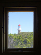
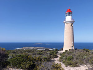 The lighthouse at Cape du Couedic |
 Cliffs to the east of the cape |
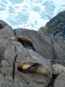
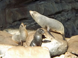
Nowadays a smooth boardwalk zig-zags its way down to Admirals Arch, an enormous passage eroded beneath the tip of the cape, where long-nosed fur seals haul out beneath the stalactitic roof of the arch to bask slug-like in the sun or frolic in a quiet pool metres from the foaming surf. On the rocks all around, fur seals were sleeping, squabbling or grooming - this is a place where you can spend a lot of time and I'm not sure that a "short side trip" would satisfy me. |
|
|
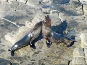 Fur seals at play |
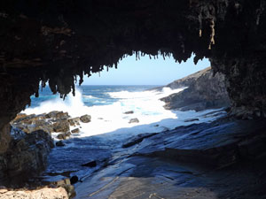 Admirals Arch |
|
There may be a good reason for the campsite being placed away in the heathland, but there seems lots of room within the general lighthouse precinct to discretely place a walkers' shelter, without imposing on the the landscape or other visitors. That way, walkers could explore this wonderful spot at their leisure. |
||
 Ruins of the storage building at Weirs Cove |
 |
 Panorama of Cape du Couedic and The Pinnacles islets |
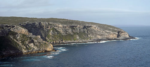
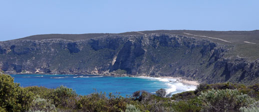
The next morning I set out to try and work out the trail route a bit better. Heading off from our cottage, I picked up the Weirs Cove footpath, which led through the sandy coastal heath and along the cliffs. Under a clear blue sky, the views of the cliffs back towards the cape were magnificent. Weirs Cove itself, with the restored remains of a storage building and flying fox used to haul the three-monthly supplies for the lighthouse keepers up the cliff-face from a small landing below, was fascinating. Beyond Weirs Cove lay the highest cliffs of all, stretching away around to the unmistakable profile of Remarkable Rocks on their massive granite plinth - one of the great coastal panoramas. |
||||
 |
 |
 |
 |
 |
I knew that a section of the new trail had been cut from Boxers Road (the road access to Remarkable Rocks) down to Weirs Cove (probably part of the planned side-trip on day 3). It didn't take long to find it and the nicely cut track led upwards, at first parallelling these superb cliffs and then winding its way through and ever denser coastal heathland. |
||
 Easterly vista from Weirs Cove |
 |
 The new Wilderness Trail |
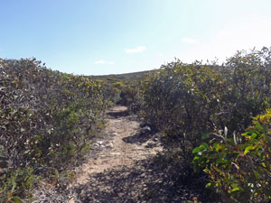
On reaching Boxer Road, I noticed an entry into the bush on the opposite side of the road - "Track under construction" it said, but what it didn't say was "no entry", so in I went, expecting that it would head fairly speedily towards Remarkable Rocks. What I didn't expect was that it would head north not east into increasingly dense 2-3 m high coastal mallee. The track had a severe case of "the meanders" as it pushed on, eventually turning east before making another big loop to the north and back again. I was beginning to wonder where it was going - was this just the line of least resistance through the mallee, did the track-layers take a wrong turn at one stage or was it created by someone who just loves being in the dense still air and tunnel-view of coastal mallee? |
|
|
 This must be the Public Liability "red tape" |
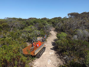 Trackwork in progress |
|
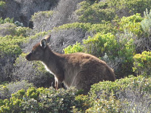
For myself, I confess to having a need to look out over my surrounds every so often. I can take 30 minutes or so in thick vegetation, but after that I like to see where I am visually rather than on my GPS. This is not because of a feeling of claustrophobia, more of ennui at the changelessness of the track, and I realised that ennui was setting in when I noticed that I was walking faster and faster. Suddenly, there was a crash of vegetation in the bush alongside and a flash of brown fur - someone else was in a hurry too. |
||
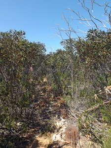

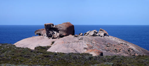
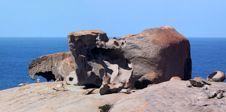
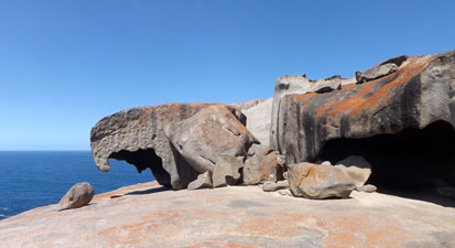
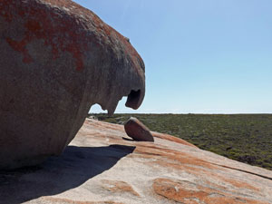
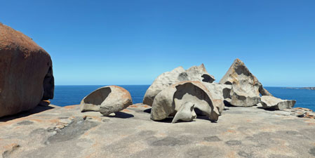
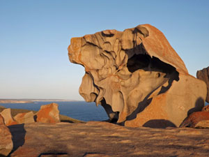
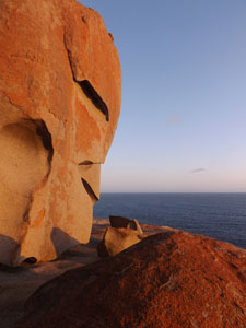
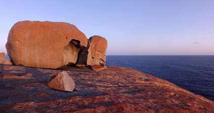
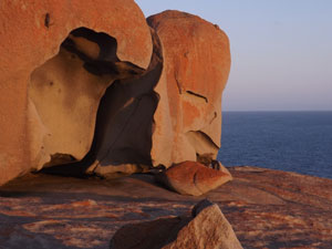
The last sections of the track were the least complete, being only a bobcat slash along a line of pink ribbons, but from the early parts this is all going to end up a fine walkable route. When I finally emerged onto a gravel road just north of the Remarkable Rocks, I couldn't help but wonder why the trackmakers preferred to meander for so long through the dense heath than to get here quickly and take in the absolutely magnificent setting of this iconic landscape. These granite rocks extruded into a limestone landscape are Remarkable by name and by nature - the photos below say it all. |
|
|
|
|
A series of photos to show why Remarkable Rocks are so named |
|
|
|
The bob-catted piste of the track appeared to continue on, but I stopped here - to walk further on would be pushing "public liability" issues and I had learnt enough. This central section of the Wilderness Trail is in many ways its "piece-de-resistance", but I was left with a nagging doubt about whether the Trail was going to do it justice. I understand that walking all the way along the cliffs is not on, to avoid disturbing sea-eagle nesting, but is detouring over a kilometre deep into the mallee the answer? |
|
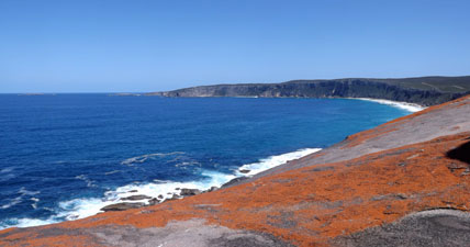
 The magnificent southern cliffs viewed from Remarkable Rocks |
 View back towards Remarkable Rocks from the cliffs |
|
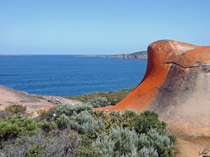
That evening we returned to Remarkable Rocks to take in the sunset - as the golden orb sank below the silhouette of Cape du Couedic it bathed the sculpted granite of the rocks in a pinkish-orange glow - surreal and serene at the same time. |
|||
 The pinkish-orange glow and shadow play ....... |
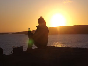 ....... of sunset at Remarkable Rocks |
|||
|
|
Overnight, the wind had picked up and was moaning about the cottage the following morning. We hurried through breakfast and headed back down to the tip of Cape du Couedic and Admirals Arch, where the seas were now huge, with 8m swells rolling in and refracting around the Casuarina Islet to create a spectacle of crashing waves, boiling water and flying foam. Even the seals were all hauled out on the leeward side of the rocks - a symphony of nature's power. |
||
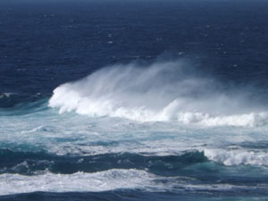 Spumes of foam wind-whipped off the big surf |
 Argie-bargie on the rocks |
 Big swell exploding 30m high against The Pinnacle |
|

Kangaroo Island Wilderness Trail - The End (Hanson Bay to Kelly Hills) |
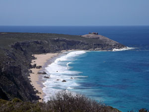
After following the cliffs of the southern coast and detouring around the isolated, but ultra-luxurious, Southern Ocean Lodge, the Wilderness Trail crosses the South West River and then heads inland across the Cape Bougeur Wilderness Protection Area to reach its end at Kelly Hill Caves. As mentioned several times, public liability issues prevented us from walking the unfinished sections of the track, so to explore the finished end, we moved on from Cape du Coeudic to base ourselves at Hanson Bay, where the cabins have glorious views over this beautiful aquamarine coloured bay with its white sand beach and rolling surf beyond the protecting reef. |
|
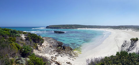 Vista of the clear waters and pale sand Hanson Bay |
 The next beach along east of Hanson Bay |
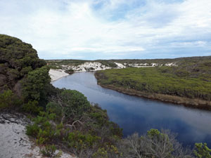
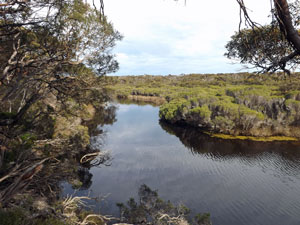
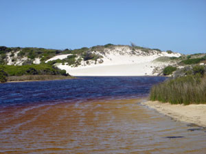
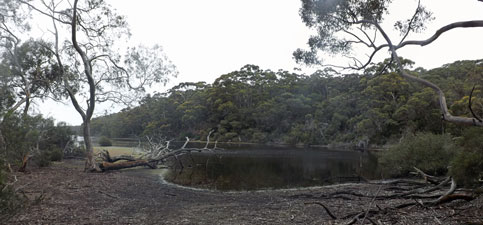
The air was warm, but the scent of change was in it as as we set out on this last leg, dropping on to the fine white sand of Hanson Beach and following the water's edge around to its far end. Here we climbed up on to a low dune - to the east lay two more wild and windswept white sand beaches before the line of cliffs continued. However, our course lay inland and we turned north. A track across the heath-covered fore-dunes quickly brought us to the edge of the South West River, or at least the lagoon thereof, as the river mouth was barred by the sands of Hanson Beach. Walled in by high white dunes near its mouth, the tea-coloured waters of the river wound their way back inland through the older dune system, covered in thick tea-tree scrub. We followed its twisting course past a series of lovely dark pools, where only a tiger snake crossing the track a few metres ahead disturbed our sense of reverie.
|
|
||
 Where the river meets the dunes |
 |
 |
 A dark pool in the South West River |
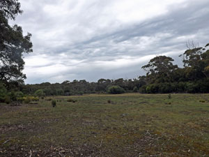
Suddenly the river spilled out into a long grassland, the remnants of Grassdale, an erstwhile farming property. Traversing its length, we again picked up the South West River, now more creek than lagoon. Passing through a small forested gap, we reached a second smaller grassy clearing, surrounded by tall trees full of bird song. I think that this is the site for the last shelter on the Wilderness Trail - if so, they have picked an idyllic spot. |
||
 Crossing the open grasslands |
 |
 A small lagoon on Grassdale |
The signed track now moved away from the grasslands to commence an undulated perambulation into the woodlands of the old back dunes. Eventually, it climbed up to a point where we could look out over the grassy openings and forest of the flatlands to the west. In a distant clearing lay the tiny shape of the restored Grassdale homestead - we made a mental note of its location. The view was impressive, but what wasn't impressive was the big band of grey cloud rolling in from the west. |
|||
 Rain clouds approaching |
 |
 |
 Looking down onto the old Grassdale homestead |
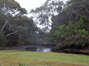
Descending northwards from the dunes, we reached the edge of the large freshwater Grassdale Lagoon set in the middle of the forest. The track turned east to follow higher up a slope along its southern shore, views of the lagoon's waters filtered through the tree trunks. It was a curious forest with virtually no understorey, just a dense layer of litter and fallen branches. With the increasingly grey sky, the colour seemed to be sapped out of the landscape. |
|
|
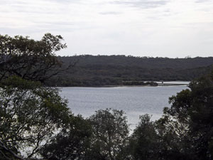 Grassdale Lagoon in black and white |
 Bare-earthed forest above the lagoon |
|
By the time we reached a small bay for our first real glimpse of the broad reach of the lagoon, the first raindrops had started to fall, splashing down on the dark water surface. It was the sort of rain where you wonder whether you should put on rain-gear or wait a while. We skirted the eastern end of the lagoon, with more open views of the shore and then headed north-west, making a bee-line towards the Kelly Hill Caves. The raindrops had stopped, but the bush was left with that wonderful damp-earth smell. |
|
|
 More rain on the way |
 |
|
|
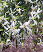
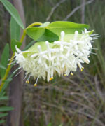
The track was at first sandy and scattered with the scrapings and diggings of goannas, and wildflowers began to become more abundant. As we began the final climb up into the Kelly Hills, the limestone underfoot became more evident.
|
|
|
|
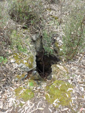
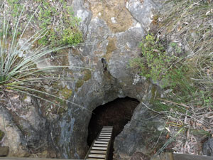

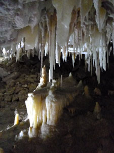
In fact, we were walking over a large (and partly unknown) cave system, where sinkholes and small openings gave a hint of what lay below. These caves have been open to the public for guided tours since 1925 - we passed the old cave entrance, with its ladder heading deep into the bowels of a limestone solution tube. |
Then it was down to the Visitor Centre, where we had a nice hot cup of coffee to cure our dampness and a chat to the local ranger. Here the Wilderness Trail ends, but offers the great bonus of being able to end with a visit to the Kelly Hill Caves (see below). Unfortunately, for those who have left their car at Hanson Bay, the journey has to be repeated in reverse .... or almost. |
|
|
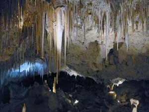 |
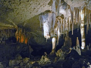 Some of the spectacular Kelly Hill Caves formations |
|
We did head back along the track all the way to the western end of the lagoon, but here we diverged. My GPS had indicated the presence of something called the Lagoon Track a few hundred metres away through the open bush along the shore of the lagoon, so we followed its directions and, lo and behold, emerged on to the end of an overgrown track. |
|
 The western end of Grassdale Lagoon |
 A slightly overgrown Boundary Track |
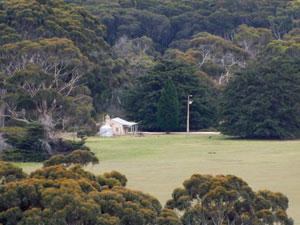
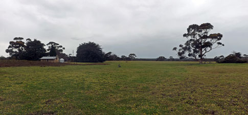
It brought us quickly to an intersection and, based on our mental note of where the old homestead was, we headed north up the almost disappearing Boundary Track to emerge on to a large expanse of open grassland, dotted with enormous grass trees and a big mob of kangaroos. Here the Sugar Gum Track guided us westward. Ahead we could see a clump of exotic conifers and then some rusting old farm machinery - all very promising. Hidden behind the conifers was the Edwards family homestead, restored with a fine verandah under which to enjoy a late lunch and listen to the occasional patter of raindrops. |
||
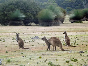 Kangaroos with grass trees |
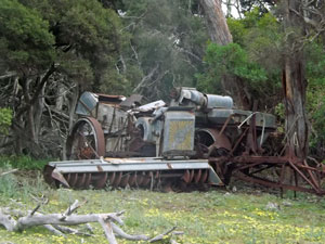 Some disused farm machinery |
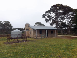 The restored Edwards' family homestead at Grassdale |
Lunch over, we headed southward, following a road and then grassy track along the edge of the South West River. There has been a lot of tree regeneration work in this area and it was educational to see the dense grass swards in an area fenced off from kangaroos, compared to the flat-grazed pastures outside. The track eventually rejoined our outward path and we were soon once again walking across the lovely Hanson Beach and back to our cabin. |
||
 |
 The pastures of Grassdale |
|
As a one-way trip, it will be a great way to finish the Wilderness Trail and, as a two-way trip, the diversion to include the Edwards homestead and extended stroll through Grassdale on the way back gave it the diversity needed to enjoy the whole walk. Footnote: While we couldn't walk the unfinished south sections of the trail west of Hanson Bay, we did do a short walk in that direction to get an idea of the rugged beauty of the limestone cliffs along this southern coast line of Kangaroo Island. This is described in on the Kangaroo Island Day-walks page. In talking to one of the locals, I learnt that the Wilderness Trail does not actually go to Hanson Beach, but cuts across further inland to cross the South West River (by canoe?) and reach Grassdale. This is presumably to avoid the man-made infrastructure and cabins at Hanson Bay, and maintain the wilderness experience. That may well be overkill, as for me, to miss the beauty of Hanson Bay, its dunes and the mouth of the river would be a disappointment. |
|