Stage 9 - Mystery Bay to Bermagui

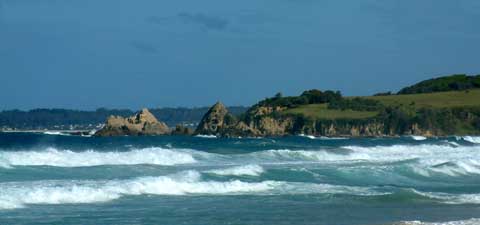
Mystery Bay to Wallaga Lake
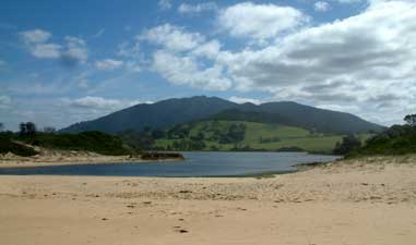
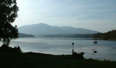

After a pleasant Easter with Liz and Tony, their family and friends in Central Tilba, it was time to be on our way again. Liz dropped us back at our marker at Mystery Bay and, after a quick morning dip in the brisk water and one last glimpse back to farewell Barunguba, we loaded up our packs and headed south.

The first part of the stage followed a track winding inland through eucalypt and undulating coastal banksia forest before bringing us out onto the northern end of 1080 Beach (there must be very few beaches in the world named after wild dog bait). At the southern end of 1080, we crossed the broad sandy bar of Tilba Tilba Lake before climbing up onto the kikuyu pastures of a small headland.


Tilba Tilba Lake

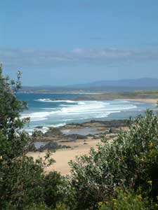
Looking through the banksias to 1080 Beach


Black volcanic rocks on 1080 Beach


Tilba Tilba Lake sandbar


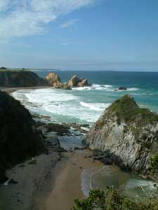
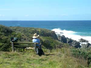
A good place to ponder


Midway across, a wooden seat invited us to stop and have a snack - it became obvious why it had been put there as it looked down onto a tiny idyllic secluded cove. Eventually pulling ourselves away from this magical spot, we descended to the 5 km stretch of Wallaga Beach.


This cove is not named on the map nor with a sign
- I hereby name it "Nello's Cove"

Unfortunately for our legs this was a steep beach with soft sand; another real calf-burner. The effort was worth it though for the constant views of the two sacred mountains; Gulaga to our right and Biamanga (Mumbulla Mountain) ahead of of us.


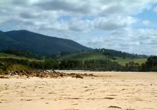
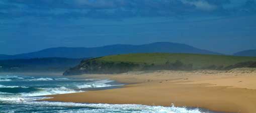
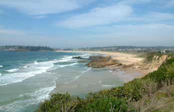
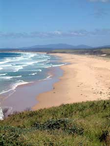
Looking down Wallaga Beach towards
Mumbulla Mountain
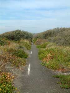

The path southward

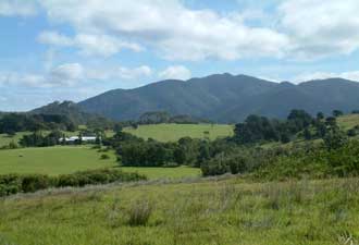
It is impossible to escape the presence of Gulaga on
this stage of the walk

Biamanga landscape


Gulaga landscape

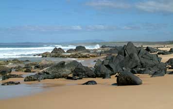
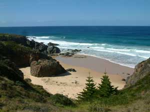
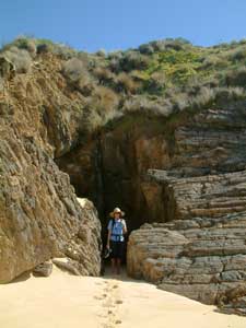
Cave on Wallaga Beach
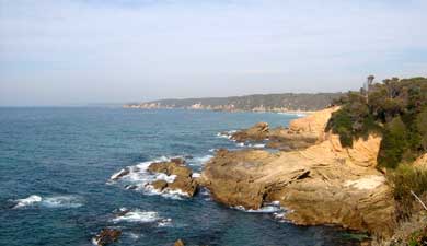
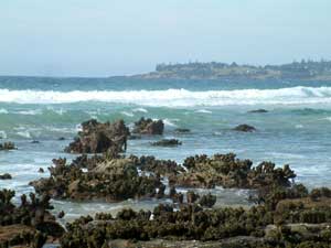
At the southern end of the beach, we crossed the sand spit holding in Wallaga Lake, before climbing up the grassy verge leading to Morunna Point. Here we picked up part of the Bermagui Coast Walk, which followed the cliff line and literally tunnelled through dense melaleuca thickets in sections.


Murunna Point

View from the Murunna cliff top
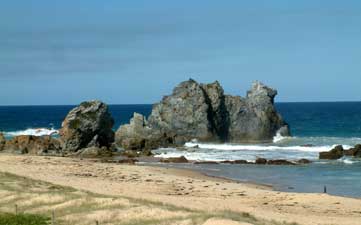
At various spots, gaps appeared to provide views of the impressive rock formations at the base of the cliff. The most well known formation was saved for last, as the path descended to the viewing point of Camel Rock (no guesses allowed for why it is called this).

Turning inland we made the short trip from Camel Rock to the Ocean Lake Caravan Park, looking west over the main body of Wallaga Lake. Watching a brilliant sunset over the lake waters from the deck of our cabin, we agreed that this would be a great spot to spend another day. It is rare to be able to watch the sun set over water on the east coast of Australia (and even rarer for us to be up early enough to watch a sunrise!), so we felt privileged to see two magnificent sunsets in a row; one a soft pastel tapestry, the other bold and gold.


Camel Rock

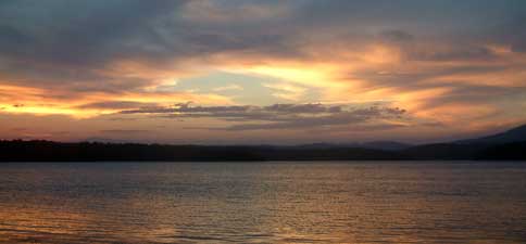
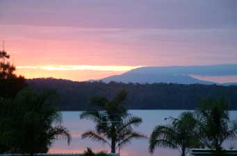
Glorious Wallaga sunset


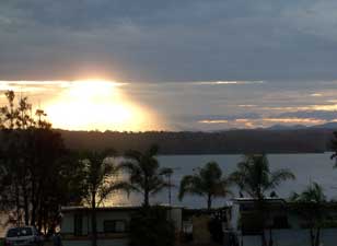
The mothership is landing!
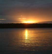

On golden pond?

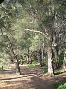
Casuarina grove lining the shore

On Wallaga Lake

The silhouette of Gulaga, ever present on our walk to Wallaga, hazily dominated the northern end of the lake. This, the different plays of light at various times of the day and angles of the sun, the everpresent birdlife, and the sighing of the wind in the casuarinas on its shoreline gave Wallaga Lake a mystical ambience.


Wallaga Lake to Bermagui


Just before Wallaga Lake we passed the 400 km mark on our walk. Quite a few people that we have met on this trip have asked whether we walk along the roads. Those following this website will have noticed that we try to keep away from main roads and as close to the coast as possible. Time for a bit more trivia for statistics addicts like myself; the following is a breakdown of how far we have walked on different surfaces: -

Walking tracks  134 km
Beaches / rock platforms 113 km
Suburbia (streets etc)   70 km
Dirt roads / forestry tracks 30 km
Bicycle paths  30 km
Paddocks  14 km
Bitumen roads  9 km
Highways 2 km
Bush bashing 1 km


When you consider that bike paths are in or near developed areas, it's scary how much of the coast is taken up by urbanisation, i.e. cities, towns and coastal villages. Fortunately, National Parks and Nature Reserves are now protecting much of the undeveloped coast from further expansion. These comments are not an indictment of local government in the area, as most councils are protective of their urban green space and have programs to make residents aware of environmental issues, e.g. painting signs on drains warning that the water eventually flows into lakes or oceans or even declaring areas "plastic bag free zones". Local residents also have self-organised into groups such as Dunecare and Bushcare to try and remedy existing environmental problems and prevent any further degradation. However, we cannot all have uninterrupted ocean views and future development needs to be consolidated in already urbanised areas.


Keep left! Storm-damaged road
turned walking track

Enough pontificating - let's get back to the walk. At 8km, Wallaga Lake to Bermagui was one of the shorter stages of our walk. We retraced our steps from our cabin on the lake across to Camel Rock, to rejoin the Bermagui coastal walking track. This led us through a narrow strip of coastal forest between the beach and the main road, before emerging onto a disused stretch of bitumen road that had been washed out by severe seas. The motorist's misfortune became the walker's fortune, as for a few kilometres we had a smooth sealed track, with pigface and acacias creeping across and the occasional stretch of line markings still in place to prevent head-on collisions between opposing walkers.


This stretch took us past Long Swamp, a freshwater lagoon trapped behind the dunes and a haven for waterbirds. A couple of discretely placed hides had been built along the way to facilitate observing the birds in the wetland.


Long Swamp

Eventually the track ended and the real road took over, so we headed to Hayward's Beach where Bermagui lay stretched out on its headland behind the entrance of the Bermagui River.


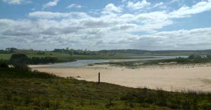
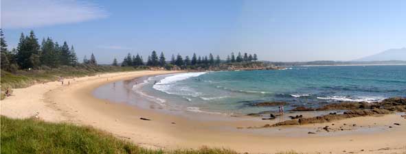
Hayward's Beach and Bermagui

The colours of sandstone

"Cungie" covered rocks - that is sea-squirts for
the profane and tunicates for the profound


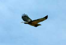
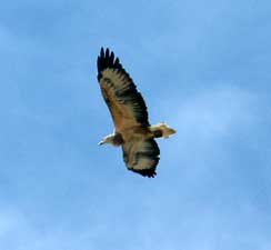
As we climbed up over Keating's Headland, a sea-eagle circled us and twice its shadow passed over us. Remembering our lessons at Gulaga about how people do not choose their totem, but that their totem chooses them, we decided that the sea-eagle had become our totem animal. Given my fascination for this superb aerialist, I was flattered.


We crossed another small wetland to reach the bridge over the Bermagui River, before following the road up the main street to our accommodation for the night at Zane Grey Caravan Park. Bermagui is one of the best known game-fishing ports in Australia and the author, Zane Grey, was a regular visitor during the 1930s to fish for the big marlin and tuna that can be found near here. It still has a lot of old town charm; the modern game boats in the harbour contrasting with the older building facades and date palms in the main street, the iconic rows of Norfolk Island Pines, and attractions such as the Blue Pool, a rock pool built into the rock platform at Blue Point over 60 years ago. We enjoyed our early morning swim in this pool and our brief stay in Bermagui.


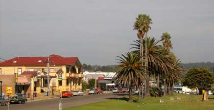
The main street of Bermagui


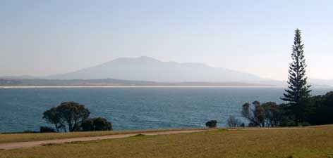
Looking across the bay back toward Gulaga

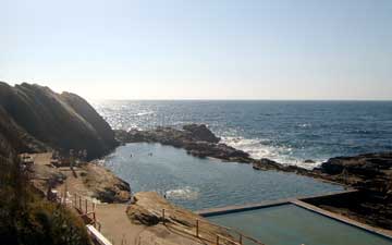
The Blue Pool - great place for an early morning dip


Norfolk Island pines lining Horseshoe Bay


The route southward from Blue Point