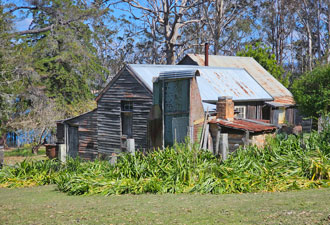
| Stage 6 - Tathra to Wonboyn |
About |
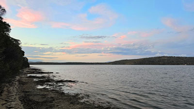
The sixth stage of our group hike along The Great South Coast Walk would be the longest one yet, 125 km from Tathra to Wonboyn over seven days. Each day's walk, however, varied in length, from 10km to 26km, because of the spacing of accommodation options. For the most part this would be a camping trip, though we had planned a relaxing two nights in a cabin at Wonboyn at the end of the walk. It was a bit tricky to find a good time for the stage. There were three major water-crossings, the Pambula River, Kiah Inlet and the entrance to Wonboyn Lake, which had to be done during the lower part of the tidal cycle. It was also best for people to start and end on a weekend and juggling the two gave us only two options, one in mid-October and one in mid-November. We settled for November. |
|
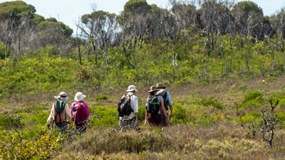
 The Stage 6 walking party .... |
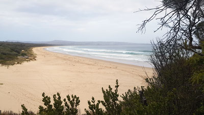
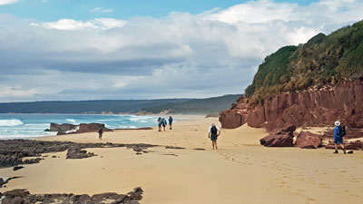
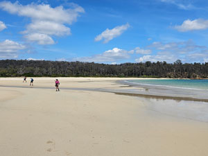
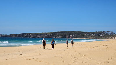 ..... heading out on golden beaches ..... |
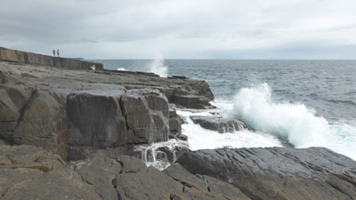
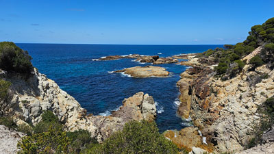
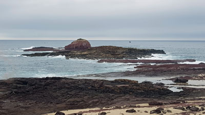
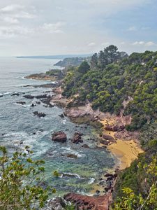
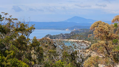
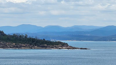
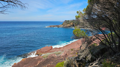
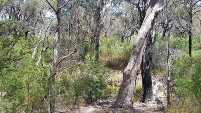
As previously, the route, which crosses Bournda and Beowa National Parks, promised a diversity of landscape - coastal cliffs and rocky coves, heathland and forest, lakes and lagoons, long stretches of isolated beaches, colourful rock platforms and rugged outcrops to scramble over, as well as small towns and villages with coffee shops for a bit of luxury. |
|
|
|
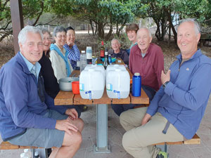
Once again, the fair Nello would be our support driver. After having recovered from a bilateral knee replacement and walking the previous section, she has been hit by a pinched nerve in the L4/L5 spine which again restricts her walking (note: she is having a laminectomy in January to fix this). For this stage, the regulars - Jan and Phillip, Lois and Bernard, Ian, Jacqui and myself were joined by Rivera to make the quota of eight walkers. |
|
|
|

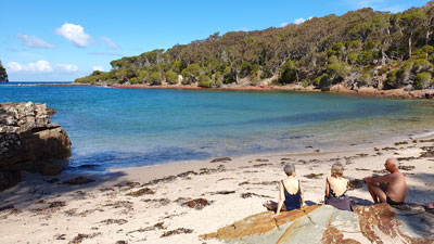
The fair Nello and I travelled down to Eden a day earlier than the rest to check out the feasibility of the water-crossings (all doable) and verify the route around Eden, where we planned a few changes from our original 2004 walk. The others duly arrived to set up camp at the Eden Reflections Holiday Park next to Curalo Lagoon and next day, on a sunny spring morning, we all assembled to await the maxi-taxi to take us to Tathra and the start of the stage. Meanwhile, the fair Nello would drive all our gear to Hobart Beach Campground at Lake Wallagoot, where we would end day 1. That is, after a bit of op-shopping and coffee and cake in Merimbula. After a slight hiccup, to swap the normal taxi sent by mistake with the maxi-taxi, we walkers were on our way up the coast to the Tathra Pub. It was here that we had ended Stage 5 with a cold beer and here that we would start Stage 6 with a hot coffee. |
|


Day 1 - Tathra to Wallagoot Lake (14.5 km - 350m ascent - 370m descent) |
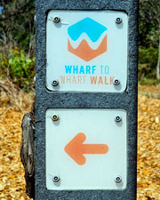
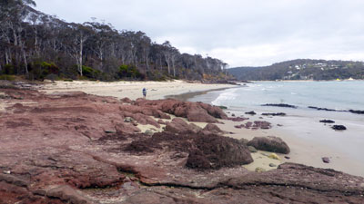
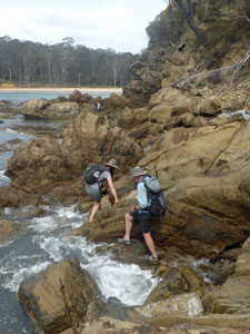
The deck of the Tathra Pub is a lovely place for a coffee, with its sweeping views to the north and south of the coastline. However, we were here to walk, so our group of eight set off to join the recently opened Wharf to Wharf Walk, which follows existing tracks southwards to Merimbula. The meandering track on the south-east side of Tathra Headland led us past some beautiful cliff-lined coves along its shore, to reach the clear green waters of Kianinny Bay and the start of the old Kangarutha Track. |
||
 |
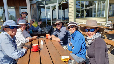 Starting the walk with a coffee at the Tathra Pub (photo: J and P Gatenby) |
|
 Heading off on the Wharf to Wharf Track |
 Rugged oastline of Tathra Headland |
 |
 Clear calm waters of Kianinny Bay |
 |
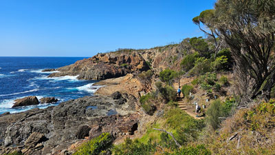
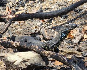
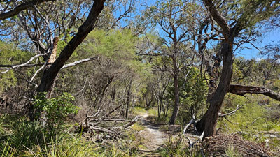
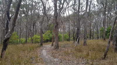
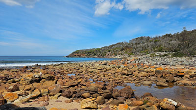
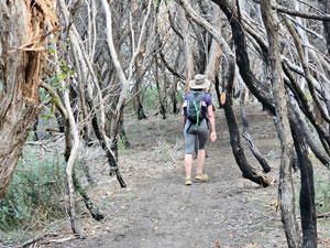
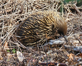
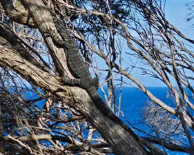
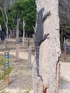
Climbing up into the tall heathland, still scarred by the bushfires of 2020, we began a long meander down the rocky shoreline. At times we tunnelled through the paperbark heath, as it wound its way up and down to cross a series of dry creek beds or emerge onto the stony beaches at Wild Horse Bay and Boulder Bay. The goannas were out in force on this section, basking in the sun or feasting on dead mutton bird. |
||
 |
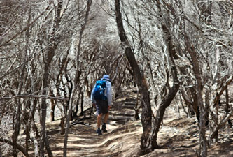 Heading up through the fire-damaged paperbarks |
 |
|
|
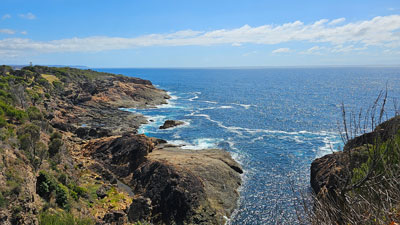
The air was still and the temperature hot in the shelter of the heath and it was pleasant to break out onto the cliff line to take in the breeze and the glorious views of this rugged coastline. A short detour to White Rock provided the most impressive views of all. |
|
 View southwards from White Rock |
 Slot canyon near White Rock |
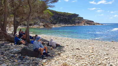

After lunch in a small breezeway ravine at the end of narrow inlet, we crossed sandy Games Beach and climbed upwards and more inland into the old dune system and its taller coastal forest. |
|
 A tiny coastal inlet |
 Lunch in a shady gulley |
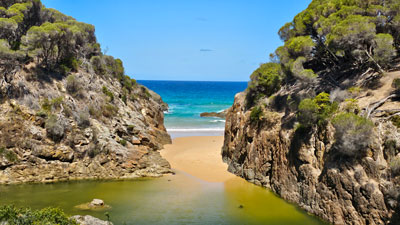
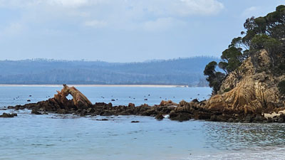
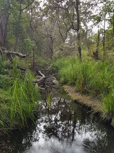
Crossing theses densely vegetated dunes, we descended again, with glimpses inland over the calm waters of Wallagoot Lake and the hinterland beyond. This brought us out at Wallagoot Gap, an impressive break in the cliff line with the ocean beyond and a shallow green pool on its inland side. It was a good place to rest in the shade and wait for the other half of our group, who had made an even longer detour to see a slot canyon cutting into the cliffs. This is a spectaular coast-line. |
|
|
|
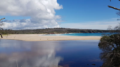
A wide sand bar blocked the lake from the sea, so we set out to cross it and wander down the fine squeaking sand of the beach for another kilometre before finding a path that led us over the low frontal dunes and through the tall heath to the lake shore. We were on the edge of Hobart Beach Campground and, from here, it was only a short walk to our campsite - a pleasant spot surrounded by tall eucalypts and coastal shrubbery, not far from the cooking shelter and hot showers (yes - an unexpected bonus in a National Park camground). |
|
 |
The fair Nello had arrived and all was ready to pitch tents and relax. It was a pleasant spot to spend the late afternoon, accompanied by the steady "plinking" of bellbirds in the canopy above and the occasional visit by the resident kangaroos or swamp wallaby. |
 |
 |
 |
Despite being a bit on the hot and sweaty side, it had been a great first day's walk on Stage 6. |
||
|


Day 2 - Wallagoot Lake to Pambula Beach (21 km - 150m ascent - 160m descent) |
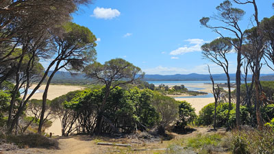
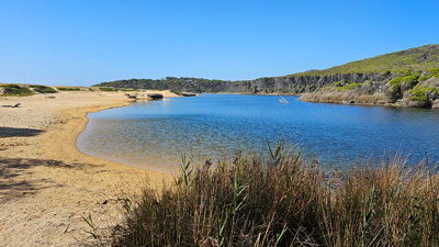
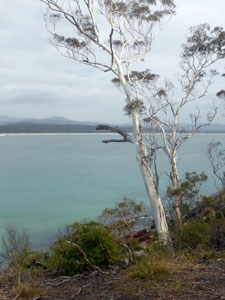
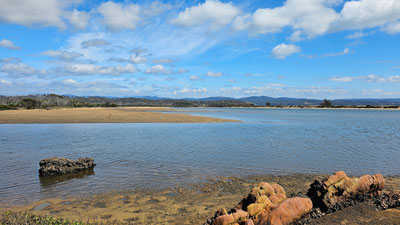
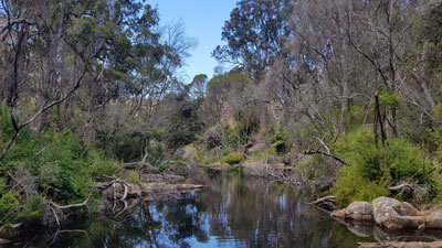
The sunny warm weather continued as we headed out from Hobart Beach and through the coastal forest to reach Bondi Lake. The lake itself lay mostly hidden, offering a few glimpses through the paperbark thicket that lined its shore as we skirted it. Climbing over a small dune, we arrived at Bournda Lagoon, a sweeping stretch of water locked from the ocean by a wide sandbar, that disappeared into the forest beyond .... picturesque. |
|
 The calm side of the sand bar separating Bournda Lagoon from the sea |
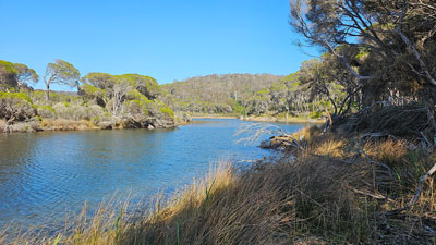 Bournda Lagoon disappearing into the forest |
We crossed the bar to climb onto and over Bournda Head and follow a track along the vegetated dune system above the long sandy stretch of North Tura Beach. After two kilometres, we dropped back onto the beach for a short sandy stroll to Dolphin Cove and a set of steps leading off the beach. As we were walking the wind began to pick up and whip up whitecaps out on the ocean. |
|
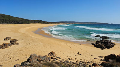 The sweeping stretch of Bournda Beach |
 View back towards Bournda Island |
At a wooden platform just above the beach exit, we were in for a pleasant surprise. Jan has a friend who lives at Tura and she had come down to meet us, bearing freshly baked biscuits .... yum!! Thanks, Lyn. Lyn then led us up a grassy track over the top of Tura Head and down to Tura Beach, another long stretch of pale golden sand. |
|
 Crossing Tura Head (photo: J & P Gatenby) |
 Windy walk down Tura Beach |
With a brisk breeze at our backs, the two kilometres of beach-walking went quickly and, finding the right exit, we crossed the foredunes to reach the Mundooi Walk, a short track through the coastal heath of the old back dunes. Out of the wind, the temperature rose quickly and it was good to reach Merimbula Back Lake. Here we left the Wharf to Wharf Walk - it was heading towards its finish at Merimbula Wharf, but we were heading more directly towards the bridge across Merimbula Lake. We headed inland just in from its shore for a while, before finding an exposed, but shady point where we could sit on the rocks and enjoy the view and the breeze over lunch. |
|
 The path along Merimbula Back Lake |
 View through the trees of the Back Lake |
The route continued to meander around the slope above Back Lake to finally cross a flat swampy area behind the lake, then a footbridge over Merimbula Creek and into the streets of Merimbula. We crossed over to the shores of the much bigger Merimbula Lake and strolled along the wooden esplanade beside the lining mangroves. The coffee shop on the esplanade was too inviting - beside their aren't too many places where you can enjoy a coffee alongside mangroves. |
|
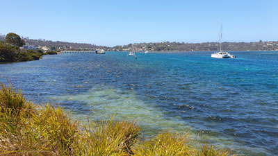 The main lake at Merimbula (Photo: J & P Gatenby) |
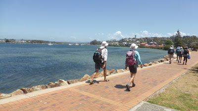 Strolling along the esplanade at Merimbula (Photo: L Padgham) |
Continuing on, we crossed the lake via the road bridge, with a strong cross-wind blowing, to traverse the Fishpen Peninsula and approach the ocean again. The strong wind tricked us into thinking it would be better to follow a sandy 4WD track through tall forest parallel to the beach. However, in the lee of the wind the track was stiflingly hot - we took the first exit across to the beach, took our boots off and wandered down the remaining four kilometres towards Pambula Beach on the firm intertidal sand, with the wind at our backs and the waves splashing our feet. |
|
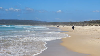 On the 6 km stretch of Pambula Beach |
 Bushwalking shouldn't alwas be hard work |
On reaching the end, we cut across into the Pambula Beach Holiday Park, where the fair Nello had swapped our original tent sites for some more sheltered ones. It was a very nice place to stay and, that evening, we wandered across to the beach restaurant for fish and chips and a glass of ale from the local microbrewery. Occasionally ending a day like this is one of the pleasant aspects of the Great South Coast Walk. |
|

Day 3 - Pambula Beach to Eden (23 km - 240m ascent - 240m descent) |
Today would be an early start, as we had the first major water-crossing, the Pambula River. Low tide was at 8 am, so we set off at 7.30 to quickly cross the beach and follow the Jiguma Track through the trees along the next headland. It brought us out to a nice viewpoint over the mouth of the Pambula River, where a well-formed low surf rolled in towards the entrance. It looked wide, but looks can be deceptive and we were not crossing at the entrance. |
|
 Looking back toward Pambula Beach |
 View from Jiguma Head (Photo: J & P Gatenby |
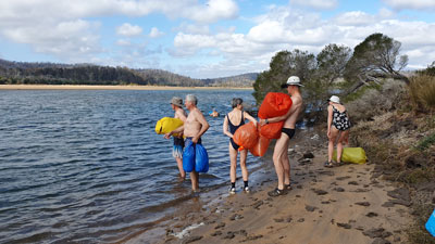
We followed the track down to the calm river-side beach and further along its shore to the crossing point that the fair Nello and I had sussed out earlier. Here, a broad sandbar curved out into the wide expanse of water to reach the deeper main channel, only 30m from the opposite bank. Bathers on and gear packed in dry-bags, we crossed faily easily with a longish wade and shorter swim across the channel in a slightly outflowing tide ... one crossing down. |
||
 How to cross the Pambula River ... pack gear in dry bag ... |
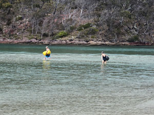 .... wade out across the sand bank ..... |
 ..... swim the channel |
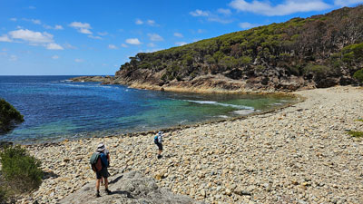
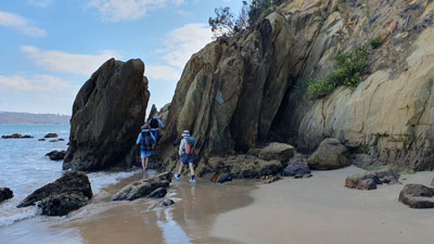
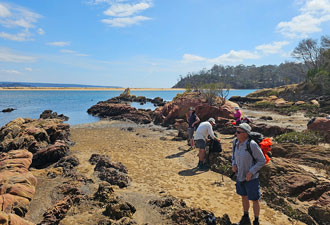
Back in our walking gear, we wandered along the shore-line across maroon-coloured rocks to reach Barmouth Beach. A little further along, we climbed up a small gully, a short-cut to reach the Haycock Point Track. This was a very pleasant track that wandered through tall eucalypt bushland and more open grassy heathland, with occasional panoramic views over the Pambula River mouth and the sweeping stretch of beach to the north. |
|
 View across the rocks to Barmouth Beach |
 Panorama of Pambula Beach and its hinterland |
|
The track spilled us out onto Haycock Point itself, with its rock ribs, offshore islets lined with cormorants and spectacular views - it was a good place for morning tea. |
|
 View north from Haycock Point |
 The islets of Haycock Point |
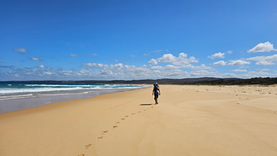
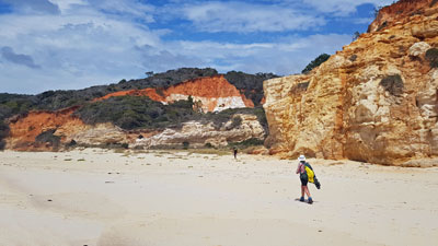
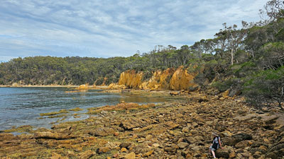
Then it was down through the heath to Long Beach, very aptly named as we could see its end over six kilometres to the south, separated into two by the rocky outcrop of Quondolo Point. It woud be a walk of two halves, with lots of time for meditating to the steady roar of the surf and the surge of negative ions. |
|
|
|
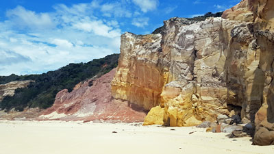
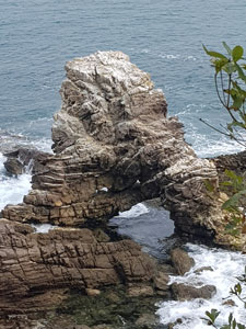
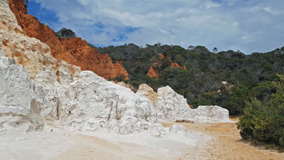
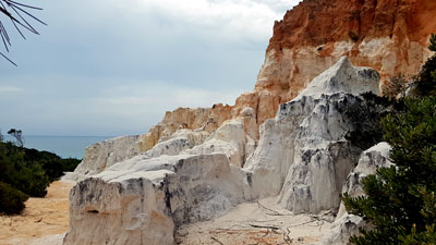
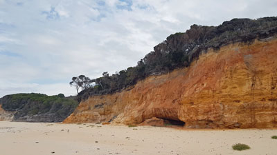
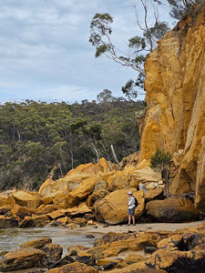
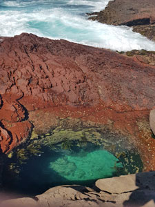
After rounding the ochre-coloured rocks of the point, we continued beneath the low, but colourful cliffs to reach an almost hidden gulley - the entrance to Quoraburagan Pinnacles. It was time to drop packs and make a short detour up into the gulley where the eroding cliffs were at their most spectacular, dramatically carved with bands of brilliant white and orange clay. |
|
|
|
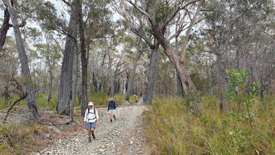
Continuing on down Long Beach, we finally reached its end, now named Terrace Beach, where a set of new metal steps led us up to a gridded platform and a parked car. The access to this beach was via a gravel fire-trail through the tall coastal forest and, after lunch and a chat with the fishing couple who owned the car, we took to the road and continued on inland and steadily upwards. Eventually, we reached a junction with another road that headed eastwards towards North Head. It was time to turn left and follow it gently downwards towards the coast as the forecast grey cloud started rolling in from the west. After another six kilometres of road-walking, we found the track to the right that we wanted, just as the first few drops of rain started to fall. It led us to the cliff-line at Worang Point with a great view over the sea towards Eden. |
|
 On the way to North Head |
 The cliffs of Worang Point (Photo: J & P Gatenby) |
Faint at times, the foot track turned back to the west and led us in and out of wooded gullies and spurs to drop down onto the sandy bar at the mouth of Lake Curalo - we were almost at our destination. Crossing the bar and climbing up onto a sealed road that parallelled Aslings Beach, we quickly reached the entrance to Eden Reflections Holiday Park. The rain had been light and intermittent, so we were now back where we had started two days ago, only slightly damp, but with hot showers, a nice camp kitchen and tent sites on the edge of the placid lake. |
|
 Curalo Lake from the bar |
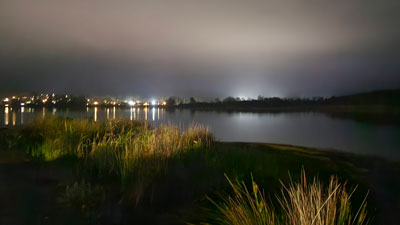 The night lights of Eden |
It had been a longer walk than anticipated, as the area north of Curalo Lagoon was now a private housing estate, obliging us to do the longer trip out towards North Head and back. My feet were a bit sore, even a couple of blisters on my toes, but it was still very satisfying to crawl into a sleeping bag after completing this very varied day on the South Coast. |
|
Day 4 - Eden to Boydtown (10 km - 70m ascent - 70m descent) |
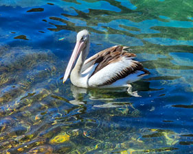
We woke up to see a mist rising off the lake after the overnight rain, as a flotilla of pelicans paddled by. The morning, however, was fine, which was good, as we needed to leave early again to catch the low tide when we rounded Twofold Bay. Sections of the bay shoreline are only passable at low tide and we didn't want to walk along the road. Even at low tide, a knee deep wade in places was inevitable, so sandals or volleys were the footwear of choice. Despite the need for an early start, it would only be a short walk (10 km) to Boydtown as part of this day would be required to do a car shuffle. |
Setting out, we strolled quickly along the pedestrian/cycleway that followed the long stretch of Aslings Beach, before climbing up behind the rocky cliff-line that continued on from the beach end. We wandered through the back streets of Eden, then headed westwards to cut across the main street and walk down towards the calmer waters of Twofold Bay. |
|
|
 Misty morning on Curalo Lake |
 Southern end of Aslings Beach |
|
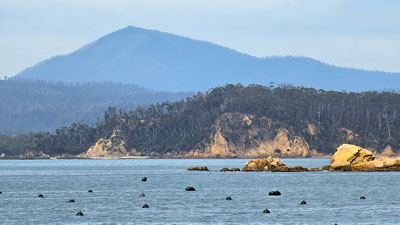
From the heights, we had a spectacular view over the bay towards the distant summit of Mt Imlay, before descending to Cattle Bay, site of a a tuna cannery from 1945-1999. Crossing the broken concrete pads overgrown with weeds, it was hard to envisage a large cannery here that was once supplied by 40 tuna boats, nor the new $130 million luxury marina proposed for the site. Such is progress. |
|
 View over Twofold Bay towards Mt Imlay |
 Rocks near Cocora Beach |
The track left the fenced-off site and headed back into bush and suburbia to reach Cocora Beach and the start of The Bundian Way. The Bundian Way is a planned 365km walk along old aboriginal pathways from Twofold Bay to Mt Kosciuzko ... a big and interesting project. For the moment it remains a 2 km trail on the north side of the bay dotted with interpretative signs telling the stories of the life of the original Aboriginal inhabitants. |
|
|
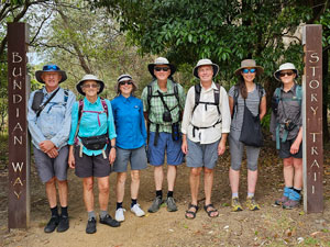 The start of The Bundian Way |
 |
|
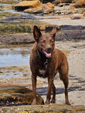
We followed it for a while, leaving to pick our way around the impressive orange rocks and cliff at Cocora Point, before rejoining the trail at Bungo Beach. A strange thing happened here - we were joined by a red kelpie named Coco (according to its tag) who led us around the rocks and, in fact, all the way to our destination at Boydtown ... more of that later. |
|
 Heading out across the rock platform |
 Quarantine Bay Yacht Club |
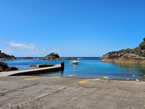
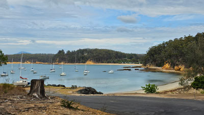
The Bundian Way ended at the Quarantine Bay yacht club, where yachts swung gently on their moorings. Here began our first low tide section, picking our way around the base of a low cliff with maroon and orange rock ribs jutting out into the water. It was a dry walk up to the end, where we were faced with a choice of wading around a big rock rib or scrambling up and over through a narrow gap. I decided to suss out the wade, slipped and had an early swim .... the others, more wise, scrambled over the rib to cross Shadrachs Creek and reach Legges Beach. I followed, somewhat bedraggled. |
|
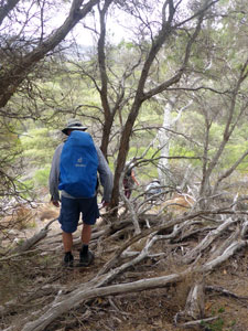
The next section between Legges and Brandy Creek Beaches was an adventurous mixed scramble and wade around and across some jagged rock ribs that protruded out into the bay. Beyond, the shore was even more rugged, so we headed inland along a dirt track to pick up a firetrail that climbed steeply up and then steep down through the forest to reach the bridge over the Nullica River. Coco led us over it to the far side.
|
|

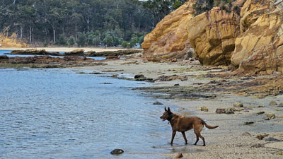
My clothes were starting to dry out when we turned back towards the bay and followed the sandy shore of Boydtown Beach to our campsite at Eden Discovery Holiday Park. The fair Nello had already arrived and, having heard the weather forecast, had switched tentsites to cabins, something we greatly appreciated when the thunderstorm passed through later that afternoon. It was not yet time to relax, as a car shuffle was in order - first to take the drivers back to Reflections Park to collect their cars and gear and bring them to Boydtown. Then, after sorting out what would be needed for the next three nights camping and what was meant for later, we did a second car shuffle to our end point at Wonboyn. I brought the drivers back in the heavy rain, but all was ready for the next part of the walk. There was still enough time to relax in the cabins - rain on the roof of a comfortable cabin is certainly a nicer sound than rain on the fly of a two-man tent. As for Coco the dog, she left us on Boydtown Beach to join up with some other people. I telephoned the number on her name tag and her owner happily came to pick her up. It had been an adventurous day that ended well for both Coco and the walkers. |
|

Day 5 - Boydtown to Saltwater Creek (26 km - 380m ascent - 380m descent) |
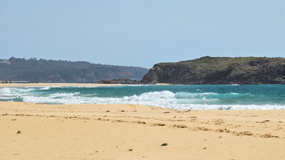
We awoke to a perfect walking day after the rain, with some cloud and a light wind. That was good, for today was goiing to be the longest walk of the stage - 26 km to Saltwater Bay in the Beowa National Park - with another water-crossing to boot. The low tide time had shifted forward to 10am, so it was not necessary to start too early. We headed off to wander past the historic Seahorse Inn, built in 1843 and recently renovated into a boutique hotel, to rejoin the beach and follow it around. Ahead lay the orange cliffs lining Nullica Bay - the top of the cliffs was private land, so a low tide route aroound the base of the cliffs was required. It was a pleasant walk, picking our way around large boulders, occasionally climbing over rock platforms and ocassionally wading shin-deep to reach Torarago Point. |
|
|
|


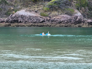
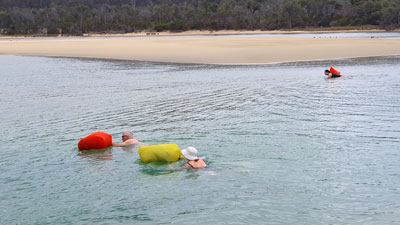
Around the point lay the long sandy stretch of Whale Spit and, once we reached it, we crossed over the narrow grassy neck to reach the broad expanse of the Towamba River, We followed the inlet side of the spit along until we arrived at a point adjacent to a small islet. The fair Nello and I had earlier sussed this out as the best place to cross and it was time to change to bathers and pack dry-bags. |
|
 Ready to cross Towamba River / Kiah Inlet (Photo: J & P Gatenby) |
 Looking back over Kiah Inlet |
A short chest-deep wade brought us to the squelching mud-sand surrounds of the islet and the legions of small crabs that guarded it. Quickly crossing the islet, it was back into the water for another chest-deep wade out to a broad sandy shoal, where the water was only shin deep. From here a long wade to reach the soft sandy shore on the far side (about 500m from shore to shore). Putting our packs back on, we trudged another 500m across the sand flat, made a final thigh deep wade of Kiah Inlet and completed the crossing. |
||
 Kiah Inlet crossing completed |
 |
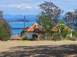
 Cottage at the old Davidson Whaling Station |
Once back in walking gear, it was but a short stroll along the inlet to reach to reach the historic Davidson Whaling Station near the entrance of the river to Twofold Bay - it was a good spot for morning tea. Continuing on, we wandered up through the buildings of the old whaling station before heading along its gravel access road upwards and inland beneath the canopy of eucalypts. On reaching a service road, we turned left to head back down to Fisheries Bay, where for the first time, we saw the enormous chip pile of the nearby Export Woodchip Port, a blot on the landscape. |
|
|
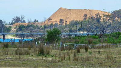 No, not a mountain .... an enormous pile of woodchips! What a fate for the trees. |
Crossing the sandy beach, we climbed up past the historic Edrom Lodge, built in 1910, and out along its access road, passing huge stacks of sawn tree trunks awaiting chipping, a sad sight indeed. Cut the trees down, chip them, ship them to Japan to be turned into glossy paper that isre-exported back to Australia, used to make advertising brochures, stuck in your letterbox and thrown in the bin .... and they call it economic progress. Enough of the sermons!! |
||
 Historic Edrom House |
 Crossing Fisheries Beach |
 Outbuildings of Edrom above Twofold Bay |
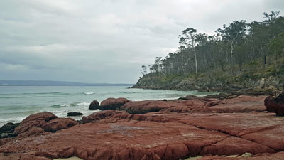
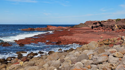
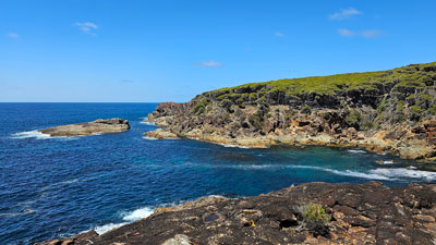
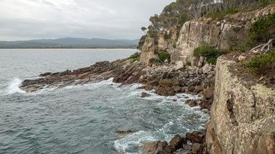
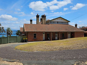
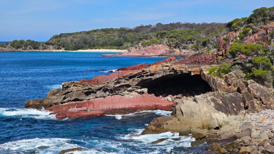
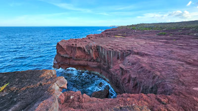
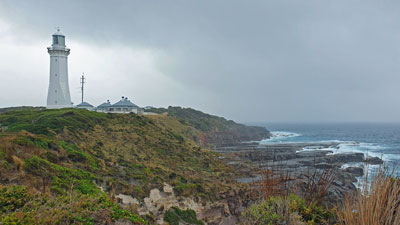
We had reached the gravel road into Beowa National park and quickly headed down it to reach Boyd's Tower - yet another historic building, constructed on the coastal cliffs by Ben Boyd in the 1840s to spot whales for the hunting. The sandstone structure itself was impressive and the views from it, northwards over Twofold Bay and southwards along the maroon coloured cliffs of Beowa were even moreso. |
||
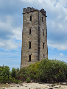 Ben Boyd Tower - builtin the 1840s |
|
 View south from the tower of the Beowa coastline |
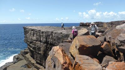
The area around the tower had been significantly upgraded, with metal boardwalks, lookouts and and fine gravel paths. This is all part of a grand and somewhat controversial project to develop the Light to Light Walk, from here to Green Cape lighthouse into an upmarket experience. It was going to be interesting to see what else they had done, as we set out after a pleasant lunch and headed down the track .... 12km down, 14 to go. |
|
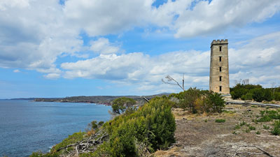 The setting of Ben Boyd Tower (Photo: J & P Gatenby) |
 Looking down the route of the Light to Light Track |
|
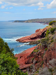
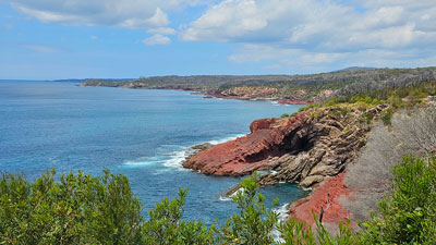
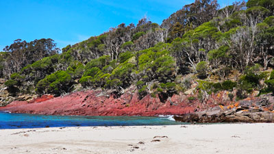
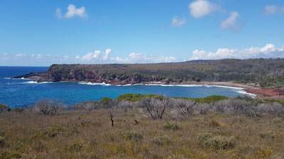
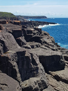
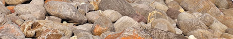
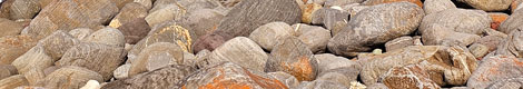
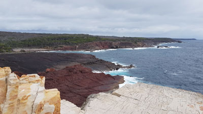
The recently upgraded path, soft earth underneath and with numerous sets of stone steps, meandered and undulated its way through the coastal heath, much of the canopy still skeletal after the 2020/21 fires. At several points the track neared the cliff edge to providse superb views back up the coast to Boyd Tower or over rocky coves. Rounding Red Rock Bay, with its slabs of maroon mudstone, we continued on to Leatherjacket Bay, a lovely spot to rest a while in the shade, with its jumble of multi-coloured stones on the beach. The day was getting hot. |
|
 |
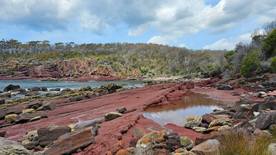 Aptly named Red Rock Bay |
|

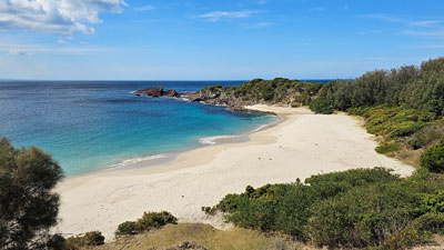
From Leatherjacket Bay, the LtoL now followed a new alignment, closer to the coastal cliff-line to take advantage of more views of bays, coves and rock formations. Crossing a couple of creeks beds and small beaches, we climbed up onto the grassier, more open headland backing Mowarry Point. Down below lay a glorious stretch of golden sand backed by clear blue waters - Mowarry Beach was too inviting to pass by on a hot day - we stopped, stripped down to underwear and had a swim. |
|
|
|
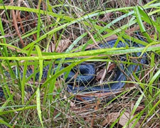
Refreshed, we climbed back up onto the tops to reach the actual point, where we could wander across a rich maroon rock platform, before climbing back up into the heath and heading south. The new track alignment brought us back onto a dramatic section of rock-topped cliffs, before one last dive into the thick coastal heath saw us heading down towards Saltwater Creek and our campsite for the night. The fair Nello had wandered out to join us for the last bit down to the camp - just in time to watch a large diamond python crossing the track. |
||
 Heading up through the paperbark thicket |
 |
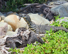
 Yet another goanna |
 Arriving at Saltwater Creek |
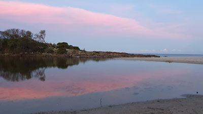 Evening light over Saltwater Lagoon (Photo: J & P Gatenby) |
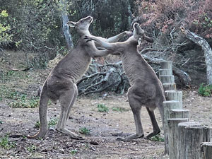
Saltwater Creek campsite sits in a picturesque spot on a grassy treed area above a sandy beach wedged by two lagoons. Boxing kangaroos, lyrebirds, goannas and bandicoots provided the amusement while the pale pastels of the evening light ended a superb day. |
|
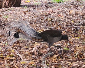 |
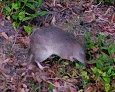 The creatures of Saltwater campsite |
 |
The only downside (apart from two of the group picking up a tick) was that we were sharing it with a group of 30 teenaged schoolboys from a local school on an outdoor adventure camp. That said, we had been hiking for 9h30 and, after such a long day, nothing was going to keep us awake. |
||
|

Day 6 - Saltwater Creek to Bittangabee (10 km - 140m ascent - 120m descent) |
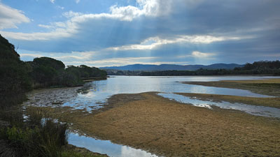
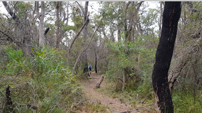
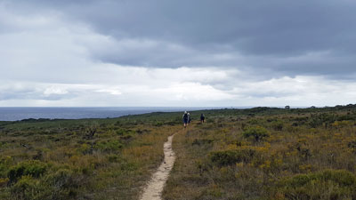
After a few light early morning showers, we were woken by the song of the resident lyrebird and, very soon after, the sun returned. A lazy morning was on the cards, as we only had a short distance (10 km) to our next campsite at Bittangabee. We set out at 9am, well after all the schoolboys had left, dropped down onto the beach to skirt the lagoon of Woodburn Creek and pick up the old LtoL track that climbed into the surrounding low heathland. We pushed quickly southwards, occasionally dropping down to cross densely timbered creeks, some where the track was blocked by fallen paperbarks. |
|
 Packing up camp at Saltwater Creek (Photo: J & P Gatenby)
|
 The tranquil waters of Woodburn Lagoon
|
|
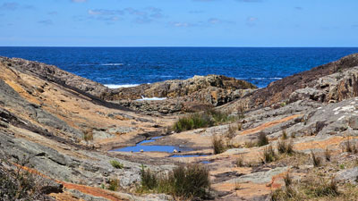
Halfway along, we reached Hegarty Bay, its stony beach framed at each end by rocky headlands. It was a good spot for morning tea and a chance to explore. Jan and Phillip remembered a nearby sinkhole in the rocks, so, before heading on, we wandered around the rock shelf to view it and admire the rich colours and rugged formations of the headland.
|
|

Leaving the Bay, we crossed paths with a large group of teenaged schoolgirls, from the same school as the boys but heading in the opposite direction ((probably best to keep them apart). The track continued on through low, open heathland (20 years ago the fair Nello and I spotted a ground parrot in this habitat, not so lucky today). The track then emerged to cross a new section of bare rock cliff tops, with superb coastal views, before heading back inland through taller heath to make its way around the northern edge of Bittangabee Bay. |
||
 |
|
 |
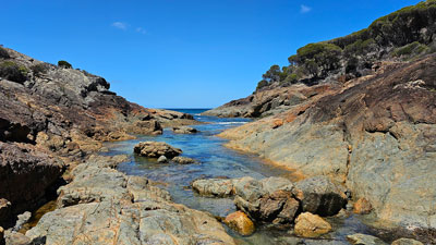
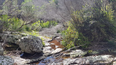
Eventually it dropped down into tall coastal forest to reach a lovely crossing of Bittangabee Creek - stone steps leading us aross a natural rock barrier, where the cool, clear water of the creek flowed down from an upper set of pools to lower ones. |
|
 Back in the coastal forest |
 Bittangabee Creek |
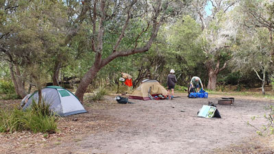
From the crossing, the track led us back eastwards, directly into Bittangabee Campground, skirting past the stone footings of a house built in the 1800s by the Imlay brothers, and arriving in time for lunch. The campsite has just had a make over, with new paths, fenced-off campsites and nice shelters with tables, seating and BBQs. It would be a pleasant place to while away the afternoon. |
||
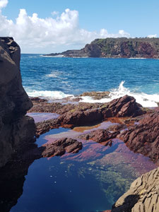
 Rock pools at Bittangabee |
 Time for a little first aid |
 Testing the new facilities at the campground |
The best spot to relax was the small beach on the bay, where a swim in the cooler waters of the ocean could be complemented by a soak in the warmer, fresher, shallow waters of the tiny lagoon that back it. It was very restorative and we needed the half-day rest, as we had just passed the 100 km mark of our walk. |
|
 Bushwalking hydrotherapy ....a refreshing dip in the cold sea water .... |
 ... followed by a warmer soak in the shallow creek waters |
Dinner around the table in the shelter was a jovial affair, enhanced perhaps by the knowledge that tomorow would be our last day on the track. The end of Stage 6 was in sight. |
|
Day 7 - Bittangabee to Wonboyn (20 km - 250m ascent - 270m descent) |
Rain had been forecast for our last day of walking, but even though the sky was grey when we woke, the air was dry .... no wet tents stuffed in the bag for the last day. One of the simple pleasures of camping is to pack up a dry tent. Today was another early start, as we need to reach the entrance to Wonboyn Lake, some 20 km away, by 1.30 pm for our final low-tide water-crossing. Unfortunately, we had to farewell Jacqui, who needed to be back home a day early. She would leave with the fair Nello in the support vehicle and headed off to Wonboyn, where our cars awaited. |
 Farewell to Bittagabee camp |
The rest of us were off by 7.30am, just ahead of the big group of schoolboys. We pressed on quickly through a section of pleasant coastal forest crossed by a couple of reed-lined creeks, to put a bit of distance between us and them.
|
 Reed-lined creek in the forest |
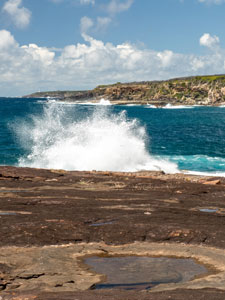
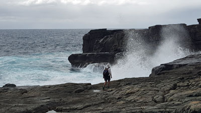
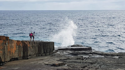
When we reached the low open heathland beyond it, we slowed to our normal pace. A stroll across the heathland brought us to a gravel road that led a few hundred metres down to Pulpit Rock. It was time for a detour to visit this spot, where a large rock amphitheatre frames views out to sea - white plumes of spray blasting up as some big waves smashed onto the stage. It was well worth the extra distance, with its great views and curious geology. |
|
|
|
Retracing our steps, we left the road again to follow the old LtoL track through more low and medium heathland, with glimpses of the distant lighthouse at Green Cape. On entering a thicket of dense paperbarks, we came across a small clearing . It was the Ly-ee-Moon cemetery, where some of the 71 victims of the shipwreck of the boat of the same name in 1886 are buried. Why the Ly-ee-Moon hit the reef here remains a mystery, as the Green Cape Lighthouse had been built only three years earlier. |
|
 Track across the heathland north of Green Cape |
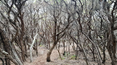 The monochrome world of a paperbark thicket |
And that is where we headed, just 500m through the paperbarks to the south .... just as the first drops of rain started to fall. It was time to put on our goretexes and unfurl umbrellas (for those who had them) to wander down past the white-washed keepers' cottages to the lighthouse itself. Guarding the northern end of Disaster Bay with the wild Pacific Ocean beyond, Green Cape and its lighthouse make a strong impression. |
|
 Lighthouse keepers cottage at Green Cape lighthouse |
 Rain coming in at Gree Cape (Photo: J & P Gatenby) |
The fine drizzle finally eased as we were trudging up the 6 km stretch of white dirt access road, at first through open heathland, then climbing up into coastal forest to reach the Disaster Bay Lookout. From here a glorious view southwards over Disaster Bay, its long stretch of white sand beach and the dark profile of Baycliff, a promontory that splits the beach and marks the entrance to Wonboyn Lake .... our destination. |
|
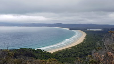 The sweeping beauty of Disaster Bay |
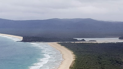 Baycliff and the entrance to Wonboyn Lake |
|
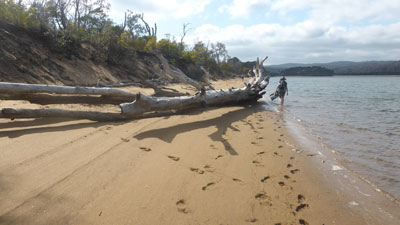
To reach the entrance, we first had to backtrack 200m to a point where a faint track left the road and headed steeply down through forest and dense undergrowth to reach the northern end of Disaster Bay Beach. It was faint when the fair Nello and I did this walk 20 years ago and it was even fainter now, with a lot more fallen timber, tangly vines and the odd snake. Still, with the aid of our GPS and a few red and white ribbon markers, we eventually stepped out onto the pristine white sand of the beach. |
|
 |
 Rest stop on Disaster Bay Beach |
|
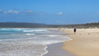
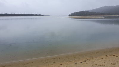
By contrast, the walk along this beautiful, isolated beach was an easy stroll on the firm low-tide sand. We crossed the sand bar at a point just before the outlet channel to reach the lake shore, where we dry-bagged our gear for the last water-crossing. After a wade and short swim, we strolled across an exposed sand shoal to reach the north side of Baycliff Head. |
|
 Looking for a crossing point at Wonboyn Bar |
 A short swim across the shoaly lake entrance |
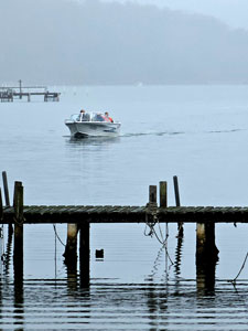
From here, it was but a short walk to cross the stony end of Baycliff, pick our way around the oyster-covered rocks on its southern flank and reach the calm sandy beach of Wonboyn Lake. Here the water was deep enough to land a boat, which was perfect as we had arranged to be picked up by Luke from Wonboyn Cabins for the trip back to Wonboyn village and our end-of-walk accommodation. |
|
|
|

As we had half an hour up our sleeve, we sat down to eat our lunch before he arrived ... under umbrellas, as by now the rain had returned in the form of a steady light drizzle. It was a welcome sight to see Luke's boat appear out of the gloom at the appointed time of 2.30 pm. As the boat held four and we were seven, it took two trips for the 10 minute zoom up the lake to the pier at Wonboyn - an exhilarating way to finish the walk. |
|
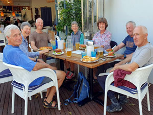
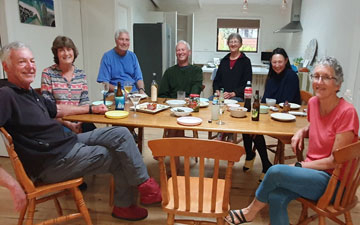
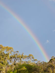
The fair Nello was waiting at the pier to lead us up to the cabins ... large, comfortable and warm ... the perfect place to complete a 7-day stage. The thunderstorm passed through after everyone had cleaned up and were sitting beneath the wide verandah roof enjoying our assorted cheeses, nibbles and celebratory ales or wines. It was a good place to be in a thunderstorm and the full rainbow that appeared as it passed seemed a fitting conclusion to another great stage of The Great South Coast Walk. |
|
|