Southern Circuit (2. Southern Ranges )

Day 6 – Wylly Plateau to Ooze Lake (10½ hours) (6.5km - 320m ascent – 440m descent)

On every long walk, there is always a day that you would describe as the bad day – this was it. It started out with me hanging on to the tent for an hour just before dawn, as the wind tried to rip it down. As soon as it was daylight, I took it down from within to avoid any damage and so was ready quite early. The forecast was for strong northerlies and hot conditions, not ideal for bushwalking, especially as I had to wear my woollen beanie for sun protection (my hat now hanging out somewhere on a branch on the route up PB).

Despite all this, we got off to a good start, descending the stone steps to the bottom of the gully from Plateau Camp and then climbing steeply down to the base of the east face of Precipitous Bluff to reach Low Camp. We were now on the Kameruka Moraine and the scrub was getting thicker. In fact, it was so thick that it was not clear which of several "pads" (Tasmanian for a faint foot track) that led out from the campsite was correct. We found ourselves doing some serious scrub-bashing for a while before picking up the pad, only to lose it again as the moraine narrowed to a boulder-strewn razorback ridge, densely covered with 2-3m high bushes.


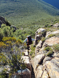
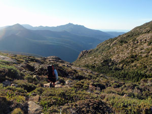
Heading down the descent gully on the east side of PB


The track drops sharply down to
Kameruka Moraine


Rupert disappearing into the scrub
east of Tramp Camp


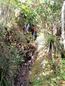
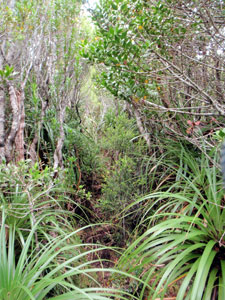
Dense scrub near Low Camp


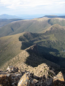
The sharp scrubby ridge of Kameruka Moraine

More scrub-bashing followed to regain the path, only for me to realise that somewhere along the ridge, my camera and I had parted company. My stomach felt as empty as my camera case. A big panic and about-face was followed by an expletive laden return towards our last stop. Miraculously, at the point where I turned to give up there it was, half under a rocky ledge ( I looked up and said thank you).


Looking back to the descent gully on PB

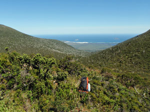
A rare viewpoint - from above Tramp Camp to the sea

Back on track, we pushed on to the small clearing of Tramp Camp for lunch, having covered 3 km in the first four hours. The same thing happened here as at Low Camp – a number of foot pads led out from the site, but which was the right one. Rupert led us off-piste through thick scrub up the slope so that we could drop down onto the next saddle, where we picked up the pad. The scrub here was so dense that you could walk within a metre alongside a track and not know it was there, so a bit of bush sense helped.


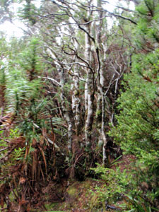
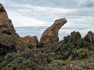
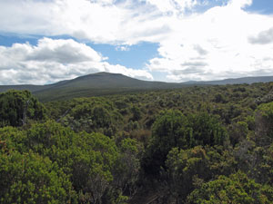
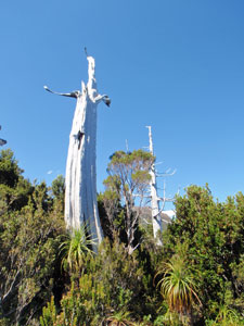
Ghosts of the plateau - burnt King Billy pines

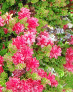
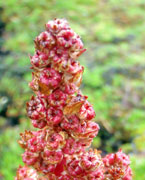
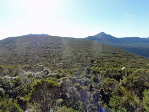
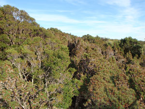
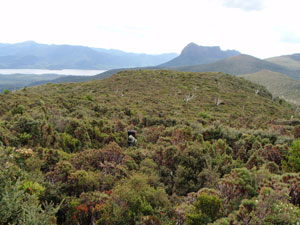
Ahead lay a sea of dense green scrub, punctuated by the occasional white ghosts of dead King Billy pines. The scrub had regenerated vigorously after the fires of a decade ago, but sadly very few live pines remained.


The route ahead - a dense sea of green scrub ...


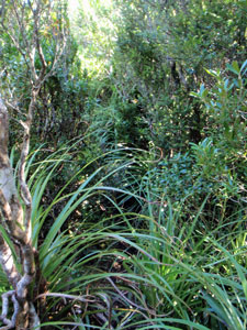
... and the "pad" through it

Once on the saddle we stayed on track, though this is a fairly generous term for a route that passed through thickets so dense that someone would disappear from view a few metres ahead or behind. At ground level, there was an obvious track etched into the often muddy soil, but by waist height it was already overgrown and largely out of sight. At head height, branches still intertwined across the track, all to ready to snag your backpack or scrape your face, so it was essentially duck your head and bull-doze through with your eyes to the ground.

For four hours we beat our way along the saddle like this, only emerging three times at a place where we check our progress via a visual fix of PB or the sea, then back into the scrub. Eventually we reached the summit of an unnamed hill, with the dark silhouette of PB in the western sky.

Still, there was another hour and a half of scrub-bashing en route, as the faint pad led us down the slope to a saddle and then up to Wylly Plateau, all in dense thickets of spiky scoparia. Give me the scratchy tea-tree branches any day!


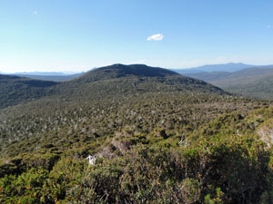
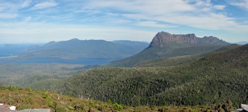
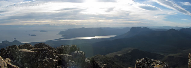
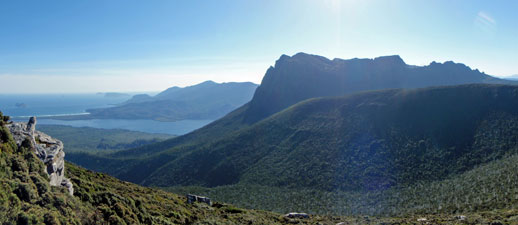
The one grand panorama of the day - PB from the unnamed knoll just before Wylly Plateau

We eventually crested the plateau 10½ hours after leaving Precipitous Bluff, the great majority of that time spent bull-dozing our way through 2-3m high scrub in the heat. My shirtsleeves were spattered in blood and my trousers ripped in several places – testimony to the viciousness of Tasmanian scrub. It was one of the hardest and least rewarding days walking that I have experienced – you expend more energy dragging you and your pack through such scrub than climbing a steep, but open, slope.


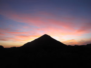
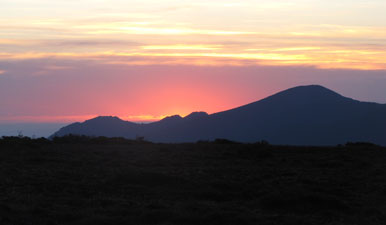
Pastel sunset over the Ironbound Range (from Wylly Plateau)

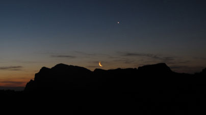
The crescent moon sets over Precipitous Bluff (watched over by Venus)

After a day in the scrub, Wylly Plateau was bliss, with its low herb and moss fields and just enough scattering of shrubs to provide shelter for your tent. The wind had long died down and we pitched camp in a pleasant spot just before sunset. As we ate in the twilight, the thinnest sliver of a crescent moon set behind the silhouette of PB – hopefully a good omen for tomorrow. At least I still had my camera (and more importantly the photos stored in it) – someone has been looking after me, after all.


Day 7 – Wylly Plateau to Ooze Lake (11 hours) (9.5km - 680m ascent – 760m descent)


For the third day in a row now, we were greeted by a fine sunrise and clear skies. Physically, I had recovered from the long day of scrub-bashing, but mentally I was trying to steel myself to the possibility that we would have to do it all over again.


Sunrise over the pyramid of Mt Wylly

Once more into the spiky scoparia scrub

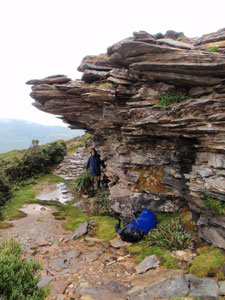
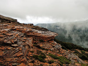
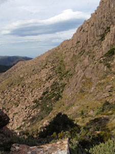
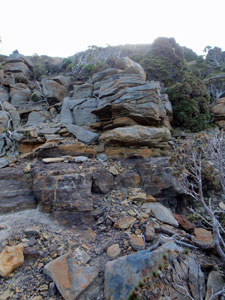
Interface between sedimentary and volcanic
rock layers on Mt Wylly

After packing up, Rupert led us off the pleasant Wylly’s Plateau to head for the mountain of the same name. No sooner had we left the saddle than we were in the thick of the scoparia and tea tree thickets. However, it was but a short section and on reaching the mountainside, we found ourselves climbing an open area of moss, cushion plants and prostrate shrubs as we followed a set of small cairns halfway up the west face of Mt Wylly and half way down the south face. This brought us to the start of a low undulating saddle that would lead us to Pindar’s Peak.

The first saddle and ridge were easy – the scoparia was only thigh-high and more open. We could look out to the south and west over New river Lagoon and PB and enjoy the cooling wind. But alas – I had just started to enjoy myself again, when we were back in it. The rest of the long ridge was covered in dense and barley penetrable scoparia / tea-tree / pandanus scrub, varying from chest height to 4-5m at its deepest.


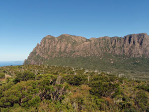
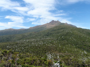
View back across the scrubby spurs to Precipitous Bluff


Another 3 hours of serious scrub-bashing lay ahead in the heat of the day and, yes, we were on the track. At one stop, I rigged up my tea towel, a la pirate, for a bit of sun protection. It worked well, especially when periodically soaked in the waterholes that lay scattered across the marshy saddles.


And yet more scrubby "track"

The scrub-cover route to Pindar's Peak

A tea-towel can be a good makeshift hat

Crossing Leaning Tea-Tree Saddle, we discovered many pads leading away – luckily one had a strip of orange ribbon. We followed this down into a myrtle beech / pandanus forest before climbing steeply up the next slope. Under the high canopy of this forest, it was both shadier and easier to move. A short-lived respite, as the tea-tree / scoparia scrub soon replaced it as we crossed Smith’s Saddle and climbed up to Pandani Knob. Here on a low rocky platform with a few stunted pandani, we at last cracked a smile – we not only had great views to the west, but it was also the end of the scrub.


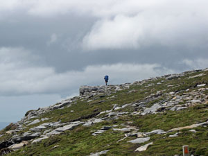
The climb up Pandani Knob


Time for a break on Pandani Knob

Ahead lay the rock spires of Pindar’s Peak and that was where we were heading, climbing steadily up the broad open spur, covered in moss, cushion plant and alpine herbs. One last brief scrub bash to attain the scree above and a quick climb up and over the rectangular plates of clinking dolerite brought us to a point not far below the summit. This is what bushwalking should be!


Traverse beneath the north face of Pindar's

Closing in on Pindar's Peak

This country is so remote, the odd Tyrannosaurus still roams

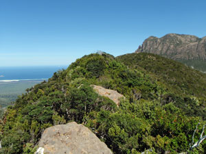
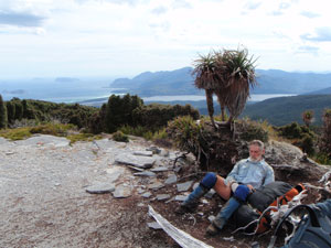
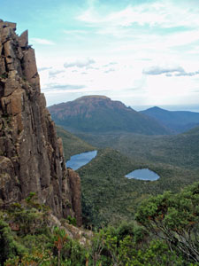
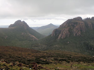
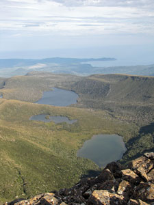
View south from Pindar's Peak over Oval Lake
and smaller tarns to South-East Cape

From here, we descended sharply to cross the base of the dolerite cliffs of the peak before climbing back up to the eastern spur. It was already 5.30pm, but I had one mission in mind and that was to climb to the summit of Pindar’s Peak. It was not a big climb from our already lofty position, but a good steep scramble over a jumble of massive dolerite blocks.


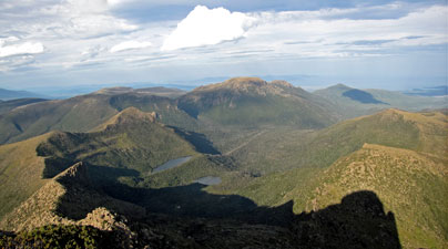
View to the north-east from Pindar's toward Mt La Perouse

At 6pm I stood on the summit to take in the incredible coastal views from Cockle Bay to Prion Beach and the broad mountain vista. Below a couple of glacial lakes sparkled in the late afternoon sunshine, while to the north the shadows marked out the long zig-zagging ridgeline that was our route ahead.


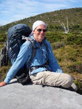
Rupert had not climbed the peak, but had gone ahead to try and find a camp site. The long shadows told me that it was definitely time to get going as well.

Once I got down from the summit and put on my backpack again, the descent continued on a steep, but well-defined track. It sidled around the lee side of the ridge, with great views over another set of glacial lakes.


Western panorama from the top of Pindar's Peak


Afternoon shadows on the route ahead
to Maxwell's Spur in the distance

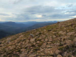
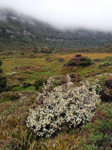
While there were possible campsites here, Rupert decided that we should push on to Ooze Lake where water was certain and shelter more likely. We crossed the sharp ridge to its windward side to be blasted by a fierce westerly. Good point about not stopping here!  A series of cairns now led us across the open shaly slope, eventually descending to reach the pretty Ooze Lake.


Crossing the shaly slopes near Lake Mountain (sure beats scrub)


Looking down on two more glacial lakes
from the northern spur of Pindar's

Near Ooze Lake - with Maxwell's spur in the background


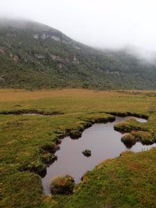
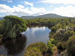
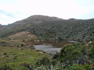
Ooze Lake beneath Knife Mountain

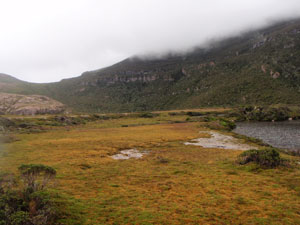
This glacial lake lay in a type of cirque backed by Lake and Knife Mountains, well protected from the westerlies. It had taken 11 hours to get here, but it was a great spot. I could even soak my feet and hair and feel slightly clean again.Tonight the lullaby was provided by the frogs of Ooze Lake and by the time I fell asleep, I had already started to black out the memories of the infernal Southern Ranges scrub.


Day 8 – Ooze Lake to Lune River (11½hours) (18.5km - 460m ascent – 1190m descent)


With our late arrival into camp, it was after 10pm before I had eaten and climbed into my sleeping bag. Less than an hour later, the first rain drops began to patter on the tent fly. The showers persisted on and off throughout the night and set in as a light but steady rain in the morning as we were preparing to leave. Rupert’s eye had been giving him discomfort since he was spiked by the needle sharp scoparia leaves yesterday and, given the probability of rain for the next few days, we decided to bite the bullet and walk out rather than camp on track tonight. It promised to be another long day at the office.


Grove of stunted myrtle beech


A good place to shelter from the wind and rain

We quickly put on full wet weather gear (which for Rupert was still a pair of stubbies beneath his goretex), packed away wet tents, and headed off into the scrub. The track here was much more obvious and the scrub less thick than our earlier experiences, so we made quite good progress climbing up to the saddle between Knife Mountain and Maxwell Ridge. However, we were now exposed to the cold gale force winds that blew the rain horizontally across from the west. All around, cloud streamed across the landscape, hiding mountain tops and limiting views to the close at hand.


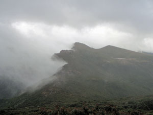
Cloud streaming of the rim of Knife Mountain


Climbing more steeply now on a track that had been deeply eroded by water to create a series of min-canyons one boot-width wide and up to a metre deep, we clambered our way through the low scrub higher up the saddle. Inside my wet weather gear, I was starting to perspire and get that good old clammy feeling – cold on the outside, hot on the inside.

Eventually, we reached a rock shelter where we could get out of the rain (if not entirely the wind) and take a break. While resting there, the sweeping mists occasionally parted to reveal our pathway up from Ooze Lake and along this sharp saddle, now generating plumes of cloud on its leeward side.


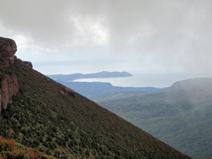
Misty view out toward South-East Cape


The richly coloured dolerite slabs on Maxwell Ridge


One of the many tarns at Pigsty Ponds

However, we could not stop too long as we were chilling down quickly and this was hypothermia weather  – time to move and warm up. The climb continued onto the exposed tops of Maxwell Ridge. We followed a line of cairns across the orange dolerite slabs and low moss and shrubs that cling to it, as the wind gusts tried constantly to knock us off our feet. Fortunately, it was at our backs hurrying us along this surreal landscape and we were able to drop down onto the leeward side before being blown off the cliffs that form the eastern face of Maxwell Ridge.

How good that was – the warmth came rushing back, as we moved quickly down the slope and dropped down into the spongy peat-moss basin known as Pigsty Ponds. Here amongst the pretty tarns scattered throughout this water-soaked region, we took another break while contemplating the exposed bare foggy heights of the Moonlight Ridge, our route ahead.


The spongy peat-moss flats of Pigsty Ponds


A touch of brightness on a dull day

As we did this, a group of walkers descended from the ridge and told us what a rough and windy time we faced – we cheered them up as well by telling them about the conditions on Maxwell Ridge where they were headed. It was definitely a day to have stayed in bed. The group headed west into the mists and we started the climb up onto the Moonlight Ridge, again a barren landscape of dolerite plates and shards interspersed with moss and cushion plant. At least it wasn’t raining anymore and, with the wind at our backs, we ascended quickly to climb over Hill Four and skirt around Hill Three to find a sheltered spot for lunch in the next saddle. The countdown to the end of our walk had begun.

The weather was now starting to lift, and we pushed on over the boggy grounds of the saddle and around the low muddy track that cut across the northern face of Hill Two. After a short steep climb, we followed a marked trail around the rocky edge of Hill One – clearly we were not doing this walk in the expected direction! Through the gaps in the cloud, we could look out over the coast line near Cockle Bay, from where we had set out a week ago.


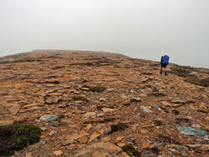
Crossing the dolerite shingles of Hill Four

View of Little Hippo and Hippo Mountains

On the crest of Hill One


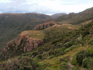
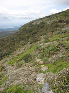
Japanese garden on the side of Moonlight Ridge

Nearing the eastern end of Hill One, a strange light appeared in the sky – it was the sun! Passing through an area that resembled a Japanese garden, with moss, mosaics of cushion plant and stunted pandani, we descended from the heights and down onto the shelter of the Moonlight Flats. Away from the wind and with the sun shining, we could remove our wet weather gear at last.


The scrub-covered plain of Moonlight Flats

One of the Bullfrog Tarns

It felt good walking unencumbered, but the Flats is not really an area designed for pleasant walking. Covered with dense scrub, it is crossed by a braided set of tracks that today ranged from pools of water to wade through or shin-deep boot-sucking quagmires of mud to squelch through. By choosing the outer track braids, we could at times pursue at drier course, but this long section of monotonous scrub seemed to never end. Only the picturesque Bullfrog Tarns provided visual relief.

Eventually, a barely perceptible change in slope became an increasingly steeper slope. We had started the final descent of the walk and were soon passing through tea-tree and pandanus forest to enter the still and mossy world of myrtle beech forest. Meandering down the moss-covered, leafy forest floor, confettied with the fallen petals of leatherwood, would normally cheer my soul, but we had been on the track now for over ten hours and my thoughts were already at the finish.


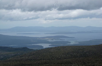
View to the east over the Huon Estuary and Bruny Island


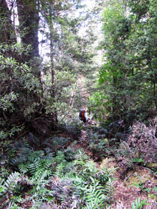
Back into the forest for the descent to Lune River

As we descended further the moist myrtle beech forest morphed into a drier eucalypt forest, but the steep and twisting descent continued infernally. My knees had joined my wet feet in complaining by the time we reached an area of limestone boulders and sink-holes, then a couple of lengths of rusted railway line told us the end was near.

We had reached the disused Ida Limestone Quarry, once served by a narrow-gauge railway line to haul out the limestone. The line of this railway, almost flat and almost straight was our exit. A bit over a kilometre later, after a brief stop at Mystery Creek to wash the mud from our boots and legs, we arrived at the road to Lune River. It was 7.45pm, 11 and a half hours since we left Ooze Lake and eight days since we left Cockle Creek – my exploration of the South Coast Track / Southern Ranges was over.


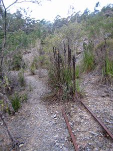
The old railway line from Ida limestone quarry

This circuit clearly has it all, with dramatic coastal and mountain scenery, a wide variety of forests and the chance to spend time on top of the magnificent Precipitous Bluff. However, having it all also includes the most infernal scrub that I have ever encountered (one pair of blood-stained walking trousers shredded and heading for the bin on return) and enough mud to rot your socks (at least they smelt that way). Still, back in Hobart, showered, shaved and having had an ice cold beer, the memories are very enjoyable. Thank you once again, Rupert, for showing me part of the Tasmania that you know so well. It was a superb and challenging walk, even though on a couple of occasions I confess to thinking “where the  ----- is he leading me?”.