
| Maria Island Walking |
About |
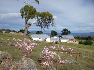
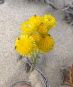
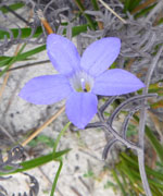
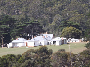
For 28,000 years Maria Island was visited by Tasmanian aboriginals. That all ended when whalers and sealers arrived in the early 1800s, though the "modern" history of the island starts in 1825, when the British established a convict penitentiary on it. Since then it has gone through several phases, as a failed land of plenty, where the Italian entrepreneur Diego Bernacchi, tried to establish his dream of a wine and silk empire (no trace remains of the thousands of vines and mulberry trees planted), than as a cement quarry and factory, followed by a period of grazing leases until, finally, in 1972, Maria Island became a National Park. Today it is a place, not for those seeking wealth but for those seeking beauty, with its interesting mix of the natural and cultural landscapes and abundance of wildlife. Traces of these past uses of the island remain and, the well-restored convict settlement at Darlington offers a peek back in time as well as a place to stay - that is, if you don't mind sleeping in a cell. |
|
|
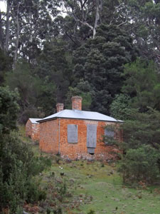
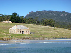 The Commissariat on Maria Island (built in 1825) |
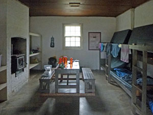 Interior of our penitentiary cell / bunk room |
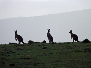
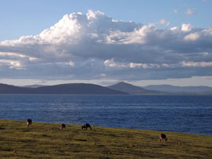 Kangaroos grazing on the island pastures |
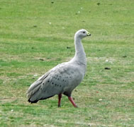
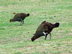
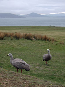
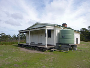
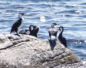
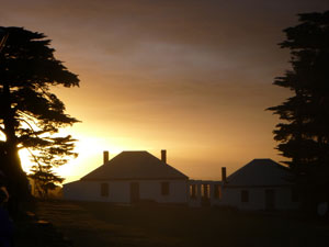
We don't mind, so we caught the afternoon ferry across from Triabunna, to set up camp in our 25 square metre cell (with just us 2 instead of the 30 plus it was built for in 1830). As we sat on the verandah of the long-white-washed penitentiary, surrounded by a complex of old buildings, watching a pair of Cape Barren geese and a foursome of Tasmanian bush-hens nibbling away on the flat-grazed grass of the quadrangle, we felt that this was a special place. |
||
 |
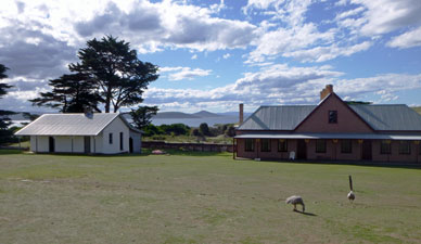 Part of the Darlington Convict Precinct |
 |
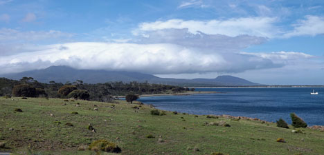
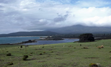
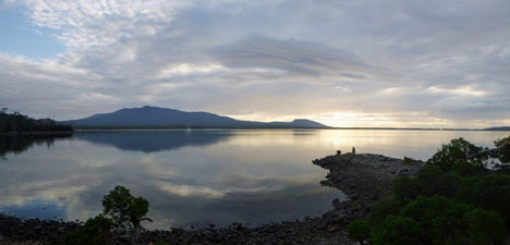
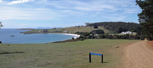
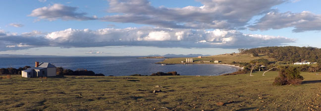 Panorama over Darlington Bay |
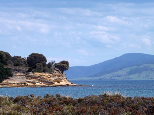
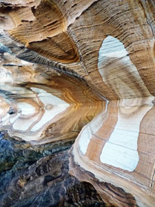 "Painted" sandstone 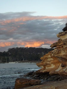 Evening light on Maria |
|
As the tide was out, for our post-prandial exercise, we decided to head down to The Painted Cliffs and watch the sun set. The evening light was particularly luminous over the grassland behind Darlington, where kangaroos grazed nonchalantly and beyond, across the sea, the hazy blue outline of the peaks of the Freycinet Peninsula framed the scene. |
||
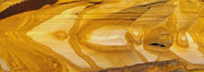
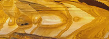
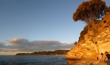 Golden glow on the Painted Cliffs |
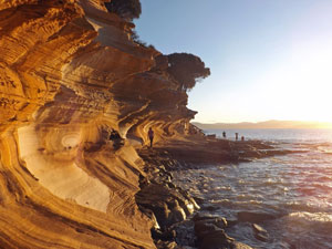 Watching the sun set at the Painted Cliffs |
|
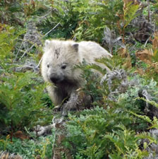
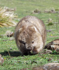
The setting sun lit up the low, concave cliffs, making the sculpted, orange and cream patterned sandstone glow. It was a great introduction to Maria and, as we walked back in the fading light, the wombats had joined the kangaroos for their evening feed - I have never seen such a high density of wombats. It promised to be an interesting few days. |
||
|
Day 1 - Climbing Bishop and Clerk (11.5 km - 660m ascent - 660m descent) |


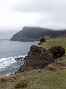
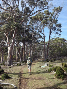
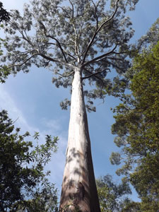
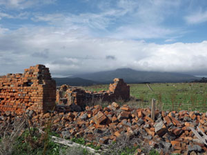
There are two main pinnacles on the island, Mt Maria, at 709m, the highest point, and Bishop and Clerk, a 630m high rocky outcrop at the northern end of the range. Its northern flank plunges straight into the sea and is capped by several dolerite columns, all of which make it the more impressive and more iconic peak. As do many of the visitors to the island, today we would climb it. We set out fairly late, as it is not a long walk. The sky was clouding up, but there was plenty of sunshine still about, as we left the old penitentiary grounds to wander up the gravel road heading east across a grassy slope. It took us past the ruins of The Twelve Apostles, cottages built in the late 1800s for the workers of Diego Bernacchi. Then on, into the tall forest, past the turn off to the convict-built reservoir and the brick shell of the old engine room. History certainly abounds on Maria Island. |
|
 Heading east from Darlington | 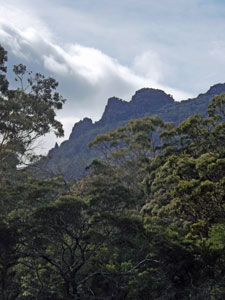 Bishop and Clerk above the forest |
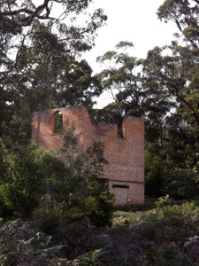 Ruins of the old engine house (built 1888) |
 Ruins of a workman's cottage |
Emerging once more on the steeply sloped grassland of Brickfields Valley, grazed flat by cape barren geese, bush-hens, wombats and kangaroos, the road petered out. We wandered up the open area to discover it stopped suddenly at the face of 100m high cliffs. Beyond the sheer cliff walls to the east, we could see the blocky profile of Bishop and Clerk. |
||
 |
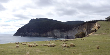 The cliffs at the end of Brickfields Valley |
|
 View back over Darlington to the Tasmanian mainland |
 |
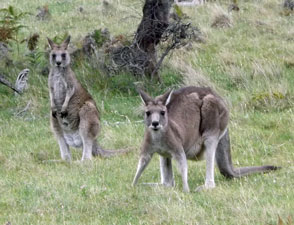 Forester kangaroos at Brickfield |
 |
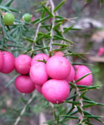
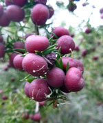
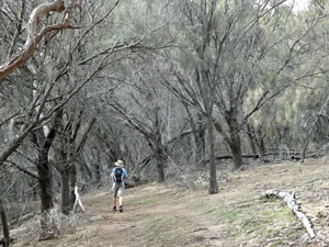
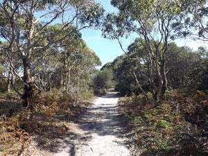
We turned toward it following the cliff-edge upwards and on to Skipping Ridge, first across more open grassland, then through a grove of casuarinas and then into taller eucalyptus forest. It was easy walking on the wide dirt track, but that ended as we reached the steeper lower slopes of the range. Here, a well-formed, occasionally rocky footpath led us up to the next tier, where the character of the forest changed from open to one with a dense and tall shrubby understory. Scarlet and pink clusters of pepper berries lined the way. |
 |
|
 The cliffs of Skipping Ridge |
 Stroll beneath the cliff-top casuarinas |
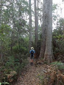 In the tall forest of Skipping Ridge |
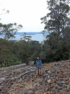
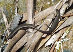
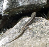
The forest stopped abruptly at the base of a steep orange and grey dolerite scree field - we were now on the upper slope of the range, where dark lizards sunned themselves on the rocks as we zig-zagged up a well-marked path to cross the scree. Once above the tree-tops, the views back over the forest to Tasmania became more and more expansive. |
||
 Climbing the dolerite scree |
At the top of the scree field, the track became steeper and more of a scramble, as it picked its way around the big blocks of dolerite near the summit. The vegetation had changed once again and we found ourselves in a low, but lush rock garden of dark-green leaves and lichen-covered trunks. |
 On the rocky final ascent |
 View back to the west from the ascent |
 |
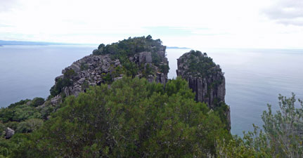 Dolerite columns just below the summit of Bishop and Clerk |
A few more twists of the path across and up the jagged rock jumbles brought us suddenly on to a collection of flat-topped boulders, no more than a few metres wide and not much longer. |
||
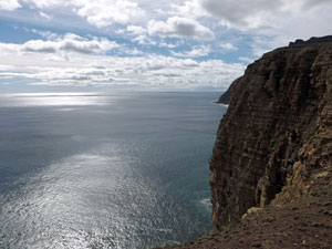
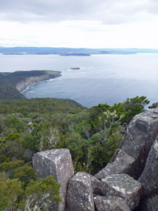
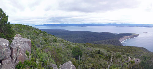
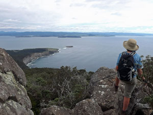
We had reached the summit and on the seaward side, the rock columns plunged straight down - it was a sight to rekindle my fear of exposure that I had thought I was getting the better of. The fair Nello wandered casually out to the end to get a better look at the impressive dolerite needle just below us. I contented myself with the spectacular views northwards past the rock columns to the Freycinet Peninsula. Three days ago, we were there looking at Maria Island and now we are on Maria, looking back. |
|
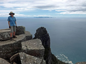 Nello on top of Bishop and Clerk |
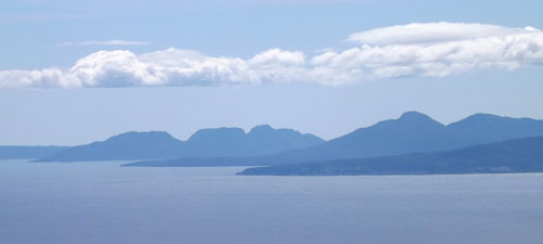 View north to Schouten Island and the Freycinet Peninsula |
|
|
While we were enjoying our lunch on the summit, we noticed that the cloud that had been building up all morning, now appeared to be getting lower. It was time to leave and pick our way carefully down the boulders, to wander back through the lovely tall forest and reach the cliff-top grasslands. When we reached there and looked back, the cloud drifting in from the south was partially obscuring the summit of Bishop and Clerk - not good for the people still heading up that we had passed on our descent. |
|
|
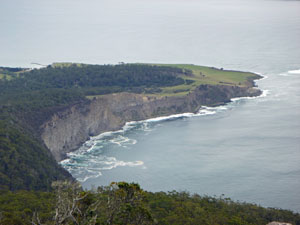 Cliff line leading around to Cape Boullanger |
 |
|
Instead of retracing our steps all the way to the penitentiary, we stayed on the cliff-line and followed it down to the Fossil Cliffs, a low grey limestone cliff, rich with the fossils of shells. This was the area once quarried to produce cement in the early 20th century. |
|
|
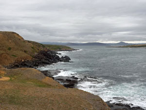 The Fossil Cliffs |
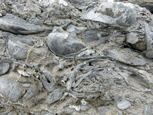 Fossilised limestone from the cliffs |
|
The weather was now changing rapidly, as a cold southerly wind picked up and a wet mist settled on us. We hurried across the grassy slopes from the Fossil Cliffs, back past the little bay and its Old Commissariat Building and up to the penitentiary, where our warm cell awaited. I bet that back in the early and mid-1800s, when convicts inhabited these cells 30 to a room, they were not as keen to return to them as we were. |
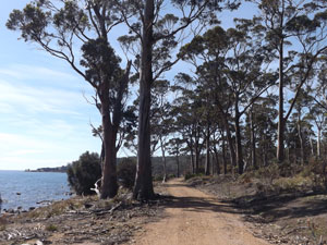
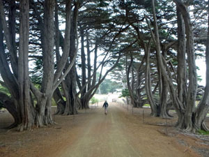 Cypress-lined road to Darlington |
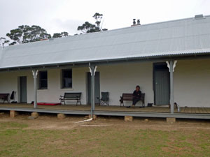 Relaxing on the penitentiary verandah |
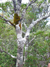
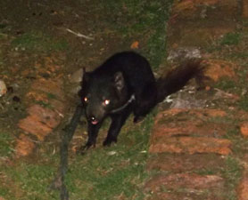 The Devil who came for a visit |
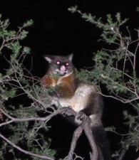
One of the day's highlights occurred after dinner, when we wandered out to do a little spot-lighting with our headtorches and see what nocturnal fauna was about. Kangaroos, wallabies, possums and wombats were all very fine - but a bright-eyed and bushy-tailed young Tasmanian devil - now that is a bonus. |
||
|

Day 2 - Darlington to Encampment Cove: Inland Route (18 km - 380m ascent - 380m descent) |
Well, strictly this is Day 3, as Day 2 was a bit of a write-off. We awoke to a cold morning and a misty drizzle, which persisted for most of the day, quietly saturating anything that stayed out in it for too long. Our plan had been to head to Encampment Cove in the south and camp there for two nights, but we didn't want to be quietly saturated, nor set up a tent in these conditions, so we exercised Plan B and booked another night in the penitentiary. There is quite a bit to see and learn in the historical displays in the Darlington Precinct. This and sipping coffee beneath a dry verandah while watching the shenanigans of the pair of Cape Barren geese that "owned" the quadrangle helped pass the rainy day (while the geese tolerated wombats and native hens grazing on "their" patch, woe betide any other goose who came along - they were quickly despatched with loud honkings and flapping of wings). It was better than sheltering in the 3 cubic metre confines of a tent. |
|
The new Day 2 was a great improvement - the rain had moved on, driven away by the strong north-easterly airflow that was blowing in from the Tasman Sea. The sun was out again, as we loaded our backpacks and set off, heading out along the gravel road towards The Painted Cliffs, helped up the hill by the wind at our backs. |
||
|
We soon left this road, however, to follow a grassy track southwards through open forest to the ruins of an old convict oast house (used to dry hops for their home brew), before crossing Counsel Creek and joining another gravel road heading towards Mt Maria. It was pleasant walking beneath the tall trees in this open forest, sheltered from the strong wind that roared through the canopy above us.
|
|
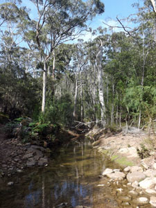
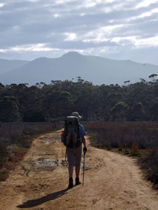
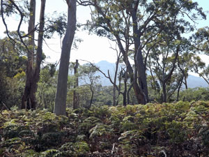
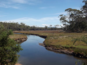
We found ourselves following Counsel Creek gently up a valley into the Maria Island hinterland. A couple of crossings from one bank to the other and a short climb out of the valley brought us to a saddle and the Mt Maria track junction. "Four hours return" said the sign - "no thanks" said the walkers (who had already climbed Bishop and Clerk two days earlier) and pushed on along the rough inland road, as it descended into a richer, moister, forest with dense shrubby understorey. Another creek crossing and a long and steady climb out brought us to Monah Hill, at 160m the high point of the inland road. From here, a winding descent took us down to Four Mile Creek. The track now meandered its way across these shallow and undulating south-facing slopes, where the forest once again became more open and dry. The road turned sandy and then turned west to meet up with the main north-south gravel road. The occasional glimpse of distant blue water through the trees told us we were nearing our destination, and it was but a short stroll to reach the clearing of French's Farm, a grazing lease from 1930 to 1976. First the rusty woolshed, then the weatherboard farmhouse greeted us. The kitchen of the farmhouse was a great place for lunch, protected from the wind that gusted across the clearing. |
||
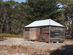
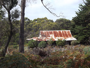 The old woolshed of Frenchs Farm |
 |
 1930s homestead - Frenchs Farm |
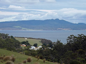
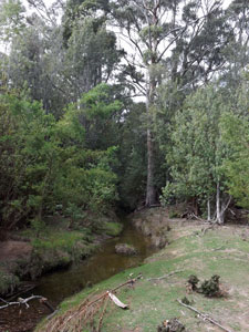
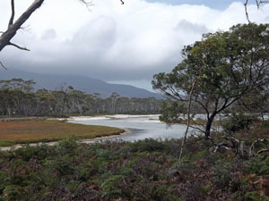
Then it was on to Encampment Cove, following the road past the swamplands of Crooked Lagoon and its exit flowing into Shoal Bay. Across the choppy waters of the bay, we could see low timbered hills of South Maria, and lining it, the white sand of the narrow isthmus that joins the two parts of Maria Island. |
||
 View over Crooked Lagoon |
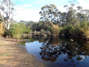 Reflections in a pond at Encampment Cove |
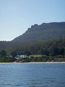
 Cloud-covered Mt Maria - from Encampment Cove |
|
A little beyond the creek, we passed the dark waters of a frog-croaking swamp to reach Encampment Cove, where a couple of boats were sheltering from the wind. Potential campsites stretched from the water's edge up a grassy slope to the tree- and shrub-covered top of a rise. It was here that we found our ideal tent spot, on a grassy flat tucked into the shrubbery that would shelter us from the wind. It must be a good site, as the ruined foundations of an old homestead lay just alongside. |
|
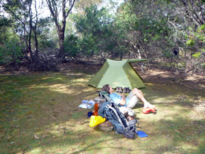 Time for a nap |
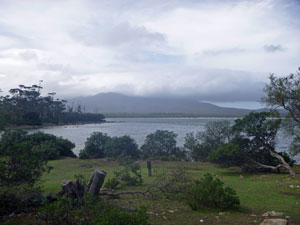
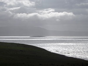
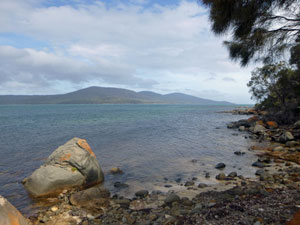 Looking across Shoal Bay to South Maria |
|
After setting up camp and brewing a cuppa, we headed off, pack-free, to explore the little peninsula of Point Lesueur. Mainly off-track, we first picked our way down through open woodland and coastal shrubs to bypass a swampy inlet and gain the treeless grasslands beyond. |
||
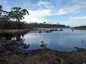 Coastal lagoon near Encampment cove |
 |
 Panorama of Mt Maria from the pastures of Point Lesueur |
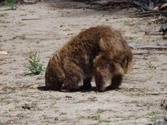
This area had been cleared by hard labour, and piles of boulders lay hither and thither. Once, in pre-National Park days, it was the home to grazing sheep. Now it is the home to grazing wombats - I have never seen so many, brown-haired and blonde, scurrying back to their burrows as we passed. |
||
 |
 |
 |
|
 |
 |
|
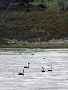
At times, we followed their trails across dense bracken fields, as we headed out past sandy beach and swan-filled lagoon towards the point. Across the white-capped channel, silvered by beams of sunlight, dark cloud hung ominously over the Tasmanian coast. Behind us, Mt Maria was caped with thick cloud - it would not have been a good day to climb it. As we turned for camp, the wind howled across the open grassland, flapping our shirts and down-rimming our hats. It seemed just as it should be in this remote corner of Maria Island for the wind to blast its negative ion-rich air across this narrow strip of land. |
|||
 Convict ruins - Point Lesueur |
 View towards the lagoon behind Bloodstone Point |
||
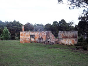
On reaching the red brick ruins of old convict cells (were they the ones who made all the rock piles to clear the land here?), we sat on the leeward side to have a bit of a break from the buffeting and thanked them for their labour. |
|||
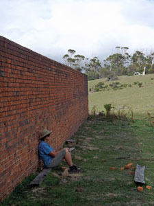
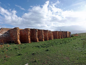 Ruins of the convict cells at Point Lesueur (built in 1846) |
 Across the pastures to the mainland |
 Campground possum |
From the ruins, a track led us back into the forest and on to our sheltered tent at Encampment Cove. It was a lovely spot, with wombats, wallabies, possums, Tasmanian devils and one other camper our only company. It was a shame that we couldn't spend another night here as planned, but if everything went as planned, life would be pretty boring. |
||
|

Day 3 - Encampment Cove to Darlington: Coastal Route (22km - 140m ascent - 140m descent) |
It was an interesting night - when the wind died down the soothing chorus of frogs drifted up from the swamp at the base of the hill. That was disturbed only by the scrabblings of possums, the growling hiss of a devil passing by our tent site (they are regular visitors to this part of the island) and the gentle pittering of rain at 6am. It was a false alarm - when we got up, the sky was clearing and waters of Shoal Bay were almost glassy. For the first time since we arrived the summit of Mt Maria stood clear of cloud. |
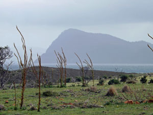
We wished we could have stayed another night, but we had a ferry to catch next morning. As mentioned, our original plan had been to spend two nights here and walk across the isthmus to South Maria to visit Haunted Bay. Time no longer allowed that, but we could still visit the isthmus, that narrow strip of sand (as little as 40m wide at its neck) connecting the two parts of Maria Island.
|
|
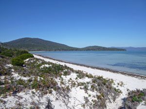
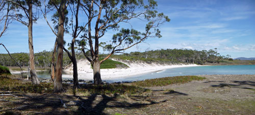
We retraced our steps back to French's Farm and just after the junction, dropped our packs in the bush and wandered on down the sandy road to Shoal Bay. Ahead lay the long curving strip of white sand known as Chinamans Beach - we set out down its length towards the timbered slopes of South Maria, a few kilometres away at the far end if the beach. It was pleasant walking pack-free, in a gentle breeze and sunshine, alongside the calm green waters of this shallow bay. However, on a long curving beach distances can be deceptive and it took 30 minutes of walking to reach the neck. Here a sandy foot track cut into the low dune of the isthmus and led us to the ocean side, only 50m across. We were now standing on the white sand beach of Riedle Bay, where the sea was blue and a small surf was breaking on the shore - very different to the protected channel side. |
|
 Chinamans Beach on the channel side of the isthmus |
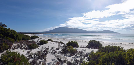 Riedle Beach on the ocean side of the isthmus - with Mt Maria in the background |
This was meant to be the end-point of Plan B, but South Maria looked so close from here - only another kilometre away. What the heck - we padded southwards along Riedle Bay towards it. But how to decide when we had arrived? We declared the first tall forest eucalypts to be part of South Maria and, having set foot on it, we quickly left, this time following a sandy track down the middle of the isthmus before popping back out on to Chinamans Beach and continuing the long stroll back to Frenchs Farm. It had ended up a 5km detour, but one well-worth it. |
||
 Track on south Maria |
 |
 Looking down Chinamans Beach to South Maria |
|
While having an oat bar and water at the old farmhouse, a group of walkers doing the luxury Maria Island Walk arrived to join us - figuratively speaking, for they occupied the front verandah, where the guides had lined up a spread with hot tea and coffee, while we nibbled our oat bars in the kitchen out back. Sometimes life is a bit Orwellian - all walkers are equal, but some are more equal than others. |
|
We headed on northwards beneath the tall eucalyptus that dominated the open forest of the coastal road. Following the sandy track slowly up, we then descended to reach the boggy mouth of Four Mile Creek. A sharp turn to the east and we were at the coast overlooking the very short Four Mile Beach (named for the length of the creek flowing in to it, rather than the length of the beach itself). It was a tranquil spot and a great place for lunch. |
|
|
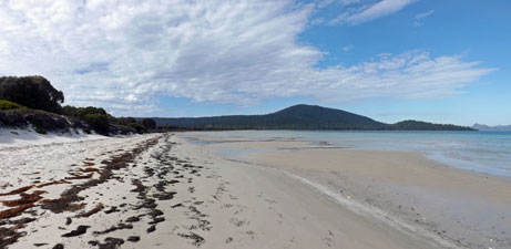
 Panorama of Four Mile Beach and the entry to the creek |
 |
|
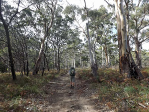
From here the Coast Road lived up to its name and hugged the rocky coast line. The day was actually becoming hot and we were glad for the shade of the groves of casuarinas that line it. Climbing over the humps of two low headlands, we reached The Painted Cliffs, from where three days ago we had watched a glorious sunset. There was no need to stop again - our legs were feeling the tiredness of the walk along the isthmus and the comforts of Darlington Penitentiary were calling. |
||
 Coastal route to Darlington |
 |
 Looking across to the Painted Cliffs |
The gravel road led us past Howell's Cottage, where Howell once had his little farm, followed quickly by Hopground Beach, at the back of which hops were grown for drying in the oast house that we passed on the way out. History is never far away on Maria Island. Finally we reached the last climb, pushing back up onto the grassy slopes above the white-washed buildings of Darlington. |
|
|
|
|
|
A short distance later and we had returned - cold drink and hot shower awaiting. The vagaries of the Tasmanian weather continued that afternoon - dark cloud built up, dropping the temperature quickly, clearing in the west just enough to offer a glorious golden sunset, which was followed by heavy rain. As I didn't say earlier, just as well we didn't stay another night in the south. |
||
|
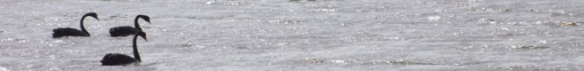
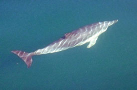
The Dolphins of Maria |
 |
 |
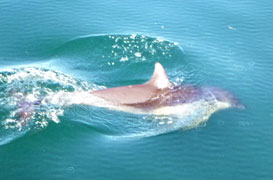 |
The next morning, we said our farewells to Maria Island, boarded the ferry and headed back across Mercury Passage to the mainland. It was an uneventful trip, save for the pod of dolphins which decided to follow the boat and play with us for a while - definitely worth a photo or two. |
||
|

