| The St Paul Trail |
| |
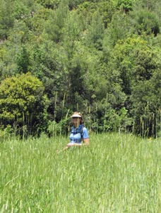
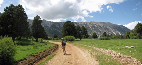
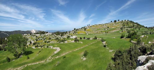
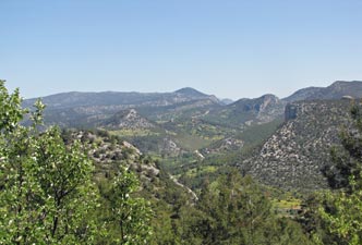
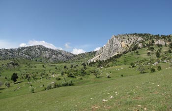
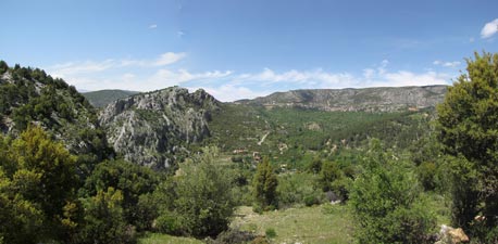
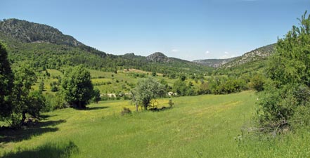
The St Paul Trail is a curious one, with two beginnings and one end. It was opened in 2004, but is still evolving, with new sections and other variants that we did waymarked as late as 2010. The trail is almost 500km long and would take several weeks to walk from end to end. Coming from the Antipodes for only 8 weeks, with a desire to sample as much of Turkey's diversity as we could, this was not an option for the fair Nello and myself. Using Kate's guide book as our reference, we chose to do a series of day-walks in the central part of the trail near where the two starting trails merge into one. We based ourselves first at the mountain village of Sütçüler and then at the lakeside town of Eğirdir. With its canyons and lakes, I supect this region best encapsulates the landscapes of ancient Pisidia. |
 |
So join us as we follow the footsteps of St Paul in this beautiful part of Turkey - at the end of our walking, I'm sure we will want to sit down, though I doubt it will be in a synagogue. |
|
Getting there
|
||
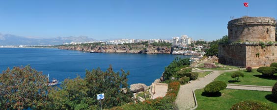 Antalya coastline - from the old Ottoman fort |
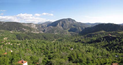 Pisidian landscape - viewed from our hotel room |
|
|
|
||
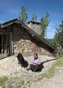 Turkish woman with goat |
|
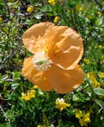
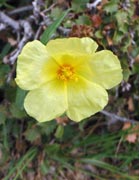
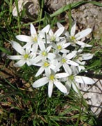
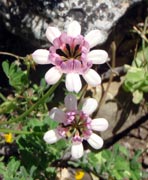
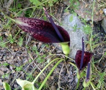
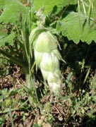
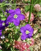
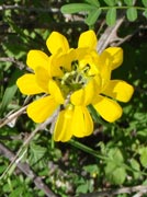
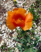
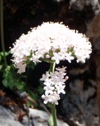
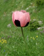
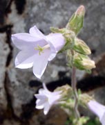
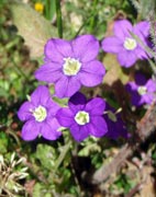
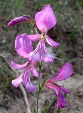
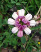
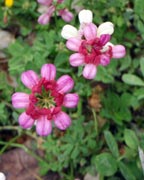
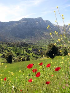 Poppies in the wheat field |
|
||||
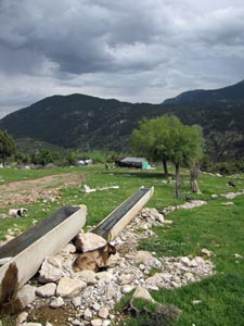
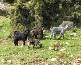
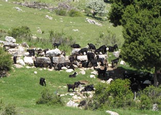
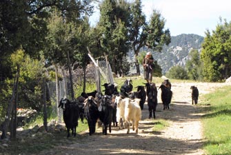 Herding the goats |
 The fields of Sarimehmetler |
|||
|
||||
 |
 |
 |
 |
 |
|
||
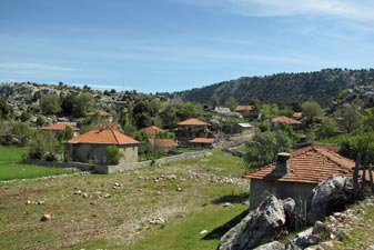 Red-tiled rooves of Sarimehmetler |
 Stone-walled track across the fields |
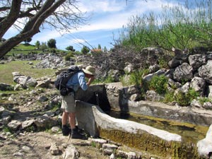 Another cool fresh spring |
 |
 |
|
 |
 |
|
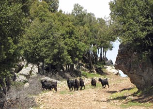 More goats on the track |
 |
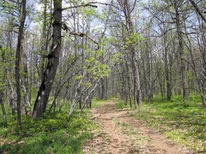
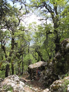
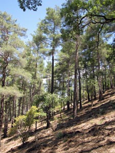
 Into the pine and oak forests |
|||
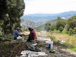 Ahmet and his daughter preparing a barbecue lunch |
|
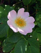
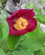
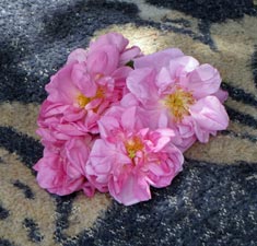 Isparta roses for a lady |
|
||
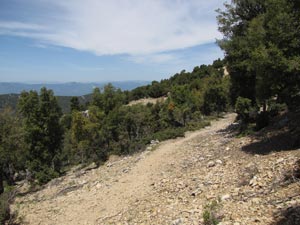 Traces of the old Roman road |
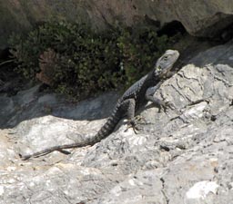
 A disinterested local |
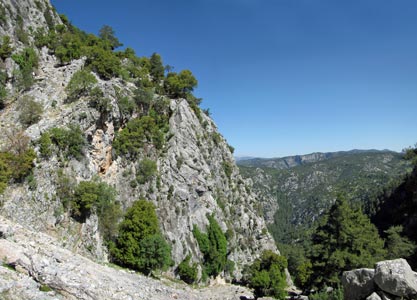
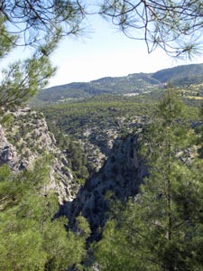
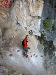
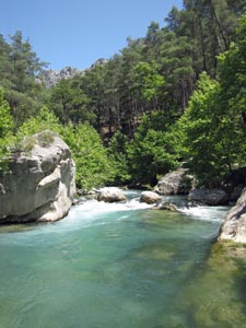
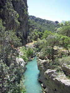
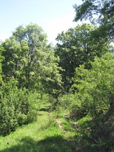
 Entering canyon country |
|
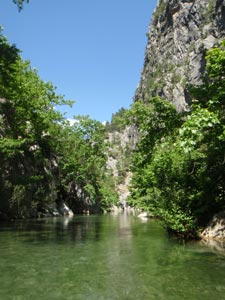
Soon we were following it beneath a shady canopy of trees until it brought us to a beautiful clear green waterhole, fed by a small waterfall – a beautiful spot to stop for a while and cool ourselves down with a swim. Cool was an understatement – the waters were icy, but so refreshing.
|
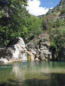 A quick swim in the icy pool in Yesildere Gorge |
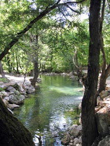 A tranquil pool in the Değirmen River |
It was hard to drag ourselves away from the pool, but time was passing, so we headed back on the opposite bank, passing a bridge and picnic area to commence the final climb back up to Sütçüler. First, a track up to a resin-scented pine forest, than following the course of a stream, criss-crossing it three times to finally climb steeply up to the outskirts of the village. As we climbed, the call of the muezzin echoed across the valley from the minaret of the Sütçüler mosque - there was no doubt that we were trekking in Turkey. The afternoon sun was now beating down and in the lee of the breeze, we were soon hot and sweaty again. |
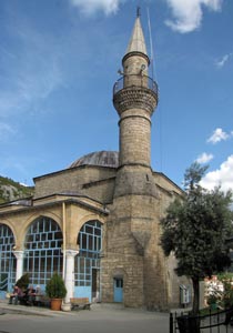 The mosque at Sütçüler |
|
||
|
|
|
|
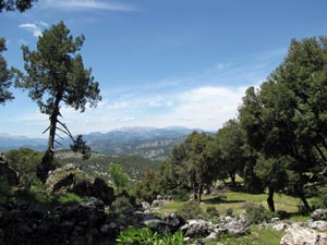
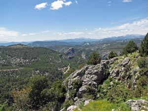
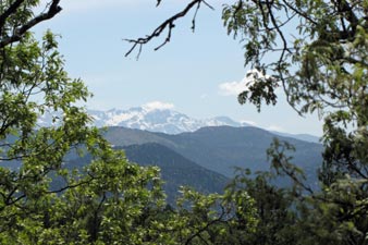
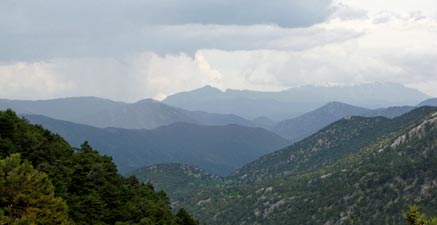
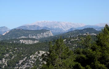 Looking over the canyons to the snow capped ridge of Davraz Dağ |
 |
|
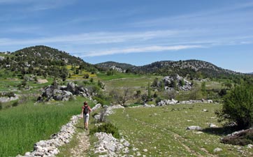
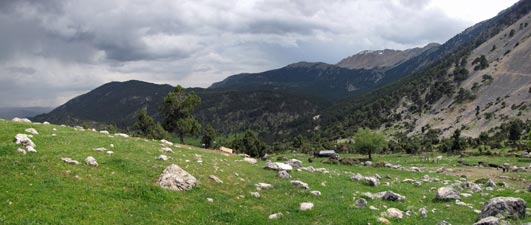
 Crossing the grassy bowl at Çuruk |
Cresting a small rise, the road led us down into a grassy bowl beneath the long rocky ridge of Erdiasum Tepe – an old house and signs of fenced plots told us that we had reached the locality of Çuruk – I say locality because it didn’t appear that anyone lived here anymore. The road petered out and we followed a track along the bed of a dry stony creek towards the point where the rocky ridge of Erdiasum Tepe plunged into the canyon. |
|||
 |
 |
 |
 |
|
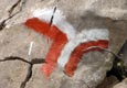
Our path ahead was becoming more obvious, a narrow and steep gap up onto the ridge. We followed the red-white waymarks up it to crest the ridge at a point where a rib of jumbled boulders spilled down from its summit. After a quick rest in the shade of an oak tree, we left our packs and picked our way up the sharply eroded boulders of the rock rib, its nooks and crannies filled with the spiky leaves of holly. |
|
|
 The way up Erdiasum Tepe |
 |
|
|
||
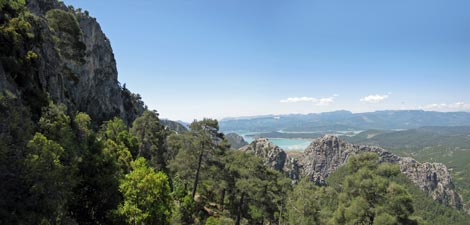
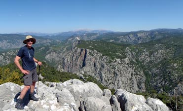 Overlooking the junction of Değirmen and Bagirsak Canyons |
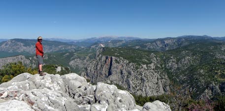
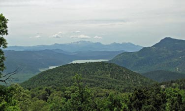
 Panorama from Erdiasum Tepe of Lake Karacaören and surrounds |
|
|
|
The views on this descent of the sheer rock walls, pine and juniper covered slopes, canyon depths and distant lake were superb. After a couple of tight squeezes, having to enter a shallow cave to get by one rock face and scramble over a sharp outcrop to get around another, our rapid descent became a gentler downward traverse, mostly in the welcome shade of the rock face above.
Soon we could hear the sound of rushing water rising up from below. The canyon floor was close as we reached a well-formed track, which led us the final few metres of descent to a road running along the floor of the canyon. |
|
|
|
|
|
|
|
  |
|
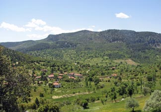
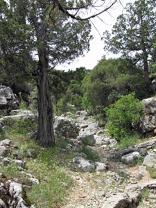
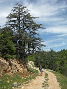
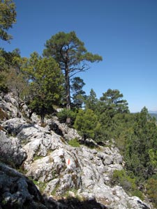
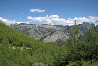
The ancient city of Adada was founded prior to the 2nd century BC and for many years was an independent city. It flourished under Roman rule in the first few centuries and was abandoned sometime between the 9th and 13th centuries. Its structures decayed and remained hidden until 1841, when the ruins were rediscovered. As a major city between Perga and Antioch, St Paul probably passed through it and the modern St Paul Trail certainly does. Today, our walk would take us from Sütçüler to the ruins of ancient Adada. |
|
||
|
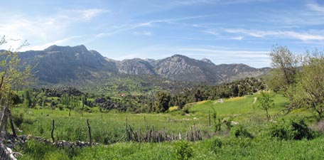
 Landscape north of Sütçüler |
|
|
|
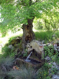 Another refreshingly cold spring |
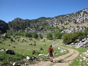
Leaving the asphalt, we headed north along a gravel road that led us through the green countryside around the base of the low Karaburun Mountains and over our first pass for the day. Ahead lay a broad green valley dotted with the red tile rooves typical of houses in this region.
|
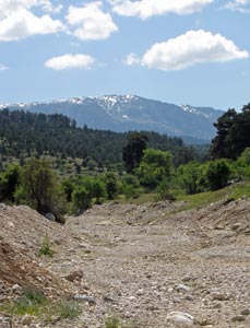 Dry creek-bed and the snowy ridge of Sarp Dağ |
The route that we were taking was a new one that had only been way-marked in 2010. The St Paul Trail is a new trail and, to some extent, is still evolving. After a few kilometres of asphalt and dirt road, we were starting to wonder whether it was evolving in the right direction, but then we turned off the road and followed a grassy track down through forest and across flower-filled meadows. Stopping a couple of times to refresh ourselves with cold clear water from the springs bubbling out of the hillside behind us, we began to appreciate its virtues. Soon we crossed the stony bed of a dry creek, that directed our gaze up to the snowy heights of distant Sarp Dağ. After the creek, the track led us up to another asphalt road, which we followed briefly before continuing our northward push on a small road leading up to the hamlet of Poslar. |
||
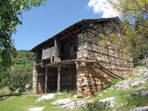 A traditionally built house in Poslar |
 |
 Looking back across Poslar towards Karaburun Mountain |
|
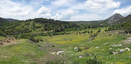
High behind the hamlet lay a steep pass, with a couple of abandoned traditional houses. The road changed to a track, which led us up and behind them to reach the pass, opening up views down to our second valley of the morning, narrower and backed by pine covered hills. The route down into the valley started out as a pathless traverse of rocky, scrub covered grasslands, marked only by red-white waymarks on the rocks – fine, apart from the fact the dense spring grass cover was attempting to hide them from us. It was a case of spot the marker, walk to it, stop to find the next one, walk to it, stop etc etc …. a slow process. For a while, a clear path emerged which led us down alongside a barbed-wire fence, but then we had to leave it to cross a stream and the game of find the way-mark was repeated. A wheat field planted across the route did not help, but we eventually picked our way through the grassy maze to join the track that led up to our third pass of the day. The midday sun was hot and so was the climb, so we declared it lunchtime when we crested the pass and found some shade and a bit of breeze from where to admire the views of the broad valley and distant village of Sağrak beyond.
|
|
 |
Lunch over, we started the descent into our third valley, firstly on a well-marked track, but soon the way-marks obliged us to drop down through the open meadows for another game of “find the route” in the long grass. We succeeded with the help of my GPS which guided us to a waypoint marking the merging of this new variant with the old route to Adada. We were now following the low-walled course of the old Roman road, passing massive old pines scattered in the fields. The road headed towards a rocky amphitheatre cut deeply into the rugged hills ahead and soon we were winding our way up into it through a low juniper scrub. |
 |
 Juniper-lined dry creek bed
|
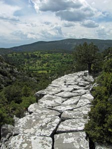
Climbing up and onto a rocky ledge, we looked ahead to realise that we had just stepped back on to the old Roman road, this time marked by a long line of massive flat rocks, sometimes even, sometimes slipping away, but curving gently around and up the slope into the heart of the amphitheatre. The road turned to the left to a reveal a narrow dry and rocky gully, almost hidden beneath the scrubby junipers and oaks.
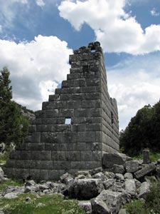
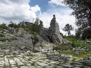
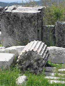
The road stopped and we continued up the creek bed, following a line of small brown-stone cairns. A broken rounded column in a jumble of rock told us that we were near and then ahead, we saw a stone wall with archway half-hidden in the scrub. We had arrived at Adada, where little remains of its past glories.
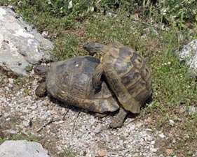
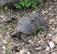
Passing remnants of the city wall, we reached the agora, a paved central square once surrounded by shops, but now left with a jumble of broken columns and rows of stone seats from where people once watched performances in the square. The only performance that we saw was a fairly risqué display by two tortoises. Did you know that they make a noise like a cat mewing when they mate? |
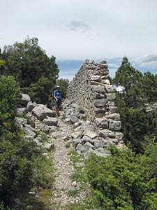 The city wall of Adada
|
|
|
|
 |
 |
|
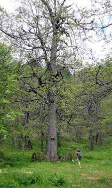
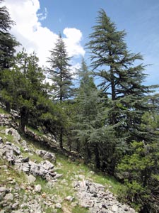
 Big cedar in Kasnak
|
|||
 Through the trees of Kasnak to the mountains beyond |
 Looking across Kasnak Forest to Kovara Lake |
|||
|
||||
 |
 |
 |
 |
|
|
||||
 Deciduous trees just coming into leaf |
 |
 |
 |
 |
|
||||
 A beautiful broadleaf grove in Kasnak Forest |
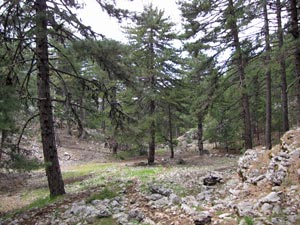
Lunch over, we scrambled down the slope to pick up a faint and very rocky goat track that traversed gently downwards around the slope to emerge in the cow pastures. Here a freshly graded dirt road led us alongside the pastures, before taking a long and sweeping upward climb into dense pine forests.
|
 The slopes of Kasnak escarpment |
We soon realised that the grading had also removed many waymarkers and, missing a turn-off, found ourselves at the top off the pass overlooking a deep valley, walled in by the scree-covered eastern flank of Davraz Dağ. There being no detailed map and limited guidelines, it was time to put the GPS to the work for which it was designed – getting us back on track. |
||
 In the un-waymarked forest - so now where? |
For the next couple of kilometres we navigated from waypoint to waypoint by GPS alone, first retracing our steps to a junction to follow a side road into a large summer pasture, then cutting through a narrow gap. From here, a rocky footpath led us down into the valley we had seen before. After wandering down unmarked and pathless pine forest gullies, we eventually emerged at a grassy clearing on the valley floor and a shepherd’s camp. It was a great relief to find that the grassy track heading out of the valley had red and white markers once again. |
 At last we reached a shepherd's camp and the track |
 Watering point at the goat-herd's camp |
However, time was getting on and our GPS still indicated a long way to go. Despite the peacefulness and beauty of this valley we pushed on, descending along an orange clay road which curved around and down. Unfortunately, our path didn’t, instead climbing steeply to the high rim of the valley. | 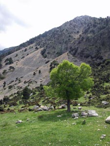 Scree slope below Davraz Dağ |
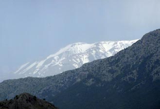 Snow still covering the distant Dedegöl Mountains (2935m) |
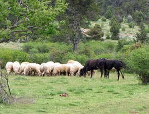
The setting here was superb, a grassy meadow beneath steep scree-covered rock walls, goats bleating and a scattering of goat-herds shelters. Even better, a spring of cold refreshing mountain water! It was the first water source on the track in 6 hours – we drank heartily and filled our bottles. Despite the beauty of their surrounds, the life of a Turkish goat-herd seems a hard one. |
|
 High pasture below the slopes of Davraz Dağ |
 The goats at play |
 |
 |
 |
 |
 |
 |
By now, dark clouds were beginning to form over Davraz Dağ in the west, so we pushed on quickly, descending once more into a valley and climbing once more steeply over its far rim on a gravel road. Near the top, the route began to follow a footpath, which took us through the rocky outcrops on a flower-speckled saddle. At last we were on our final descent, chased by darkening clouds and peals of thunder, across open meadows and past distant marble quarries. |
|||||
 Chased by the storm |
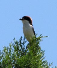
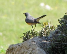
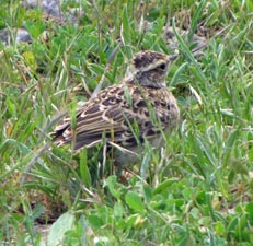 Ground lark being coy |
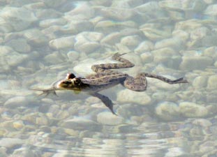
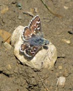
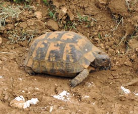 Another day - another tortoise |
|
|
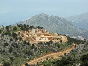 Marble quarry near Akpinar |
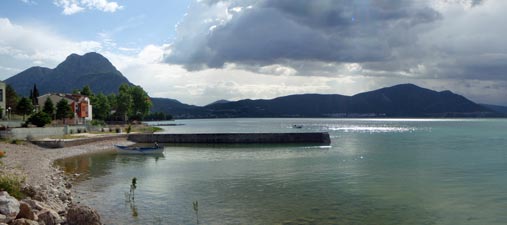
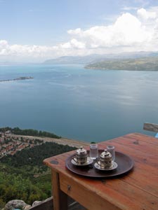
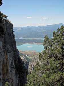
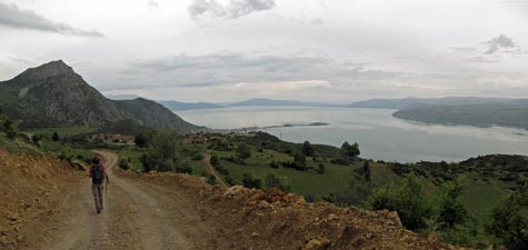 The road into Akpinar - looking over the spit in Lake Eğirdir |
We may not have walked into Eğirdir (much of which would have been on sealed roads and in urbanised areas), but we had still enjoyed the serenity of the forest and the grand vistas over the high valleys and farmlands beyond. It was a very different walk to our ones around Sütçüler and complemented them well. However, unless you are a super-fast walker and don’t want to smell the roses, Akpinar is definitely the place to call it a day. We would also strongly discourage anyone from doing this walk without a GPS – with unmarked sections in deep forest and no features to guide you, without a GPS loaded with waypoints, you might still be wandering through the forests of Pisidia.
|
|
We had pretty much recovered from the long walk of yesterday after a comfortable night in Ali’s Pension, on the tip of Yesilada, a causeway-linked island jutting out into beautiful Lake Eğirdir. Still, with tired feet, we decided to just do a morning walk and take advantage of this wonderful setting for some relaxation in the afternoon. We were off to climb Sivri Dağ – the 1733m mountain which dominates the skyline behind Eğirdir.
|
|
 The route up to Sivri Dağ
|
 |
 |
 |
|
|||
 Goats grazing amongst the ruins of Prostanna |
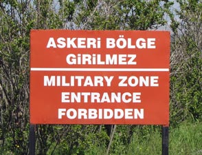
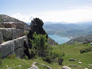 Ancient stone wall in Prostanna (note the sniper's dummy) |
 Que? No entiendo turco o inglés |
|
||
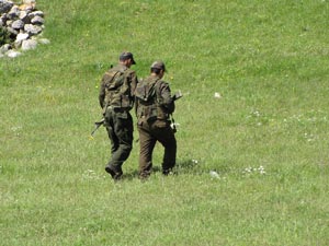 Some fellow walkers on Sivri Dağ |
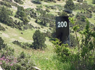 Range marker |
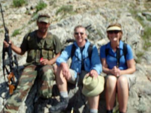 Photo blurred to protect the identity of innocent trekkers |
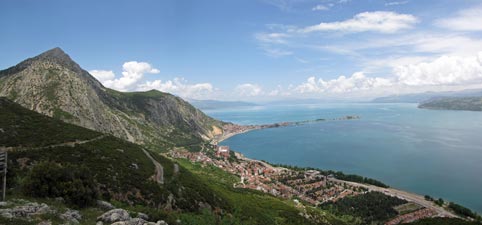
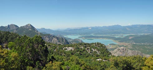
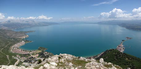 Panorama of Lake Eğirdir from the summit of Sivri Dağ |
|
|
|
|
|

 Crossing our first valley
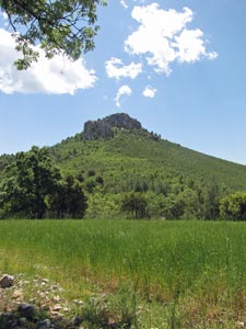
 Looking down on the third valley south of Sağrak