| Climbing Mt Kaçkar |
Getting There |
After a couple of days in the tourist-free city of Kayseri following our trek in the Taurus Mountains, we were keen to head back into the Turkish countryside again. Getting to the Kaçkars from Kayseri proved to be a bit of an epic in itself, due in part to more last minute changes to our itinerary. |
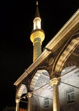
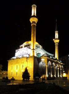 Kayseri mosque by night |
|
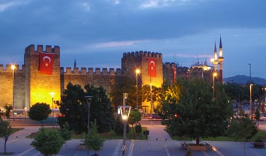 The walls of the old fortress at Kayseri |
 |
|
|
||
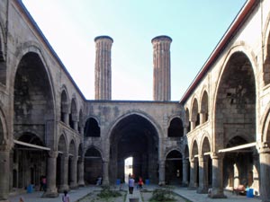
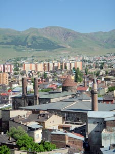 Erzurum skyline |
Two indicators of the extent to which western cultural influences have penetrated Turkey are women's clothing and alcoholic drinks - unlike cosmopolitan Antalya, there was no sipping a beer as you watched the world go by in downtown Erzurum.
|
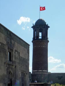 Tower of the old Erzurom citadel |
|
|||
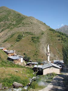
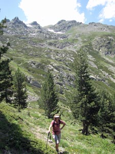
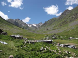
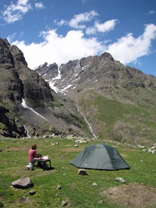
| Warm up walk to Korahmet (7 km, 190m ascent, 190m descent) |
|
|||
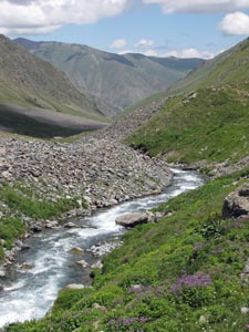
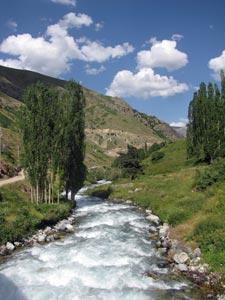 The Hevek Dereşi near Yaylalar |
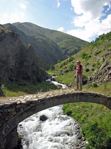 Old Ottoman bridge over the Zamevan Dereşi |
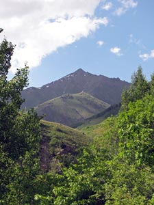 Murzut Tepe (3305m) |
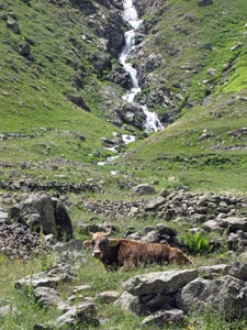
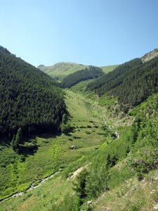
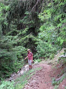
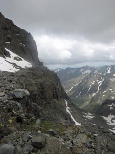
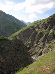 Ravine on the way to Korahmet |
|
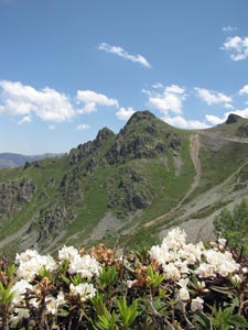
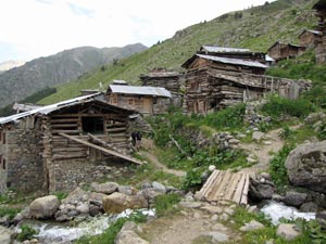
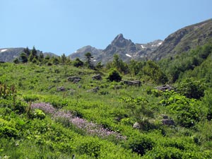
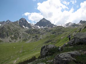
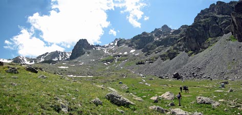
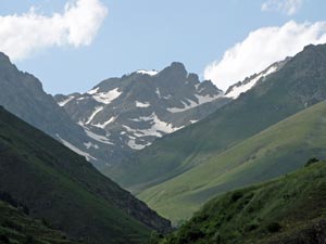
The wildflower-lined path curved around beneath a rocky cliff face, opening out views down the valley toward the 3350m peaks of Lale Tepe. Following the track around to the east, the village of Karamolla with its traditional stone houses appeared. We walked through the village to pick up an overgrown track higher up the slope that led us to the ghost-town like village of Korahmet.
Here we stopped as time was getting on and followed the gravel access road back to Karamolla before retracing our footsteps down the path to Yaylalar, framed by snow-tipped green mountains. The greenness of the Kaçkars was all the more striking for its contrast with the barren, orange-tan landscapes of the Taurus Mountains, where we had just been. |
|
It was a short walk, but gave us a good taste of what lay in store; snow-capped peaks, deep valleys with rushing streams, green meadows and wildflowers in abundance. Our appetite for the next week of walking was well whetted. |
|||||
 |
 |
 |
 |
 |
 |
| Yaylalar to the Modut Valley (12 km, 910m ascent, 1110m descent) |
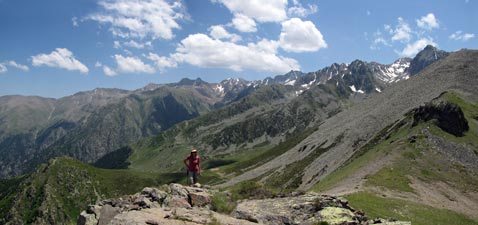
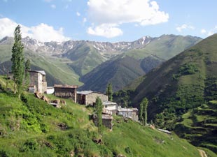
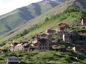
As has been the case since we arrived in Turkey, clear blue skies greeted us on our first real day of walking in the Kaçkars. We were planning a walk up to the high slopes behind Yaylalar, from where we could get a grand view of the main range of the Kaçkar Mountains to the north and our eventual goal, the 3937m peak of Mt Kaçkar itself. |
|||
 The mosque of Yaylalar |
 View down the Hevez Gorge |
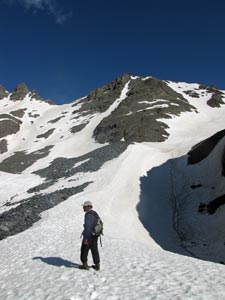
 The climb ahead up the Aksav Yaylasi |
 Ibrahim gives the lady a hand |
 |
 |
|
 |
 |
|
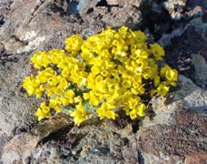
 Herb-fields of Aksav Yaylasi |
 Grassy bowl on the slopes of the Davut Mountains |
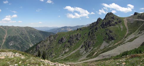
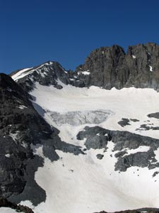
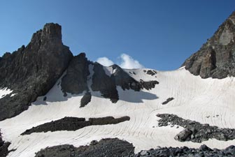
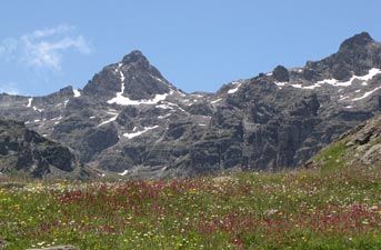
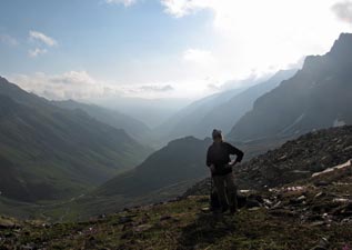
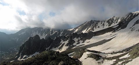
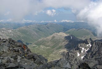
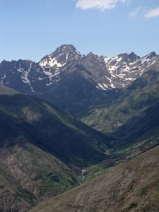
The broad open higher slopes of the Davut Mountains looked down on us, as Ibrahim led us up the faint overgrown track and into a grassy bowl backed by the bare rock wall of the mountain ridge. One more climb, up through some scattered pines on a spur to the east brought us out to a stone cairn and impressive views across the valley towards the Bulut Mountains and the dark 3420m dome of Caymakçur Tepe. |
|
 Climb up through the junipers |
Further to the left, the unmistakable snow-covered south-western face of 3937m Mt Kaçkar was just appearing from behind the green slopes of the range we were on. It was a good place for a rest stop and a chance to become a bit more familiar with the profile of these mountains. |
|
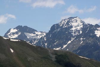 First glimpse of 3932m Mt Kaçkar |
|
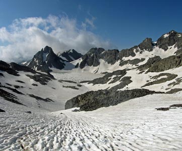
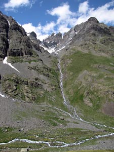
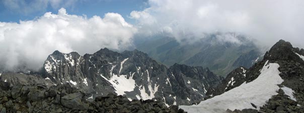
Descending back to the saddle, we pressed on to pick our way carefully down a soft scree slope and reach a narrow saddle between two valleys. The wind was now picking up, so we sat on the leeward side to have our lunch – soon to be joined by a squadron of kamikaze March flies. It was the first time we had been bothered by insects on our walks in Turkey. However, they did not distract from the main spectacle of cloud rising up on the northern side of the main range and spilling over into our side through passes and over saddles – an impressive lunchtime display. |
|
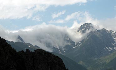 Black Sea cloud spilling over the Bulut Mountains |
 |
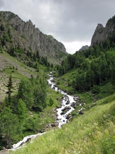
 The head of the Modut Valley |
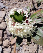
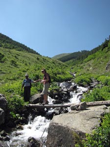
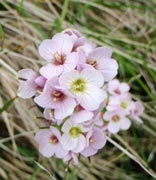
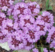
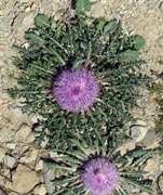
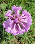
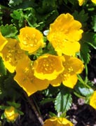
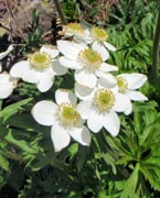
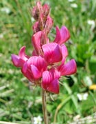
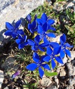
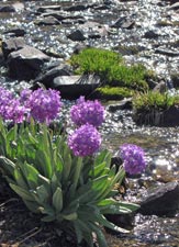
What we didn’t notice, as we watched the cloud display on the mountains, was the other band of grey clouds creeping up behind. It was time to move on and Ibrahim led us quickly down into the valley high above the stone and wood houses of Modut Yayla, a place where local people spend the 2-3 months of summer. Reaching the upper part of the valley, with its twin silvery streams tumbling down from above, we stream hopped past fields of flowers, included clusters of tiny purple orchids, before descending the rocky yayla pastures to reach the village itself. |
||
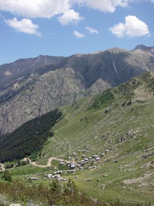 Looking down on the houses of Modut Yaylasi |
|
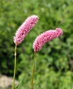
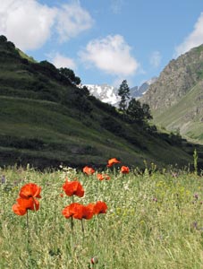
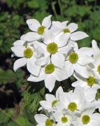
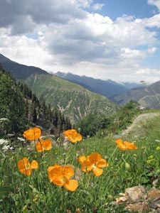 Poppies in bloom |
From Modut, we picked up a rough gravel road, descending it with the occasional short cut to pass the smaller yayla village of Sakura, with its outer houses perched on the edge of a formidable drop into the deep ravine of the Hevez Dereşi. The way down for us was the road, with an interminable series of hairpin bends, until Ibrahim found a footpath that not only cured the tedium of the road by passing through shady pine and fir forest, but got us down much more quickly. |
|||
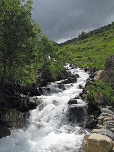 The Modut Stream in full flow |
 Steep descent through the fir forest |
 The beauty of the Mikelis Gorge |
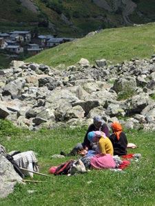
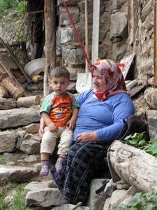 Turkish friends in Mikelis |
|
|||
 |
 |
 |
 |
 |
 |
| The way up - Yaylalar to Dilberdüzü Campsite (11 km, 1010m ascent, 10m descent) |
|
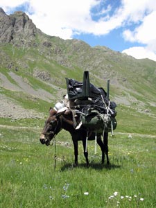
 The moving haystack is actually being carried by a mule |
 Heading towards the mosque at upper Yaylalar |
It was a busy road, women tending their gardens, men scything the thick herb-fields for hay, mules passing by almost obscured by their loads of fresh hay for storage in the barns, kids wandering off to school. It was the season of the harvest – time to lay up supplies for the animals during the long cold winter ahead.
|
 Poppies in the field |
|
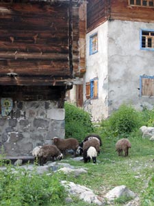
The road changed to gravel and crossed the rushing stream, leading us into Olgunlar with its stone and wooden houses and a small open-air café, where we stopped for a cup of çay and a chance to enjoy the lush green valleys of the Kaçkar. |
|||
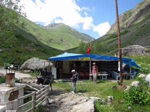 Tea house in Olgunlar - time for a çay |
 The route up the Büyük Valley |
|||
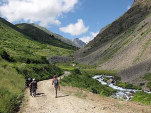
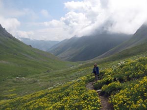
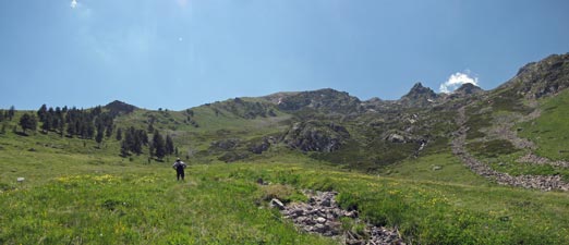
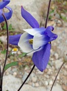
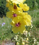
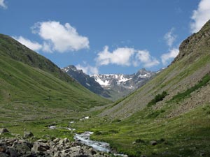
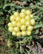
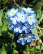
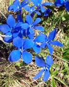
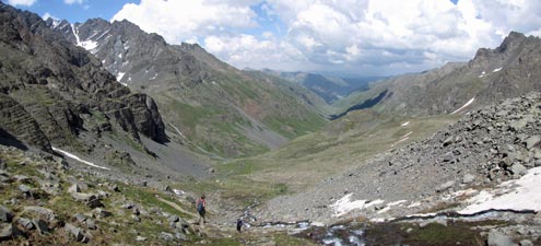
Pushing on, we now followed Makşur and the donkey onto a nice footpath that headed up Büyük Valley, the road to Mt Kaçkar. It was a long and beautiful glacial valley, a green canvas of grass and herb-fields spattered with the whites, yellows, blues, pinks, purples and oranges of their flowers. |
||||
 |
 |
 |
 |
|
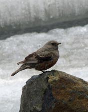
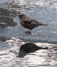
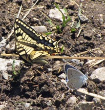
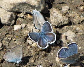
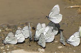
Butterflies flitted by, grasshoppers crossed the path and the faint song of the ground lark could be heard above the sound of the rushing stream, as it tumbled over rock and boulder. Our mule was enjoyed the moving buffet of different tasty herbs and grasses as we slowly headed up the valley. Rounding a curve, we could see the snow-capped ridge of the main range and started to head directly for it. |
||||
 |
 |
 |
 |
|
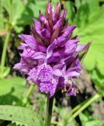
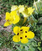
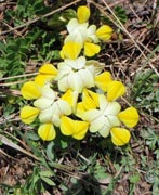
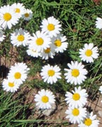
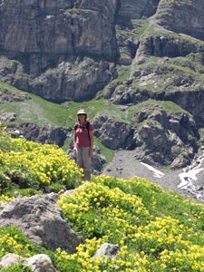
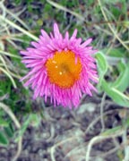
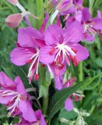
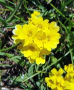
After passing through the empty houses or crumbling stone ruins of Hasta Yaylasi with its low stonewalled fields lining the stream, the climb started to get steeper. We crossed a boggy area, full of purple orchids and pink flowering herbs to reach a broader plateau. The flower fields were becoming denser, with thick clusters of yellow and white blooms providing a superb foreground to the dark walls of the mountains rising behind them. |
||||
 The abandoned summer settlement of Hasta Yaylasi |
 Flower-fields of the Kaçkars |
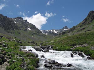 The Büyük Stream rushing down its broad glacial valley |
We were now well into the upper valley and the mountains had begun to enclose us, silvery streams flowing down from the heights. We were starting to feel quite hungry, but our guide/cook was keen to get to the campsite and set up before eating. One last steep climb brought us out to the hanging valley of Dilberdüzü, a broad green grassy flat, split by a rushing stream and backed by the sheer rocky ramparts of the main range. |
|||
 In amongst the herb fields |
 Pondering the world at Dilberdüzü |
 Silver streams converge at the head of the valley |
 The face of Kaçkar Zirve |
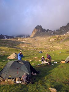
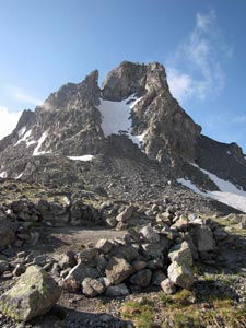
In full trekking season, Dilberdüzü can have more than 50 tents scattered on its grassy flats. We were fortunate to find only one other tent, plus a couple of brand new stone-walled toilets, functionally sound if bodgily built. Creature comforts were creeping in to the high Kaçkars. We set up camp and had a late lunch, looking out over the 3600m peak of Kaçkar Zirve, on a spur of the main mountain. The summit of Kaçkar itself was hiding behind the dark walls of Seytan Kayalari (Satan's rocks) rising up to the north of our grassy flat - we would have to wait for the start of the ascent next morning to see it. |
||
 |
 The grassy campsite at Dilberdüzü, backed by the rock walls of Seytan Kayalari |
 |
The afternoon passed slowly and pleasantly in this beautiful alpine setting. A trio of Turkish trekkers dropped in to our campsite on their way down from the mountain for a çay and a chat – their description of the views made us even keener for the climb tomorrow. It was only 4.30pm when the sun disappeared behind the ramparts and the temperature dropped dramatically in 10 minutes. Time for down jackets and beanies – at least we got a chance to wear them after carrying them around Turkey for 7 weeks! It was also time to get stuck into Makşur's hearty dinner. |
||
 Looking back down the Büyük Valley from Dilberdüzü |
 |
 Çay and a chat with the Turkish trekkers |
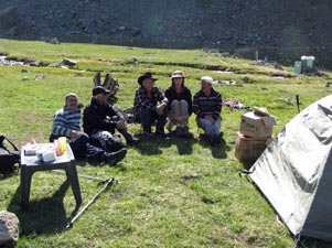
Later that evening, we shared a bowl of hot soup and chatted to the Polish couple from the other tent - they had also also just climbed the mountain - and two Americans, who had just arrived and, like us, planned to do it the next day. However, on cold mountain nights you retire early and we were soon snuggled into our sleeping bags. A slight rustling from the direction of Makşur's tent announced the arrival of Ibrahim, our guide of yesterday. He had walked up late in the day and tomorrow would be the one to take us to the summit. Our sense of anticipation was rapidly building up. |
|||||
 |
 |
 |
 |
 |
 |
| The ascent of Mt Kaçkar (10 km, 1120m ascent, 1120m descent) |
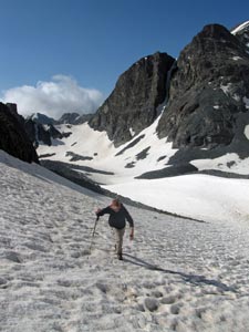
“Kahvasi – besh”, Makşur had told us before we crawled into our tent to sleep. I wished that with my smattering of Turkish words that I hadn’t understood – breakfast at 5am did not really appeal, but you need to start the climb of Mt Kaçkar early, as it has a reputation for clouding over in the afternoons. Still, after a night spent on 5mm foam mats, we were glad to get up. Our hips, spoilt by a 20mm thermarest when we camp at home, woke us up to complain regularly and at the best we got an hour or two’s sleep. The star-filled sky that we left when we crawled into our tent had been replaced by low cloud which hung about the peaks. We weren’t sure what to expect of today. |
 Kahvasi besh - breakfast at 5am
|
 Cloudy Kackar sunrise |
 Start of the climb in the morning mist |
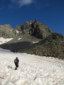
By 20 to 6 we were on the way, with Ibrahim leading us up and out of the camping area to start a long and steep climb beside the stream that tumbled down from the snow fields above. As we zig-zagged upwards, the mists above began to break up a little and by the time we reached the fluted drifts funnelling down between jagged black rock ribs, the sun was breaking through. Ibrahim had timed his run to perfection. |
||
 Snow drift sweeping down the valley we climbed from Dilberdüzü |
 Not Mt Kackar (it is just behind) |
|
We crossed the strangely rippled snowdrift, to climb up rocks to the next level, then more snowdrifts and more rock. The pattern for our climb was quickly becoming apparent. As we pushed on through this monochrome landscape of snow and rock, cloud drifted by, hanging over the valleys or wrapping itself around the ranges on the far side. |
||
 View back towards the Karmovut Mountains |
 |
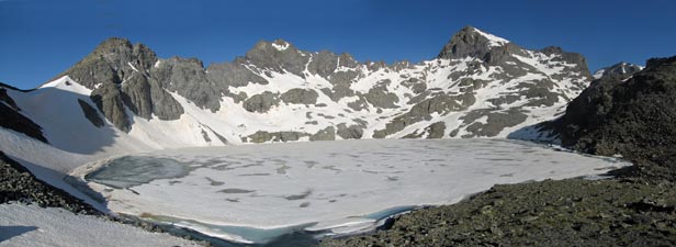
 Stone tent shelters near the lake |
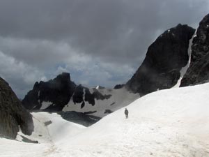
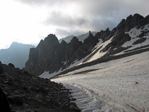
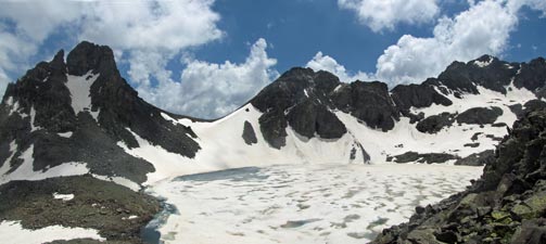
For the moment though the route ahead was clear and, with one more trudge up a snowdrift, we reached the magnificent site of Deniz Gölü, a large glacial lake surrounded by sharp peaks and jagged ridges. Even though summer had well and truly started, the lake was almost completely frozen over. It was a good spot to sit and absorb the grandeur of these mountains for a while before heading on. |
||
 |
|
 |
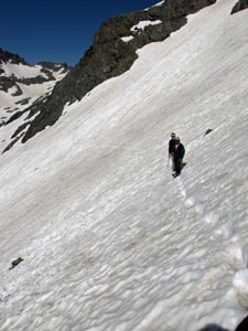
Meditational moment over, we rock-hopped across the mouth of the stream flowing out of lake to climb a large knob of jumbled lichen-spattered boulders. From the heights above the lake we could see the dark rocky summit of Kaçkar for the first time – my, it looked high! Then it was back into the snow, still crisp in the early morning cold. It crunched beneath our feet as we sought out rock islands in this white sea, before traversing upwards across a steep snowdrift. |
||
|
|
|
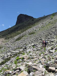
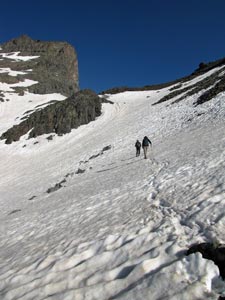
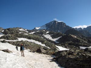
We had lost almost 100 preciously gained metres. Ahead lay what looked like a morain of basalt boulders, which helped us regain some of them before we once again headed across a bowl of snow that swept down from the rock faces and funnelled into the gullies below. Looking at these huge snow-filled bowls, we could see why all the streams pouring off the mountains were so swollen with meltwater. Glancing behind at one particularly steep, north facing slope, we could see a patch of bluish ice – one of the glaciers revealed. Another steady climb traversing a snow bowl brought us to a small cliff face, where we needed to do some rock-scrambling across the face of a trickling waterfall. |
||
 Steep traverse up a long snow-covered slope |
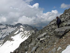
We were now only 400m below he summit and, looking up, we could see the general route to it – 200m up a steep snow slope (and a lot further down if you slipped) followed by another 200m of scrambling over the sharp-edged boulder jumble that led you to the top. Luckily we had Ibrahim to plot our way carefully upwards across snow and over boulder. Below us we could see the tiny forms of the two Americans who had left later and were following our path – they were in luck today, because in these snowy conditions it would be very difficult to find the way without a guide. |
|
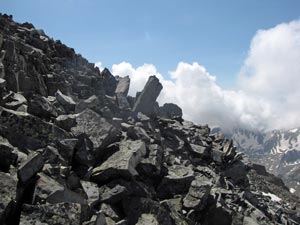 The jagged boulder jumble below the summit |
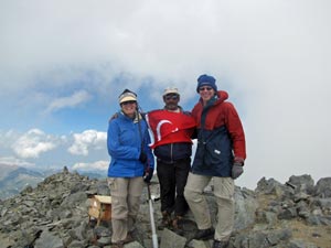 With Ibrahim (holding the Turkish flag) on top of 3937m Mt Kaçkar |
|
The fair Nello was the first to spot the Turkish flag marking the summit when we were some 40m below it. However, before making the final ascent, we stopped to put on windproof gear, gloves and beanies as the icy wind was now whipping over the exposed slopes. A few more steps and, after 4.5 hours and 1100m of climbing, we were there, at 3937m on top of Mt Kaçkar and the whole Kaçkar Mountains. We signed the register, took the obligatory summit photos and took in the views. |
|
 View north from the summit over the Black Sea valleys |
 Eastern panorama from the summit towards the cloud covered Altiparmak Mountains |
They say that on a clear day you can see Mt Ararat, but today wasn’t that day. Cloud was swirling about, occasionally obscuring neighbouring peaks, but with gaps opening up to show these wild mountains in their full splendour. We could look down into the valleys of the north side and east and west along razor-sharp ridges and over snowy bowls, glacial lakes and towering rock pillars – the reward was well worth the effort we had expended to get here. |
|
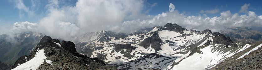 Panorama to the south-east over much of our route up Mt Kaçkar |
|
|
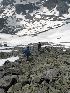
We were soon joined by the two Americans, but with the icy wind finding its way through our clothing, it was time to head back down. The route down was in some ways just as demanding – not energy sapping, but more adrenalin, as we picked our way back down the boulder screes and down the steep snow bowls, now much softer as the sun worked its magic. The fair Nello did a perfect 30m slide when she slipped off a snow traverse while I buried one leg up to the thigh in a section of very soft snow. |
|
 Descent o the upper boulder slope |
 The base of Kaçkar's summit |
|
Apart from that and wet feet from bootfulls of snow, the descent was uneventful. A leisurely lunch on the edge of frozen Deniz Gölü, a long zig-zagging descent from plateau to campground and we were back. Makşur had a pot of hot cay waiting, which in the absence of Efes was a good way to celebrate the climb. |
||
 |
 The frozen surface of Deniz Gölü in the afternoon light |
 |
|
 With Makşur - mule driver and chef extraordinaire |
|
 At last we arrive back at Dilberdüzü |
 |
|
|
| Descent from Dilberdüzü to Yaylalar (11 km, 10m ascent, 1010m descent) |
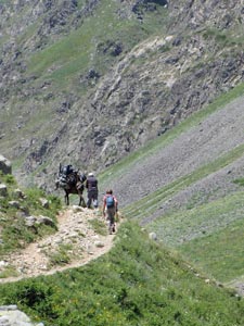
Despite the weather antics of the previous evening, the sun shone brightly again next morning. After packing up our campsite, we were off back down the track to Yaylalar, with Makşur and his loaded up mule in hot pursuit. We headed quickly down the long green-walled glacial valley, as cloud formed and dissipated on the peaks around.
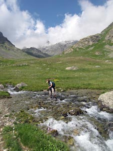
Makşur and the mule soon caught us, just in time to watch us get our boots full of water crossing a side stream, and soon raced ahead. A mule on the way home is hard to beat. However, it had its advantages, as Makşur stopped off at the çay shop in Olgunlar and a fresh brew was waiting for us when we arrived.
|
|
|
 |
|
 |
|
 |
 |
 |
 |
All too soon, the road dipped sharply and we were back in Yaylalar - time to have a hot shower before lunch, and a quiet afternoon washing and mending torn trousers etc. Tonight we would have a nice comfortable mattress and a chance for a good sleep, dreaming of our climb up Mt Kaçkar. Tomorrow, it would be time to leave the southern side of these mountains and cross the range to the north – another early morning rise, I fear. |
|||||
 |
 |
 |
 |
 |
 |


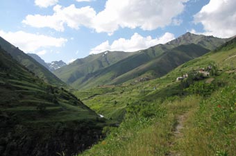
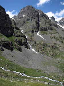
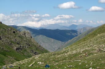
 Looking up a distant valley to Caymakçur Tepe