Walk 4 - Pouakai Circuit

Chased from Napier, where we had been relaxing after the Lake Waikaremoana walk, by torrential downpours, which left parts of the town in flood, we made a rain-drenched journey across the North Island to New Plymouth. This small city is the major centre of the Taranaki region, which juts out into the Tasman sea. The area is dominated in every way by Taranaki, a majestically isolated 2518m volcano and this was the reason we had come - to walk on and about it and experience its powerful presence.

However, Taranaki was cloaked beneath the clouds when we arrived and storms still rolled in across the Tasman - while we waited for good weather we explored the beautiful parks, curious black sand beaches, coastal walkways and the centre of New Plymouth, and whiled away time soaking in hot mineral baths.


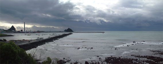
Storm clouds over Port Taranaki

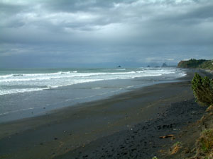
The black sand beaches of Taranaki


Taranaki (2518m) and the Pouakai Ranges

The clouds finally lifted revealing the mountain in a brilliant mantle of snow and ice - the next morning we drove up to the North Egmont Visitor's Centre to begin a 3-day walk on the Pouakai Circuit, a route which crossed the middle slopes of Taranaki, before crossing over to the Pouakai Range, remnants of an earlier volcano, and returning via Taranaki's lower slopes (see linked maps).


Day 1 (North Egmont to Holly Hut)
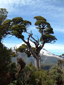

H
umphreys Castle points the way

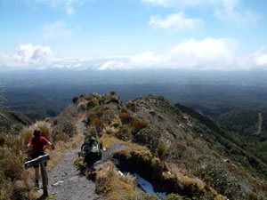
On The Razorback looking out over the plain


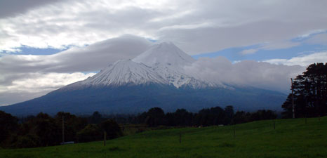
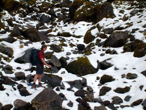
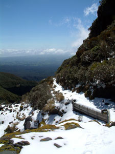
Snowy track on the north face
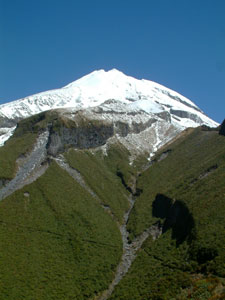
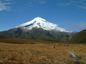
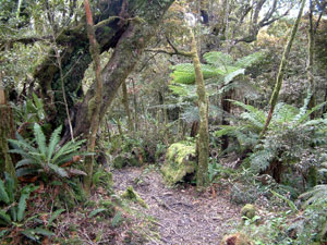
Leaving the North Egmont Visitor's Centre the track quickly climbed via series of steps through first, cloud forest, and then, sub-alpine scrub. High above the silhouette of Humphrey's Castle, a lava outcrop, pointed the way to the peak of Taranaki. Soon the steps ended and we found ourselves on a track that snaked along The Razorback ridge, leaving our foot prints in the melting remnants of the last snowfall.


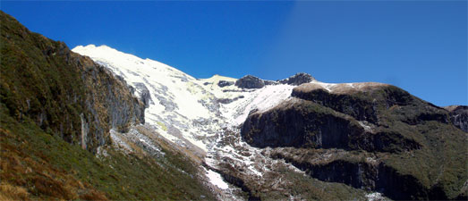
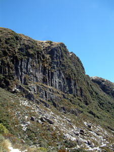
Dieffenbach cliffs - the crumbling end
of an old lava flow

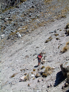
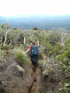
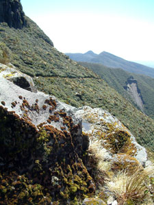
Turning westward, we began a slower climb along the snow covered track to our highest point (1310m) before crossing under the impressive 140m Dieffenbach cliffs, the glacier-like end of an old lava flow. Our passage across the north face of Taranaki continued on a slow descent, past a mini-cirque opening up views to the peak, and across the Boomerang Slip. a major landslide that made for an interesting passage.


Track under the Dieffenbach cliffs

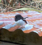
Can you spot the well-camouflaged wildlife?


An impressive cirque formed by lava cliffs
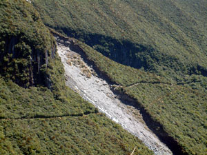
The Boomerang Slip


Looking back up to the Ambury Bluff


Holly Hut

A short steady climb brought us to the junction of the Kokawai Track and a superb view back on our route to date, before the track began a long steady descent down through a low dense leatherwood scrub dotted with taller mountain cedars. A cold wind sprang up and mist began to roll in from the west as we descended and, crossing a small boulder-lined stream, we were very pleased to see Holly Hut, with its solar-powered lighting, sheltered in a grove of moss-covered kamahi and scattered cabbage trees.


31m high Bells Falls and the
lava cliffs of The Dome


Crossing the Boomerang Slip


Mist over the leatherwood scrub

--------------

After a break, watching the mist come and go, we made a short pack-free side-trip, descending through a wind-whistling narrow valley to the Stoney River. The mist we were experiencing was due to cloud being sucked up from the coastal plain through this narrow gap. Reaching the river, we climbed back up through a moss-covered, fern-lined forest to a spot looking out over Bell's Falls. At 31m, this is the highest waterfall in the Park, but it is even more impressive set against a backdrop of the 160m high lava cliffs of The Dome. After a time spent contemplating the serenity of the falls and the mossy, boulder lined Stoney River, we climbed back up to Holly Hut to enjoy a pleasant pot-belly warmed night, alone in the heart of Taranaki.

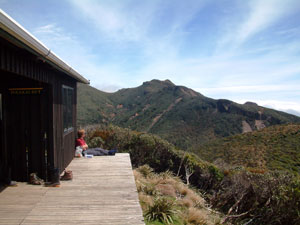
Day 2 (Holly Hut to Pouakai Hut)

Our alarm clock the next morning was a tom-tit tapping on the window. These small black and white birds seem to frequent the back country huts and their antics were a source of amusement. The heavy morning fog, however, was not very amusing. Nonetheless, as we faced a relatively short walk for the day, we lit up the pot-belly stove once more and waited in its warmth until the fog lifted and the sun could take over.

A short climb from the hut brought us to a crest overlooking the Ahukawakawa Swamp with the Pouakai Ranges, our destination, 300m higher behind them. Ahukawakawa is a unique habitat - a fragile sphagnum bog with numerous tarns, drained by the (not so) Stoney River, and home to many endemic species of flora in the region. A boardwalk down and across the swamp saw us to the other side with minimal disturbance.


Crossing the Ahukawakawa Swamp


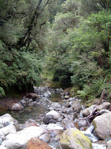
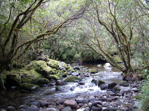
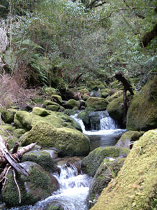
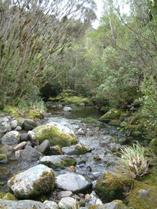
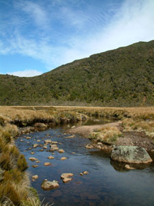
Stoney River draining the
Ahukawakawa Swamp


Old man cedar
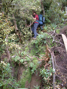
As soon as we had crossed the swamp, the 300m climb of the Pouakai range commenced in earnest, following a narrow razorback ridge, where landslides had further reduced the width to under a metre in places.

This was the most dangerous part of the walk, not because of the landslides, but because the views behind of Taranaki were so superb as we climbed the ridge, that the constant pull to turn around and admire them posed a serious risk of falling flat on your face in the muddy track.

Looking back at the perfect cone of the volcano framed in the wind-sculpted silhouettes of the mountain cedars reminded us of a Japanese rice paper painting.
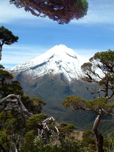
Homage to Fujiyama


Pouakai Hut in the heart of the Pouakai Ranges


Cloud bands above the New Plymouth plain

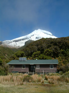
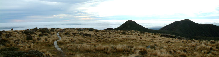
Despite this distraction, we made it unmuddied to the top of the range and following the ridge along eastward, soon found ourselves at Pouakai hut, overlooking the line of ranges as they circled the ancient crater to the east and looking out to a band of cloud above the flat green landscape of the Taranaki plain to the south.

We spent a pleasant, lazy afternoon watching clouds drift over the mountain passes, break up and reform, and meeting other trampers as they arrived at the hut to stay or just to rest a while.


Lights of New Plymouth


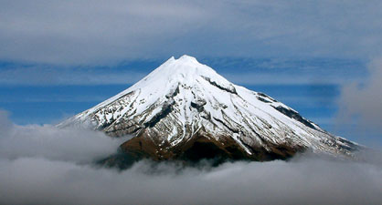
A mountain floating on clouds - yeah, right!!
(with apologies to Tui)

One of the pleasures of walking is the passing company of kindred spirits - that night we enjoyed the company of Corey from Canada and kiwis, Glenys and Vicki, learning a lot about different tramps in New Zealand. Below us the clouds lifted, revealing the lights of New Plymouth stretched out like a string of jewels along the Taranaki coastline. It had been another rewarding day.

Day 3 (Pouakai Hut to North Egmont)


Tussock grasslands of the Pouakai range above a sea of cloud - Maude and Henry Peaks (ca. 1200m) on the right

This time, the morning weather had a slightly more ominous appearance - high cloud was drifting in from the west and it seemed that a change was imminent. It was time for any early start to our walk back to North Egmont. Back on the Pouakai Ridge we descended gently along a boardwalk through boggy tussock grasslands and past two small tarns, before sweeping arond the edge of Maude Peak to the daunting foot of Henry Peak. There ca. 700 wooden steps led up the steep 130m pinch to the peak, a tribute to the DOC staff who installed them as part of the track improvement program. From the viewing platform on the peak we could see from the Taranaki coastline to the west to distant Ruapehu, rising above the clouds 120 km to the east, barely visible as a whiter shade of pale than the dense cloud band below it and the thin high level clouds above.


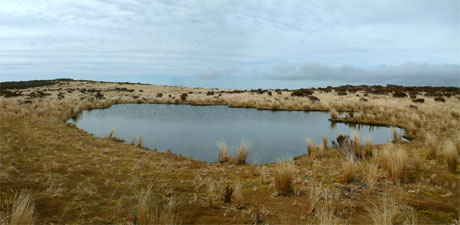
A peaceful tarn amid the tussock and sphagnum


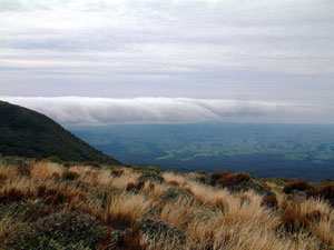
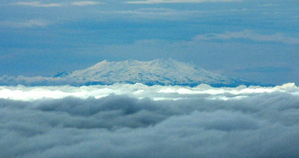
A whiter shade of pale - Ruapehu above the clouds 120 km to the east

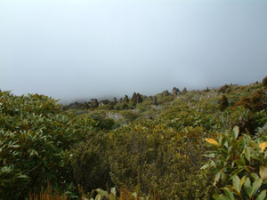
Views from Henry Peak
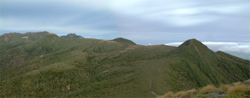


The Pouakai Range


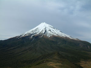
The north face of Taranaki

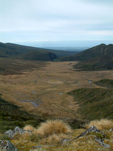
Looking east over the Ahukawakawa Swamp


The "track" from Henry Peak


Some of the many streams .......


The climb up Henry Peak is the Rolls Royce of the circuit track. The climb down the other side made us appreciate this even more - we were on the notorious Kaiauai Track (not many words with 6 vowels in a row, I bet!). Descending 460m in only 1.3 km, the first 60m lures you into a false sense of security as the wooden steps continue - then they end and, for 400m descent, the track becomes a rutted, twisted muddy erosion gully, at times more than waste deep and ony one footwidth wide at the base as it plunges through the dense leatherwood scrub, then the moss- and fern-covered twisted tree trunks of the "goblin" forest zone, and finally into taller fern-filled cloud forest of kamahi and totara. Piles of timber at different places and some very short sections of boards suggest that you may have to hurry to have this quintessential New Zealand tramping experience before the track is terminally improved.

Eventually the route levelled out to a much slower descent, before dropping sharply once again into the Kaiauai Gorge, where we finally found a dry spot to drop our packs for a rest at the shelter near the river crossing. Dry is definitely at a premium on the Kaiauai Track.

After boulder-hopping across the river, we began a traverse across the lower slopes of Taranaki - a path that looked relatively flat, but this is a volcano. Water has to flow somewhere and the slopes resemble a fan of spreading creases as numerous streams, creeks and rivers rush almost vertically down off the mountain. Our traverse crossed several of these, climbing in and out of steep gulleys via ladders or muddy eroded footholds - the fern-lined, boulder strewn bubbling streams, cascades and occasional waterfalls that we passed were beautiful, but the experience was hard-earned on this track.


Descending the Kaiauai Track


...... flowing off the volcanic cone

Finally a swing bridge across the Waiwhakaiwo River marked the end of this traverse and the beginning of a long climb up the Ram Track along a densely forested lava spur, followed by another short series of steeply undulating stream crossings, just when you thought that the walk was over. Rain started to fall as we climbed the spur, but few drops reached us under the forest canopy. Finally we saw the welcome sight of the Camphouse and the North Egmont Visitors Centre. As we reported in, the skies opened up - we had just made it, for Taranaki was about to demonstrate another side of its character and, in the next 24 hours, we would see more rain fall than our poor old drought-stricken home town in Oz had received in the past 6 months.

R & R at Dawson Falls


Front row seats for the show of the year

On finishing the walk, we drove around to the eastern side of the mountain and spent 2 relaxing days as sole occupants of Konini Lodge, a slightly more upmarket hut (i.e. electricity, heating, refrigerator etc) within the NZ hut system. Installed in our armchairs in front of a large window framing the eastern face of Taranaki with its smaller siamese twin, Fantham's Peak, we were treated to a spectacle of the changing moods of the mountain, from sheets of rain (200mm in 24 hours) to games of peekaboo, as clouds variously covered or uncovered the mountain, and a brilliant sunset as a finale. The rain was not a surprise (the annual fall here is 6-7,000 mm) - the fact that we enjoyed the rain for the first time in New Zealand was!


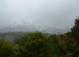
Watching the rainstorms


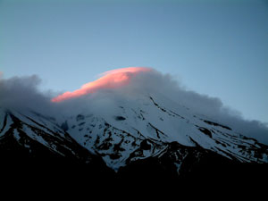
Sunset on the mantle of cloud

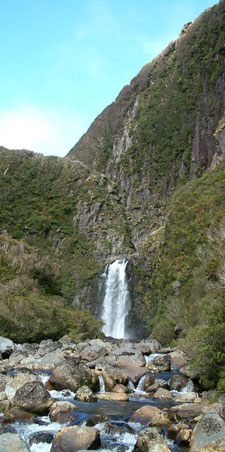
"Goblin" forest near Dawson Falls


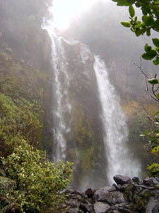
A misty Dawson Falls

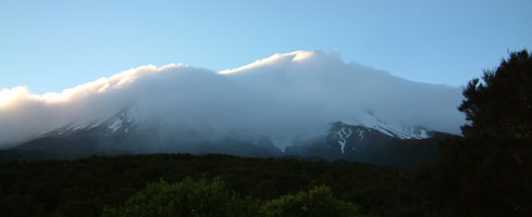
Taranaki wears its white mantle - cloud spilling over from the western side


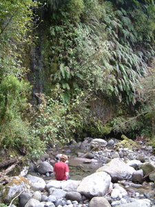
When the weather lifted we did a couple of "warm-down" short walks in the misty rain-soaked forest. To celebrate our walk, we treated ourselves to a night out at the Dawson Falls Lodge - garlic and cheese mussels, an enormous minted lamb shank and roast vegetables. home made pavlova, with a fine local riesling and cabernet merlot - delicious! Trampers do not always subsist on a diet of dehydrated vegetables, muesli and pasta.