| Walk 7 - Cape Reinga Coastal Walkway |
|
|
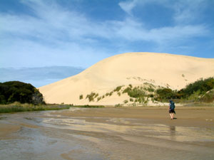
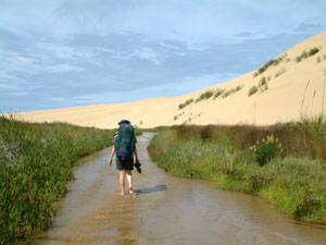
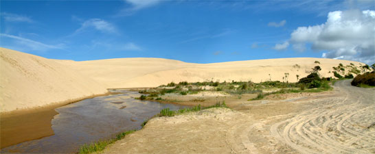
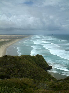
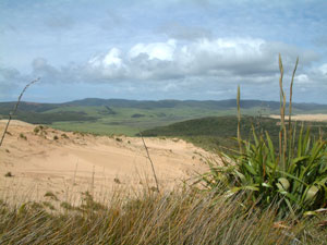
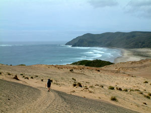
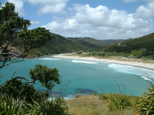
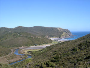
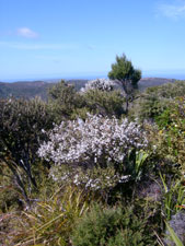
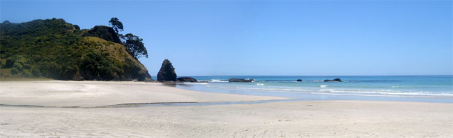
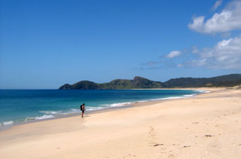
Day 1 - Te Paki Stream to Te Werahi Beach We had seen the large dune systems in the distance as we drove up to Waitiki Landing and were looking forward to seeing them more closely, so although the Walkway officially started at the mouth of the Te Paki Stream, we asked to be dropped off higher up where the the shallow fresh waters of Te Paki first met the massive complex of shifting golden sand, and flowed gently for 3km between 60-70m dunes to reach the Tasman Sea at the 90 Mile Beach. The soft sand bed of the stream, known to swallow cars if they stayed still too long in one spot, was our pathway to the sea and we took off our sandals and waded barefoot down the ankle-deep water in high spirits. |
 Start of the walk at the Te Paki dunes |
|
|
|
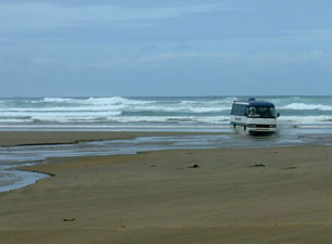
Near the stream mouth, we made our solitary encounter with commercial mass tourism, as a number of buses and four-wheel drive vehicles splashed past us - many individuals and several busloads of tourists each day make day trips along the hard sand of the 90 Mile Beach from the south before turning in at Te Paki Stream to rejoin the road and visit Cape Reinga and its lighthouse. Happily, when we reached the stream mouth we turned north along the wide hard sand of the beach, away from buses, cars and civilisation into the splendid isolation of this coastline, the roar of the breakers to our left and the massive silence of the dunes to our right and the seabirds for company.
|
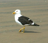 The imperious Pacific gull |
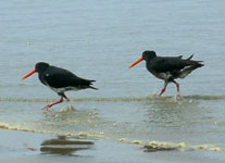 Oyster catchers on the run |
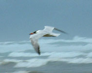 Blackcapped tern in flight |
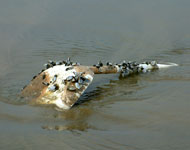 Plastic spade with pipis - now what journey has that made? |
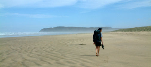
 View south along the 90 Mile Beach |
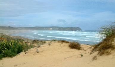
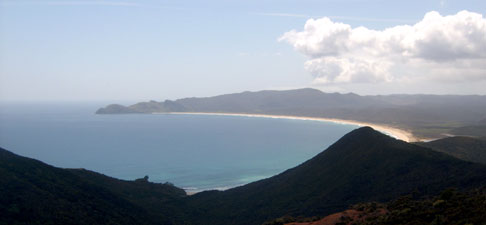
After a few kilometres we reached the northern end of 90 Mile Beach and, after a short break, climbed up on to Scott Point, where a tremendous view south of this incredibly long stretch of beach disappearing into the sea haze awaited us. For another few kilometres the track meandered across the manuka heathland holding a shallow layer of soil to the sandstone ridge of the point. |
|
 Scott Point |
 Track through the manuka heath |
|
 |
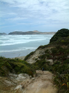
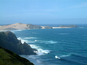
At the northern end of the ridge, the view opened up over Twilight Beach showing our path over Cape Maria van Diemen, New Zealand's most westerly point. We descended onto the beach for a bite of lunch in the warm sun, before resuming our trek north across the deep soft sand of Twilight Beach. We hadn't reached halfway before we received a lesson in the vagaries of New Zealand's weather; the sun suddenly vanished as a dark cloud band moved in from the south-west. A small front was rapidly approaching - fortunately for us it past us by as quickly as it came and, after several minutes sheltering in a grove of Pohutukawa trees from the few drops of rain, we were able to press on. By the time we reached the end of the beach, the sun had returned. |
 |
 Descending on to Twilight Beach |
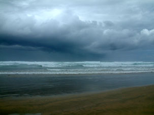 A rain front passed rapidly over Twilight Beach ... |
 ... but had gone by the time we reached the northern end |
|
||
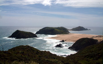 Silhouettes of Cape Maria van Diemen and Motopao Island |
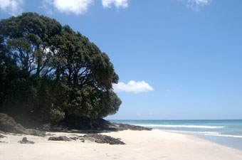
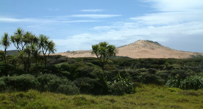
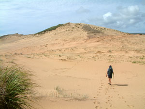
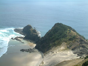
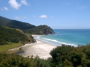
On the seaward side the stark cliffs of the cape and Motuopao Island stood out against the cobalt blue of the sea, while inland the green of cattle-grazed kikuyu pastures contrasted to the pale yellow of the dunes. Ahead lay the imposing sandy outline of Herati Hill. We left the heath and followed the vague track across sand, clay pans and stony outcrops, up and around the hill, before descending down again to Te Werahi Beach. |
 Views toward the grazing lands of the interior |
|
 Cabbage trees in the manuka heathland |
 Crossing Herati Hill |
 Descending to Te Werahi Beach with Cape Reinga in the distance |
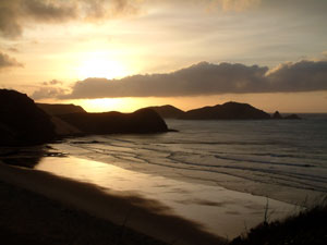 Sunset over Cape Maria van Diemen |
  |
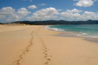
It was still and sunny when we set off in the early morning light, each lost in our own contemplations as we wandered up the deserted sands of Te Werahi Beach, the distant silhouette of Cape Reinga growing ever larger in front, the long drawn out form of Cape Maria van Diemen shrinking into the sea haze behind. |
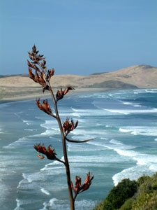 Flax flower spike over Te Werahi beach |
||
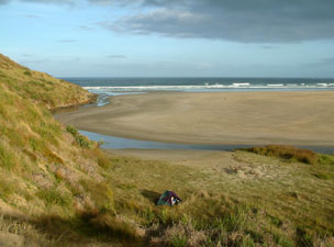 Bush camp at Te Werahi Stream |
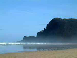 Silhouette of Tarawamaomao Point |
||
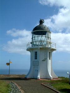 Cape Reinga lighthouse |
After an hour we reached the end of the beach and climbed slowly up through the flowering flax plants along the cliff edge that led to the Cape Reinga parking area. Dropping our packs, we walked down the path to make the obligatory "been-there done-that" visit to the lighthouse, for all purposes other than geographic, the most northerly point in New Zealand. Out to sea the waves surged and eddied, as the currents of the Tasman Sea and Pacific Ocean met. |
|
 Cape Reinga |
 Looking back to Cape Maria van Diemen |
|
 Cliffline east of Cape Reinga |
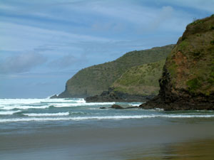
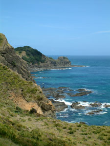
Leaving the cape behind, we turned east along a rugged coastline that had once been farmed. The path descended down a mown kikuyu track, through regenerating bush of manuka, flax and cabbage trees. As we descended a narrow ridge toward the beautiful inlet of Sandy Bay, the deep blue of the Pacific provided a brilliant backdrop to the green-clad cliffs leading away from the cape. A final sharp rocky descent saw us on the beach, where we stopped for a bite to eat and a rest in the shade of an old Pohutukawa tree.
|
 Descending down to Sandy Beach |
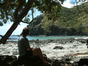 Under the shade of the Pohutukawa |
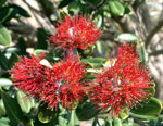
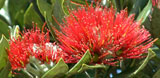
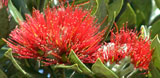
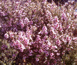
These superb trees, jutting out of rocky outcrops all along this coastline with their gnarled, spreading branches, dark green foliage and downy white buds, have become my favourite New Zealand tree; in a few weeks time they will be a blaze of crimson flowers, but for the moment, the prolific cover of swelling buds and odd precocious bloom tantalised us with the imagination of what this would be like. |
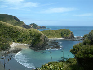 Sandy Bay |
 |
 View over Tapotupotu Bay and inlet |
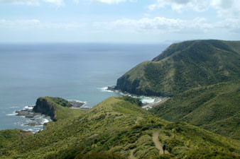
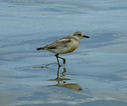
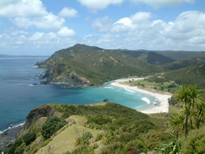
A pair of Paradise ducks scolded us for invading the privacy of their beach, while a pair of dotterels hearded their solitary chick away from the spot that we occupied. We left them to the seclusion of their small bit of paradise and commenced our third and last steep climb for the day up the opposite slope, before the track flattened out across the flax-covered ridge. Soon, the white sand horseshoe-shaped beach of Tapotupotu Bay appeared beneath us: its regular, perfectly shaped 1m waves attracting a small group of surfers into the cold water. This bay is accessible by a gravel road and has a well-serviced campground, where we set ourselves up for the night. |
 Tapotupotu Bay |
|
||
  |
Day 3 - Tapotupotu Bay to Spirits Bay
|
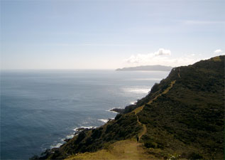
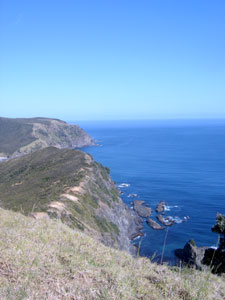 Pacific cliff-line |
|
 The Tapotupotu Estuary |
 Climbing up to Darkie's Ridge |
|
 View inland from Darkie's Ridge |
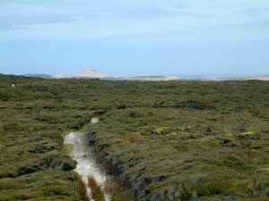
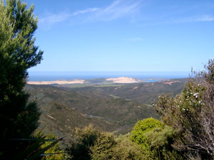
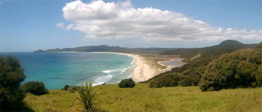
Inland, the views from the ridge opened out over the bush-clad hills to the distant sand dunes that we had crossed two days earlier, while towards the coast, the long white strip of curving sand defined our intended path along Spirits Bay. |
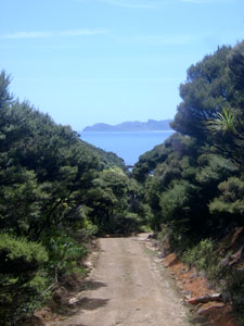
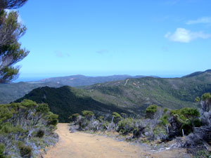 Old farm track along the ridge |
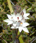
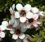
 ... ... The delicate beauty of manuka blossoms |
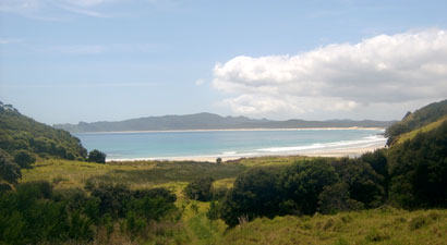
 Looking east over Spirits Bay |
 Road to Pandora |
 |
 Pandora Beach |
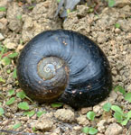 Shell of the giant predatory kauri snail |
|
|||
 |
 The beautiful white sands of Pandora |
|
|
Low tide in the morning means high tide in the afternoon, and our beach route out of Pandora was blocked, meaning a slighty tiresome walk up and over the gorse-infested headland to its east. Coming back down to the beach at Waitohoro Inlet, we fould ourselves at the last stage of our journey; a 7 kilometre walk along a hot exposed track just behind the sand dunes of Spirits Bay and following the shoreline of the Waitohoro Lagoon. |
 One last look back at Pandora |
|
 Spirits Bay and Waitohoro Lagoon |
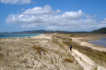 Track at the back of the dunes |
 Alone again in Spirits Bay |
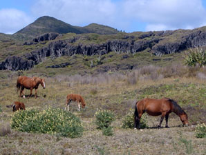 Wild horses of Te Paki |
Another couple of kilometres and we found ourselves at Spirits Bay campground, our pick up point. After the long sun-drenched walk from Pandora, and with an hour to spare, it was good to lie down in the shade, relax and reflect upon the great coastal landscapes through which we had passed. Yes, you guessed, it was under the shade of a Pohutukawa tree. |
|
 The lagoon at Spirits Bay camp ground |
|