| Walk 8 - Queen Charlotte Track |
|
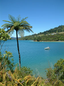
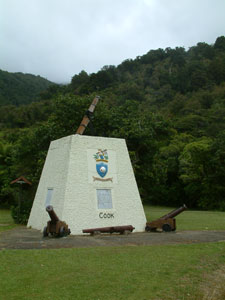 Start of the track - Cook Monument at Ship's Cove |
|
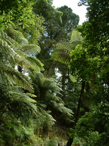
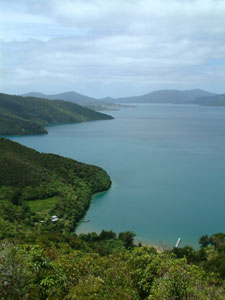
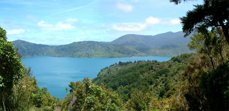
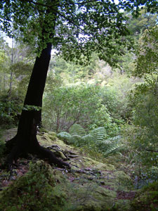
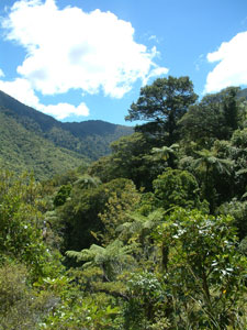
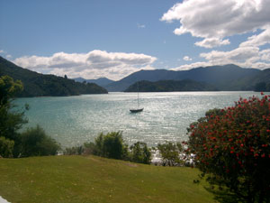
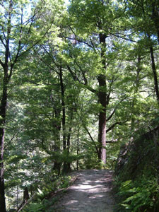
The morning cloud was just begining to break up as we disembarked from the water taxi at Ship Cove. This point has historic significance as Captain Cook anchored there five times on his various voyages of discovery in the late 18th century. A monument to this event marked the official start of the walk for us. Almost immediately, the broad, well-formed track began a moderate climb up through a dense broadleaf-podocarp forest with an understory dominated by black and silver tree-ferns. Several kahikatea, New Zealand's tallest (if not largest) tree species towered above the forest canopy at different spots, but as we moved higher and away from the coast beech trees became increasingly common. |
About 20 walkers and a mountain-biker had set out from the wharf, but the Queen Charlotte Track soon spread us out and swallowed us up, so that all could walk in whatever level of isolation or company they chose. |
|
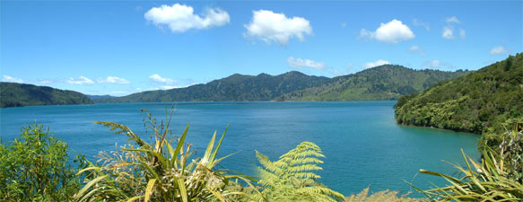
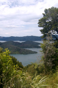
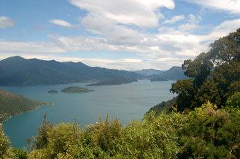
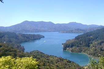
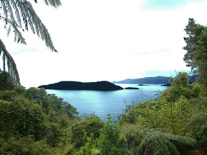 Morning cloud over Queen Charlotte Sound |
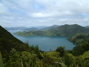 View over Resolution Bay from the saddle |
|
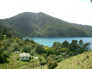
 You are now entering private land |
A little later a sign advertising coffee and muffins signalled the presence of private enterprise at work as well. It was too hard to resist and, sitting at a table in a lovely garden setting, overlooking the jetty and clear deep waters of Resolution Bay sipping our freshly-brewed coffee with boysenberry muffin, we realised that this walk was going to be a little different. |
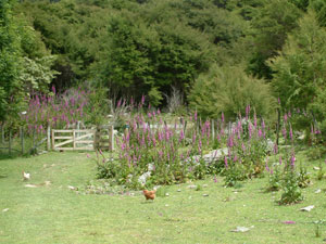
 A bit of kiwi paradise |
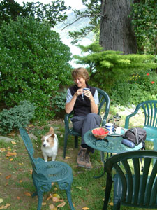 Coffee and muffins with one of the locals |
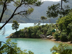
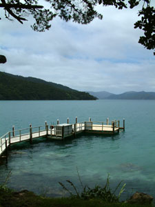 Resolution Bay jetty |
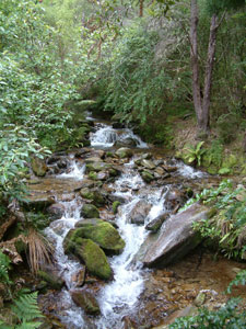 A small cascade on the track |
 Last glimpse back over Resolution Bay |
 Resolution to Endeavour saddle  Adult weka |
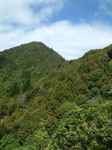
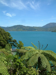
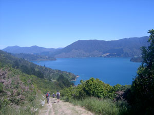
Pulling ourselves away, we commenced a long, but gentle climb up the shady forested slopes of the hilly spine. Every so often, a gap in the vegetation would reveal a wonderful view looking down over the indented shoreline and islands to the deep blue waters of Queen Charlotte Sound. Rounding a corner, a soft peeping sound and muted boom alerted us to something moving in the forest. Suddenly a pair of wekas and their chick crossed the path ahead of us, unperturbed by our presence. We were privileged to see 6 of these curious birds before the day was out - they appear to be thriving in the Marlborough Sounds despite being generally endangered due to the ravages of introduced predators, such as the stoat. |
 Beech forest 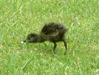 Weka chick |
 First glimpse of Endeavour Inlet from the saddle |
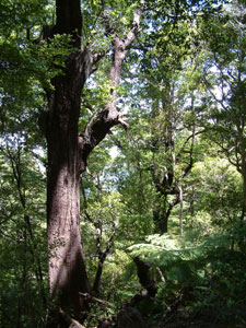
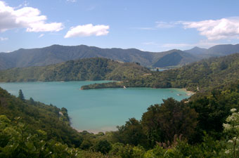
Without realising it, we had climbed 200m and, after taking in the sweeping views over Endeavour Inlet from the ridge, commenced an equally gentle descent through superb temperate rain forest to the "The Pines", a small settlement of houses on the inlet shore, and our accommodation for the night at "Cnoc na lear" backpackers; our backpacks, a warm welcome and even warmer muffins awaited us. |
 Endeavour Inlet |
|
 Boatshed at The Pines |
 G & T on the verandah of Furneaux Lodge, perhaps? |
|
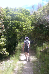
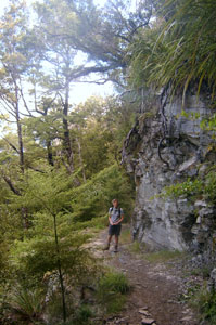
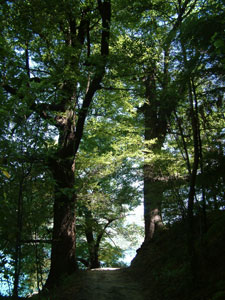
 In the forest behind Furneaux |
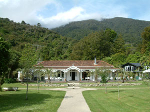
After a late lunch in the sunshine, we completed the day with a short side trip through some more magnificent rain forest to a small, but pretty waterfall upstream from nearby Furneaux Lodge - the forest silent apart from the occasional melodious call of a bellbird. With the old-world charm of its white weatherboard exterior and manicured lawn and gardens leading down to the sea, a well-earned beer on the verandah of the lodge was the ideal place to finish our day. This walk was definitely different! |
 Tree-fern alley |
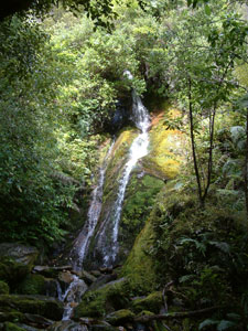 Rain forest waterfall |
Day 2: The easy stroll - The Pines to Punga Cove
|
 Inauspicious start to the day |
|
 A group of locals relaxing on Endeavour Inlet flats |
 The forest at Big Bay |
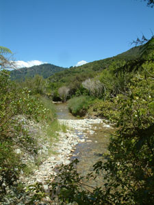 Rocky stream flowing into Big Bay |
 The green-clad slopes of the Sound |
 Camp Cove |
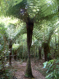
Eventually we turned north-west into calmer protected Big Bay, following the track through a dense mixed forest on the steep slope of the ridge. The sun rarely reached the track here and the track rarely dried, so the soft muddy squish of our boots was added to the sounds of the day. With the dark canopy overhead, looking down through the tree-ferns, trunks and foliage towards the lake at the turqoise water gave the illusion that the sky was beneath us. Above the shade, the forest canopy was a rich mosaic of different textures and shades of green, as patches of broadleafs, podocarps and tree-ferns competed for space and light. One final major change of direction brought us back again on to a southerly bearing and a final stroll along the far shore of Big Bay to Camp Cove and our rest stop for the night at Punga Cove Resort (backpackers section!) - time for a late lunch, beer on the sunny resort lawns in the lee of the wind and a chance to read and relax in preparation for the much harder day that faced us next morning. |
|
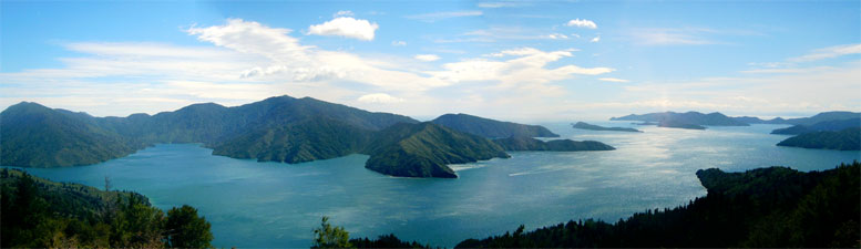
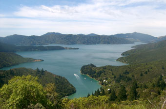
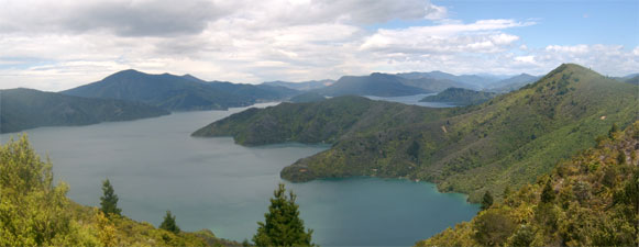
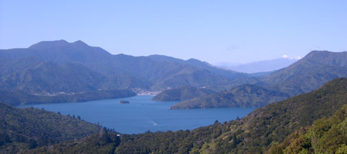
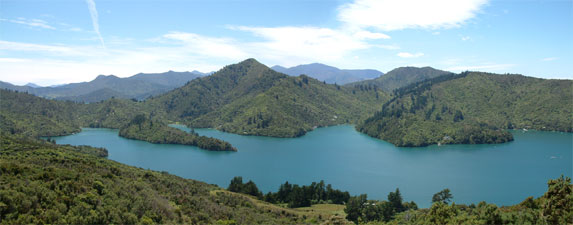
 Endeavour Inlet Panorama |
Day 3: The long haul - Punga Cove to Portage
|
|
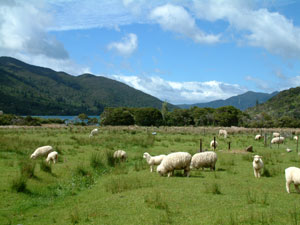
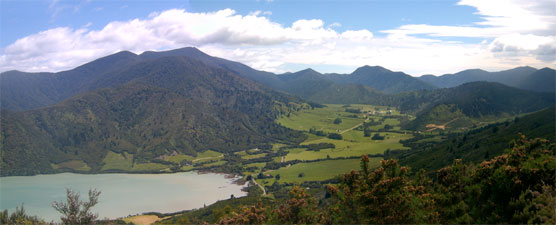 Farmland at the northern end of Kenepuru Sound |
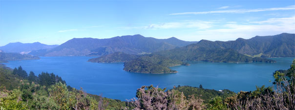
 The Bay of Many Coves |
|
 Blackwood Bay |
|
 Walking the no-wind tunnel |
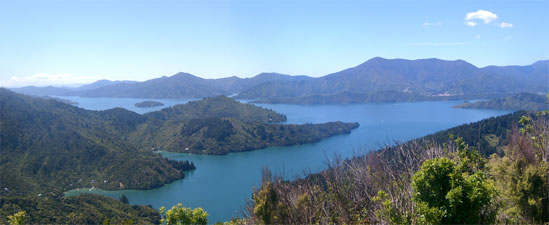
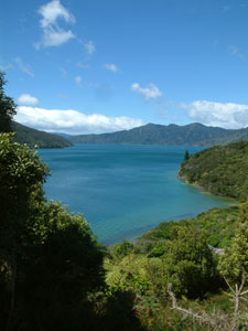
 View over Kumutoto Bay toward Picton |
|
 Just one more stunning view |
 Looking down the Sound to Picton |
 Schist outcrop on the descent to Torea Saddle |
Climbing one last time along a track lined with tall dense wind-resistant shrubs, we reached our final crest for the day above Kaipakirikiri Bay. There remained but a long steady descent through cool beech forest, across a steep schist-outcropped slope to the Torea Saddle, a narrow 90 m high neck of land over which the Maori dragged their canoes from Torea Bay to Portage Bay, thereby avoiding a 200 km paddle. |
From here, we followed the bitumen road down to the little village of Portage sleeping serenely in its sun-drenched bay, where a nice cold pint of DB awaited at the Portage Pub to reward our efforts for the past 23 km. The fish and chips from the Portage Shop tasted extra good that night, as we ate them on the deck of our comfortable backpackers, watching the sun set golden over the Kenepuru Inlet. |
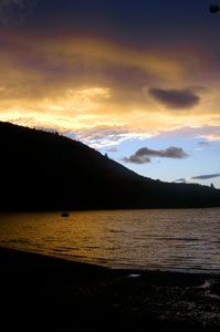 Sunset over Portage Bay |
|
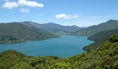
 View over Portage Bay from Torea Saddle |
 Kenepuru afternoon (from the beer garden) |
|
Day 4: The home stretch - Portage to Anakiwa
|
 Overlooking Picton and the snow-capped Kaikouras from high on the Torea Saddle |
 Steve, Ed and Nello descending the broad QC track |
 Kenepuru Sound |
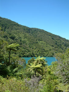
 Lochmara Bay |
|
Descending from the lookout, we followed the track around the base of the hill, before another steep descent brought us to Te Mahia Saddle, another narrow neck in this long sea-bound ridge-line, which separated Mistletoe and Te Mahia Bays. From the saddle, the track turned south, and climbed gently past gorse-invaded scrubby vegetation and farmland, where cattle grazed peacefully high above Onahau Bay. After a few kilometres the track again turned back to its westerly direction. A rocky ledge provided one more panoramic view down the length of the Grove Arm of the Sound towards our final destination of Anakiwa, then plunged into the cool, beech forest that lines the south-facing slopes in this area. |
 Waterfall, Mistletoe and Onahau Bays with Hilltop Lookout in the background |
 Forest track |
|
 In the cool dark beech forest |
|
|
 |