| Whanganui River Journey 'Great Walk' |
|
|
|
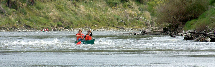
We opted to do a three-day trip from Whakahoro to Pipiriki, down a section of river that passes through the wilderness of Whanganui National Park. The canoe rental people picked us up from the backpackers at National Park and, after a winding hour-long drive through the steep hills and valleys, we found ourselves at our starting point near Wades Landing, Whakahoro, where a large open Canadian canoe awaited us. Our gear loaded up in six water-tight drums lashed to our canoe, we set off from the banks of the Retaruke Stream, swiftly moving along with the current to swing a sharp left hand turn into the Whanganui - our journey was underway. |
|
|
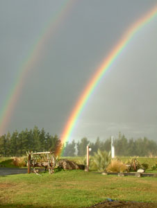
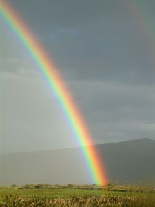
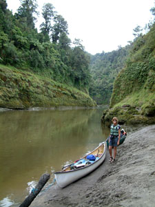
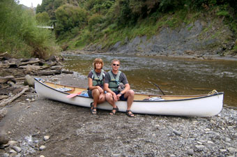 Ready to hit the river |
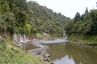
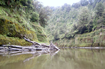
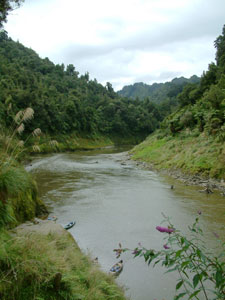
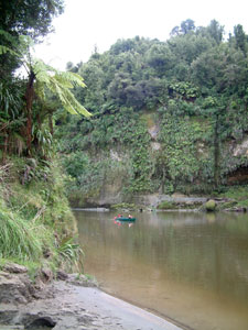
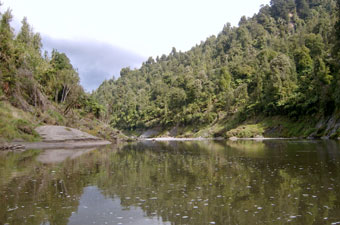 First glimpse of the Whanganui |
|
|
 Still water entering a small rapid |
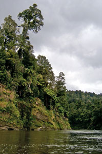 Tall rimu on the river's edge |
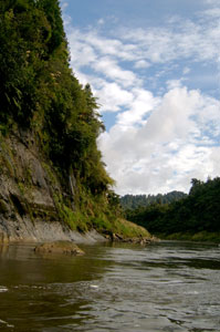
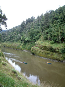
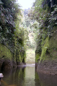
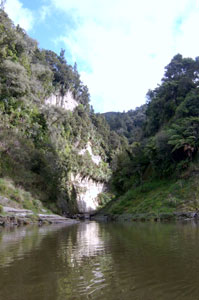
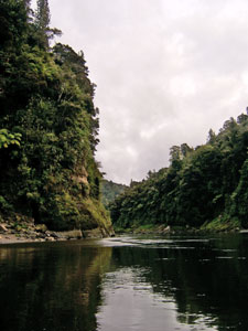
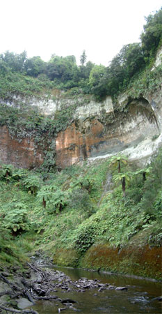
Very quickly we found ourselves in the green-clad Whanganui Gorge, alternating between small rapids and long reaches of still water. This was to be the pattern for most of the trip, as we glided down the river under the steep papa (mudstone) walls of the gorge, topped with tree-ferns, nikau palms, beech and tall podocarps, their branches laden with epiphytes. All morning we had alternated between sun and cloud until finally the weather did what the river couldn't - drenched us! However, once the rain cleared, we dried out quickly and the remainder of our trip was under fine, if mostly cloudy skies.
|
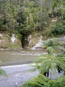
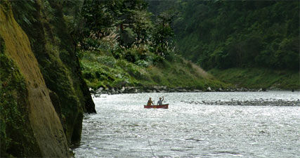
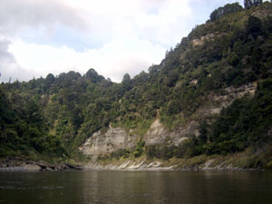
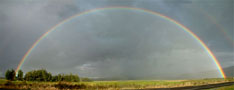
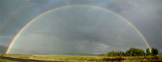
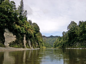 >>>>> >>>>>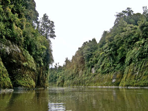 Two views of the Whanganui Gorge and the dense forest along its banks near Man O'War Bluff |
|
|||
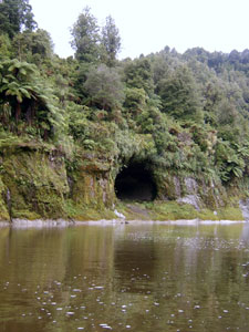 Tamatea's Cave |
 Small rapids in front of the Ohauora Stream entrance |
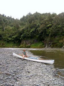 Rest stop on a shingle bank |
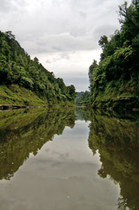 Reflections in the still waters of Otaihanga Reach |
|
Day 2: John Coull Hut to Tieke Kainga Leaving John Coull Hut, we continued on down the Whanganui Gorge, passing the broad opening of first the Tangarakau and then the Whangamoama Rivers. Below these confluences, the river edges were lined in places with snag banks, where large trees that had been washed out of the two side rivers during floods were trapped in tangled heaps by the eddies of the Whanganui. The campsite at Mangawaiiti perched high above the river on a grassy flat at the edge of the papa cliffs was a good spot to stop for a break and watch other canoeists drift by below us. |
|
|
 Snag banks lining the edge of the gorge |
|
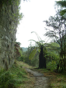
Pushing on, we soon arrived at Mangapurua Landing where we tied up for lunch and a chance to stretch our legs with a 5km sidetrip up the Mangapurua Gorge to see a monument to failed dreams; "The Bridge to Nowhere". After the First World War, soldier settlers had been given land in the Mangapurua Valley to "develop" into farms. For many years they struggled in the steep unforgiving terrain with the river their only point of access. A strong concrete bridge was finally built in 1935 giving road access to the valley, but it was too late; many had already abandoned their holdings and a few years later the government bought out the remaining farms and closed off the valley. Nature reclaimed the Mangapurua, leaving the bridge isolated in the middle of the wilderness as a stark reminder that mankind does not always win when he chooses to butt heads with nature. |
|
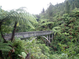 The Bridge to Nowhere |
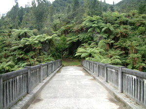 Yes ... it really goes nowhere |
|
 Time for a break on a rare sandy beach |
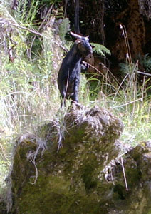 King Billy - one of many feral goats that live on the steep river edge |
 View downstream from Mangapurua Landing |
Back on the river again, we found ourselves gliding down a long steep-walled reach. The river is a strangely quiet place; the soft stone-rumble of the rapids periodically punctuating the silence of the reaches, and the occasional song of a forest bird or bleat of a feral goat on the cliffs above us, a reminder that other creatures call this place home. It was easy to let the mind drift as we watched the strange patterns of the eddies and uprising columns of water in the river. You can imagine the rhythmic chants of the Maori warriors as they paddled their wakas from one village to the next, or the amazement of the boater- and bonnet-hatted Victorian tourists lining the decks of a paddle steamer pushing upstream through the exotic and feerique landscape of this green-clad gorge. |
 |
|
||
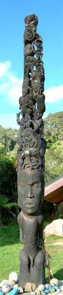
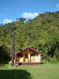 The Marae at Tieke Kainga |
 >> >> Sole residents of Tieke Marae |
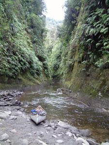
 Whanganui cliffs |
|
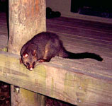
 At night you never know who is watching you |
|||
Day 3: Tieke Kainga to Pipiriki
|
|||
 Te Wahi Pari (The Place of Cliffs) |
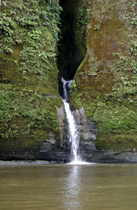 Waterfall emerging from its cleft in the cliffs |
 Bend near Kahura Landing |
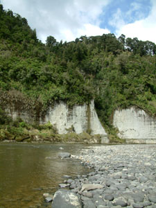 Shingle bank and mudstone cliffs at Ngaporo campsite |
 Sunlight reflecting on rough water near Ngaporo |
The reach ended at the confluence of the Manganuioteao river and not long after we heard the sound of Ngaporo, the first of the three big rapids on the river. Soon the current was drawing us into the V of the rapid that led us into a long plume of standing waves and before we knew it, it had spat us we out the other side, none the worse for wear than a couple of buckets worth of water to bail out from the wash of the waves. The nagging fear that we might capsize at least once before the trip was over began to evaporate with Ngaporo behind us. |
 Last part of the Gorge |
|
 Mangaio Amphitheatre |
||
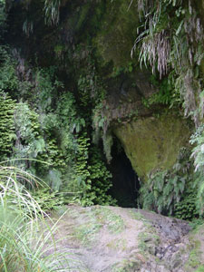 Puraroto Cave |
 Fern-covered cliffs near Puraroto |
 In the ravine of Mangaio Stream |
|
Only Paparoa, the longest rapid of all lay between, but our 3 days of practice had put us in good stead and riding its long, narrow band of waves through in style was a perfect way to finish our Whanganui River journey. |
 Ninety-second and last rapid before home |
|
  |