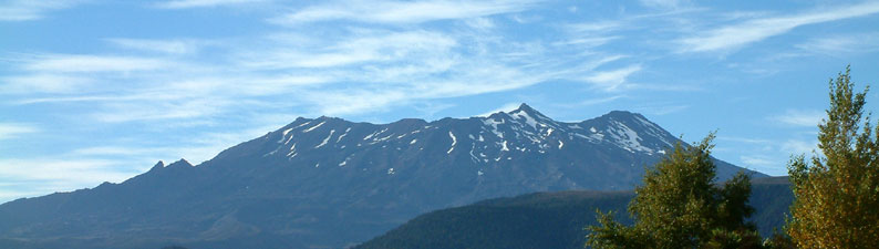
Walk 26 - Ruapehu Crater Walk


Seize the moment and the rewards will come. We hadn't planned to climb Ruapehu - the Whanganui River Journey was to have been our last adventure - but waking up and looking out the window of our backpackers hostel in National Park, it was there. Ever since we had arrived, Ruapehu had been covered in cloud and now it stood majestically in the morning sunlight. At 2797m, Ruapehu is the highest mountain in the North Island and an active volcano to boot, having last erupted in spectacular fashion only 10 years earlier. It was not a hard decision, we booked another night and headed off to climb the mountain.


The lure of Ruapehu (2797m)


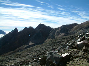
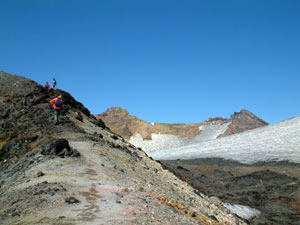
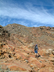
Starting the scramble up Ruapehu

Ruapehu is an easy climb if you take the chairlift of Whakapapa ski field to the 2000m top station. The one drawback is that a ski field is not a pretty sight in summer, with infrastructure scattered on the slopes, particularly on such rocky slopes where cables and pipes cannot be buried. However, the visual impact of ski field was quickly left behind as the station disappeared behind the first lava ridge and the first spectacular views began to appear as we began a relatively easy 650m scramble up a jumble of lava boulders and scree.


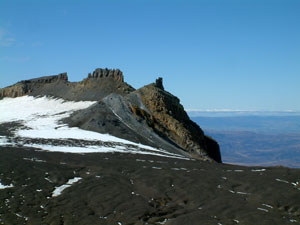
Silhouette of The Pinnacles

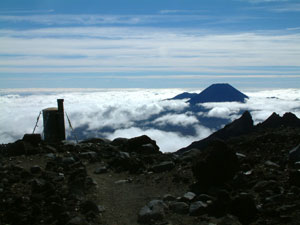
Another in the "loo with a view" series


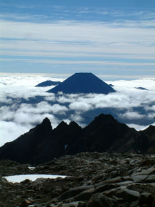
The cone of Ngaurahoe rising behind
The Pinnacles

Not long into the walk, the majestic cone of Ngaurahoe began to appear from behind the jagged ridge of The Pinnacles, a band of cloud swirling in slowly from the north-west around its base. As we climbed, the views opened up over the broad plain to the west, or more exactly to where they would have been if not covered by a billowing sea of white cloud.


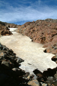
Remnant snow drift in an
old lava gulley

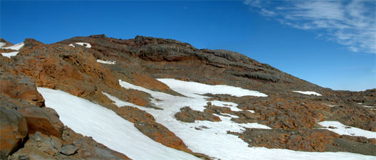
Orange, grey and white; colours of the upper slopes of Ruapehu
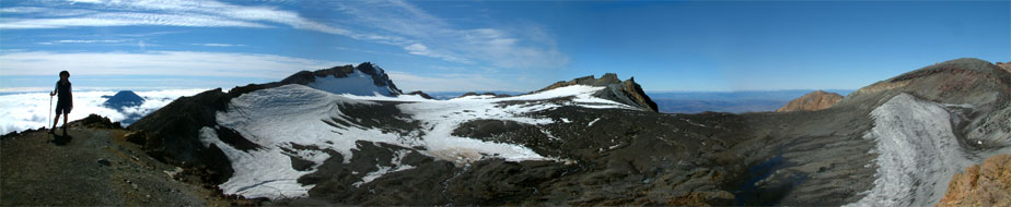
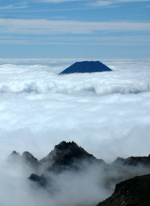
It was becoming clear that a band of cloud was moving in and slowly rising. We climbed steadily up the orange and grey rocks of the oddly named Restful Ridge towards Paratetaitonga, one of several peaks on the hugecrater rim. Behind the long northern spur of Paratetaitonga, the distant cone of Taranaki rose above the cloud bank in splendid isolation. By the time that we reached the final climb up the loose scree slope of the crater rim, the clouds had reached the base of Ruapehu.

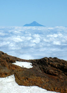
Taranaki floating on a sea of cloud


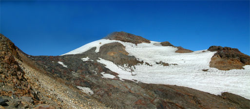
Near the rim - dark fresh flow from the 1995 eruption below Paratetaitonga

Cresting the rim, we forgot about them immediately as we were greeted by the glorious panorama of the summit plateau of Ruapehu; a broad black gravel and ice filled bowl, rimmed by the dark silhouettes of the other crater high points - Glacier Knob, Tukino Peak, Te Heu Heu and Cathedral Rocks. to the southeast, the rounded form of Dome Ridge hid the main peaks of Ruapehu. We headed along the razorback crater rim toward it and Dome Shelter, at 2660m the highest point of the walk.


Panorama of landmarks around the rim of the summit plateau of Ruapehu; The Fair Nello, Te Heu Heu, Cathedral Peak and Dome Ridge

Views extended across the breadth of the North Island; as far west as Taranaki, standing above the bank of cloud 130 km away, and 120 km across a cloudless sky to the mountains of the east coast and the Pacific Ocean.


A different perspective of the black ice and gravel filled bowl of the Summit Plateau as cloud moves in from the west


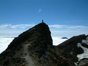
Nello on the Crater Rim


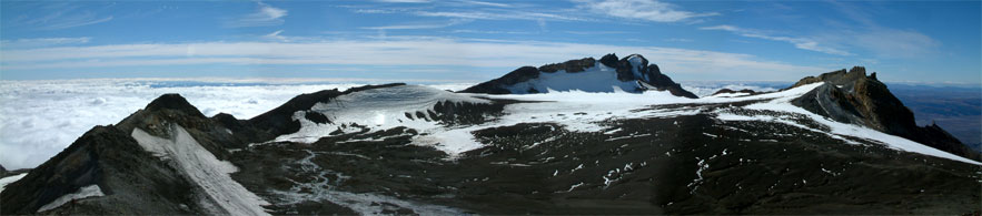
Cathedral Peak and the view to the south-east

Climbing Dome Ridge

From the shelter, which was buried in ash and mud during the 1995 eruption, an even more magnificent panorama revealed itself, dominated by the Crater Lake and its orange and white backdrop of Tahurangi Peak, the highest point of this volcanic massif, and the dark cinder mound of Pyramid Peak rising sharply from its eastern shore.

The lake has refilled since being blown apart 10 years earlier in a cloud of steam and boiling mud. We stayed for 40 minutes taking in the views and feeling the potential power of this volcano, but the cloud bank was still rising up the mountain behind us so we turned and headed back down to meet it.


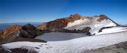
View over Crater Lake framed by Pyramid and Tahurangi Peak (the highest point of Ruapehu)


Ngaurohoe becomes an island as
cloud envelopes The Pinnacles

When we reached the rim edge looking back down the ski field, the cloud had already begun to envelope the middle slopes, where we had begun the walk. The tops of The Pinnacles were just about to disappear and the cone of Ngaurohoe was now an island in a white billowing sea. Down is a lot quicker than up on scree and rock, and the chance to do a bit of boot-skiing on a long remnant snowdrift saw us rapidly down to the halfway point, where we met the rising cloud.

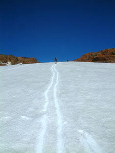
A good slope for boot-skiing - Nello follows my tracks down


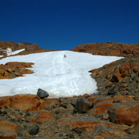
Orange, grey and white landscape
of Ruapehu


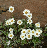
One of few plants clinging to the
rocky substrate

Taking one last good look around to get our bearings, we descended into the mist. It was a strange and different world of rock and fog, but by crossing a rocky gully and climbing back up to where we had last seen the top of the ski lift, we were able to follow the line of pylons down (ugly as it was, we were grateful for the ski field infrastructure this time). Soon the sound of voices signalled that we were near the Top Station, where we had a hot coffee and looked at a display of the impressive series of eruptions in 1995, before descending into the fog down the chairlift and back to civilisation.


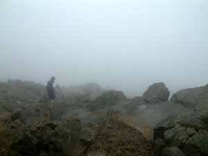
Nello descending into the mists of Ruapehu


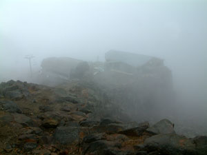
The Top Station emerging from the mist

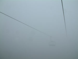
Down the disappearing chairlift - tramp over

Ruapehu is an imposing mountain. We were drawn to it when we first arrived to see its snow-clad splendour and now once more for the chance to spend time on the roof of the North Island. It was the perfect way to finish our tramping in New Zealand.