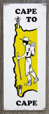
| The Cape to Cape Track (part 1) |
Cape Naturaliste to Yallingup (14 km) |
 |
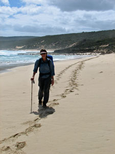
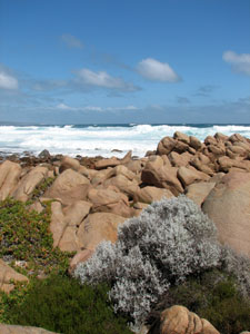
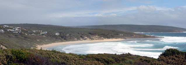
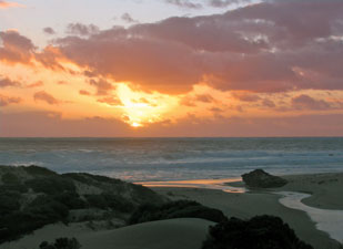
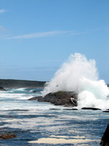
Yesterday we had driven slowly down to Augusta calling in at various points to arrange accommodation, leaving supplies where we intended to stay in cabins and hiding food and/or water stashes near the places where we would be camping. The preparation was good, but the gale force winds and strong rains that greeted us that day were a bit disconcerting! It was a reminder that this corner of Western Australia protrudes into the westerly circumpolar airstream, which can sweep cold fronts through with regular succession. The plus-side is that, to the west, the nearest land is the southern tip of Africa, 8000 km away; the air that you breathe here has got to be some of the purest on the planet! Moreover, the fronts pass as quickly as they arrive - by the time we had caught the bus back to Dunsborough and the taxi out to Cape Naturaliste lighthouse (the start of the track) the weather was looking much more promising. We sipped a coffee in the lighthouse cafe as a light shower squall whipped by and, with the return of the sun, set off down the track on our way to Cape Leeuwin. |
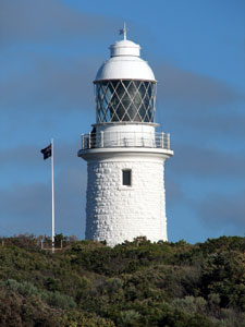 Cape Naturaliste Lighthouse |
|
|
|||
  |
  |
  |
  |
|
|
||||
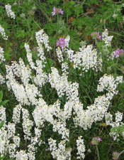
 Weeping peppermint by the path |
 |
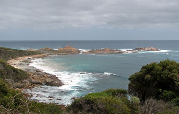
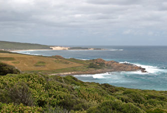
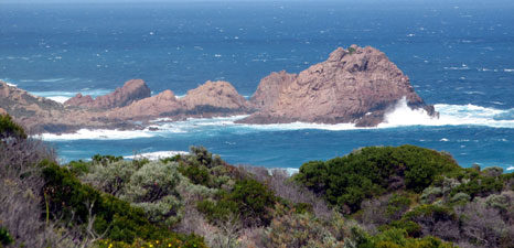 Looking across the heath to Sugarloaf Islet |
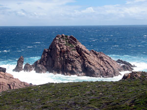 Sugarloaf Islet |
 |
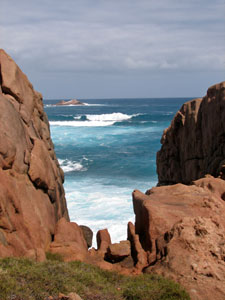
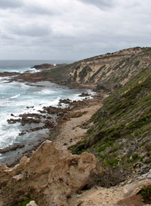
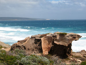 Eroded limestone |
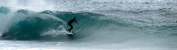
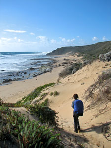
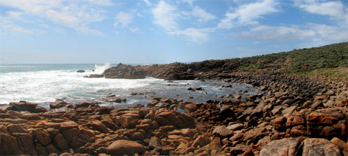
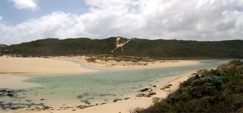
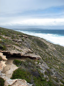
 Kabbijgup Beach |
Reaching Kabbijgup, we descended a set of wooden steps onto the beach, famed for its Three Bears surfbreak, and found a place to eat lunch in the shelter of a jumble of orange-coloured boulders as another brief squall passed quickly overhead. The sun soon returned. |
 Beach boulders at Kabbijgup |
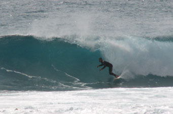
 Big surf at Three Bears |
|
 The jagged eroded cliff edge |
|
 Ancient limestone cliffs south of Kabbijgup |
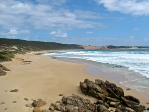
 View south toward Yallingup |
|
|
|
 Yallingup village and its famous surf beach |
|
|
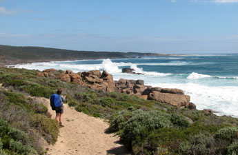
Yallingup to Quininup Brook (16 km)
|
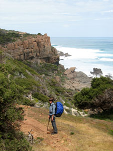
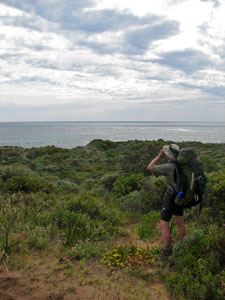
 Contemplating the route ahead - only 120 km to go! |
 |
 Heading down to Smith's Beach |
|
A quick rest stop after crossing Gunyulgup Brook at the southern end of the beach and we were soon winding our way up steeply through the superb orange-coloured boulders of the headland.
|
|
 |
 Looking out over Canal Rocks |
 Aftermath of the storm |
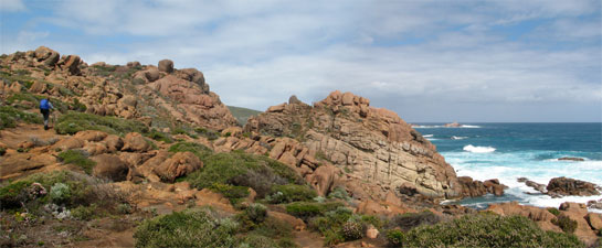
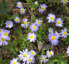
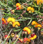
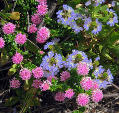
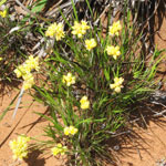
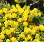
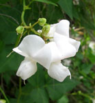
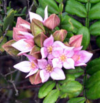
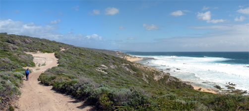
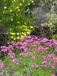
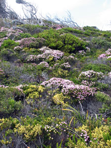
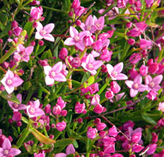
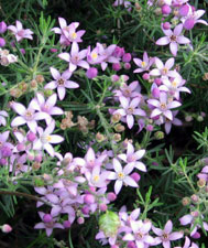
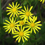
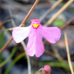
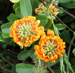
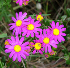
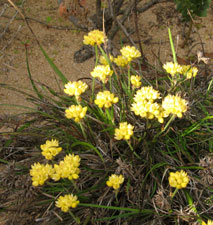
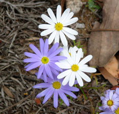
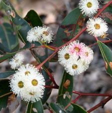
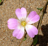
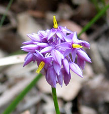
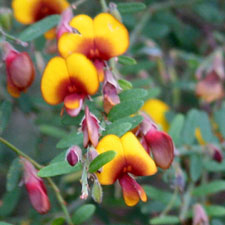
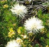
Energy recharged from a scroggin stop at the viewpoint, we climbed slowly up to another lookout, before crossing over a rocky limestone ridge, covered in dense heath. Coastal heath is a deceptive environment. It looks like a lumpy carpet of different shades and textures of green, but pass through it in spring and you are greeted by flowers of every hue; not compelling tapestries of colour like the inland daisy-fields, but splashes of cream, yellow, blue and pink, sprinklings of white and orange, and the rare gems of crimson and purple hiding on the path edges. Such has been the heath we have passed through. |
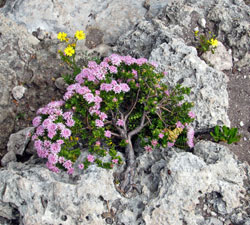 Bonsai pimelea |
|||
 |
 |
 |
 |
|
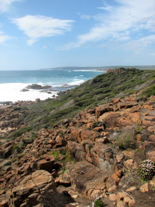
At the bottom of the ridge, we reached the cliff edge, in time for lunch on a viewing seat overlooking the rugged cliffs to the north and a grassy headland with the distant sand dunes of Cape Clairault to the south. |
 Limestone cliffs south of Canal Rocks |
 Crossing Wyadup Brook |
 Views over Wyadup farmlands to the dunes of Cape Clairault |
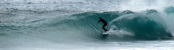
 Injidup Beach |
|
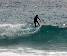
 Riding the big waves at Injidup Break |
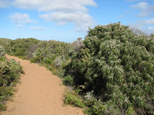
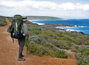
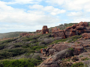
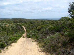
From Injidup, we climbed up and over Cape Clairault, keeping to the tea-tree thickets on the landward side of the dunes; the sound of the surf was replaced by the soft twittering of small brown birds. Crossing the cape, the path joined a sandy 4WD track which led us southward for 5 km through the heath above low cliffs. Sandy tracks are great to see what wildlife is out there; the footprints of various birds, the odd small mammal, the alternating crescents of the goanna, the fat straight trail of a stumpy-tail lizard, the S-shaped track of a snake - oops, time to move on! |
 Descending the dunes to Quininup Beach |
 Track through the heath south of Cape Clairault |
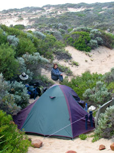 Campsite in the dunes at Quininup Brook |
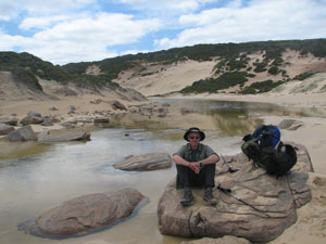
Eventually we descended back on to the shore, rounded a large dune and found ourselves at Quininup Brook, its cold fresh water flowing out across the beach and into the surf. Upstream lay a series of undulating, shrub-covered sandy hollows. We found the perfect spot to pitch a tent in a small depression, sheltered from the wind. |
 Quininup Falls |
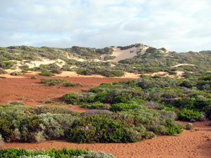 Red sand patch at Quininup - sacred to local aboriginal people |
 The sun sets over the mouth of Quininup Brook |
|
|
|
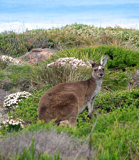
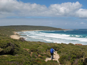
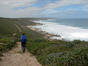
Quininup Brook to Gracetown (16.5 km) There was just a slight breath of air when we arose at 6am and light cloud covered most of the sky. It promised to be a good walking day. After a short steep trudge up the dune on the southern side of Quininup Brook, we followed the track around a cliff indented with small inlets, meeting a pair of kangaroos and our first Cape to Cape hikers in 3 days. A pair of hawks soared overhead, harried by a local raven, as we climbed up through ever-thickening heath to the lookout at Moses Rock, our first rest stop for the day. For the first time the sea was free of white-tops, but unfortunately no whales were to be seen - perhaps they were all already ploughing south across the Southern Ocean. |
|
|
|
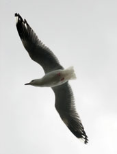
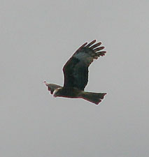 Patrolling hawk |
||
|
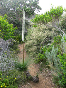 Grass tree in flower |
 Colours of the heath |
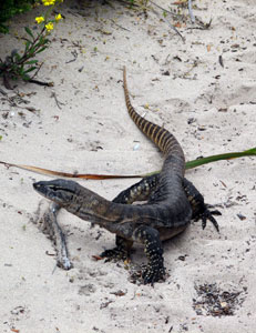 Sand goanna |
 Path through a tea-tree thicket |
|
|
||||
 Heading south from Moses Rock |
 At Wilyabrup Brook crossing |
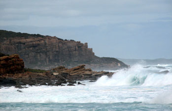 Big seas at the Wilyabrup Cliffs |
 Natural rock garden |
We reached the cliffs by passing through an area of abandoned farmland, where open paddocks were slowly being reclaimed by the native vegetation and rock gardens of pimelea and wattle lined the path. |
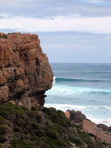 The impressive profile of Wilyabrup Cliffs |
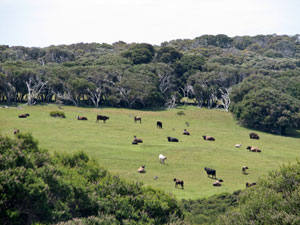 Contented cows on coastal farmland |
 Descending into Biljedup Brook |
A steep descent into Biljedup Brook and rocky climb back out, and we were back on top of the cliffs, looking down on a group of abseilers at the cliff edge. The sun was getting quite hot now and, with little wind, it was time to switch to shorts. A narrow footpath through the heath eventually brought us to Cullen's Beach, where we descended to trudge for a short distance behind the frontal dunes, before climbing back up again to follow the heath-covered cliff tops. |
|
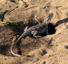
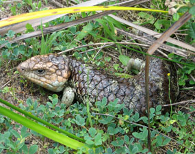 A friendly stumpy-tailed lizard (aka bob-tailed skink) |
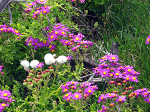 Crimson daisies in bloom |
|
 |
 |
 |
|
|
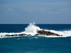
 Waves exploding on Whaleback Rock |
||
 Coastline south of Veryiuca Brook |
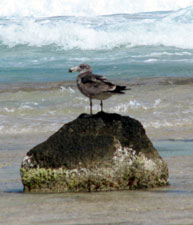
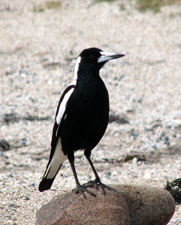 Beach magpie waiting for a handout |
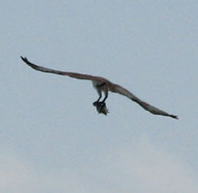 Osprey bringing home the catch of the day |
|
 A boulder-strewn beach south of Veryiuca Brook |
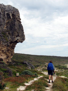
 Granite outcrops near North Head |
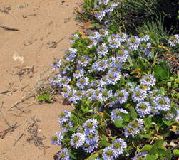
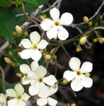
This began one of the nicest parts of the trek to date, as we quickly crossed the rocky bed of Veryiuca Brook. We wandered around orange lichen-covered rocky outcrops as offshore, the seas crashed against the rocks in explosions of foam. Traversing a boulder strewn beach, we wound up through the granite landscape amidst orange and pink flowering heath, underlaid by a carpet of small blue and white daisies and, amongst many other flowering herbs, pink fairy orchids and the occasional larger greenish-yellow orchid. |
 View northward from North Head |
||
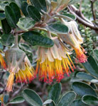
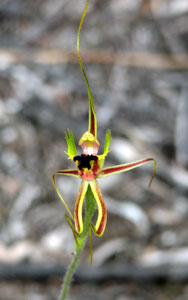
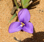
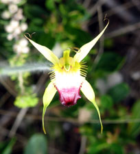 Our first spider orchid |
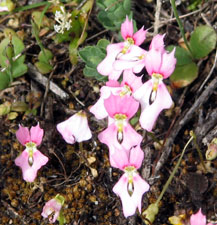 Tiny pink trigger flowers |
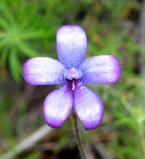
 One of many pea-flowers in the heath |
|
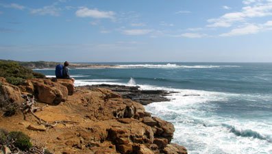 Watching the surfers from North Head |
Crossing a small stream flowing through the red rock, we climbed up to the edge of the orange cliffs around North Point, before dropping back down to a high rock shelf. Ahead, a group of surfers sat out on their boards waiting for the next big wave at the North Point Break. |
 The calm of Cowaramup Bay |
|
|
 |
 |
 |
 |
 |
|
Gracetown to Prevelly (19 km)
|
|
 Lefthanders' Beach |
 |
 Riding the break at Lefthanders |
|
 Boardwalk to Meekadarabee Waterfall |
||
 |
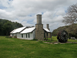 Ellensbrook Homestead - built in the 1850s |
 |
|
 At Meekadarabee the stream falls into one mouth of a cave ..... |
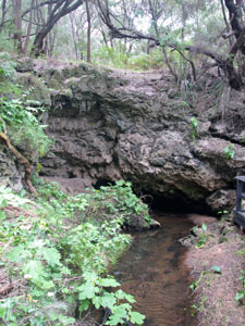 ..... and flows out the other nearby |
New species of wildflower started to appear as we pushed further inland up a paved and boardwalked path alongside the cool and shady Ellen Brook, babbling beneath a canopy of gnarly old peppermints. A little way on, we stopped to admire first, a small stream flowing out of the exit of a cave in the rockface and then, the Meekadarabee waterfall, trickling into the cave entrance in a cool and luxuriant grotto. |
 The first big trees as we head inland |
 In the Gnoocardup Forest |
We pushed on to the Ellensbrook campsite, planning to top up our water before the long inland section - alas, the tank was dry, but a quick packless sprint back to Meekadarabee saw our water bottles full of cool fresh spring water (the moral of this story is that a water tank does not always mean water!) |
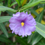
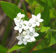
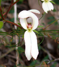
 Butterfly orchid |
|
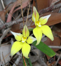 Cowslip orchid |
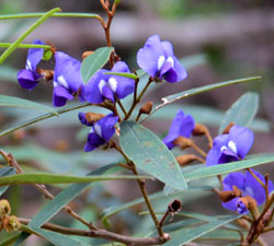
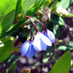
 Blue enamel orchid |
||
|
 Passing under the peppermints |
||
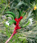
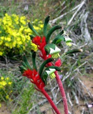 Red and green kangaroo paws |
 |
 The curious cow kick |
|
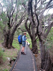
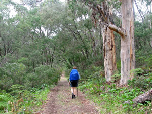
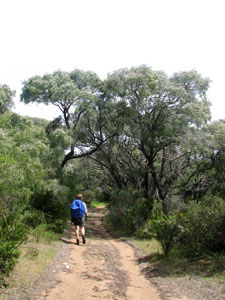
 The track through Gnoocardup coastal mallee |
The track undulated up past tall grass-trees, cycads, peppermints and eucalypts, rich with the songs of forest birds, but as we reached the top of the plateau, the taller timber gave way once again to tall heath plants. From the high points, you could see right across this green inland sea to the ocean and distant Cape Mentelle. Lunch under the shade of a tea-tree grove and we undulated downward once again, past an alley lined with kangaroo paws, before a westerly bend in the track took us once more toward the sea. |
 |
 Flowering eucalypt |
 Whale watching near Gnoocardup Beach |
What a welcome the ocean gave us; far out to sea a large splash caught our eye, followed by smaller sprays as a pod of humpback whales blew and breached as they pushed steadily south on their journey to Antarctic waters, their minds focussed on the feast of krill awaiting them. I was glad that I had put a pair of binoculars into the pack at the last minute. Farewell, cetacean friends, your journey makes our present trip seem pretty ordinary! |
 Nello passing beneath Joey's Nose |
|
 |
 |
||
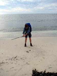 "Sea-urchin golf" on Kilcarnup Beach |
|
 The white limestone cliffs of Cape Mentelle |
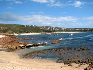
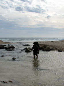 Crossing the Margaret River at its mouth |
|
 Margaret River mouth |
|
|
|
|
|
 |
|
|
 |
 |
 |


 -
-  -
- -
- -
- -
-