
| Bibbulmun Track South (Peaceful Bay to Denmark) |
|
Peaceful Bay to Boat Harbour Campsite (24 km) After a pleasant rest day in the sunshine and tranquility of Peaceful Bay, it was time to bid farewell to our little green van and move on. It was an early start as today's walk would be the longest of our trip. The weather was overcast and strangely still as we left, almost at the point of drizzling but not quite able to do it. We quickly walked through the village, past the quaintly named beach cottages, reminiscent of earlier days, and soon found ourselves pushing along a grassy track through tall climax heathlands towards Irwin Inlet. |
|
||
 |
 |
 |
||
|
|
||
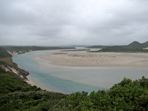 Overlooking the mouth of Irwin Inlet |
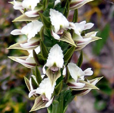
 Scented sun orchid |
 |
|
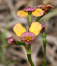
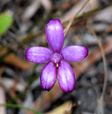 Purple enamel orchid |
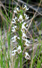
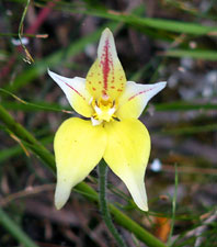 Cowslip orchid |
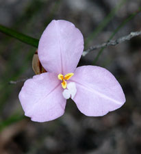
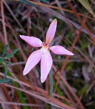 Pink fairy orchid |
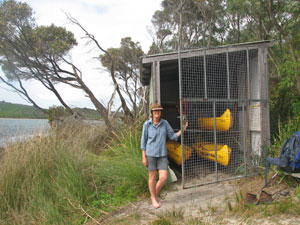 At the Irwin Inlet boatshed |
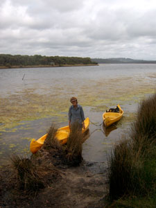 Successful crossing of Irwin Inlet |
After a while, we arrived at a boatshed containing three canoes provided for the 150m crossing of Irwin Inlet. The canoe crossing made a pleasant change from walking - we loaded our packs into one canoe, tied it to another and paddled across to the eastern bank. Then, after unloading our packs and tying a third canoe from the eastern boatshed, we paddled our canoe train back across the inlet, put the two towed canoes into the first shed, and paddled for the third time in our solitary canoe back to the eastern shore. Complicated, but the nett result was that we and our gear were over and there were again three canoes on each side. Sad would be the walkers who arrived to find all canoes on the opposite bank!! |
|
 |
 View across the the grassy meadows to Irwin Inlet |
|
|
||
 |
 |
 |
 The grassy downs of The Showgrounds |
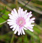
Soon we reached an area of more open grasslands, dotted with the yellows and, occasionally, pink and blue of coastal daisies and other herbs. We had arrived at "The Showgrounds", a rolling landscape that curiously resembled an alpine herbfield and would have been very enjoyable to stroll through, had it not been for the bushflies. I think that we carried an extra kilo each of flies sitting on our packs waiting for us to stop walking so that they could head straight for our faces - this area may be more aptly named "The Flygrounds", and drove the fair Nello to bring out that ultimate walker's fashion statement, the fly net headpiece! |
|||
 Nello's fashion statement ..... |
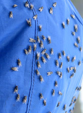 .... and the reason why! |
 Showgrounds resident |
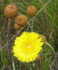 Large flowering daisy |
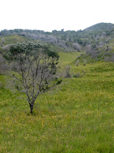 Daisy-dotted meadows |
|
||||
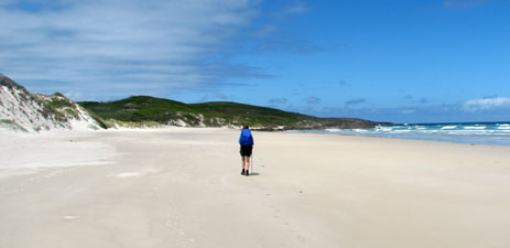 Alone on Quarram Beach |
|
 A pair of endangered hooded plovers doing their best to ensure the survival of the species |
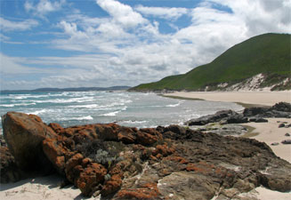 Looking back down Quarram Beach |
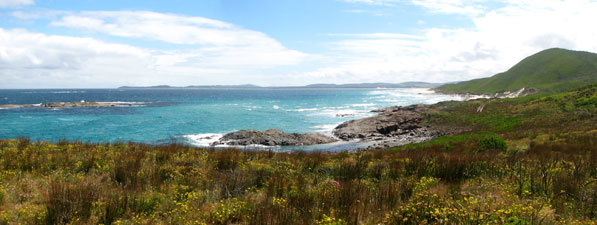 View over Foul Bay toward Peaceful Bay and Irwin Point |
|
|
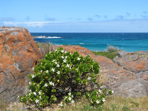 White starred tailflower are associated with granite |
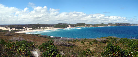 Overlooking the headland to Little Quarram Beach and the cliffs beyond |
Little Quarram is a gem of a beach, and we were disappointed that the track took us away from it after only a few hundred metres, leading us back into the dunes, where we followed the path through the still hot air of the depressions and swales in this sandy heath-covered landscape. Eventually we again climbed up and over one high dune, passed above a rocky shelf where the Southern Ocean surf rolled in, and slowly made our way back upward towards the cliffs. Parts of the low heath that we passed through had been transformed into brilliant tapestries of pink and green by the clumps of flowering pimelea. Inland, we overlooked the flatlands of Owingup Swamp and the lakes associated with it. In front of us lay a large dugite sleeping on the track. Skirting the snake and a set of tall mobile dunes, we were treated to glimpses of the cliffs and bays of the Boat Harbour peninsula. |
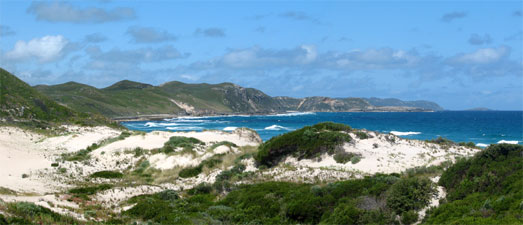 Looking over the sand dunes of Little Quarram toward the cliffs of Boat Harbour |
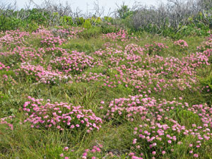 Carpet of pimelea in the regenerating heath |
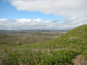 Looking inland over Owingup Swamp |
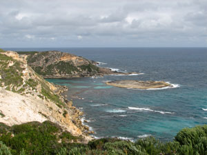 Coastal cliffs near Boat Harbour |
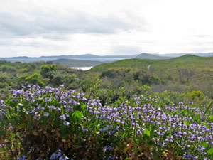 The blue of succulent-leafed scaevola dominates the heath |
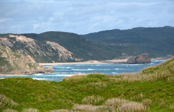 Coastal landscape near Boat Harbour |
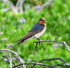 |
More climbs and descents through blue and yellow flowering heath of varying heights and finally the Boat Harbour shelter came into view - it was a welcome relief as it had been a tough day's walk and the clouds were once again taking over the sky. It was a comfortable shelter in the midst of the brightly flowering heath and we shared it with a family of swallows that had built a nest in the rafters - no other walkers, just the swallows and a lone frog, but nonetheless a very pleasant night was had by all. |
 |
|
|
Boat Harbour Campsite to Mazzoletti Beach Retreat (17 km)
|
|
Here we were greeted with half a kilometre of deep soft sand, followed by a steep climb up through the dunes to the top of the limestone cliffs - that's one way to get the body going first thing in the morning. However, we were recompensed by glorious views back along our path from Point Irwin and forward to where we were headed at Point Hillier. The cliffs here appear to be formed by an uplifted limestone ridge; on the landward side, they slope down to a flat swampy landscape dotted with lakes that reflected their fringing vegetation in still morning waters. |
|
|
|
|
|
|
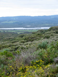 Looking over the peppermints towards Parry Inlet |
||
 |
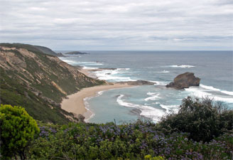 Coastline near Point Hillier |
 |
|
Halfway up, we stopped and had a chat with a group of a dozen walkers on a guided trip. Our envy at their light daypacks and stories of proper beds and cooked meals with red wine each night was tempered by the thought that tonight we would also be treating ourselves to a bit of luxury at the Mazzoletti Beach Retreat. Our own stash of good food and red wine was awaiting, so we pushed on, pausing to climb up to the trig and sit for a while, taking in the sweeping views in all directions that it offered. |
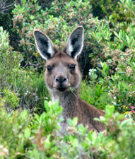 So who's walking through my heath? |
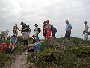 Day trippers near Hillier Trig |
 |
 |
 |
 |
|
From the trig it was almost all downhill, along various 4WD tracks and paths, past an old abandoned quarry area, and eventually beneath a dense canopy of peppermints that brought us out to the Parry Inlet Campground and the sea once again. Here we found the perfect spot for lunch, underneath an old peppermint looking out over the long expanse of Mazzoletti Beach, disappearing into the distance. |
 Lunchtime views from Parry's Beach |
||
 |
 |
 |
|
|
||
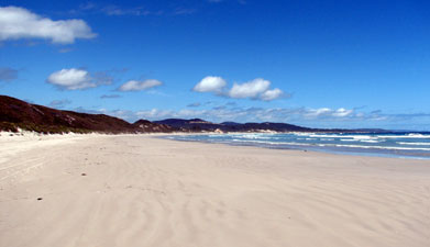 The firm white sand of Mazzoletti Beach |
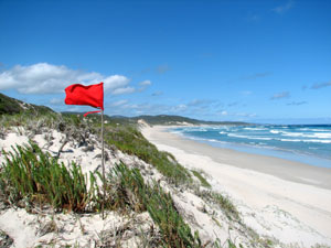 Red flag = Mazzoletti Beach Retreat |
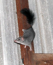 Brush-tailed phascogale |
|
||
|
Mazzoletti Beach Retreat to Light's Beach (12 km) It was a good sleep-in and a cuppa in the comfort of our queen-size bed - a step or two up from thermorests on a hard base. Our main reason for staying at Mazzoletti Beach was to convert two long hard days of walking into three easier days, so we only set off late in the morning, as the sun was breaking up the grey cloud layer. |
|
||
|
|
|
||
Heading quickly back down the track to rejoin the beach, we turned eastward once again for a late morning meditational stroll along the firm flat sand. The problem with this long beach was that, midway along, it morphed into a series of slight mounds and hollows, the hollows staying firm but the mounds being deep and soft. It is amazing how quickly meditation can cease when the incoming breaker surges up one of the hollows to fill your boots with sea-water. |
||||
For the next couple of kilometres we trudged on across this variable sand, following old footsteps to make the going less strenuous, until, just before the 7 km beach ended, the track headed off into the dunes. Dutifully we followed where the waugul led us and soon found ourselves climbing through dense peppermint woodland as the track headed up Tower Hill. On the shoulder of the hill, nestled in a sheltered hollow, was William Bay Campsite. We stopped here for a long lunch with time to explore the wonderful granite tors that are dotted on this hill. The views from these rocky belvederes over the coastal strip was nothing short of spectacular. |
|
|
 William Bay Shelter in its nook beneath Tower Hill |
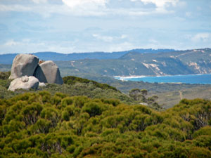 Granite Tors on Tower Hill |
|
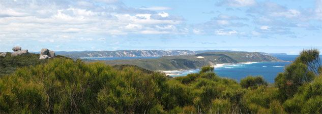 Views over Point Walton from Tower Hill |
 |
|
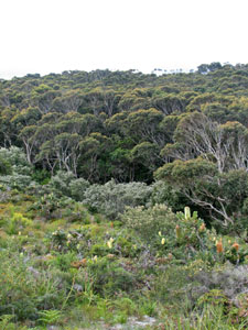 A nice ecotone between heath and forest |
|
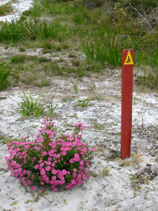 Follow the waugul - Bibbulmun track marker |
|
 |
 |
||
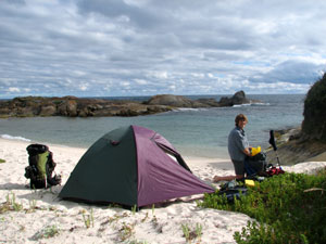 World's best campsites series no. 14 - Light's Beach |
|
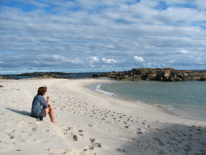 Quiet time at Light's Beach |
|
||
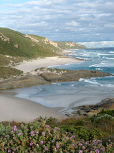 Eastern end of Light's Beach |
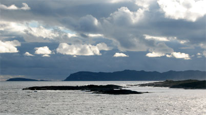 Evening falls over Madfish Bay and Point Hillier |
With the protecting rocks and rock ribs, separating several tiny white sand beaches, and a long line of limestone cliffs glowing in the setting sun, it was one of the nicest sections of coastline that we had seen on this walk. To the west we could look out across Madfish Bay to the silhouettes of Point Hillier and Point Irwin. Light's Beach is a special place and to have had it to ourselves that night was one of the highlights of this walk. |
|
|
Light's Beach to Denmark (17 km)
|
|
|||
 |
 |
 |
 |
||
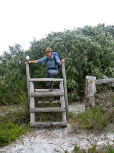 Nello crossing a fence in "stile" |
|
||
 |
 |
 |
|
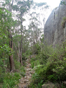 Track up Mt Hallowell alongside Monkey Rock |
We were about to start the climb up Mt Hallowell and would cross paths with Paul a couple more times on the ascent (and later on that evening for a large juicy rare steak at the Denmark pub) before he finally zoomed on ahead. Mt Hallowell is really a large hill, with dense forest and many granite outcrops and tors. The 300m climb up was short and steep, but rapid, with a detour halfway up onto Monkey Rock, a massive jumble of granite, to refuel and take in the spectacular views over green farmlands to the coast. |
|
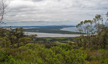 Views across Wilson Inlet and Ratcliffe Bay |
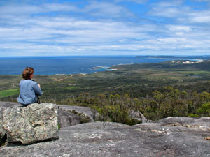 Taking in the views from the top of Mt Hallowell |
|
 One of several granite outcrops on the descent of Mt Hallowell |
|
|||
 |
 |
 |
 |
|
|
||||
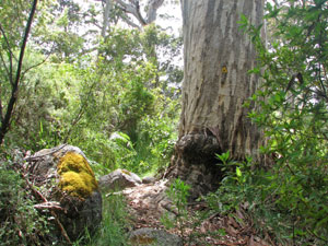 The last few big karri of our walk |
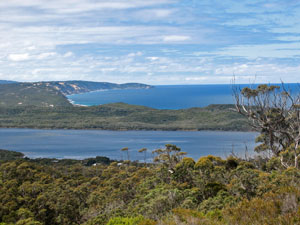 View over Wilson Inlet to the sea |
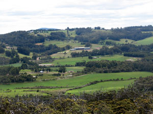 The green green grass of Denmark |
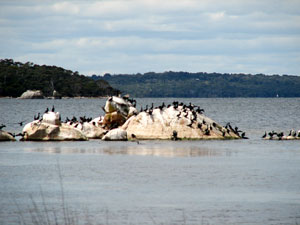 Cormorants on guano rock in Wilson Inlet |
 |
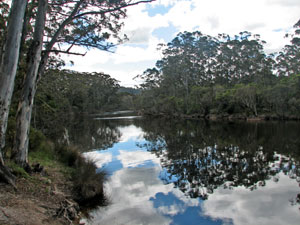 Reflections on the still dark waters of the Denmark River |
|
|
 |
          |