Day walks in the Stirling Ranges

The rugged peaks of the Stirling Ranges rise to over 1000m like an island in the flat plains that surround it. An island in the ecological as well as physical sense, they are home to over 1500 species of plant, of which over 80 are endemic. Rugged, isolated mountains with a unique flora - no walking trip to the south-west of Western Australia would be complete without a visit to the Stirling Ranges, an ideal complement to the coast and the tall forests. We had seen their silhouette 80 km inland from some of the high coastal dunes during the final stages of the Bibbulmun Track and agreed that when we had finished that long trek, a couple of day walks in the Stirling Ranges would be a nice "cool down".


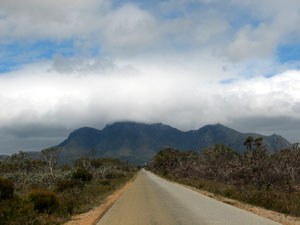
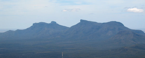
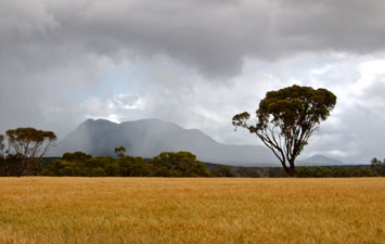
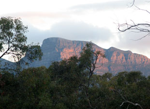
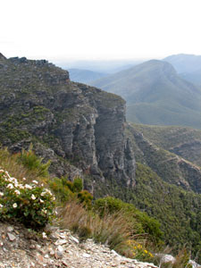
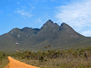
First view of the eastern Stirling Ranges (viewed from the southern approach)


Showers over Mt Trio

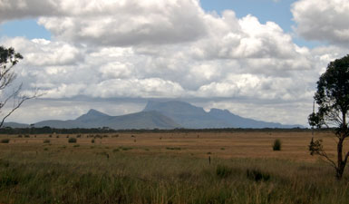
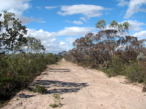
Mallee scrub on the plains fringing the Stirling Ranges


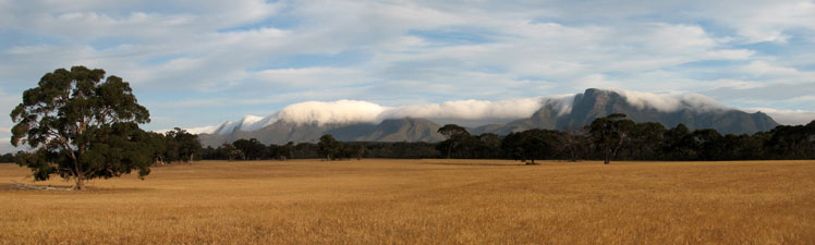
Heading north from Albany in the drizzle, it was surprising to see how quickly the green of the coastal strip changed to a dry and thirsty landscape. Like south-eastern Australia, the inland part of the south-west corner has suffered badly from drought and both pastures and native grasses had already dried off.

Bisecting the ranges via the Chester Pass Road, we reached the Stirling Ranges Retreat, set between wheat fields and flat mallee scrub that provides a northern fringe to these mountains. Soon we were settled in to our comfortable rammed earth cabin listening to the soft patter of the occasional passing shower.


Local rock parrot


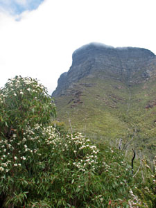
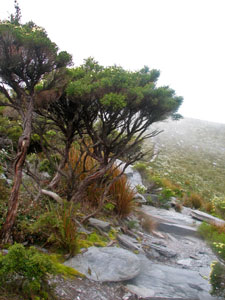
Stirling Ranges landscape (Mondurup Peak)

That afternoon, when the last of the drizzle cleared, we ventured out on a short flat walk through the scattered wandoos and white gums. Here we were in the rain shadow of the ranges and, notwithstanding the present few drops, only half of the expected 350 mm of rain had fallen this year. The main season for wildflowers here is during September and October and even this had been shortened by the drought. Even the white everlasting daisies and purple mulla mullas were suffering on the parched plain. Only in the creekbeds did a few wildflowers still thrive.


It was clear that we would need to climb a peak or two to see what remained of the famed Stirling Ranges flora. Moreover, the silhouette of Bluff Knoll was beckoning across the scrub-covered plain.


The last rays of the sun on Bluff Knoll


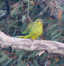
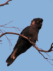
Yellow-tailed black cockatoo


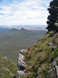
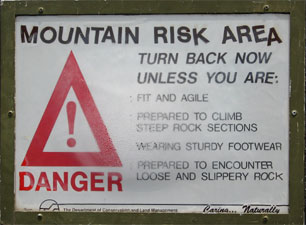
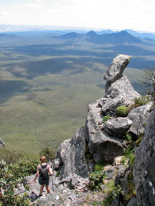
Bluff Knoll (6 km return, 630m climb)

At 1073m, Bluff Knoll is the highest point in the Stirling Ranges and, by far, the most popular day walk. To cater for its popularity, a nice sealed road takes you up to a nice sealed carpark with shelters and viewpoints. We headed off early in the morning only to be confronted with the spectacle of low cloud covering most of the mountain - visibility on top would not be very good. To the east, the pyramid of Toolbrunup, the second higest peak in the range stood clear. It seemed a better proposition, but by the time that we had driven there, it too was hidden in the low cloud. We retreated to our cabin, tails between our legs and waited. The one certainty about Stirling Ranges weather is its uncertainty - this is the only place in Western Australia where snow has been recorded.


Cloud descending over the top of Bluff Knoll

It was 2pm when we declared all systems go - there was still some cloud on the very top but it was lifting and, after all, this is only a 3-4 hour walk. Short it may be, but it has been listed as one of the top 25 walks in Australia and, viewed from the car park, the face of Bluff Knoll is indeed an impressive sight. To climb it is not an insignificant feat.

The track initially descends slightly on a tarred footpath wandering through eucalyptus regrowth from the fire of 2000, before following a natural surface up through more open scrub dotted with kingia grass trees. We were surprised to be greeted by old floral friends from the coast track, in particular the southern cross flowers, beaufortia brushes and pink-starred boronias.


Looking up at the face of Bluff Knoll


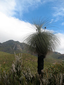
Silhouette of a Kingia grass-tree

A local skink


Watching a wedge-tailed eagle soar above us, I could understand the attraction of these mountains for the gliding fraternity. The track now started to climb more steeply, traversing the side of the ridge leading up to the face of the bluff. Periodic sets of wooden steps and a mainly easy gradient made the climb fairly straight forward.

Here we spotted our first rose-pink mountain bell (one of several endemic species of Darwinia for which the ranges are reknowned). We quickly found ourselves climbing up under a rock face with ever more expansive views opening out to the west. The two halves of the Stirling Ranges are quite different; we were climbing part of a chain of peaks with broad north-facing sheer walls, while to the west many peaks seemed to emerge isolated from a large undulating plateau. It was these that we saw, fading into the western horizon.


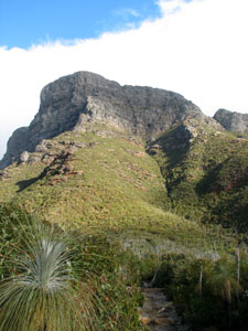
North facing crags of the western Stirlings


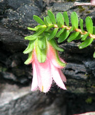
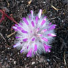
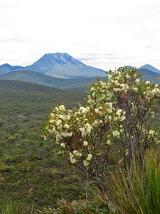
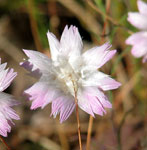
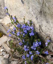
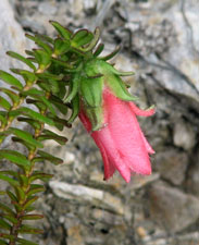
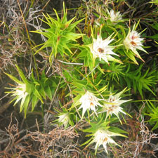
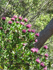
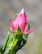
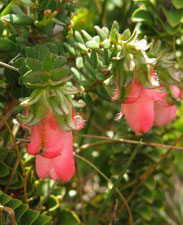
Some of the endemic mountain bells


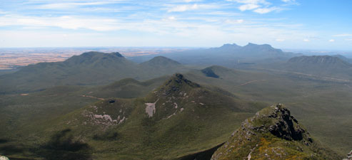
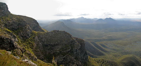
Panorama of Toolbrunup and other peaks of the western Stirlings across the face of Coyanerup Peak


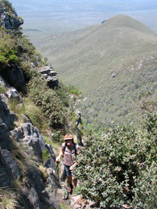
About to crest the saddle between Bluff Knoll
and Coyanerup Peak
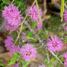
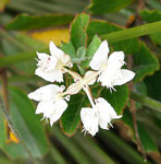
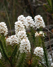
Reaching the top of the rock face, the track rounded the western side of Bluff Knoll. The views across the craggy bluffs of neighbouring Coyanerup Peak to the mountains of the western Stirlings were increasingly impressive. Reaching the saddle between the two mountains, we found ourselves exposed to the cold southerly wind for the first time.


Paper heath

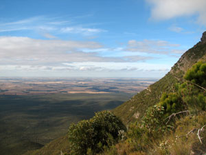
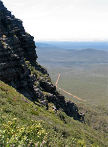
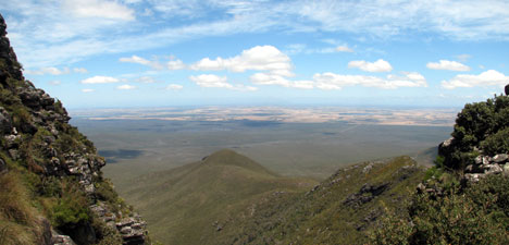
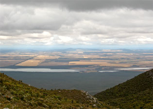
View from the saddle over the lakes to the south and
the wheatfields beyond

Spiny andersonia

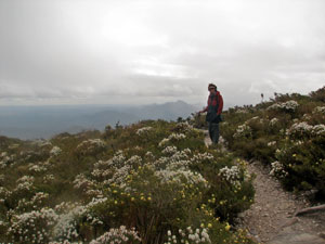
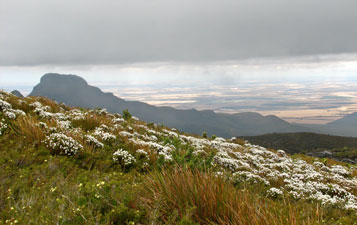
Field of paper heath on the southern slopes of Bluff Knoll,
with Ellen Peak in the background

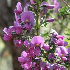
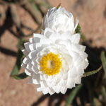
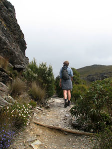
We turned eastward briefly and then northerly to begin a steady climb up through the scattered dwarf grass-trees of the sloping southern ramp of Bluff Knoll. As we gained height, we entered the domain of stunted shrubs and mountain herbs. These upper south-facing slopes are as close to an alpine meadow as you would get in this part of the world, dotted with white and yellow wildflowers, and scattered with small groves of bonsaied melaleucas in mossy beds.


Sheltering from the wind on the edge of Bluff Knoll


Cloud being generated on the southern ramps moved rapidly
up the slopes of the Bluff

Finally, we reached the rim of the Bluff - beyond lay the dry yellowing landscape of the northern plains dotted with the white shapes of dry salt lake beds. To the south, the view was similar, though the lakes were full from mountain run-off. To the east, the dark silhouette of The Arrows and Ellen Peak stood out.

The grey cloud was now only just above us and we were beginning to see how the weather system operates here, as mists formed and raced up the southern ramp to spill out and over the top of the bluff. Donning long trousers and fleeces, we sheltered from the icy wind and mists behind the rocks at the edge of the bluff, soaking up the atmosphere of this magically menacing place, both metaphorically and physically.


Bleak afternoon on the roof of the Stirling Ranges


The top of Bluff Knoll - a world of stunted shrubs and herb fields, where
strange creatures inhabit the rocky outcrops


The late afternoon sun illuminates Bluff Knoll


View over the northern plain from halfway down


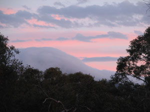
By evening the cloud had returned to envelop the mountain

The descent was quickly done - by the time we reached the saddle we were back into the sunshine again and another hundred metres below that we were completely in the lee of the wind. It was a warm, sunny day again and the forest birds were singing. Above us the cloud generated by the range was now slowly settling in on top the bluff. We had been lucky - we had made it to the top in clear weather and seen the magnificent views, but had also experienced the changing moods of the mountain. Despite the dodgy start, it had been a satisfying day.


Toolbrunup Peak (4 km return, 600m climb)

The day of our ascent of Toolbrunup, at 1020m the second highest peak in the ranges, could not have been more different - hardly a cloud in the sky and just a breath of wind - real shorts and tee-shirt weather. Toolbrunup is also a very different mountain to Bluff Knoll, being a true peak that rises steeply to a summit barely 10m x 20m in area. With a route that is also shorter and steeper, this is more a climb than a walk.


Eucalypt woodland at the base of Toolbrunup


Toolbrunup Peak - impressive for only 1020m high


From the small dirt carpark, the track headed off through a low eucalyptus forest, starting off flat but slowly getting steeper until an almost vertical final ascent - a bit like walking up the inside curve of a parabola.

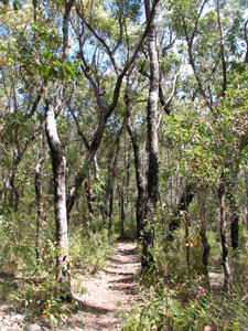
Smooth at first, the track gradually became rockier as it followed a gully steeply up the southern side of Toolbrunup. Even though we were in the shade of lush gully vegetation, it was still and humid and we quickly worked up a good sweat.


After a while we skirted the first of several rock scree slopes, before finally breaking out of the gully and its shady vegetation cover onto a steep and narrow boulder-strewn shute. The walls between the main peak of Toolbrunup and its south-western ridge were now narrowing. Behind us the forest and distant plain were opening out in a broad panorama.


Climbing a boulder shute


The southern wall of Toolbrunup

The first of several scree slopes


Following the steep gully up to the saddle

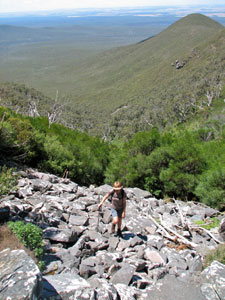
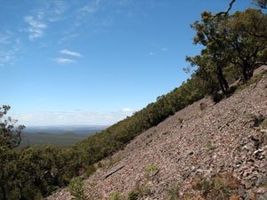
A short climb through dense heathy scrub brought us to a second boulder scree shute, which took us quickly up to the wall of the peak. We sidled our way upwards against the rock wall, our destination still a couple of hundred metre directly above us. Eventually the track brought us out to a saddle. For the first times we could see to the north over the dull green forest of the ranges to the vast expanse of salt lake dotted farmland beyond. To the south-west, the Porongorup Ranges were just starting to appear above the razor back ridge extending from the saddle.


View north from the saddle below Toolbrunup Peak


On the pinnacle of Toolbrunup

From here it was all clambering over rocks as we made the last very steep ascent of Toolbrunup's peak, emerging to a 360 degree panorama for up to 80 km. The summit was a jumble of rocks with a couple of small flattish grassy areas scattered with low pea shrubs and beautiful pink and white everlasting daisies.


Panorama to the east from the top of Toolbrunup Peak


Isongerup Peak, The Arrows, Ellen Peak and Bluff Knoll

There was just a breath of cooling air and two young Germans on the summit when we arrived. It was a very pleasant place to spend an hour - surrounded by wonderful views and the low buzz of thousands of insects (flies, wasps, native bees, chrysomelid beetles, longicorn beetles, weevils, hemipteran bugs) attracted to the less than pleasant scent of one the pea species on the summit. I could see why the sleek dark skinks that soaked up the sun on the rocks were all so fat. We basked in the warm sun on ripple-surfaced rocks, once part of an ancient sea-bed, now resting on a pinnacle 1000m above sea-level. What a dynamic planet we live on!


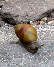
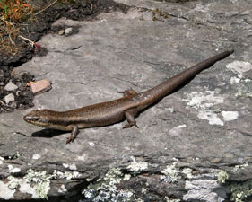
One of many fat skinks

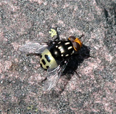
Part of the well-fed skink's diet


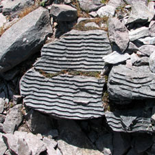
Ripples of the sea on the top of a mountain

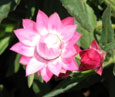
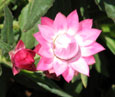
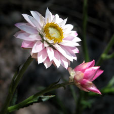
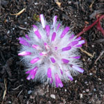
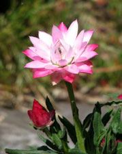
The beautiful pink waitzia daisy

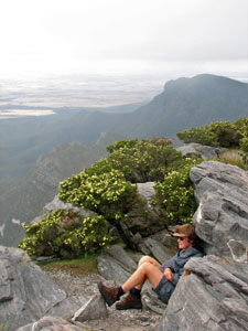
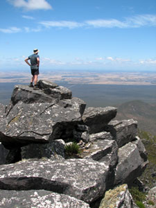
Contemplating the world below

Soon we were joined by another German couple and a Dutch couple - strange, yesterday we were all alone on the vastness of Bluff Knoll, today we are eight on the tiny summit of Toolbrunup. What a pleasant way to spend an hour it was - it was hard to have to get up and finally head back down again.

Nello starting the descent from Toolbrunup

This is a walk where the descent is almost as hard as the ascent - scree slopes and boulder shutes are probably more easily climbed than descended. Fortunately, being able to add a few extra centimetres to our adjustable walking poles (the only thing that stopped our knees from turning to jelly) made the descent a lot easier and we were soon leaving the steep and rocky exposed sections behind and strolling beneath the cool canopy of the forest.


Panorama to the south from the saddle

Back down again, we returned to the Stirling Ranges Retreat and went for a quick swim in its pool to cool down, reflecting on the fact that yesterday at the same time we had been wearing fleeces in an icy wind. Later that afternoon, The Ranges had one more treat in store for us and one more revelation of their mastery of the weather.


Panorama of the cloud-enveloped Stirling Ranges from Ellen Peak to Bluff Knoll


A slow-moving waterfall of cloud flowing over
the ramparts of the eastern Stirlings

The sky had been virtually cloudless above the eastern ramparts a few hours earlier, yet when we looked across from our cabin a dense white river of mountain-hugging cloud was rolling slowly over the craggy crests from The Arrows through to Bluff Knoll and flowing slowly down their faces like an enormous waterfall filmed in slow motion. With the sun illuminating this ethereal cascade of dense mists it was a spectacular sight. What better way to finish our time in this unique part of the world.