| The Tupiza-Uyuni Circuit (Part 1) |
|
Day 1 - Tupiza to San Antonio de Lipez |
 |
|
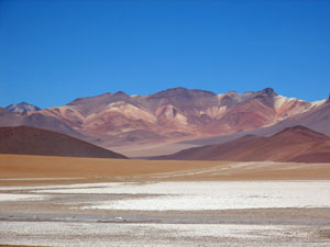
 Valle de la Luna |
 A last look back towards the hills of Tupiza |
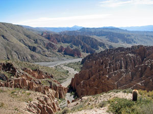
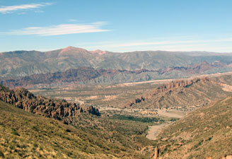
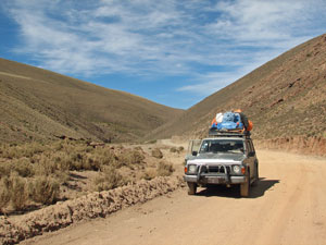
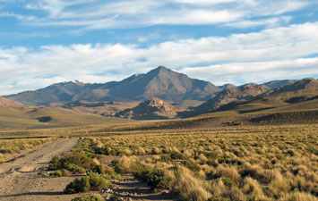
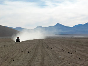
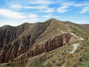 The route up from Tupiza |
|
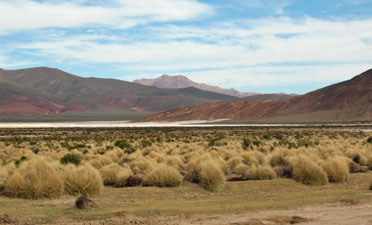
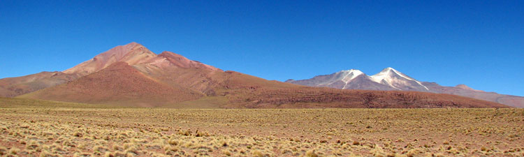
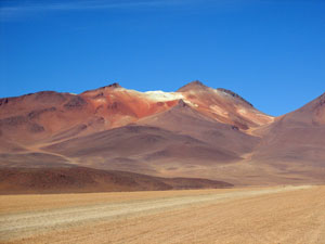
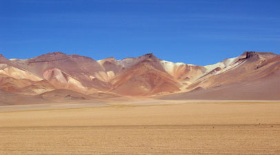
 The dryness of the landscape |
|
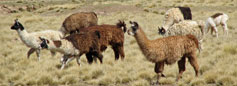
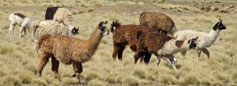
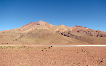
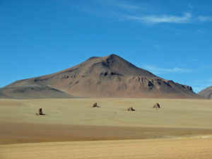
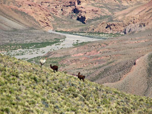 Our first llamas |
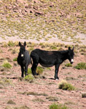
 A pair of burros with a herd of llamas |
|
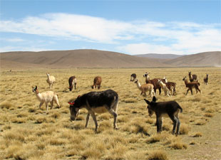
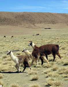 Lunch with the llamas |
|
|
 On the road again |
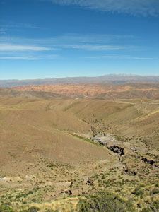
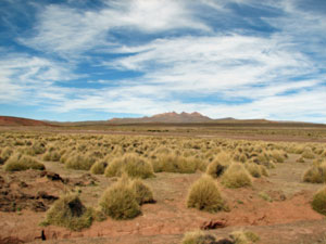 The puna - tussock plains of the Altiplano |
|
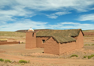 An adobe church |
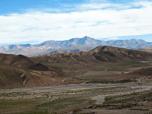
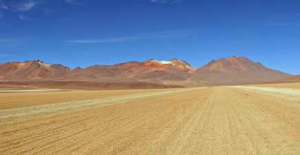
From the lunch spot, we descended alongside a barely flowing creek before climbing once again to reach the Altiplano proper. We were driving along a high plain covered with large expanses of yellow paja ichu (tussock grasses) on pink-tinted soil, surrounded by low rounded bare hills with the more distant higher mountains on the horizon. The going was slow to avoid the many washouts (it rains rarely but when it does the run-off carves its way through the soft soils). |
 Puna (tussock grasslands) of the Altiplano |
|
||
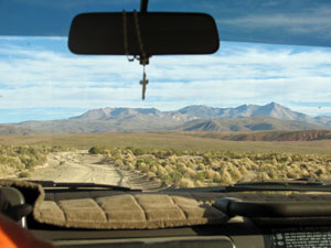 View of the road ahead |
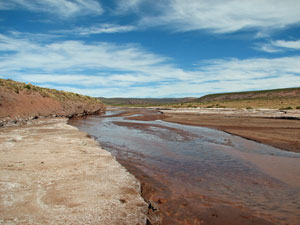 Shallow river meandering through the Altiplano |
 View across the San Pablo River |
 Heading towards Cerro San Antonio (5100m) |
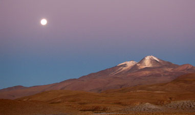
Finally, one last steady climb toward Cerro San Antonio, in the brilliant late afternoon light with the yellow tussocks and purple mountains, brought us to the village of San Antonio de Lipez (4200m) and our rooms for the night in a comfortable adobe refugio. We were well fed, the full moon shone brightly and the stars twinkled. All would have been well except for the headache and nausea that we four gringos suffered to varying degrees. We had climbed 1200m in a day and at this height there is a price to pay for such quick gain in altitude. |
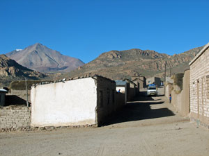 Village of San Antonio de Lipez |
|
Day 2 - San Antonio de Lipez to Quetana Chico |
||
 |
We were off on the road again by 8.30, following the river bed down along the broad tussock covered valley floor, bright yellow in the early morning sun. The ice crunched in the frozen stream as we crossed it. |
 Stony stream bed on the Altiplano |
|
||
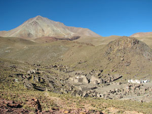 Overlooking the ghost town of San Antonio de Nuevo Mundo |
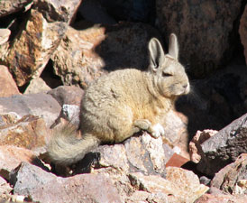 The viscacha - current resident of San Antonio |
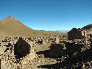 The ruins of San Antonio |
|
||
 Llama herder's hut and stone corral |
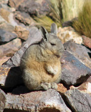 Viscacha in buddha pose |
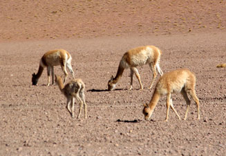
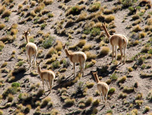 A small herd of graceful vicuña |
 Puna landscape |
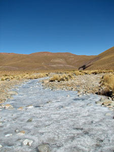 Even the running streams were frozen |
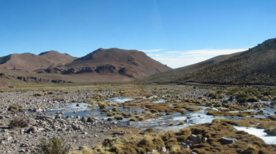
From the pass, we dropped into the valley of an ice-filled stream, to climb yet again to our high point for the day at 4910m. Here we entered the Reserva Nacional de Fauna Andina Eduardo Avaroa, a sanctuary for the many species of this desert region. On cue, a ñandu strolled casually through the tussock grass alongside the road. |
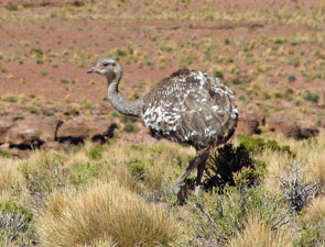 Nandu |
|
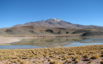
 Close up of Lago Morejon and Volcan Uturuncu |
|
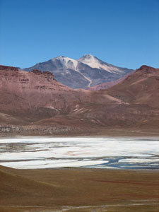
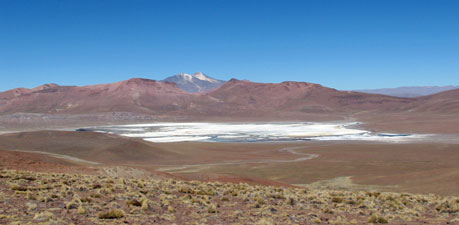 View of salt-covered Lago Morejon and the twin cones of 6008m Volcan Uturuncu |
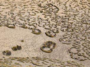 The strange circular patterns of paja tussocks |
|
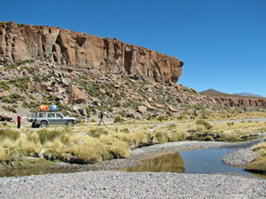 Lunch stop in a small gorge |
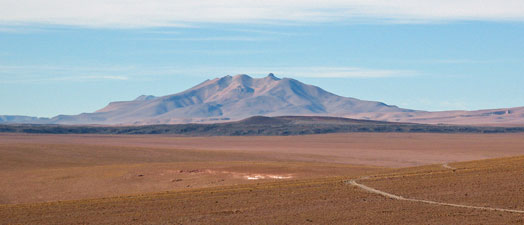
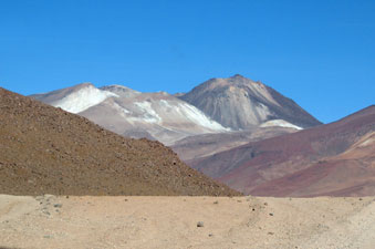
Replete after another great meal from Elena, we pushed on, climbing up to a broad flat plain covered in flaking slabs of pinkish-tan shale. As we drove around their bases, the spectacular views of Volcan Uturuncu, with its white streaks of sulphur, and a neigbouring nameless multi-coloured mountain changed continuously. |
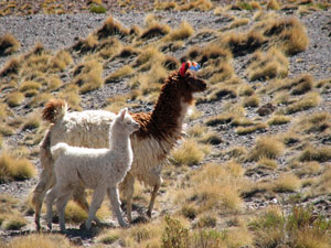 Llama madre y hijo |
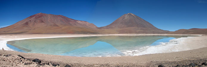
 Panorama of a polychrome mountain sin nombre and the sulphur stained cones of Volcan Uturuncu |
||
 The flaking red shale plain |
 |
 Volcan Uturuncu reflected in the waters of Laguna Negra |
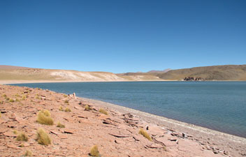 The main body of Laguna Celeste |
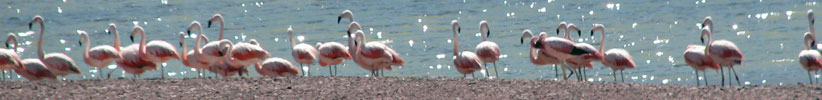
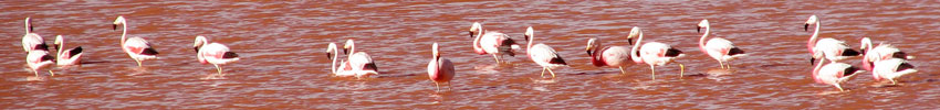
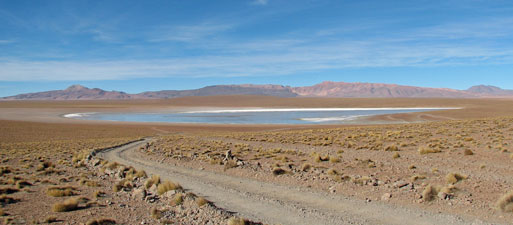
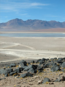
Eventually we reached Laguna Negra, with its reflections of the volcano, followed by the beautiful Laguna Celeste (4560m). This lake, reknowned for the sky-blue colour of its water, was our main objective of the day and we spent some time wandering along the shores absorbing the atmosphere of this isolated spot and watching the flamingos, ducks and other waterbirds. |
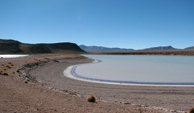 The shallow side arm of Laguna Celeste |
 |
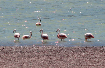 Flamingos on Laguna Celeste |
|
|
|
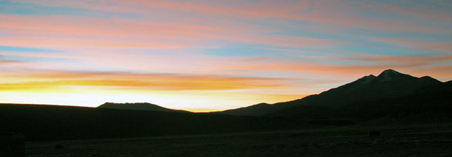
 Late afternoon light on the Altiplano |
 Full moon rising over Volcan Uturuncu |
|
|
|
Day 3 - Quetana Chico to Lago Colorado
|
|
 A pair of huallata Andean geese |
The landscape was becoming distinctly more desert-like as we gently descend past salt-laden Laguna Hedionda and our first flock of flamingos, filtering out algae in the shallow lake waters. We also realized that we hadn't seen any llamas for some time; this extremely arid region is the land of the vicuña, grazing the tiny grasses and herbs that grow in the desert gravels. |
 View across the plain towards Cerro Zapaleri - the meeting point of Argentina, Bolivia and Chile |
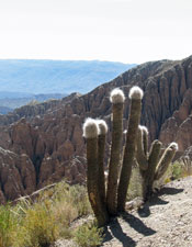
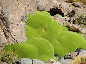 Llareta - the hard green cushion plant of the Altiplano |
 Road down to Laguna Hedionda |
|
 Polychrome mountains above Salar de Chalviri |
Not much later, we crossed over to the blindingly white bed of Laguna Kollpa, where a small enterpise harvested the salts to make shampoo. From there, we traversed a broad gravelly landscape before descending to Salar de Chalviri, framed by a range splashed in many shades of ochre colours. We crossed the salar on a borax highway, our smoothest road of the trip, before turning south to pass the Termas de Polques, hot water springs that steamed in the morning cold and sun. We would return, but first we had a detour to cross the barren flats of the Dali Desert, surrounded by surreally coloured mountains and dotted with unusual rock pillars. |
 More polychrome mountains framing the Desierto de Dali |
 Las piedras de Dali |
 Vicuña grazing on desert herbs |
 Another jeep racing across the striated desert gravel |
 The strangely lined gravel of the Desierto de Dali |
Even in this apparently vegetation free habitat, a herd of vicuña were eking out a living. Climbing over another rise, we descended along a gently sloping bed of gravel, dotted with volcanic rocks, heading towards the 6000m peak of Volcan Zairecahul. |
 6000m Volcan Zairecahul |
 View over a basalt ridge to Laguna Blanco |
|
|
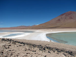 The narrow neck between Laguna Blanco and Laguna Verde |
 Laguna Verde turned opalescent green when the wind blew |
|
|
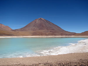
 Reflections of 5950m Volcan Licanbur on the surface of Laguna Verde |
|
After lunch at Laguna Verde, we doubled back to the Termas de Polques for a dip in the hot spring - out first experience of volcanic activity in the area. It was very pleasant soaking in the hot mineral-rich water in the warm afternoon sunshine. The only problem was that it was a meeting point for all the jeep tours, so many people had the same idea, which detracts somewhat from the experience. We were now on the main jeep circuit where tours originating in Uyuni and Tupiza follow the same path - La Ruta de las Joyas Altoandinas. |
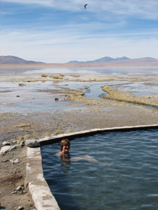 A dip in the hot springs at Polques |
|
 Returning across the Dali Desert |
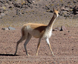 The graceful vicuña |
|
|
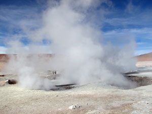 Jeep and people dwarfed by the steam geysers of Sol de Mañana |
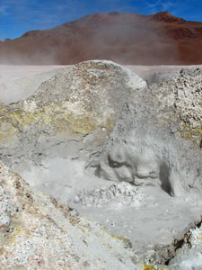 Bubbling mud pools .... |
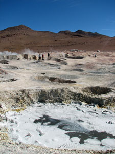 ... boiling grey ponds ... |
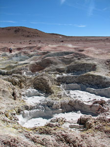 ... and pockmarked with craters ... |
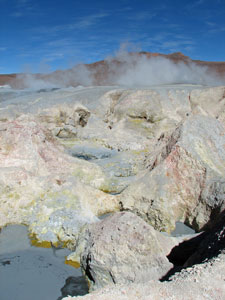 ... define the landscape of Sol de Mañana |
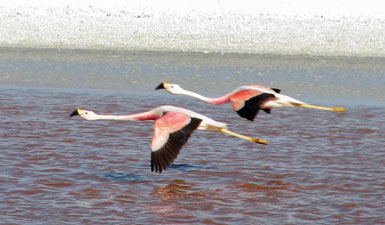
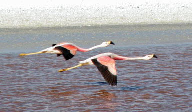
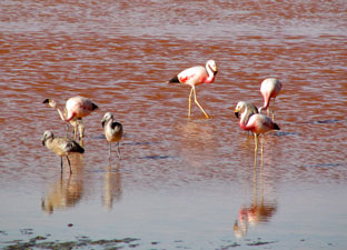 Flamingos wading in the rose-coloured water |
Once over the saddle, the track followed an equally gentle descent through the barren brown rocky landscape, before dropping to the well-reknowned Laguna Colorado (4320m). We checked in at the Hostal Huayllajara, an isolated refuge in the dusty barren landscape, before heading off the the lake's edge.
|
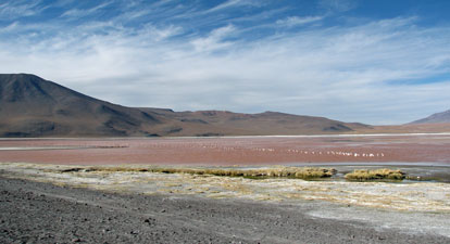 The shallow pinkish water of Lago Colorado is home to large flocks of flamingos |
|
|
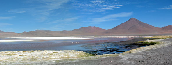 A different view of Lago Colorado |
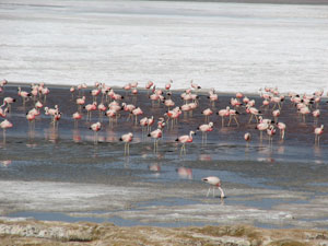 More flamingos feeing in the algal-rich water |
 |
 |
|
|