Around Osorno

Getting there

Leaving Isla Mocha was as tricky as getting there, but after a short flight in a Cessna, four hours spent in two buses with standing room only (and barely that), an overnight at Temuco and two more bus changes, we arrived at the Hostal Zapato Amarillo, run by Armin and Nadia, a superfriendly Swiss-Chilean couple, in Puerto Octay - the second recommendation that we had received at Casa Chueca.

Puerto Octay (11km - 30m ascent - 30m descent)
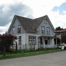
Puerto Octay is a small village set on the hilly edge of a beautiful bay on the northern shore of Lago Llanquihue, looking out onto the imposing cones of Volcans Osorno (2652m) and Calbuco (2003m). It is famous for its architectural patrimony, having many timber buildings and houses that date back to the German settlers who came to southern Chile in the late 19th century. We needed to stretch our legs after several hours on a bus and a walk around Puerto Octay and its beautiful surrounds seemed a good way to do this.


Evening view of Volcan Osorno (from our bedroom window)


The galvanised belltower of the 1908 church


Setting out from the small plaza de armas, we followed the Paseo Historico, a trail that wound through the streets of Puerto Octay past some of the more impressive examples of historical buildings, dating back to the late 18th and early 19th century with weatherboard, shingle or galvanised iron sheeting and painted a range of ochry pastel colours. Names such as Casa Teuber, Casa Wulf, Casa Schmidt and Hotel Haase giving away the origins of the people who built them.


Casa Niklitschek


Casa Anazco Trujillo

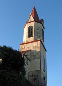
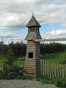
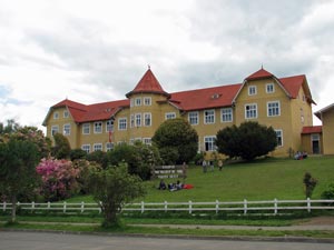
Colegio de Niñas San Miguel

The paseo led up to the old catholic cemetery, with its magnificent views over the Centinela Peninsula to Volcan Calbuco and directly across the lake to Volcan Osorno. When we had arrived, this isolated cone of snow lay hidden and brooding beneath a layer of cloud, but now its white crater rim was clear, surrounded by a thick halo of low cloud.


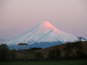
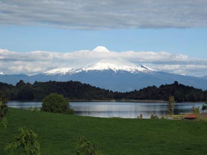
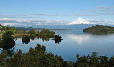
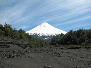
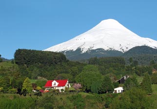
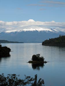
Volcan Osorno (2652m) and its halo of cloud


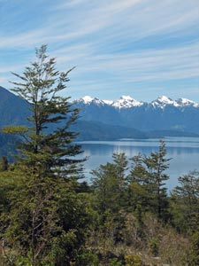
Looking across the Centinela Peninsula to the volcanoes beyond
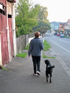
Nello y su amigo

At the cemetery we were joined by a black labrador, who followed us for the remaining 10km of our walk, as we headed back into town and out the other side to follow the road leading out to the narrow Centinela Peninsula. We seem to have a strange attraction for dogs on some of our treks.


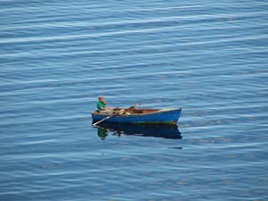
The solitary fisherman
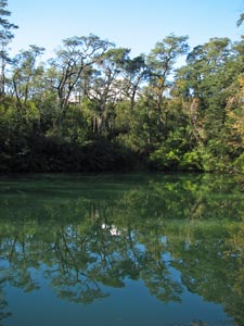
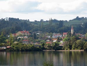
Puerto Octay

The road out led through the magnificent Spring-green countryside around Puerto Octay; birds were singing and the wildflowers were out in magnificent array. The air was almost still and the surface of Lago Llanquihue shimmered with the reflections of its shoreline.


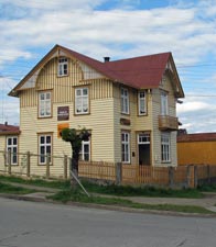
An example of the quaint rural architecture
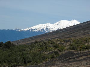

Osorno landscape


Reflections of the lake shore

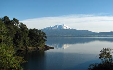
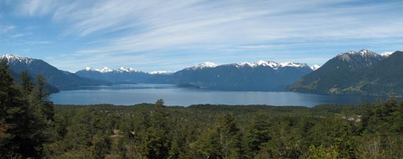
Every bend or rise offered new vistas of the magnificent Osorno, sometimes framed by small islets in the lake, sometimes by trees and green pastures, sometimes just rising impressively out of the water. Slowly the halo of cloud surrounding it thinned to reveal the perfect cone of Osorno in all the brilliance of its snow-covered whiteness.


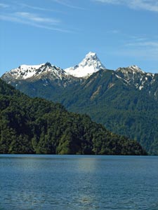
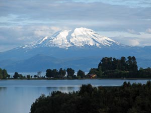
Volcan Calbuco (2003m) above the Centinela Peninsula


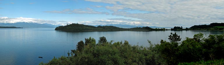
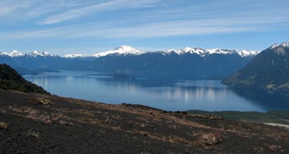
A panorama of Volcan Osorno and Lago Llanquihue

Like Arequipa before, Puerto Octay earned a place in this essentially trekking site by being different and by striking an aesthetic chord. That said, an afternoon walk around the town and peninsula whetted the appetite for one of the fine artesanal beers and a big slab of kuchen - it is not only the striking architecture that keeps the German influence here alive.

Sendero Paso de la Desolacion (16km - 450m ascent - 950m descent)
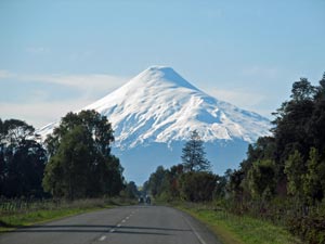

The road to Osorno

Having been captivated by the striking cone of Volcan Osorno, we knew where our next walk would be, and our host Armin, told us about good day walk across the eastern saddle leading up to the the volcano as well as organising transport to get there.

It was one those days where the sky was clear, the sun was just the right temperature and there was hardly a breath of wind - a perfect spring day in the south of Chile as we drove through the incredibly green countryside on the north shore of Lago Llanquihue to the starting point of our walk at the Rio Blanco, in the more open beech forest on the north side of the volcano.


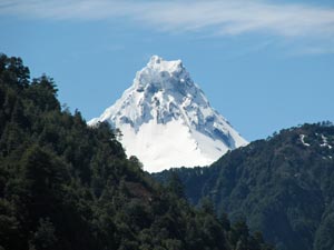
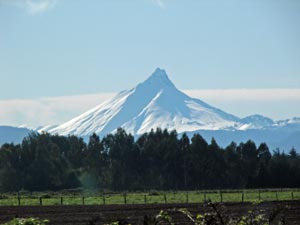
The curious asymmetry of Volcan Puntiagudo

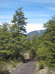
The track up the Rio Blanco to La Picada

The white cone of Osorno was hidden from view by the steep tree-covered slopes of a long ridge lining the dry bed of Rio Blanco as we set out, walking along a 4WD track formed from scoria and lava rocks. The rocky floor of the river bed was covered with an off white carpet of soft cushion plants that colonised the decomposing scoria; which, with the stunted beech trees emerging through the carpet, gave the appearance of a Japanese garden.


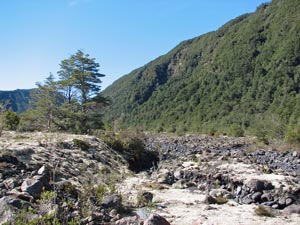
Dry bed of the Rio Blanco


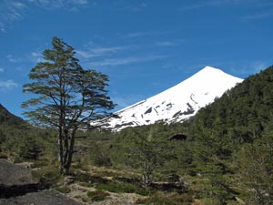
Volcan Osorno appears from behind the ridge

Soon, however, the white edge of Osorno appeared as the ridge sloped away, growing larger with every step. By the time that we reached Refugio La Picada, the northern face of Osorno was fully visible above the deep rocky cleft holding the Rio Blanco. We started a more direct approach to the pass, following a footpath up the side of this deep lava-walled gully, stopping briefly to chat to the local ranger. She told us that there was quite a bit of snow on the pass and that, as we were the first to cross for a while, we would have to blaze our own trail across the wide drifts. I looked at my trusty GPS and we pushed on.


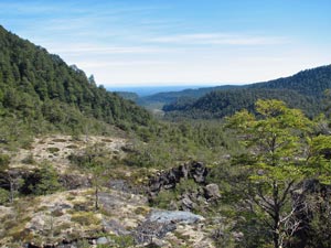
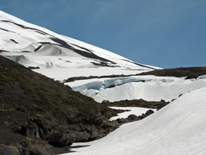
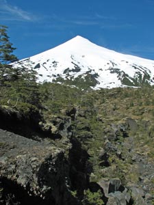
Looking up the lava gully toward Osorno
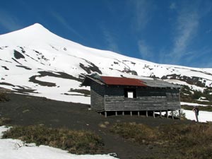
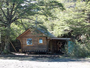

Refugio La Picada


Looking back down the Rio Blanco Valley

We climbed steeply up the track, the scoria crunching beneath our feet to reach our first snow-drifts in a barren landscape of loose volcanic cinder rock - the contrast between the black of the cinder bed and the white of the snow was quite incredible. Only the deep blue of the sky broke the monochrome panorama. Reaching an old abandoned shelter we stopped for a bite to eat and to admire Osorno from near, as we had yesterday from afar.


The old mountaineer's hut on Paso de la Desolacion
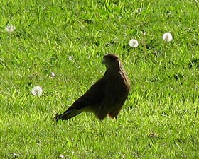
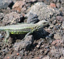


lava lizard

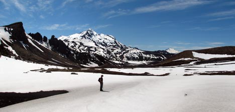
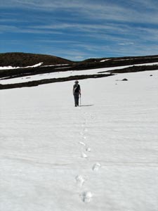
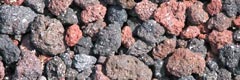
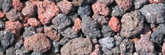
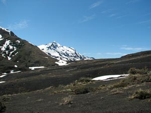
The barren cinder slopes that give the pass it's bleak name


Making the first track of the season across Paso de la Desolacion


View past 1750m Cerro La Picada to distant Monte Tronador and Lago Todos los Santos

Leaving the shelter, we passed through the remnants of an old gate to cross a series of increasingly wide snowdrifts. The views ahead to the east of a jagged ridgeline heading up to the snow-dappled crest of 1715m Cerro La Picada complemented the perfect lines of Osorno behind us.


Nello tracks across the virgin snow

Here the track disappeared in the drifts and we climbed slightly to traverse the eastern slope of Osorno, reaching a point with an incredible view over the distant waters of Lago Todos Los Santos to 3484m Monte Tronador on the Chile -Argentine border. Our South America adventure had almost come full-circle, as our first walk in this amazing continent way back in March had ended high on the slopes of Tronador.


Waterfall on the lower face of Cerro La Picada

----


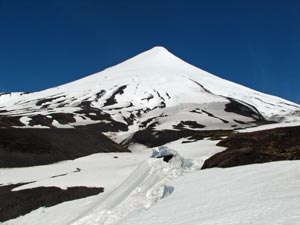
The stark monochrome of the eastern face of Osorno


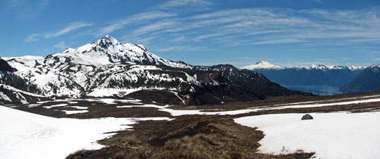
In the distance, mighty Tronador (3484m) blocks the horizon

Ahead lay a mini-canyon eroded into the cinder bed, its walls were too steep to cross, which obliged us to follow it down for a few hundred metres to rediscover the track and head on. In front of us, a waterfall tumbled down from La Picada alongside cliffs cut into the compacted cinders, revealing the curious layering of past eruptions. The volcanic landscapes were amazing.


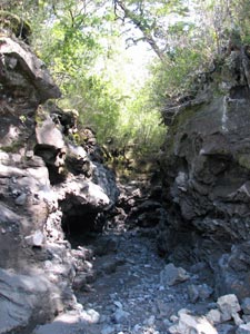
Eroded chasm in the lava slope


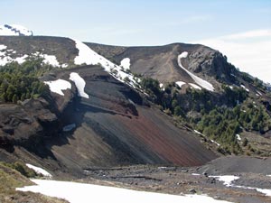
Coloured cinder cliffs of Cerro La Picada
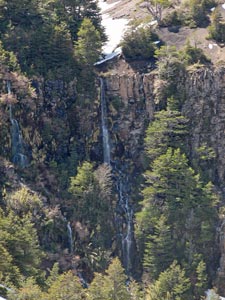
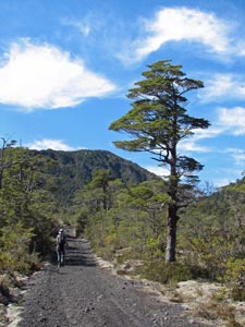

Starting the descent toward Petrohue

We were now in an area where cushion plants, mosses and prostrate herbs had begun to colonise the scoria. The track now began to descend more rapidly and the first stunted trees appeared; views across Lago Todos los Santos opened up revealing more of the lake and snow covered ridges lining it.


The beauty of beech


Panorama of Lago Todos los Santos

To the east, the towering plug of distant Volcan Puntiagudo (2190m) appeared through a gap and then vanished again. Crunching our way quickly down the scoria track, we found ourselves in an area of low open forest and shrubs, and soon were passing through groves of taller beech as we traversed the lower slopes of the volcano.


The forest reappears on the southern slopes


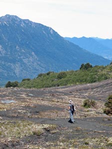
Looking across scrub and cinder slopes to Volcan Calbuco


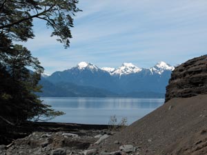
The snow- and ice-capped plug of Volcan Puntiagudo

Early Spring at Lago Todos los Santos


View of the southern face of Osorno from a wide erosion gully

The track now led us to the broad dry bed of Zanjón Picada, etched deeply into the mountain side by centuries of water run-off. We dropped into the gully and, instead of following the track across the mountain, headed directly down this broad gravelly bed toward the lakeshore. It was fascinating to follow this watercourse down through the ever denser forest; bone dry now, but its deep and sharply carved edges testifying to the large volumes of water that had recently (and probably frequently) rushed down to the lake.


The loose scoria rim of an erosion gully


Heading down Zanjón Picada to the lake

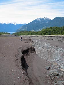
A deep washout in the cinder bed

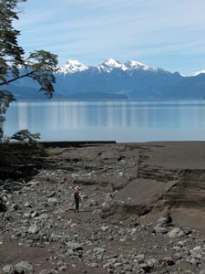
The shoreline of Lago Todos los Santos

We arrived at the lakeshore more sedately and followed its soft black sandy beach around, icy clear waters on our left, dense green forest on our right. Our path led us across two more deep water-carved channels, offering views back up to the snowy cone of Osorno, before heading inland to join a 4WD track that led up and over a small hill in the coolness of the beech forest to the small settlement of Petrohue, where our cheerful "chofer" awaited us.


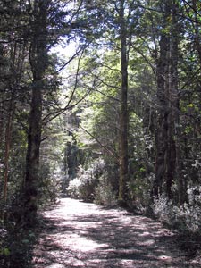
Track through the dense lakeside forest


Volcanic cinders, clear blue water and snow-capped peaks


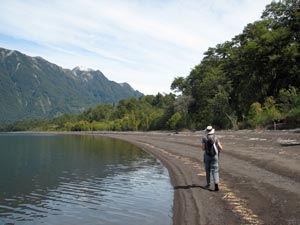
Strolling along the black sand beach


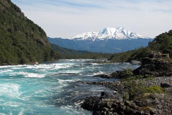
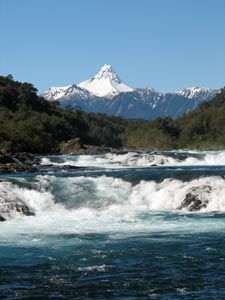
Rapids of Rio Petrohue overlooked by Puntiagudo


Reflections in the Green Pool

Our superb walk, which showed us three sides of Volcan Osorno and the magnificent setting in which it lies, was over, though there were still a few more oohs and aaahs to come.


Rio Petrohue flowing west towards Volcan Calbuco

The waters from Lago Todos los Santos flow down a narrow canyon to join Lago Llanquihue and soon form a wild set of rapids, overlooked by the three volcanoes. The rapids culminate in the Saltos de Petrohue, where the river is forced through a series of narrow gaps in an old lava flow.


Volcan Calbuco reflected in a quiet bay of Lago Llanquihue


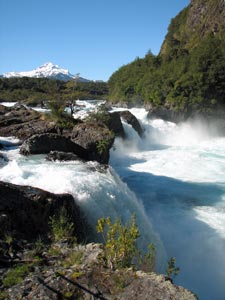
The impressive Saltos de Petrohue


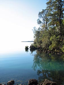
Lago Llanquihue - where water and sky merge


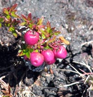
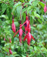
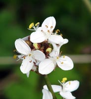
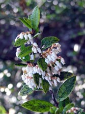
A cluster of snowbells

On the way back, we stopped several times to watch the spectacle of huge volumes of water surging, eddying, boiling up, cascading, jetting and foaming down this old lava bed; a particularly impressive sight if you are from a water-deprived continent, as are the fair Nello and I. Yet all this was absorbed into the hugeness of Lago Llanquihue as though it were a mere trickle, the mirror-like surface of the lake reflecting so perfectly the sky that the junction between the two was hard to see.

Without doubt, the combination of volcanoes, lakes and the greenness of the pastures and forests makes this one of the most beautiful parts of Chile. It is certainly one abiding image that we will take back with us when our South American odyssey is over.


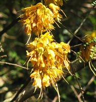
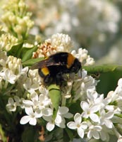
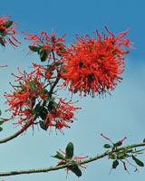
The vivid colours of the Chilean countryside