| West Coast Trail (Gordon River to Carmanah Creek) |
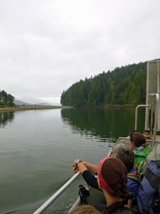
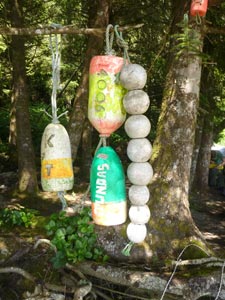
Getting There |
|
|
|
|
 |
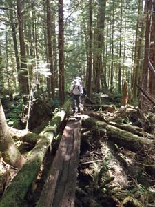
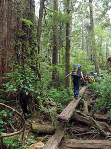
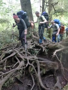
Day 1 - Gordon River to Thrasher Cove (6km - 240m ascent – 240m descent) |
|
|
|
|
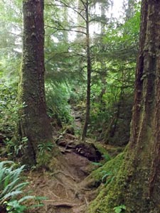
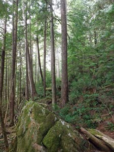 Mossy rock outcrops and regrowth forest |
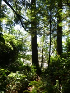
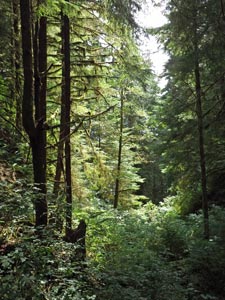
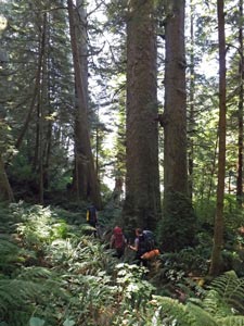
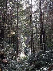 Deep in the forest |
||
|
|||
 |
 |
 |
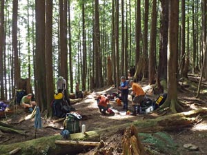 Lunch break in a forest clearing |
|
|||
|
|||
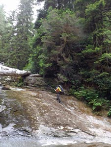
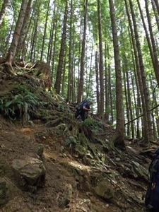 Steep descent |
 Sun-dappled forest clearing |
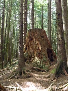 Red cedar stump amongst the regrowth trees |
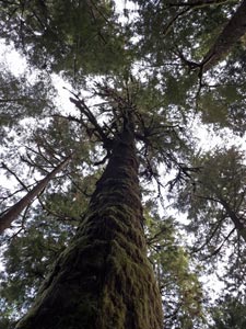
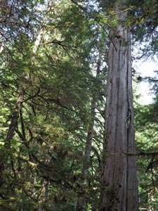 A surviving forest giant |
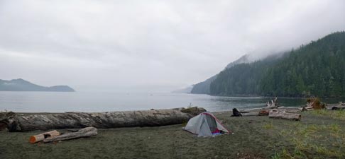
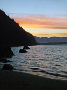
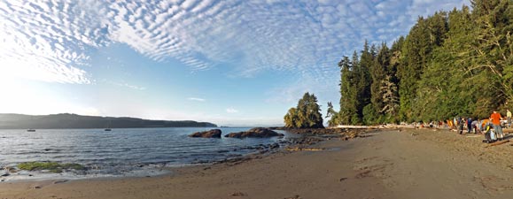
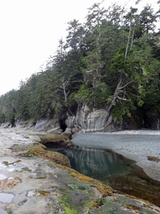
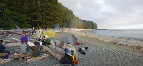
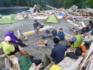
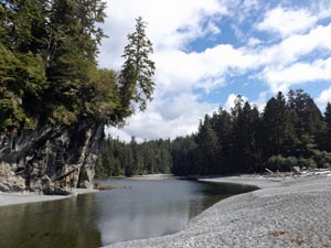
| A final series of ladders brought us to the smooth grey sand of the cove – beautifully set between the sparkling sea of Port San Juan and the tall spruce and hemlock lining the shore. Quite a few campers were already there, having arrived from both directions, but we found a cosy corner amongst the driftwood to set up our tents and have a nice fire to sit around later in the evening. | 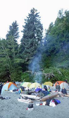 Sitting around the camp fire |
|
 Descent to Thrasher Cove |
|
|
|
|
Day 2 – Thrasher Cove to Camper Bay (8km - 80m ascent – 80m descent) |
|
|
|
 The coastal route to Owen Point |
 View back up Port San Juan |
|
|
||
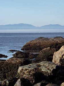
 View across to the Olympic Peninsula |
 The end of the rocky shoreline |
|
|
||
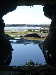
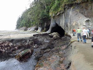
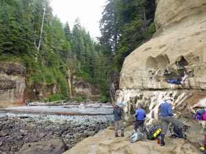
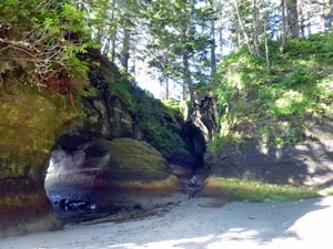 Sea caves beneath Owen Point |
 Sea-grass covered rock platform |
|
 |
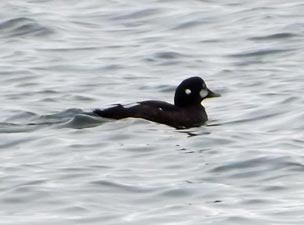
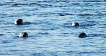 Fur seals off the point |
|
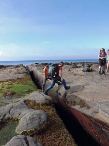 Some surge channels could be jumped ....... |
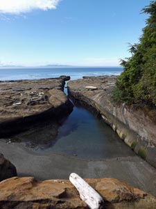 .... others had to be walked around |
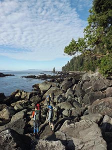
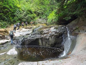
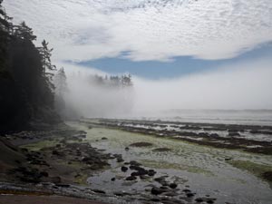
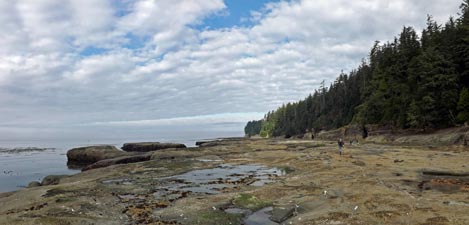
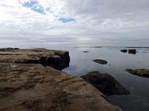
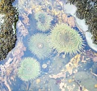
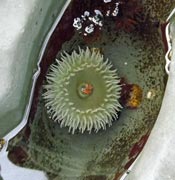
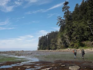
Our pathway was a broad and flattish rock shelf, etched with run-off channels and pot-holes, and occasionally cut by deep surge channels. Some we leapt across, others we rounded by heading briefly inland. On passing an impressive sandstone headland, mists began to swirl low across the platform. A band of sea-mist was moving by and, on looking back, cloaked the headland in an eerie shroud. It was superb – as we crossed the bright green beds of algae and curious lines of congregating anemones, the sun was shining and the sea-mist drifting by at the same time. |
 A line of congregating anemones |
|
||
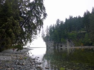
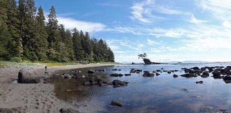
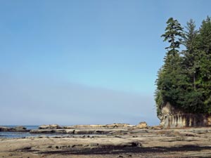 Rock platform north-west of Owen Point |
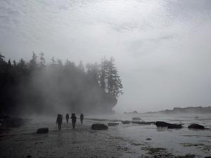 Walkers in the mist |
 A band of sea mist engulfs the headland |
|
|
|
|
||
 |
 |
 |
||
|
|||
 Back amongst the big trees |
 Crossing a tree-trunk bridge |
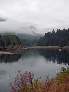
 A cool green pool in the forest |
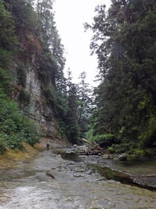
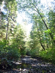 Stoney bed of Trisle Creek |
|
|
|
 The stone bed of Camper Creek |
 |
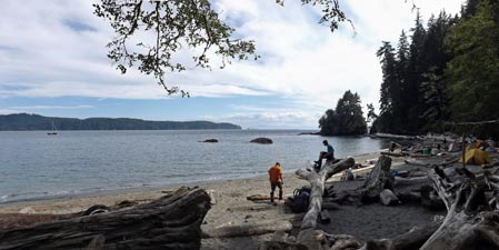
 Camper Bay beachscape |
|
  |
Day 3 – Camper Bay to Walbran Creek (10.5km - 250m ascent – 250m descent) |
|
||
 Leaving Camper Bay |
 Honeycomb etchings on the sandstone |
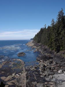
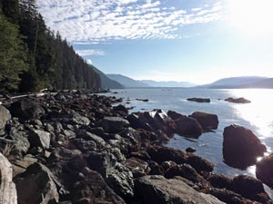
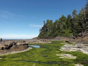
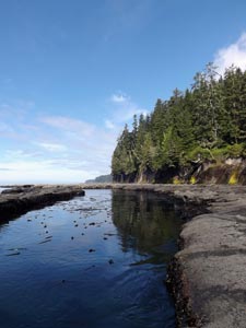
 The rock platform north of Camper Bay |
|
||
 |
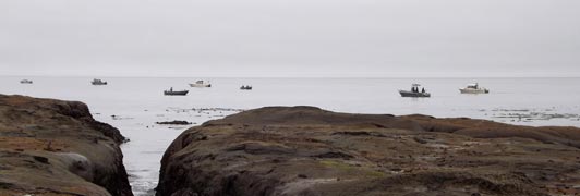 The flotilla of salmon fishing boats |
 |
|
||
 Surge channel cutting the rock platform |
 A strangely still Pacific Ocean |
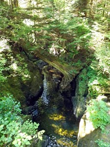
 The entry to Sandstone Creek |
|
|
|
 |
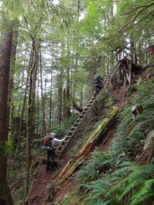
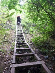
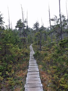
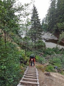
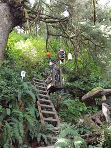
Back up the creek bed we went, leaving it to climb the 174 rungs in six sections of ladders that brought us back to the forest plateau. The path meandered along for a couple of kilometres, passing through more sphagnum bog and dwarf cypress, beneath giant centuries-old cedars and through the thick understorey of berry-fruiting shrubs. Long sections of boardwalk, some rickety and collapsing, others new and stable, were connected by muddy wallows or gnarly rooted path. Occasionally, tree-trunks, their tops planed flat, became a type of rapid transit through the thick vegetation. Sometimes we walked along the massive trunks of fallen trees, sometimes we ducked beneath them. |
 |
|
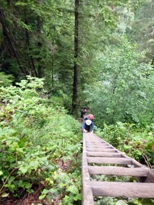 A day on the WCT - long ladders .... |
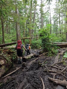 .... muddy wallows .... |
 .... a bit of log balance work .... |
 .... and gnarly roots |
|
|
|
|
|
 Walbran campsite |
 Sitting around the campfire |
|
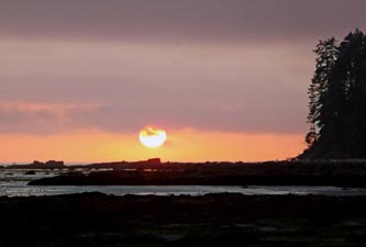 Sunset over Walbran |
|
||
  |
Day 4 – Walbran Creek to Carmanah Creek (11.5km - 0m ascent – 0m descent) |
|
|||
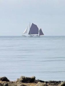 Full sails out to sea
|
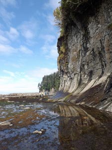 Impressive sandstone cliffs east of Walbran |
 A deep pool in the rock platform |
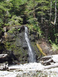
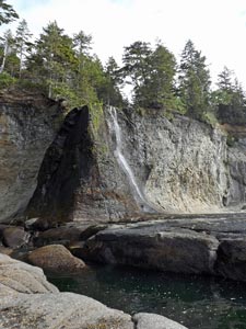 Adrenalin Creek Waterfall
|
|
|||
 |
 |
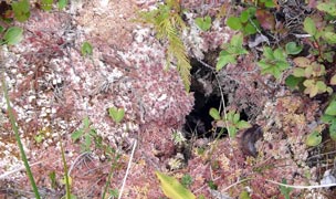
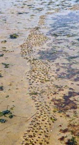
 The dreaded tar spot algae |
 |
 |
|
||||
 Farewell to Walbran Creek |
 |
 Rock platform west of Walbran |
|
||
 |
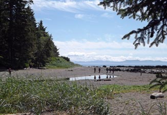
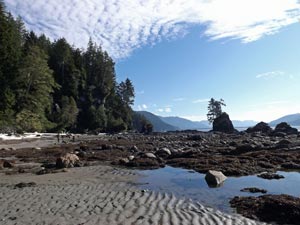
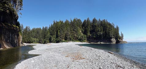
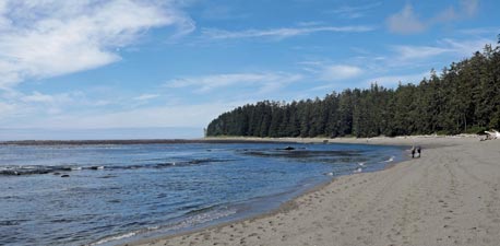 The grey sand beach between Vancouver and Bonilla Points |
 |
|
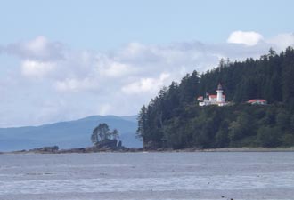
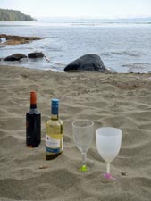
One last section of sloshing rock platform brought us to the Bonilla campsite and back beneath the beachside spruce, taking in the view to the south of fluffy white clouds over the Olympic Mountains, across Juan de Fuca Strait. It was another superb spot to enjoy a gourmet lunch.
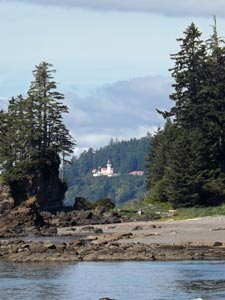
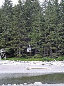
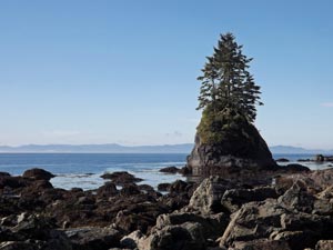
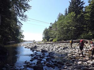
Lunch over, we only had a short walk left to our camping spot for the night, passing set of tree-covered islets amid a boulder-speckled sea – nature's own zen garden. Ahead, the white buildings of the distant Carmanah Lighthouse were framed between cliff and islet. A bit more soft sand trudging brought us to Carmanah Creek, where the choice was to wade or ride the cable car. Having done the former many times and never the latter, the choice was easy – it was a brief thrill!
|
|
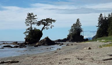 Flower pot islets |
 The beach east of Carmanah Creek |
|
||
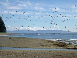 |
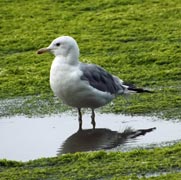
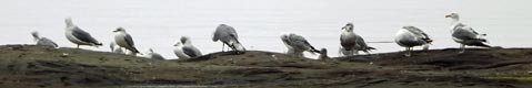
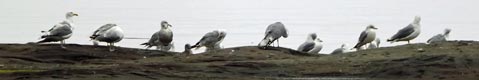
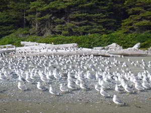
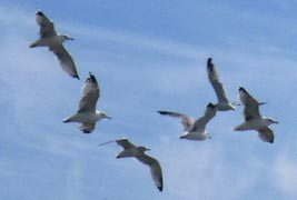 The gulls of Carmanah |
 |
 |
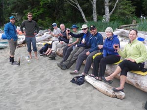 Mid-hike celebration at Chez Monique (photo by Beth Dempster) |
|
|
||
|