
| Day Walks in the Tatra Mountains |
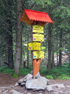
Getting there |
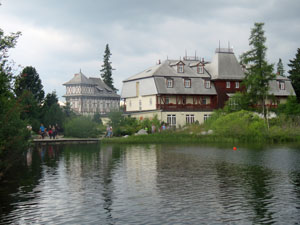
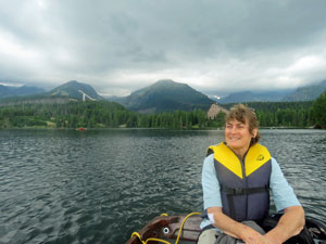
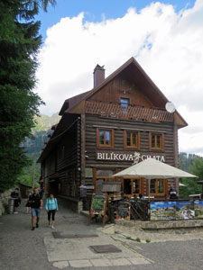
With our Danube Mark 2 cycling tour over and Budapest well-exlored, it was time to move on. Our idea was to head to the High Tatras, which form the western end of the Carpathian Mountain Range in northern Slovakia, and do some walking. The fair Nello's knees have started to grind down and she can no longer carry a heavy backpack for long-distances, so our walking modus operandi is changing. For this trip, we would base ourselves in a pleasant Penzion in the little mountain resort town of Tatranska Lomnica and use it as a base for a series of day-walks. Thus, we hired ourselves a car in downtown Pest and left the busy Hungarian capital under the guidance of our trusty car GPS that we had brought with us. We trusted it implicitly, to the extent that I didn't even check out a route before following the directions of our even-tempered cyberguide. She did an excellent job, navigating us through the passing thunderstorms, highways and back country roads of Hungary and Slovakia. However, listening to an Australian-accented robovoice pronouncing Hungarian road and town names can be very amusing.
|
|
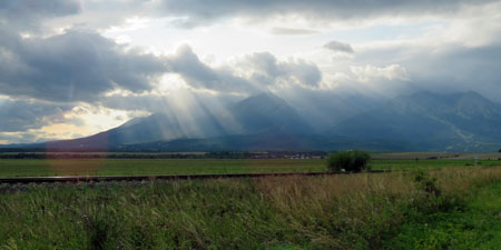
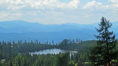
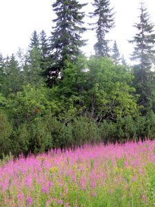
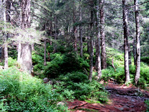
Our arrival in the Tatras was a bit of a surprise. After an hour or so of climbing over steep little passes and following winding roads through the foothills, I got the impression that the mountains just got continually large and more rugged. It was a shock then to arrive at a broad flat plain, but one in which the northern horizon was dominated by the cloud-covered peaks of the Tatras, rising abruptly from the flatlands. With the suns rays beaming through some holes in the cloud, it was a spectacular entry. It must be said that the weather was consuming our thoughts a little - with the promise of heavy rain and storms later in the week. Lets hope that we have enough fine days to get into the heart of the magnificent Tatra Mountains. |
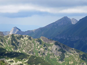
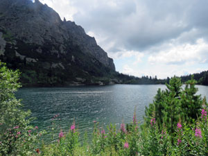
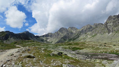
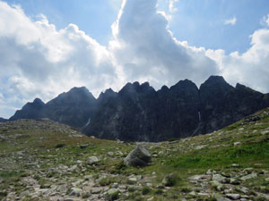
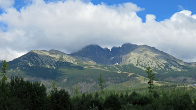 Lomnicki Massif in the High Tatras |
|

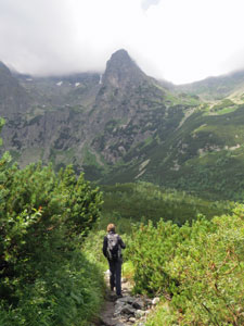
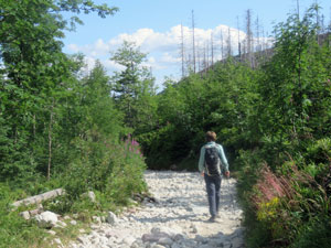
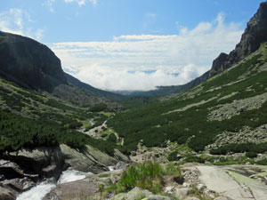
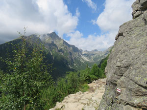
Climbing Velka Svistovka and down the Bielej Valley (15 km - 300m ascent - 1120m descent) |

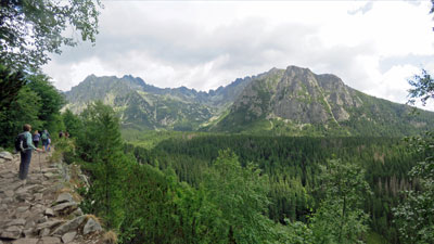
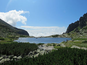
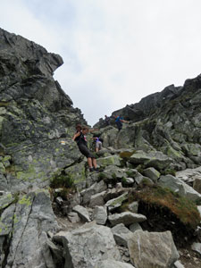
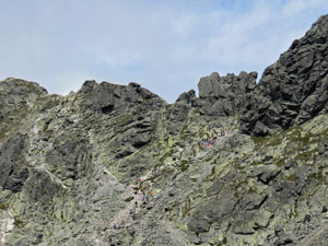
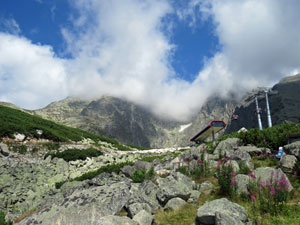
From our bedroom window we could see the dark Lomnicki Massif, its several peaks ominously capped by dense cloud. Still today, only a few showers were forecast, so the fair Nello and I decided we would head high for the views of the High Tatras. Our target was Velka Svistovksa, a smaller peak on the eastern spur of Lomnicki. The front slopes, that lead up to Lomnicki's sheer rock face, are part of a ski field - no point wasting time and energy on a climb up these ski slopes, we caught the cable car. It was while purchasing tickets that I realised we would not be alone, as I joined the end of a queue of hikers waiting to head up. Hiking is a popular sport in the Tatras and on a school holiday weekend, there were lots of people planning to walk this popular route. |
||
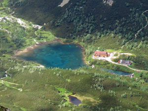
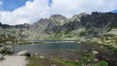
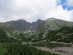 Skalnate Pleso - glacial lake at the base of 2634m Lomnicki |
 |
 View over the lowlands from the start of the walk |
Thus, the first 800 m of ascent were over in 15 minutes, as we emerged from the cable car to face the dark rock wall of Lomnicki, its peaks disappearing into the cloud. A little below us lay the small glacial lake, Skalnate Pleso. We descended to cross a bridge over its outlet, water tumbling down towards the broad valley below. |
||
 Last look at Lomnicki before rounding the spur |
 |
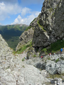
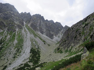
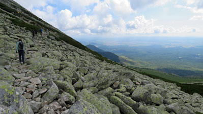 Crossing the boulder-strewn lower slopes of Huncovsky Stit |
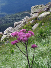
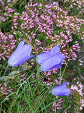
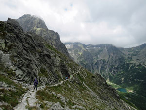
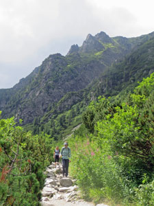
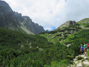
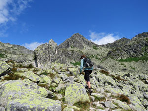
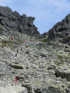
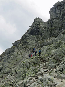
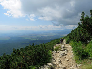
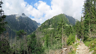
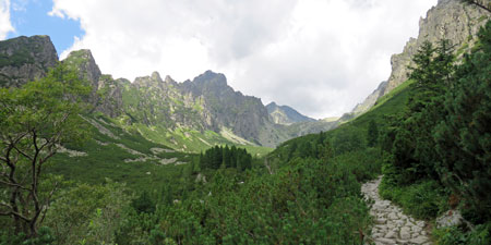
Once on the other side, the route was directly up through scatterings of bluebells, a good way to warm up in the cold mountain air, before turning to cross the steep-sided slope of granite boulder scree. There were spectacular views out over the valley as sunlight and cloud alternated above. Turning a corner, we were greeted with the sight of a long line of walkers zig-zagging their way up the boulder field to Velka Svistovka. We were also greeted with gusts of icy wind breaking through the high pass. |
|
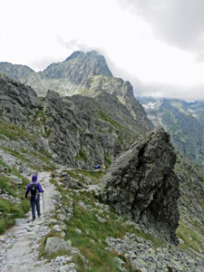
 The route ahead to Velka Svistovksa (2037m) |
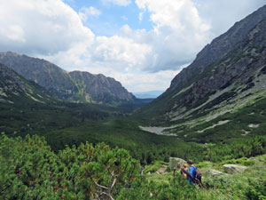
 Panorama of Kezmarsky Stit (2556m) and the Bielej Vody Dolina (valley) |
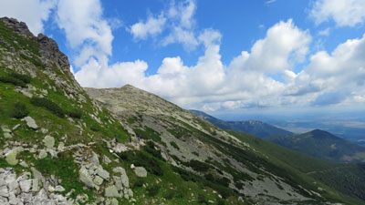
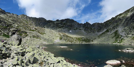
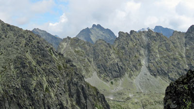
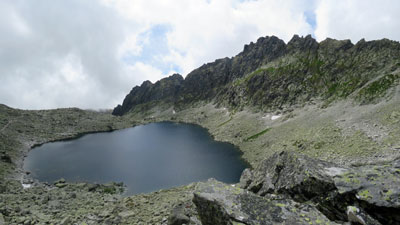
The climb was a steady one and, by the time we reached the rocky peak, a broad vista of mountain and plain had opened out on all sides. The west was dominated by the dark peaks of Kesmarsky and Huncovsky Stit, while way below to the north, sun glinted off the green waters of Zelene Pleso, high in the neighbouring valley surrounded by a magnificent cirque of peaks. The mountain chalet on its edge was our destination. |
||
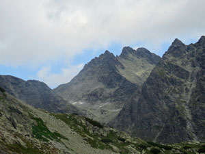
 Distant peaks of the Tatras |
 |
 Zelene Pleso and its mountain hut way below |
|
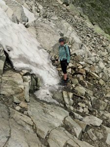
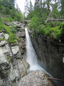
We put on our goretexes before starting out as the icy wind blowing across the ridge was starting to chill. The slope on the northern flank was even steeper and the rocky path quickly zig-zagged its way down. Not long into the descent, the first short sharp shower fell - dark clouds spilled over from the mountains, dropped their load and soon the sun followed. The path now passed through a region of stunted pines to reach the one serious obstacle of the descent, a narrow defile down which a small mountain stream was tumbling. A set of chains made its tricky descent a lot easier, though the arrival of the second sharp shower was not particularly welcome.
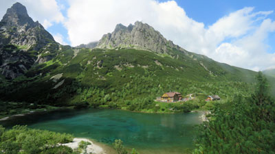
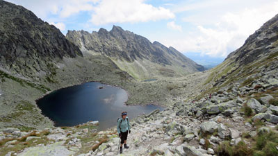
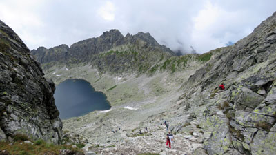
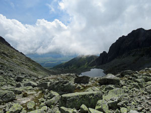
Once below the defile, the slope began to flatten out, and patches of wildflowers began to light up the path. Once again the sun was out and, as we emerged from the scrubby pine to reach Zelene Pleso, its green waters were sparkling.
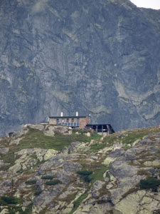
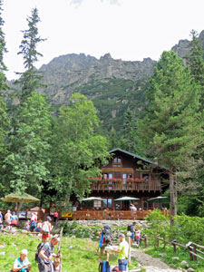
What a lovely setting, surrounded by towering dark peaks. The chalet on the lake provides hot meals and drinks and it was time for a late lunch - unfortunately, half of Slovakia seemed to have the same idea and the bustling crowds were a bit of a downer to the Tatra experience so far. |
|
 View across to the central Tatra mountains |
 |
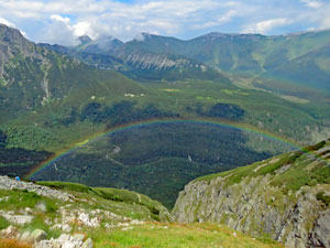 Rainbow in the Bielej Vody valley |
 One moment cloud and mist .... |
 ... the next moment, sunshine |
|
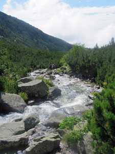
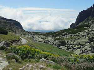
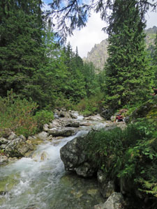
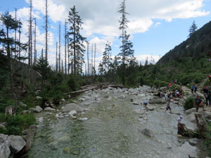
When we finally managed to get served and eat our lunch, it was time for the long walk down the valley of Dolina Bielej Vody - a descent of over 600m in 8km, that followed the tumbling waters flowing out of Zelene Pleso and down the valley. The track was wide and the slope gentle, but for the most part it consisted of loose uneven rocks - very tiring for the feet. |
||
 A stony road on the descent |
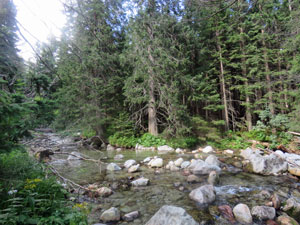 Zeleny Stream flowing benath the spruce and larch trees |
|
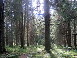
As we descended, the vegetation changed, passing through pines into tall spruce forest before eventually flattening out. It was here that the last and heaviest downpour hit us. Luckily, the road surface was now more even and we quickly pulled out our umbrellas - no point getting wet with only a kilometre or two to go. |
||

On reaching route's end at the main road, we checked to discover that the next bus was 40 minutes away - with the possibility of more rain, it didn't seem too extravagant to grab one of the taxis waiting for tired hikers and head back to the warmth of our penzion. Thus ended our first hike in the High Tatra Mountains - the instant takeaways were magnificent scenery, uneven feet-tiring rocky tracks, crowds of people and rapidly-changing weather. Let's see if tomorrow confirms these impressions. |
|
Three Lakes Walk (18 km - 820m ascent - 820m descent) |
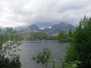
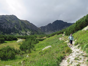
Looking out the window, Lomnicki was sporting only a token cap of cloud and the weather forecast was for only a chance of a shower. We decided to do one of the longer day-walks, a trip that incorporated visits to three of the Tatra Mountains most beautiful lakes. For that, we needed to drive to Štrbské Pleso, some 20 km to the east. At 1395m, it is also Slovakia's highest town. We parked in the centrum car park, to buy a few muesli bars, jelly babies, rolls for lunch etc for the walk, and from the speed at which it was filling up decided that parking places were at a premium and this would be the start of our walk. Our first impression of crowds of people was confirmed. In holiday season, the mountain villages of the Tatras are like ant nests, with columns of walkers pouring out in different directions - we joined one column heading north past Štrbské Pleso, the first and largest of the lakes. While we prefer walking in solitude, the fair Nello and I were impressed by the fact that so many people of all ages enjoy walking here - families with babies in backpacks and in utero, muscly legged 3- and 4-years olds skipping along, athletic teens and young adults, a few old fogies like us and even some dogs - so different from home. |
|
 Štrbské Pleso and the distant Low Tatra Mountains |
 Crossing the balcony above the conifer forest |
We soon arrived at the junction where the red-marked actual track left the road and climbed steadily up into the spruce-covered slope. Our second impression was immediately confirmed - the tracks here are very rocky. So, to save space, unless otherwise mentioned, all tracks that we walk on can be assumed to be rocky. |
|
 On the road to Popradske Lake |
The climb soon levelled out to a traverse of the steep, forested slope. Gaps opened up at times to reveal the plains below and the sheer rock face of Ostrva Peak ahead, as we crossed the occasional boulder scree and babbling stream. |
|
 |
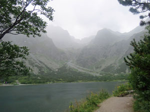
 Popradske Pleso |
|
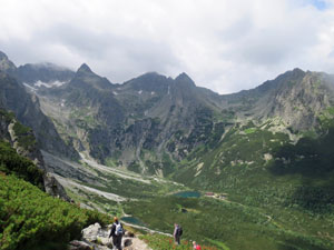
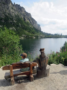
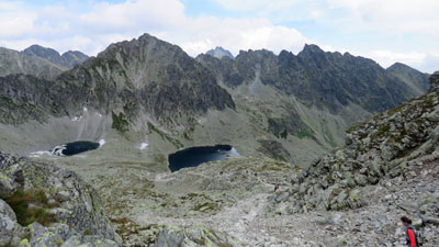
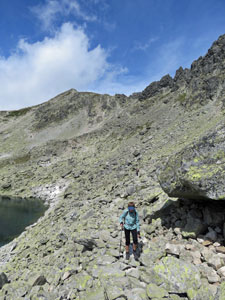
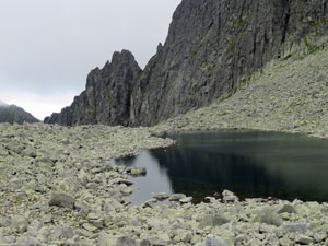
Eventually, we reached a junction with a sealed road and followed it quickly down to the shores of Popradske Pleso, a beautiful glacial lake at the base of the 450m high Ostrva rockface. It was the perfect spot for lunch, and with most of the crowd eating at the lakeside chalet, we enjoyed our packed lunch on an outdoor seat. However, it was decision time - the fair Nello's dodgy knees had not liked the steep, uneven descent of yesterday and were complaining already. She decided to stay at the lake and enjoy its magnificent surrounds, while I made a dash for Veľké Hincovo Pleso, the top lake, 4km further and 500m higher up the valley of Mengusovska Dolina. Our third impression was confirmed - The High Tatras truly have superb mountain scenery. |
||
 View back down Mengusovska Dolina ..... |
 .... up at its steep side walls .... |
 ..... and ahead towards its next tier |
Back on the rocky foot track (oops! I promised not to mention that any more), I headed quickly up the valley beneath the shade of the tall spruce trees. Suddenly, these gave way to low and scrubby pines and views opened out of the route ahead - it was a steep wall, with a track zig-zagging its way upwards. |
|
 The upper valley of Mengusovska Dolina |
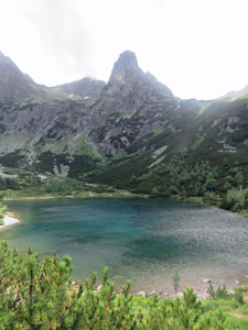
 Veľké Hincovo Pleso - largest glacial lake in the Tatras |
Passing the track junction to Ryzvy, the highest peak in Poland (yes, we are very close to the Polish-Slovakian border) and crossing a babbling stream beneath a small waterfall, the steep climb began. The advice of a long-ago Nepalese guide came back - "bistari, bistari" (slowly, slowly), so I steadily headed upwards, stopping only to take in the magnificent views down the peak-lined valley. |
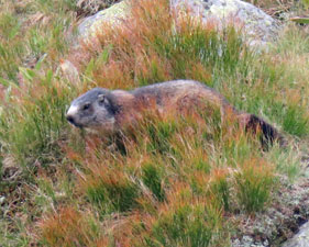
At a bit over 2000m the track levelled out - I had reached the terrace that held Veľké Hincovo pleso. Passing a couple of smaller tarns in this magnificent cirque of sheer-walled peaks, I crossed its barren floor to reach the lake shore. High above, the ridge line marked the Polish border. I scanned its horizon to see whether some Polish chamois might be watching, but no. Then it was time to descend again - part way down, I stopped to take off my sweatshirt and, attracted by a slight movement, looked up. A hundred metres above, I was being watched by a couple of Slovakian chamois. It was a highlight, as the High Tatras are one of the last hold-outs of this endangered species. To add to the faunal delights, a lone marmot whistled its warning from the far slope. |
||
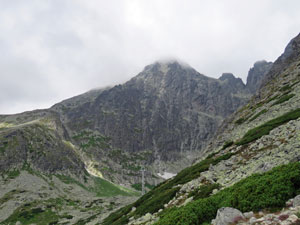
 Vysoka (2547m) -one of big peaks of the Tatras |
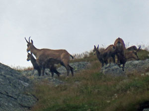 Slovakian chamois |
 Dark ridges of the Mengusovska Dolina |
That aside, I noticed one curious thing - the absence of humanity. It was late and no more people were coming up and, for a while, I was on my own going down - the serenity of the mountains embraced. Then, it was rapidly down the path to catch up with the fair Nello at Popradske Lake, compare notes of her exploration of the lake and its memorial cemetery to all the climbers lost in the Tatras, and head for home. |
|||
 Kopky Peak and the Mengusovska Valley |
 Relaxing at Popradske Pleso |
 1984m Ostrva Peak |
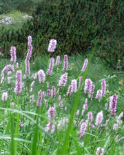
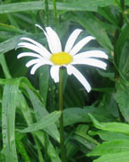
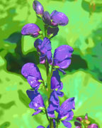
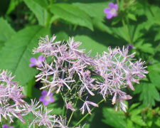
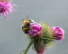
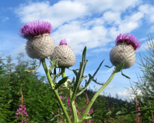
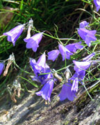
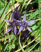
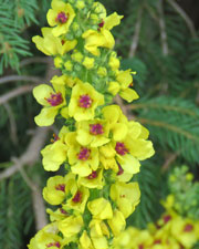
 Some Tatra wildflowers |
To avoid a complete retracing of steps, we opted to follow the quiet, sealed service road down the valley - softer on the foot and, at times, lined with wildflowers, it gave us a bit of variation before returning us to the centrum car park and a drive back to "home" at Tatranska Lomnicki As we left the car park, the first of the days showers arrived. |
|||
 In the larch ad spruce forest |
 |
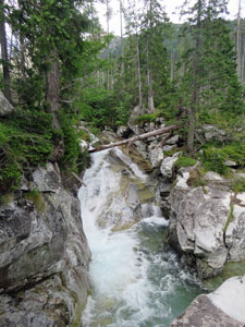
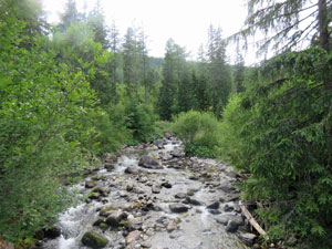 Stream on the lower slopes |
|
It had been another great, if tiring, day in the mountains and I suspect we were going to sleep very well. |
|
Rest day in The High Tatras |
With the weather forecast not looking good (rain and thunderstorms developing), it seemed a good day to take a rest. So what do you do when not walking in the High Tatras. Well, after catching up with a bit of correspondence, we walked down to the station and caught the local train from Tatransky Lomnicky back to Štrbské Pleso village. |
|
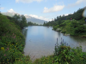
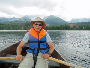
Here we had time for a stroll around this clear glacial lake and a bite of lunch on its shoreline. Feeling in need of an upper body workout, we rented a row boat and had a leisurely row on Štrbské Pleso as the sky above gradually darkened. The sound of distant thunder decided for us when to head back to shore, and, by the time the rain began to bucket down, we were happily esconced under the shelter of a cafe awning, sipping mugs of rich hot chocolate. It was a good way to get our energy back and it was certainly not a day to be out on an exposed slope in the mountains.
|
|
 Traditional houses on the lake shore |
 View across Štrbské Pleso |
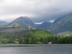 The big ski jump |
|
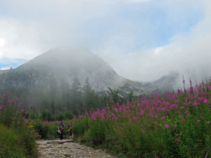
Two Valleys Walk (12km - 940m ascent - 440m descent) |
Wow! If you ever only have time to do one walk in the High Tatras, this is the one. It was well worth taking a bit of time off and freshening ourselves up for it. It must be said, we weren't sure what was in store initially - a couple of heavy thunderstorms rolled through in the night and morning brought a lot of low cloud from the moisture evaporating and rising as mist. |
||
 The mists lifting at Strbske Pleso |
 Climb up through the damp spruce forest ..... |
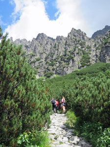
 .... and into the sunny dwarf pine belt |
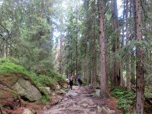
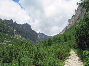
By the time we had driven to Štrbské Pleso, our starting point, we were in a dense fog and wondering what the visibility might be like high in the valleys. That proved a moot point, as it all began to lift quite quickly once we set foot on the track. Joining the ant-line of walkers, we headed north into the spruce forest, humid after the night's rain. Our ascent of Mlynicka Dolina, the long first valley, had begun. The track was stony and gnarly with conifer roots, but there were sufficient gaps to enable our feet to find a happy even surface to walk on. |
|
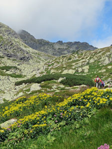
Pink and yellow wildflowers began to light up the path, as we emerged from the forest into the region of dwarf pines. For the first time we had a good look at the 2200+ m high razor-backed walls that line both sides of the valley in morning sunshine (yes, we had escaped the mists) - the light was that brilliant clarity that can only be achieved after a good storm has cleared the air. It was mountain scenery at its best.
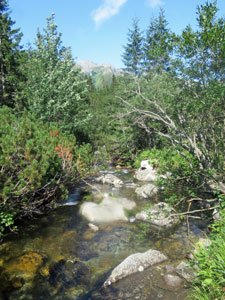
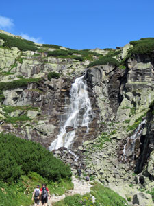
Soon our ears picked up the sound of rushing water as the track began to parallel a mountain stream. Ahead, we caught our first glimpse of its source, Skok Falls, tumbling down a rock face to a final 30m drop into the stream below. Mlynicka Dolina seems to comprise a set of rocky tiers, each one taking the valley floor to a new level. We would be leaving most of the morning walkers at Skok to sunbake by the stream or take selfies in front of the falls.
The climb up alongside Skok Falls was our first serious climb of the day, assisted at the top by a couple of chains. Once on the higher level, we were greeted by the sight of Pleso nad Skokom, a smallish tarn, which, when viewed looking back to the valley mouth, almost resembled a natural infinity pool. Down the valley the morning fog was rising, while up the valley the sky was almost cloudless blue. |
|
 The shimmering surface of Pleso nad Skokom |
 Crossing the middle valley boulder field |
 View back down the middle Mlynicka valley |
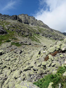
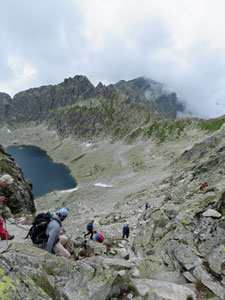
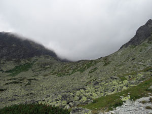
We quickly reached the second tier and another short, steep climb to bring us up to the next level of the valley. What a sight to greet us - this level comprised a massive field of jumbled granite boulders, splashed black and lime-green with lichens. We slowly picked our way across this jumble to reach the base of the third tier (it must be said someone has done a great job of placing flat rocks through parts of this boulder field which helped the crossing). |
||
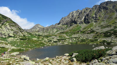
This tier was even higher, but efforts were rewarded with the sight of Capie Pleso, a lovely glacial tarn sitting in its rocky hollow at the base of a superb mountain cirque, with its fascinatingly-named peaks - 2412m Velke Solisko, 2428m Hruby Vich, 2381m Strbsky Stit and 2340m Hlinska Veza. |
|
 The barren setting of Capie Pleso at the head of the Mlynicka Valley |
 Ascent from Capie Pleso (2364m Velka Capia in the background) |
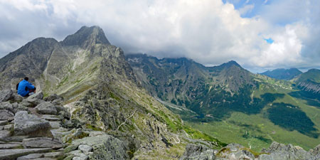
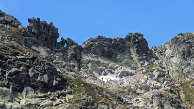
What was a little daunting though, was the sight of people working their way slowly up the serrated eastern wall of the cirque and disappearing into a narrow gap over 200m above us. Welcome to Bystra Lavka Sedo, at 2300m the pass that would lead us into the next valley. |
|
 Panorama of the Capie Lakes backed by 2381m Strbsky Stit |
 The razor-backed ridge and 2300m Bystra Pass (the tiny triangle of blue) |
|
After a few jelly babies for extra energy, we headed upwards and onwards ("polmary, polmary"), as cloud began to form and drift across ridge-line. The expanding views over the glacial lakes and surrounding peaks were superb. From here we could see Ryzvy, the highest peak in Poland, protruding above the eastern ridge-line. Passing under a remnant snow drift, we reached the gap, where a set of chains helped us scramble up to the opening.
Only now did we realise, just how sharp, these precipitous razor-back ridges are. It took but two steps from looking over 200m down to the lakes in Mlynicka Dolina on the east to looking down almost 200m to the lakes of Furkotska Dolina on the west.
As quickly as we crested one side, we were descending the steep boulder scree down to beautiful upper lake, Vyšné Wahlenbergovo Pleso. It was a magnificent place for lunch with whisps of cloud billowing over the ridges.
|
|
 The descent route from Bystra Pass |
 View down the Furkotska Dolina |
 The lower lake - Nižné Wahlenbergovo Pleso |
The descent of Furkotska Dolina was a slow one, picking a careful line through the boulder fields, as we dropped off first one and then another tier to pass a second glacial lake lower down. Behind us the clouds were looking decidedly thicker and it was good to be descending, not climbing up like a few brave souls we passed. |
||
|
 Panorama of the plains from the middle tier of Furkotska Dolina |
|
A little lower down, grasses and wildflowers began to populate the slopes and a family of marmots romped about on the rocks and whistled their warnings. Views were now opening up over the sunlit plains below and we found ourselves following the track through dense thickets of dwarf pine. |
||
 Cloud descending into the Upper Valley |
 |
 A last stroll down to the Solisko Chairlift |
Finally we saw what we were looking for - a junction with a path that led to the top of the Solisko Chairlift. Sometimes sore knees need to be pandered to, so we made one last short climb around the end of the spur to reach the chairlift and descend the final 2km and 500m of elevation in comfort. Today, the High Tatras had shown us their best. |
|
Going local - a nice stroll to Studena Dolina (10.5 km - 80m ascent - 560m descent) |
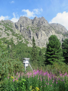
While walking here, we had noticed that for many Slovak people, a day out in the High Tatras involved a walk up to one of the mountain huts to enjoy a long lunch and glass of beer, or spend the day relaxing by a waterfall or tumbling stream before heading back down again - healthy exercise combined with other pleasures. After three strenuous walks, we thought we would follow the local custom and have an easy last day, just enjoying the mountains without the need to reach a high lake or peak. Thus, we caught the cablecar up from Tatranska Lomnica to Skalnate Pleso, as on the first day - one last chance to look at the cloud-capped face of Lomnicki Stit, the second highest peak in the Tatras, before heading off. This time we turned westwards and downwards to pick up a (rocky, of course) path that took us past the small and quaint Skalnata Hut, overlooking the grassy ski fields. |
||
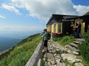 Taking in the sights at Skalnata Hut |
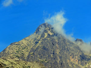
 Looking up to the cloud-capped summit of Lomnicki Stit |
 Path around the lower slope of Lomnicki |
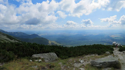
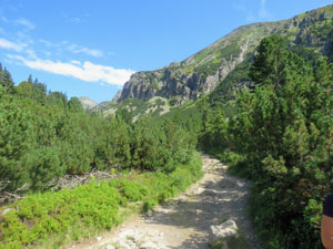
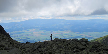
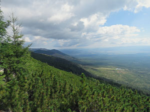
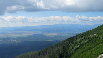
The track now followed a long, gently descending traverse of the slope of Lomnicki Stit, cutting through the dense thickets of dwarf pines that dominate this altitude. Out to the south, the view expanded over the broad plain, dotted with town and village to the silhouette of the Low Tatras beyond. |
||
 The pine forest of the lower Tatras |
|
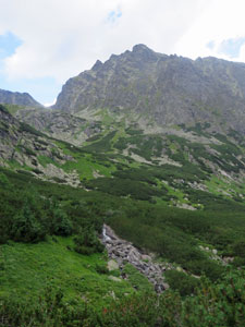
 Tunring towards Velke Studena Dolina (Big Cold Valley) |
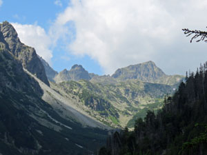
As we descended further, low pine was replaced by taller spruce and larch and the views were restricted ..... that is, until we rounded the end of a long spur and found ourselves looking down the throat of Velke Studena Dolina (the Big Cold Valley), beautiful in the morning sun, with its classic glacier-carved U-shape and steep walls rising to over 2000m. |
|
 Panorama over the plains to the south |
 The entries to Velke and Mala Studena Dolina (Big and Little Cold Valleys) |
|
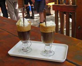
To its east lay Mala Studena Dolina (the Little Cold Valley) and that was our target - we headed quickly down the steepening track to the forested mouth of the valley and Zamskovskeho Mountain Hut, a delightful timber building set in a clearing amongst the spruce trees. It was time to find a table, order our Viennese coffees and watch the world go by a la Slovakians. The tables and benches were full of people doing the same, families, couples and groups of young people all enjoying the morning sun, the mountain air and their beers (a slight exaggeration, but we have noticed that Slovakians love their beer).
While looking at the map, I noticed that the forest cleared a little higher up the valley and it wouldn't take much effort to get a better look at Mala Studena Dolina, so I left the fair Nello chatting to a group of young Czech hikers about their 3-day trip from hut to hut and headed up. It was worth it - the track followed a beautiful, clear, rushing stream through the forest, before emerging into the open, with the high valley walls rising up on each side.
|
|
On reaching a point where you could see distant Teryho Mountain Hut, perched high on a hanging valley above a silvery waterfall, I stopped and returned - after all, this was meant to be an easy day. From Zamskovskeho Hut, the well-formed, but uneven track dropped quickly down through the forest, passing a small, but powerful waterfall to reach the bridge across Velke Studena Stream. It was surprising how quickly the proprioceptors on our feet adapted to the knobbly track surfaces after only a few days in the Tatras. |
||
 Looking down ..., |
 .... and back up the Mala Studena valley |
 Forest recovering from cyclonic wind damage |
|
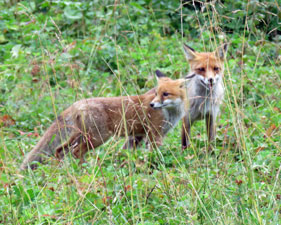
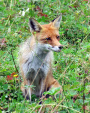
Just a little further lay the cabin-sized Rainerova Hut, oldest mountain hut in the High Tatras. We joined the locals to sit around its grassy verge and enjoy our lunch, while watching the antics of a pair of red foxes, that clearly were becoming a bit too used to people. From Rainerova, the descent continued , following the course of the Studena Stream as it crashed its way over a series of cascades and small falls. The surrounds here had a devastated appearance, with many trees torn down or standing dead, due to mini-cyclonic winds that flattened large areas of Tatra forest in 2009.
A final short, sharp climb brought us up to the ridge and to the top terminus of the Hrebienok funicular railway. It was our way down off the mountain - after all, this is an easy day. Reaching the bottom terminus, we disembarked the funicular, wandered the short distance across the town of Stary Smokovec to the railway station and caught the local train back to Tatranska Lomnicky. |
|
Sitting at what had become our favourite railside cafe in this pleasant little town, we decided this had been an excellent way to finish our time in the High Tatras of Slovakia. Following the locals' beer-drinking ways, we raised our glasses of Zlaty Bazant and saluted a great week of mountain walking. |
|
