
| Transylvanian Walking Circuit (part 2) |

Day 4 - Ciocanu to Moieciul de Sus (14 km - 260m ascent - 510m descent) |
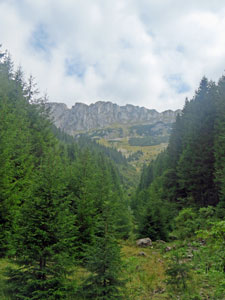
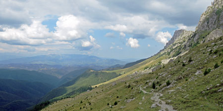
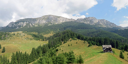
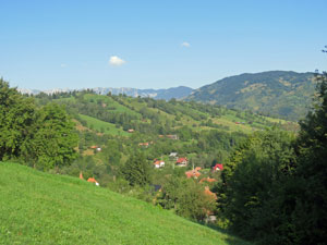
As always the day started with a clear blue sky - however, we knew the forecast promised something different, so we set out early. Our walk today would also be different - a transition from the Piatra Craiulul side of the valley to the Bucegi Mountains side, crossing the rolling hills and villages in between. |
|
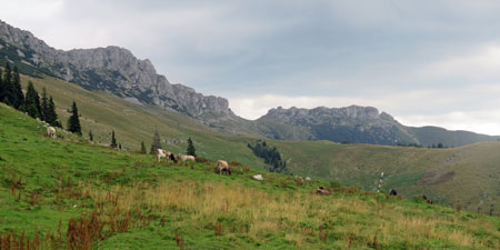
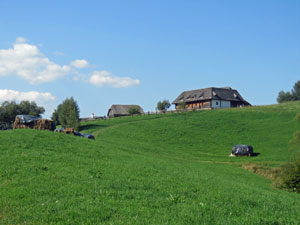
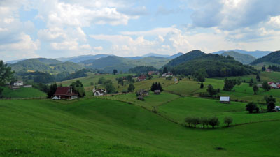 The greenness of the countryside near Ciocanu |
 Route through the farmlands |
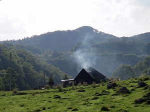
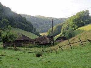
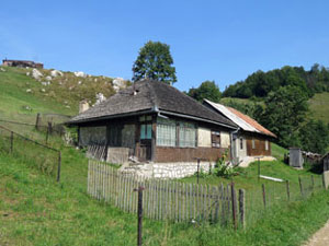
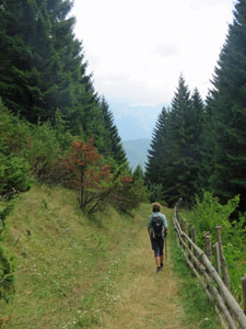
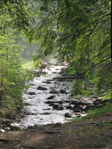
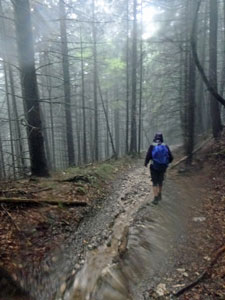
The air had that typical post-rain freshness as we set out from Ciocanu, quickly leaving the road to head down into the damp grass of a small V-shaped valley. The track was now a bit on the muddy side, but still firm, as it led us past a series of traditional and newer houses to reach an old abandoned farm - some of the buildings still showing their typical shingle walls and rooves, others already falling down. Such is life in parts of rural Romania. |
||
|
|
|
 |
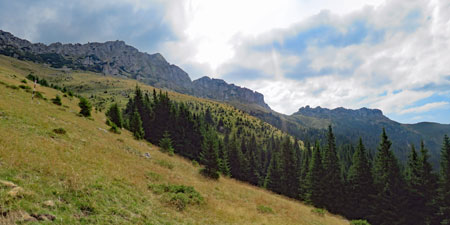
We then climbed out the far side of the valley, following an old stone wall to an area where bell-tinkling cattle grazed, Carpathian sheepdogs watched us carefully and quietly, and small, yappy house dogs barked away to boost their little egos - if this is the worst of the "dog problem" on this walk, the pepper spray we had been given seems a bit of overkill. |
 |
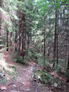
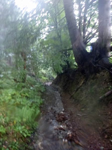
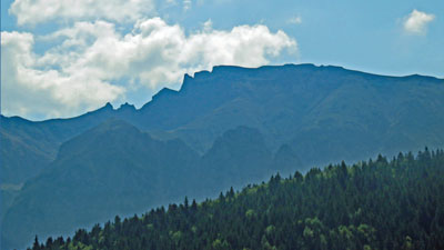
The route now levelled out, passing through a lovely section of forest ..... lovely, that is, until we noticed the villagers used the deep creek as their local rubbish dump. Emerging on to a large sloping meadow, we followed our guide notes and headed uphill beneath a crackling high-voltage powerline to reach National Route 73. For the next half kilometre, we were obliged to walk along the edge of this busy road, though the views it offered back over the Piatra Craiulul Massif were adequate compensation. |
||
|
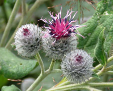
 Why you should walk in Transylvania |
|
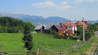
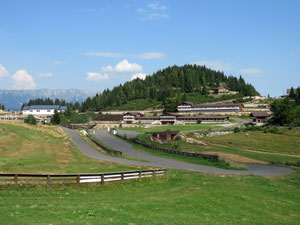
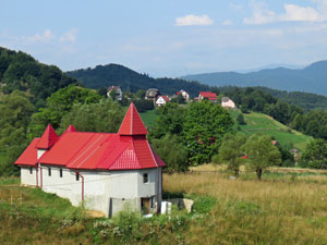
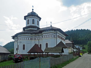
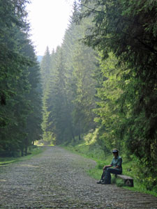
Once we left the asphalt road, the next part of the walk involved an undulating meander along narrow and quiet gravel roads, past the scattered houses of the village of Fundata, past the extensive complex of a Cross-Country Ski Training Centre, through a small grove of dark firs, and down a ricketty-fenced lane to the "centre" of Fundata. I say centre because it had a church and a shop, the first interesting because it was a very impressive building for such a small village and the second welcoming, because it was a good place to stop for a cold drink. |
||
|
|
|

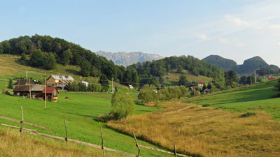
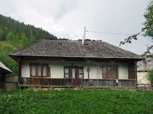
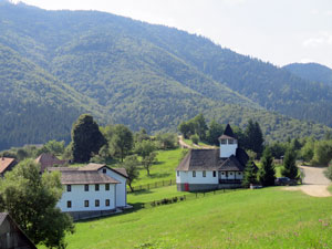
 Farmhouses facing the Buvcegi Mountains |
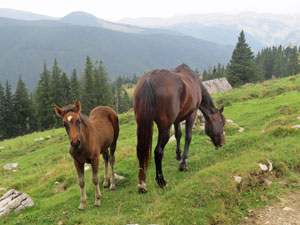
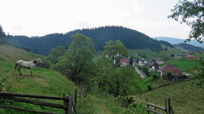 Horse surveying he countryside |
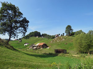
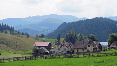
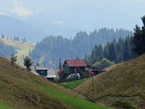
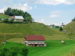
However, we could not afford to stay too long - like yesterday, the clouds were beginning to build up and take on a menacing grey hue. We headed on for our last long descent, down another V-shaped valley that looked out on to the Bucegi Mountains, following a grassy road between more traditional mountain houses - yet again, postcard perfect. |
|
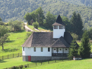
 The lower church in Fundata |
 The route down |
 Old farmhouse in Fundata |
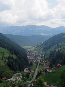
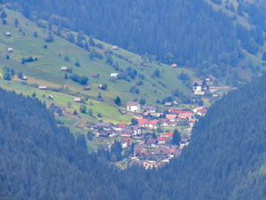
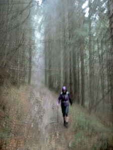
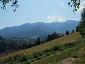
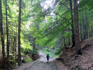
On reaching a junction, the route led us down into the forest to follow a contour around the slope, as the first peals of thunder rolled across the landscape. As we had come to expect, the track ended with a steep descent of the spur to reach the village of Moieciul de Sus, stretched out along a long valley that pointed up to the Bucegi Mountains. Tomorrow that would be our route - today it just drew our attention to the thunderheads forming over the range. |
|
 Farewell to Fundata |
 View across the forest to the Bucegi Mountains |
 Heading down a country lane ..... |
 ... followed by a forest path |
 The town of Moieciul de Sus |
 |
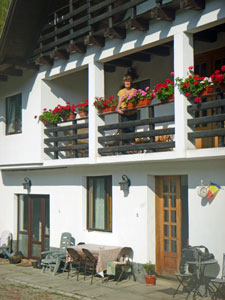
However, we had beaten them in and arrived at our pensiunea a bit after mid-day. Our hosts were absent, which was a bit annoying, so we sat down at a garden table to enjoy our packed lunch. As we finished, our host arrived with a tray of local sheep's cheese and a nip of artisanal eau-de-vie de plum .... all was forgiven. The thunderclaps grew louder and the storm broke, followed by a bit of hail and several other downpours during the course of the afternoon. How pleasant it was to watch this spectacle of nature from our little balcony rather than from under the rain-drenched hood of a goretex out in the open. |
 |
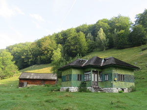
 A centuries old farmhouse ....... |
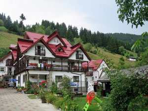 ..... and a modern guesthouse in Moieciul de Sus |
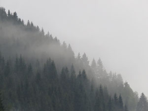 The mist and rain finally arrive |
It had been a very different day, more cultural than natural as we passed through the meadows and farms that have existed here for centuries. Tomorrow, however, we will be back to the natural as we head up into the Bucegi Mountains .... and the forecast is for the return of fine weather. |
||
|
Day 5 - Moieciul de Sus to Simon (23 km - 970m ascent - 1040m descent ...... plus 4km by horse and cart) |
There is a saying "third time lucky", but for us it was more like "third time unlucky" .... more of that later. Today was going to be a long walk, so we headed out early - retracing our steps to the road junction and then heading south-east down the main street of Moieciul de Sus. The mountains towering above in the distance beckoned. |
||
 Early morning stroll through Moieciul de Sus |
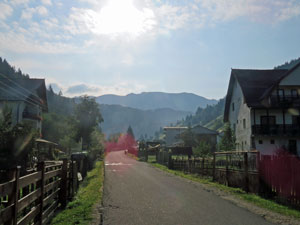
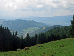
There seem to be two types of village in this region - hill-top ones that are scattered across a broad area of rolling country and valley ones, that stretch out along narrow valleys with one or occasional two rows of houses on either side of the road. Moieciul de Sus was one of the latter - thus we ambled along its asphalt street for the first 4 km, before finally leaving the houses (half of which seemed to be guesthouses or tourist places) behind. |
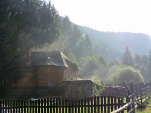 Vapour rising from the wooden houses |
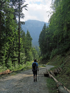
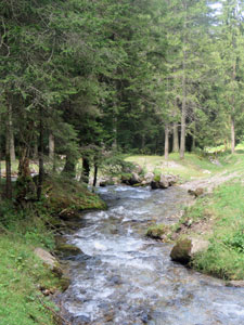
No sooner had we left the village than we entered Parcul National de Bucegi and the road turned to rough stone as it led us directly up the gently sloping valley beside a babbling brook in the midst of dense fir forest. The air had a slight mistiness, as the morning sun evaporated the wetness of the storms. |
|||
 Bangaleara Stream |
 Waiting by a forest road |
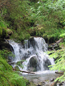 A small but spectacular waterfall |
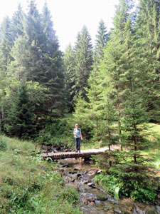 Crossing a small wooden bridge |
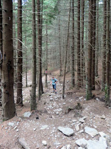
Gradually, the slope began to steepen and the road eventually morphed into a foot track which crossed the stream back and forth on little log bridges. The last bridge led us to the base of a steep fir-clad spur - the access route to the mountain tops. |
|||
|
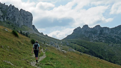
For the next 30 minutes, we worked our way up a deeply eroded path beneath the dark trees, emerging on to a lovely grassy meadow, only to discover that the steep ascent was not yet over. Another 15 minutes of climbing directly up a pole line brought us to our contour.
|
|
|
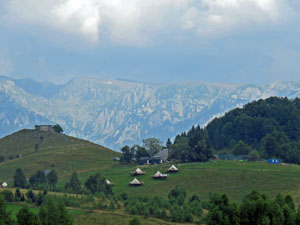
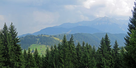
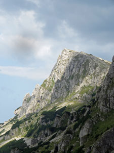
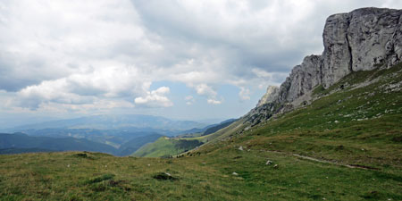
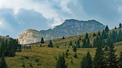
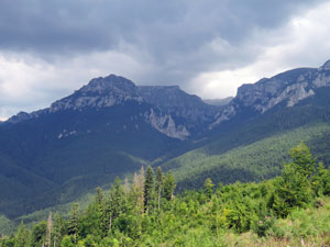
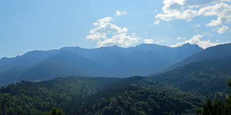
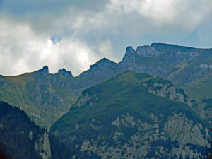
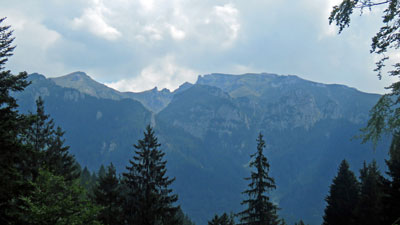
What a spectacle it was from here, as the grassy meadow rose steeply up to the vertical limestone cliffs of the Bucegi Mountains. This line of cliffs stretched out on both sides, while behind us lay a sweeping panorama of the valley and mountains beyond. Above us, the sun was in a battle with the clouds that these mountains seemed to be generating - sometimes the cliffs seemed luminous, at other times menacing. |
||
 |
 The 2000+ m limestone walls of the Bucegi Mountains |
 |
After a break to take it all in, it was time to head south on a climbing traverse to reach 1910m Saua Strunga, a saddle between the limestone walls of Strungile Mari and Strungile Mici, that opened up views to the other side of the mountains. Just below the saddle, it was a surprise to come across a flock of sheep, four cows, one shepherd and three large Carpathian sheep-dogs. The latter barked a warning and then watched me pass. |
|
 Heading towards the 1910m pass at Saua Strunga |
 View east over Refugiu Saua Strunga from the pass |
Just below the saddle, it was a surprise to come across a flock of sheep, four cows, one shepherd and three large Carpathian sheep-dogs. The latter barked a warning and then watched me pass. |
|||
 Colti Tapului (2168m) |
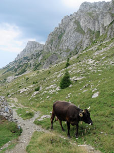 The local residents - cattle ..... |
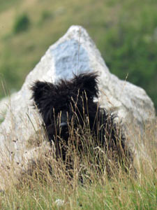 .....big sheep-dogs .... |
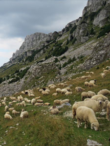 .... and, of course, the sheep |
 |
 Zooming in on Moieciul de Sus way below |
 |
Returning from the saddle, we continued on this high traverse beneath the magnificent limestone cliffs, undulating and meandering across the broad sloping meadow and soaking up this panoramic vista. |
|
 The impressive walls of 2181m Varful Batrana |
 Looking back over the mountain meadows |
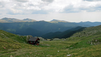
The route slowly descended, passing a shepherd's hut, before crossing a small copse of spruce. Here, we found ourselves following four horses into the next meadow, along with its everchanging views of the cliffs above. The descent now began to steepen, down through a long section of forest to emerge at Poiana Gutanu, a second large and steeply sloping mountain meadow beneath the rock wall of the Abruptul Gutanu (Gutanu Cliffs). The unrolling face of these mountains continued. |
||
 |
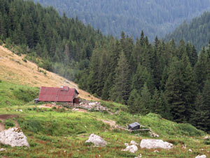 Shepherd's hut near the forest verge |
 |
A little lower down, the vistas of the mountains from the Gutanu Forestry Hut were even better. It was time to descend before sensory overload set in. We entered the forest to begin a steady descent of a long spur radiating out from the high slopes. |
|
 2422m Scara Peak |
 Panorama of Gutanu Forestry Hut |
More views opened up of the line of peaks as we passed a couple of clearings - out to the east, the dark clouds forming over Gaura Peak looked menacing. With an hour of descent through the tall, dense fir forest, still to go, the fair Nello commented "I think we should hurry, that looks like rain". "No worries" I replied " the forecast is for fine weather". |
||
 View over the valley of Moieciul de Sus |
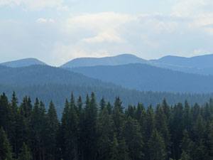 The colours of the eastern Carpathians |
 Bad weather over Gaura Peak |
The first few drops found their way through the forest canopy a few minutes later and I still thought it was a passing shower when we felt obliged to put on our wet weather gear and put electricals, wallets etc in the dry bag. Then the skies opened and it began to bucket down. For the next 50 minutes, we trudged our way down a muddy slope that was rapidly turning into a stream, as peals of thunder joined the downpour. Water trickled into boots and down backs as little by little we ended up drenched - at least the rain wasn't cold. It was a relief to finally emerge from the forest at the entry to Simon. |
||
 The descent to Simon ...... |
 ...wet, wet ..... |
 .... and wetter |
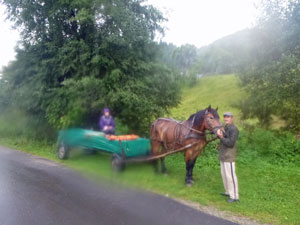 Mr Florin with his transport |
There, waiting for us in the rain was Mr Florin with his horse and cart - part of this day was to be an enjoyable horse and cart ride through the 4km length of Simon's street (another valley town) to our pensiunea. Whether enjoyable was the right word in such conditions is debatable, but to be driven by horse and cart for the last four kilometres, rather than walk it in the steady rain, was certainly a great relief. Thank you, Mr Florin. |
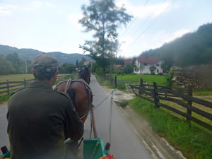 A final trip by horse and cart to our guesthouse |
So, after two days of avoiding thunderstorms, in the end we were well and truly caught - it was "third time, unlucky". The mountains had taught us again not to treat them lightly. The wet ending did not detract from a magnificent day in the mountains of Transylvania, it just emphasised the need to not be complacent .... and, really, there is no better shower than a hot one after a drenching. |
||
|
Day 6 - Simon to Poarta (11 km - 310m ascent - 310m descent) |
After yesterday, it was good to see the morning sunshine - not so much from the perspective of walking, but for drying out wet boots, clothes and packs from yesterday's soaking. In the end, only our boots resisted and remained wet for today's walk. The guide-notes for today wanted us to climb back up through the forest to the high meadows of the Bucegi Mountains and continue further north beneath their impressive limestone cliffs before again descending through the forest to the village of Poarta - probably another 20km day. As we had been to this area yesterday and knees were still a bit sore from the fast descent in pouring rain, we didn't relish the idea of all that climbing and hiking in wet boots. It was time for Plan B - on perusing the map, I noticed that we could cross the two ridges between the valley of Simon and the valley of Poarta by a shorter route with much less climbing. Moreover, the route looked like it might offer nice views and pass through interesting areas. |
||
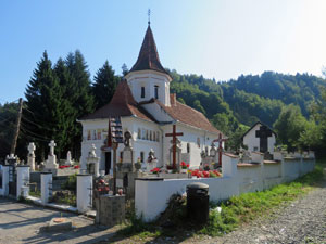 Orthodox Church in Simon |
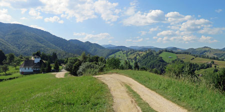
 Climbing into the hills south of Simon |
 Farmland on the hill slopes |
Thus, after a late start around 10am, instead of heading back up through the village of Simon, we turned east at the colourful church to start a steady climb up onto an open ridge that was a patchwork of meadow and tree groves. As we reached its crest, beautiful views lay in all directions across the green, green landscape - to the east where the hazy blueness of the Bucegi Mountains formed a jagged horizon, and to the west, where the sun illuminated the white karst tops of the Piatra Craiulul. We could see much of our route of the last five days in one big field. It was a good choice to come this way for our last day of walking in Transylvania. |
||
 |
 A last look across the forested hills to the summits of Piatra Craiului |
|
We were now wandering along the Balaban Ridge on an easy gravel road, lined with ricketty pole fences. The road led us down to the chapel of Bran Monastery, newly built in 2006, but still aesthetic on its hill-top overlooking meadows, forest and mountains. |
||
 Hill-top farmhouse |
 Bran Monastery |
 The chapel of Bran Monastery |
We rested there for a while, but quickly left when we spotted a group of over a hundred Romanian school children and teachers heading up the hill towards us and the church on a cultural outing. Passing them, we turned left at an intersection of roads and entered the forest - a lovely mix of deciduous trees and fir. |
|
 Hill-top meadows on the Balaban Ridge between Simon and Poarta |
 Transylvania - land of forests and mountains |
Dipping slightly in to a middle valley, the road then climbed up into a fir monoculture. Here, we realised that its main purpose was for logging not hiking, as we passed through a section where the roadside had scattered piles of fir logs waiting to be transported. While the scene was not the most aesthetic, the scent of fir in the post-rain dampness was invigorating. As my Monday walking group back home know, lunch requires a good log to sit on, and here there were an abundance. |
||
 Descending through the forest |
 |
 Bucegi Mountain sky-line |
After lunch, we followed the zig-zagging road down to the next valley - the one that our destination of Poarta calls home. Reaching the main road, we turned to follow it out of the forest alongside a rushing stream, almost overflowing from the recent storms. On leaving the forest, though, the walk became a bit anticlimactic, as our pensiunea lay at the far end of Poarta, stretched out for 4km along the valley floor ....... Mr Florin, we need your horse and cart! |
|
|||
 |
 |
 |
 |
|
|
Thus, as we finally checked in to our last pensiunea, our walking adventure in Transylvania came to an end. What a great adventure it had been, too - for people like us from a land where brown and yellow are often the normal colours of landscape to see such a sea of green is quite amazing. |
|
Fascinating too was to see how aspects of traditional village structure and life (e.g. shingle houses, shepherds in the mountain pastures, home made cheeses, jams, eau-de-vie etc) remain and how the modern world of tourism has crept in. Add two beautiful karst mountain ranges into the mix and you have a wonderful region for walking. Finally, aren't you glad ..... we have been walking in Transylvania for the last seven days and I have not made even one vampire joke. |
|
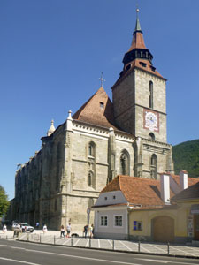
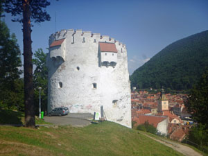
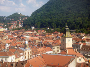
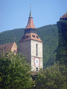
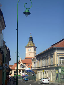
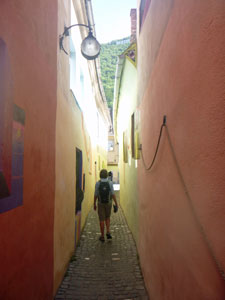
Brasov |
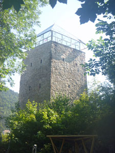 The 15th century Black Tower (Turnul Negru)
|
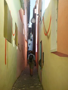
As a bonus (and because I didn't know wherelse to put them), here a few more photos of Brasov, Romania's well-known medieval city. The city was built by the Teutonic Knights in the early 13th century as Kronstadt, later changing name to Brasov. It still has many medieval buildings and is well worth a wander if visiting Romania. We spent another half-day there after our walk in Transylvania and stayed overnight in a charmingly restored 16th century hotel.
|
|
 |
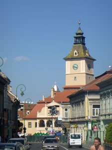 14th century Casa Sfatalui |
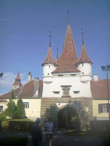 Poarta Schei (City Gate) |
 |
|

