Thorsborne Trail - Hinchinbrook Island

Getting There

Hinchinbrook Island is an 1100m high coastal range that has been cut off from the Australian mainland by a narrow channel. The entire island is a National Park, which protects the rich diversity of landscapes; rainforest, sclerophyll forest, mangroves, white sand beaches, rocky headlands, creeks and waterfalls. The Thorsborne Trail stretches down the eastern side of the island between mountain and sea and passes through these habitats. A permit is required to walk the trail and camp on the island, and this is limited to 40 people on the trail at any one time, with a maximum of four nights. Four nights gives ample time to explore Hinchinbrook in a leisurely manner, and that is what we are doing.


View across to Hinchinbrook Island from Cardwell

Access to and from Hinchinbrook is by ferry and sailing times depend on the tide, which can also determine how many nights you camp and in which direction you walk. In our case, the early morning sailings meant it was easier to walk north-south, catching the ferry to the island at Cardwell, returning to the mainland by ferry at Lucinda and then getting a connecting bus back to Cardwell.

We had spent the last two and a half days in a car, travelling from Alice Springs and the recently completed Larapinta Trail - so, armed with our permits, ferry tickets and fully-loaded backpacks, we were ready to stretch our leg muscles again. From the arid red centre to the lush green of the coastal tropics - the contrast couldn't be any greater. It was time to go.

Mangroves to Little Ramsay Bay (8.5 km - 350m ascent - 350m descent)

Our small and speedy ferry set out for Hinchinbrook Island with us, five other track walkers and two day-trippers on board. Leaving the Port Hinchinbrook marina, our captain carefully guided the boat across the choppy channel before reaching the protected waters to the north of the island and opening out to skim across at 40 kph. To the south lay the rugged mountain spine of the island, while ahead our way seemed barred by a flat green belt of mangrove swamps. However, the captain guided us into a long and ever-narrowing channel within the mangroves to eventually pull up at a tiny wooden dock. We had arrived and the Thorsborne Trail lay ahead.


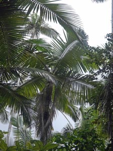
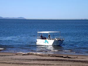
About to set off from Hinchinbrook Marina


The forest-fringed edge of Hinchinbrook

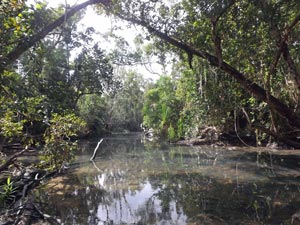
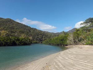
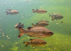
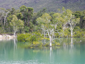
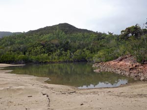
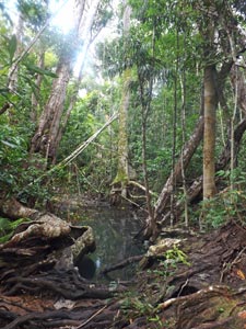
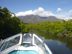
Passage into the mangrove swamp

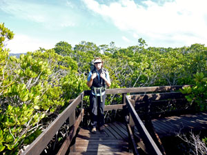
The boardwalk through the mangroves

From close up the cloud-capped and rugged mountains of Hinchinbrook were even more impressive than from the mainland and we were keen to get underway. A short section of boardwalk took us from the dock in the mangroves (home to saltwater crocodiles) to the edge of a low sand dune.

Once over the dune, we were greeted by the sight of a long stretch of sand fringing Ramsay Bay and by a stiff south-easterly wind. We turned and headed down the beach, towards the outline of the mountains and into the face of the wind.


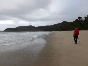
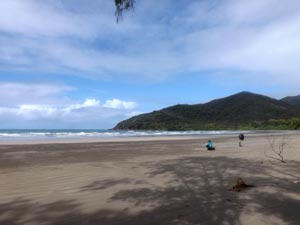
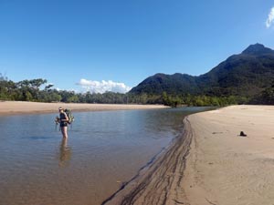
On the beach at Ramsay Bay - ready to set off

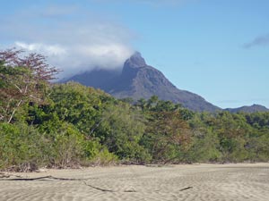
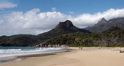
Heading south towards Nina Peak and Mt Bowen

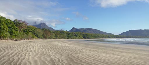
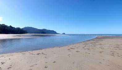
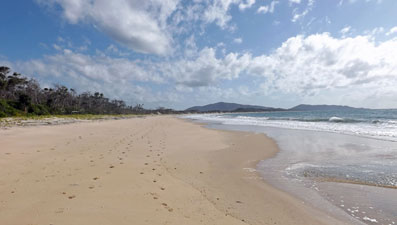
Looking back along the broad sandy beach of Ramsay Bay


Lowland rain forest near Ramsay Bay

It wasn't for long though - the beach soon ended and an orange marker directed us inland. Almost immediately, we were in the still and humid rain forest - not a breath of wind in here as we meandered our way over a low saddle to descend to the pretty creek outlet at Black Sand Beach.


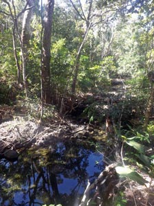
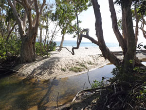
Black Sand Creek .....

... and its deep sandy mouth lined with giant paperbarks

It was but a brief coastal visit, as once again the track headed inland to climb steadily through the forest to a higher saddle. One of our fellow walkers had asked us whether we were going to climb Nina Peak, which to be honest I didn't know that you could. However, when we reached the saddle and noticed the unmarked track junction and then saw the sheer rock face of Nina Peak through the trees, we thought "why not?".


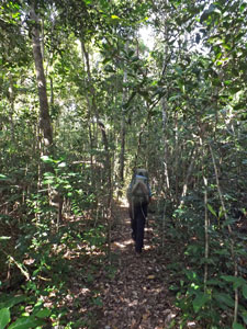
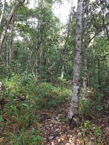
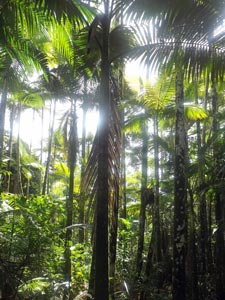
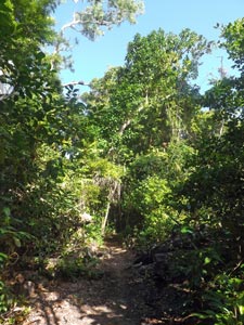
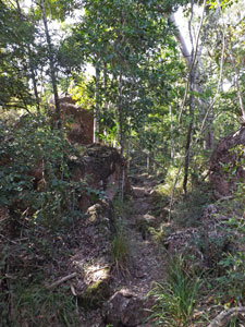
Into the rain forest ...

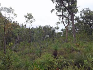
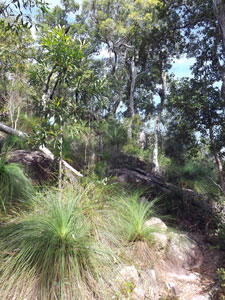
... followed by drier sclerophyll ....

.... and rocky heath

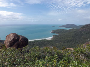
View from the climb up Nina Peak

It was a very steep and, near the top, a rock-scrambling climb up through a drier vegetation of casuarinas, eucalypts and grass-trees, but the views from Nina Peak made it "well worth the deplacement" as the French would say.


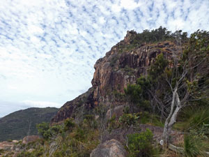
The sheer face of Nina Peak

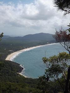
The route ahead - Nina Bay from Nina Peak

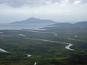
Channels in the mangrove swamps of north Hinchinbrook

From the rocky summit we could look directly across to the rugged face of Mt Bowen, at 1120m the highest point on the island. Back to the north lay a broad expanse of mangroves, split by a series of long and winding channels. To the south lay our route ahead across white sandy beaches and tree-covered headlands and spurs.


The face of Mt Bowen (1120m) and the Hinchinbrook Range


View north from Nina Peak over Ramsay Bay


Tide is out in the stony creek

The cloud seemed to be settling in as we headed down to put our backpacks on again and continue. The track led us down the south side of the saddle, across a couple of mangrove-lined creeks where the outgoing tide had sucked out most of the water. This was good for us, as the crossings were reduced to a bit of rock-hopping.


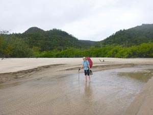
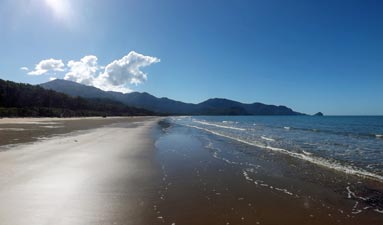
Crossing the wave-rippled beach of Nina Bay

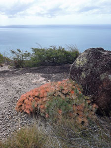
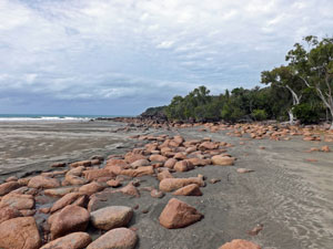
Pink boulders on Nina Beach

Following the creek and the increasing sound of the surf, we crossed an old dune to reach Nina Bay. It was a good place for lunch, but the wind at the northern end hit us as soon as we stepped out of the forest and on to the sand. We pushed on down the wide low-tide beach to its more protected southern end and found a comfortable fallen log next to the pink boulders of a tidal creek in the pumice-fringed zone between sand and forest.


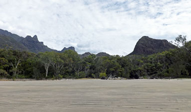
Forest and mountains backing Nina Bay

Nina Peak rises high above Nina Bay


Rocky passage at the southern end of Nina Bay

The setting of Nina Bay is quite spectacular, backed by the impressive rock face of Nina Peak and the Hinchinbrook Range - we were now looking up to the place from whence we looked down.


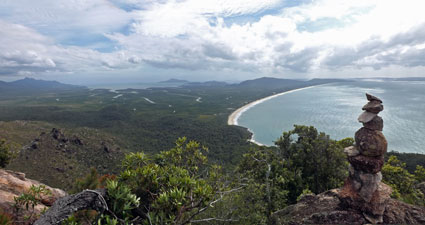
Looking down onto Boulder Bay


Lunch over, we headed back to the beach to pick our way around the pink and maroon boulders at its southern end and climb to the top of a small headland. From here, a short track led us down through the scrubby vegetation to Boulder Bay.

No sand here - we boulder-hopped and rock-scrambled our way across this jumble of stone to leave via the southern end of the bay and start a long, steady climb up to the saddle between Boulder Bay and Little Ramsay Bay. An equally long and steady descent brought us to the northern end of Little Ramsay, popping out of a thickly wooded gully onto the beach.


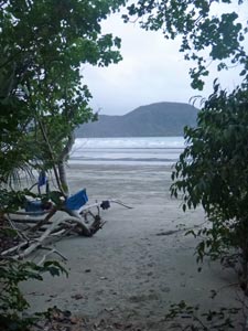
Little Ramsay Beach next to the campsite
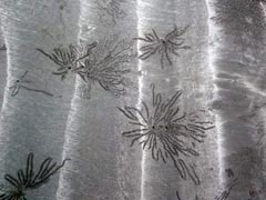
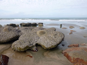
Tidal sculpture

Ahead lay a long stretch of sand - firm, wide and runnelled by the outgoing tide. A short stroll brought us to the lagoon - beautiful body of water, with semi-submerged paperbarks reflecting in the still surface, and backed by the dark back-lit silhouette of Mt Bowen.


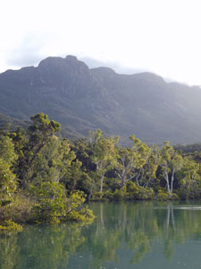
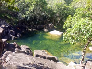
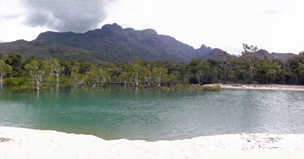
Little Ramsay Lagoon and Mt Bowen


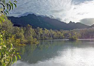
The beauty of the lagoon

On the south side was our campsite, just in the trees and sheltered from the wind. We found a spot, pitched our tent and then did our water run. A few hundred metres up the north side of the lagoon lay a lovely boulder-filled creek, framed by rain forest trees and babbling with cool clear mountain water.


Fresh water creek up from the lagoon


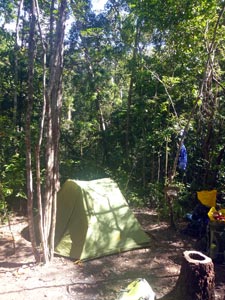
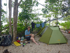
Campsite at Little Ramsay

Time to relax a little


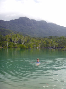
Now we could brew a cuppa, followed by a swim in the calm refreshing water of the lagoon. The wind had dropped to a breeze and the sun had broken free of the cloud for a perfect end-of-day relax in this delightful spot, wedged between the Coral Sea and the rugged peaks of Hinchinbrook.


The magic of a Hinchinbrook afternoon

Trekkers kept arriving from north and south - if 40 people are allowed on the island on any one day, over half seem to have found their way to Little Ramsay tonight. By day's end, pretty much every bit of space at the site was occupied by tents - it was cosy, if not crowded.


The perfect end to a great day's walking


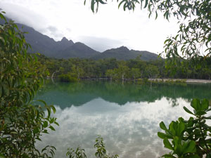
The lagoon from the campsite - by day ....
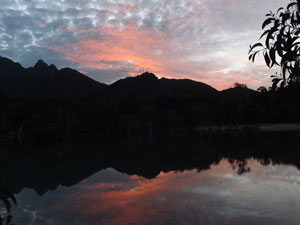
.... and at sunset

Replete after our delicious rehydrated chicken and Moroccan sausage couscous and uplifted by the dramatically reflective sunset, we agreed that the Thorsborne Trail was living up to its reputation. We retired to bed, to fall asleep to the hypnotic sound of wavelets rolling gently on to the beach alongside.

Little Ramsay Bay to Zoe Bay (11.5 km - 150m ascent - 150m descent)

What a strange night it was - at 10.30pm I woke with a start to find the whole tent illuminated. No, it wasn't that someone turned on the campground floodlights, it was the full moon that had risen above the eastern horizon. In fact, it was a super moon, when the moon's orbit approaches closer to the earth and it appears larger in the sky. It was a magnificent spectacle to see the white beach bathed in moonlight and the cloud-capped peaks lit by a pale light. However, a super moon also extends a stronger gravitational pull resulting in super tides. In fact, all that was left of the beach was a narrow moonlit strip between the surf and our tent site. No wonder that the soft rumble of the surf had become a repetitive crashing roar - from sleep-inducing to sleep-inhibiting.

By 4 am a strong gust of wind arrived and, with it, the first shower squall, followed by a series of others. We were greeted by a damp campsite when we got up, breakfasted and packed up - all in the inter-shower intervals. The rain seemed to synchronise departure times, with everyone watching for the break and, when a bit of sun emerged, we all took off. We found ourselves in a sort of drawn-out convoy of 15 hikers, heading south down the wet sand of Little Ramsay Bay. It was a wide highway though as the super moon had sucked the sea back out again.


Heading off after the rain


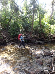
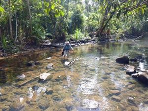
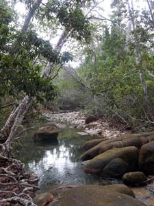
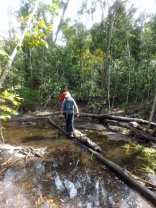
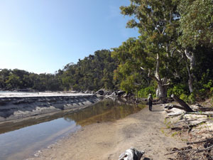
The sort of river crossing we like

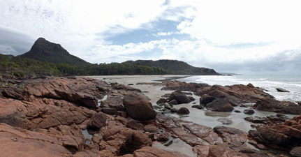
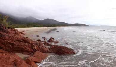
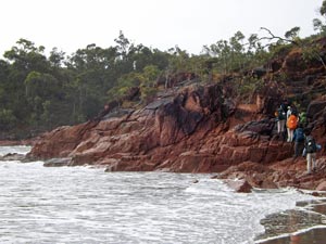
Climbing up onto the red rock headland
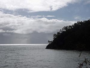
Rain out to sea

Near the end of the beach, it was boots off for our first water crossing of the day - a tidal creek just too wide to jump. Then we headed on to the jumble of maroon rocks at the end of the beach. Stopping only for one last backward look at the beautiful setting of Little Ramsay Bay, framed by the mountains of the hinterland, we climbed up and over a small scrubby headland to reach an inlet backed by a beach of stone and boulders.


The rocks of Little Ramsay

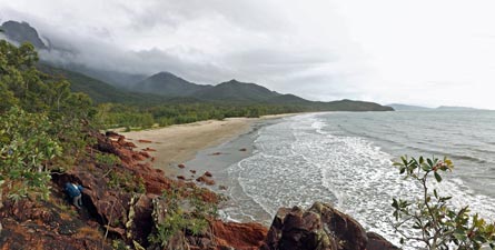
View back over Little Ramsay Bay from the headland


A section of maroon-coloured rocks

We carefully picked our way across it to reach the sandy southern end. This brought us to the start of our one big climb for the day, heading up a rain forest gully, leaves dripping with the morning's rain. As soon as we entered the forest, the humidity soared and my brow began to drip with perspiration. Leaving the gully, we continued up through grass-tree / casuarina forest to a track junction.


The fringe between beach and forest

To the east, a track descended to Banksia Bay - we took the detour, effectively uncoupling ourselves from the hiker convoy. Pack-free, we quickly descended through the forest to reach the lagoon-backed beach of Banksia Bay .... and its croc warning sign! It had looked so inviting. We settled for a muesli bar apiece and climbed back up to the junction.


Track through the rain forest


Descent to Banksia Bay


A self-explanatory sign at Banksia Bay


Cloud-covered mountains framing the beach at Banksia Bay


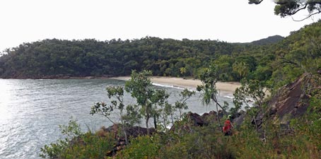
The lagoon at Banksia Bay

Packs back on, the track led us down beneath a dark rock face to cross Banksia Creek and then steadily upwards to the saddle. From here, we could see the route ahead - the dark green rain forest and swampland flats backing Zoe Bay. We were about to spend a couple of hours in the dripping and somewhat claustrophobic rain forest.


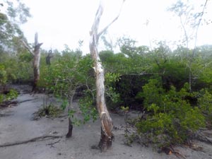
Scrubby heathland on the saddle

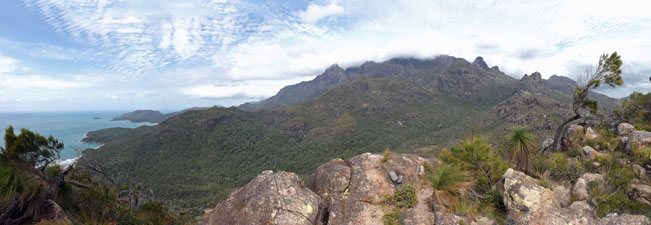
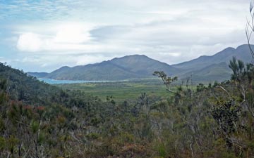
View over the rainforest flats and Zoe Bay

The route down to it followed a steep and rocky gully (good for ankles) before bringing us out into the dense rain forest flats. Here the track meandered its way beneath an intensely green and silent world of competing vegetation, with barely a dash of wildflower colour to be seen or a bird to be heard.


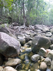
Big boulders in the descent gully

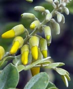
Nello adds a touch of colour to the greenery

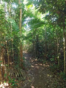
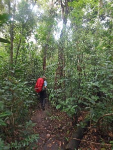
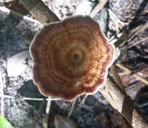
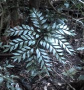
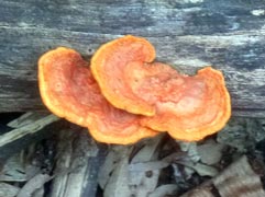
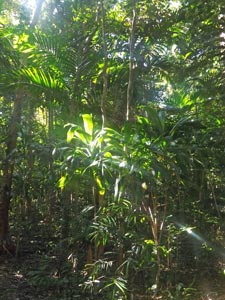
In the lowland rain forest

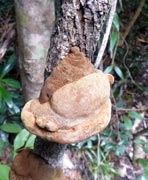
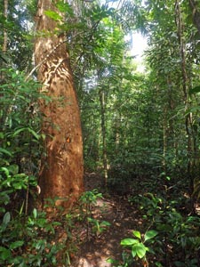
Orange-barked giant in a sea of green

We had a brief respite from this overdose of green when we emerged into an open paperbark swamp, skirting the muddy edges to re-enter the rain forest. It was difficult at times to judge which direction we were heading as the narrow green corridor wound its way along. Reaching a paperbark / mangrove swamp, I miss-placed a step and filled my right boot with squishy black mud (the quintessential Hinchinbrook experience), before arriving at the lovely setting of North Zoe Creek (so lovely that crocodiles have taken up residence). Here we rock-hopped the channel between a series of water holes that the crocs called home, before once again pushing on across stony creek and muddy bog beneath the dark green canopy.


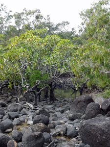
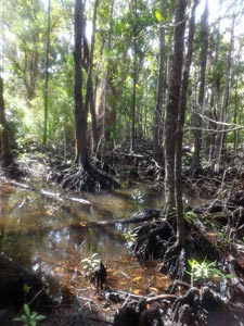
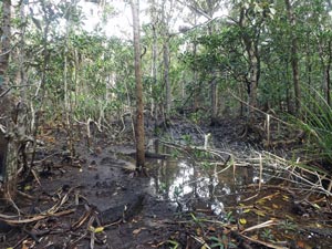
In the more open paperbark swamplands

Mud, mud mud ..... where I filled my boot with mud

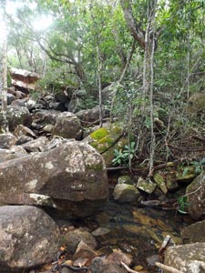
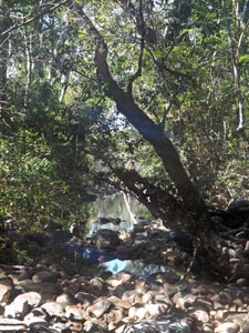
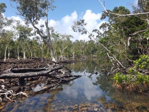
The setting of North Zoe Creek
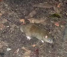
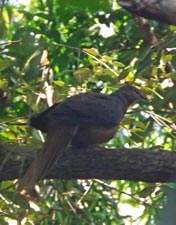
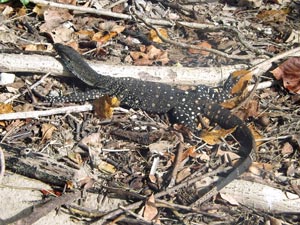

An easy creek crossing


Sunlight in the fan palm forest

An easy crossing of one channel of Fan Palm Creek belied the next - it was time to take the boots off and wade, which at least allowed me to clean the mud out of my sock.


A quiet pool in Fan Palm Creek

As we climbed out on the far bank, the showers returned. However, deep in the forest only one drop in ten reaches the forest floor, so we pushed on, crossing boggy stretches of fan palm forest and finally changing direction to make a bee-line for the coast.


So this is where the crocodiles live


A wet-foot crossing


Fan palm canopy


A slightly more open forest


Coastal swampland

Soon after Cypress Pine Creek the rain forest gave out (no more lawyer vines and fine-spined palm tendrils to latch on to skin and clothing) and was replaced by more open coastal sclerophyll forest and then by mangrove swamp. The track skirted the mangroves as the next shower passed, forcing us under the shelter of a large tree. It passed quickly and we continued, back into rain forest.


Track next to the mangrove swamp

For a while, the sound of surf had been getting louder and we heaved a sigh of relief to finally emerge into the open, wide sandy beach of Zoe Bay, where the air actually moved and refreshed. I like rain forest up to a point, but the point had long been passed.


At last the open beach at Zoe Bay


Crossing Cypress Pine Creek on a log


View out of the entry to our campsite

Turning south, we strolled down the beach to the campsite next to the lagoon at its southern end. No sooner had we sat down than the sand-flies struck with blood on their minds. We retreated back up the beach where there were a couple of smaller camping spots set in the coastal forest. They had the luxury of a table and seats and ... no sand-flies. It was a pleasant spot for the six of us and one goanna who camped there that night.


The camp goanna

A sheltered spot in the coastal forest

About a kilometre upstream from the lagoon lay Zoe Falls, where silvery threads of water slide down angled rock walls and into a large aquamarine plunge pool of cool, clear water. That was where we headed, once we had set up camp and had a late lunch. It was superb and the sweat and grime of the rain forest were soon soaked away.


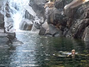
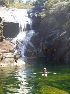
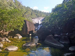
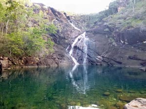
The lovely green pool of Zoe Falls

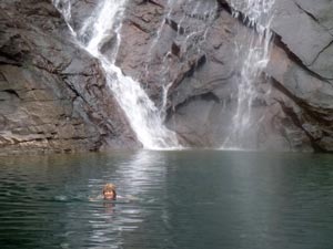
Time for a refreshing swim

Then, filling our bottles and bags with water, we headed back to camp to write up, boil the billy, chat with our fellow campers - two chaps from Cairns and two Swiss girls - and enjoy our dinner as the bush rats scurried around the site. There were stars about tonight and everyone held on to the hope that the rain had finally passed.

Zoe Bay to Mulligans Falls (6.5 km - 310m ascent - 310m descent)

Despite the starry start to the night, the clouds returned and we heard the pitter patter of raindrops on the tent fly a few times. However, morning came and we were greeted by bright sunshine - the weather had turned. We had a very leisurely start to the day as the walk to Mulligans Falls would only take 4½ hours, according to the guide, and we were in no rush, enjoying the sunny morning at Zoe Bay.


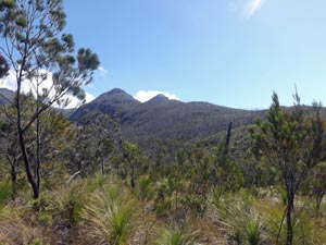
Mt Bowen with its plume of cloud

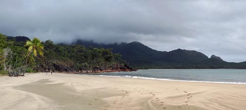
Sunny morning at Zoe Beach

Eventually though it was time to leave and we left the sound of the surf for the silence of the rain forest, heading back up the track to Zoe Falls - it was tempting to have another swim, but we hadn't yet raised a sweat. That came quickly as we made the short steep climb, rope-assisted in one section, up to the top of the falls.


The mouth of South Zoe Creek


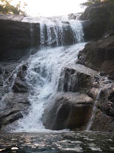
Farewell to Zoe Falls

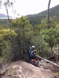
A bit of ropework on the climb to the top of the falls

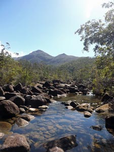
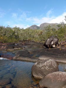
Looking up the rocky bed of South Zoe Creek

From here we could look out over the shimmering sea of Zoe Bay and inland, up the boulder-strewn bed of South Zoe Creek to the face of Mt Diamantina.


Pool at the top of Zoe Falls and Zoe Bay


The route then began the long and steady climb up the South Zoe Valley, at first along the bouldery banks of the creek, then taking to the low casuarina / grass-tree scrub. At times the track was quite overgrown, with the arching green grass blades brushing the dust off our shins as we passed. After crossing a couple of headwater creeks we reached the saddle, at 260m the high point of the track, and took time to look back over the scrubby heath for one last view of Mt Bowen, our companion for the last two days.


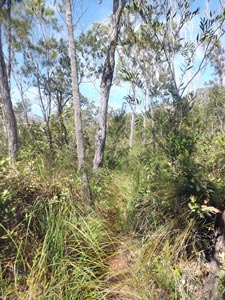
On the somewhat overgrown track


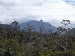
A final glimpse of Mt Bowen above the heath

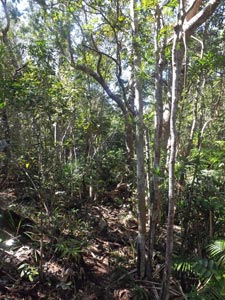
Back into the rain forest on the southern slopes

The saddle was quite broad and, when we finally left it, we dropped down to cross a deep and shady creek and commence a gnarly-rooted traverse of the rain forest covered slopes south of the saddle. Generally leading us down, the path crossed a succession of gullies and spurs, giving lots of little climbs to break the downward momentum.


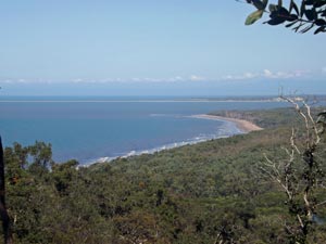
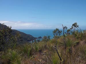
The blue of the Coral Sea

Looking inland toward Mt Diamantina

The Palm Islands on the horizon

One last steep climb brought us back into open casuarina scrub with views out past the steep green slopes of Hinchinbrook's ranges to the deep blue of the Coral Sea beyond. Off in the distance we could see the silhouettes of the Palm Islands and, closer to the south, the almost 6km long white line of the Lucinda sugar terminus pier on the mainland - civilisation was starting to intrude.


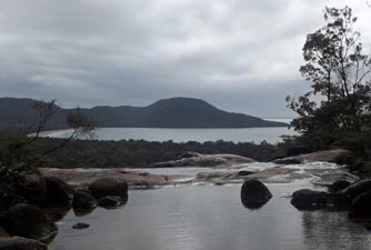
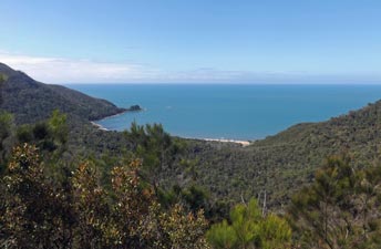
Looking down to Shipwreck Cove


View south towards the mainland


Diamantina Creek

The sun was beating down as we crossed a small grass-tree covered knoll and then dropped down to Diamantina Creek. We had been warned that this would be a wet-foot crossing, but managed to find a dry route hopping from one big boulder to another.


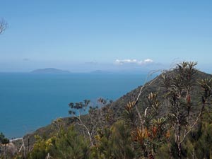
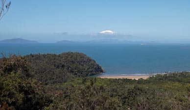
View out over the Coral Sea and the Palm Islands

On the far bank, I did a strange thing - I sat down and fainted (so the fair Nello tells me). To be honest, I had been feeling bereft of energy for most of the morning - the climb seemed harder and the pack heavier than they should have. I was also sweating profusely in the high humidity of the rain forest and my clothes were drenched. That said we were keeping ourselves well hydrated, so I am not sure what happened, other than the fair Nello waking me up on the side of the track [this was apparently due to an episode of bradycardia and PVCs that plague me from time to time].


Sunny campsite at Mulligans Falls

After that bit of excitement, we still had a kilometre to go - over a hill and then a steep descent to the rain forest campsite at Mulligans Falls. It was a very long kilometre for me on wobbly legs, but we got there slowly, slowly. Rain forest can be a dark and dank place in which to camp, but Nello found a site where the sun broke through the canopy to dry wet clothes - a cup of sweet black tea, a sugar-loading of jelly snakes, and after half an hour I felt normal again.


Mulligans Falls and its clear green pool

It was time to head down to the magical setting of Mulligans Falls, to swim in the crystal clear cooling waters of its large plunge-pool, as a silvery sheet of water slid down from the rocks above. That was the best medicine!


Time for a swim


Close-up of the falls

The two Swiss girls arrived and set up camp near us. In the canopy above, a wompoo pigeon skulked from branch to branch looking for fruit, and a brown fantail hopped about the forest floor - it was good to see a few forest birds. Tonight we would not be sleeping to the sound of surf, but to the more constant and softer sound of the waterfall. We were enjoying Mulligans Falls.

Mulligans Falls to Georges Point (6.5 km - 10m ascent - 30m descent)

The night of the bush rats was over - these fearless little creatures had arrived at sunset to scurry around our feet as we ate dinner. Their forays continued throughout the night as they investigated packs, upset saucepans and cups and even climbed over our heads between tent and fly. Small wonder that the Parks people provide metal boxes to keep food safe - anything edible in pack or tent would quickly be found and gnawed. Cute might not be the right word, but they provided a lot of amusement.

There was again no hurry to be off, as Georges Point, the southern trail head, lay only 6½ easy kilometres away. The morning was ours to enjoy, once again, the pleasures of Mulligans Falls, and the sun shone brightly to enhance this. So it was a lazy breakfast in the rain forest, a bit of a wander to explore our environs and spot the elusive birds, brew a cup of coffee and, of course, swim with the fish in the crystal-clear waters of the rock-pool and sunbake on the dark water-smooth boulders to the soporific sound of the falls. The electric blue flashes of a Ulysses butterfly fluttering above added that touch of magic to the scene.


One last swim at Mulligans Falls


The upper pool

Sunlight on the lower pool

Still, nothing lasts forever, so after a lazy poolside lunch, it was time to pack up and leave - what a great morning it had been!

The guide says that there is no reliable water between here and Georges Point, so we filled up all our containers before setting off - the extra five kilos of water more than making up for the food we had eaten - oh well! We left the camp on an easy walking track that led us through the flat lowland rain forest and across the bouldery beds of five small creeks - mainly dry, but some with waterholes and a small flow (no doubt not reliable).


A last walk in the rain forest ....

... past one creek ....

.... and another ....

.... and another

Finally the vegetation changed from rain forest to paperbark swamp and then the knotty jumble of coastal trees. A gap appeared and we were suddenly out in the open - on a broad tan-sand beach facing the blue of the Coral Sea - what a difference to the closeness of the forest.


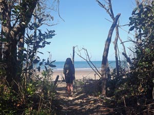
Reaching the beach at last

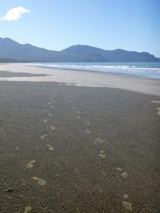
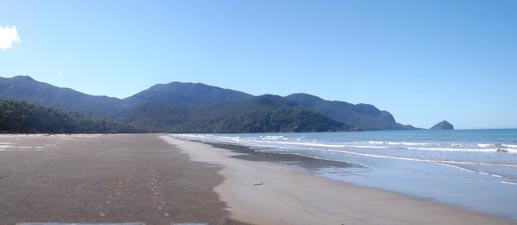
Looking north along Mulligans Bay


Footprints across the carpet of
crab sand-balls

We headed south along the beach, which would be our highway for the last five kilometres. The firm wet sand and a slight breeze made for a speedy passage. The mind can wander when walking long sections of unchanging landscape. Mine wandered to the huge expanse of small sand balls, carefully arranged in overlapping radiating patterns along the tidal fringe by the industrious sand crabs. How many sand balls could there be in the section we would walk? My guesstimate was 8 billion! Never underestimate the dedication of a crab.


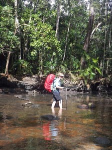
Crossing Mulligans Creek (not as deep as expected)

The mouth of Mulligans Creek

With the outline of the Hinchinbrook mountains behind us, we quickly reached Mulligans Creek, where Mt Straloch, the southernmost peak on the island looked down on us. It was our last wet-foot crossing (knee-deep in fact). Having taken our boots off, there seemed no good reason to put them back on for the final few kilometres. Our feet revelled in the fresh air, massaged by the carpet of sand-balls beneath and washed over by the warm lappings of Coral Sea water, as we splashed our way southwards.


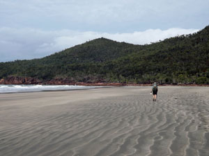
Afternoon light on Mulligans Beach


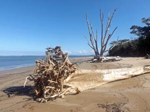
Trunks of trees ripped out by Cyclone Yasi in 2011

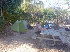
Beach campsite at Georges Point
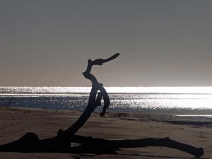
Sea-horse driftwood

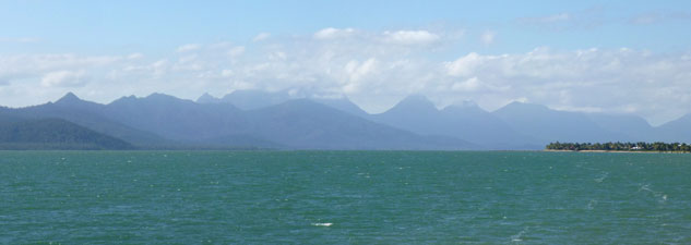
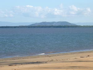
Looking over Hinchinbrook Channel to the mainland

Ahead, across the channel, the enormous 6km length of Lucinda sugar terminus on the mainland was growing larger - civilisation was but a ferry ride away. We rounded the point, the blue of the Coral Sea gave way to the muddiness of the Hinchinbrook Channel and we reached our campsite - a couple of sandy clearings in coastal scrub fronted by the fallen trunks of trees uprooted by Cyclone Yasi a few years ago.


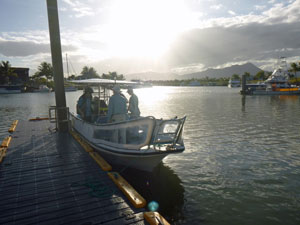
The ferry arrives to take us back to the mainland

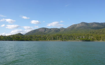
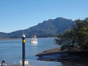
Hinchinbrook Island from Lucinda marina

Fourteen trekkers had assembled here at walk's end for one last night. For reasons of tide, the ferry would only arrive early next morning to take us back to the mainland. It was a good way to end our Hinchinbrook adventure, watching the lights of Lucinda across the water and chatting to our fellow hikers about the past few days. Only a few kilometres of sea separated us from civilisation, but for one more night at least the real world remained a gulf away.

The next morning the small ferry arrived at the appointed hour to take us back on the short trip across Hinchinbrook Channel to the mainland. While waiting for the bus to Cardwell, I wandered over the road to buy a couple of craved-for capuccinos - as I waited "the real world" hit me in the face - the television in the store was blurting out the breaking news about a passenger jet shot down over the Ukraine, interspersed with national politics and disasters (the two words seemed interchangeable). I hurried back to the landing - please Mr Ferryman, take us back to Hinchinbrook!