
| Kayaking the Myall River |

About |
I mentioned that we had bought an inflatable kayak - 4.6m long, but packing down into a much smaller bag that can be transported in the boot of a car. We have tried it out on a couple of day paddles and were impressed with the way it tracked and the ease of paddling. However, the intention has always been to do some overnight trips, so our first stop was the Myall Lakes and River on the central New South Wales coast. Here we planned an experimental paddle from the Bombah Broadwater down the river to Hawks Nest, camping out for two nights. Hopefully, our collection of gear-laden dry bags will sit nicely in and on the kayak and give us a pleasant ride. |
 |
|
Day 1 - Mungo Brush Camp to Brambles Green Camp (5.5 km) |
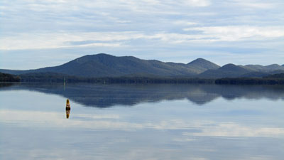
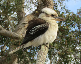
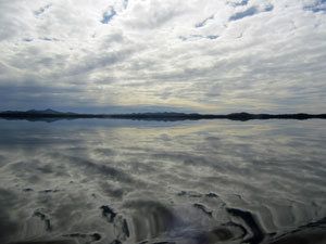
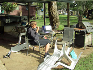
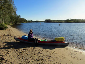
We had planned to do this river trip three days earlier, but with 50-80 km/hr winds and icy weather forecast, it seemed a good idea to delay it. Imagine our surprise then, to arrive at Mungo Brush campsite on the Bombah Broadwater and look out over a perfect mirror of the lake surface as water and sky merged into a cloud-filled canvas. It took a while to work out how to best pack the kayak with our assortment of dry bags, but, once done, I drove back to Hawks Nest to park the car near our end point and take a taxi back to Mungo Brush. In the meanwhile, the fair Nello enjoyed some time with the kookaburras and bush turkeys that called the campsite home. |
||
 |
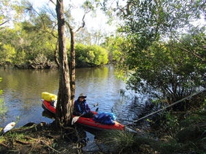
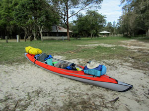 Our kayak loaded for the trip |
 |
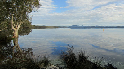
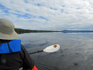
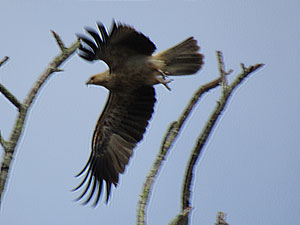
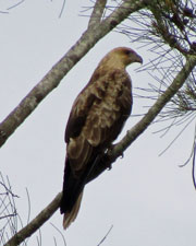
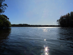
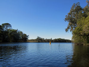
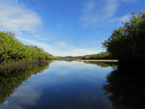
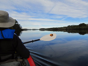
When I returned, we quickly launched the kayak. It was already midday, though our planned paddle for the day was a relatively short one. We were soon out on the glassy surface of Bombah Broadwater - blue hills reflecting in the distance between the two skies. Along the lake shore, the gnarly paperbarks were mirrored in the lake as well and, overhead, a pair of sea-eagles soared by. It was a magical setting and a great way to start out. |
|
 View over the broadwater from our start point |
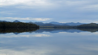 View over the Bombah Broadwater to the hinterland beyond |
 Heading out onto the Broadwater |
 Lakeside forest |
 Clouds reflected in Bombah Broadwater |
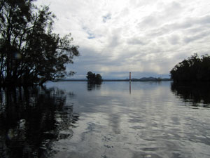
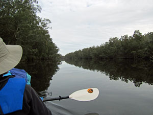
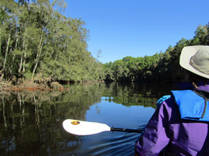
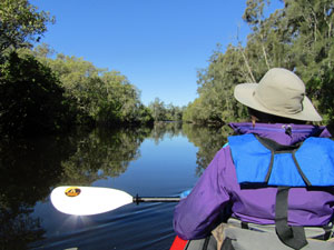
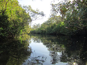
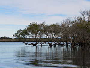
We made a bee-line for Sandy Point, rounding it and turning south to head down into a large bay of the lake and the mouth of the Myall River. After skirting the almost submerged islets, with their thickets of casuarina, that guarded the entrance, we paddled into the river. |
||
 Reflections at Sandy Point |
 |
 Looking back at the entrance to the Myall River |
No sooner than we entered its dark tannin-stained waters than the first of several fisherman's huts appeared on the right bank. We had reached the community of Tamboi, accessible by river only, with its eclectic collection of buildings. No-one seemed to be at home, so we pulled into shore for a late lunch in the comfortable chairs at someone's outdoor barbecue shelter - a lunch shared with a couple of local magpies. It was pleasant sitting in the small patch of sunshine that had broken through the high cloud. It would be the last we saw of it for the day. |
||
 Fishermen's huts at Tamboi |
 |
 Lunch stop at Tamboi |
Pushing on, we rounded a bend to enter a long reach, setting up a steady paddling rhythm. A slight left turn led us past a couple of prawning net sites to a small patch of green grass on the tree-lined left bank - we had reached Brambles Green, a tiny riverside campground shared by walkers and kayakers. Today though we would be alone - idyllic. |
||
 |
 |
 Brambles Green tent site |
We set up the tent, with views out towards the still, dark waters of the Little Brasswater, a widening of the river with a small islet in its middle. As we sat there enjoying the view, the coffee and the bird songs, the increasingly darkening sky delivered on its threat and the first raindrops began to splash on the river. The steady gentle rain lasted for two hours, during which time we found shelter beneath the natural umbrella of a grove of cabbage palms. |
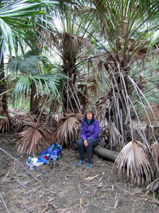 Beneath the cabbage palm umbrella |
|
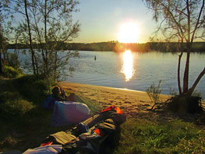
 Sunset at Brambles Green |
 |
|
As night began to fall, the rain stopped and we could once more enjoy our dinner of home-dehydrated spaghetti bolognese with a glass of red, looking out onto the dark surface of Little Brasswater and the spreading rings of rising fish. So, here I sit, in the solitude and stillness of the river. However, I've noticed that my breath is producing steam and the coldness is starting to seep in - its time to crawl into our sleeping bags and get some rest. Tomorrow is the long day of our trip. |
|
Day 2 - Brambles Green Campsite to Myall River Camp (18 km) |
Around 8pm, the second band of rain arrived and we had the pitter patter of a steady, but gentle rain on our tent for the next six hours. Somehow, you feel more snug when warm inside a tent while lulled by the sound of the raindrops. However, it was not conducive to getting up for a mid-night wee. Fortunately, by the time we got up in the morning, the sky was clear and we could watch the sun rising above the river. The ground was fully sodden and it was a standing breakfast. Looking ahead, I could see gusts of wind racing across the surface of Little Brasswater - towards us! The wind was good for drying a wet tent fly, but perhaps it would not be so good for paddling in a westerly direction. We had 18 km to the next campsite and there were quite a few west-pointing reaches ahead. |
||
|
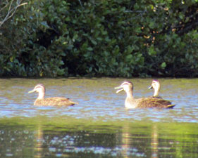
By the time we broke camp and set off, the wind was intensifying and gusted across the open waters of Little Brasswater. We pushed past the islet in its centre and turned into a more southerly pointing reach. Here the paddling was easy, protected by the tall trees on the west bank, as we headed down, listening to the wind sighing in the tops of the tall casuarinas and the rhythmic tinkling of our paddles, watching the cormorants and ducks skim across the surface as they took flight ahead of us and being watched by a pair of sea-eagles roosting high in an overhanging branch.
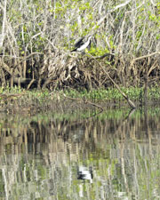
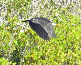
It was a false promise, for we started to bump a little as we paddled into a series of mysterious low swells. Their source became apparent when we turned westerly again into The (Big) Brasswater, an exposed lake in the river system. Almost immediately we found ourselves paddling into the face a strong 30+ km/hr westerly wind that was generating white-capped waves. It was a slow and strenuous paddle to cross Brasswater. The relief of exiting it was quickly dampened when we arrived at an even longer west-pointing reach of the river - another 2 km of paddling into white-capped wind waves and pushing through 50 km/hr gusts before we finally turned southwards into a calmer and enjoyable reach. At this point, I had hoped to take a short-cut down a narrow side channel, but sadly its entrance was snagged by a fallen tree. |
|

 Paddling down a protected reach
 |
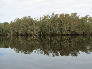
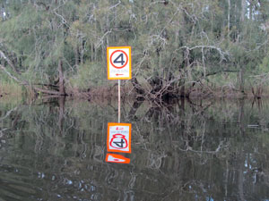
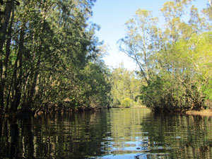
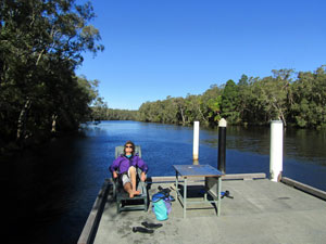
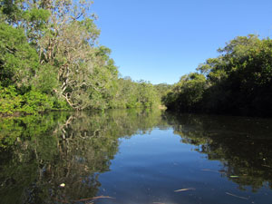
A little later, we were able to make a shorter short-cut to miss a river bend. This brough us into the next calm reach and Engels Reach Landing. The solid new pier jutting out into the river was a fine place to stop for morning tea and a soak in the sun. Paddling into the face of the wind and the spray of its waves can be a bit chilling. The pattern of alternating windy and calm reaches continued after leaving Engels Landing until we reached the entry to Pipers Creek. We turned left into this narrower and calmer stretch of water. For the first time, reflections appeared on a still surface and mangroves became the dominant riverside vegetation. |
 |
|
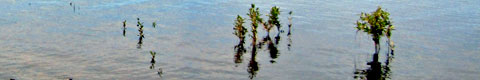
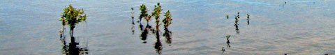
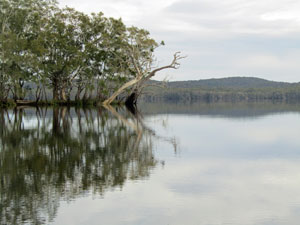
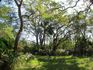
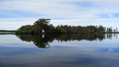
We were enjoying the stillness of the water and quietness of our surrounds so much that we almost missed the tiny break in the mangroves. We pulled in and tied up to a tree - this was Pipers Creek Picnic area and the wider sunlit grassy patch in the forest was a good place to stretch the legs and have lunch. Shortly after leaving our lunch spot, we found another narrow channel heading west into the mangroves. The river here was becoming increasingly braided, forming a series of channels and mangrove-fringed islands. This channel took us between Nickey and Kangaroo Island. |
|
 A mangrove-fringed channel |
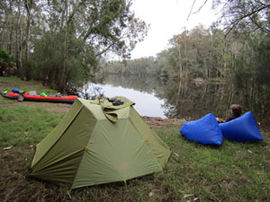
 Arrival at Myall River Camp |
 Time to contemplate the setting sun |
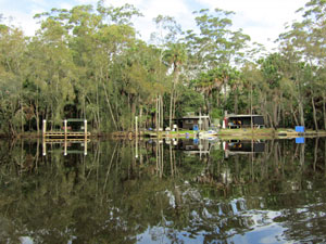
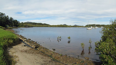
The channel gradually widened into a broader reach that joined the main river channel and to our delight, we noticed that the wind had begun to ease. Keeping to the left bank, we cut through another side channel to join the eastern anabranch of the Myall River. Rounding one last bend, we spotted the long clear shoreline of Myall River Camp, our destination for the night. Its sandy beach was a welcome sight after along, hard day of paddling. |
||
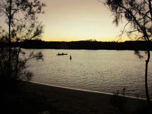 Sunset over Myall River Camp |
 |
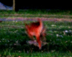 Dingo running thorugh the camp at night |
Our tentsite was on the river's edge with a tiny private beach for our kayak. Tent up and dry clothes on, we sat down to enjoy the warmth of the late afternoon sun, relaxing as we watched it set over the dark waters of the Myall River and create an orange glow on the western horizon. All in all, it had been a very diverse day on the river. |
|
Day 3 - Myall River Camp to Hawks Nest (6.5 km) |
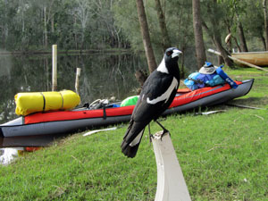
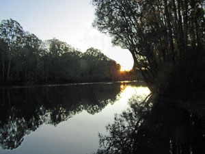
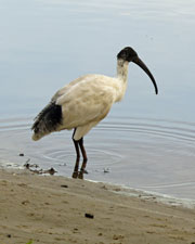
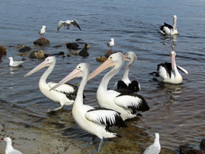
After a cold, clear-skied and starry night, we were wakened by a dawn chorus of forest birds to light cloud and still air. There was no hurry to leave as we only had a short paddle to our destination at Hawks Nest and enjoyed a leisurely breakfast looking out over the still river water - yes, no wind. A pair of ibis wandered by as we sipped our tea, looking for rubbish bags to check out. They were out of luck. The dingo that had wandered through the camp the night before on a similar mission was the more exciting wildlife story. Finally packing up and loading the kayak, with the sun now shining, we set out for a short paddle back upstream. On the way down I had spied a narrow channel through the mangroves that would both save us a bit of paddling and provide some interest. The channel opened out into a broad body of water. With the tide well out, sand bars protruded and, at times, we found ourselves poling across the shallow water rather than paddling. |
||
 All ready for another day's kayaking |
 |
 Still morning in the mangrove-lined channel |
Eventually though we reached a deeper channel, which took us back to the main river - the braiding of river here is fascinating with channels creating a series of low mangrove islands. |
||
 The transition between river and estuary |
 |
 Mangroves in the estuary |
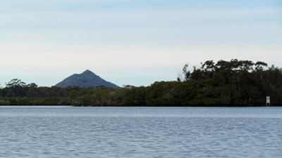
Turning left to follow the broad channel of the river, we soon found ourselves at the mouth of the estuary proper, with the water opening out to lake-sized proportions. In the distance the conical peak of Yacaaba Headland marked the entrance of Port Stephens, a large harbour into which the Myall River flows. We were nearing the end our trip and the sight of the riverside buildings of Tea Gardens confirmed this. Sticking to the western side of the estuary, we paddled past Dredge Island and a series of tiny mangrove islets, their lower trunks covered in oysters. This brought us to the edge of the village of Tea Garden, its stone-walled riverside lined with houses, landings and boats. Along the way, we spotted a coffee shop, so pulled over to moor at a low landing. A mug of flat white and tea cake on a sunny water's edge in Tea Garden seemed just the thing. |
|
 A mangrove islet |
 Reflections of Tea Gardens |
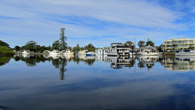
All that was left now was a short paddle downstream, past the moored boats and under a span of the Singing Bridge (it apparently sings when the wind blows from a certain direction) to reach the boat ramp at Hawks Nest. Our kayak trip down the Myall River was over - we pulled in to enjoy lunch while the kayak dried out before deflating it and packing it away into its bag. I was really pleased with the way it had performed - loaded at both the front and the rear with a variety of drybags, it remained very stable and tracked well. It also handled the winds and the white-capped wind waves. |
||
 A coffee break at Tea Garens |
 |
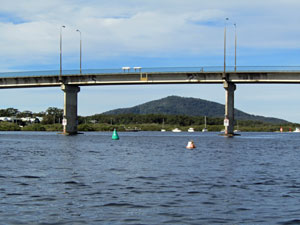 The Singing Bridge |
Over lunch, we debated which of the rivers we have paddled down we would recommend to others and agreed it would be the Myall. The main reason was the variety of riverine landscapes - from crossing a lake framed by distant hills at Bombah Broadwater, to the changing landscapes of the river, lined with eucalypts, paperbarks and casuarinas upstream, often overhanging the water, changing to an increasingly braided series of mangrove-lined channels and islands and finally emerging into a broad estuary with the twin villages of Tea Gardens and Hawks Nest. Also ..... where else can you finish a 3-day paddle with a mug of hot coffee and tea cake. |
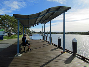
 Quiet cove at Hawks Nest |
|
