| Cape Hillsborough Day-Walks |
About |
Cape Hillsborough is a peninsula of volcanic origin to the north of city of Mackay. Its remnant rain- and vine-forest vegetation is protected by a small national park of the same name. To be honest, I had not heard of it before, but, when looking for new areas of the Queensland coast to visit, it stood out as a place of interesting day-walks and a diverse coastline of headlands, beaches and even an island to explore. Thus, we headed from Eungella to the cape and our basic but comfortable cabin at the Tourist Park, set next to a broad sandy beach in an enclave of the National Park. The downside of our stay here was that an unseasonal intense low was approaching with forecasts of up to three days of heavy falls. The rain duly arrived, but not before we managed one short walk to check out the landscapes and with a sufficient gap on the second day to enable me to walk across Cape Hillsborough itself. When the 36-hour period of continuous heavy falls finally arrived, our cabin was an even more comfortable place to be. There is something soothing about sitting on a sheltered deck and watching the big raindrops patter down. |
||
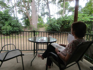 The deck of our cabin - good place for watching the rain |
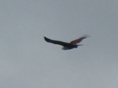
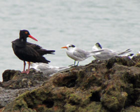
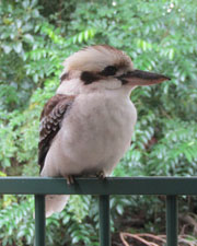 Even the birds preferred to be under shelter |
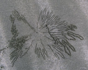 Crab art on Casuarina Beach |
Herewith, then a brief description of our rain-interrupted stay at Cape Hillsborough. |
|

Andrews Point / Wedge Island Circuit (5 km - 140m ascent - 140m descent) |


How many walks of 5 km or less would include three types of vegetation, walking on ridge-tops and beaches, spectacular views and a visit to an island. Well, this superb short walk at Cape Hillsborough does that, which is why it gets a nomination to my list of best short walks. |
||
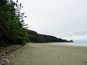
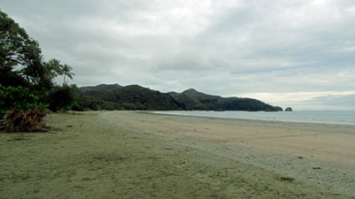 The broad expanse of Casuarina Beach |
 |
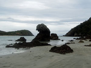 Rocks at the southern end of the beach |
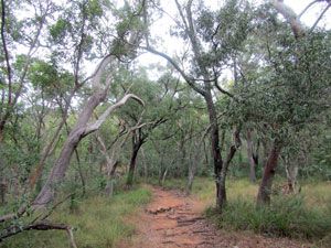
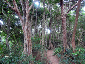
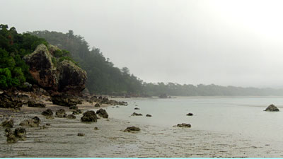
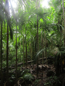
We had arrived at lunch time to grey skies and the forecast of developing showers. I was in need of a good leg stretch, so set out on this walk at the southern end of Casuarina Beach, where it abutted a long ridge-line. The track immediately began to climb steeply up the ridge, beneath the dark canopy of the vine forest that covered this northern flank. |
||
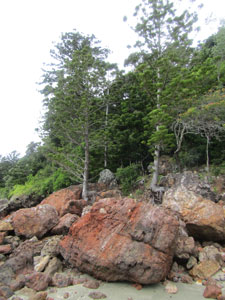 Hoop pines ...... |
 .... and vine forest ... |
 ... amidst the basalt landscape |
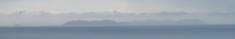
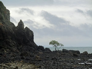
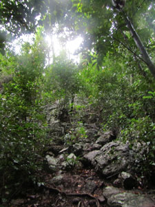
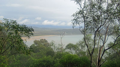
Zig-zagging up through the volcanic rock that formed the ridge, I passed a couple of small, but interesting lava caves, to reach the Twin Beaches Lookout. Here a superb vista opened to the north of the sweeping curve of Casuarina Beach backed by the rugged hills of the cape. Out to the east, I could look down on to Wedge Island, linked to the land via a stony causeway, and to the distant silhouettes of offshore islands lining the horizon - a pair of spectacular panoramas. |
||
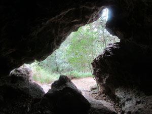 Inside an old lava cave |
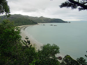 View over Casuarina Beach |
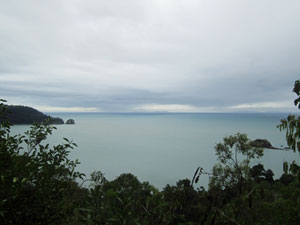 Rain squalls out to sea |
From the lookout, the slope became more gentle as the track continued through more open eucalyptus woodland to reac the top of the ridge. It then followed the narrow ridge along, offering views out to the south over the sea and mainland coastline. At Turtle Lookout, high above the ocean, I could see scattered showers developing, both out to sea and inland - the promised weather was closing in. |
||||
 |
 |
 The more open eucalypt forest |
 |
 |
 |
 View south from Andrews Point |
 |
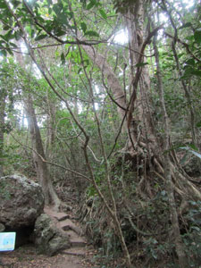
The track now began its descent, passing another lookout at Andrews Point (named for a search and rescue helicopter pilot who was killed in a crash near here), as it moved back into the dense thickets of the vine forest on the lower slopes. |
||
 Descending beneath rain forest ... |
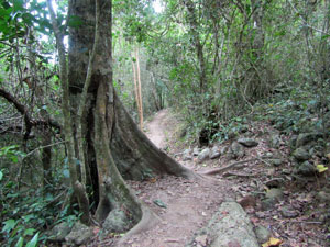 ... past buttress-rooted trees ... |
 ... and though dense vine forest |
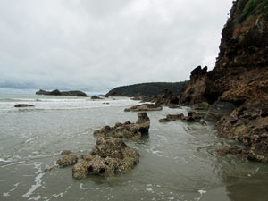
Reaching the bottom, I emerged onto a rock platform directly in front of Wedge Island. It was nearing low tide and the stony causeway was exposed, offering a chance to wander across and explore the near end of the island, with its small sandy beach, jagged volcanic rocks and scattered mangroves. Across the bay, the hills of the cape were fading into a misty rain. I was grateful for the broad-leafed trees at the back of the beach to shelter under during the shower. |
|
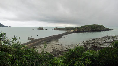 The stony causeway to Wedge Island |
 Misty weather near Andrews Point |
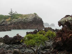 Looking across to Orchid Rock |
 |
 Cliffs on the southern end of Wedge Island |
Returning to the mainland, I followed the coast around, past the sculpted volcanic outcrops, tall hoop pines and vine forest at the base of the ridge. Finally, a short stroll across the wet sand of Casuarina Beach brought me back home to close the loop. Even in the misty rain, or perhaps because of it, this had been a magnificent short walk. |
||
|

Cape Hillsborough in the rain |
The first wave of rain passed through on the Saturday. By lunchtime, we were starting to get cabin fever, so donned wet weather gear and headed out for a recuperative walk on the Diversity Trail, a short (1.2 km) well-signed and partly board-walked track that passes through mangrove swamps, vne forest and drier eucalyptus "islands". It was a good chance for the fair Nello to give her injured calf some softer exercise. The reward was coffee and cake at the nearby Old Station Teahouse - there are worse things to do on a rainy day. |
||
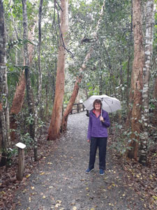 Wet day beneath the coastal paperbarks ... |
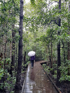 ... on the mangrove boardwalk ... |
 ... and back up into the grass trees and eucalyptus |
In fact, it worked so well, that we headed out to Wedge Island together later in the day when the weather cleared a bit. Hopefully, she will be back to normal soon. |
|
Crossing Cape Hillsborough (6.5 km - 290m ascent - 290m descent) |
Cape Hillsborough is formed by volcanic hills that bulge out into the ocean between the lowlands of Smalleys Beach and Casuarina Beach. The fair Nello dropped me off at Smalleys Beach on her way to check out the Sunday markets at nearby Seaforth. Although the the sky was grey and showers were around, a morning walk was called for, as the showers were forecast to turn to steady rain in the afternoon. |
 Grey day at Smalleys Beach |
Thus, I found myself heading off from the Smalleys Beach campground, onto the beach and eastwards for a short distance between the mangroves and the forest. At the point where the two merged to block further beach access, someone had tied a blue and a pink ribbon to the shrubbery on the forest side. It marked the beginning of a foot track across Cape Hillsborough. |
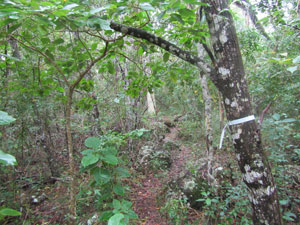 Ribbon marking the start of the track |
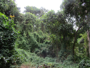
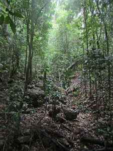
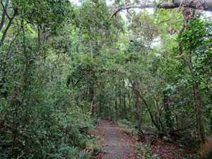
Entering the bush, I soon found myself walking parallel to the beach through thick wet grass beneath an open woodland canopy. This was not going to be a dry walk and, by the time the track turned to begin the climb, my trousers were already saturated. The landscape changed dramatically as soon as I started climbing, as the steep northern slope was covered in dense vine forest. Curiously, because the floor was quite bare with its damp litter cover, the lower half of me was no longer getting wet, while my upper body started getting dripped on from the wet canopy above. |
||
|
|
|
 |
The narrow track was a proper bushwalker's one that wound its way upwards, its route marked by a series of pink and blue ribbons. From their condition, it looked like the pink ribbons were older, while the newer and more frequent blue ribbons had been added later. There were times when I had to double check for the next ribbons before proceeding, so thanks to whoever put them there. |
 |
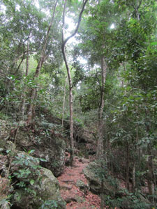
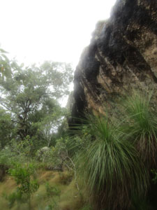
There were quite a few steep sections as the rocky and gnarly-rooted track pushed directly up the slope, climbing outcrops of volcanic rock and weaving through the tall rainforest trees. halfway up, a heavy shower seemed to spring from nowhere and I spent 15 minutes standing on a steep slope beneath my umbrella - a fairly silly sight in the rainforest, I suspect. |
|
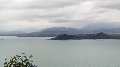
 View west over Ball Bay towards Newry Island |
 Breaking out above the rainforest |
When the shower passed, I continued on and, just as suddenly as I entered the vine forest, I left it to enter a more open eucalyptus woodland. Behind, glimpses of Smalleys Beach and the coastline to the north peaked through the trees. |
||
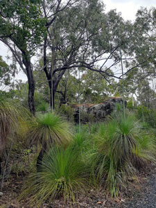
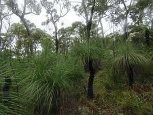 Grasstrees and eucalyptus forest on the tops |
 The open tops of Cape Hillsborough |
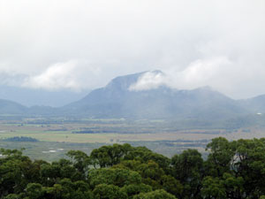 View inland towards Mt Jukes |
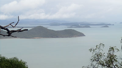
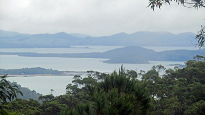
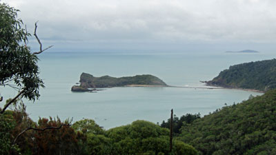
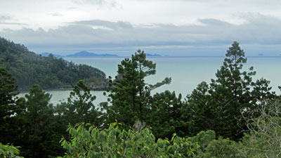
Finally, I reached the top of these cape hills, an undulating region of open eucalyptus with a thick cover of grass trees. Looking around, I spotted the track ribbons and headed off through the grass-trees to cross a small creek and sidle my way up an open ridge. Out to the south and west, a panorama of the coast-line and mountainous interior opened up. Ahead, I could see the rocky summit that marked the high point of the cape. A short detour led up to the jumble of white, tan and grey lichen-covered boulders. The views east out the end of the cape and offshore islands and south to Casuarina Beach and Wedge Island were superb. |
|
 Panorama of the O'Connell River Estuary |
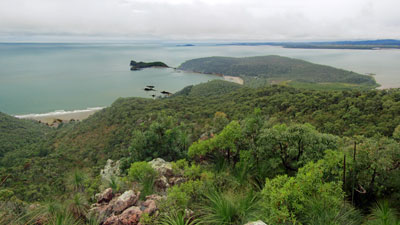 Looking down onto Wedge Island from Cape Hillsborough |
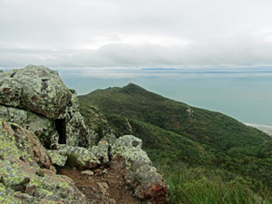 The high point of Cape Hillsborough |
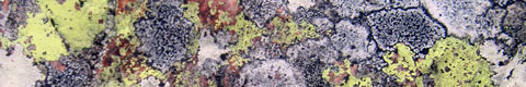
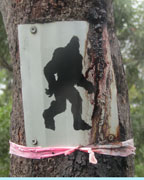 There be Yowies here |
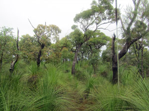 Descent through the grass tree thickets |
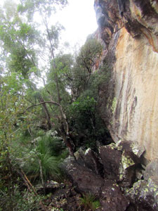
From the summit, the track began its descent through the thicket of grass-trees and down a narrow spur. As the slope steepened, I entered the vine forest ecotone to continue down a rocky gully and reach the base of a low rock cliff. For a short period, I had to pick my way through the jumble of rocks at its base, before continuing more directly down the slope. |
||
|
Arriving at a saddle, I met up with the Beachcomber Track, an asphalt paved footpath. The hard walking was over as I strolled down its switchbacks to reach Beachcombers Beach, with its lovely backing of hoop pines. |
|
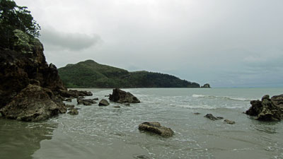
The southern end of the beach was guarded by a cliff-line and jagged rocks. This can be walked around at low tide, but I was just a bit too late. It was time to take off footwear, roll up trouser legs and wade - one last little bit of adventure before strolling across the wide sandy Casuarina Beach to the end of another great short walk at Cape Hillsborough. |
||
 Track down to Beachcomber Cove |
 Beachcomber Cove - its flat sandy shoreline ... |
 ... guarded by a rocky promontory |
 Looking out over the coastal hoop pines |
 Why I took my shoes off to get around the point |
FOOTNOTE: True to the forecast, the rain set in in the afternoon. In fact, it continued for another 48 hours, as the unseasonal upper atmosphere trough and associated "rain bomb" passed by. |
|
|