| Cape Tribulation |
About |
Cape Tribulation - where the rain forest meets the reef, as the posters say, was once considered one of the last frontiers in Northern Australia. Separated from the south by the crocodile-infested Daintree River, it is home to some of the oldest rain forest on the planet as well as being one of the closest points on the mainland to the outer reefs of the Great Barrier system. As a result it has become a mecca for nature-loving tourists, though it is only 12 years ago that an all-weather road reached the cape. Beyond that it is strictly 4WD country. |
||
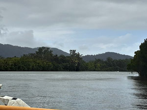 Crossing the Daintree by ferry |
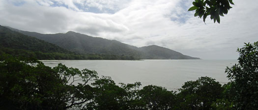
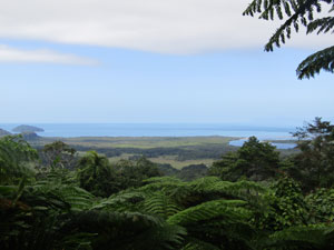 View from Mt Alexandra Lookout |
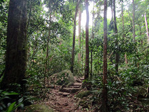 Ancient rain forest of the cape |
Despite numerous attempts to establish fruit, farming, grazing or timber industries, the isolation of the Cape largely thwarted these. By 1981, it was realised that the natural beauty was its strong suite and Cape Tribulation was incorporated into The Daintree National Park, before being given World Heritage status in 1988 as part of the Wet Tropics of Queensland WH site. Low key ecotourism is now the economic mainstay of the cape. |
||
 |
 Landscapes of Cape Tribulation |
 |
Thus, we found ourselves crossing the Daintree by ferry and driving into the misty mountains of the cape. It would be the northern end of our roadtrip, but we could not have turned back towards home without exploring the area - even if it is just for a few days. |
|

Dubuji to Kulki short walk (6 km - 40m ascent - 40m descent) |


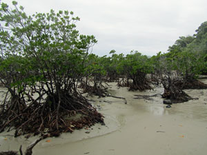
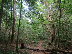
Dubuji Boardwalk is a short informative walk with lots of explanatory signage, highlighting the lowland forest swamps and mangroves of the Daintree National Park. It was quite close to where we were staying, so we walked over to do it, adding a beach walk up to the actual cape at Cape Tribulation for a bit of diversity. The stroll around the boardwalk loop was pleasant one, with fan palms dominating the mid-story beneath the canopy of rainforest trees and thick sedges lining the shallow creeks. Closer to the beach, the boardwalk passed by areas of muddy flats with buttress- and aerial-rooted mangroves. Dubuji packs a lot of vegetational diversity in a very small area. |
|||
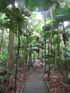 Heading out beneath the cabbage palms ... |
 ... to explore the lowland rain forest .... |
 ... and mangrove wetlands ... |
 ... of the Dubuji Boardwalk |
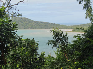
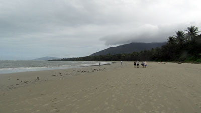
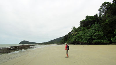
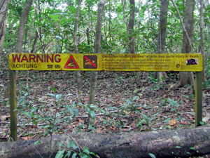
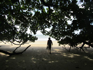
Leaving the boardwalk, we took a short sandy track to emerge onto Myall Beach, a long flat stretch of sand fringed with palms and backed by misty mountains. The strong south-easterly winds that prevail at this time were whipping up the sea and some good size breakers were rolling in. It's a shame there was also a big yellow sign warning against swimming because this is crocodile habitat. Looking north along the beach, we could see Cape Tribulation jutting out to sea. We turned in that direction, strolling up its firm sand with the warm wind at our backs. |
|
 Strolling along Myall Beach |
 Looking up Myall Creek towards the hinterland |
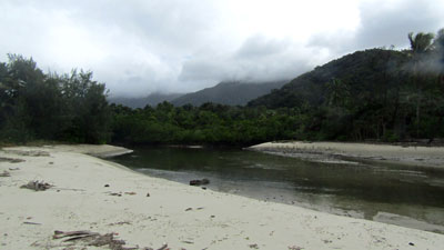
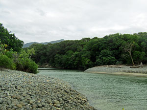
Reaching the opening of Myall Creek, views opened up to the green clad mountains of the interior, their tops capped with misty cloud. With an outgoing tide, the creek was only shin-deep and we waded it to reach the northern end of the beach. Here, we had to search for the foot track meant to lead us across the saddle of Cape Tribulation. It was hard to spot as heavy seas had eroded the beach, leaving low sand cliffs and debris where a smooth entry should have been. However, another yellow sign warning of crocodiles gave it way, and we clambered up and headed on through the lowland forest. |
||
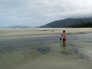 Wading Myall Creek |
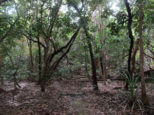 Lowland forest |
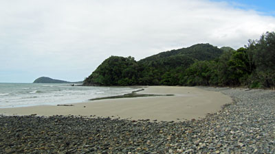
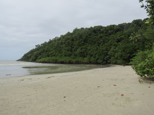 The beach at Cape Tribulation |
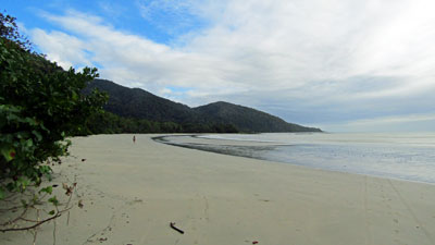
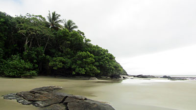
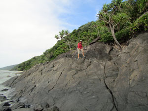
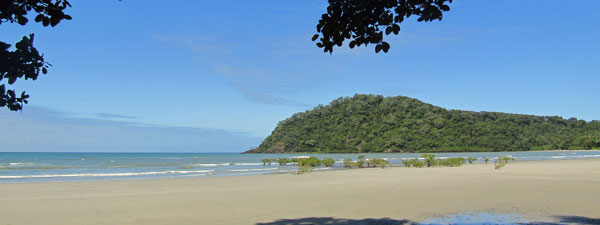
Apart from the eroded entry and an easily rounded section blocked by a land-slip, the track was in good condition and we soon climbed up and over the saddle to reach the Kulki car park. From here a boardwalk took us out along the base of the cape to the Kulki Lookout, with its iconic view of Cape Tribulation Beach and the rain-forest clad mountains that back it. |
||
 |
 The classic view from Kulki Lookout |
|
We dropped down onto the beach for a short stroll before returning by another path to the carpark. There was no point going further, as this would be the start of a longer walk in two days time. From Kulki, we continued to retrace our outward route, back across the saddle with its dense vegetation, an even shorter wade across Myall Creek (the tide was now way out) and a stroll back along the beach, with its superb views of the cloud-topped mountains to the south. |
||
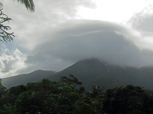 Cloud cap on the mountains of Cape Trib |
 |
 Swimming in the waterhole at Masons Waterhole |
Reaching a track leading off the beach, we headed inland across the freshwater swamp and its mangroves and back to our cabin at Safari Lodge. We had enough time for a refreshing swim in the clear waters of nearby Masons Waterhole - a crocodile free pool higher up the creek system. This really is a place where the rain forest meets the reef - tomorrow it's time to explore the latter. |
|
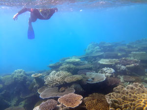
Snorkelling Trip to Mackay Reef (40 km return by zodiac) |
Cape Tribulation is one of the places from where you can take a trip to snorkel on the outer reef - in this case, Ocean Safari will take you to either Mackay Reef or Undine Reef, some 20 km offshore, depending on conditions. After the disappointment of the fringing reefs that we had snorkelled on the way north, the fair Nello and I were keen to visit the outer reef, where the coral is supposed to be much better. Thus, we found ourselves lining up for wet suits with 19 other intrepid snorkellers of all ages plus our boat driver, Moz, and our snorkelling guide, Jesse. Unlike most other outer reef tours, Ocean Safari keep the numbers down and use a rigid inflatable "super-sized zodiac" with twin 350hp motors, that can carry 25 passengers very quickly out to the reef. Also, because of its design, it can go out in conditions that conventional boats would not. This was a good thing, as the forecast for today was for 15-20 knot winds, gusting to 25, and a 1.5m swell. Kitted up, we all wandered down to Myall Beach, where the boat was waiting just off shore, waded out and climbed aboard. With the south-easterly wind, our destination today was Mackay Reef. It took only 25 minutes to cover the 20 km to it as we rocked and rolled our way through the big swells at 50 kph. The trip is half the fun. |
||
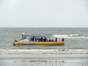 Leaving Cape Trib for Mackay Reef |
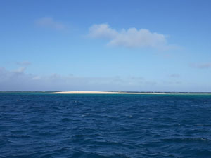 The tiny sand cay at Mackay Reef |
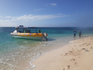 Arrival on the cay |
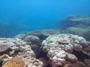
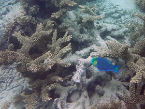
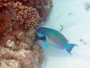
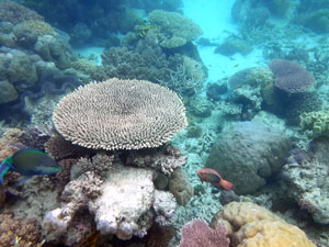
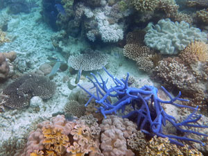
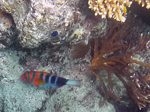
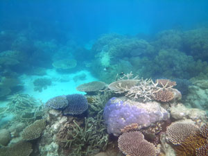
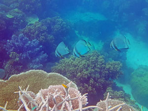
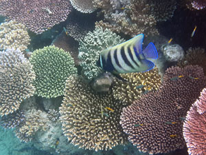
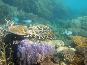
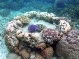
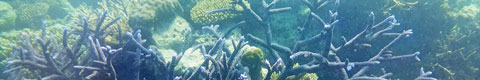
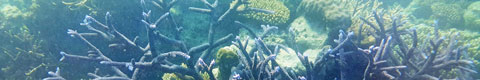
Reaching the reef, Moz anchored the boat at a point where several tongues of coral stretched out across the light blue water above a sandy bottom. Even in the lee of the reef, the wind was still stirring the surface. However, once in and facing down that was all forgotten ... as was the not-so-good snorkeliing on inshore reefs. The coral here was superb - lots of colour, a great range of forms, and lots of colourful fish .... plus turtles. A lot of the northern Great Barrier Reef has suffered coral-bleaching this year due to warmer sea conditions, but Mackay Reef seems to have been spared. The images below show it better. |
||
|
|
|
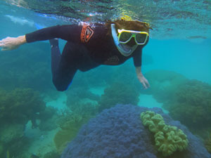
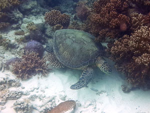
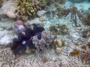
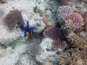
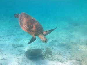
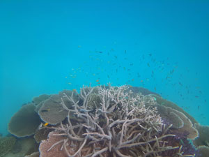
After an hour snorkelling the reef edges, Moz shifted the boat to stop at the small sand cay within the reef. We clambered out on this tiny patch of "land", perhaps some 50m long by 30m wide at this tide level, surrounded by kilometres of open ocean ....almost surreal. The cay was our base for the next hour of snorkelling ... watching turtles and checking out the series of small bommies and reef around it. Again, the photos below show it better than any description. |
||
|
|
|
Then it was time to return and, with the wind picking up to gust at 25 knots, the ride back was even wilder ... an exhilerating adventure that ended as we pulled back in to Myall Beach. Thanks Moz and Jesse for an informative and good-humoured trip. Our quest for a good coral-viewing experience had finally been achieved. |
|
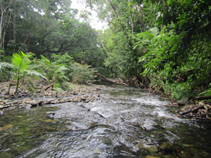
Emmagen Creek Coast and Rainforest Walk (13 km - 130m ascent - 130m descent) |
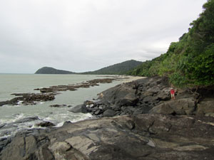
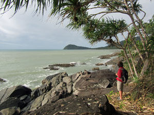
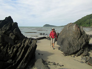
It was time to sample the coastal walking possibilities here at Cape Tribulation - our plan, to walk northwards along the coast from the cape to the Emmagen River and return on the Bloomfield Track beneath the rainforest. We drove to the Kulki carpark on the southern end of Cape Tribulation beach and wandered down the sandy track to the shore. It was 9am and the tide was near its ebb - it needed to be, as this is definitely a low tide route. |
||
 |
 Looking north along Cape Tribulation Beach |
 |
Passing beneath the arching branches of rainforest trees that overhung the sand, we took in the view of the cape to our south before turning and heading north up the beach. With the tide out, it was wide and firm, which made for pleasant walking. Morning cloud still dominated the sky and a warm wind was at our backs. Ahead, we could see the steep rainforest slopes plunging directly into the Coral Sea - this was not going to be just a beach walk. |
||
 Where big trees overarch the beach .... |
 |
 .. and mangroves create a mini-maze |
The first obstacle was a thicket of short mangroves protuding out past the beach on a stony bed. A shallow freshwater creek flowed down through them, but was easily crossed on natural stepping stones. We picked our way through the mangroves to reach the northern end of Cape Tribulation Beach, its fringes draped with the green overhanging tree canopy. Behind us, Cape Tribulation itself dominated the view - always present, framed by trees or rocks, whenever we cast a backward glance. |
|
 Looking back along the beach to Cape Tribulation |
 Rain forest covered slopes above the beach |
The beach narrowed and gave way to a stony bed, the coast now lined by the remnants of a narrow on-shore reef. The rock-hopping here was easy, but ahead we could see the the slope plunged straight into the sea. |
||
 A section of rocky inshore reef |
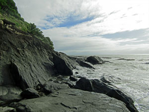 Difficult passage against the rocks |
 Pandani lining the coast |
 Passage through the jagged boulders ... |
It was the start of a slow section, working our way around and over the jagged and steeply-sloped rocks with the sea lapping at its base. I confess to liking this type of coast-walking. Eventually, the edge flattened somewhat and we could now rock-hop across uneven boulders and even walk on a bit of flat sand. This continued for a while, with one more short traverse up and over a small pandanus-line rock cliff. By now patches of sunlight were starting to break through the clouds. |
 ....and above the smoother rock walls |
Rounding a point, we saw the broad sandy stretch of Emmagen Beach - the hard bit of the walk was over. We wandered up the beach to take a look at the mouth of Emmagen Creek - supposedly good croc country - before finding the foot track that headed inland through lowland rainforest to the Bloomfield Highway. |
||
 Emmagen Beach ..... |
 .... and the mouth of Emmagen Creek .... |
 .... where there be crocodiles |
Highway is a bit of an exaggeration, as this is a dirt road acclaimed by 4WD enthusiasts as an adventure trip. We followed the road until it crossed Emmagen Creek at a car-door height ford, then headed off along a foot-track that led inland beneath the rainforest canopy. |
||
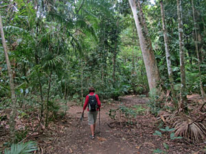
 Rainforest track from the beach |
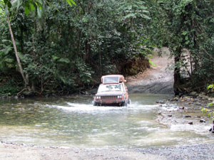 4WD crossing Emmagen Creek on the Bloomfield Road |
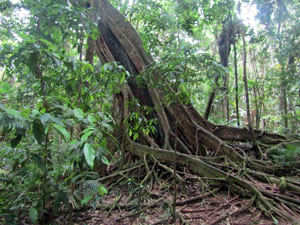
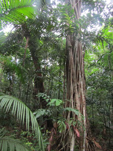
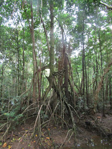
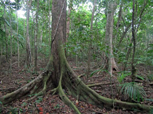 Buttress-rooted rain forest tree |
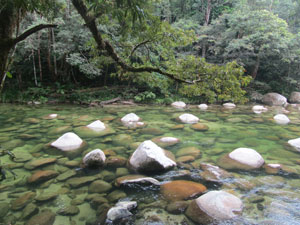
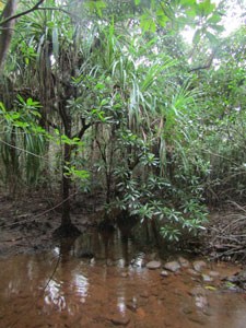
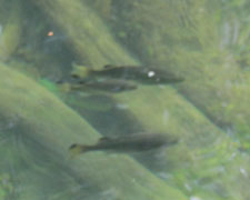
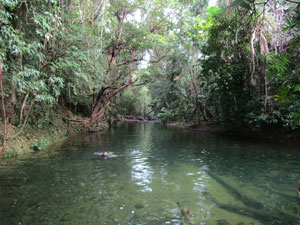
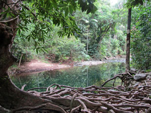
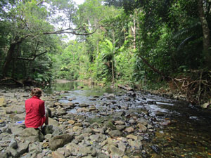
Our destination was a couple of swimming holes on Emmagen Creek (supposedly crocs do not travel beyond the ford). The first was a clear deep hole, but difficult to access due to a huge mass of gnarly roots on itse edge. The second was a long, deep waterhole, book-ended by small babbling rapids. Its gravelly bank was a great place to stop and wade in. The water was cold, but crystal clear - a great spot to soak in after a hard walk. Even better, there was no one else to share it with but the fish. We stayed for a while after our swim to soak up the ambience of this rainforest stream. |
||
|
|
|

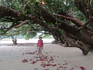
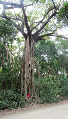 Nello and the giant strangler fig |
Finally, heading off, we walked back to the road, but this time continued along it. With the rising tide, some of the cliff sections along the beach would now be virtually impassable. The road-walking was more pleasant than I had anticipated, a smooth dirt surface beneath the tall rainforest canopy and only a few vehicles passing by. |
|
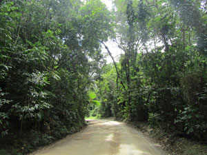 Walking back along the Bloomfield Track |
 Back onto the beach at the cape |
|
It climbed steadily as it rounded the steep slope above the rocky shoreline we had traversed earlier. We walked to the sound of waves breaking on the reef below us and to glimpses of the Coral Sea between the trees as the road climbed and descended a series of rises. |
||
After a while, we reached the entry to the Cape Trib Beachhouse, a group of cabins in the rainforest. It provided access to Cape Tribulation Beach beyond the rocks, so we headed down and out on the beach to walk the final section along its sandy shore. The sun had now won the sky and Cape Tribulation almost glowed green at the end of our walk.
|
It had been a good walk - beautiful coastline, a bit of rock-scrambling adventure, open beaches to balance the enclosed rainforest and a lovely refreshing swim in the middle. This sort of rainforest walking, we could get used to. |
|