
| Jotunheimen Circuit |


Getting There |
|
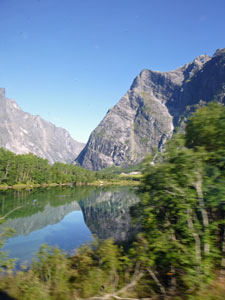
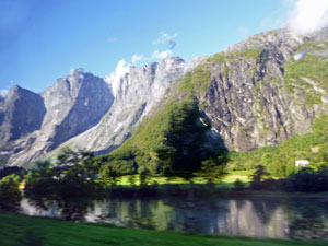
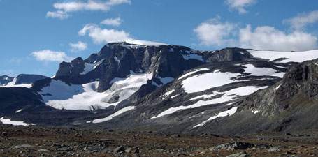
Who'd have thought it! Who'd have thought that after getting up to a bleak day in Ålesund, with low grey cloud settled like a blanket over the landscape, then driving in a bus towards Andalnes in drizzling rain and fog, that we would be on the Raumabanen (the scenic railway from Andalnes to Dombas) looking up to a bright sun-filled sky as well as up to Trollwegen, the 1000m high rock walls and peak that line its route. Clearly, the weather in Norway can change from one valley to the next, for which we were very grateful.
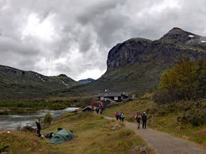
One bus from Ålesund to Andalnes, two trains to Otta via Dombas, then two more buses that took us deep into the central mountains of Norway. Finally, we reached Gjendesheim, the flagship DNT lodge. This was to be the start of our 5-day hike through the Jotunheimen Mountains, and we had arrived - time to laze on the edge of Lake Gjende beneath the sheer rock walls of the Bessegen Ridge and soak up the mountain atmosphere. We were not the only ones with this idea - already there were no double rooms when we arrived in early afternoon and, by the time we went to bed, our dorm and others were full. When we woke in the morning, there were even more people, sleeping on mattresses in the lounge areas. Gjendesheim was overflowing, but the mantra of the DNT is that they never turn anyone away - clearly they don't. |
|
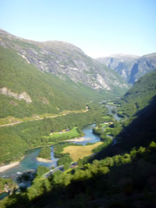
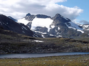
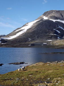
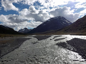
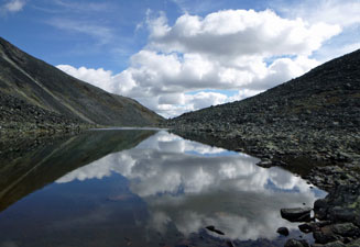
 Lake Gjende from Gjendesheim |
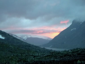
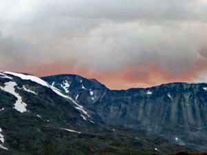
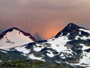
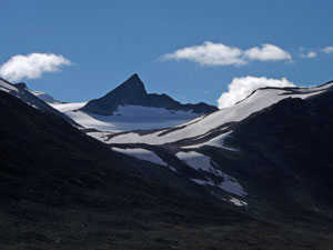
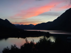
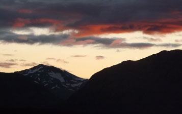 Jotunheimen sunset |
|
Day 1: Gjendebu to Olavsbu (16.5 km - 490m ascent - 50m descent) |
|
|
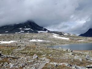
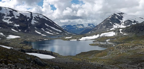
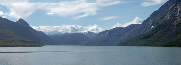 Lake Gjende and the Bessegen Ridge |
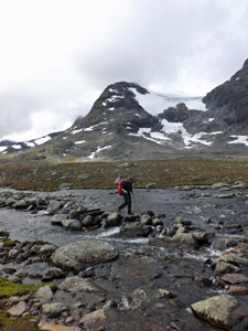
 Disembarking from the boat at Gjendebu |
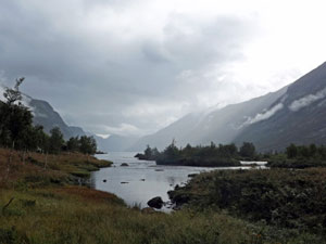
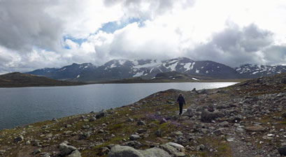
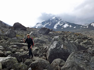
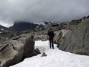
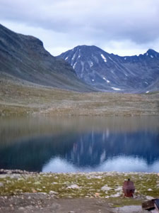
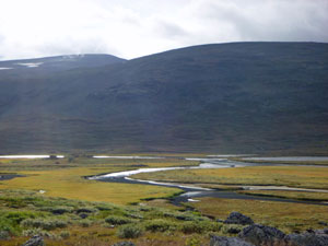
 According to my GPS, today we covered over 34 km. Fortunately, for us, 18 of those were on the boat that takes people down the length of the lovely glacial Lake Gjende. We had made an early start to the day, heading to the pier a little after 7am to catch the boat from Gjendesheim to Gjendebu, at its far end. There were two queues at the jetty - ours for Gjendebu, which was about 40 people long by the time the boat arrived, and the other for people wanted to go to Memerubu, midway down the lake, to start the famous hike across the Bessegen Ridge, made famous as the site of one of Peer Gynt's exploits. There were already a couple hundred people in this queue and it was still growing as we sailed off. The Bessegen Ridge is one of those places that has succumbed to its own fame and has become a must do for Norwegians and backpackers alike. To have several hundred people crossing the ridge on the same day is not unusual in the Norwegian summer holidays and this was the last weekend before school and work started - a weekend that had brought the crowds to Gjendesheim in force.
It took 40 minutes to reach the far end of the lake, time and distance enough for the partial sunshine of Gjendesheim to be swallowed up by thick grey cloud. We disembarked at the pier and strolled around the shore to the DNT lodge at Gjendebu, backed by the rocky rampart of Gjendetunga - time for a coffee before setting out on our journey of discovery of the Norwegian mountains - time also, for the first shower of rain to fall. |
|||
 Gjendebu Lodge below the bluff of Gjendetunga |
 |
 |
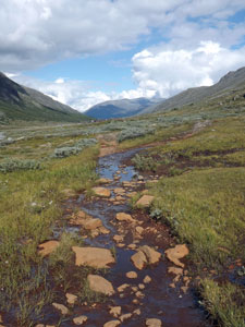
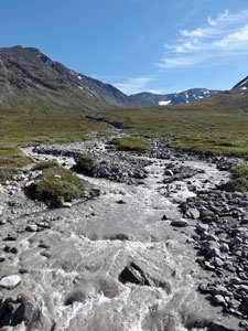
 The mouth of the Veslåe Stream |
|
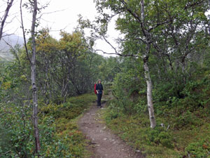
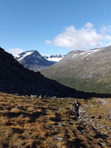
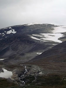
Setting out, we quickly crossed the inlet stream to Lake Gjende to start a gradual climb up through a scrubby birch forest - it would be a long time before we saw another tree. This brought us out beneath the towering walls of Gjendetunga, as the vegetation changed to low alpine shrubs and herbs. The track followed a babbling stream up the Veslådalen Valley - shower and sun, sun and shower, raingear on, raingear off.
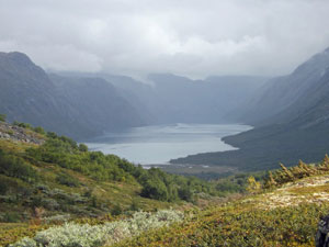
To the south, cloud hung low over the snow-tops of the Slettmark Mountains as we reached a track junction and began a steeper climb out of the valley. On reaching the saddle, the mountain scenery opened out to reveal a large lake stretching down the valley beyond. |
|

|
We turned north, sidling around the western end of the lake, beneath the slopes of a high ridge. we had entered the long and lake-filled valley of Rauddalen. It was a tranquil place and, even better, the sun seemed to be winning the sky. By the time we left the lake, we were starting to warm up, climbing steadily up a rocky rise and crossing the occasional boggy wetland.
|
|

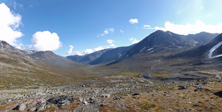
 The stony landscape of the upper Rauddalen Valley |
 Panorama of the Slettmark Mountains |
 Cloud over Snøhøltinden |
 |
 |
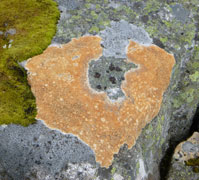
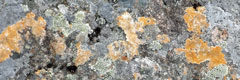
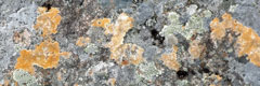
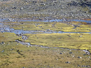
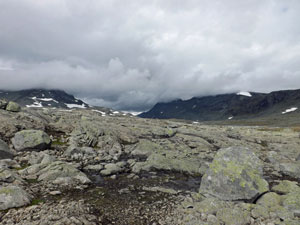 Lichen covered rocks in Rauddalen |
Over the rise, another smaller lake appeared and the track sidled around it to repeat the exercise, climbing up to the next rocky rise and a third lake, this one wedged between the peaks of Snøhøltinden and Rauddalseggje. Cloud drifted about these peaks, as we followed a line of stone cairns to pick our way across wide bands of rocks, tinged yellow-green with lichen. |
|||
 |
 The second Rauddalen Lake |
 |
We had entered a second broader arm of the valley, as we pushed steadily on, when a slight movement uphill attracted our attention - it was a herd of reindeer grazing on the grassy slope. Now, that was a bonus! We stopped to watch and admire, before heading on towards the twin conical peaks of Mjølkedalstinden. |
||
 A rare patch of sunshine in Rauddalen |
 |
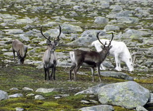 Our first herd of reindeer |
A fourth lake appeared and we began to pick our way around its rocky shore-line. Suddenly, big drops of rain began to hit our backs - a band of rain had snuck up from behind us, only 15 minutes out from Olavsbu Lodge. After quickly putting on our wet-weather gear, we hurried on to reach the lodge in its picturesque setting between lake and mountains. |
||
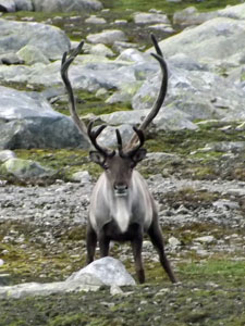 So who is watching who? |
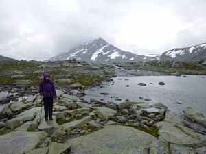
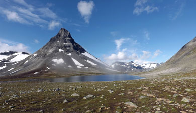
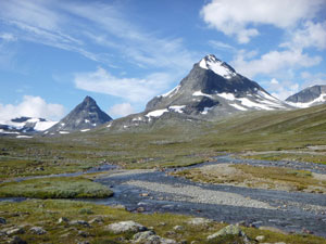
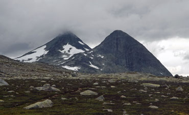 The twin peaks of Mjølkedalstinden (1970m) |
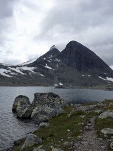 The last lake before Olavsbu |
 Bad weather coming in from the south |
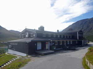
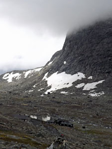
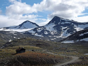
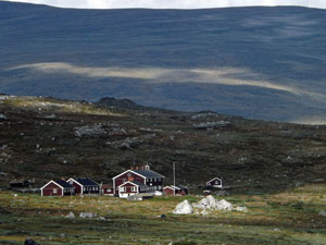
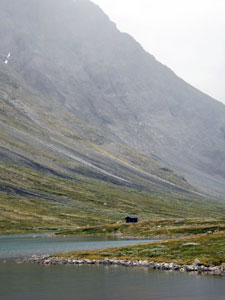
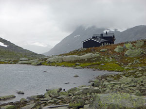 Olavsbu Lodge |
 Sunset over Rauddalsvatnet |
Olavsbu is one of DNT's self-catering lodges, meaning food can be purchased in tins or packets and everyone pitches in to do a few chores, such as looking after the wood-stove, fetching buckets of water from the nearby stream. There were only a few people when we arrived, but by evening the lodge was full (22 people) and buzzing with the sounds of cooking and conversation. With the rain pattering on the window panes, it was a bubble of warmth in the cold, but beautiful Norwegian mountains - a very pleasant place to be, indeed. |
||
|
Day 2: Olavsbu to Leirvassbu (11.5 km -340m ascent - 360m descent) |
|
|
|
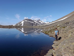
 Early morning fog and reflections at Olavsbu |
 Climbing the rocky slope of Skardalstinden |
|
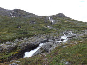
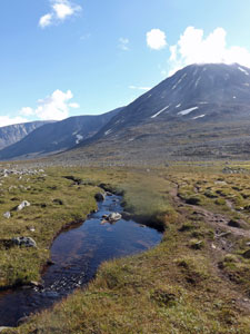
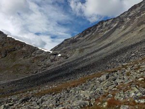
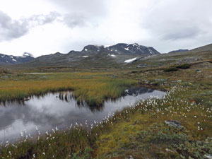
We headed out quickly from Olavsbu into the cold mountain air, climbing steadily up the rocky lower slope of Skarddalstinden. To the west, the valley opened out to yet another distant lake beneath snowy peaks on either side - a panorama in monochrome. Soon we reached the wide bowl of the Rauddalsbandet, the upper catchment of the valley, picking our way across the stony landscape and rock-hopping the shallow streams that flowed out of this basin. |
||
 View down the valley towards Lake Rauddalsvatnet |
 |
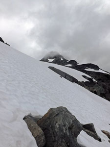
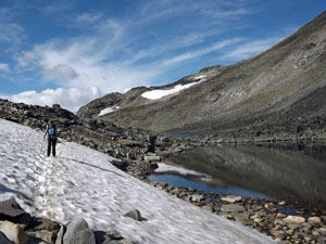
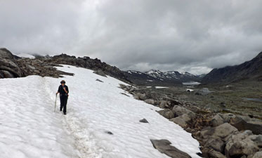 Crossing our first snowdrift |
|
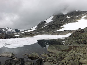
The far side was more boulder field than stones, but a series of red Ts and cairns led us through it and to the top of the saddle. Perched in a small hollow was a lovely little lake, still framed by snowdrifts and partly covered with a thin sheet of ice at the end of the Norwegian summer.
|
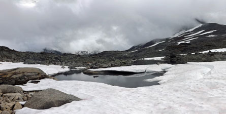
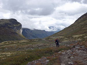
We worked our way over the boulders to the top of the saddle, where grand views appeared over the next valley and Høgvagljonnen Lake, backed by the glacier-topped Høgvagl mountains. The way down to it was tricky, firstly gingerly stepping down a steep snowdrift, then picking our way down large boulders and, finally, one more snowdrift and we were next to the blue-green waters of the lake. By now, the first gaps of blue were appearing in the sky and the sun's rays started to chase the cold. |
||
 A misty Jotunheimen mountainscape |
 Nearing the top of the pass |
 Tarns below the Rauddalstindane Ridge |
 The big drift |
 View from the pass down to the lakes of the Semeldal Valley below the rounded dome of Høgvagltindane (2015m) |
 Group descending the big drift |
We walked a way along the lakeside track, part rocky and part boggy where water seeped and flowed shallowly down the slope, to head towards a long range peaked by the snow-covered tops of Visbretinden and Semeltinden. Nearing the low point, the waters of Longvatnet came into view, as the lake stretched down the length of the valley. |
||
 |
 At last the sun begins to break through |
|
|
We, however, followed the track upwards, gradually climbing past a series of cascades that drained the water from the upper Høgvagljonnen lake to the lower one. The sun was now out in full and warming our backs as we worked our way across the rocks that lined the north side of the upper lake, climbing high above its shore. The sun also brought out the brilliant deep blue colour of the water, beautiful with its frame of snow-capped peaks. |
|
 Marshy flats below Høgvagltindane |
 Rounding the rocky shore of Høgvagljonnen lake |
|
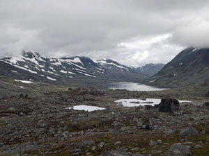
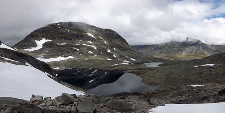
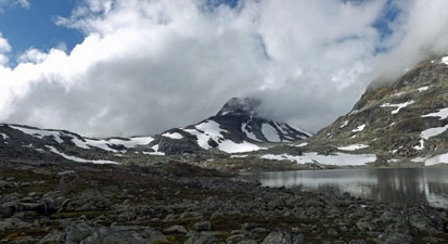
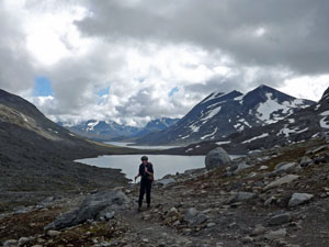
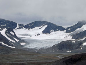
On reaching the end of the lake, the climb continued, pushing up to reach a saddle overlooking the next valley (our third valley system of the day). ahead lay Leirvatnet Lake, with the distant brown buildings of Leirvassbu Lodge on its western shore and the immense dark pyramid of Kyrkja Peak on its east. |
|
 On the pass high above Høgvagljonnen lake |
 Panorama of Leirvatnet Lake and the pyramid of Kyrkja Peak |
|
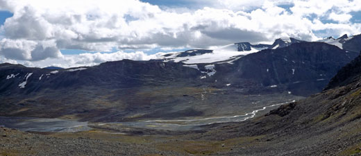
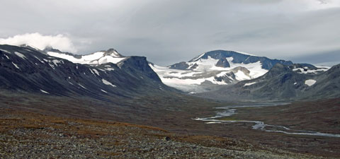
We climbed on, around the lower northern slope of Høgvagl mountain, to cross one last snowdrift and start our descent to the lodge. In no time, an immense panorama opened up of the upper bowl of the Gravdalen Valley, with its beautiful lake sparkling in the sunshine, surrounded by snow- and glacier-capped peaks. Far to the west, even more snowy mountains filled the horizon. |
|
The valley itself wound down to eventually reach the Sogne Fiord - we were looking through a window to the west and it was a good place to take a long break and contemplate the beauty of these mountains and valleys and the power of the ice that shaped them. |
|
 Panorama of the upper Gravdalen Valley |
 Leirvatnet Lake and Kyrkja Peak (2032m) |
|
|
|
From here, the descent was rapid - down to a gravel road that led quickly (and smoothly) to Leirvassbu Lodge. It was still early afternoon and we had plenty of time to bask in the low Norwegian sun and soak up the this superb mountain scenery - all the time, dreaming of the 3-course meal to follow. We were back in a fully-catered lodge and the gourmet Norwegian concept of trekking was about to resume. |
||
|
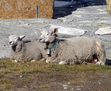 Mountain sheep enjoying the sunset at Leirvassbu |
|
|
Day 3: Leirvassbu to Spiterstulen (15.5 km - 110m ascent - 410m descent) |
|
||
|
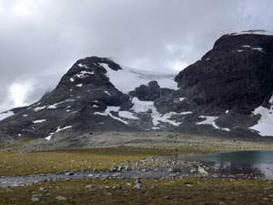
Setting out from Leirvassbu, we worked our way steadily around the stony northern shore of Leirvatnet. The dark eminence of Kyrkja, backlit by the morning sun, hung over the eastern shore of the lake. as we slowly approached and then climbed gently alongside and past, its summit changed from pyramid to crooked hat. |
|
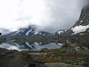
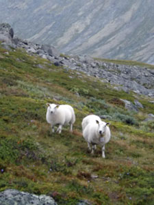
Cresting a low rise, we were greeted by the still, clear waters of Kyrkjetj, a small lake whose mirror-like surface reflected the colours of snow-dappled slopes around it. We picked our way carefully around the boulders lining the lake shore, stopping occasionally to turn and admire the reflections of the mountains backing Leirvassbu and the distant glacier-clad massif of Smorrstabtinden (at 15 km2, the largest glacier in Jotunheimen). Apart from the occasional tinkle of a mountain sheep's bell, a deep silence pervaded this tranquil spot. |
|
 Mountain reflections on Kyrkjetj Lake |
 Edging around the rocky shore of Kyrkjetj |
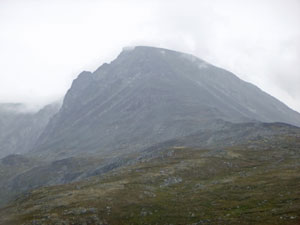
Leaving the lake, a short and gentle climb took us up to Kyrkeglupen, the pass between this and the next valley system. Ahead lay a broad, deep and long valley, draining to the north, steep brown walls hemming it in. On either side of this valley lie the two highest peaks in all of Scandinavia, though, for the moment, hidden deep behind the valley walls. |
|
 Last view back to the iconic peak of Kyrkja from the pass .... |
 .... and then on into the Visdalen Valley |
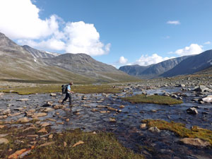
In the foreground was the wide green bowl of Grønbakkan, draining water off the surrounding mountains in a silvery web and channelling it into a single stream. We descended steeply to its soft and spongy surface, rock-hopping our way across several of these wide braided streams, to start a steady and gentle descent of the valley - steady as the descent goes, but stony or boggy as the track goes. |
|
||
 Braided streams of Grønbakkan |
 |
|
|
|
Somewhere along the way, the Grønbakkan became the Visdalen Valley as we wandered down its length, crossing numerous small side-streams and water soaks on the way. Gaps in the valley wall revealed high perched glaciers, and the milky green glacial meltwater tumbled down the slopes to join the main stream and add to its now rushing torrent.
|
|
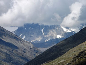
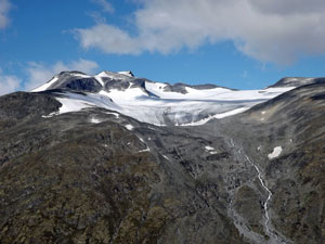
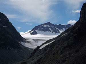
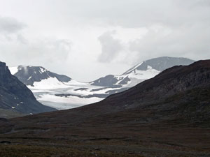
The mountains of the south disappeared behind us as the valley curved, replaced by the pyramidal form of Udadalstinden. We crossed a couple of large but dry stream beds (glacier outflow diverted?). Ahead another gap in the valley wall slowly revealed the summit and glaciers of Galdhøppigen, at 2469m the highest peak north of The Alps. |
|
|
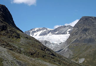 The glacier below Galdhøppigen (2469m) |
 A long step is required |
|

We were now on the run home, one more curve in the valley and the buildings of Spiterstulen Lodge came into sight. Built in 1790 as a summer farm, Spiterstulen was one of the first places to embrace tourism, offering lodgings to mountain walkers in the 1800s. Today, it was our comfortable home for the night and a good place to admire a different landscape of the Jotunheimen Mountains. |
|
|
 The buildings of Spiterstulen Lodge |
 At Spiterstulen, the Visa has become a wide glacier-fed river |
|
Interestingly, there were not that many people at the lodge, as had been the case at Leirvassbu. For our first two nights here, the lodges had been full to overflowing - perhaps not that surprising, as it had been the last weekend of the Norwegian school holidays and the last hurrah for many before returning to work and school. Life in the mountains was returning to its sedate and quiet existence and, to be totally honest, we preferred it that way. |
|
Day 4: Spiterstulen to Glitterheim (16.5 km - 620m ascent - 300m descent) |
After a bit of overnight rain, the sun returned to greet us in the morning - metaphorically, for Spiterstulen lay deep in a north-south running valley and it would be a while before the morning sun rose above the eastern wall. We left the lodge and headed north along the access road for about a kilometre - 1km of smooth, flat surface and, if we'd known then what we know now, we would have savoured it a bit more. |
|
A red T indicated where we left the road and resumed the walking path to quickly start the steep ascent of the eastern flank of the Visdalen Valley. It was still quite a good track and, shaded from the sun, we had pleasant conditions for a long and steady climb. In no time, we crested the lip of the valley to emerge into the warm sunlight and continue on a more gentle gradient up the green pastures of a high hanging valley. |
|
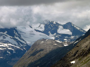
 View across the valley to Galdhøppigen ...... |
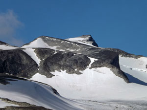 .... at 2469m, Norway's highest mountain |
|
Across the Visdalen, a similar side-valley opened up to reveal superb views of Norway's highest peak, Galdhøppigen, and its large glaciers. Further north lay the summer ski-field of Juvasshytta, though no-one seemed to be skiing on it. |
|
 The open meadows of the plateau ..... |
 ..... soon gave way to a stony desert |
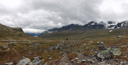
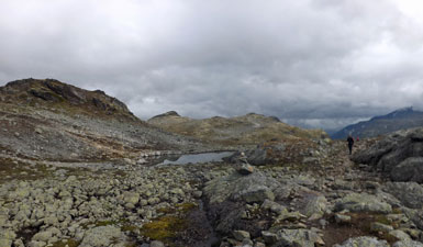
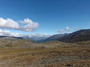
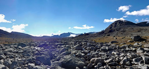
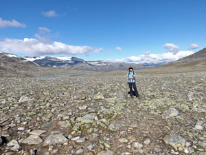
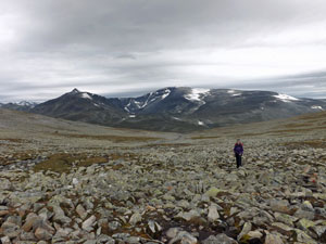
Passing over a small knoll, we looked ahead to see a broad and undulating barren plateau. We had entered the realm of Stautflyi, a vast stone-covered plain that sloped gently to the south. The track changed quickly from grassy with some rocks to rocky with a bit of grass and moss. It had become a track that demanded your full attention as to where to next put your foot, and would remain so for virtually all of the remaining 13km to reach Glitterheim. |
|
 Crossing the stony plain of Stautflyi |
 Leirhøe Mountain (2110m) |
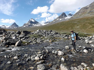
We picked our way steadily across this flattish, but uneven, stonescape. To the south, views began to appear of snow-capped rugged peaks. As we moved eastwards, this gradually opened up to a vast panorama of mountains and glaciers, dominated by the peaks of Veotinden and Memerutinden, two of the many 2000+m peaks in the Jotunheimen. They provided a distraction to the steady plod across the stones and boulders of lunar-like Stautflyi. |
|
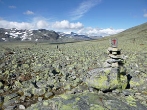 Cairn marking the route across the Stautflyi stonescape |
 Panorama of Leirtjonne Lake and the western face of Skauthøe |
The track began to climb steadily, edging up the northern flank of the plateau and, as it did so, its surface changed from stones to small boulders. Ahead, the bare rock walls of a pass loomed - we had reached the mouth of Veslglupen Gorge and its series of large tarns, not only our high point of the day, but our escape route from this barren high plateau. |
||
 Entering the barren Veslglupen Gorge ... |
 ... with its series of lakes ... |
 .... reflecting the cloud above |

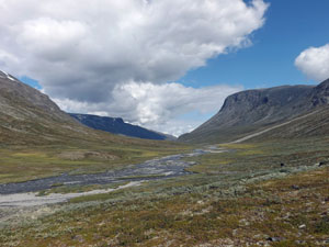
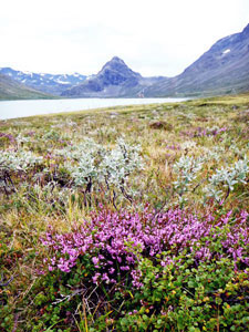
We began to pick our way around the large boulders that lined the shores of these tarns, trapped between the barren walls of the gorge. It was slow going, but, at the end of the fourth and last tarn, the gorge ended and the land dropped away quickly to reveal the wide green-clad valley of Veodalen, and its silvery braided streams that carried the glacial meltwaters away from the surrounding mountains. |
|
 Looking back up at our descent route into Veodalen |
 Looking down on the Veodalen Valley |
|
The descent into the valley took us down and across a wide talus slope (scree the size of boulders) and on to the grassy mid-slopes of the valley - grassy, yes, but the track itself was often badly eroded to bare the sharp-edged rocks beneath. It was a lovely setting, with the dark, glacier-capped massif of Veotinden dominating the head of the valley, the silvery strand of the river below and the gently sloping green valley walls. However, we had had our fill of uneven rocky track and were on a mission to reach Glitterheim Lodge. |
|
|
 |
 View back up the Veodalen to the glaciers at its head |
 |
|
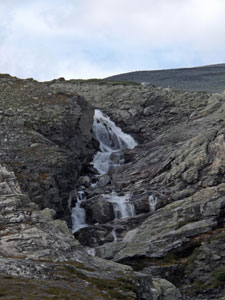
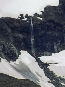
When it finally appeared in the distance, our pace quickened, barely distracted by the glimpse of the top of Glittertind, Norway's second highest peak, to the west. One final crossing of a broad stream babbling down through the silverbushes from the waterfall above and we arrived.
|
|
It felt so good to finally put our feet up, as our legs were starting to suffer under the relentless pressure of Jotunheimen's rocky tracks - feet swollen, knees aching and shins splinting. It was over the end-of-day cold beer that we declared the section from Spiterstulen to Glitterheim the hardest track surface that we had ever walked on. Let's hope that there is no competition for this title tomorrow. |
|
Day 5: Glitterheim to Memerubu (19.5 km - 570m ascent - 920m descent) |
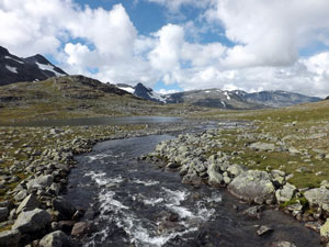
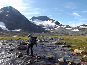
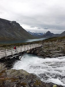
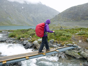
We quickly traversed the reedy flats below the lodge to cross the surging grey-green torrent of the Veo River on a bouncing suspension bridge. Once on the other side we turned south, gradually heading away from the river and up the eastern slope of the Veodalen Valley. |
||
 Wetlands of the Veo River |
 Flower-lined pond in the marshes |
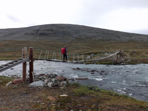 Crossing the Veo |
Taking a more direct uphill line, the stony track steepened as it passed along the edge of the small Høstbakkan Ravine. Behind us, the rounded, cornice-topped dome of Glittertind rose above the surrounding summits - Norway's second highest peak revealed. |
|
|
 View across the valley to the rounded dome of Glittertind (Norway's second highest mountain) |
 Classic Jotunheimen mountainscape |
|
|
|
|
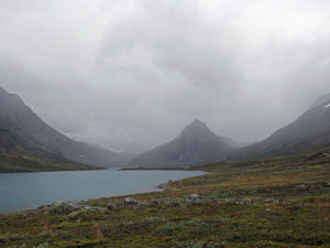
We continued climbing steadily up the slope on stony track or boulder jumble, till eventually we reached the saddle separating Veodalen from the next valley system. Ahead, we could see distant Russvatnet Lake, backed by the dark rock walls of Besshøe.
|
|
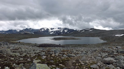
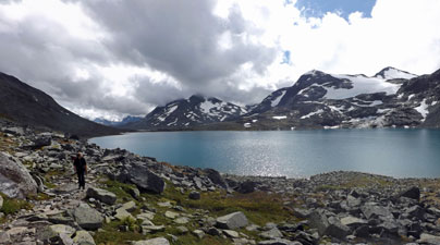
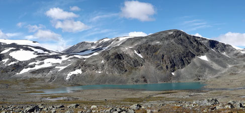
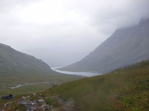
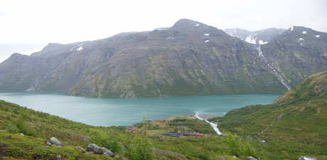
The top part of the descent from the saddle was quick and steep, which was just as well for we had emerged into the face of an icy wind on the top - an extra layer and beanie were called for. The route down towards the lake was long and steady across a barren slope. Glacier-topped mountains to the west fed a series of streams that coalesced to create the thundering Blatjørnda Torrent. A new bridge had been built across it, along with new access tracks - at last smooth earth beneath our feet and great views down the length of turquoise-coloured Russvatnet. Looking towards its other end, Russvatnet lay wedged between the the towering rock walls of Besshøe and Gloptind. This was our onwards route. |
||
 |
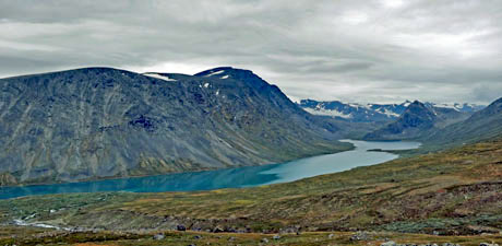 The turquoise waters of Russvatnet |
 |
|
On crossing the bridge, the new track quietly vanished in the alpine heathland. Unperturbed, we angled our way towards the lakeshore, crossing a slope of spongy heath and prostrate shrubs. Our off-piste foray soon brought us back to the main track as it to headed lakewards, to follow the shoreline of Russvatnet past a series of tiny sand beaches. |
|
|
 |
 |
||
It was here that the rain caught us - arriving an hour earlier than forecast. We quickly put on our full wet-weather gear and plodded on, passing through a gap in Sundodden, a finger of land jutting out into the lake, to cross a wet and boggy area where a series of small streams trickled their way from slope to lake. |
||
 Bad weather on the way |
 Crossing stream below Øvre Russglopet |
 View back down the Nedre Russglopet Valley |
|
The rain was now getting heavier and the sight of two small huts at Blackwellbue gave us hope for a dry lunch. Sadly, they were locked, but the front of one did give some protection from the driving rain. After eating, we plodded on in the wet, passing in front of an impressive surging waterfall to edge our way around the shoreline beneath the rocky ramparts of Gloptind's pyramid. |
|
|
 |
 |
||
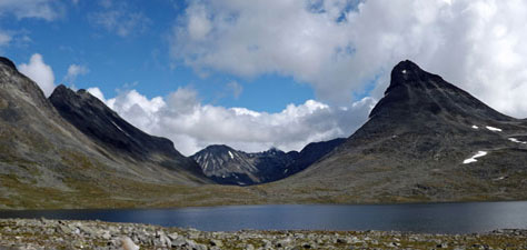
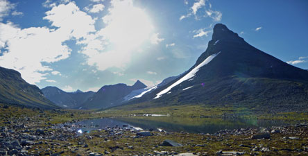
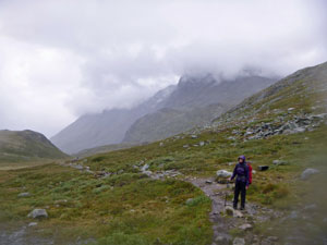
This brought us into the Russglopet, a high valley beneath the Bessegen Ridge. it became a slow slog up the valley, as the rain turned the track into glistening and slippery mud. How ironic that, after whinging about the stony paths for the past five days, we were now seeking out rocks to step on and avoid the mud and pools on the track. A final steep climb zig-zagged its way up to the ridge high above Memerubu Lodge. Cresting the barren top, we were greeted by full on exposure to the weather - strong icy winds from the west and driving rain that stung our faces. We struggled along into the face of the wind, but, somewhere along the ridge, one gust ripped off the fair Nello's pack cover and sent it on its way to Finland - lucky everything inside was still protected by a waterproof pack bag. |
|||
 Wet end to the day's walk |
 |
 |
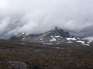
 Cloud covering the Bessegen Ridge |
We had now joined up with the famed Bessegen Ridge Track to begin the 400m descent to Memerubu on its wide but eroded track. After a long, twisting and knee-jarring descent, two bedraggled hikers arrived at Memerubu Lodge. At eight hours, the crossing from Glitterheim had taken longer than expected, but such is the nature of Jotunheimen's tracks and terrain. Not only had we seen a wide range of mountain and valley landscapes, but had also experienced a wide range of the weather on offer here. |
|
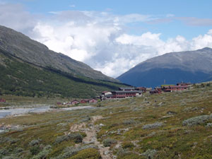
 Looking down on Memerubu on the shore of Lake Gjende |
 Sunset over Gjende |
Memerubu marked the end of our trek,as we planned to catch the lake ferry back to Gjendesheim and the luggage that we had stored there the next day. Dry after a hot shower, with a cold beer in hand, we had the luxury of reminiscing about the day's adventures in a comfortable lounge as the rain beat against the window panes - and that is how a hard day's walking should end. |
|
