| Lofoten Islands - from sea shore to mountain top |
About |
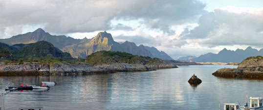
The Lofoten Islands sit above the Arctic Circle, stretching out in a long chain from the Norwegian Coast. A dramatic product of unusual tectonic events and glaciation, they comprise rugged mountains intersected by narrow fiords and sculpted by glacial cirques and valleys. For someone from far away in the southern hemisphere, they represent the apotheosis of of the wild Nordic landscape. Thus, we have arrived to see whether these islands are as spectacular as we had imagined.
|
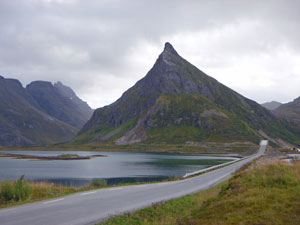
From our mountain walk in Jotunheimen, we travelled by local bus to Oslo Airport and, the next day, took a flight to Evenes Airport in Norway's far north to pick up a rental car and head off down the long chain of the Lofoten Islands. The E10 must be one of Europe's most scenic roads, as it winds it way down the chain, crossing from island to island by large arched bridge or undersea tunnel, edging around deep fiords and cliffs that plunge into the sea or boring straight through beneath the peaks in long curving tunnels. |
|
|
|
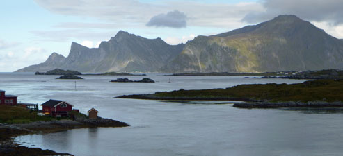
On its winding journey, it connects the many fishing villages that have plied their trade for a thousand years, red wooden cottages and rows of fish-drying racks. Some have kept their original charm, others have grown into larger and more modern regional centres. Surprisingly, there are areas of green rolling hills where pink and white bales of mown hay testify to more agricultural pursuits as well as fishing. The road also takes you past beaches, strips of white sand so unusual for the Norwegian coast, with bays dotted with rocks and skerries. Eventually though the road ended at the far end of the chain, at the picturesque village of Å (pronounced awe, which is an appropriate descriptor). It was a good place to stay.
|
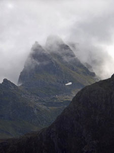
Dominating this scenic feast, though, are the mountains. Never have I seen so many peaks compressed into such a small area - and jagged peaks, their summits carved into intricate variants of block and pyramid, cone and dome. And so, we drove our long and winding road down the length of the islands, absorbing the amazing land- and seascapes and confirming our antipodean impressions of a wondrous part of the world, as a North Atlantic gale whipped down the fiords and valleys to add atmosphere to our surroundings. The Lofoten Islands were just as we had hoped. |


The Munkan Loop (13.5 km - 960m ascent - 960m descent) |


 |
The gale of yesterday had dropped to a light breeze and blue patches of sky were breaking up the cloud cover. It was the right day to explore the mountainous hinterland of Lofoten and one of the best ways to do that would be to climb to the top of Munkan with its 360° views. We drove a few kilometres from our guest house in Å to the neighbouring village of Sørvågen and parked near the coffee shop/gallery. It was here where the map I had downloaded from the Rando-Lofoten website said the walk began. It took a bit of searching and asking locals, but eventually we located a large red T on a rock and set off. |
 |
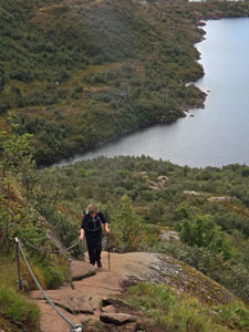
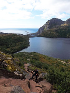
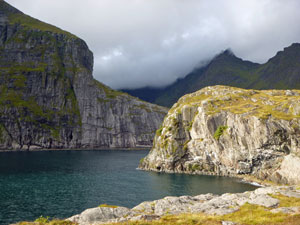
A smooth footpath led us around the shore of Sørvågvatnet, lined with houses on its eastern shore and backed by steep ridges and peaks on its western shore. The footpath ended and a narrow walking track led us on - unfortunately we soon parted company with it on a small rocky knoll, following a more obvious track to the left. While not the correct track, it was a case of all roads leading to Rome, as we followed water pipes up a steep hill to their inlet at the end of lovely Stuvdalsvatnet Lake, backed by sheer-walled cliffs. |
|
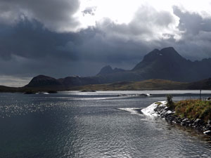
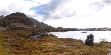 On the shore of Sørvågvatnet Lake |
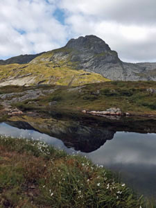
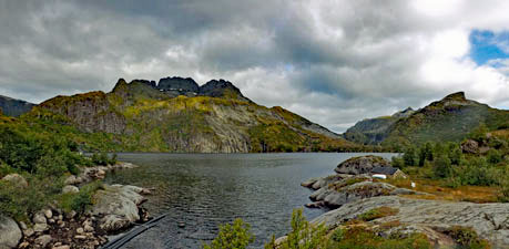 The southern end of Stuvdalsvatnet Lake |
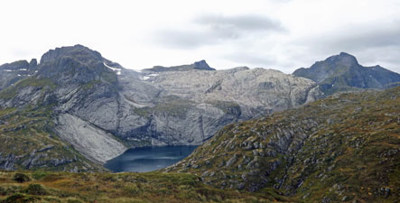
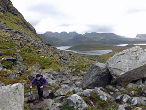
We had entered the first tier of a valley of glacial cirques, a long valley with a series of lakes each at a higher level. A narrow track led us around the eastern shore of the lake for a few hundred metres and, lo, we were back on the right path - guided in by my faithful GPS. This track continued its undulating journey around the lake edge towards a group of huts, perched amongst the birch forest at the base of a steep ridge. |
||
 |
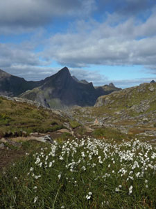
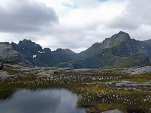
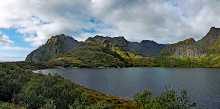 View from the north of Stuvdalsvatnet Lake and its backing mountains |
 |
|
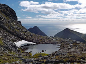
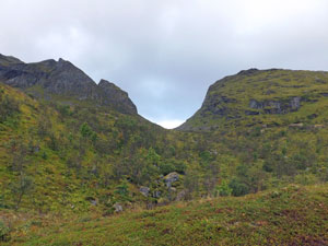
Here the steep ascent to the next tier of the valley began, aided by a couple of sets of chains on the exposed rocky outcrops. It brought us out above a smaller lake, Tridalsvatnet, to cross an area of boggy hollows and pretty tarns. All the time the views of the valley ahead were expanding - the next tier of the valley lay above, backed by the jagged peaks of the island's interior.
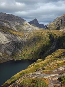
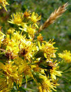
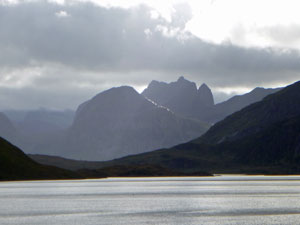
The track turned away from the lakes to start a steep zig-zagging ascent of eastern wall of the valley. Soon we were looking down on Fjerdalsvatnet, the next lake in this series of cirques, backed by jagged topped ridges and peaks. More and more the sun was appearing from behind the clouds and when it did, the green of the slopes was luminous.
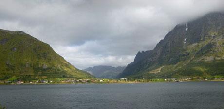
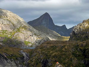
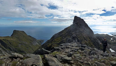
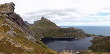
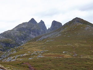
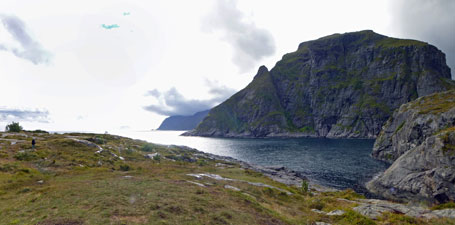
A gap opened up to the east and, far below, we could see the bridge over the blue waters of Djupfjorden, hemmed in by sheer-walled ridges on either side and backed by the sea beyond. The climb continued over Djupfjordheia, a high knoll, where for the first time we could get a good view of our destination, Munkan. Three sheer rock pillars rose up above the ridge, but fortunately the fourth, Munkan, was a rounded dome - steep-walled but eminently climbable. |
|
 |
|
 |
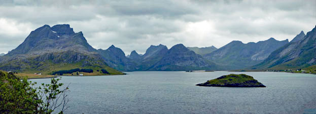
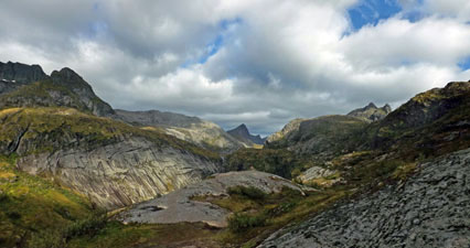
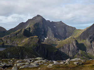
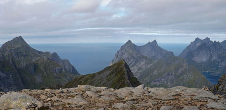
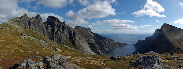 Panorama of Munken and Reinebringen Mountains and the inlet of Djupfjorden
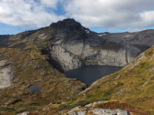 The steep cliffs of Stovla |
 climbing up the meadow of Djupfjordheia |
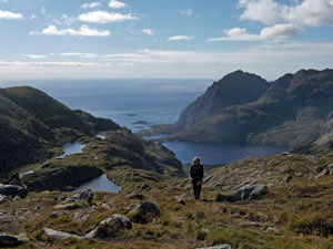
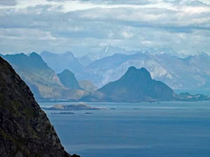
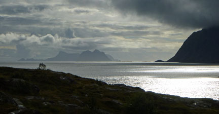
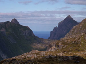 View through the mountains to the North Atlantic Ocean |
 |
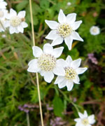
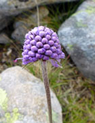
The track now led downhill for a while, across the open slope, past tiny tarns ringed by cottony wildflowers and down towards the DNT hut at Munkebu, in its superb tarn-side setting. |
|
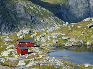 The idyllic setting of Munkebu Hut |
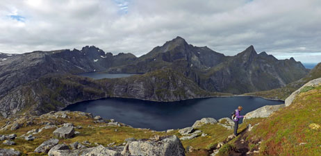
 View over Tennesvatnet Lake to the peak of Hermannsdaltinden |
|
The mountains of Lofoten were now revealing themselves in all their grandeur - two beautiful lakes, Tennesvatnet and Krokvatnet, tiered in the valley, backed by a jagged-edge ridgeline with the pyramidal peak of Hermannsdaltinden (at 1029m the highest point on Moskenosøya island) dominating centre-field. It was hard to take it all in. We wandered down to the hut at Munkebu and sat on the deck in the warm sun, trying to do so - an amazing landscape. |
||
 Ascending Munkan - high above Lake Tennesvatnet |
 |
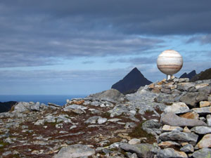 A curious globe on the ascent of Munkan |
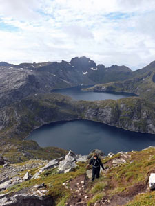 Tennesvatnet and Krokvatnet Lakes |
From Munkebu, the final ascent began quickly - a steep and zig-zagging climb of 350m in little more than a kilometre, but the higher we got, the better the views. When we finally crested the top, with its single string of Tibetan prayer flags, the whole northern horizon opened up. |
|
 Hermannsdaltinden - at 1029m the highest mountain on Moskenesøya Island |
 Nearing the summit of Munkan |
|
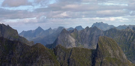
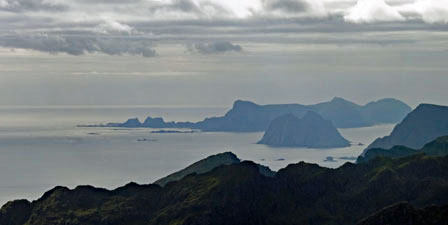
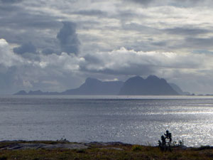
Some 760m below, the deep blue waters of the Kjerkfjorden, and rising up, sheer-walled, from them, row after row of impressively jagged peaks fading to the north. The geology of these islands is amazing - so many peaks compressed into such a small area. To the south, we could look out across the sea to the pale blue silhouette of Vaeroy Island, tip of the Lofoten chain. |
||
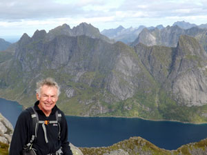 A rare photo of the photographer ..... |
 ... on top of Munkan |
|
|
|
|

While having lunch on the summit and admiring the views, we were joined by Olivia from Switzerland and she walked back with us on the descent. Halfway down from the summit, we took a left turn at a track junction to avoid having to climb back out from Munkebu Hut. It took us more directly down and across to the Djupfjordheia Knoll. |
|
 Looking out to Merraflestinden Peak and the grassy Kjølen Ridge |
 The sheer pale-grey cliffs backing Tridalsvatnet Lake |
|
|
|
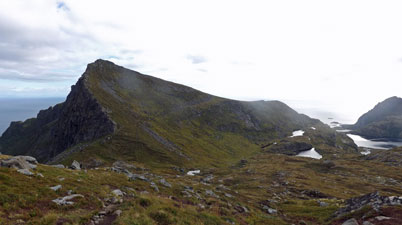
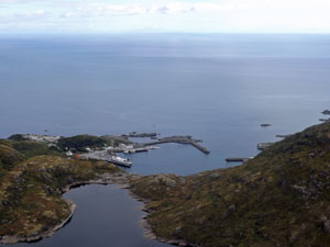
Once across the knoll, we decided to return via a different path, climbing quickly across the face of the triangular peak, Merraflestinden, to wander along the broad grassy Kjølen Ridge, with its sweeping outlook out across the shimmering sea to the Norwegian mainland, and views down to the ports of Moskenes and Sørvågen - wonderful stuff. |
||
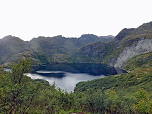
 Moskenesvatnet Lake |
||
|
|
|
It was pleasant walking along the ridge, but the price was a steep and, in the end, a muddy descent down through a birch forest gully to the huts on the edge of Stuvdalsvatnet Lake. From here it was a simple matter of retracing our steps, or even better, finding the right path back to the trackhead at Sørvågen. |
||
What an incredible walk it was - a definite contender for the top day-walk list, and a superb way to discover the majestic scenery and landscapes of the Lofoten Islands. |
|

A day in Å |
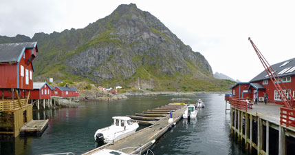
It rained quite heavily during the night and morning brought grey cloud and drizzle. Wispy cloud wrapped around the nearby peaks - it would not be a day for mountain-walking, so we decided to have a lazy day and explore our village of Å. Like most villages on the Lofoten Islands, Å is a fishing port and has been for a very long time. For a thousand years, the islanders have been catching cod, salt-drying it and trading the dried fish with the countries of southern Europe. Even today, the drying racks dominate the village landscape. |
|
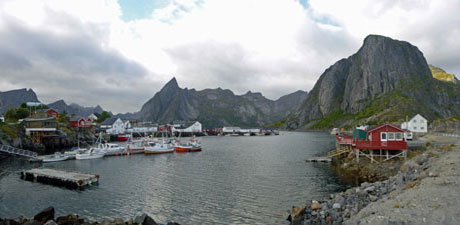
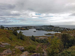
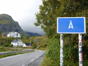 Å - village with the world's shortest name |
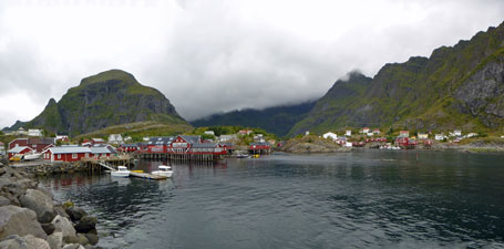 Looking across the harbour of Å |
|
|
Thus, we wandered down to the small harbour, breathing in the tangy salt air and listening to the mournful call of the gulls. Scattered about the harbour were the red-painted rorbuer, old wooden fisherman's houses perched on stilts above the crystal clear water at the edge of the rocky shore (now expensive tourist accommodation). We wandered by them and beneath the drying racks, littered with discarded cods pieces (oops, I mean pieces of cod). What aromas must fill the air when the fish are hanging there drying from January to June. |
|
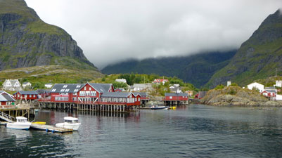 Awesome Å |
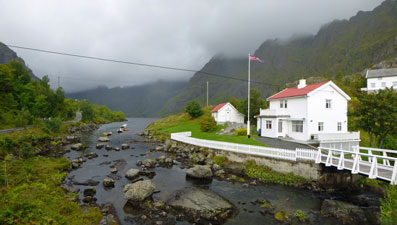 The creek flowing from Ågvatnet Lake |
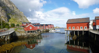
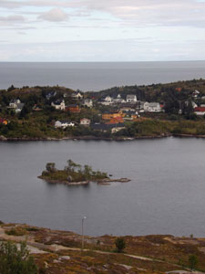
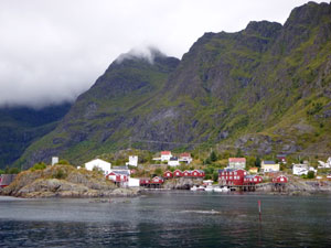 Houses perched between sea and mountains |
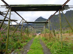 Cod-drying racks |
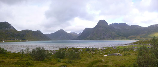
 Ågvatnet Lake |
There was also time aplenty for coffee and freshly baked kanelsnurrer as the rain showers came and went, with periods of sunshine in between. During one sunny break, we followed a track to the end of the road. Å is the last town and the E10 road literally stops here. From the rocky point at the southern end of the village, it was easy to see why, as the dark cliffs beyond plunged directly into the ocean. |
|
 End of the road - where route E10 ends south of Å |
 A shaft of sunlight over the Lofotens |
|
 |
|
If at times inclement, it was a good day. We hadn't planned such an extensive exploration of the village, but to understand life on Lofoten, a slow wander through one of the old fishing villages is a must do. |
||
|

Kvalvika Beach (5km - 210m ascent - 210m descent) |
Apart from rugged mountains, The Lofotens are famed for their scattering of sandy beaches, a rarity on the Norwegian coast. Virtually all the tour books and websites about Lofoten say that Kvalvika is one of the most beautiful in the island chain, so we had it pencilled in as a walk to do while shifting our base from Å to Kabelvåg in the north. Our plan had been to do a circuit centred around the beach, but persistent morning rain showers put paid to that idea. With the weather clearing around mid-day, we settled for a shorter walk in and out of isolated spot, accessible only on foot. |
||
 |
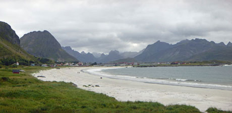
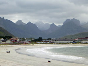 The lovely setting of Ramberg Beach |
 |
After a coffee at nearby Ramberg to wait out the last of the morning showers, we drove to the trackhead, a kilometre or so past the village of Fredvang, and set out on foot. The track immediately started to climb the ridge between us and Kvalvika. The first section was muddy and slippery from the rain, as we headed up through scrubby beech forest and out on to the grassy upper slopes. |
|
|
|
|
|
Behind us lay glorious views to the south across the sun-sparkling waters of Selfjorden to the northern peaks of Moskenesøya Island. To the east, similar views across the Torsfjorden revealed the rugged peaks on the south of neighbouring Flakstadøya Island, separated from us by a narrow channel.
|
|

A series of boardwalks helped us cross a boggy area as we climbed up towards Skoren, the gap between the two guardian peaks of Kvalvika Beach, Moltinden and Torsfjordtinden. The route quickly became an exercise in rock-hopping as we crossed the gap and began our descent. A triangle of blue North Atlantic sea appeared ahead and grew larger to finally open up and reveal the setting of Kvalvika Beach, far below. |
||
 Nearing the top of Skoren Pass |
 |
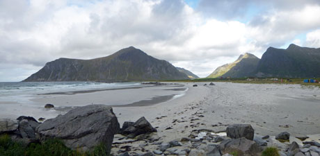
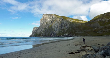
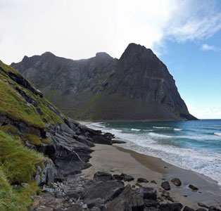
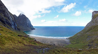 Looking down onto Kvalvika Beach and the blue Atlantic Ocean |
|
A strip of white and grey sand lay backed by a small strip of grassy slope. To its north, the sheer pale cliffs of Ryten rose 500m above the sea, while the dark pillar of 600m high Kjerringa blocked the cove to the south. In the middle, splitting Kvalvika into two beaches rose the black-wall massif of Moltinden. It was an impressive sight, made more so by the realisation that looking out across the sunlit sea beyond, there was no more land between us and the North Pole. |
|
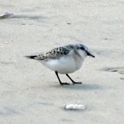
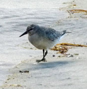
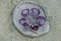
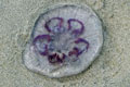
We descended to the beach and spent a pleasant time exploring its length and checking out the flotsam, jetsam and numerous jellyfish thrown up by the Atlantic swells. There was just enough time to climb up onto the rocks below Moltinden and follow the track far enough to have a look across to the second beach along, before heading back and climbing once more over the pass to reach our car on the shore of Torsfjorden.
|
|
To be honest, the beach itself had been a little underwhelming (but then we come from a land that is spoiled for beautiful beaches). However, the dramatic setting of Kvalvika beneath towering cliffs and peaks rising out of the sea, would be hard to match. It was a good complement to our mountain walk of two days ago. |
|
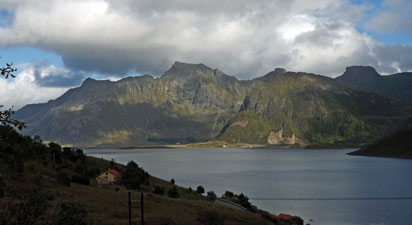 View of Flakstadøya island while descending from Skoren Pass |
 Curious light over Torsfjorden |
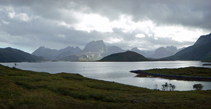
Then it was a long and winding drive back up the E10, leaving Moskenesøya to cross the islands Flakstadøya, Vestvagøya, Gimsøya and Austvagøya and on to Kabelvåg. with the sun now shining on us, it was a last chance to enjoy the diverse beauty of this remote island chain. |
|
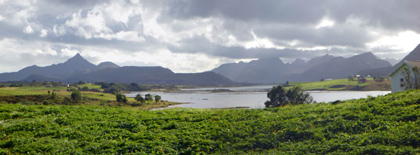 Even the Lofotens have some "flat" country - pastures on Vestvagøya Island |
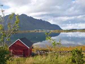
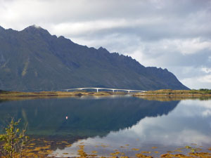 Reflections of the bridge between Gimsøya and Austvagøya |
|
|
|
To do just one walk amongst the high peaks, one on an isolated beach and one through an old fishing village can hardly do justice to the Lofoten Islands, but it did cover its attractions in a nutshell. For us, this was probably just as well, as the next day the heavy rain set in all over the islands - we would do no more exploration of this spectacular part of the world, as we were heading north yet again. A five-day walk on the Finnish-Norwegian-Swedish border was calling. |
|