| Land of Giants Circuit |


About |
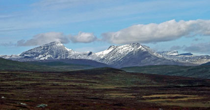
Land of Giants is a circuit put together by Gareth Hutton, a young New Zealand-born guide, who has set up his own outdoors adventure company in northern Finland. Its name stems from Finnish mythology about the creation of the region and it gave us the opportunity to explore one of the last great wilderness areas of Europe - the Arctic forests and open fells of Lapland. For us, it also had the attraction of crossing three borders, as it wanders its way from Finland into Norway, Sweden and back into Finland, something that we had not done since the Tour du Mont Blanc. |
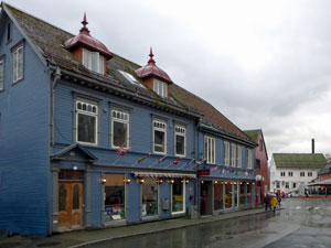 The old wooden buildings of Tromsø |
Thus, we headed north from the Lofoten Islands, driven by the strong winds and sleety rain of a North Atlantic gale as well as the local bus, to reach Tromsø, the self-proclaimed capital of the Arctic. The next morning, Gareth arrived to pick us up from Tromsø and drive us the 2h30 to Kilpisjärvi, just across the Finnish border. The rain that followed us for most of the trip had pretty well stopped by the time we arrived and settled in to our very comfortable chalet, set amongst the low birch forest typical of this region. |
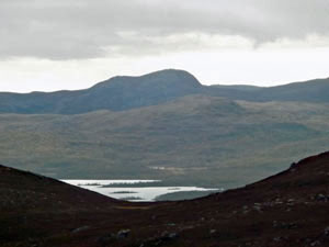
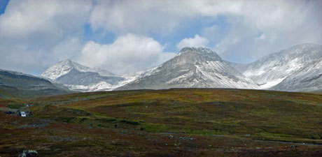
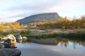 Saana - the iconic peak of Kilpisjärvi |
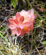
The setting was made even nicer by the golden leaves of the birches - the Ruska (change of colour) had arrived in the deciduous forests of northern Finland. The afternoon was spent sorting out and distributing the food that Gareth had supplied for the trip amongst our three backpacks, finding out the details of the walk, watching a foursome of heavily-antlered reindeer that wandered by the cabin, grazing on the herbs and grasses and thrashing a couple of bushes in an attempt to shed hanging remnants of velvet from their impressive antlers. |
||
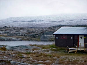
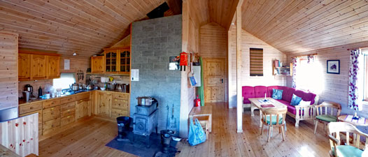
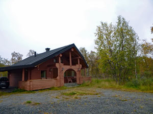 Our chalet at Kilpisjärvi |
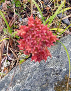
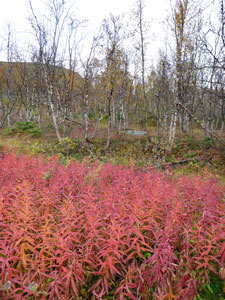
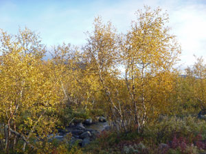 Autumn colours of the birch |
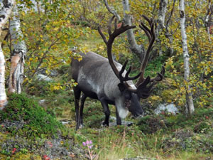 Visit by a local reindeer |
Followed up by a traditional Finnish meal of sauteed reindeer with lingonberry sauce and a dessert of sweet cheese with vanilla cream and cloudberry jam, we were ready to set off in the morning. The first appearance of the sun, just before it set was a promising omen. |
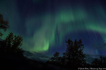
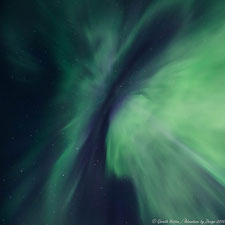
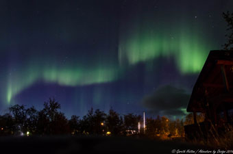
Aurora! Aurora! |
What a night! About 12.30 am, I wandered outside to check out the sky - clear enough, but with a few traces of wispy looking cloud to the north. But wait, weren't they a slight shade of green? As I looked at it intently, the "cloud" shimmered and parts of it began to glow. I raced inside to wake up the fair Nello and Gareth - we were about to be treated to a full-blown display of the Northern Lights, driven by a 600 m/sec spike in the solar wind. |
||
 The Northern Lights ...... |
 ... in all their glory ... |
 .... photos courtesy of Gareth (my camera wasn't up to it) |
What a display it was - shafts of pale green light flaring high into the sky from the north, long plumes that slowly rippled low across the horizon, a superb corona of light sweeping across the sky directly above us, intense, shimmering, then fading away as other plumes brightened up the night and in their turn faded. For almost 30 minutes, the aurora borealis danced its slow luminous dance for us and the two of us were awe-struck, standing in our night-shirts in the cold Arctic air as excited as children getting their first Christmas present. A dream of coming to these high latitudes had been fulfilled. |

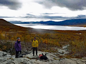
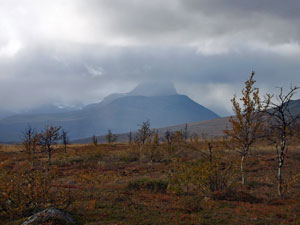
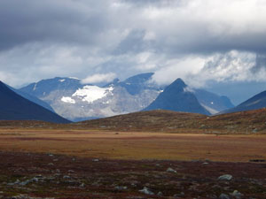
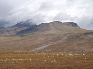
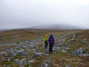
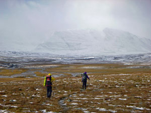
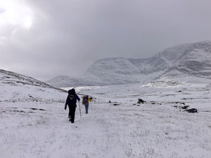
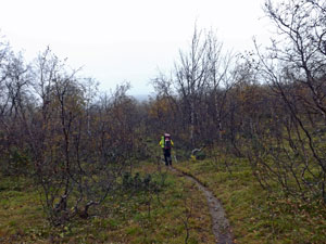
Day 1 - Kilpisjärvi to Goldahytta (13.5 km - 290m ascent - 250m descent) |
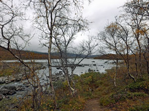
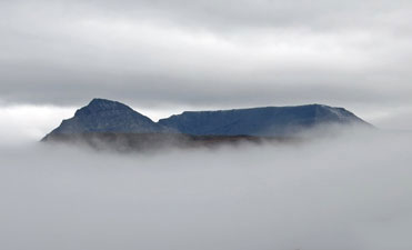
It had been hard to get back to sleep after watching the Northern Light Spectaculaire, but we eventually did, to wake again a few hours later to the sun rising above the eastern horizon and bathing the forest in a golden light. To the east, cloud clung to the top of Saana, the flattish-domed mountain that dominates the eastern shore of Lake Kilpisjärvi (and one of the giants of the legend). Unfortunately, it wasn't to last long, and by the time Gareth had driven us to the starting point of the walk, a few kilometres north of the town, grey cloud had moved in to blanket the sky. However, we were still on a high from seeing the Northern Lights for the first time and, despite the single digit temperatures, we couldn't get the smiles off our faces. Gareth headed off and we followed, as the track wound its way into the low beech forest to cross the stream flowing from the smaller Lake Siilasjärvi into Kilpisjärvi. We had now entered the Malla luonnonpuisto, Finland's oldest nature reserve, which is celebrating its centenary this year. |
||
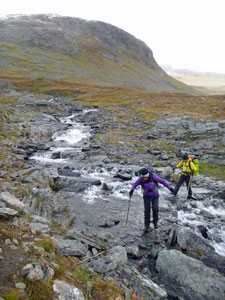
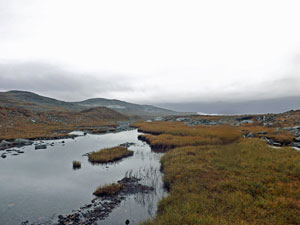
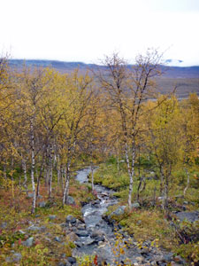
 The outlet stream from Lake Siilasjärvi |
 |
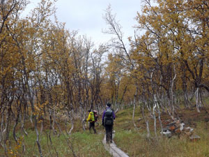
 Climbing up into scattered birch forest |
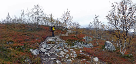
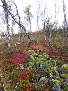
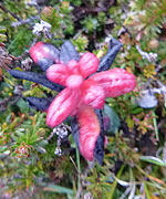
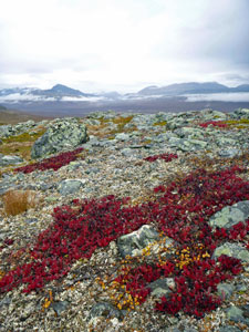
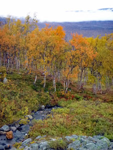
Once over the bridge, we climbed steadily up through the yellow autumn-leafed beech forest to reach the open fell vegetation, where birch trees were replaced by dwarf birch, their leaves turning a burnt orange, low growing berry bushes, yellow-tinted grasses, lichens and mosses. The wild blue berries were still fruiting and we grazed on them as we passed. |
||
 The autumn colours of Malla luonnonpuisto |
 |
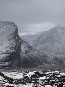
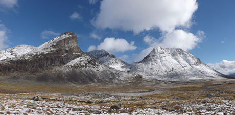
 View over the Pikku-Malla saddle |
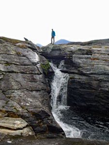
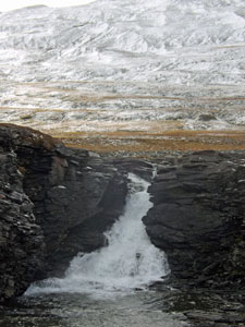
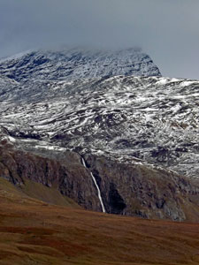
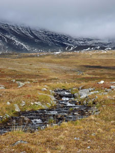
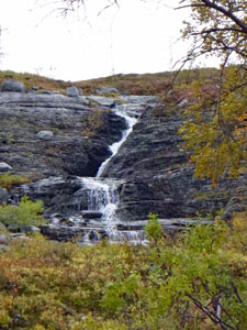
Climbing steadily upwards, under the gaze of a couple of bell-tinkling reindeer, we soon reached the saddle between Pikku-Malla and Iso-Malla (two more of the legendary giants). The dark rocky slope of Iso-Malla loomed above us to the north, while to the south, isolated rays of sunshine lit up bright circles on the surface of Kilpisjärvi. We had reached the high point of the day, and steadily picked our way down towards Kitsiputuos, a lovely waterfall tumbling silver down the black face of Malla. |
|
 On the southern slope of Iso-Malla |
 Patches of sunlight on Kilpisjärvi |
|
||
 The yellow tinges of autumn |
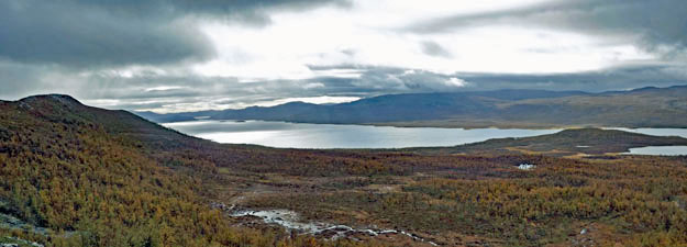
It was a good place to take a break and take in the grand views of the valley beneath - the low forest of birch, clad in autumn yellow, stretching down to the shores of this huge lake.
|
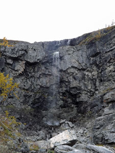 Kitsiputuos Falls |
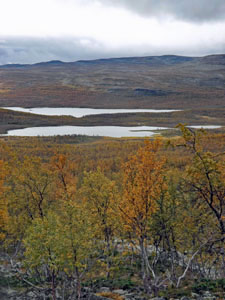
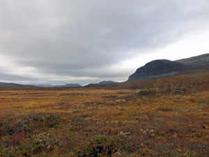
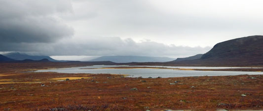
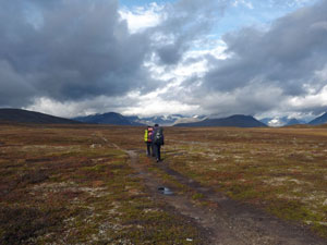
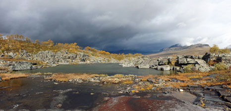
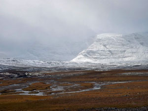
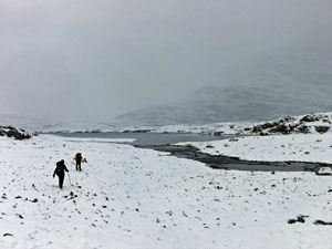
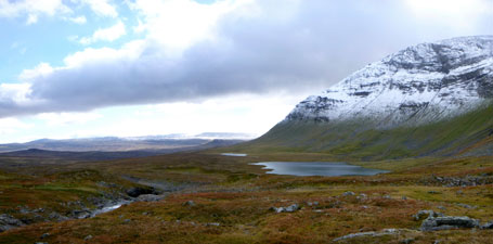
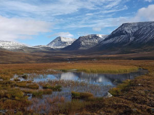
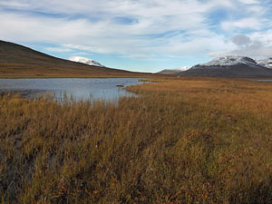
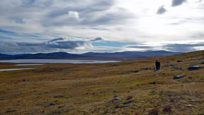
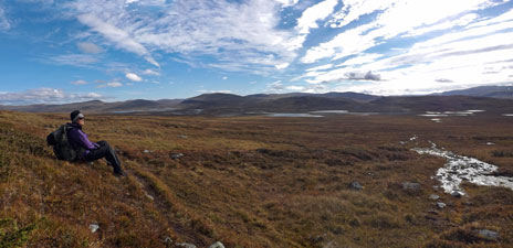
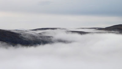
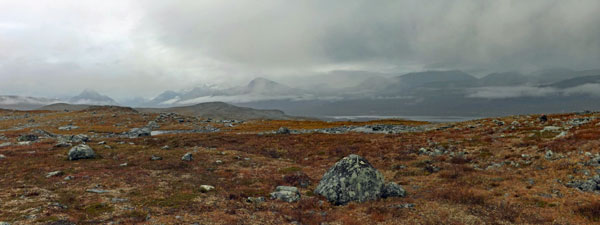
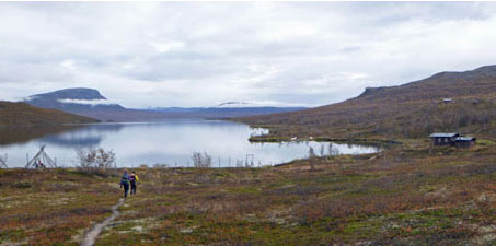
Pushing on, we crossed the uneven birch-covered lower slope of Malla to reach the broad open spaces of the fell - a landscape redolent with the solitude of the Arctic. Looking down below, we could see the boggy flats and river that flowed into the top of Lake Kilpisjärvi. Somewhere down there, sitting in a shallow lake, was the triple border point of Finland, Sweden and Norway. |
|||
 Crossing the open grasslands ..... |
 |
 |
 ..... and down through the boggy birch forest |
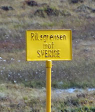
We started our descent through the silvery trunks and bright yellow leaves of the birch forest, crossing boggy areas on pine-trunk boardwalk, to reach a fence that marked the Finnish-Norwegian border (built to keep reindeer in, not people) and followed it down across the soggy flats to the marsh-edged lakeland of Treriksröset, the triple border. |
||
 Marshy plains near the Norwegian-Finnish border |
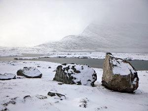
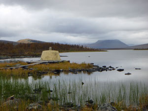 The Treriksröset .... |
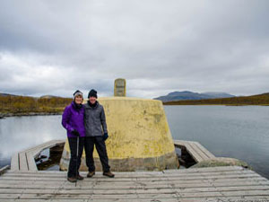 .... triple border point of Finland, Norway and Sweden |
There, at the head of reed-lined Lake Golddajávri, lay a large yellow concrete "plug" surrounded by a boardwalk. We didn't resist the temptation to visit the three countries several times as we circumnavigated the marker, before retiring to a nice wooden bench overlooking the wetlands in Finland for a late lunch. |
|
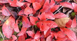
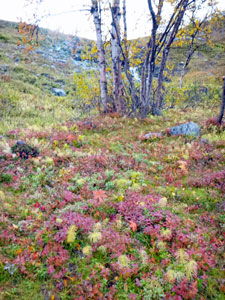
Farewelling Finland, we climbed through an opening in the reindeer fence and entered Norway, to follow a walking track along the northern edge of Lake Golddajávri . The ground cover beneath the forest here was vibrant in its autumn hues of red and pink. |
|
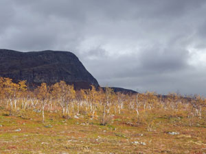
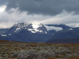
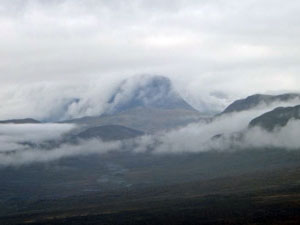
 Barras Peak - its top hidden in the clouds |
 Sunlight on Goldahytta |
|
Soon the brown wooden building of Goldahytta appeared on a small rise amongst the scattered birch trees. We had arrived at this pleasant and cosy hut almost at the same time as the sun. It was good to feel its warming rays on a skin chilled by the Arctic temperatures - a nice way to finish a delightful first day amongst the forests and fells of Lapland. |
||
 The dark bluff of Golddabakti above the golden birch |
 |
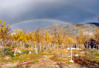 Goldahytta rainbow |
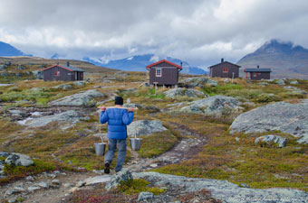
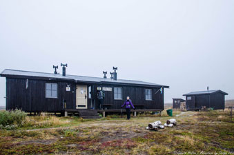
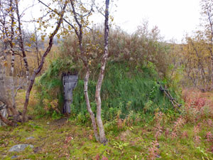
Hut talk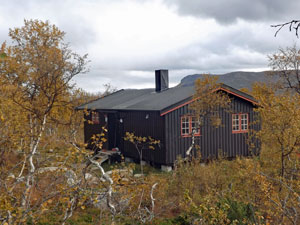 "Hut" is probably a misnomer for the Norwegian mountain huts - they are more a lodge, with lounge, fully-equipped kitchen, wood-stove for heating and bunk rooms with pillows and doonah provided. The long-drop loos are in a separate building, where the dry firewood is stored. I would have liked to say hot- and cold- running water, but you can't have everything. There is a cubicle area for a warm body wash, if desired, and drinking water is fetched by bucket from a nearby stream. They are really very comfortable places to be after a day's walking. Goldahytta had two huts that each held 12 people, and not long after we arrived, a group of 13 Finnish hikers walked in, which quickly filled both huts. It was a snug fit when dinner was cooking, but they were a friendly bunch and it was interesting to compare the different ways of walking in the wild. We were very much into weight minimisation, but our Finnish friends all had huge packs with enormous amounts of food, clothing and supplies - harder walking but a better time in the huts. |
|

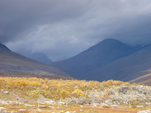
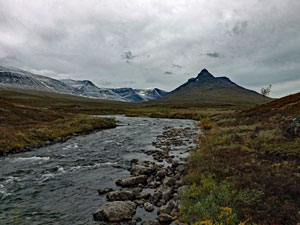
Day 2 - Goldahytta to Gappohytta (12.5 km - 330m ascent - 150m descent) |
The forecast rain band passed through in the early hours of the morning, leaving a grey and foreboding sky, as we headed off from Goldahytta. Gareth led quickly down from the hut to cross the marshy flats near the western end of Lake Golddajávri. High up the valley, cloud hid the top of Barras Peak (yet another of the giants) as we clomped across the low wooden bridge over the Stordalselva River. The air was still and heavy. |
||
 |
 View across the marshlands to Lake Golddajávri |
|
|
From the river, the track gradually climbed up through a birch grove, many trees already bereft of their foliage, and led us out onto the open slopes of the lower fell, where birch tree was replaced by prostrate birch shrub. |
|

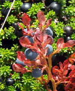
The sun was now trying to shine through the cloud layer and, in the watery light, the slopes glowed with the burnt orange autumn colour of these dwarf birches. We walked through a shin-high carpet of colour, speckled with the black, blue and red of fruiting berry bushes. |
|
 Climbing up towards Gäldahaugen |
 The burnt-orange tinge of dwarf birch in autumn |
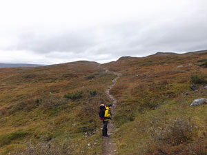
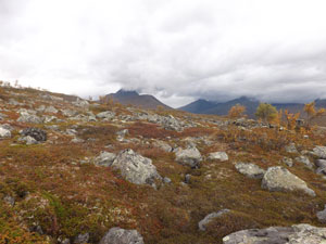
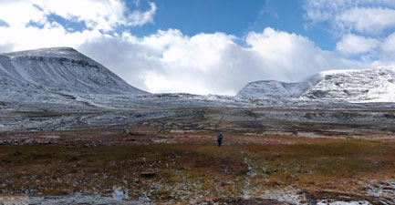
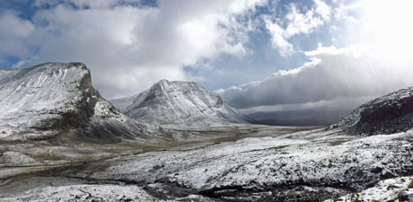
As we climbed steadily up onto the exposed tops behind the rounded knob of Gäldahaugen, the wind gradually picked up. Fortunately, its icy breath was soon at our backs as we skimmed by the Swedish border to start heading west. Ahead lay the high flat plateau of the upper fell - gone the dwarf birches to be replaced by a ground-hugging vegetation that stretched out across this broad and open landscape. |
||
 Crossing the high plateau ..... |
 .... with its ground-hugging meadows .... |
 .. and surrounding peaks and glaciers |
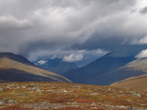
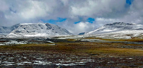
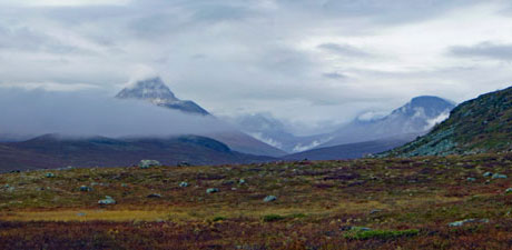
The sun finally broke through to warm our backs and illuminate the route, with views ahead of snow-capped Norwegian peaks above the shadowy depths of the Stordalen Valley. To the north, the cloud-capped double-tiered mesa of Markos-Malla dominated the horizon, while to the south we caught glimpses of the dark peak of Pältsa (last of the giants) on the other side of the border in Sweden. The size of a landscape is not measured by area, but by perception, and this is big country. We were revelling it. |
||
 Looking towards the Stordalen Valley |
 Fell landscape |
 The interplay of sunlight and cloud |
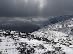
Reaching the small, but dramatic, rocky gorge of Indre Skjaerdalen, we stopped to refuel. As we were enjoying the views, a cloud band swallowed the sun and the valleys ahead began to fade into a grey mist - the weather was changing yet again. |
|
 On the edge of Indre Skjaerdalen |
 The sun breaks out over the rocky fringe of Indre Skjaerdalen |
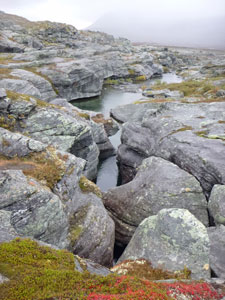
We quickly hurried on, crossing the braids of the gorge to start a steady climb up into a very different landscape of rocky rises and hollows on the barren lower slope of the Gáhpooaivi Rundfjellet. It was here that the rain caught us and began to hurry us along even more, as the cold wind swung to the north to whip raindrops onto our exposed cheeks. The huts of Gappohytta appeared in the distance, only to vanish again as we dropped back into the hollows of this uneven slope. |
|
|
 Rocky slopes of Gáhpooaivi Rundfjellet |
 Menacing weather ahead |
|
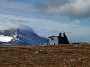
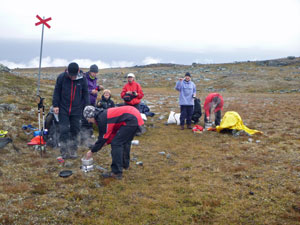
Eventually, the huts appeared again, sitting above the grey rock walls of a small gorge - it had been easy to find, just 100m north of Sweden. Gáhppojohka Stream had carved its way through this gorge to create whirlpools and waterfalls - an impressive sight. Still, our thoughts were for the shelter of Gappohytta and a short climb brought us up to the huts - time to shed wet rain-gear and light the stove, as we were first to arrive, to get things drying and enjoy a late lunch and hot chocolate in the warmth of the hut. |
||
 The water-worn rocks of Gáhppojohka Stream |
|
 A small waterfall in the Gáhppojohka Gorge |
Eventually the sun returned, but the icy north wind (a major player in the legend of the giants) stayed. It was good to get back out into the fresh air to take a few photos or fetch buckets of water from the stream, but even better to get back to the warmth of Gappohytta, our little cocoon in the Arctic fells. |
Hut talk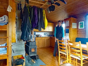
Once again the friendly hiking Finns arrived later in the day to fill the hut at Gappo and after spending a second night together, conversation flowed more freely. Gareth is a person who likes his cards, so that evening the fair Nello taught him how to play the game of "May I", a favourite of ours on camping trips, and then proceeded to thrash the both of us. Beware the smiling face that hides a mean card player! |
|

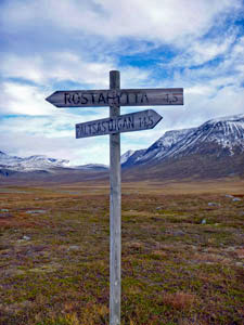
Day 3 - Gappohytta to Rostahytta (19.5 km - 350m ascent - 590m descent) |
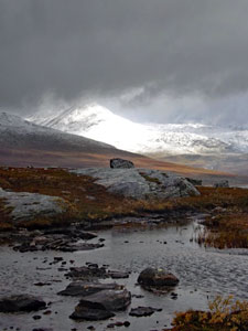
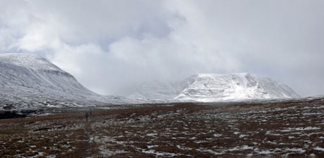
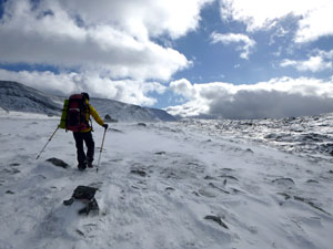
Snow! When the fair Nello looked out of the bunk room window, a thin dusting of snow lay on the ground and hut rooves and the nearby peaks were veiled by bright white snow-clouds. Clear patches of sky appeared, followed by more flurries of sleety snow driven in by the icy north wind; a pattern repeated for a couple of hours. By 9.30am it looked like the clear sky was winning the day and Gareth declared it time to head off into the white-speckled, barren tops of high fell. |
||
 Snow greets us in the morning at Gappohytta |
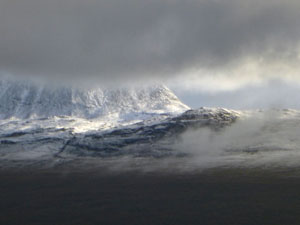 A snowy Markos-Mallin peaking through the cloud |
 Setting off from Gappohytta |
For a while, we marched westwards with the icy cross-wind nipping at our faces - my right cheek was soon anaesthetised while my left cheek stayed rosy warm. The mountains appeared like ghosts through the veil of snow-cloud, only to disappear again - the lighting was quite surreal. |
|
 Is this Norway or Sweden? |
 The pass ahead - between Moskkoggáisi (1522m) and Njearrečazagáisi (1475m) |
Eventually, we turned more to the south-west, moving imperceptibly into Sweden with wind now more at our backs and helping us along. It would be a short visit to Sweden, crossing the triangular wedge that jutted into Norway, as we pushed on towards the high pass ahead. |
|
|
 Heading towards the ghostly fells |
 View over the Njearrelahku flats to Njearrečazagáisi - say that 3 times quickly! |
|
For the moment, the track led us gently downhill from the border ridge, as the sunny patches became more and more frequent to reveal the mountain terrain we were heading for in all its splendour - the snow adding definition to every spur and gully on their slopes. |
||
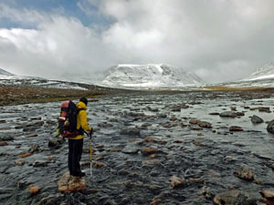 Crossing the wide, but shallow Njearrelahku Stream |
 The sun emerges over Moskkoggáisi |
|
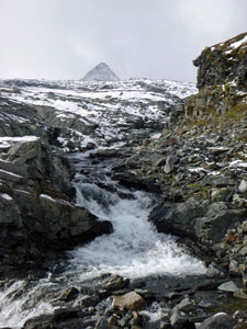
 Waterfall in a small gorge
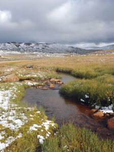
We quickly reached the wide boggy valley of the Njearrelahku, a fast-flowing, wide, but shallow stream, which we crossed via some studious rock-hopping. From here, the land rose gently to the south and, as we climbed, the spatterings of snow began to coalesce into a thin white carpet. With the magnificent semi-circle of mountains about us, bearing lyrical Sami names such as Čorrováhgáisi, Njearrečazagáisi and Moskkogáisi, the whole world was turning white and impossible to pronounce. |
|
 A grand panorama of the high fells |
 The snowy tops of Njearrečazagáisi and Čorrováhgáisi |
We climbed past border marker Rr291, a cairn of yellow-painted stones to complete our crossing of Sweden and re-enter Norway. We were now on a long flattish section of Čievččasčahca, the pass between the massifs of Isdalsfjella to the west and Pältsan-Måskakaise to the east. In the lee of the wind, all was silent except for the soft crunch of feet on fresh snow. |
|
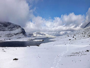
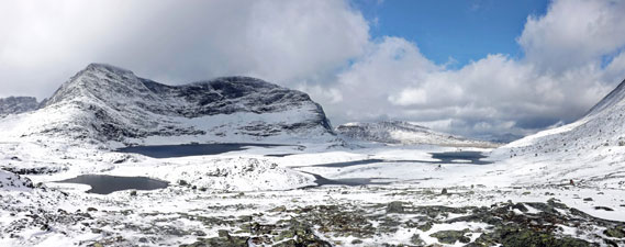
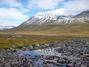
The walking was easy on the soft carpet of snow, which levelled out the rocky terrain, and we pushed on up to the next tier of the pass, where a large lake lay tucked in against the snow-streaked wall of Isdalsfjella - a magnificent spectacle.
|
|


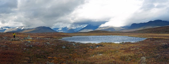
 Reaching our first lake |
 Snowrama from the pass |
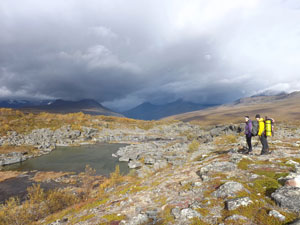
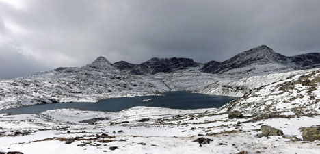
Sunlight, flurries of tiny snow crystals and bands of cloud alternated to play magical games with the light. The spectacle of snow, mountain and water was repeated as we crested the next tier to see an even larger lake tucked into a deeper cirque of the massif - my mind boggled. The eastern slope of the pass and the shore of the lake were scattered with large dark boulders, a "garden of boulders" as Gareth called it. |
||
 In the Garden of Boulders |
 Tracks beside the lake |
 Crossing the boulder field to reach the top of the pass |
 |
|
|
We worked our way around the lake to begin the final rocky ascent of the pass, as mists swept through to shower us with tiny snowflakes and the gusting wind at our backs sent plumes of snow-dust racing across the surface. We found a large boulder to shelter behind and eat lunch - energy and focus would be needed for the long descent to come. |
||
 Surface snow whipping along with the wind |
 Gareth surveying the route ahead |
 Strange light on Čievččasčahca Pass |
Then it was downwards, picking our way carefully through the snow-covered rock field. Ahead, a grand panorama was opening up of the sheer black rock face on the southern end of Moskkugáisi and a beautiful, snow-filled hanging valley that split the massif. Beyond it, the sunlit snow-dappled upper valley of Isdalen stretched away towards the dark clouds hovering in the south. The light was brilliant.
|
|
 The wonderful view of the upper Isdalen Valley ..... |
 .... and, equally impressive from the valley floor, the peaks of Moskangáisi |
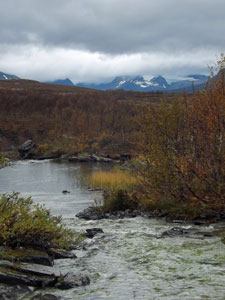
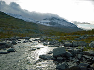
Carefully we picked our way down the steep path alongside the Iselva torrent, as it rushed down the slopes in a series of roaring waterfalls and cascades. At the bottom, a bit more judicious rock-hopping was needed to cross the stream, before we began a long and steady descent on the easy track of the Isdalen Valley. |
|
 Cascades rushing down from Isdalsfjella Cascades rushing down from Isdalsfjella
|
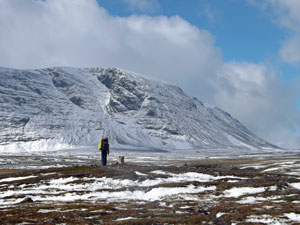
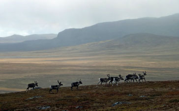
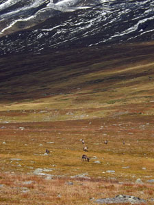
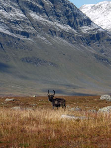
The snow finally disappeared and, apart from the need to cross several fast-flowing streams, the walking was quick and easy. Fortunately, there was always a rock in the right place. Waterfalls poured off the mountains to the west and small herds of reindeer kept a wary eye on our passing, as we continued down above the widening valley.
|
 Watching me watching you
|
|
|

Rounding the last ridge, we stayed on grassy slopes, high above the now-braided bed of the Iselva, as it led us towards its junction with the Rostadalen valley. A final descent brought us out to Rostahytta, in its beautiful setting on a grassy flat beside the surging Rostaelva river and backed by the snowy tops of Likka mountain. |
||
|
 |
|
It had been a long day, but was one of the best days of mountain walking that we have done. The scenery itself was dramatic, but with fresh overnight snow highlighting every alpine feature and creating an ethereal landscape for us to pass through, it was indeed the icing on the cake. |
||
Hut talk
Rostahytta is the most modern of the Norwegian huts and is also a bit larger, with its own drying room (instead of hanging clothes above the wood-stove). Tonight, there were only six people at the hut, as the Finnish group had decide to have a rest day back at Gappo. However, two of our companions for the evening, a Belgian couple, were on the 99th day of a 125 day, 2700 km trek from the southern tip of Norway to Nordkap, its northernmost point (and that of Europe). Amazing exploit, I hope that you complete it before the Arctic winter arrives. |
|
Day 4 - Rostahytta to Pältsastugan (17.5 km - 360m ascent - 230m descent) |
The overnight cloud that dashed our hopes of a second Northern Lights viewing (geomagnetic activity was high) had cleared away by morning. To be greeted by clear blue skies on walking was a good consolation prize and it was pleasant to head off in sunshine, which made the 6°C temperature feel warm. |
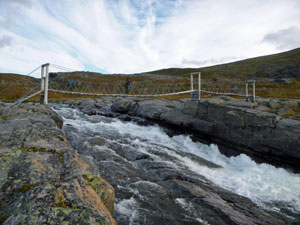
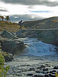
Gareth led us out along the edge of the fast-flowing Rostaelva to its junction a little way upstream with the Iselva. Here, a solid wooden suspension bridge provided the means to cross the Iselva rapids and start a steady, but gentle climb up onto the open shin-high low fell vegetation of Adjavardi, a low rolling rise in the middle of a broader valley through which flowed the two afore-mentioned rivers. |
|
||
 The Rostaelva River backed by Likká mountain and glacier |
 |
 |
|
|
We were heading eastwards into the low Arctic sun, with a cold breeze bending the grass heads of this sweeping landscape. Ahead, Moskangáisi was already generating cloud about its summit and more cloud was starting to drift in from the south. It was hard to know what the weather had in mind for us.
|
|


Taking advantage of the pleasant condition while they lasted, we wandered along the rise, taking in the expansive views. To the north, we could look back up the Isdalen Valley - one more panoramic view of the superb snow-capped mountains that we had passed beneath yesterday. |
||
 Wetlands on the Adjavardi plains |
 |
 Path across the marshes |
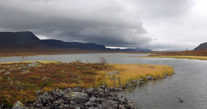
As we pushed on eastwards, the panorama unfurled to reveal a series of small lakes back by the steep slopes of Moskangáisi. on reaching a junction in the trail, Gareth took the northern branch to follow a faint foot-track across the rolling landscape, before dropping down to squelch our way across the channels and spongy peat-bogs of the marshlands between Lakes Adjavardajávri and Moskanjávri. |
|
|
|
Our destination was the lonely little hut of Måskohytta on the north shore of the latter lake. With cloud building up and the wind getting stronger, it seemed a good place to stop for an early lunch. |
|

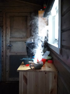
Once inside, Gareth fired up his gas burner and cooked us a hot meal with a steaming hot chocolate. Very nice on a cold Arctic day - both food, drink and breath steaming. |
||
 Måskohytta Hut below Moskangáisi |
 Reflections in a valley tarn |
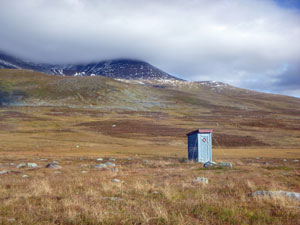 The lonely outhouse at Måskohytta |
While we were eating in the hut, the sun had a temporary victory over the cloud and we were once again walking in the warmth of its rays, as we picked our way across a trackless marshy lands around the edge of the lake. A small herd of reindeer seemed intent on following us for a while, before rushing off, heads and tails in the air. |
||
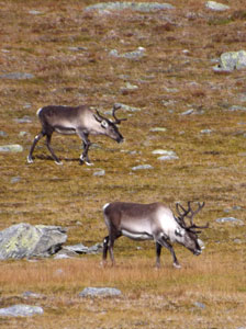 Reindeer ..... |
 .... marshy streams ..... |
 .... and more reindeer |
Veering away from the lake, we soon joined up with the main track, following it over the lower slopes of Juoksavatnjunni beneath the gaze of its conical snow-speckled summit. Part way across this slope, we left Norway and re-entered Sweden - red track markers being replaced by orange ones being the only noticeable difference. |
||
 Welcome to Sweden |
 The fair Nello taking in the wide open landscape |
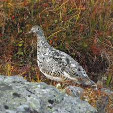 Snow partridge in summer garb |
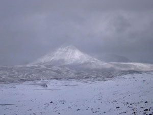
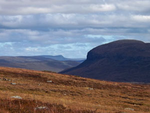
Not log after, we started the long and steady descent into the valley of the Bealčanjohka River, chased by the ominous looking cloudbank that had built up in the south. Gradually, the dark pyramid and mesa of Pältsa appeared in the west - the last of "the giants", it is a brooding peak that seemed to have shaken any snow off itself, standing in contrast to the snow-dappled ridges about it. |
|
 Looking deeper into Sweden |
 View back towards the border mountains - Juoksavatnjunni and Moskangáisi |
|
|
|
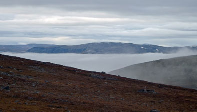
Finally, crossing a low moraine and fast-flowing river, we reached the hut at Pältsastugan, the most northerly hut in Sweden. I was good to arrive, as the weather had by now definitely turned - the sky was a bleak grey and the wind had regained its icy breath. Once again, we had walked through a different landscape to previous days - the broad and open valleys as opposed to the mountains. Variety is certainly the key to an enjoyable walking experience. |
||


Hut talk
Pältsastugan was a single large hut with a resident warden. When she greeted us on arrival, she said "Oh, you must be the Australians - I've heard all about you". The large group of friendly Finns had arrived earlier, via a direct route from Gappohytta and, not only reserved a room for us, but also lit the wood-fire in our bunkroom to warm it up for us (yes - a fireplace in the bedrooms!). Such is the cameraderie of walkers and just as well, because, as the weather worsened more and more hikers walked in. By bedtime, the hut was full with people sleeping on mattresses on the floor, as outside the wind rattled the wooden doors of the sauna. |
|
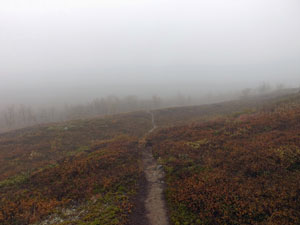
Day 5 - Pältsastugan to Kilpisjärvi (14 km - 460m ascent - 580m descent) |
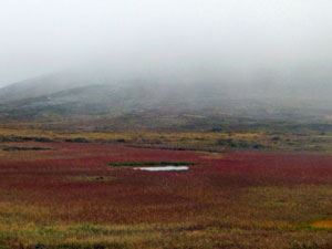
Fog! The overnight rain and wind had stopped and a calm stillness hung over the valley as cloud gently settled upon us to veil the surrounds in a light fog that hid the surrounding mountains. It looked like we would experience yet another mood of the Arctic weather for our last day on the track. Leaving Psältastugan behind to continue our crossing of Sweden, we quickly began a climb up through a grove of fell birch trees; some were still golden-leafed, others already bare, giving the forest an eerie appearance in the mists. |
||
 Track through the low leafless birch forest |
 Heading up into the fog |
 The peak and mesa of Psälta emerge |
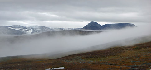
The climb led us up beyond the tree-line into the low shin-high, orange-tinted land of the dwarf beech. It was a strange sensation, walking in such still air - we had become used to the Arctic wind. As a result, the climb was heating us up and we soon shed a layer of clothing before pushing on upwards and through the mists. Turning around, we could look over the top of the cloud filling the valley to the opposite ridge. |
|
 A view back to the mountains of Sweden |
 The play of mists on the high plateau |
As we climbed even higher, the snow-covered line of the Moskangaiji massif culminating in the black pinnacle of Psälta appeared as if floating on the clouds. Fog can indeed be very photogenic! |
|
 Psälta floating in the clouds |
 Cloud rising up from the Bealčanjohka Valley |
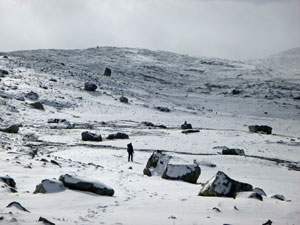
The walking track joined up with the pink-crossed poles of the winter ski trail to cross a series of rises and lake-filled valleys and bring us to the top of the Duoibal ridge-line. The tops were now completely clear, revealing a grey sky above, as we moved quickly across the undulating stony landscape of this broad ridge. |
||
 Fog hanging over a ridge-top tarn |
 Yet another herd of reindeer |
 One of many small tarns on Duoibal |
The sky darkened and a light rain pattered on our pack-covers for the next couple of kilometres, as a strange mantra started to go through my head - "sauna, shower, ice cold beer", it said in rhythm with my steps. We were definitely on the home leg and, after five days on the track my thoughts were turning to the comfort of the chalet waiting for us in Kilpisjärvi. |
||
 Cloud cloaking the peaks |
 Finnish hikers cooking up a hot lunch |
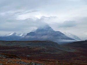 Yet another mood of Barras Peak |
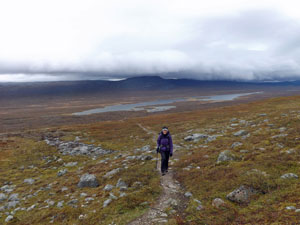
These thoughts were quickly distracted as we started the final descent towards Lake Kilpisjärvi across a somewhat boggy slope, criss-crossed by shallow streams. The main distraction though, was the beautiful panorama out over the next valley, with the fog lifting to reveal the mirror-like surface of Lake Goldajavri far below. We were looking over our path of the first day and the cloud-wreathed peaks that framed it. |
||
 |
 Looking across the Duoibal meadow to the valley of Goldajavri |
 |
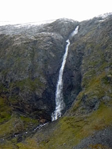
The descent quickened across the marshy slope, as the silvery surface of Lake Kilpisjärvi came into view for the first time. The fair Nello was, by now, becoming somewhat of a bogmeister - flitting like a butterfly from rock to spongy peat mound to avoid puddle and mud. Below lay a shimmering golden layer of beech trees, and the track channelled us into them, past a pretty waterfall and down through a lovely gully. |
|
|
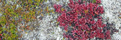
 Red-tinted sedges of a high swamp |
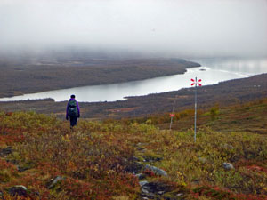 Descent to Kilpisjärvi |
|
 One last admiration of the mountain landscape |
 View over Lake Kilpisjärvi from the heights of Duoibal |
|
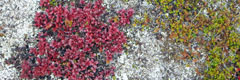
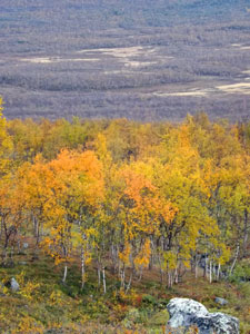
The autumn colours here were spectacular, with the yellows and orange of the birch leaves complemented by the reds and pinks of ground flora - the ruska in all its glory. What a spectacular way to finish a hike!
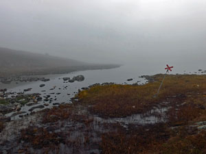
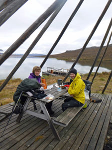
From the edge of the forest, a short walk across open flats brought us to a boat landing near the Sami summer village of Koltaluokta. Passing through a gate in the reindeer fence, we found a comfortable wooden table beneath the poled frame of a Sami tipi and settled down to lunch, hot chocolates and views over the lake of Saana's rounded dome reflected in the water, as we waited for the boat to take us back across the lake to Kilpisjärvi - "sauna, shower, ice cold beer". |
|

 Lunch beneath Sami tipi poles |
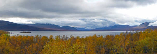
Later that evening we stood on on the deck of our chalet at Kilpisjärvi, looking out over the golden birch to the lake and mountains beyond. What better place to be after our "sauna, shower and ice cold beer" - Lapland in a single frame. |
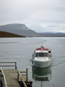 The boat from Kilpisjärvi arrives |

Finally, thank you to Gareth, knowledgable and well-prepared as a guide, as well as being a great companion on the trip. He has created a walk that really showcases the Arctic region of Scandinavia and his passion for this area is obvious. The Land of Giants trek was a highlight of our travels here. PS I'm not going to tell you the legend of the giants. If you want to find out how it fits in with the landscape and the mountains involved, best give Gareth a call and make a booking for this spectacular hike. |
|