Singalila Ridge Trek
Getting There

At 8.30 am a 4WD with our trek sirdar, Sunder Sherpa, picked us up at the hotel and and tooted its way out through the crowded streets of misty Darjeeling.


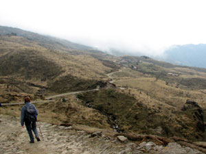
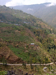
Terraced gardens of the Darjeeling Hills

After a quick stop to visit the Yiga Choeling Tibetan monastery in Ghoom, we descended into the thick fog and up throught the swirling mists and patchy sunshine on a 4 hour - 70 km trip to the starting point of our first trek at Rimbik; a winding, narrow and at times crumbling road that took us up and down steep ridges through magnificent coniferous forest, before descending into a valley whose sides were terraced with vegetable gardens. A final steep set of hairpins brought us out to the village of Rimbik, set on its ridge at 2286m. It was good to stretch our legs again.


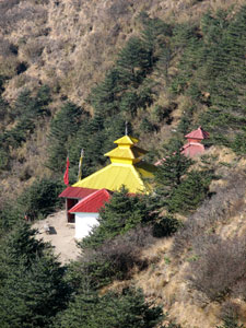
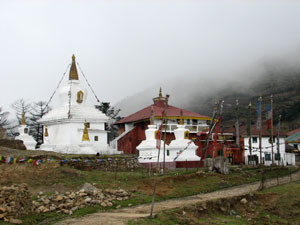
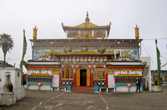
The Yiga Choeling Monastery built in 1875

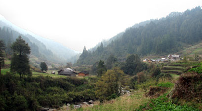
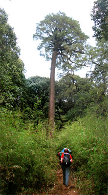
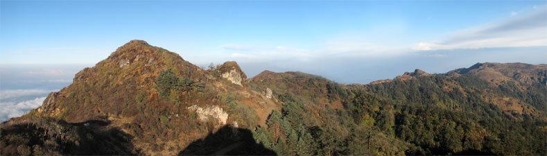
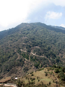
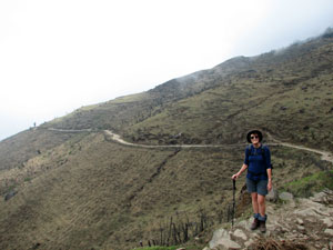
Rimbik to Siri Khola

The 11 porters and cooking team of 5 (all for 5 trekkers - I kid you not) were already at Rimbik when we arrived and soon headed off with the trekking gear, while we explored the local weekly market. As we wandered past the many stalls of food and assorted goods, the increasingly grey skies finally opened up - luckily umbrellas are not expensive at the Rimbik markets.

Soon after, we found ourselves setting off on our first Himalayan trek with our guide, Wangchuk Sherpa, under steady rain in the company of a happy gaggle of blue-uniformed Nepalese school kids who had just finished for the day. Amidst many greetings of "hello" and "namaste", the numbers of children gradually dwindled as they turned off into the homes that dotted our pathway.


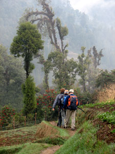
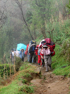
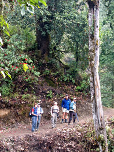
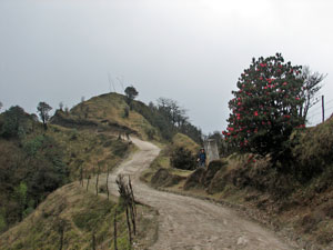
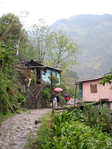
Passing through suburban Rimbik

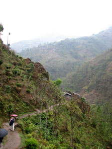
Descending toward the Siri Khola

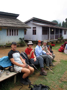
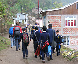
Trekkers and school children heading off from Rimbik
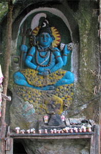
Roadside shrine


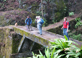
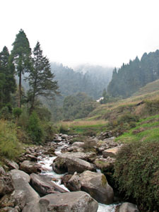
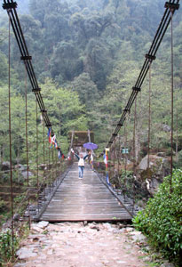
Wangchuk crossing the Siri Khola

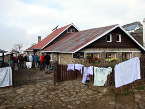
After a short descent of 4 km traversing the steep slopes, we crossed a suspension bridge over the rushing waters of the Siri Khola to reach the Goparma Hotel, our spartan but comfortable lodgings for the night, and to enjoy the first of our nightly three-course dinners, rich with the flavours of India and Nepal. Glad not to be camping out in the rain, we fell asleep listening to the waters of the Siri Khola rushing down on their path to the mighty Ganges.


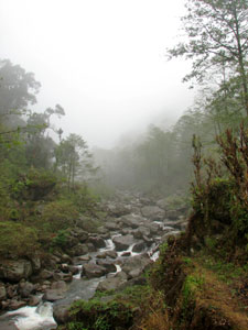
The evening mists settle over the Siri Khola Valley

Dzos passing through the cardamon fields
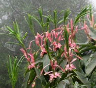
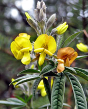
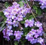
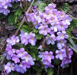
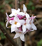
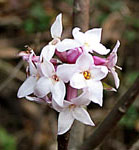
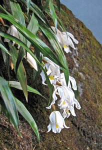
Our first orchid


Siri Khola to Samanden - getting into the trek


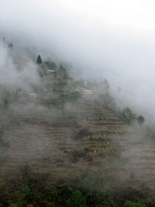
Mists rising over the terraced hillsides

Following trekking tradition, we were woken with a hot cup of tea at 6 am, served a hearty breakfast of porridge, eggs and croissants at 7 am and set off again at 8 am. Such would be the pattern of each day. The overnight rain had cleared leaving a misty morning behind as we climbed quickly up along a daisy-lined path through garden terraces of potatoes and peas that traversed these lower slopes of the Singalila Ridge.


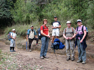
Spot the mystery fifth trekker

Stream through the cardamon plots


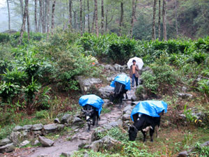
Step aside - porters coming through!

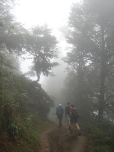
Once more into the ghostly mist

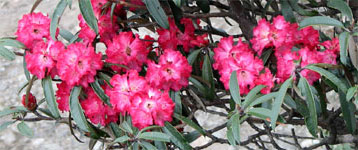
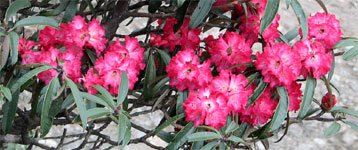
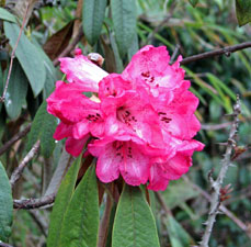
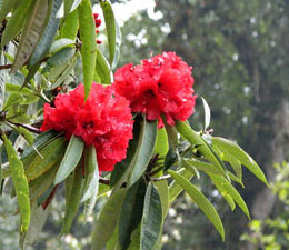
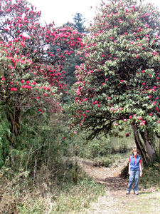
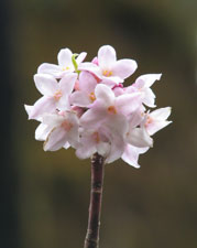
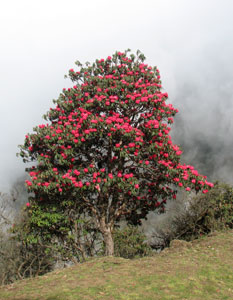
Vivid colours of a long-leafed rhododendron

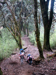
Soon we entered a mixed broadleaf forest, which gradually changed into a zone of tall conifers, as a dense fog settled down to create a landscape of ghostly shapes. Reaching the village of Ramman, we stopped for a tea-break in a Nepalese teahouse and were greeted by the sun and the local school children on our emergence.

I have always marvelled at how a little bit of sun can lift the spirits. Even the birds seemed to sing louder as we headed off, traversing across a slope of gnarled lichen-covered oaks, the yellow orchids drooping from high on their trunks complementing the brilliant pink and red colours of the first rhododendrons in bloom.


"Namaste!"


Into the deep Singalila forest

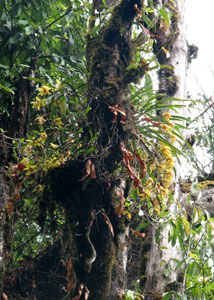
Yellow orchid high on lichen-draped tree trunk

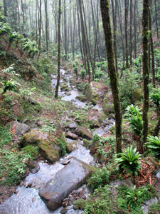
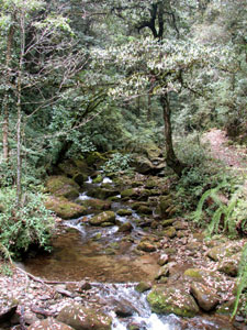
A mossy-rock filled stream

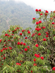
The luminescence of a red rhododendron

A rapid descent through the forest to cross a mossy-rock filled stream and a short steep climb on the other side brought us out to a grassy clearing, surrounded by tall firs and fields of peas and potatoes, in the village of Samanden, where the porters were just setting up our tents for the night. As we sipped a hot lemon drink, we watched the kids from the nearby school playing in the field below, their laughter mingling with the tinkle of bells on a pair of grazing horses - a singularly idyllic setting.


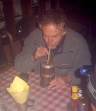
Nothing like a nice hot lemon drink when you arrive!

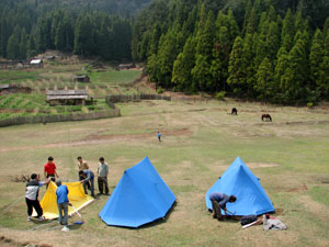
Setting up the tents at Samanden
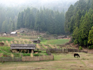

Bucolic bliss

A brief sunny interlude

The village of Ghorkey sleeping in the mists of the Ramman Valley

Mountain stream near Ghorkey

After lunch and a short nap, we wandered down a steep stone path, lined with rhododendrons and pines, to visit the village of Ghorkey; the houses of this tranquil Nepalese village were spread out over a misty valley at the junction of two mountain streams. Climbing back up we arrived just in time for tea and a chance to watch a game of cricket on the "village green" between our porters. The life of a trekker can indeed be a hard one. The only downside to the day was the ongoing dose of Darjeeling quick-step that afflicted all of our party; immodium was fast becoming the drug of choice.

Meanwhile back to the cricket ..... at 5pm rain stopped play.


Samanden to Phalut - the big climb

We were up at 6 am to be greeted by the first early morning sunshine that we had seen since our arrival. The ferocious thunderstorm that drenched our tents in the night seemed to have cleared the mists away. Dropping quickly down into Ghorkey (2260m) once again, we started the 1250m climb up to the top of the Singalila Ridge.


Start of the day's trek at Samanden

The climb started steeply through a row of prayer flags lining the path up through the village gardens and into the dense foothills forest. Just ahead, the sound of singing drifted down the mountain (shades of "The Sound of Music") and soon we met up with some fellow trekkers - a Sherpa family heading up on a day-visit to Phalut. Laughing and singing sherpa folksongs as they climbed rapidly up, the Sherpa Family von Trapp soon disappeared into the heights. Struggling and puffing as we followed, we agreed that they were much better than the movie.


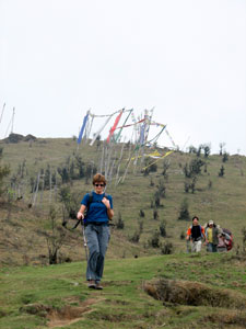
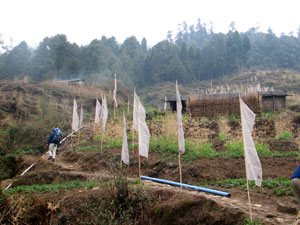
Climbing up through the prayer flags of Ghorkey

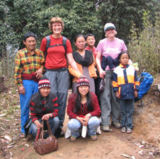
Nello and Hazel with the Sherpa family von Trapp

At 2900m, the track flattened out and followed the crest of one of the ridge spurs through a forest of tall lichen-covered oaks and monkey nut trees with an understorey of dense bamboo thickets. This was red panda country and, somewhere high in the trees well out of sight, the red pandas were sleeping.


-------


At last the track flattens out


Red panda country

Steep climb up the Singalila spur

The track meanders beneath red and pink rhododendrons

Gradually, the taller trees gave way to smaller rhododendrons, their branches overhanging the track aglow with red and pink blooms. Scattered amongst them were yellow pea-flowers and white clusters of daphne on bare branches.


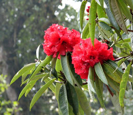
Rhododendron lighting up the forest


Back into the dense fog

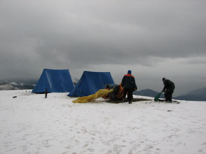
At 3250m we stopped for lunch and, as we ate, the wind gradually picked up, whipping streams of cloud through the trees on the top of the spur. Climbing on, we emerged into an open grassland, splashed with a dash of pinkish-purple primulas, and were soon enveloped in a thick fog. As the wind strengthened, Wangchuk led us across the foggy landscape to our destination at the Indian army border post of Phalut (3505m); the big climb was over!

The porters had just set up our tents and, after a hot tea and rum (courtesy of George), we climbed into our tents for a nap. Well that was the plan; during the next two hours we experienced hail, followed by gale-force winds, a fierce thunderstorm, and finally a blizzard.


Abandoning the tents after the blizzard


Singalila Ridge after the blizzard

It wasn't clear whether we would be struck by lightning, blown off the ridge into India or just have our tents shredded and die of exposure! At 4pm, after Chris and Hazel's tent started to break apart, the Sherpas decided it was time to abandon our tents to the snow for the relative security of the trekker's lodge next to the army post. Wangchuk and Sunder declared it the worst weather that they had experienced on this trek! At 3ºC it wasn't the warmest place in the world, but who wanted to be outside. Tired after the long climb and the events of the day, we were soon in the warmth of our sleeping bags, listening to the wind howl and wondering just what the morning would bring.

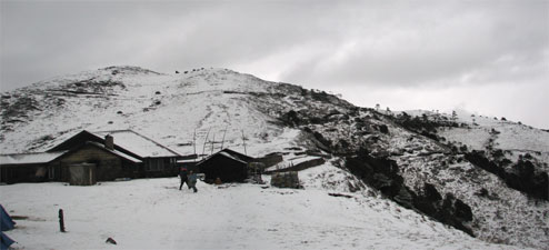
The bleakness of the trekker's hut at Phalut


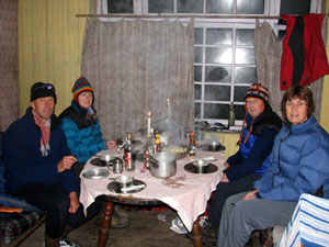
Hot soup and momos at the Ritz-en-Phalut


Phalut to Sandakphu - icy weather on the Singalila Ridge


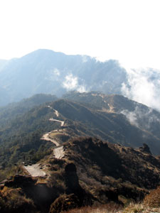
Setting off from Phalut


The Singalila Ridge is a long narrow grass-clad ridge line that divides India and Nepal and provides spectacular views across Nepal to the Himalayan Chain and then on the the mighty profile of Kangchenjunga some 60 km to the north, with a sweeping panorama on its eastern side of the mountains of Sikkim and Bhutan.

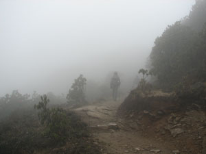
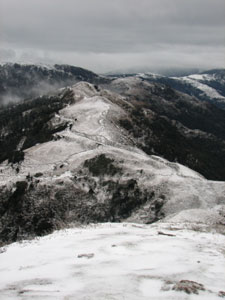
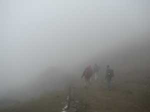
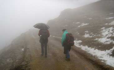
Of these views I can offer no comment! For us the Singalila Ridge was an ethereal world of dense fog, icy winds that whipped over the ridgeline from Nepal, rain, sleet, hail and snow. Walking 21 km from Phalut to Sandakphu in these circumstances was a surreal experience.


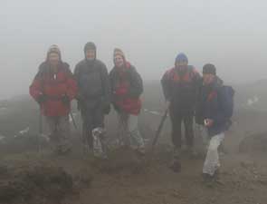
Photo stop on the Nepalese border


The sweeping panorama across Nepal to the Himalayan Chain, as viewed from the Singalila Ridge - well the brochures did say that the sky was not as clear in spring!


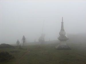
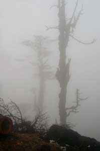
The ghostly shapes of trees in the fog

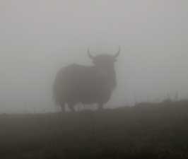
It seemed that we were walking through the dense fog in a slow-moving bubble with a 30-40m radius of visibility; there was no real perception of distance or depth, at times the ground would slope up, at times down, at times it was flat. The strange ghostly shapes of trees faded in and out of our bubble, the stark silhouette of the odd grazing yak or dzo appeared and disappeared. Even the occasional display of a flowering rhododendron failed to lift our spirits. At that moment, I would have traded a million rhododendrons for one brief glimpse of Kangchenjunga!


A lone yak watching us pass by


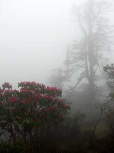
Even the rhododendrons failed to lift the gloom


Indo-Nepalese border marker

The sound of disembodied voices soon gave way to a line of porters almost jogging down a "sherpa shortcut" and then vanishing again into the mist. We were particularly glad for the skills of our two guides, Wangchuk and Sunder, who shepherded us safely through the dense fogs of Singalila, and to the cooks who managed to prepare a hot lunch in the worst of conditions.

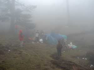
Kalu and his team preparing a hot lunch in the cold fog

And just when it couldn't get any worse down came the hail!

As we walked through the hail after lunch, wandering in and out of India and Nepal, my mind focused on the reactions of my body to walking at altitude; the extra slowness of pace and change in breathing patterns on the climbs. It was our first experience at walking over 3500m and we seemed to be holding up OK on that score. It also distracted from the disappointment of six months of imagining doing this part of of the walk under sunny skies with glorious Himalayan panoramas all around. Just as well our little group collectively had a great, if somewhat dark, sense of humour - it certainly helps on days like today.

Soon, the profile of buildings drifted into our visual bubble - we had arrived at Sandakphu and the shelter of the Sunrise Guesthouse, just on the Nepalese side of the border - a comfortable bed, a hearty dinner, a "real" toilet and rooms hovering around 5ºC (a lot warmer than outside). We felt good, but then here everything is relative.


Sandakphu to Tumling - a taste of Nepal
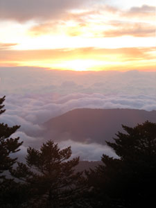


Sandakphu sunrise

What a difference a day makes! Mighty Kangchenjunga must have taken pity on us as we struggled across the ridge the day before, for with the dawn the sun broke through over the sea of billowing cloud below us, and the mountain revealed itself for the first time. Our guides knocked on our bedroom windows at 5 am to let us know that the weather was clear and we hurried out to take in the spectacle of the day dawning over this massive peak, at 8580m the third highest on the planet.


First glimpse of the Kangchenjunga Himal (Jannu 7710m, Kabru 7315m, Kangchenjunga 8598m and Pandim 6691m)


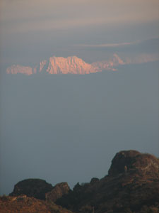
120km across Nepal to the northeast the sun illuminated part of the Himalayan chain


The mystical profile of 7710m Jannu

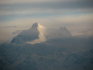
Kangchenjunga basks in the morning sun above the red rooves of Sandakphu


Further to the west, two small triangles appeared briefly above the cloud - the tips of Everest and Makalu - while parts of the Himalayan chain shone white in the distance. We were also able to see the path that we had taken through the fog from Phalut to Sandakphu, as the Singalila Ridge was bathed in early morning sunshine. It was a great start to the day.


At last the sun shone on the Singalila Ridge showing yesterday's path from Phalut


Hindu temple near Sandakphu

As we ate breakfast, the cloud began to rise up from the valleys and by the time we set off, was drifting across the low points of the ridge line. We quickly descended a stony road, surrounded by the the dense green forest of the Singalila National Park.

The rhododendrons seemed to be particularly beautiful this morning as whisps of cloud blew through from the Nepalese side of the ridge. Reaching the village of Bakhay, we followed the road into Nepal, traversing the western side of the ridge through several small Nepalese mountain villages, and looking down into the deep valleys of eastern Nepal below us.


Singalila track heading south from Sandakphu

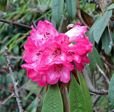
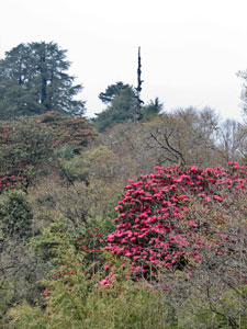
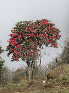
Another glorious red rhododendron

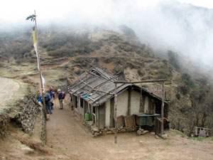
Nepalese teahouse at Bikhebhanjang, below Sandakphu


We stopped for morning tea in a teahouse in the village of Kalapokhari, before heading back into India. The locals and passing trekkers are indifferent to the border here - it seems only to be a concern for the Indian Army posts that sit on strategic hills on the ridgeline (no photos please!).

Descending slowly, the track led us through the superb forest on the Indian side, with rhododendrons, and the occasional brilliance of magnolias, lighting the way. A steep descent to the village of Gairibas saw us reach our lunch stop and passport check by the border post.


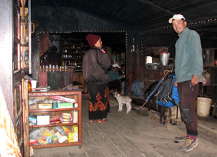
Wangchuk and our host in the teahouse at Kalapokhari

Sorry, I couldn't resist ....
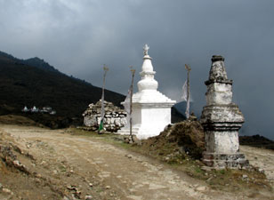
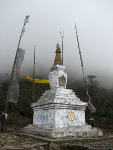
Roadside chorten

Magnolia blooms in the forest

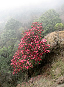
Just another pink rhododendron tree lighting
up our path


Left side, India - right side, Nepal


A fellow trekker who joined us for a few kilometres

The climb up from Gairibas to Jaubari

After lunch, we had an equally steep climb back into the treeless grassy slopes of Nepal, up to the village of Jaubari, with its Hindu temple, Buddhist chorten and burnt out police station. Apparently, the Maoists had attacked the station a few years earlier and it had not been re-manned - an indication of who really controls this part of Nepal. On occasion, they have also stopped trekking parties to collect "trekking taxes"; beautiful as it is, there is a harsher political reality to this part of the world.


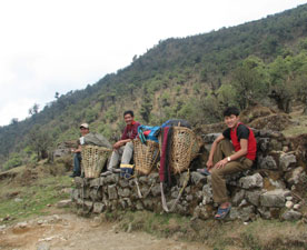
The porters' having a rest break

Where have all the trees gone? - Nepalese side of the ridge


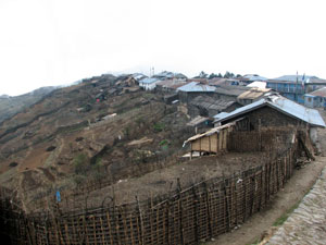
The village of Jaubari on its barren ridge


The contrast between the Indian and Nepalese sides of the Singalila Ridge is stark; on the one side, the rich and verdant forest of the Singalila National Park, on the other bare shrub-dotted grass-lands, denuded of trees by centuries of wood collection for fuel. Then who are we to be critical; we like to walk in the forest, but at the end of the day are still happy to sit in front of a warm fire in a Nepalese guesthouse.

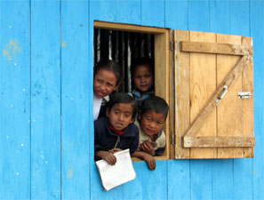
Still, the villages are all full of young children and you can't help wondering what the future holds for them.

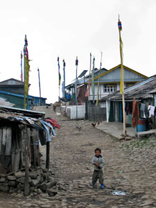
The main street of Jaubari and some of its residents


The lonely shell of the Jaubari police station - destroyed by
Maoists two years earlier

Mane wall and chortens near Jaubari

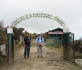
Nello and Hazel at the National Park gate

One more zig into India, one more zag into Nepal and we reached our destination for the night, the very pleasant Shikhar Lodge at Tumling, with its large comfortable bedrooms and fire-warmed lounge.

Sitting around sipping our warm millet beers through a large straw, we agreed that this had been the best day of the trek. We were even weaning ourselves off the immodium. What a difference a day makes!


Tumling to Maney Bhajang - the road home


George admiring the mornng views


Another 5am rise to catch a glimpse of the great peaks - not a cloud above, but unfortunately, plenty in the valleys and across to the north.

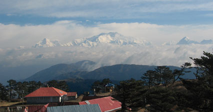
The tip of Kangchenjunga rose faintly above the low cloud band, but that was all that we would see for the day. Still, the view back along the ridge to Sandakphu was magical, with thin wisps of mist drifting over the pastel shades of the ridge and forest in the pre-dawn light.


Pre-dawn view from Tumling across the misty valleys to Sandakphu


Farewell to the Shikhar Lodge, Tumling, Nepal


On the road to Tonglu

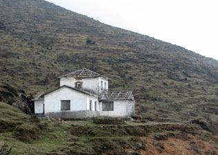
Senchencholing Monastery at Tonglu

With only 12 km of trek left, we set out along a winding stony road, dropping into the bare Nepalese side once more, climbing slowly back across the ridge into India at Tonglu, with its Buddhist monastery of Senchencholing.


Back into the mists near Meghma

From here we followed a well formed road downward through the forest, diverting back onto open grassland near the village of Meghma, to cross a landscape of chortens, mani walls and long rows of prayer flags fluttering in the wind. Wisps of cloud began to float across as the large stupa and buildings of the Csitray Buddhist monastery appeared around a grassy hillside.


Descending the grassy flats of Meghma

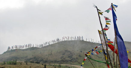
Skyline of prayer flags on the hills near Meghma

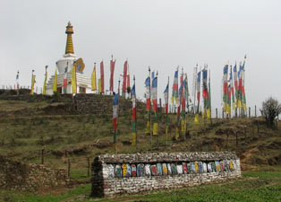
Mane Wall, Chorten and prayer flags at Csitray Monastery

Wangchuk invited us to visit the monastery - his brother had spent three years meditating here and Wangchuk knew some of the monks. To view the richness of Tibetan Buddhist art and have tea and homemade biscuits with the monks was a great way to finish the trek. All that remained was a steep descent along a stony footpath and road through the blue pines to Maney Bahjang, where our transport back to Darjeeling was waiting. The fog had once again returned to the ridge by the time that we arrived; as we started so we finished!


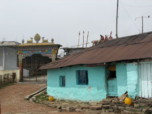
Entry to Csitray Monastery


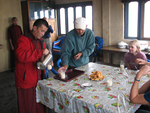
Tea and biscuits are served

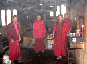
The monks of Csitray in a steamy kitchen

It had been a fascinating introduction to trekking in the Himalayas. We had experienced some of the most severe weather that the ridge could throw at us, and in the end had only been able to see the great Kangchenjunga for a couple of hours, but then a prize easily won is not appreciated. The culture of the hill peoples, the terraced gardens lining the slopes, the many villages with their temples and shrines, the friendliness of the locals, particularly the smiling faces of the children and their greetings of "namaste" as we passed by, are all part of this trek, together with the superb landscapes and vegetation of the Himalayan foothills. We were also fortunate to have had great guides and trekking team as well as very pleasant and humorous trekking companions. Thanks, Wangchuk, Sunder and company, Hazel, Chris and George; despite the weather, we had a great time.