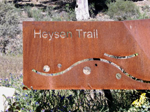
| Heysen Trail North (Part 2) |


 Day 5 - Wilpena Pound Resort to Yanyanna Hut (24 km - 390m ascent - 490m descent) |
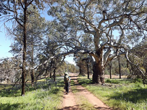
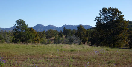
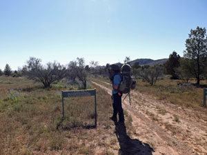
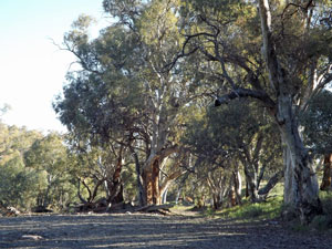
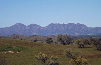
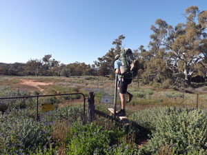
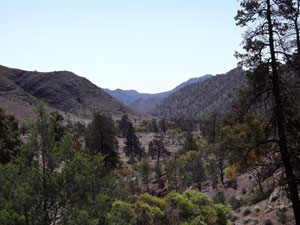
We were up early, feeling somewhat fitter after our day off at Wilpena Pound. This was probably just as well, as today would be the longest of the walk at 24 km, and with four days supply of food loaded up as well. There wasn't a cloud in the sky as we set out, though the air still had a cool tinge to it. We quickly left the resort village area and headed out on the track. Well, not quite the track ... in our enthusiasm to go, we managed to head off on the wrong side of Wilpena Creek, but that was quickly corrected and we were soon following the trail markers on a well-formed track across an open grassy rise. The walls of Wilpena Pound glowed red to our west and the wind rippled silver across the thick green grass. It was good to be out and about. |
||
 Leaving Wilpena |
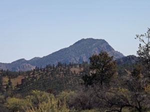
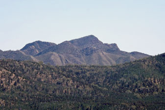
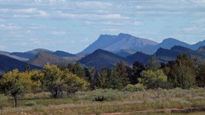
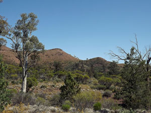
 St Mary's Peak (highest point in South Australia) |
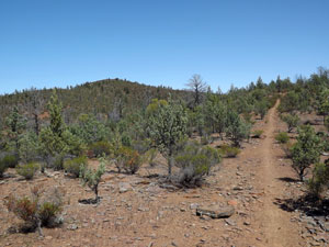
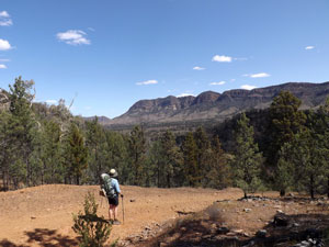
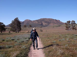 Crossing the grasslands north of Wilpena Resort |
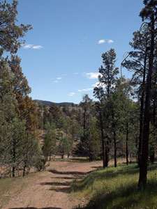
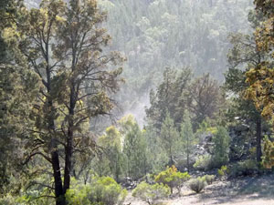
The grassland morphed into an undulating woodland of cypress-pine and the path (which here was shared by the cyclists' Mawson Trail) wound its way through, with St Mary's Peak appearing through the gaps every so often. Passing Black Spring, the track led us down alongside a deep creek bed to emerge on the Wilcolo 4WD Track. We turned north and headed on, with the cool wind at our back. |
||
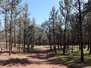 Re-entering cypress-pine woodland |
 Looking across to the rim of the Pound |
 Descending Black Spring Creek |
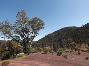
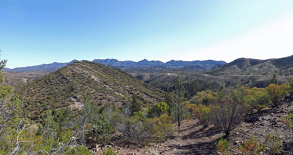
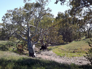
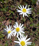
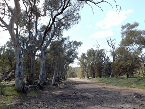
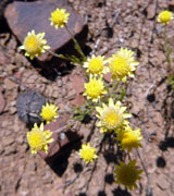
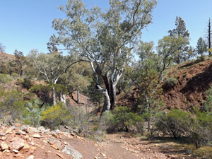
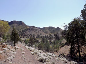
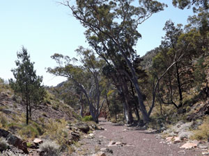
For the next 10 km we would follow this wide dirt vehicle track, as it meandered its way north between the rugged and rocky Heysen Range to the west and the lower, rounded and tree-covered ABC range to the east. It was perhaps the easiest walking of the trip so far, as we gradually descended the long Wilcolo Valley, crossing numerous side creeks with their thick white-trunked, canopy-spreading red gums a contrast to the rough, dark-barked and columnar cypress-pine. Patches of purple Paterson's curse and pale blue forget-me-nots added colour to the green of the groundcover. |
|
|
 Wilcolo Valley Track |
 A slaty outcrop below the ABC Range |
|
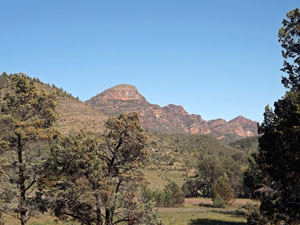
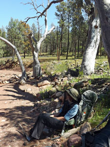
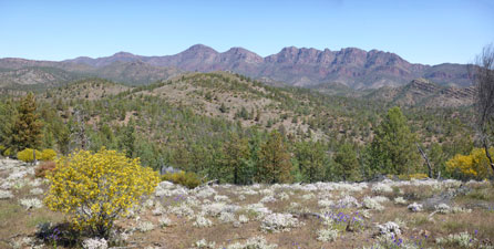
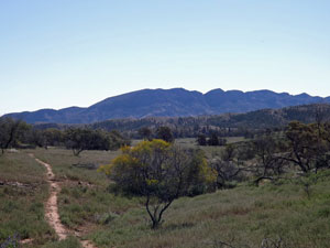
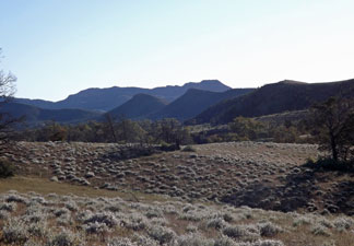
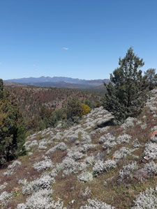
As we sat by the roadside enjoying a short break, a group of mountain-bikers cruised by. They were the only people we would see today. The lower part of the valley was drier and flinty-soiled, its vegetation a bit sparser and shorter. Finally, St Mary's Peak was behind us and the new peaks of the Heysen Range, Mt Abrupt and Mt Sinnet, were taking centre stage. |
||
 |
  |
|
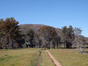
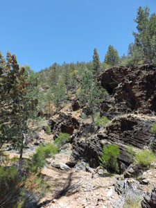
Our long wander down the Wilcolo Valley finally came to an end, as the Heysen Trail headed suddenly eastward on a well-marked footpath to cross the ABC Range. At first it passed through a short quartzite-walled gorge, before commencing a steady climb up the slope of the rounded hills - it was the sort of climb where you quickly got into a rhythm and pushed steadily upwards. As we climbed, the views over new peaks of the Heysen Range became more expansive. |
||
 Gorge leading into the ABC Range |
  |
|
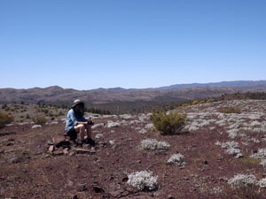
We had planned to have lunch at the ridge, but when we arrived we were met by a strong, cold and gusty south-easterly. Clearly, the Wilcolo Valley had been protected from the full force of this wind. Instead of eating, we dropped packs to make a quick rush to the Bunyeroo Viewpoint, a rounded dome with 360° views, and then headed down the eastern side of the ABC Range into the Bunyeroo Valley. |
|
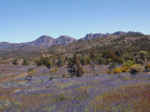
 Looking back over the ABC and Heysen Ranges from Bunyeroo Viewpoint |
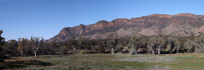
 Heysen Range panorama |
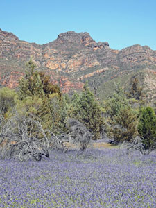
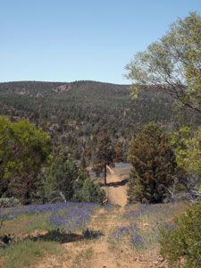
Here we found a relatively sheltered lunch spot amongst the fields of purple. Very pretty, but it was the invasive Patersons Curse again - it seemed to have a particular liking for the Bunyeroo Valley and purple carpets framed many of the lovely views over valley, creek and mountain range. |
|
 Descent from the ABC Range ...... |
 ...... into Bunyeroo Valley and its fields of Paterson's curse |
|
 |
|
Picking up a fire trail, we continued north, dropping deeper into the Bunyeroo Valley to cross the creek of the same name, with its superb and massive lining of red gums. The track now followed the creek system northwards - or it would have had not the markers become lost in the dense Patersons Curse. Still, you can't go too wrong following a creek bed, especially one that seemed to be gradually becoming deeper and more gorge-like. |
||
 Dense growth in the bed of Bunyeroo Creek |
 Heading deeper up Bunyeroo Creek .... |
 .... to a small V-shaped gorge |
|
 |
|
|
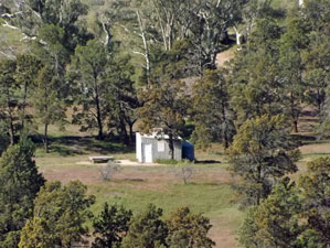
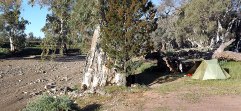
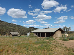
Our pleasure at leaving the creek did not last long, as it was to make to short, but very steep climb out onto the hills lining its eastern bank - a sting in the tail of an otherwise easy day. The good news, though, was that from the crest of the hills, we could see the shape of Yanyanna Hut on the cypress-pine and grass- and herb-covered flat ahead. After 24 km, it was great to reach this cosy tin hut and drop our packs for the last time today. |
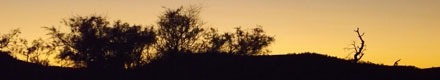
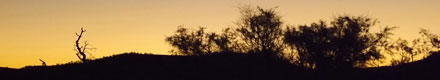
 Yanyanna sunset |
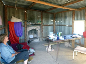
The hut was a very pleasant place to pass the evening - as the flies retired for the day, we could eat our dinner out on the wooden platform, while watching the sun set to create an orange ribbon across the western horizon. |
|

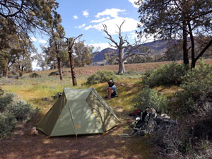
Day 6 - Yanyanna Hut to Trezona Campsite (11.5 km - 40m ascent - 120m descent) |
We had a late start to the morning, as today's walk was only going to be a bit over 10km to Trezona Campsite. It was either that or 25 km on to the next one - the spacing of campsites in this section of the Heysen Trail is a bit out of kilter, but when you make use of car camping sites and old stockmen's huts, that is the way it goes. We didn't mind - it was nice to take it easy and enjoy the morning ambience of Yanyanna. We even got to show the first of the day visitors around "our" hut. Finally, we packed up and left, following the dirt tourist drive for a few hundred metres before leaving it on the Yanyanna Track, a 4WD route heading northwards. |
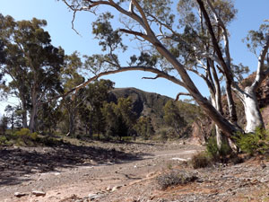
 Heysen Range backing the clearing at Yanyanna Hut |
|
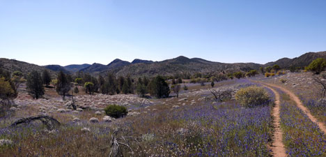
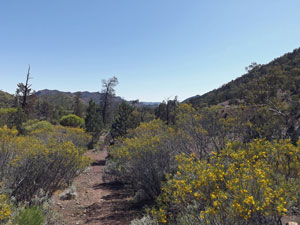
The countryside here was very open, surrounded by low rolling hills, and looked great with its green groundcover, with splashes of purple and white (too bad the green was a virtual monoculture of Wards weed, the purple was Patersons Curse and the white was onion weed, all invasive alien plants - pray for the National Parks people in their efforts to restore the native vegetation). Thickets of scrubby bush and the occasional stand of stunted cypress-pine on the drier shaley soil completed the landscape. The wind had swung around to the east, cool enough to be comfortable and just strong enough to keep the flies anchored to our backpacks and away from our faces. |
|
 |
Needless to say there were also numerous creeks to cross. The hydrology here is quite complex, as these dry creek beds thread their way across the depressions, creating ribbons of gnarly river gums throughout the landscape. They also create shade, and we were enjoying a break beneath one, when a mountain-bike rider zoomed through the creek without even seeing us. This confirmed two things - that we were back on the shared Heysen/Mawson Trails and that bike riders miss out on a lot of the scenery about them, as they focus on the ruts and bends of the track. |
|
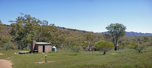
We pushed on - the landscape had a sameness that was missing on earlier days, but that wasn't all bad - such tracks are good for contemplation of the soul or discussing the next home improvement, or both. In quick succession, we passed the ruins of the Old Elatina Hut and then the restored brick Middlesight Hut, both set on creek banks to the north of rock-ribbed low hills. The latter looked so inviting that we decided to stop for morning tea and to brew a cup of hot coffee (another advantage of having a short day's walk). In fact, it was so inviting that we stayed on for lunch.
While, there a face appeared at the door for a bit of a chat. It was Mark from Lalor in Victoria, who was a day short of completing the Mawson Trail on his mountain bike - taking a bit less three weeks and bit more than two tubes of Dencorub to ride 1000 km. Congratulations, Mark! |
||
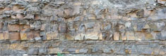
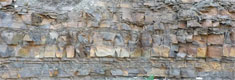
When we finally headed on, the wind had dropped right off and the temperature was beginning to feel distinctly warm. We followed a re-routed version of the Heysen Trail that led us across slope and creek to reach the Brachina Gorge Road. Brachina Gorge is famed for its geology and fossils and, at the point where detour and old track rejoined, were a couple of signs showing examples of two 600 million year old formations, one a type of dolomite and the other marine deposits. |
||
 Between Middlesight Hut and Brachina Creek |
 Rocks of the 620 million year-old `Elatina formation |
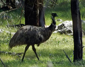
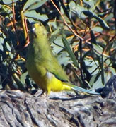
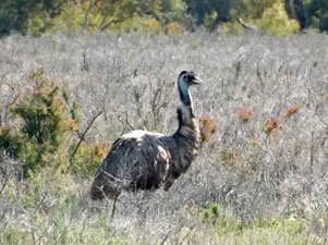 Emu at Trezona |
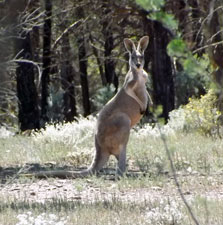
From the road, it was but a short walk across the open herb fields, past kangaroo and emu, to reach the Trezona Camp Site. We filled our water containers from the tank and set off to find a spot to pitch our tent. For the first night on the walk, we would not be camping alone, as Trezona is also a car-camping place. However, the sites are well spaced along the creek and we found a very pleasant spot shaded by a gnarly old red gum right on the edge of the broad gravelly creek. |
||
 Big gums on Brachina Creek |
 |
 The landscape north of Brachina Creek |
|
|
|
The afternoon was but half over - plenty of time to set up camp, explore the further reaches of Brachina Creek a bit and chat to the other campers. Overall, it may have been a bit short on kilometres but turned out to be a very enjoyable day. As the evening shades settled in, one of our neighbouring car-campers with whom we had chatted earlier brought us a gift of some wood. It was a nice thought, as there is nothing that completes a day more in the great outdoors than sitting about watching the flames flickering in the fire-pit. |
||
|
Day 7 - Trezona Campsite to Aroona Campsite (14 km - 290m ascent - 280m descent) |
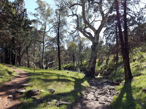
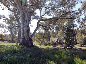
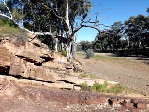
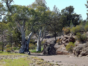
Trezona was a lovely place to wake up in, beneath the picturesque red gums and broad creek bed. The dawn chorus of birds had been particularly melodious and their array of twitters, whistles and sweet songs kept us company over breakfast. You can see the importance of these creek systems for bird life, with everything from thornbills, a few centimetres long, flitting through the trees to 2m high emus running across the creek bed. Add a mix of cockatoos, parrots, whistlers, doves, tree-creepers, swallows, kookaburras and many others and this becomes a bird-lovers paradise. The day was already warming up and for the first time in several days, we unzipped the legs of our trousers to let the sun shine in and set out, heading east from the campsite across a small herb-covered flat to reach Enorama Creek. Here in the bank if its broad tree-lined bed was the "golden spike", marking the site where. in 2004, rock samples were used to describe an entirely new geological age - the Ediacaran Period, which occurred over 500 million years ago, just prior to the Cambrian. That puts a lot of things into perspective. |
 |
 Rocks of the Ediacaran Period |
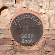 The "golden spike" |
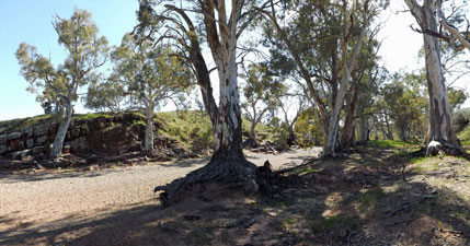 Enorama Creek |
|
Pushing on, we crossed the creek bed and headed out across an open rise, carpeted green with Wards weed and scattered with low scrubby bushes. It was a bit like yesterday and we slipped easily back into meditational and house improvement planning mode. This track skirted the low Trezona Hills to our east and eventually led us back through lusher cypress-pine woodland to the banks of Brachina Creek. |
|

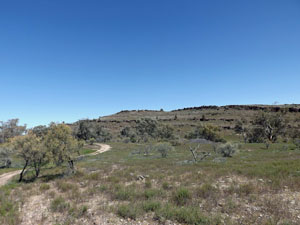
We had also joined the Hayward Hills Track Network and distance markers were appearing every 200m. With a few extra Heysen Trail markers thrown in, it would be very hard to get lost on this section of the trail. For the next couple of kilometres, we followed the pleasant creekside track northwards beneath a shady woodland of pine and river gum. The track then crossed Brachina Creek to turn westerly and climb gradually up into the low hills. The soil here was much poorer - a bare surface of broken shards and flakes of maroon siltstone, with stunted cypress-pines, desert oak and the odd low shrubs. It was perhaps the most barren landscape that we had crossed to date. |
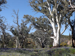
 Yet another heysenesque creek setting |
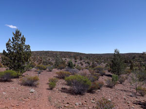 The aridity of the Trezona Hills |
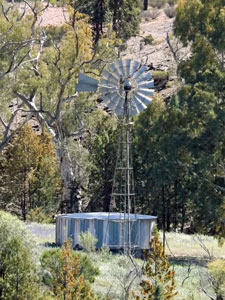 Trezona Bore
|
Climbing up, we passed the windmill of Trezona Bore to the right and the ruins of Monela Hut, a mid-nineteenth century shepherd's hut. A dip took us back into the creek system and then on to the big climb of the day, winding up steadily across these arid hills once again, a steady plod in the heat marked only by the crunch of our boots on the flaky rock surface. |
||
 Climbing up through the stunted cypress-pine and desert oak |
 Rest stop on the hill top |
|
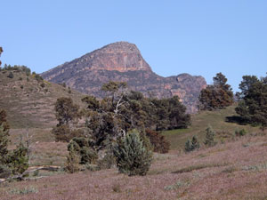
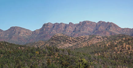
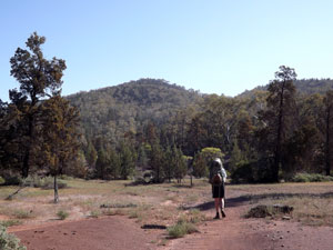
Nonetheless, it was an enjoyable stage, as for one of the few times on the trail to date, we were walking on ridges, with views out towards the rugged profile of the Heysen Range ahead and back over the rolling Trezona Hills behind. On reaching the open high point, we stopped to enjoy the all round views and the puff of cool breeze on the crest. |
||
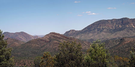 View across to Hayward Bluff |
 Peaks of the Heysen Range |
From here it was largely down, crunching our way beneath the cypress-pine woodland to reach Yuluna Creek and lunch beneath the shade of a large red gum. The track then meandered and undulated its way through the gaps of the ABC range. On the way down, we caught up with a couple of day-walkers and had a bit of a chat with them on the final descent into Aroona Campsite beside the creek of the same name. |
||
 Descending through cypress-pine woodland |
 Yuluna Creek |
 Descent into Aroona |
|
 |
|
We quickly found a tent site and set up - quickly, because despite this being a lovely spot with tap-delivered spring water, the flies were the worst we had come across - I am actually writing this while wearing the Fair Nello's fly veil - she is in the tent reading a book. The late afternoon and evening light here seemed particularly vibrant - you could see why it was a favourite spot for Hans Heysen, the painter after whom these ranges and this trail are named, to come and capture the beauty of the Flinders Ranges. |
||
 |
 The beauty of the Flinders Ranges |
|
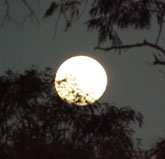
Eventually the sun set in the west and half an hour later, the full moon rose over the hills in the east to shine down through the branches of cypress-pines, bathing the landscape in a pale, moon-shadowed light. These are the moments that make all the hard walking worthwhile. |
||
|

Day 8 - Aroona Campsite to Parachilna Trailhead (18.5 km - 240m ascent - 370m descent) |
We were up early to enjoy a cool and fly-free 90 minutes of early morning at Aroona. Sadly, the flies had become active by 8am, so we were on the track 15 minutes later. It promised to be even warmer today, so we wanted to put as many kilometres behind us as possible before the heat of the afternoon set in. |
||
 Aroona shepherd's hut |
 |
 The ruins of Hayward's homestead |
Strolling past the pine-log shepherd's hut, where Hans Heysen stayed to do many of his Flinders paintings, we climbed up to the stone ruins of Hayward's Aroona Station. Hayward had set himself up well, when he built it in 1854, piping water from the spring with hollow pine logs and placing the long-gone verandah to take in the glorious views of the Heysen Range, now glowing red in the morning sun. Hayward's name lingers in the names of the three prominent nearby crests in the range.
|
Leaving Aroona, we stepped over a stile to leave behind the Flinders National Park - beyond the fence-line we were now on Alpana Station land. The Heysen Trail headed north up the narrow, well-timbered Aroona Creek valley, wedged between the Heysen and ABC Ranges. The cypress-pines were laden with pollen, and the occasional gusts of wind or bird lodging on a branch would release clouds of pollen-dust to drift across the landscape like plumes of smoke - a curious sight. |
||
 Crossing into Alpana Station |
 Not smoke, not dust ..... its pollen |
 Track beneath the ABC Range |
A few kilometres along the track, we passed a party of six young blokes walking from Parachilna to Hawker (the reverse of our trip) - only the third party of Heysen Trail walkers that we had met in eight days. The climb continued its creek-crossing ways up the Aroona Valley, passing Pigeon Bore, where we stopped to sample the ground-water from a rusty old hand pump - slightly salty but potable. |
||
 Aroona Creek |
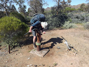 Sampling the water at Pigeon Bore |
 On the saddle between Aroona and Five Mile Creeks |
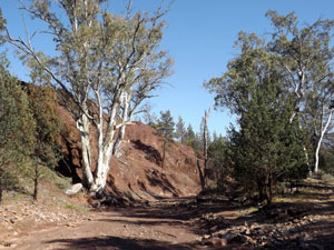
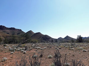
The gradual ascent continued, until we reached a saddle for one last backward look over the route we had travelled before beginning an equally steady descent of the next creek system - Five Mile Creek. The Heysen Range to the west had diminished to a series of bare hills and the landscape took on a distinctly more arid appearance. At times we followed the creek-bed as it cut in close to the ABC Range, forming maroon-coloured cliffs to frame the gum trees along its course. |
|||
|
 |
 |
|
 Maroon creek banks below the ABC Range |
|||
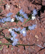
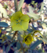
At other times we drifted further west to traverse the lower slopes of the Heysen Range, where silver mulla mulla and yellow flowering senna bushes were scattered over the flakes and shards of shattered siltstone. Five Mile Creek left us to flow eastwards through Crisps Gorge. A short steep descent and climb took us across the beginnings of the gorge and into a wider, undulating part of the valley, covered in cypress-pine woodland. |
||
 |
 Wild Dog Creek country |
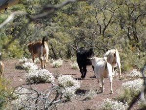 |
Wildlife began to appear more regularly in the landscape - 4 kangaroos and over 40 feral goats, which pretty much sums up the situation. This section, which followed the course of Wild Dog Creek, was proving hot and sweaty, so we were pleased when the trail led us through a narrow gap and into the face of a now-northerly breeze. |
||
 The Heysen Range finally fades away |
 View from the gap towards the end of the trail |
 One last stroll down a dry creek bed |
We were on the run home, following track and creekbed down to reach the broad, gravelly bed of Parachilna Creek (where a flock of 20+ goats grazed, blissfully unaware that they were the target of a culling campaign). It was but a short walk out of the creek and over one last stile and our Flinders Range end of the Heysen Trail was over. We had arrived at the northern trailhead of the Heysen Trail (1200 km from its southern trailhead, which puts our 120 km foray on it into perspective). |
 Parachilna Creek |
 Parachilna Trail Head |
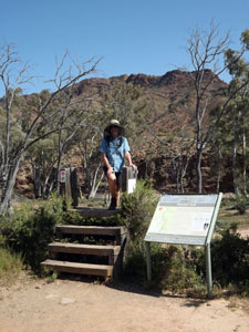 Three steps down and the walk is over |
We had arranged with Dave from Angorichina to pick us up at 4pm, but were there at 2.15pm (eight days walking makes you fitter). A passing motorist kindly passed this information on and Dave came down earlier to pick us up - a much better proposition than waiting with the flies at the trailhead. Thanks Dave and thanks, anonymous passing motorist. |
||
As is our tradition, after a long hot shower, we celebrated the end of the walk with a cold beer, while looking out from Angorichina at the sun setting on the ABC Range. These mountains took on a new friendly perspective, having been our companions for the past four days - we raised our glasses and drank them a toast. |
|