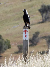
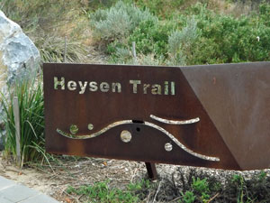
Heysen Trail South |


Getting There |
 |
The Heysen Trail has one peculiarity - the guidebook and maps describe it from south to north, yet our experience is that most people walk it from north to south. Hence, The southern trailhead at Cape Jervis is probably best viewed as the end rather than the beginning. The fair Nello and I had decided to walk this end of the Heysen Trail mainly because it is the only section that follows the shoreline and has some fairly spectacular coastal scenery to nicely complement the more arid and mountainous scenery of the northern end of the trail. Our original plan was to walk from Cape Jervis to Victor Harbor over five days, but at the last minute that changed to walking from Victor Harbor to Cape Jervis. We did this for a couple of reasons:- firstly, it seemed a nice idea to arrive at the southern end, just as we had the northern end, but mainly it was because an early heat-wave was passing over South Australia and we would commence walking in over 30 degree temperatures. Walking east to west would mean an earlier start (we were already in Victor Harbor and there would be no need to get transport to Cape Jervis) and the amount of climbing on the first day would be less. We also had the bright idea of leaving a food drop near the second campsite, which decreased our initial pack weights during the hot first couple of days. Thus we would avoid both extremes of temperature and of effort. |
One obstacle remained - this section is not a circuit, so transport back to the start has to be organised. The Heysen trail website, an extraordinarily helpful site, has one of its rare hiccups here. It tells you that there is a bus link provided by SeaLink between Victor Harbor and Cape Jervis. However, this is not a public bus - it is only for passengers of the Sea Link ferry to Kangaroo Island who are leaving on that day, which is not very feasible for the Heysen Trail walker. Fortunately, we found a local taxi company (Peninsula Taxis) who do Heysen Trail drop-offs and pick-ups (the owner is even a member of the "Friends of the Heysen Trail", so is kindly disposed to walkers and their needs). |
Thus, all organised, we could set off from Victor Harbor on this Monday morning with confidence that, if we reached Cape Jervis by 3pm on Friday, we had a way back. |
|
 Day 1 - Victor Harbor to Waitpinga (18 km - 260m ascent - 230m descent) |
By the time we parked our car at the Beachfront Holiday Park (where we would be staying on our return) it was already quite warm. The forecast was 36°C with strong northerly winds - not at all a good day for a stroll in the park! We left the park to pick up the esplanade bike path that followed the shoreline of Encounter Bay, on one side a slaty sea and sea-weed covered beach, on the other a row of magnificent old Norfolk Island pines. |
||
The wind was fresh, but pleasant this early in the morning. Halfway along the esplanade, the fair Nello spotted the local coffee shop - time to call in for a hit of caffeine. Recharged, we pushed on quickly, passing several groups of red-shirted locals out for their morning promenade. |
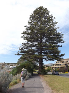 A big Norfolk Island Pine on the bike path |
|
 View of The Bluff from Encounter Bay |
 |
|
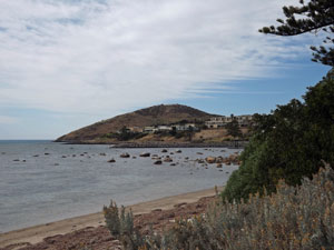
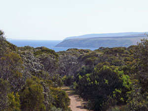
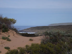
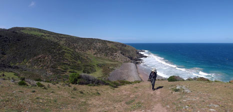
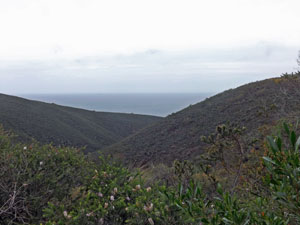
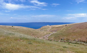
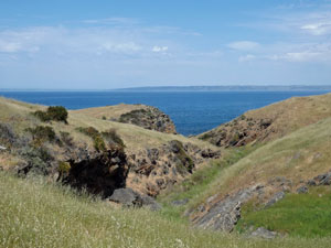
The domed shape of Rosetta Point (aka The Bluff) grew larger as we approached to eventually leave the bike path for a short section of dirt road and then a footpath up to the saddle between bluff and mainland. From here there were lovely views back over Encounter Bay and Victor Harbor and, a little later, even more lovely views of our route ahead towards West Island offshore and the long dark line of the Waitpinga Cliffs. |
|
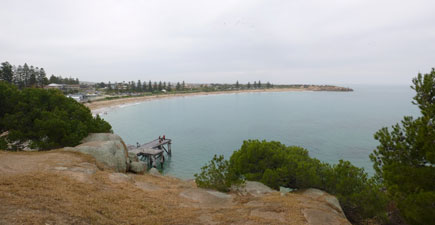 View back over Encounter Bay and the old whaling port jetty |
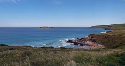 Looking west over West Island and the Fleurieu coast line |
|
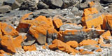
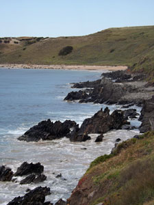
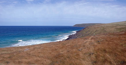
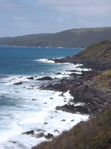
Thin high cloud had formed along the coast and filtered both the light and heat of the sun. The northerly wind became our friend as we were heading south-west, which made the walking altogether pleasant as we headed out along the well-formed cliffside track. Green pastures and wheat fields sloped down to these low cliffs, as we passed areas of jagged black rock and crossed sandy beaches. |
|
|
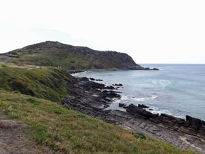
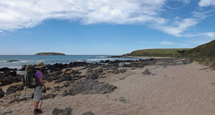
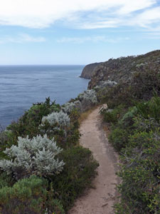
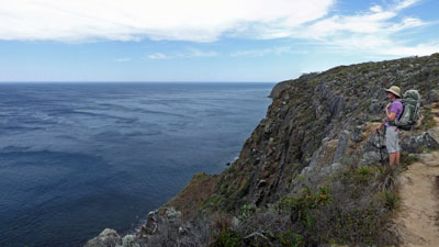
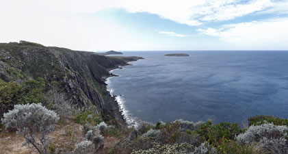
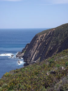
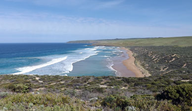
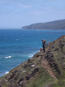
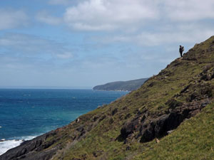
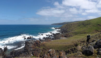
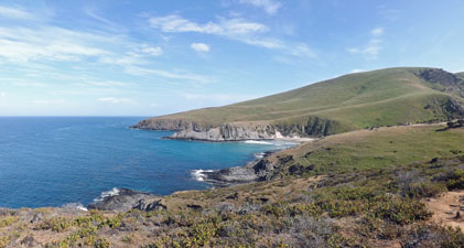
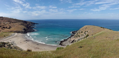
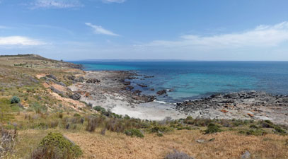
The strong on-shore wind flattened the ocean, giving it a burnished slaty blue sheen. Just before King Beach, we joined the Heysen Trail proper and followed it around the back of the sandy shore and grassy headland to find a nicely placed bench at the top of King Head. We sat down to take in the magnificent view of the sheer 100m high Waitpinga Cliffs falling away to the west. Then it was time for the morning climb up to the cliff-line. |
|
 |
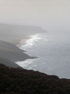
 The long line of the 100m high Waitpinga Cliffs |
 |
|
 |
 |
|
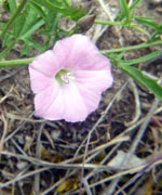
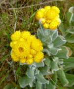
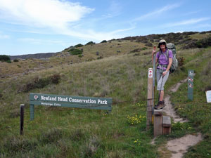
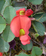
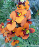
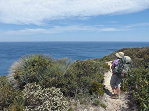
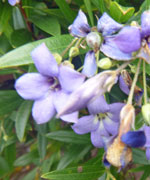
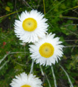
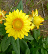
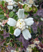
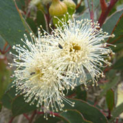
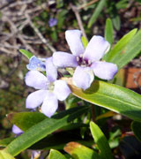
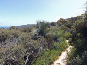
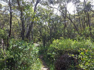
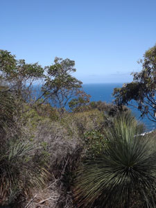
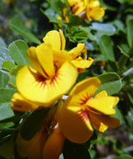
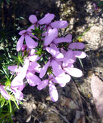
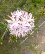
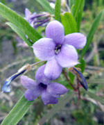
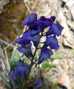
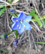
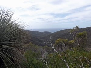
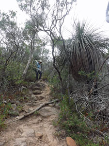
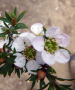
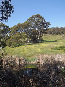
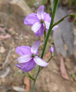
While climbing, we crossed a stile to leave the pastures and wheatfields behind and enter the Newland Head Conservation Park. What a difference that made - wildflowers suddenly began appearing in all shades of colour amongst the remnant mallee and coastal heath. The rocky track was not only great for flora - it also took us right alongside the edge of the cliffs, with spectacular views both forwards and backwards of their sheer blocky walls. |
|||
 The natural heath vegetation of Newland Head |
 |
 |
|

|
 Looking out over the Southern Ocean |
 |
|
At one point we found a table and seats, well placed for excellent views of the cliffs, a bit of protection from the wind and an excuse for an early lunch. Today was a walk in two parts and this ended the first part, a wondrous cliff-edge promenade. As we ate our lunch, the high cloud moved on, allowing the sun to shine down with its full intensity. This quickly drove the temperatures up towards the day's maximum of 36°C, signalling the start of the second part (also know as the "hot slog"). |
|
 |
 View back along our route from The (distant) Bluff |
|
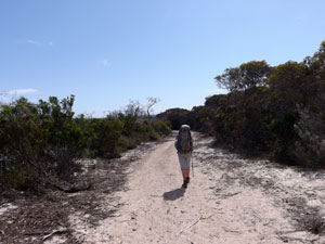
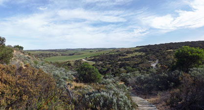
We soon left the cliff-line, following the track as it meandered its way across the low, scrubby heath on the old dune systems. At times it wandered along the fence-line that separated open farmland from this narrow strip of natural vegetation. When it did, we were exposed to the full strength of the hot wind, now gusting at 40-50 kph. At other times the track wandered back into a low mallee scrub, high enough to cut the wind, but not the sun. We were starting to feel the heat. |
|
||
 A sandy section of cliff top heath |
 |
 |
|
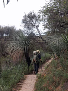
Eventually, we reached a part of the park that penetrated deeper inland. Here the mallee was denser, but unfortunately a fire had gone through a few years earlier and the vegetation was mainly low, thick regrowth, exposing us to both wind and sun as we undulated our way across deep gully and rounded spur. A short sharp climb brought us to a stony firetrail, which we then followed as it slowly climbed inland and northward, directly into the face of the wind. Along this section, we learnt a bit about human physiology. The hot dry wind was essentially evaporating our perspiration as soon as it left the pores, so quickly in fact that there was no cooling effect. Even though we had enough water, we were literally overheating and had to make a couple of "heat stops" - finding a bit of shade and shelter where we could perspire freely and cool down. They say that only mad dogs and Englishmen go out in the midday sun and it occurred to me that we weren't English. |
||
 Turning inland from the coast |
 |
 The thick mallee of Newland Head |
|
The firetrail became increasingly sandy as it headed inland, finally reaching "the point of the three happinesses" - 1) we were now out of the burnt scrub and back into taller, shadier woodland, 2) it had turned westward again and we were out of the face of the wind, and 3) it was all downhill on a wide sandy trail to the Waitpinga Campsite. What a relief it was to finally arrive. |
||
 |
 |
 |
|
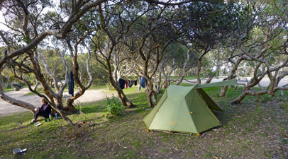
Set behind high coastal dunes, Waitpinga was a very pleasant campsite. We pitched our tent beneath some shady tea-trees, brewed a cuppa and slowly regained lost energy. With an extra hour of daylight (summer time had just arrived) there was plenty of time left to enjoy the location and watching the sun set over the far end of the Fleurieu Peninsula from a high sand dune was magic. We also had special treat for dinner - chocolate fondue. Originally meant to be a block of chocolate, it had completely melted, but when dipped with pieces of dried fruit .... yum! |
 |
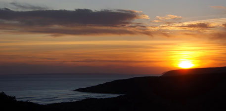 Waitpinga sunset |
|
Waitpinga has only one downside - it is near a marshy estuary that breeds a particularly vicious species of mosquito that thrives on DEET and bites through shirts. As soon as darkness fell, they emerged and we quickly retreated to our tent. It was a bit like a sci-fi movie where the heroes are stuck in a 3 cubic metre pod of safety protected from raging blood-suckers by only a thin wall of mesh. Lets hope that the other, more inland, campsites are mozzie-free. |
||
|
Day 2 - Waitpinga to Balquhidder (11.5 km - 340m ascent - 220m descent) |
What a difference a day makes. Yesterday we laboured into Waitpinga Campground in 36°C heat and hot northerly winds. Today I write this at Balquhidder Shelter wearing a beanie to keep out the cold westerly that is blowing grey clouds across the sky. Still, the start of the day was altogether better as the cold front had not yet arrived. |
||
 View from the dunes over the coastal hinterland |
 |
 High in the Waitpinga dunes |
The morning was considerably cooler then yesterday when we got up at Waitpinga and broke camp. Overnight the wind had abated and swung around to a nor'wester - a lovely cooling breeze in fact that, with a milder sun, made for perfect walking weather. We quickly headed up and over the high fore-dunes to reach Waitpinga Beach, a favourite spot for surfers and fishermen. The tide was going out, which was just as well or else we would have been right up against the sea-eroded dunes. As it was, the sand was soft under foot as we crossed Waitpinga Creek and pushed our way slowly along the beach to the sound of the rolling surf. |
||
 |
 Big surf at Waitpinga Beach |
 |
|
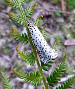
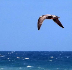
At the end of the beach, we climbed up and around the rocky heath-covered Parsons Headland. Clouds of speckled white moths scattered before us as we passed by to reach a point overlooking Parsons Beach, with its solitary fisherman. I love this sort of beach-walking with the rhythmic dull roar of the surf, and the briny intensity of negative ions in the air. It was time to put the body on autopilot and let the mind loose. |
|
 |
 The tracks of zen |
|

We stopped to sit for a while at the far end of the beach, in the sunshine and cool breeze, watching the fisherman reel in some nice surf fish. Then it was time to leave the conservation park by a stile over some barbed fencing and enter the grassy meadows of the local landholders. |
||
 Parsons Beach |
 |
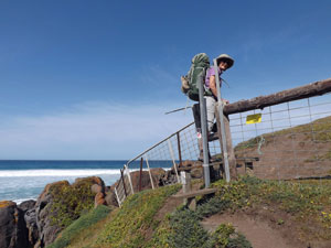 Crossing a sea-side stile |
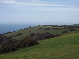
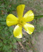
The track led us up into the cliff-top pastures, splashed with the yellow daisy flowers of cape weed. It meandered its way through green paddocks, over fence stiles and across deep V-shaped gullies, as the sea on our left glistened bright blue before crashing in spumes of white foam onto the dark jagged rocks. It was an idyllic stretch of coast, provided you can cast from your mind the fact that the natural vegetation had long since gone (they were an industrious mob of land-clearers in the late 19th century). |
|
 Grand vista of the cliff-top pastures |
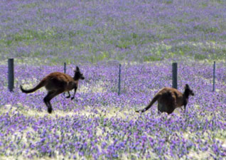
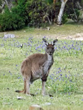
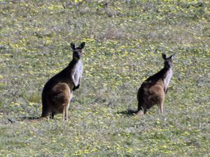 Roos amongst the cape weed |
|
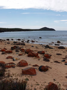
Just before a long line of green-clad cliffs stretching to the south-west, we descended steeply to the mouth of Coolawang Creek. Instead of continuing along the coast, the Heysen Trail headed inland, following the valley of the Coolawang - broad and marshy at first, narrowing to a deep green and steep-sided gully. |
|

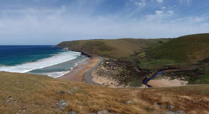 Overlooking Coolawang Beach and its creek - our path inland |
 The stony mouth of Coolawang Creek |
Once again trees were beginning to form a part of the landscape and we stopped to eat our lunch in the shade of one, before tackling the steep climb directly up and out of the valley. As we climbed, we noticed the breeze strengthening into a wind and grey clouds appearing in the western sky. A change was definitely on the way. Our guide across this property was the fenceline, which brought us out on to Mount Scrub Road, a dirt vehicle route. |
||
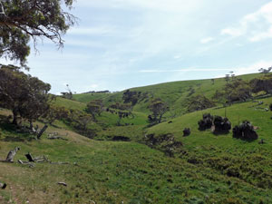 The intense green of the inland gully |
 |
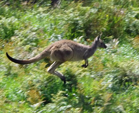 One good leap deserves another |
It was but a short descent of the road to reach Balquhidder Shelter, making one brief stop to retrieve our food drop from its hiding place beneath the spreading leaves of a grass tree. The shelter was in a lovely setting, platform and water tank above a pretty creek surrounded by green grassy slopes and bird-filled eucalypts ..... and NO mosquitoes. Our only problem was finding a spot flat enough to pitch the tent on, but that seems typical of the rolling inland Fleurieu Peninsula terrain. |
||
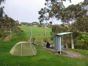 At Balquhidder Shelter |
 |
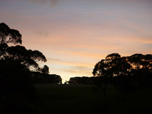 Balquhidder sunset |
Not long after we set up, the cold front rolled through, with its icy gusts bringing a distinct drop in temperature - 36 this time yesterday, 16 today. What a difference a day makes! |
|

Day 3 - Balquhidder to Tapanappa (17 km - 550m ascent - 480m descent) |
After a night of being serenaded by the frogs of Ballaparudda Creek and slowly slipping downhill off our thermarests, we awoke to a cold south-easterly wind and cloud scudding across the sky. The windshift, however, would work in our favour as we continued our westerly push along the Heysen Trail. After breaking camp, we quickly rejoined Ballaparudda Road and followed its wide dirt surface uphill, past pine and eucalyptus plantations to meet Callawonga Creek road. This led us down to the creek of the same name and up again to the Tunkhead Road intersection. |
||
 On the road to Ballaparudda |
 Coastal paddocks ...... |
 .... and their inhabitants |
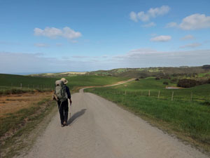
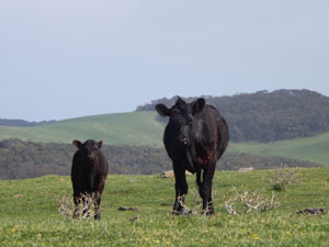
Our "road trip" was now over,as we crossed a stile and headed towards the coast across the trackless green pastures, keeping an eye out for the next distant trail marker to stay on course. The pasture here was so lush that the Black Angus cattle grazing it must have thought themselves in cow-heaven. |
|
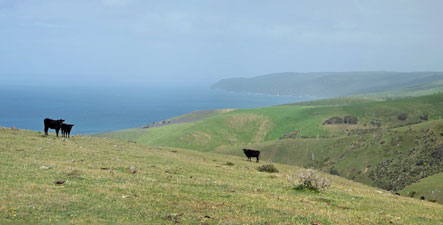 A panorama of bovine heaven |
 Looking out over the pastures to Tunkalilla Beach |
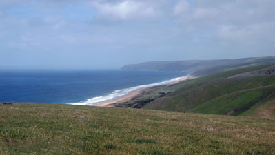
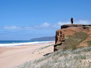
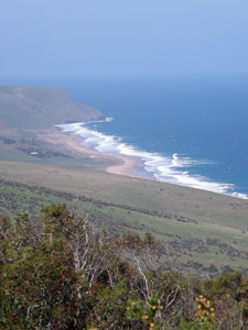
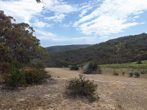
On the exposed hillside, the wind was glacial, so different from two days ago. Ahead, the hazy sea beckoned us on and, ten fences and ten stiles later, we reached the last rise before regaining the coast. The view from here to the west was superb, along Tunkalilla Beach to the cliffs beyond. The route to the sea was down - straight down a very steep 100m high slope. It followed the fenceline, which past walkers had clearly put to good use - the top row of vertical strands had all been bent downhill - clearly a helping handgrip for walkers both climbing and descending. |
|
 |
 A meditative stroll down 4.5 km long Tunkalilla Beach |
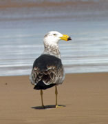
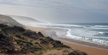
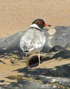
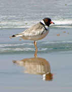
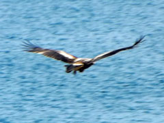
The steep descent spilled us out on to the wild and windswept Tunkalilla Beach, a 4.5 km stretch of sand pounded by the waves of the Southern Ocean. We set out on a long, silent meditational perambulation along its soft tan sand, interrupted only by the occasional Pacific Gull sweeping by in the air or the rare hooded plover scurrying across the beach. With the wind at our backs driving low plumes of powdery sand ahead of us, it was easy walking. |
||
 |
The wind was also sweeping away the salty haze and most of the clouds - the clarity and colour were superb. Nearing the end, a low eroded red clay bank offered a diversion from beach-walking, so we climbed up it to continue through the rippling grass on its top before rejoining the beach, now broader, smoother and backed by green-clad cliffs. |
 Tunkalilla in green, red and gold |
|
 |
|
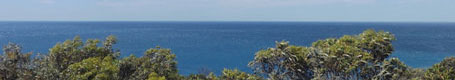
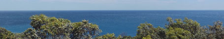
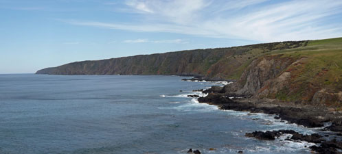
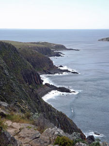
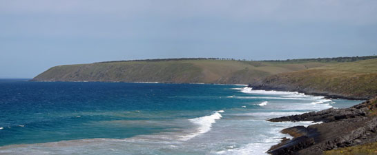
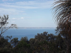
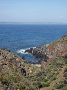
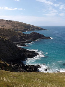
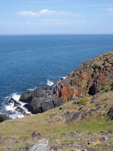
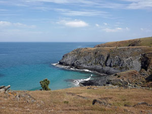
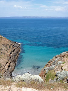
We took a break at beach-end (or cliff-start) before embarking on perhaps the most picturesque section of the day, as the track wound its way across the steeply sloping cliffs,high above a coastline of jagged black rocks, deep blue sea and foaming white surf. The faint outline of Kangaroo Island (25 km away) looked back at us from across Backstairs Passage. |
||
 On the cliff side track |
|
 A rocky gully carving down to the sea |
|
 |
|
Near the end of the cliffs, we crossed a stile to enter the Deep Creek Conservation Park. A little later, we dropped sharply on to the boulder-strewn Boat Harbour Beach, where we declared a lunch break on the flat grassy area behind the jumble of water-smoothed stones. We needed the energy, as ahead lay the big climb of the day. |
||
 Boulder beach at Boat Harbour |
 Climbing out of Boat Harbour |
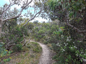
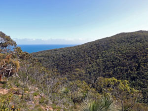
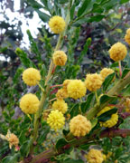
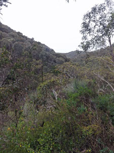
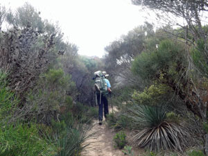
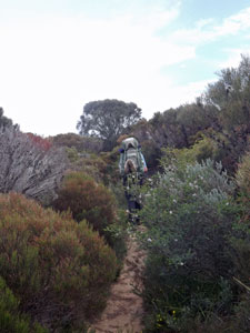
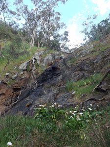
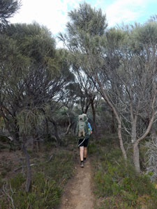
Leaving the beach, a sharp steep climb brought us once more into the natural vegetation of the area - a rich mix of eucalyptus forest, grass trees, understorey shrubs and flowering herbs. The Conservation Park folk had constructed a well-formed track that steadily wound its way up the sidewall of Tapanappa Creek, through this dense and vibrant vegetation. As we climbed, the sea began to appear as a shallow blue V filtered through a curtain of branch and leaf. |
||
 Back into natural vegetation .... |
 .... at Deep Creek Conservation Park .... |
 ... with its dense inerior forest |
|
|
|
|
|
|||
At the head of the creek, the track turned west to provide a long balcony with views out over the forested slopes to the sea beyond and the distant islets of The Pages - superb. A final climb up to the ridge-line and a short walk along a dirt road brought us to Tapanappa Campground, primarily set out for car campers, but in a very pleasant spot sheltered from the wind. We found a nice site amongst the low gnarly mallees and pitched camp. Another great day of coastal walking was over. |
|||
|

Day 4 - Tapanappa to Eagle Waterhole 12 km -470m ascent - 520m descent) |
Today we would not return to the ocean, as it was to be an exploration of the interior of the Deep Creek Conservation Park. It started out a curious morning - the cold wind had abated to become a cool breeze, but, by the time we set out, cloud was winning the battle for the sky and we were soon walking under a pale grey ceiling. |
Leaving Tapanappa, we headed out along the dirt road that followed a grassy ridge from the campground to Tapanappa Lookout. To the east, our route of yesterday faded into the greyness of sea and sky. Out to sea, a container ship plied its way steadily westward between Kangaroo Island and the mainland. With the views, the cool wind at our backs and lots of kangaroos out for their morning graze, it was an enjoyable stroll. |
|
|
 Heading out to Tapanappa Lookout |
 |
|
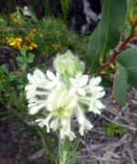
In fact, where the Heysen Trail ducked down into the forest, we ignored it and stayed on the ridge to its end. At that point we met the Deep Creek Waterfall Hike and followed its track back down the slope to where it merged with the Heysen Trail. We were once again wandering through the dense but lovely forest of Deep Creek, a rich mosaic of greens sprinkled with the colours of wildflowers in bloom. |
||||
 |
 |
 |
 |
 |
|
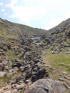
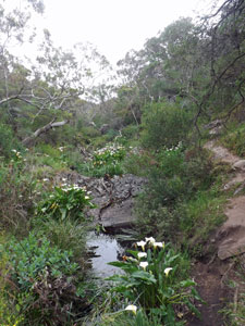
The track meandered and undulated its way across slope and gully, high above the V-shaped valley of Deep Creek - it deserved its name. After a while, it brought us out to the edge of the creek itself, water babbling down its overhung and rocky bed. Following the creek led us further up this now tight valley and to the Deep Creek Waterfall. Often dry, it was flowing well this spring, with water tumbling over the grey rocks into a large plunge pool - the perfect place for a break. |
|
|
 |
 |
||
Retracing our steps slightly, we crossed the creek to start the biggest climb of the day. Aided by some stone steps and several sets of wooden ones, we quickly climbed up into an increasingly dry landscape. In the stillness of this deep valley we were working up a good sweat in doing so, but at least today it was doing its job and cooling us down. The vegetation of the hill-tops was quite different to the slopes, as we crossed a more scrubby landscape to reach Tent Hill Road. |
|||
 |
|||
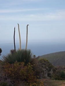
We were now right on the northern boundary of the conservation park and followed its fence-line down past thickets of old black-stumped grass trees, their flower-heads pointing like spears to the sky. The other side of the fence began as a manicured pasture, but, as the terrain became steeper, all returned to bushland. |
|||
 |
 |
||
On the steep descent into Tent Rock Creek, we met a couple of British girls hiking through in the opposite direction and exchanged track notes. Then it was down to the creek for lunch on the rocks, as the small stream trickled by. |
|||


 Lunch break amongst the boulders |
 The gully cuts through the hills on its way to the sea |
 Path through the casuarinas |
Our after-lunch walking started with a steep and, at times, scrambling climb out of Tent Rock Creek and on to its scrubby tops. The track here was almost overgrown as it meandered its way through thickets of low scrubby casuarinas. That said, there are few sounds more soothing than that of the wind passing through a canopy of these trees. |
||
|
|
|
|
|

|
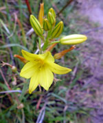
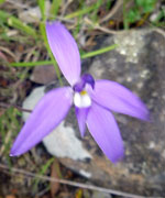
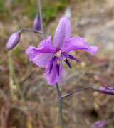
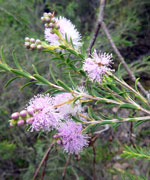
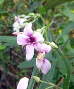
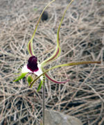
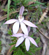
Again we reached the park boundary, an old fence in the middle of the bush that turned us westwards through the scrub to meet up with an old farm road on the top of a ridge. We were now in more open landscape and, even better, the cloud that had kept the air so humid and perspirational, was starting to break up. As a bonus, I spotted a rare spider orchid in flower (to be honest I almost sat on it when we stopped for a break). |
||
 |
 |
 Finally the blue sky returns |
|
It was but a quick stroll down the final kilometre of road to reach the Eagle Waterhole Shelter, set in a lovely tranquil spot of open woodland next to a grassy kangaroo-grazing slope. The British girls had recommended this as a place to stay rather than pressing on 2km to Cobblers Hill Campground. |
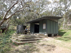 The modern and comfortable Eagle Waterhole Shelter |
 |
 Reed-fringed Eagle Waterhole |
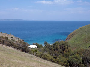
With the sun now fully out and a scattering of fluffy white clouds, it would be an idyllic place to while away the afternoon of our last evening on the Heysen Trail, to the songs of the birds and the rustle of a breeze in the trees (NB beware, though, the magpie in the large gum tree north of the site - it is a serial swooper if you venture near its nesting area). |
||
We weren't going to be alone, as a group of five University students on a trip as part of their Outdoor Education course walked in from the west. However, they preferred to set up their tents on a flat bit of land above the shelter. I couldn't blame them - after four days on the track, our socks and clothes were more than "just a bit whoofy". (Footnote: In the end, the students confessed that it was a requirement of their exercise to camp and sleeping in a shelter would probably turn an A+ into a B-. Our social standing was redeemed.) |
|


Day 5 - Eagle Waterhole to Cape Jervis (16 km - 320m ascent - 490m descent) |
After a soothing night of soft croaking from the multi-species frog chorus in Eagle Waterhole, we were up early. It was a mild morning for our last day of walking - this afternoon we would reach Cape Jervis, the southern end of the Heysen Trail. It was also a "cardboard shirt" morning - the morning after a sweaty day on the track when you put on a salt-encrusted and stiff shirt - not a pleasant thing to do. |
Farewelling the outdoor ed students, we set off down the firetrail that followed lily-lined Aaron Creek (or is it Arum Creek - they do have a problem with these pretty invaders) to cross it and head slowly up a steep-walled side creek. The arum lilies were thick here as well and we named the two small black-walled waterfalls that we hade to scramble up and around, Arum Falls 1 and 2. The creek was just running and a small trickle flowed over their shiny black faces. On the western flank of this deep gully lay Cobblers Hill and the campsite of the same name. In between was a steep climb directly up the slope - we took the legs off our trousers and set out at a slow and steady rhythm in the still humid air. By the time we reached the more open top, our cardboard shirts were nice and supple again, if a little saltier.
|
|
|

|
After a brief visit to check out the campsite (and congratulate ourselves for having chosen to stay at Eagle Waterhole), we continued on along the casuarina-topped ridgeline of Cobblers Hill, heading directly back to the coast. Views opened up of the blue waters of Backstairs Passage and Kangaroo Island, now looking closer than ever (as it was). After a long winding descent of the spur off Cobblers Hill, we reached a small rocky cove and our exploration of the interior of Deep Creek Conservation Park was over. |
|
|
 Panorama of Blowhole Beach and its grassy hills |
|
Rounding the cove, we climbed over a small slope, covered in low coastal heath and, like earlier on the walk in this type of habitat, each step was greeted with a cloud of speckled white moths fluttering out of the shrubbery - like a flurry of snowflakes in winter. Even better, when we crested the last rise, we were greeted with the sight of Blowhole Beach, an exquisite sandy cove, hemmed in by rocky cliffs and backed by grassy green slopes. We stopped to enjoy the scene and watch a couple of surfers trying to catch the not-so-surfer-friendly waves that rolled in. |
||
 |
|
 |
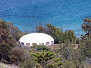
It was a place where you could easily spend a lot of time, which we didn't have (we needed to be in Cape Jervis by 3pm for our pick-up back to Victor Harbor). Heading off again beneath the bright blue sky, we climbed up above the cliff-line and continued westwards across the grassy tops. Near Naiko Inlet, the track headed inland and upwards, which we couldn't understand at first. However, looking back down, the track was blocked by a stranded alien mother ship (see photo). Clearly, there must have been residual radiation, or we wouldn't have been obliged to take such a wide by-pass. |
||
|
|
|
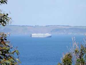
The by-pass took us through the grassy slopes high above the sea and cliffs, which was in fact very enjoyable. Here, the pastures were beginning to dry-off. Bleached seedheads waved in the wind between the deep blue of the sea and the green of the surrounding hills - the colours were intense. At one point, we stopped beneath the shade of a parasol pine to take it all in and watch a large container ship ply slowly up through the passage. |
|
 Crossing the fields of waving grass |
 The coastal grasslands of Fleurieu |
|
|
|
|
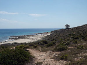
Continuing on through this grassy landscape, we slowly veered back down to the coast, passing some regeneration plantings of casuarina (it is hoped to reintroduce the glossy black cockatoo to the Fleurieu Peninsula and its food plant is being re-established) and winding our way along track and farm road to Fishery Beach. |
|
 Talisker Creek heading to the sea |
 Perhaps Fishery Beach is not the place for lunch |
|
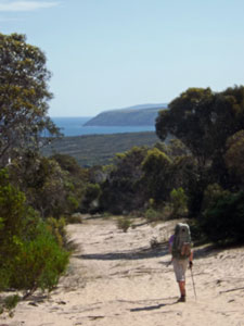
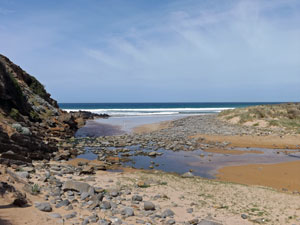
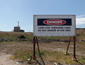
It had been our plan to have lunch here, but the bay is the crossing point for a 33000 volt electricity cable that supplies Kangaroo Island. There was also a dramatic change in landscape to low limestone hills, covered in scrubby heath. We pushed on in search of deeper shade, eventually giving up and eating our lunch tucked in to a low coastal wattle. The remainder of the track was similar, passing just back from the shore, either on rocky limestone or tan-coloured sand. We gradually swung north and, rounding the solitary Norfolk Island pine at Lands End, saw for the first time our destination - the lighthouse of Cape Jervis. The last kilometre and a half were a bit anticlimactic, as they passed through some fairly barren degraded coastline. However, judging by the numbers of plastic plant protectors on the slopes, a lot of regeneration work is underway. |
|
 The solitary pine at Land's End |
 Barren beauty of the limestone shelf west of Fishery Bay |
Thus, we arrived at the Trail head (which doubles as the Kangaroo Island ferry terminal) some 40 minutes early. Even better, the friendly Peninsula Taxi driver had also just arrived "in case we were early" - what perfect timing! Off the track and into the taxi bound for Victor Harbor, a hot shower and a cold beer in just a few minutes. We felt very content - the Fleurieu Peninsula certainly provides some of the best coastal walking in Australia. As self-appointed connoisseurs of coastal walking, we declared the Fleurieu Peninsula as right up there with the best in Australia. |
||
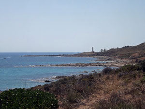 Nearing the end - Cape Jervis lighthouse appears |
 |
 Southern end (or beginning) of the Heysen Trail |
I noticed from the Heysen Trail website that much is made of being an "End to End" walker. Having just completed both northern and southern ends, does that make us "End and End" walkers? |
|