
Kangaroo Island Day-Walks |
Ravine des Casoars (8 km - 90m ascent - 90m descent) |


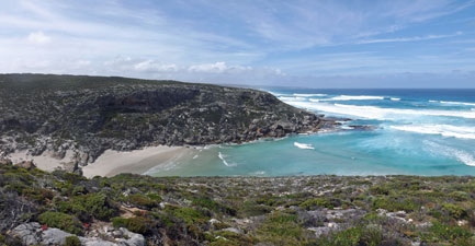
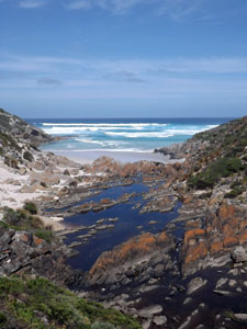
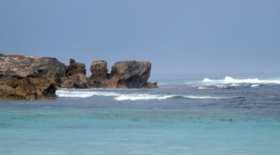
In between long multi-day treks it is always nice to do a shorter pack-free walk, to stretch tired muscles and just enjoy the pleasure of putting one foot in front of the other without a heavy burden. Having finished the southern end of the Heysen Trail and arrived on Kangaroo Island to pre-view the new Kangaroo Island Wilderness Trail, we returned to a place that we had visited almost 20 years ago to do just that - it was The Ravine des Casoars, named by the French navigator, Baudin, in 1802, when he mistook the now extinct dwarf emus of Kangaroo Island for cassowaries. There is no mistake, however, in the beauty of this remote valley and beach surrounded by coastal cliffs on the western edge of the island. |
||
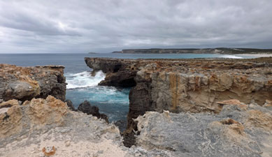
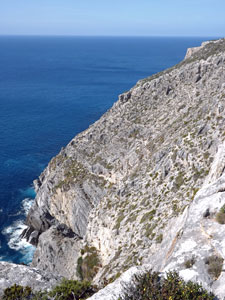 The lmestone cliffs of Cape Borda |
|
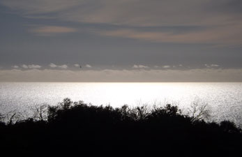
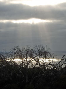 Strange lightout to sea |
|
|
|
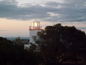
When we arrived, we checked in to our accommodation at Cape Borda, the old relief lighthouse keeper's cottage. The lighthouse has long since switched over to automatic, but is the last in South Australia to keep the revolving Fresnel lens of a true lighthouse - all the rest are effectively beacons. It was a great spot to stay, with the pure white buildings set out on a red laterite gravel yard, surrounded by coastal heath on cliffs high above a blue, blue sea - a sea that stretches thousands of kilometres to the west before it next reaches land. |
||


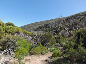
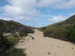
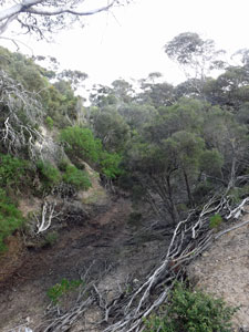
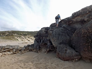
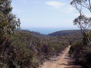
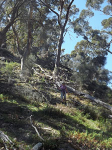
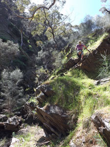
The next morning, we drove down a gravel road to the walk start and set out. One the way in, one may wonder what is so special about this walk, as you pass through the dense regrowth of sugar gum and scrubby understorey from a severe bushfire that burnt this whole area some years back. The dead trunks of taller trees added to the starkness of the landscape. However, as you descend this limestone escarpment into the ravine, that view begins to change. |
|||
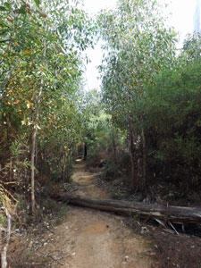 Start of the track down the Ravine des Casoars |
 |
 |
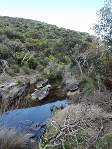 A dark pool in the creek |
On reaching the rocky bed of the creek, with its tannin-stained waters reflecting the wooded slopes around, it changes even more. This was reinforced as we approached the coast, eventually crossing over a rickety wooden bridge at the end of a tea-coloured lagoon, its surface rippled by waves from the off-shore wind that had found its way this far into the ravine. |
|
||
 Heathland near the coast |
 |
 |
|

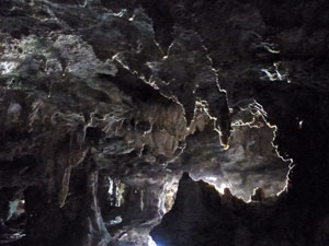
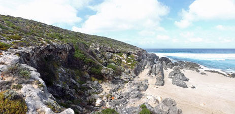
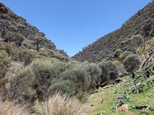
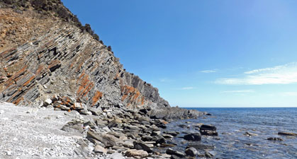
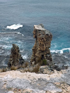
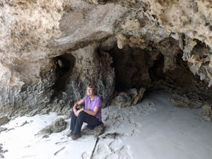
Wandering around the edge of the lagoon next to a large sandy dune, we looked across the water at the cliffs opposite. What we had come to see was already becoming evident, as the cliff showed signs of smoother limestone flows amidst the more jagged-edged rock-face. Hollows and small caves began to appear in the cliff face with old water-dripped formations. This is cave country and the Ravine des Casoars has some amazing caves, a mix of "normal" caves formed by chemical weathering as water leaches through limestone, sea caves where the sea has undermined the limestone cliff-face causing collapse, and even some hybrid caves, where the two types have merged. |
||
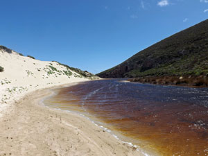 Tannin-stained lagoon at the mouth of the creek |
 |
 Crossing the broad sand bar at the Casoars Beach |
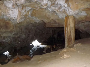
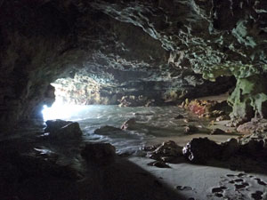
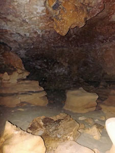
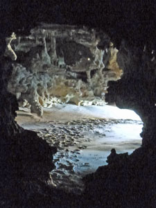
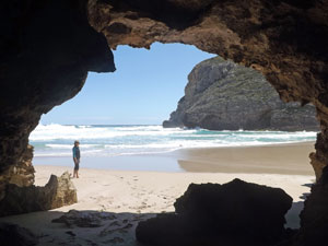
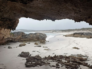
Ahead lay a broad sand-bar, wedged between two lines of limestone cliff, holding back the lagoon from the rolling surf. We crossed it and made our way to the main cave system in the northern cliffs. The entry was via a dali-esque "melting" doorway, but behind it lay an exquisite cavern connected by a narrow passage into a second cave. Looking through, all was dark and for a moment, we cursed the fact that we had forgotten to bring our torches. However, the human eye is an amazing organ, and by just sitting in the darkness for a few minutes our eyes adapted sufficiently to allow us to explore the twilight of the caves. |
|
|
 Beach entry to the main cave |
 The entry from inside the cave |
|
| On passing through the passage into the second cave, we were greeted by waves surging in from the opening to the ocean - lovely to watch, but be prepared to step back quickly. |
||
 The sea cave entry from within |
 The beauty ofthe caves |
|
|
|
|
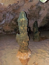
Higher up the beach was a larger, drier cave with a large antechamber and some ancient columns, while on the southern side are a couple of more open sea caves with collapsed rooves, that offered a completely different perspective. We spent a couple of hours exploring, relaxing on the sandy beach and enjoying the ambience of this special place. The following photos give an idea, but barely do it justice - enjoy. |
||

|

Three things that I like when out in a two-person hiking tent are 1) the patter of raindrops on the fly at night, 2) the silence of raindrops stopping before morning and 3) waking up with no moisture on the interior of the fly. Last night, we had all three, plus the sound of the distant surf rolling in over the heath, so it could be considered a good night. Today was the day when we would have followed the Kangaroo Island Wilderness Trail down the west coast of the island from Snake Lagoon to Cape du Couedic. However, as mentioned before, much of this track is still being constructed and the land is in the hands of the trackmakers - the dreaded "public liability" vetoed our plan. However, we could still walk a little of the trail from Snake Lagoon to the mouth of Rocky River and experience the wildness of the west coast by walking some of the coastal cliffs north of river mouth. In fact, we decided to do a circuit walk that would incorporate that plus other different west coast landscapes - one which would prove a very enjoyable alternative to walking the trail. |
||||
 |
 |
 |
 |
 |
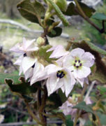
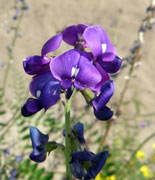
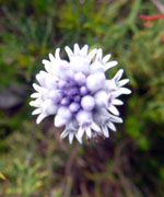
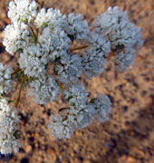
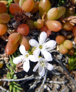
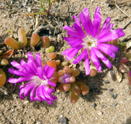
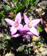
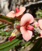
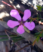
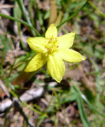
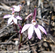
This circuit involved a bit of road walking and it seemed a good idea to get that out of the way first, so we headed out of Snake Lagoon campsite back up the red laterite gravel road to turn left on the West Bay Road - 3km of road-walking through the dense low heathlands of the west coast interior. Road-walking can be tedious, but there are ways to make it more interesting. For example, the cleared verges provide open ground for many of the areas wildflowers, so we amused ourselves with a game called "spot the new flowering species". There were a couple and, before we knew it, we had arrived at Sandy Creek crossing with its taller riverine trees. |
||
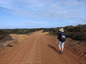 On the road to West Bay |
 |
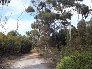 Out of the heath and into the forest |
|
We didn't cross the creek, instead turning towards the coast to follow the southern bank of its dry bed towards the ocean. On the north south, a high vegetated dune had formed on the limestone slopes. Before long, the track dropped into the creek and the sandy creek bed, with its catalogue of different animal, bird and reptile tracks, led us down to Maupertuis Bay. |
|
 |
 Lower Sandy Creek |
|
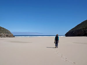
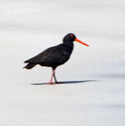
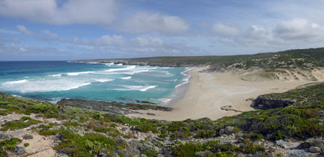
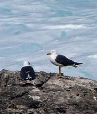
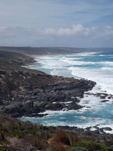
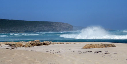
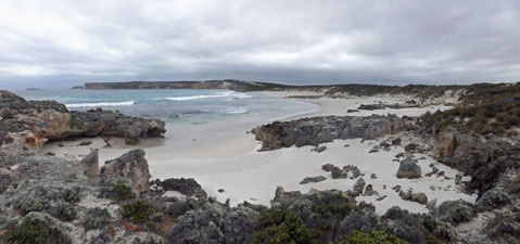
A gap in the dunes led out on to a broad and isolated beach of pale sand pounded by the rolling surf of the Southern Ocean. To the north-west, a long line of limestone cliffs faded into the distance towards Cape Bedout. The big ocean swells exploded against the cliffs and rock platforms sending plumes of spray tens of metres into the sky - Sandy Beach was the type of place where you sit and ponder the imponderables of the world. We did just that, as a solitary gull soared on the wind, an oyster-catcher strode purposefully by and and a pair of hooded plovers scurried across the sand. |
||
 The sweeping expanse of Sandy Bech |
 |
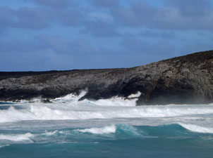 Big seas on the west coast |
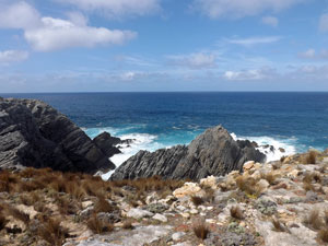
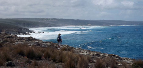
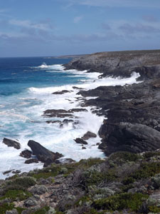
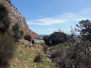
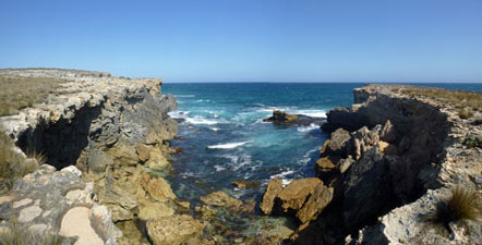
The cliffs also headed off to the south as well and this was our direction. Finding a low point, we scrambled up the jagged rock face and on to the cobbled limestone surface of the cliff-tops to commence our trackless route south towards Rocky River. Here the heath was ankle high and the going was easy - we made our way over the high point to see our route ahead. |
||
 climbing up onto the cliffs |
 |
 The low limestone cliffs near Sandy Beach |
It was wonderful walking along the edge of these cliffs, with the surf pounding the rocks below and a cool south-westerly breeze coming in from the ocean. There is no air fresher to breathe - nothing lies to the south-west between here and Antarctica. |
||
 Next landfall ...... South Africa |
 |
 View back over Sandy Bech and Cape Bedout |
Our steady progression continued, as we allowed the vegetation and rock patterns to guide our path. Occasionally, the rock surface was more tesselated and jagged, required a bit more care, other times it was sandy and easy. Occasionally the heath became denser and thigh-high, but there was always a way through. walk gently and when one passage closes, another opens. |
||
 |
 The wildness of Kangaroo island's west coast |
 |
|
|
|
The views expanded to the south as we passed deeply eroded cliff-faces and crossed the open heath-covered tops. We could see the deep indent of the Rocky River mouth and beyond it, the continuation of the long cliff line backing Maupertuis Bay that would take the Wilderness Trail southwards to Cape du Couedic. For us though, the cliff walking was over, we turned inland, slowly picking our way down the steep slope towards the small beach where the Rocky River met the sea. A final scramble down the red rock face and we were there. |
||
 The entry to Rocky River |
 |
 |
Rocky by name and rocky by nature, this river has a spectacular entry into the ocean, as it tumbles down a series of small waterfalls and cascades into the sea, where foaming waves roll up the beach to meet it. Again, it was the ideal place to sit and soak up the ambience, which we did. The tide, however, was on the way in, suggesting it was time to move on. |
||
 Descent to Rocky River cove ... |
 .. where the river cascades its way to the sea |
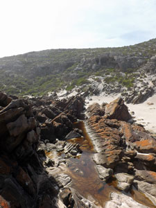 Red rock ribs at the river mouth |
 Where river meets the ocean |
The final leg of our circuit was to follow the track up from the river mouth, passing the series of rock ribs that force the river water to run a curious zig-zag course. At one point a series of wooden bridges takes you from the south to north bank of the river. It was here that we spent the late afternoon yesterday soaking our feet, and we did so again today, before climbing up and over the limestone ridge back to Snake Lagoon - circuit completed. |
|||
 Looking up the Rocky River valley |
 |
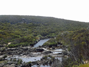 Crossing point on Rocky River |
This circuit is a superb day-walk in its own right and was a great way to discover the wild side of the west coast cliffs and the river and creek systems that flow into it. If this is what the Kangaroo Island Wilderness Trail offers, it will definitely become one of Australia's great coastal walks. |
|
Waterfall Creek (to the sea) (7.5 km - 260m ascent - 260m descent) |
|
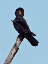
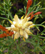
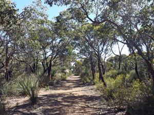
Waterfall Creek is one of a number of short walks described in the National Park booklet. It lies within the Western River Conservation Park, one of the last refuges of the glossy black cockatoo, on the northern shore of Kangaroo Island. The official track is only 2.5 km in length and it did not take us long to wander down the dirt road, gravelled with red pellets of laterite. The road headed directly towards the coast, through a pleasant eucalypt and casuarina forest with grass-trees and scatterings of flowering herbs and shrubs on its verge. Reaching a long downhill section, we could look out over the forest to the sea, and not long after, we reached the end of the road. |
|
 The gravel track heading down to the waterfall |
 |
 View over the forest to the waters of Backstairs Passage |
From here, a foot track took us up and over a spur to a point from where you can look out over the deep ravine of the lower creek and a 40m waterfall that divided this from the upper section. In winter, this waterfall can carry a lot of water, but not so today - just a trickle ran over the blackened rock face and into the ravine below. |
||||
 |
 |
 |
 |
 |
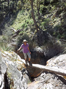
Normally, the walker would return from this point, and in our case, would be feeling a little disappointed. However, for us the adventure was just about to start, as we intended to continue on through the bush and follow the creek another kilometre and a half to the sea. The first step was to pick a way down the steep and scrubby sidewalls of the ravine and into the creekbed. From here the job description was simple - follow the creek to the sea. In practice this was a little more difficult, as the ravine walls were at times very narrow and it has been a long time since this area was burnt - there were a a lot of fallen branches and obstacles to negotiate. |
|||
 Nello picking her way down into the ravine |
 The route along the creek bed .... |
 ... with the odd log bridge .... |
 .... and rock scramble |
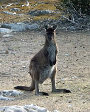
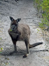
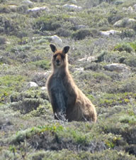
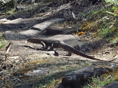
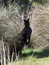
That said, it was good fun picking our way down, hopping the creek bed from one side to the other to find the best passage and scrambling down the odd rock face to get around dry cascades. At times we followed kangaroo pads for a while, watched by the chocolate-brown furred track makers, as the ravine wound its way down towards the coast. |
||
 Casuarina grove in the valley |
 |
 Approaching the outh of Waterfall Creek |
Finally, it straightened up and charged straight to the sea, passing through grassy kangaroo feeding grounds and thickets of casuarina before emerging on to a stony beach set between high cliff walls. After an hour of picking our way down the bush-enclosed ravine, we had a cool wind and open sea before us. It was great to be in such an isolated and wild place and we spent a long lunch-hour just hanging around and enjoying the ambience, before retracing our steps. |
||
 |
|
 Tilted strat where Waterfall Creek meets the sea |
Knowing the route made the return quicker than the outgoing walk, even though we were now ascending the creek, and the GPS gave us the right spot to climb back up the scrubby side of the ravine to the Waterfall Lookout. From here it was but a short walk up the road to the trailhead. There is nothing like a bit of off-track bushwalking to give you a feeling of achievement. |
|
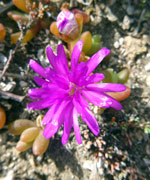
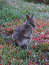
When we arrived at Hanson Bay, the sun was shining and a cold southerly wind had swept any cloud and haze from the sky - the clarity of the air was cutting. For us it was a day off walking and we could enjoy the views of the crystal clear water, the white sand beach and the distant cliffs of Cape Bougeur. On more exposed beaches further east, the wind was driving a big swell into shore while to the west, the jagged rocks of the sea-sculpted limestone cliffs stood out in contrast to the deep blue of the sea. As evening settled, the Tamar wallabies came out to feed on the pig-face below our cabins - as days-off go, this was a good one.
|
|
|
|

 |
|
|
|
By contrast, our last day at Hanson Bay was a bleak one, with the threatened weather change arriving in full - grey skies, strong wind and passing rain bands. Still, to avoid cabin fever, we did a short walk from the Hanson Bay cabins around the cliff edge to a long sandy beach in front of the Southern Ocean Lodge - the cliff face and the private property were a barrier to going further, but it gave a good idea of the type of landscape the Wilderness Trail might cross. I say "idea" because the trail does not pass along the coast here, instead heading inland to go through the coastal mallee at the back of the Southern Ocean Lodge and Hanson Bay properties. However, when complete, it will follow the cliffs from Sanderson Bay to Cape Younghusband further to the west. |
|

|
|
|
|
 Superb cliffs near Southern Ocean Lodge |
 Sheltering from the rain in a sea cave |
As the photos show, the cliffs are severely eroded by wind and sea into jagged faces and blocks of limestone - almost sculptural masterpieces in some cases. Undercutting has created a number of sea-caves, one of which provided welcome shelter for us during a passing squall. It was a good final walk amongst these magnificent coastal landscapes. |
 View from the cave |
|

