| Arkaroola Day Walks |
Getting there - Willow Springs |
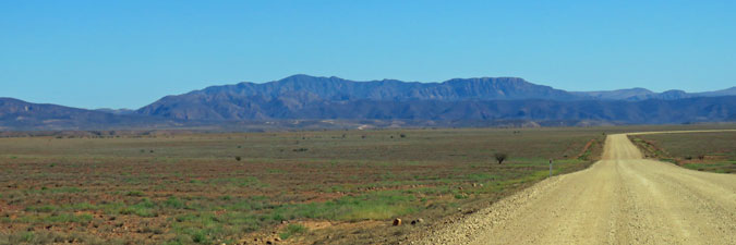
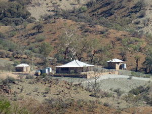
It is a long drive from Port Lincoln to Arkaroola and the last 150 km are on a gravel road, so we decided to break the trip with a stay at Willow Springs Station, opposite Wilpena Pound, icon of the North Flinders Ranges. Willow Springs is one of several pastoral properties in the region that have diversified into tourism, catering more for the 4WD enthusiast than the bushwalker, but nicely set up with camping and cabin accommodation.
|
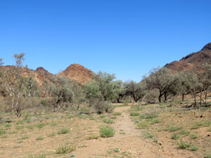
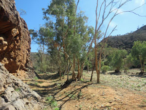
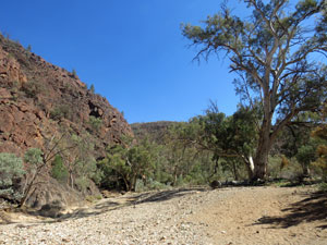
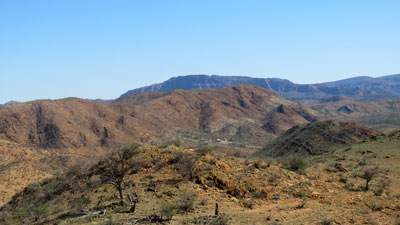
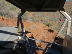
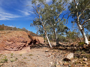
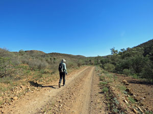
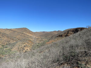
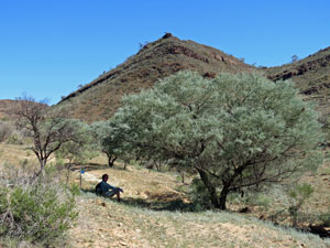
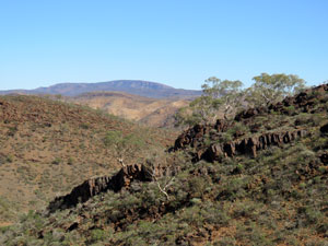
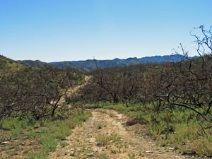
We arrived as the last of several light rain bands passed by and with an hour of daylight left, I felt the need to stretch my legs after 6 hours of driving. I followed one of the 4WD tracks that took me away from the campsite and along a dry creekbed lined with red gums, before starting to climb up into the rugged hills beyond. |
||
|
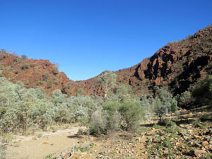
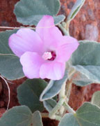
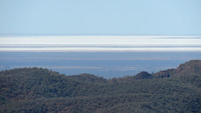
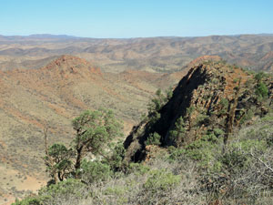
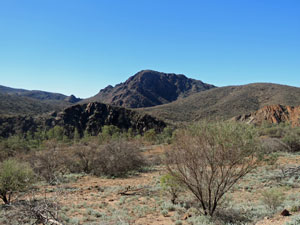
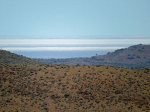
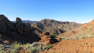
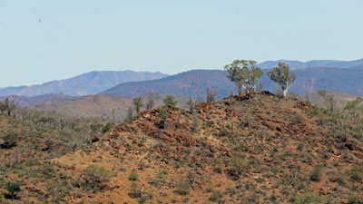
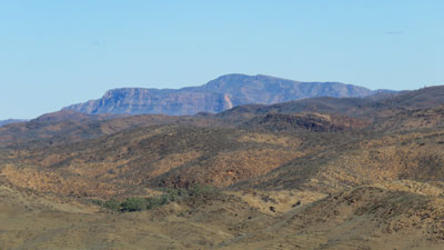
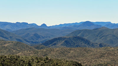
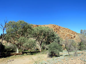
Here, I noticed a conical hill with a stone cairn on top. Suspecting that it was a viewpoint called Yacca Lookout, I left the track to climb up the open and rocky slope, bare but for scattered ankle-high plants. The top gave a great 360° panorama of the hills and ranges beyond and a very pretty sunset to boot. The photos tell the story.
|
|
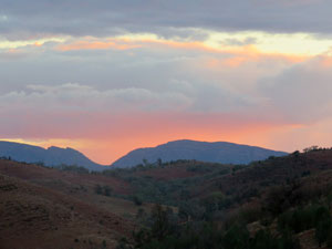
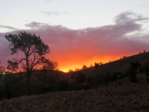
 The arid backhills of Willow Springs |
 Evening glow over the Fliners Ranges |
As the sky darkened and a crescent moon brightened, I headed back in the cold evening air, where the fair Nello and a steaming bowl of ravioli awaited. |
|
|
Weetootla Walking (15.5 km - 255m ascent - 255m descent) |

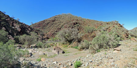
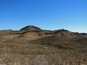
Technically, this walk is not in Arkaroola, lying 30km to the south. However, by staying overnight at Willow Springs, we were able to stop off and do the walk on the way through. It gave us a chance to explore part of the Vulkathunha - Gammon Ranges National Park. Here, a well-signed walking network has been developed, so we chose to combine the Balcanoona Creek and Monarch Mine walks to create a nice circuit.
|
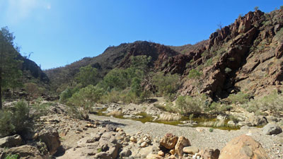
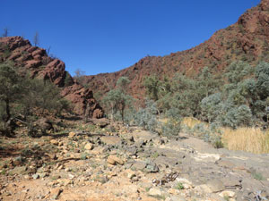
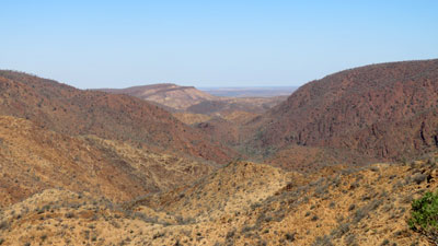
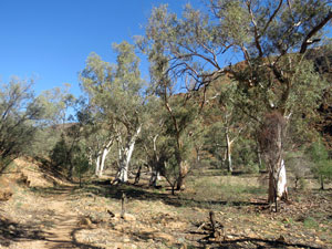
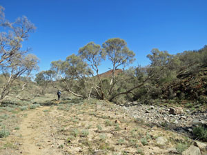
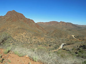
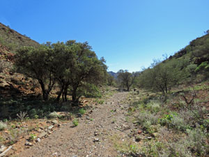
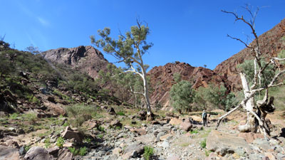
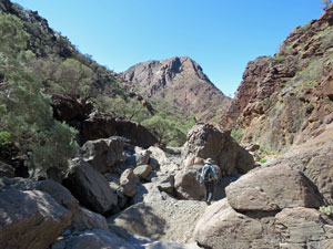
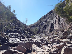
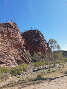
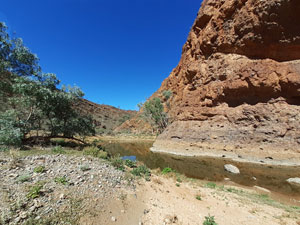
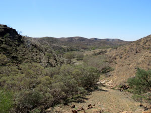
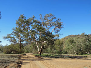
The clear-sky outback weather had returned as we set off from the track head on Balcanoona Creek just on the east side of a range of rugged hills. Our path followed the creek, criss-crossing its dry and stony bed. Here, Balcanoona Creek had eroded a nice gorge that punched through the line of hills. Wide at first, this early section had some nice interpretative signs on bush-tucker and plants used by the aboriginal people. |
|||
 Balcanoona Creek Trackhead |
 |
 |
 The dry bed of Balcanoona Creek |
|
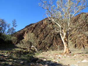
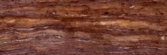
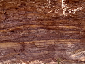
The dark grey blocky walls of Weetootla Gorge soon closed in around us, though. The rock was tillite, a dark red-grey sedimentary rock embedded with pebbles and small stones. This we knew from one of several geosites marked along the way - as I mentioned, a well-signed walk. |
|
 |
 In Weetootla Gorge |
|
 A sandy section of creek bed in the gorge |
 |
 Hells Gate |
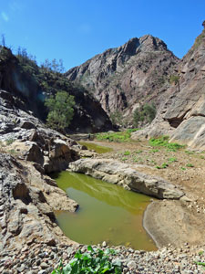
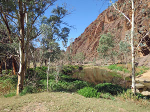
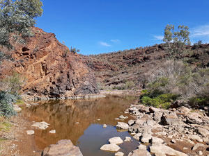
The gorge reached its narrowest and deepest at Hells Gate as it twisted its boulder strewn course around through the hills. Soon after, we came to a junction and the start of the Monarch Mine loop. Leaving the Balcanoona Creek track, we headed north up Wortupa Creek. Dry at first, we soon noticed lusher riverbank vegetation and thick patches of reeds - then a water crossing. We were nearing the Weetootla Spring, which feeds a small section of permanent water in the creek. It was enough water for a fish population to develop, as we were shown when we came across a group of volunteer conservationists measuring fish lengths and checking on the health of the system. |
||
 At the junction with Wortupa Creek |
 |
 Crossing a pond at Wortupa Spring |
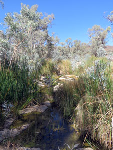 Lush spring-fed vegetation |
A little further on, after one last water-crossing through the reeds on a set of smooth white magnesite boulders, we reached our exit point, heading upwards into a jumble of worn arid hills. |
|
 |
 Looking back at Wortupa Creek and the Balcanoona Range |
|
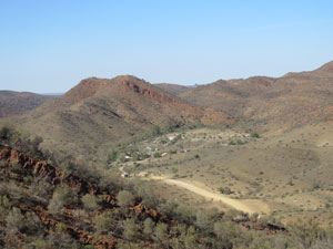
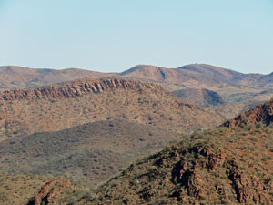
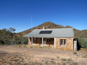
The track climbed steadily around ridge and flank as views opened up. To the east, the steep rocky walls of the Balcanoona Range glowed red in the afternoon sun, while to the south-east lay the slot of Hells Gate. Winding our way around, we reached Magnesite Saddle, with views now opening out to the north and west - over the fringing range and lumpy hills of the Illinawortina Pound. Down in the valley to the south, we could pick out the form of Grindells Hut, once an outstation of the Balcanoona Station. |
|
|
|
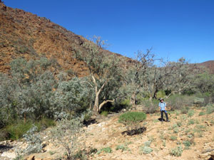
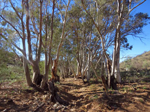
Continuing on this very pleasant ridge meander, we passed the ruins of the Monarch Mine, a failed copper venture of the early 1900s. The long and winding descent towards Grindells Hut now commenced, leaving behind magnesite for landscapes of dolomite and siltstone. The geology here is amazing. A few hundred metres before the hut, we reached Balcanoona Creek once again and the end of the impressive Monarch Mine not-quite-loop. Turning east, we headed back along the creek - wide and lined with tall river redgums. |
||
 The abandoned Monarch Mine |
 Grindells Hut |
 Back in tree-lined Balcanoona Creek |
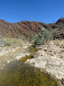
A band of dark blocky tillite cliff forced the creek into a narrower bend which we followed around, before exiting to cross a gentle saddle that short-cut the next bend in the river. Returning to its stony bed, we soon found ourselves back at the first junction - loop completed. All that remained was to retrace our steps back through Hells Gate and the Weetootla Gorge to the trackhead, a second chance to admire its impressive geology. |
||
 Outcrop blocking Balcanoona Creek |
 On the way home |
 At Hells Gate again |
It was time to head on to Arkaroola for our 4-night stay, but we agreed that this had been a very nice introduction to the walking tracks of the Gammon Range - Arkaroola region. |
|
Acacia Ridge (6 km - 280m ascent - 230m descent) |
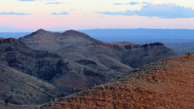
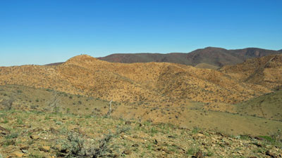
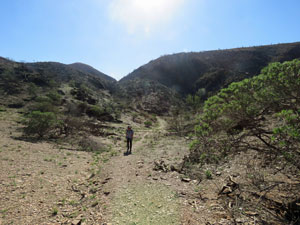
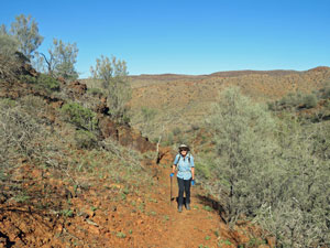
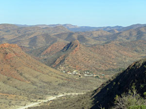
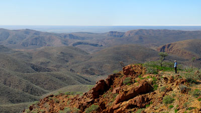
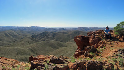
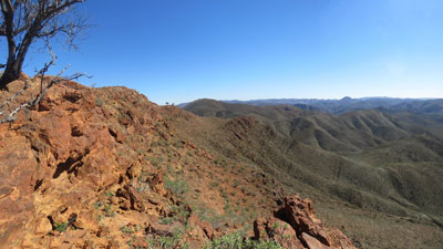
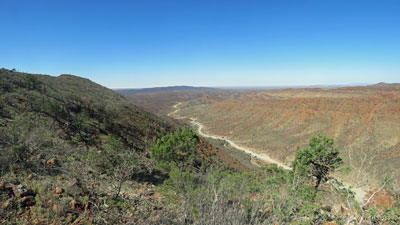
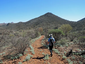
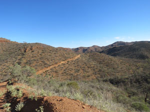
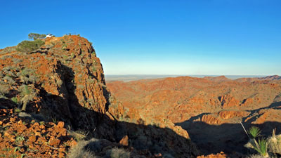
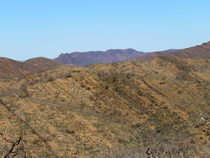
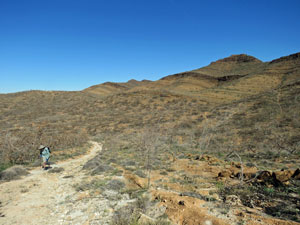
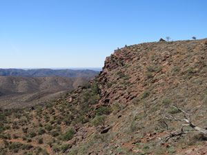
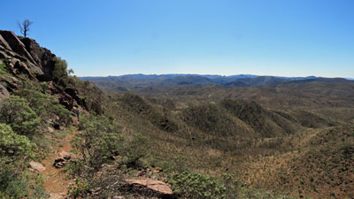
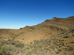
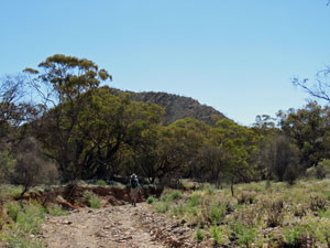
Having just arrived at Arkaroola, it seemed a good idea to first get our bearings. An excellent way to do this is by walking nearby Acacia Ridge, a relatively isolated outcrop to the south-east of the tourist village. Even better, the village provided a daily bus drop-off at the trail head, from where you could climb the ridge and descend directly back to your accommodation. Thus, we found ourselves getting off the bus at the southern end of Acacia Ridge and starting its gradual winding ascent. The track was well-formed and well-signed, as it led us on a gentle gradient that steadily climbed the western flank, winding around a couple of gullies in the process. The views out to the west of the long banded hills of the Gammon Range improved as we climbed. |
||
|
|
|
|
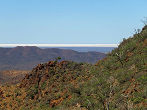
Eventually, we crested the ridge and turned back southwards for the short climb to its summit and the 360 degree panorama that awaited. It was superb, as we could now look out to the north and east to see the more chaotic and dramatic Arkaroola landscape, with its peaks and ridges, pounds and gorges. Beyond the ranges to the east, the white salt band of Lake Frome stretched out on the horizon, glistening in the morning sun. |
|
 |
 Surveying the world from Acacia Ridge |
|
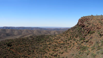
We spent a bit of time on the summit, enjoying this wide, brown landscape, before starting our descent on the northern end. Ahead, we could see the buildings of the tourist village nestled between arid knobs. This time, the track at first stayed on the eastern flank of the ridge, before directly following its narrow spine down. It was a steeper trajectory than the ascent on a rocky path. |
|
|
|

 The road into Arkaroola |
 |
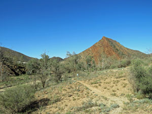
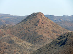 A prominent nearby hill |
 Heading down the ridge ..... |
 .... along a well-formed track |
 The dry bed of Whywhyanna Creek |
We were soon at the bottom, and a short walk up the stony bed of Whywhyana Creek brought us back to the village. Acacia Ridge certainly provided us with an all-over view of the Arkaroola landscapes and, if you were to rate short walks, this would be right up there with the best. |
||
|
Ridge Top 4WD Drive (42 km - 1440m ascent - 1440m descent) |
The "signature" adventure at Arkaroola is the Ridgetop Drive, which takes you out into the heartland of these rugged ranges on what were old 4WD mining tracks. Now we are not really 4WD people and I believe vehicles are designed to get from A to B, not for pleasure, but there is no other way to see this country, so the fair Nello and I signed up for a tour in the afternoon, after finishing our Acacia Ridge hike. In fact we were quite lucky, as no-one else had done so, so it was only the two of us with our congenial and informative driver, Andrew, who headed out on the tour vehicle (a Toyota Hilux with shaded seats bolted to the tray). |
||
 Mt Oliphant |
 Mt Gee |
 View from Coulthards Lookout |
Thus began a quite amazing adventure, as we headed out to the north of the village, following the Whywhyana Creek up and on through the locked gate to the ranges beyond (the route is too dangerous to allow the average four-wheel driver in and there is no way to tow a broken-down vehicle out). |
||
 The salt surface of Lake Frome in the plain beyond |
 The Armchair |
 Old mining track through the hills |
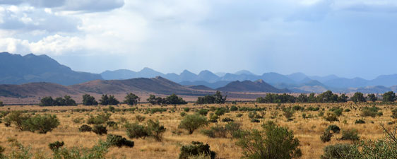
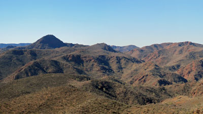
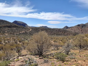
It took us 3 hours to drive the 21 km to the end of the track, cranking slowly up steep and shaly inclines, down rain-rutted slopes, along stony creek bed or narrow ridges and traversing steep and rocky flanks, as we meandered our way out into this chaotic and beautiful landscape of peak, ridge, creek and pound. A pair of wedge-tailed eagles soared high above - it was a good sign that wildlife was returning after the long drought. |
|
 View over Sunset Pound to Mt Painter |
 Mt Painter close up |
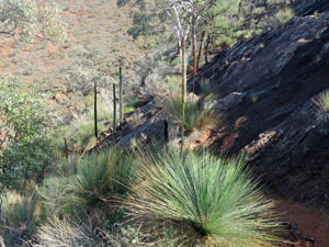
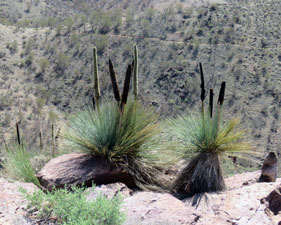
 Grass Trees at Split Rock |
 A steep climb out of Radium Creek |
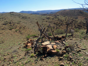
 Site of an abandoned radium mine |
We stopped at different places, where the views were at their most spectacular, learning about the geology and vegetation on the way. To be honest, we enjoyed every minute of bouncing, rocking and cranking up and down bouldery tracks with up to 24 degree gradients. |
||
 |
 Late afternoon light on the ranges |
 |
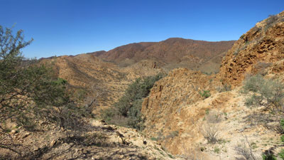
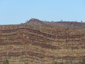
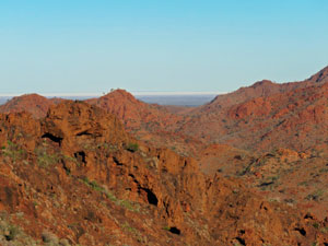
Arkaroola is considered a geologist's mecca - a place where ancient super-continents separated, where rocks of 1.6 billion years lie next to rocks a billion years younger (but still pretty old), where uranium decay has superheated the underground water to dissolve granite and turn it into an effervescent slurry, now visible on an eroded surface as the rugged red peaks of Arkaroola. The existence of such a variety of sedimentary, igneous and metamorphic rocks of such diverse age and history in such a small area is quite incredible. |
||
 Looking over Split Rock to the Freeling Range |
 The 4WD perched on top of Sillers Lookout |
 Afternoon tea at Sillers Lookout |
 |
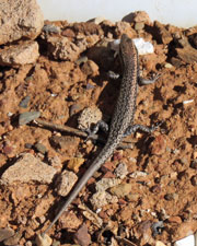
 A couple of locals |
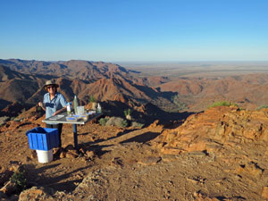
On reaching our furthest point north - the spectacular (and rather hairy for a vehicle to climb) Siller Lookout, we stopped to enjoy the late afternoon light while Andrew prepared an outback cuppa with lamingtons. Then it was time to retrace our path, slowly bouncing our way back to the village as the sun set over the arid ridges to be replaced by a pale crescent moon and a myriad of stars, as the desert sky around us darkened. It had been a great afternoon exploring country that we would never have seen otherwise. Sometimes, four wheels have an advantage over two feet.
|
|
Barraranna Gorge (8 km - 235m ascent - 235m descent) |
After a long day yesterday, we needed a more leisurely walk today. The Barraranna Loop seemed a good choice - only 8 km long, but exploring the gorges and waterholes of Arkaroola Creek. It seemed the perfect complement to the high walking on Acacia Ridge - a chance to get close to and intimate with the landscape. |
||
|
|
|
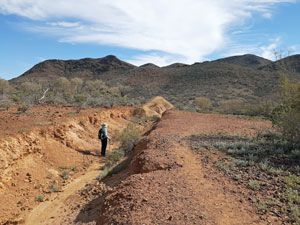
We drove out to the trackhead, pausing to have a quick look at some nicely coloured ochre banks in Oppaminda Creek on the way. The trackhead was surrounded by low arid hills and belied what was to come. We set out in a clockwise direction, climbing up an abandoned 4WD track to reach Spotted Schist Pass. Having just passed some copper stained volcanic basalt, and with schist on one side and a mix of conglomerate and sedimentary rocks on the other (due to a fault line) the amazing mosaic of Arkaroola geology continued. Every so often, geosite signs explained what was present. |
||
 |
 Junction of Spotted Schist and Arkaroola Creeks |
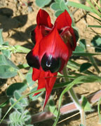 |
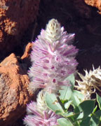
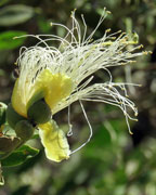
The track now descended down a pebbly creekbed, which seemed to be a water-rich habitat, as many of the shrubs and herbs were flowering, including the scarlet of Sturt's desert pea. This side creek led us into a picturesque small gorge, twisting its way through the dark rock walls of the range. Rounding a corner, the sheer, smooth western wall of Barraranna Hill dominated the view. |
||
|
|
|


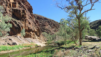
We headed towards it to reach the junction of Arkaroola Creek, diverting slightly from the track to wander up the creek into the mouth of Barraranna Gorge, where a string of waterholes lined the creek bed. From the debris and cracked clay surrounds, they could be much deeper after a good rain. It was a good spot for a break, sitting beneath some almost vertically folded sedimentary rocks admiring these surrounds. The gorge floor beyond was filled with large blocky boulders. |
 Barraranna Creek and Arkaroola waterhole |
 The rocky bed of the Barraranna Gorge |
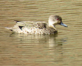
 A home for ducks in the desert |
Backtracking slightly, we continued on down Arkaroola Creek, passing another waterhole that was home to a small flock of ducks. The creek now widened with some statuesque white-trunked gums lining its bed. |
||
 |
 A green oasis in the arid gorge |
 |
 The tree-lined bed of Arkaroola Creek |
 |
 On the Paralana Hotsprings Road |
At the end of this passage, we emerged on to a gravel 4WD track that led to Paralana Hot Springs, and followed it along the creekbed to Stubbs Waterhole, set beneath some magnificent cliffs glowing red in the sunlight - a good spot for lunch. |
||
 A pair of red rock sentinels above Stubbs Waterhole |
 Stubbs Waterhole |
 Mara Murumuru Waterhole |
The route down Arkaroola Creek continued between these firey cliffs, passing the Mara Murumuru Waterhole. Here we took leave of the creek and followed the markers up into a narrow and deep sided-creek, lined with dark blocky rocks and boulders. |
||
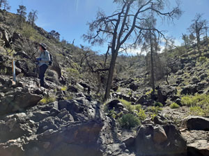
Beyond its entrance, the side-creek widened out into a small gulch. We followed this for a while, clambering up a couple of small, dry waterfalls, before climbing out of the creek and heading steadily up into the Welcome Pound, a broad basin that drained into Arkaroola Creek via our exit creek. |
||
|
|
|
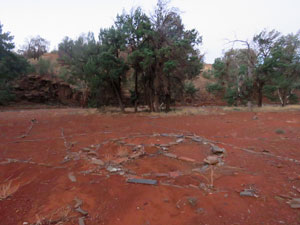
We were now nearing the end of the loop and, cresting the ridge, could see the remains of the Welcome Mine (a 19th century copper mine) and our car beyond. It really had been a fascinating walk - yesterday the high ridges and summits, today the deep gorges and creek beds. What an incredible landscape Arkaroola is. |
||
|
Oppaminda - Nudlamutana Track (15.5 km - 365m ascent - 290m descent) |
It was another perfect clear-sky day for our last walk in the region. We opted for the Oppaminda-Nudlamutana Track as it encompassed different landscapes than we had seen and passed through both Arkaroola Wilderness Sanctuary and the Vulkathunha - Gammon Ranges National Park. It was a linear walk, but again Arkaroola offered a daily 9am drop off at the Munyallina trailhead, some 15 km to the south. Again, we were the only two walkers and had the track to ourselves for the day. |
||
 Start of the Oppaminda-Nudlamutana Track |
 Gum trees in Oppaminda Creek |
 Nudlamutana Hut |
The start of the walk was along a flat 4WD track through low shrubby vegetation with rounded hills to the west. A few gentle undulations, as we crossed a small dry creek bed lined with redgums and we entered the National Park to arrive at the site of Nudlamutana Hut. Once an outstation of Balcanoona Station, it is now rented out as holiday accommodation. No-one was there, so we took advantage of the outside table and chairs for a brief stop and water top-up. |
||
 In the Vulkathunha - Gammon Ranges National Park |
 A forest of curly mallee killed by the drought |
 Rounded domes of the Gammon Range |
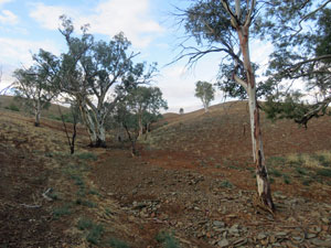
The walking had been easy so far, but on leaving the hut we climbed steeply up and over a dry saddle into a winding, undulating creek system. This led us even higher, but still on an old 4WD track, undulating through four small creek systems, with views of the higher ranges off to the west. The track notes said the walking here may be tedious. It was actually worse than that - it was depressing. These low hills and gullies were covered with stands of curly mallee, hopbush, tea-tree, acacia and other woody shrubs. Normally, that would make for a pretty walk, but the problem was that they were all dead - victims of the three-year drought and no sign of regeneration since the recent rains. It was as if we were walking through the Valley of the Shadow of Death and I fear that, with climate change, the droughts will be more frequent. What we were seeing was the beginnings of habitat transformation and that depressed us. |
|||
 Valley of the Shadow of Death |
 |
 |
 At last some surviving trees |
Fortunately, as we crossed a small rise below the higher ranges near Mt Warren Hastings, we found ourselves amongst living trees and shrubs and even a solitary curly mallee in full golden bloom - how good would a whole slope of them have looked! It seems that a spring-fed creek passes through this area. Although the spring was dry, there must have been enough sub-soil moisture for the trees to survive the drought. |
Mt Warren Hastings was our target and we now started to climb into the ranges. Following a rutted track up the creek, we passed the rocky source of the spring with its dense thicket of tea-trees, and wound our way steeply around to the western side of the range. |
||
 Spring below the ranges |
 View over the saddle to Lake Frome |
 On the ascent of Mt Warren Hastings |
Here, a well signed footpad left the old 4WD track and climbed gradually up to the ridge-line. At a small saddle, we had a brief glimpse out to the south-east where Lake Frome and its long white line of salt marked the horizon. |
|
 Westward view towards the Benbonyathe Hills |
 Looking south towards Mt McTaggart |
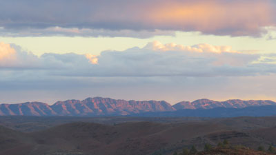
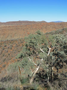
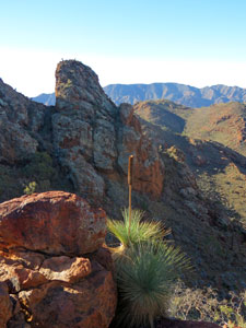
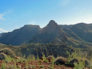
Then it was back on to the western flank of the range to steadily continue the climb, with superb views out to the Gammon Ranges in the west. The trees on these steep, rocky flanks had survived the drought and framed the views nicely. One last switchback brought us to the big cairn of stones on the summit of Mt Warren Hastings. Although only 590m high, it offered a glorious 360 degree panorama - from the knobbly horizon of Arkaroola's ranges in the north, to the smoother Gammon Ranges of the west, eastwards to the distant plains and salted horizon of Lake Frome, and to the rows of even more distant ranges stretching out to the south. The cool westerly wind was a bonus. |
|||
 The summit of Mt Warren Hastings |
 |
 |
 Grass trees on the summit |
 Grass tree silhouette |
 |
 Looking north towards Arkaroola country |
The route down followed a series of switchbacks on the steep eastern flank of the range, beneath the sheer sides of exposed rock. Spying a small saddle below that might offer both a bit of shade and a bit of breeze, we descended to it for lunch. The day was heating up. |
|
 The descent track from Mt Warren Hastings |
 Panorama of the eastern flank of Mt Warren Hastings |
After lunch we continued down the footpad out along a small spur to reach the 4WD track and the long valley home - once again we were in the Valley of the Shadow of Death, with the skeletal trunks of dead mallee and shrubs all about. The ground was green with regenerating herbs and grasses, but with not a single seedling of a taller shrub to be seen - it was a cruel hoax. |
||
 The aridity of the Gammon Ranges |
 A further section of drought-killed curly mallee |
 What a little groundwater can do |
The road followed the old fence-line between Arkaroola and Balcanoona stations - we followed it and the footprints of an errant emu in the white dolomitic dust. After a while, we entered a lower area, which seemed to have a richer network of small creeks - at least that might explain the sudden verdure and presence of large mallees, wattles and other shrubs, which brought a bit of joy to the spirit. For the last 4 km, the vegetation seemed in pretty good condition. |
||
 In a lush grove of mallee |
 |
 Whywhyana Creek |
These feeder creeks flowed into Whywhyhana Creek, dry but lined with elegantly tall river red gums and a pleasure to walk next to. However, after crossing its wide stony bed, the route turned into a dusty road for the last two kilometres and our thoughts turned to home. It was good to see the observatories and buildings of the village again. |
||
 The road back to Arkaroola |
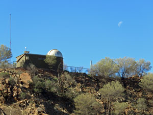 Arkaroola Observatory with crescent moon |
 Griselda Hill in front of the village |
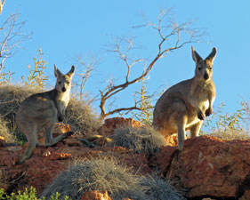
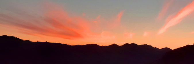
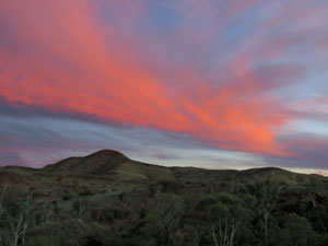
This was certainly a walk of parts - part depressive, part magnificent scenery as we have come to expect and part a little tedious. Perhaps after four consecutive walks and a 4WD trip we were "experienced" out. Tomorrow it is time to head for home, with no regrets for having finally made it to this unique part of outback Australia. But, before we left, we did the final must do activity at Arkaroola - headed out at evening to the creek opposite a rocky knoll for a bit of rock wallaby spotting. The superb sunset as we waited was a bonus. |
||
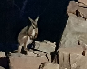 An endangered yellow-footed rock wallaby .... |
 |
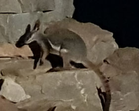 ....or two |
|