Stage 7 - Eurobodalla Coast
          (Bateman's Bay to Tuross Head)

Bateman's Bay to Lilli Pilli


Sunrise over Bateman's Bay (the early rise can be blamed on the end of daylight saving - but what a great time to be up)

At Bateman's Bay we passed the 300 km point of our journey. This stage commences with a quiz; place the footwear shown below in the order most used and guess the number of kilometres used per pair (hint: the total adds up to 300!). The answer is given at the bottom.


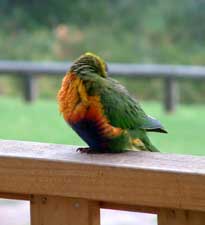
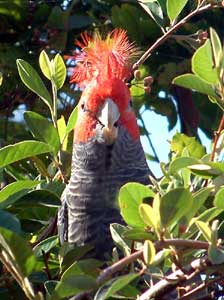
Gang-gang calls by to check out his website

Situated on a picturesque bay at the mouth of the Clyde River, Bateman's Bay and its satellite villages have long been a summer playground for the residents of Canberra in need of a dose of sun, sea and sand.


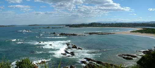
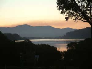
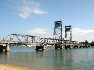
The lifting bridge over the Clyde River is a well known
South Coast landmark


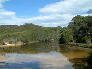
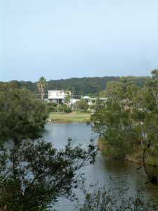
Clyde River waterscape


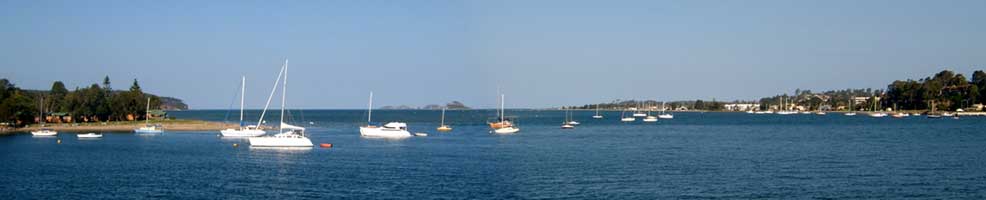
View from the Clyde River bridge toward Bateman's Bay

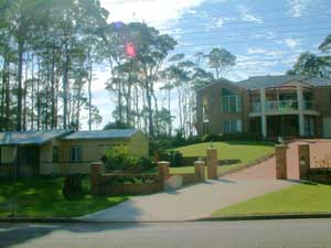
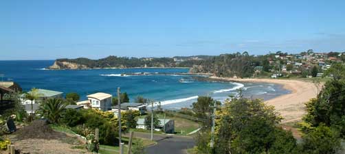
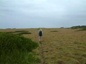
Today's stage was relatively short, as we were heading to the coast house of our good friends, Jenny and Peter, at Lilli Pilli, a peaceful and leafy village 8km south of "The Bay". The route crossed many of the place names familiar to the fair Nello, from when she and her family took their summer holidays here over 40 years a long time ago - Batehaven, Casey's Beach, Denham's Beach, Surf Beach. As we strolled along Beach Road, she remembered when it was a quiet no-through road linking a number of isolated villages. Today it has become a noisy major thoroughfare along what is now a long unbroken stretch of suburbia. People's love for the coast has led to many moving here permanently, particularly as our baby-boomer generation has started reaching retirement age. Such is the price of progress!


Casey's Beach


A contrast in coast house styles


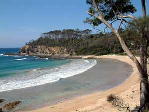
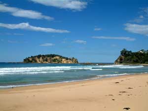
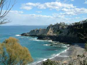
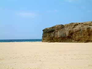
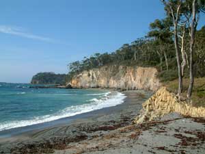
Cliffs between Surf Beach and Lilli Pilli


At Surf Beach, I remembered a coastal track that followed the headlands and coves around to Lilli Pilli, so we left the noise of cars and finished our walk to the noise of the bush and surf. You do not have to get far away from the main roads to see why people are still attracted to this beautiful area.


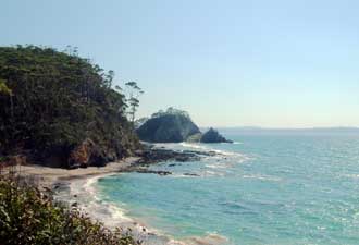
Looking north from the cliffs


Lilli Pilli Beach

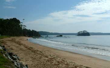
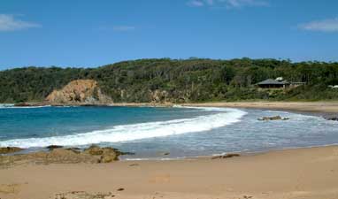
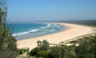
Finally we crossed Lilli Pilli Beach, a little pearl of a beach tucked away between two rocky headlands, before climbing up the hill to Peter and Jenny's place. Sitting on the deck of their house, looking at the ocean horizon through the silhouette of tall eucalypts and sipping a gin and tonic as the fragrance of frangipanis wafted up from the garden below - you can see why the South Coast is such an attraction to people living in inland cities.


Quiz Answers:

    1. Sandshoes ...... 93 km
    2. Sandals ........... 87 km
    3. Boots .............. 74 km
    4. Bare feet ......... 46 km


Lilli Pilli to Mossy Point

Ah! The things one can achieve with that extra morning hour when daylight saving ends. Up with our biological clocks, we walked down to Lilli Pilli Beach for an early morning body surf in its nicely shaped waves, before a leisurely breakfast and departure on our next stage. We had barely gone 500 m, when we had our first stop - a cappuccino break on the deck of a pleasant café overlooking Mosquito Bay. It would have been easy to stay there, but we had a long day ahead, and pushed on through the back streets of Malua Bay to reach a million-dollar view over Malua Beach. I say this literally as any house in this part of the world with such an ocean view would now cost well over $1 million.


Peaceful Garden Bay

Million dollar view over Malua Bay

Crossing the beach, we climbed over another suburban headland to finally reach the start of a walking track on the southern end of Pretty Point. The view to the south from here was spectacular, with a sweeping panorama of the rugged coastline from Jimmie's Island to Mackenzie's Beach. The track led down to Mackenzie's Beach, a beautiful little circular cove of clear blue water and broad sandy beach, guarded by cliffs on either side.


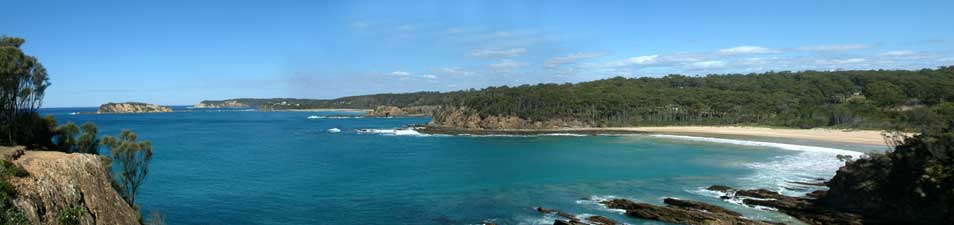
Panorama of the coast from Jimmie's Island to Mackenzie's Beach
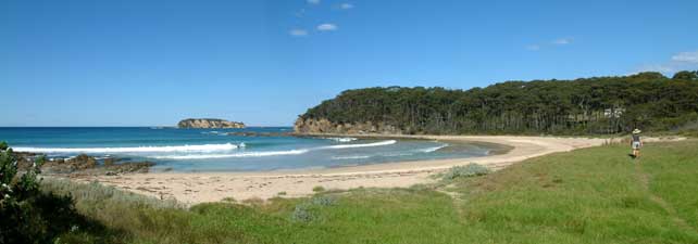

Mackenzie's Beach


Our attempt to walk around the rock platform at its southern end was thwarted by a deep channel, so we backtracked and climbed up over the trackless headland, before again picking up the walking track up through Rosedale and down on to the long sweeping curve of Rosedale Beach, blocked at its southern end by Jimmie's Island (I wonder who Jimmie was).


Sweet pittosporum berries


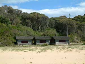
What price absolute beach frontage? These are the 3 cabins
that Nicole Kidman bought for $1.5 million


... but then this is the view from her window!


A quiet coastal creek


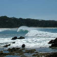
Nice wave at Rosedale

The track to South Rosedale Beach

From Rosedale, the track led us slightly inland through coastal forest, before emerging at heritage-listed Guerilla Bay, with its impressively tortured rock formations and cliffs at either end of a quiet little cove. What better place to stop for lunch.


Southern end of Guerilla Bay

Northern end of Guerilla Bay

Climbing up through the secluded coast houses set back in the bush from Guerilla Bay, we reached the top of the southern cliffs of Burrewarra Point. Winding through the dense heathland of the point, the track regularly emerged at cliff-top clearings, revealing panoramic views across Broulee Bay, as far south as Mount Dromedary, 80 km to the south, and to the mountains of Deua National Park on the western horizon. Sometimes it is difficult to find the right superlative to describe what you see, but the coastal scenery that we had been passing through since Malua Bay was nothing less than inspirational.


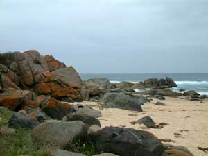
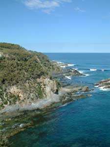
The cliffs of Burrewarra Point

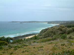
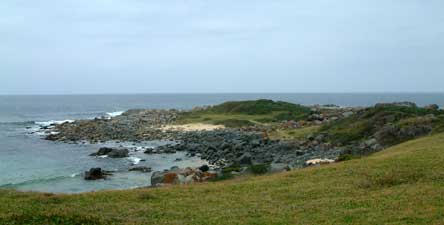
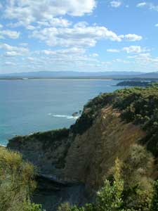
Looking south over Broulee Bay


Secluded cove west of Guerilla Bay with
Mount Dromedary 80 km south on the horizon


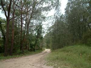
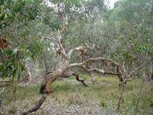
Heading west, we followed the track inland and down into a dense thicket of casuarinas, before climbing up once more through a forest of tall spotted gums, ironbarks and burrawangs. The rapid changes in the composition, height and density of the vegetation as one moves in and out of different heathland and coastal forest habitats adds to the enjoyment of any walk on the South Coast.


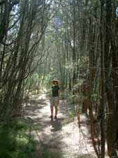
Passing through a casuarina thicket


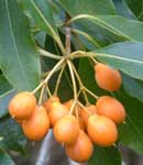
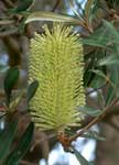
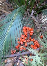
A ripe burrawang cone

Back amongst the tall eucalypts

Finally, we reappeared on the shoreline at the eastern end of Barling's Beach, with its backdrop of hazy blue mountains. Following the beach along, we eventually reached our final obstacle; the entry to the Tomaga River - time to get out the inflatable air mattress and bathers for another river crossing.


Barling's Beach


Crossing a paddock behind Tomakin

Looking south toward Mossy Point and the mouth of the Tomaga River


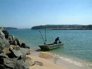
Crossing the Tomaga River

As we were got ready to cross the river, Nello noticed a familiar figure on the other side; Sara, her sister. We were going to spend the next two nights at her partner David's coast house and she had walked to the river in the hope of meeting us.

Once over, it was just a short walk for the three of us to reach the coast house at Mossy Point. The walk had been one of the most spectacular of our trip, with magnificent coastal scenery under a clear sunny sky, and what was even better was that we were thoroughly pampered by Sara for the next few days, with fine food, wine and company. Thanks for a great bit of R & R, Sara.


Mossy Point to Moruya Heads


After a pleasant day of doing very little and eating very well, it was time to move on again, though this time we would have the company of Sara, Nello's sister, for the stage. We were also leaving behind a landscape of rocky coastline, indented with small coves and secluded beaches and entering a different landscape where long-sweeping beaches were separated by relatively small and isolated headlands.


Late afternoon at Broulee

The sun shone brightly, with a slight haze over the distant mountains, as we headed down Broulee Beach before crossing Broulee Head to look down the vast expanse of Bengello (or South Broulee) Beach, stretching 6 km toward the mouth of the Moruya River. This was to be our highway south and, apart from the odd surf fisherman, beachworm collector and person playing Russian roulette with the sun for a bronzed body or a dose a skin cancer, we were alone to enjoy it.


Surf's up, class is in - School kids learning to surf at Broulee


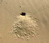
The sand crab must be the most abundant animal on our beaches and its burrows dot the sand

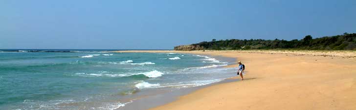
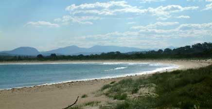
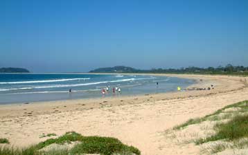
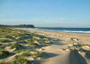
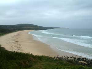
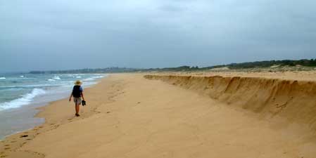
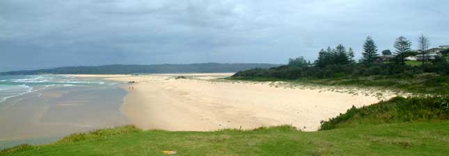
The 6 km long sweeping curve of Bengello Beach
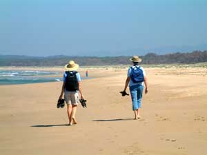

Two sisters

Hunting for beachworms

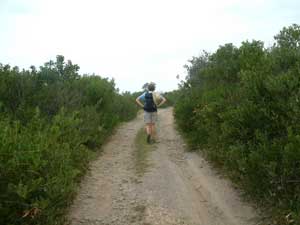
Sandy track through the dune heath

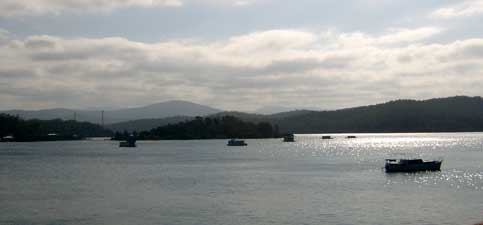
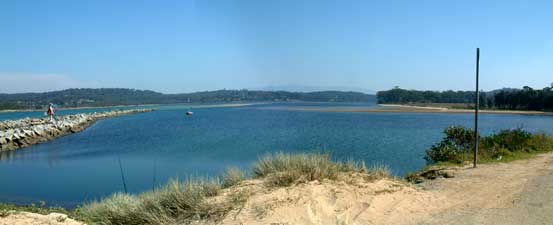
Overlooking the Moruya River

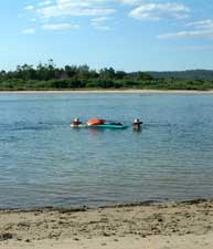
The retired oyster punt that took us over the river

Finally reaching the breakwater of the Moruya River, we climbed over the low dune to the sight of the river disappearing to the west under a backdrop of hazy blue mountains. As we admired the view, a strange barge-like vessel pulled up on the sandy shore. It was a "retired oyster punt" and was our means of transport for crossing the Moruya River. Its friendly driver from the Moruya Boatshed had motored up from Moruya township, 6 km upstream, to pick us up and deposit us on a tiny beach next to the opposite breakwater.


The granite blocks of the Moruya breakwater reach seaward -
Moruya quarries were also the source of granite for the pylons of Sydney Harbour Bridge

Following his good advice, we crossed the granite boulders of the breakwater and rounded a small beach to find a peaceful, shady picnic spot near Shelly Beach on the South Head; time for one last gourmet meal, as we feasted on a lunch of minced lamb, bacon and tomato tart, with accompanying Greek salad and fresh juicy nectarines prepared by Sara.

.
Gourmet lunch - courtesy of Sara


Lunch over, it was time for farewells, as Sara headed back to Mossy Point and Nello and I continued southward, though this time we had just a short walk over South Head to the Dolphin Beach Tourist Park, sheltered behind the dune heath.

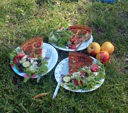
We had had a very sociable last week. Thanks to all our friends who came down to help celebrate the fair Nello's birthday and who shared their houses and company with us.


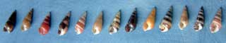
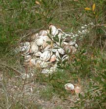
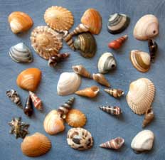
A collection of beach shells - by special request
for Jules


Late afternoon on Dolphin Beach

Sunset over the Moruya River

Moruya Heads to Tuross Head


Looking at the map, this stage appeared to be a fairly direct route along the beach with a few headland crossings with no real features of interest, one of those journeyman days where the only aim is to get to the other end as quickly as possible. How uninformative maps can be; the South Coast was about to reveal more facets of its diversity and provide us with another fascinating trek.

Having sampled the soft sand of Dolphin Beach the previous evening, we decided to follow a dirt road that parallelled the beach inland for the first few kilometres. The road passed through coastal heath dominated by gnarled old banksia trees, illuminated with their lemon-coloured flowers. Where soil quality improved, patches of taller eucalypts replaced the banksias and in damper areas we passed through groves of casuarinas.


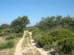
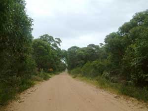
Dirt road parallelling the coast

Eucalypts on the left and casuarinas on the right
- the changes in vegetation were quite strongly defined

Gnarled old banksias

Finally we emerged at Congo, a tiny isolated coastal village. Dropping down to the beach again, we rounded Congo Point, a softly moulded sedimentary headland. The twisted, jagged metamorphic rocks forming the headlands of the previous few days were now behind us. Ahead of us, the next headland glistened black in the sunlight; the first basalt flow that we had seen since near Bawley Point, 70 km to the north.


Coast houses near Congo Creek

The sun shone warmly on us, but a glance behind revealed the future of the day; dark grey clouds were approaching quickly from the north as we climbed up the heath-covered dunes and picked up a track heading inland from the southern edge of Congo village.


Sedimentary cliffs of Congo Point

Basalt cliffs 2 km south of Congo
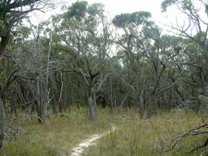

The weather ahead looked very promising but .........


...... dark clouds were chasing us from behind

Small pockets of undisturbed bushland, long narrow sections of coast, coastal lakes and wetlands and small islands have all been incorporated into the widely dispersed Eurobodalla National Park to protect them from further coastal development. The National Parks and Wildlife Service has done a great job in developing a system of marked trails within these park fragments and these, linked by sections of beach walking, formed the remainder of our path for the day. While walking through Murramarang National Park earlier, we had also noticed many improvements to park infrastructure. The National Parks and Wildlife Service deserves to be applauded both for the way in which it is taking steps to protect the beauty and diversity of the South Coast and for facilitating access to it.


Ironbark forest

View toward Meringo from a grassy headland

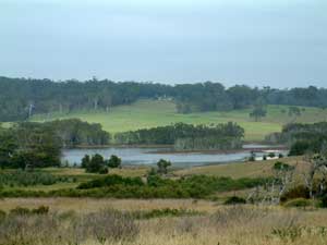
Rural landscape at Meringo

The marked track led us through an open ironbark forest before emerging on a grassy headland with panoramic views over Meringo and Mulimburra Point. Meringo is an old dairying property and the green rural landscape that we glimpsed contrasted sharply to the blue-grey of the coastal forest. We descended to the sandbar blocking the mouth of Meringo Creek and crossed the deserted beach, before climbing back up the next headland, where made our only human encounter for the day - a farmer riding a very large draught-horse. He told us that he was returning from Tuross and the giant hoof prints of his horse appeared from time to time throughout the day to assure us that we were on the right path.


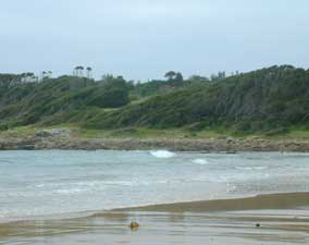
Sand bar across Meringo Creek


Looking north from Meringo


Wind-sheared vegetation on the seaward side
of a headland
Climbing up through the wind-sculpted shrubs on Mulimburra Point, we again entered a diverse and changing vegetation, low acacia heath, taller banksias, scrubby coastal mallees, casuarina thickets and clumps of paperbark, as the track threaded its way across the headland to Meringo Beach.


In a grassy clearing

Track through the acacia heath


Wind-twisted coastal mallee

Lichen covered rocks on Meringo Beach


Again a changed and confusing geology confronted us in the form of mixed granite and basalt boulders, partly covered by orange-coloured lichens, brilliant against the grey sky that had by now engulfed us. At the southern end of the beach, Bingie Bingie Point is a well-known site for geology students because of the complexity of the igneous rock formations found there.


Bingie Bingie Point


Modern day middens - the remains of an abalone poacher's picnic


Crossing a grassy headland

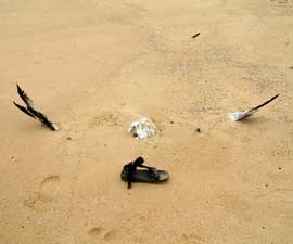
The 2.5 m wingspan of an albatross -
What an ignominious end for this king of the ocean swells

The ocean is continually reshaping beaches

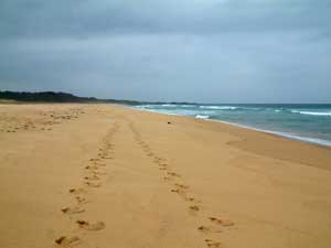
5 km seems such a long way in the calf-burning
soft sand of Bingie Beach

From Bingie Bingie, we could see the silhouette of Norfolk Island pines that marked Tuross Head. Only the 5 km stretch of Bingie Beach separated us from our destination. An hour and a half later, we arrived with calves aching; it is surprising how much soft sand can slow you down. However, the diversity of vegetation and geology had ensured that our fascination for the South Coast did not diminish.

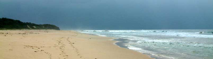
Bleak days in Tuross

Tuross Head is a beautiful place, nestled in between the broad waters of Lake Coila, ideal for sailing, and the winding channels and reaches of Tuross Lake, much loved by fishermen. These, plus the superb beaches, make it a great spot to stay, and we have spent several sunny and enjoyable weekends over the years on the beach or skimming across Lake Coila on a sailboard.

However, this time we were to be denied by the weather, and we spent three days at Tuross with a dense fog, grey skies, drizzle, strong winds, occasional heavy rain and the occasional tauntingly brief glimpse of sun or moon. The south coast appeared to be giving us a sample of every type of weather that it could conjure up.

The art became to discover the beauty in bleakness and the images below are an attempt to do so as well as give a feel for Tuross and its surroundings during the breaks in the weather.


Fog on Tuross Lake

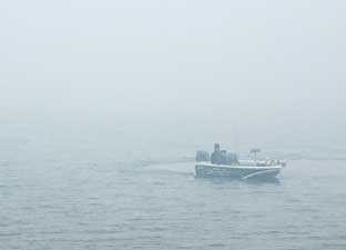
Fisherman emerging from the fog
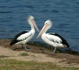

Percy and pal

Grey skies do not stop the avid water skier

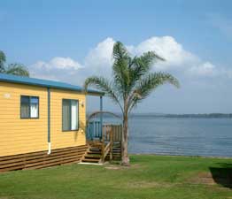
Not so bleak -
the sun breaks through at our waterfront cabin


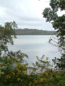
The serenity of Tuross Lake


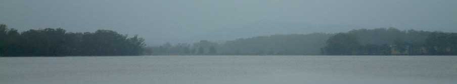
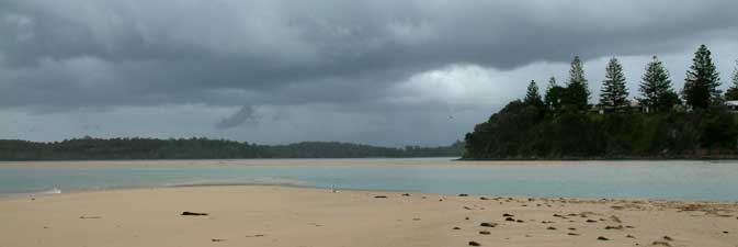
Bleak skies over Lake Tuross (for comparison with the image on the banner at the top of the page)
- well done to those who had already recognised the banner image as Tuross


View over One Tree Beach toward the entrance of Tuross Lake

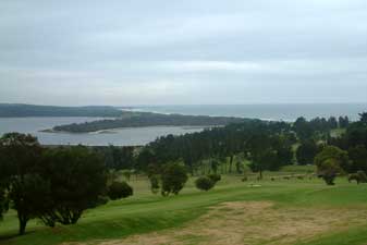
View over the golf course to Lake Coila and the ocean


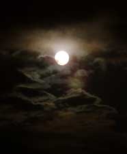
A brief glimpse of the moon
between showers


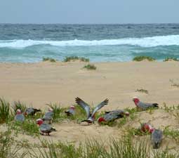
A new species - the sea galah

When it rains you can always
sleep on the balcony