
| African Safari - Namibia (part 1) |
Day 3 - Orange River to Fish River Canyon |
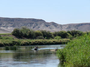
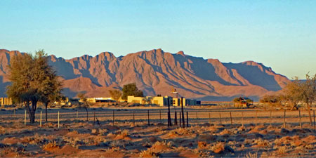
It was a beautiful morning when we woke at Fiddler's Creek campsite - clear blue skies, no wind and the rugged barren hills of Namibia reflected in the glassy waters of the Orange River. Even better, we had a couple of hours to relax by the river bank, watching the long fronds of water weed swaying in the current and cormorants flying low across the surface, as well as listening to the sweet twitterings of birds in the riverside reeds and trees. |
||
 Canoeing the Orange River |
 |
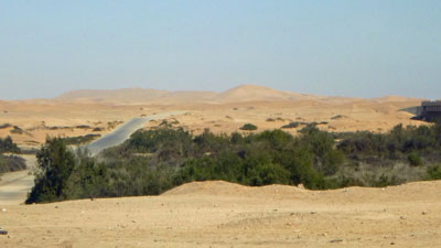
 Orange River - border between South Africa and Namibia |
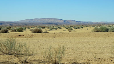
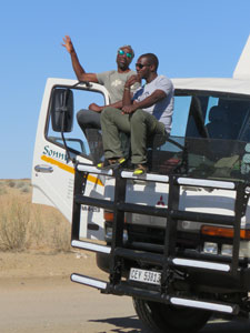
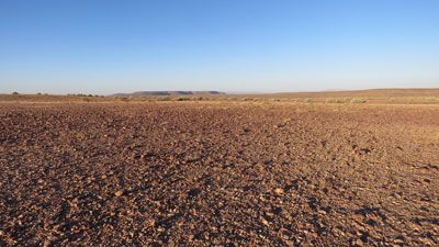
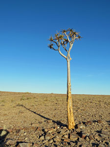
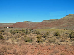
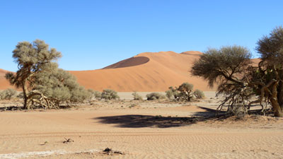
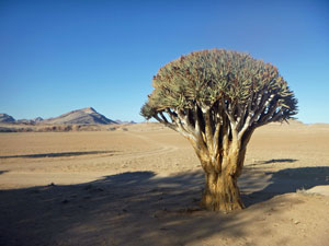
A couple of hours canoeing on the river was an option that we had declined. When those that did the canoeing returned, a bit wet, a bit tired and a bit sunburnt, we quickly packed up, broke camp and headed back to the border crossing. Some 90 minutes later, we had checked out of South Africa, crossed the Orange River and checked in to Namibia. Our drive through the Namib Desert continued. We had the smooth sealed highway for only a few kilometres, before turning off on to a gravel road that headed westwards in the direction of the Fish River Canyon. Far from being a uniform landscape the Namib is constantly changing - flat in parts, rolling hills in others, grassland and low shrubs here, scattered clumps of low shrubs on bare earth there, and the occasional strange silhouette of an aloe tree. |
|
|
|
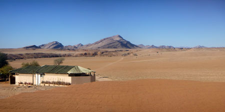
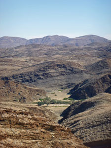
After a while, we entered a region of low rocky hills as we approached the canyon and wound our way through them to Hobas Campsite - a veritable oasis of shady trees in the desert (watered by a 10 km long pipeline to the Fish River). It was late afternoon, so we quickly set up camp before climbing back into the truck and following the pipeline to the rim of the Fish River Canyon. |
|
|
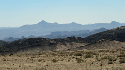
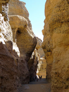
 Approaching the canyon |
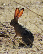 Long-eared desert hare |
|
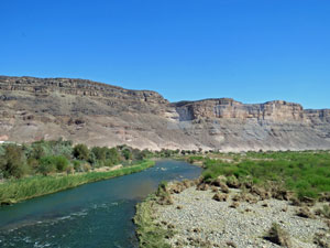
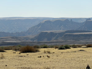
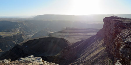
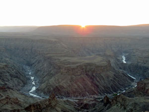
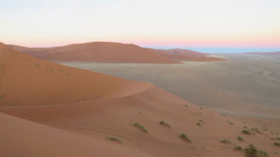
We had two hours before the sun disappeared - time to take a walk along the rim before watching the spectacle of sunset over the canyon walls. The first sight of the canyon was breathtaking, as the walls fell steeply to show the course of the inner canyon and the waterholes of the Fish River glistening at its base.
|
|
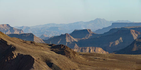 Fish River Canyon - view to the south |
 Fish River Canyon - view to the north |
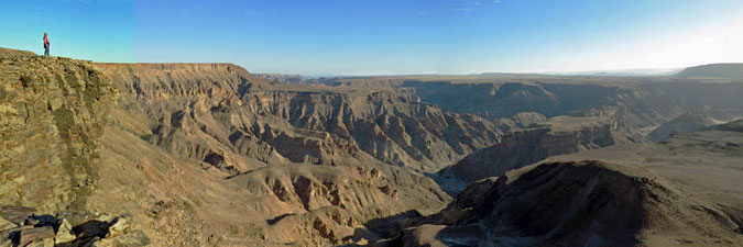
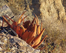
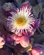
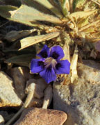
Views slowly changed as we strolled along the clinking volcanic rocks of the rim. It was an almost lunar landscape, yet even here, tiny plants found enough moisture to bloom - finding the scattered specks of colour was like fossicking for gemstones. |
|
|
 Lunar landscape of the canyon tops |
 |
|
 |
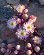 |
 Desert blooms |
 |
 |
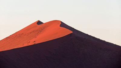
 The sun sets over the horseshoe bend of Fish River Canyon |
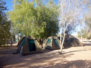 Campsite at Hobas |
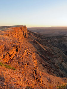 The setting sun turns the canyon walls red |
After the sun finally set, painting the rocks of the canyon walls a vivid brick red, we headed back to camp for another of Jojo's delicious dinners and our first night under the incredibly clear, starry-bright night sky of the Namib Desert. |
||
|

Day 4 - Fish River Canyon to Sesriem |
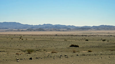
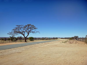
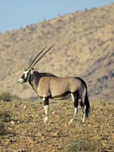
Yet another cloudless day in the Namib Desert. Packing up camp was now becoming easier after a couple of days of practice and we were on the road by 7.45am. Retracing our route briefly, Justice turned Sonny the truck left and we headed off in the direction of Sesriem - 7 hours away on wide, but rough, gravel roads. It was to be a long day, but with changes in the tapestry of the desert floor and the occasional sightings of springbok, oryx and ostrich out on their morning perambulations, time passed smoothly. |
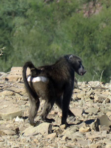 A baboon salutes us |
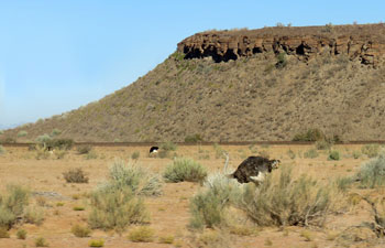 Ostriches grazing the desert flats |
 The dry sandy bed of the Fish River |
Then, surprise, surprise, an oasis of greenery appeared - long rows of palm trees and grape vines stretched out from the road. Big business had dammed a small river to create a mega agricultural enterprise in the middle of the desert. I hope that it is sustainable. |
||
|
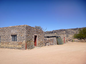
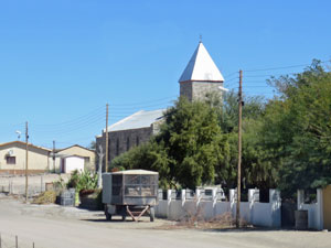
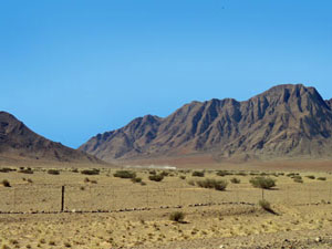
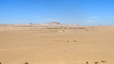
Reaching the Fish River at a point above its canyon, we made a short break for "bushy-bushy" and to take in the views of the low red hills framing a wide sandy bed with a few waterholes and a long line of trees. This is the major river of the Namib. Once across the Fish River and through the rocky hills on its eastern flank, we returned to the flatness of the desert, stopping briefly in the tiny town of Bethanien - for fuel, coffee and a glimpse of the oldest building in Namibia, a Lutheran church built in 1899 - and a stop for lunch under the shade of a silky oak (a bit of nostalgia for home). Interestingly, almost all this sparsely vegetated open land is fenced, as much of the Namib is privately owned rangeland where cattle and goats find hard pickings. |
|
|
|
|
|
|
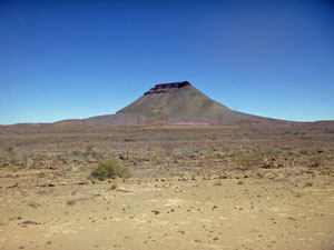
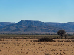
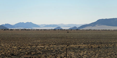
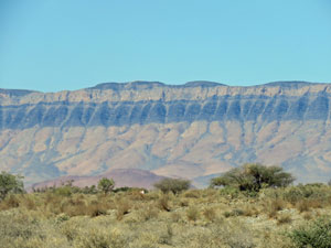
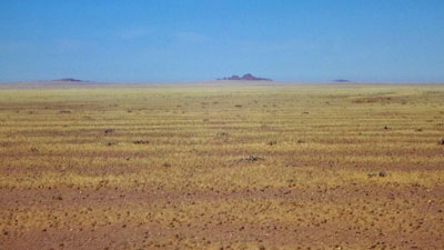
The long drive continued in the afternoon, through the changing landscapes of the Namib - long flat stretches, some sparsely grassed after a rare rain event, others bare sandy soil with tufts of small hardy shrubs. Distant mesas and low rocky ranges passed by in an hypnotic blur. |
|
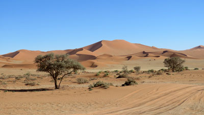
 Grasslands and mountains |
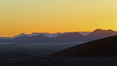
 Evening light on the mountains at Sesriem |
After a while, the mountains bordering the wide desert flats became more prominent and with one long last surge of rocking and rattling, Sonny the bus cruised into the Sesriem campsite - a broad expanse of sand and shady camel-thorn trees. A twittering of weaver birds from their massive straw communal nest in one of the trees greeted us. |
||
 Social weaverbird ...... |
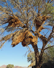 .... and its massive communal nest |
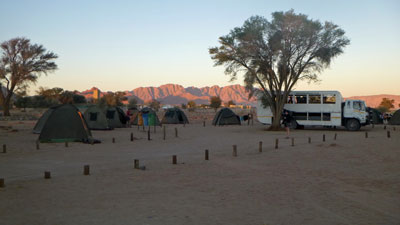 Evening at Sesriem campsite |
This site was well-served, with a bar for a cold beer and even a swimming pool, supplied by a deep bore. How pleasant it was to relax in its cool water and soak away the aches of our 7-hour trip through the desert. |
|
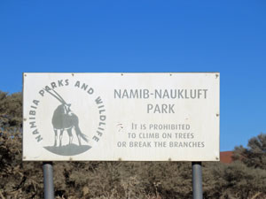
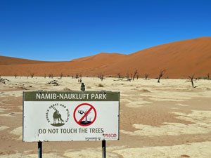
Day 5 - The Namib-Naukluft National Park |
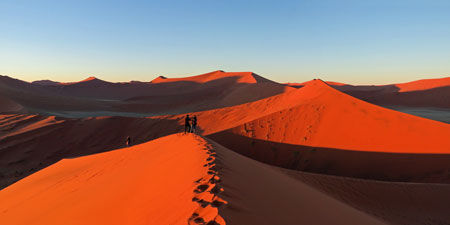
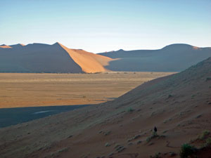
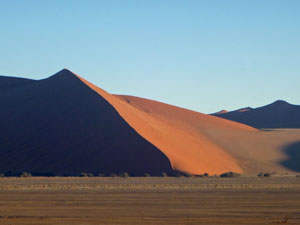
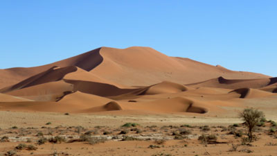
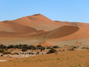
Today was to be, for me, the highlight of the trip, a visit to the famous red sand dunes of the Namib Desert. We started early, up before 5am, to drive the 40 odd km or so to the dune area. This stretch is probably the only sealed road in the deep Namib, and Justice wound up Sonny the truck, roaring along its smooth surface in the pre-dawn darkness to get us to the famed Dune 45 before sunrise. |
||
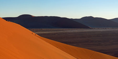
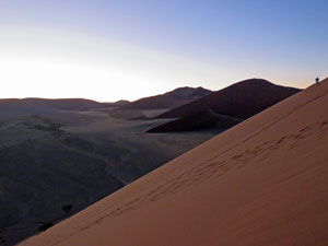 The slope of 300m high Dune 45 |
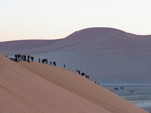 Climbers heading up the crest of Dune 45 |
 View to the east from the dune |
He did it, and we were head of the queue, trudging our way up the steep soft red sand ridge of the 250m high dune as the sky began to lighten in the east. It was a cold desert morning and we were rugged up in parkas and beanies as we climbed steadily up the narrow ridge of Dune 45, reaching the top and heading on a little further to find a prime viewing position. |
|
 Pre-dawn glow in the eastern sky |
 The pastel pre-dawn shades of the dunes and Sossusvlei clay-pan |
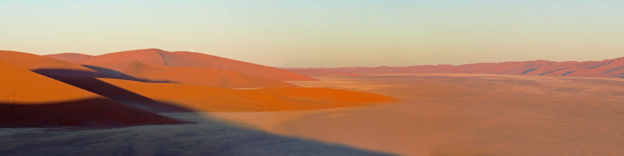
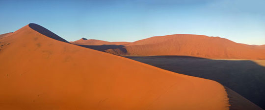
It was magnificent to watch the changing colours of the desert sunrise – as the sun cleared the horizon, the pre-dawn yellowness of the eastern sky suddenly vanished and the endless dunes around us glowed red in its rays. We stayed on the dune for more than an hour, revelling in the changes of colour and the contrasting patterns of light and shade as the sun climbed slowly higher. The photos below barely do the spectacle justice. Finally, we descended the western flank of the dune for our reward - one of Jojo's hearty breakfasts. |
|
|
|
|
|
|
|
|
|
|
|
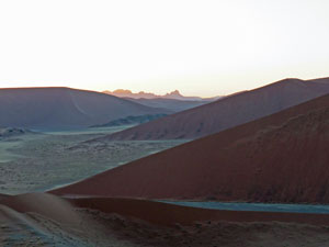
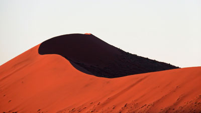
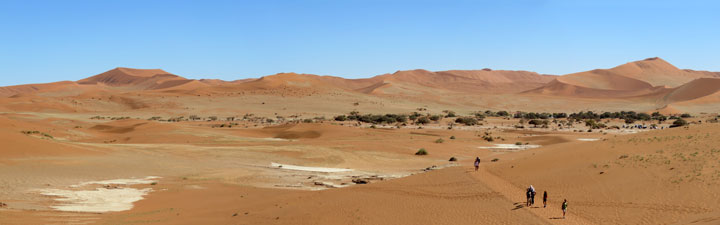
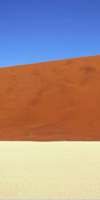
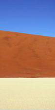
Then it was deeper into the park, driving down the wide Sossusvlei claypans that separate two long lines of enormous undulating dunes, to reach the end of the road. From here, we proceeded along a soft sand track, towed in a trailer by a John Deere tractor, to reach the end of the valley. Dunes lay all around us, Big Daddy and Big Mama, both over 300m tall, looking over the remnants of clay-pans and scatterings of camel-thorn trees. |
|
 |
 |
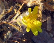
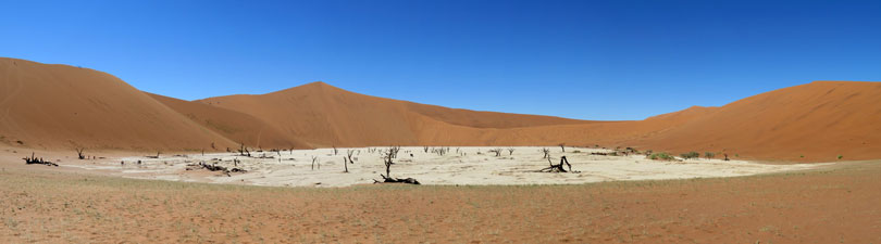
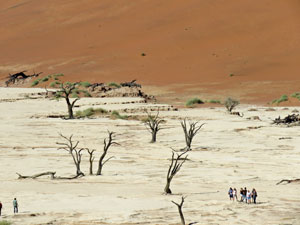
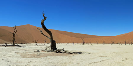
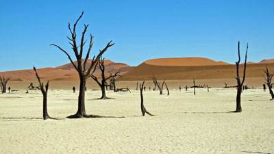
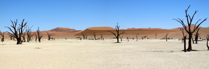
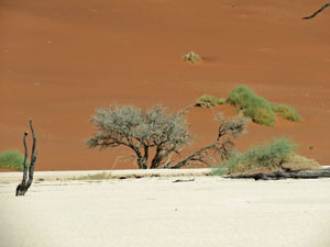
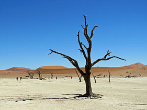
Justice now led us on a short walk across the red sand to reach the Deadvlei, an isolated claypan of brilliant white cut off from Sossusvlei by the encroaching sand. Here, walled in by 300m high dunes of fine red sand, a grove of trees had died some 2000 years ago .... and the skeletal trunks and branches still remain (the air is so dry there is nothing to break them down – it hadn’t rained here for seven years until a deluge of 17 mm this year). The contrast of bright white clay, red dunes and blue sky was surreal. There are way too many photos here, but I just love the colours.
|
|
 |
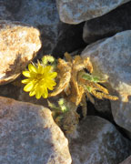
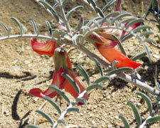
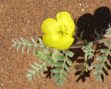 Once in seven years a flower blooms |
 |
|
|
|
|
|
|
|
|
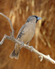
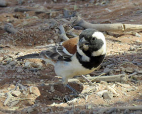 The sparrow weaver-bird |
 |
 Thorn trees and red dunes |
Too soon we left, retracing our route back to Sesriem Campsite, before making a small detour to visit the (much) smaller cousin of Fish River Canyon - Sesriem Gorge, a 2km long narrow slot cut 60m deep and 10m wide into the soft conglomerate rock by a long vanished river. |
||
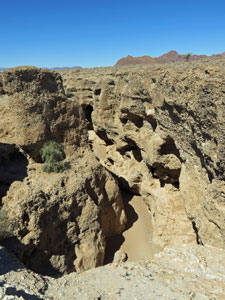 Looking down into Sesriem Canyon |
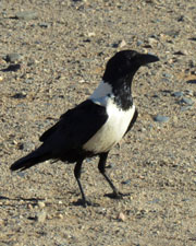
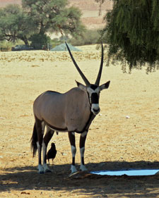 Oryx and crow seeking shade at Sesriem |
 In the depths of Sesriem Canyon |
After a walk down to the sandy floor, we all boarded the bus and headed on across the desert. Our destination - Boesman's Campsite, set overlooking a dry river bed and backed by rocky hills - a lovely desert camp, where water is supplied by a 200m deep bore, and which we had to ourselves. |
||
 |
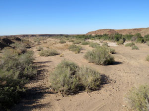
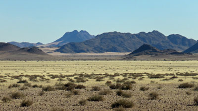
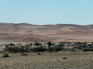
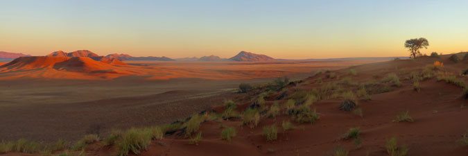
 Some more divergent Namib desert landscapes |
 |
|
|
|
 |
|
 |
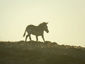
The day was not yet done, however, and, after we set up our tents, we all headed out in a small 4WD safari truck for a late afternoon tour of this arid landscape, spotting oryx and mountain zebra en route and watching yet another superb desert sunset over the immense Namib landscape. |
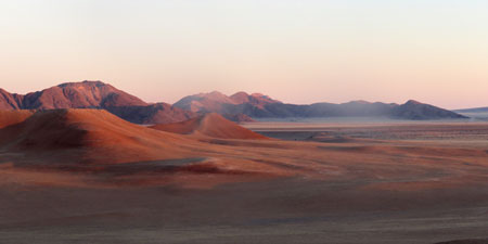 The beauty of desert mountains |
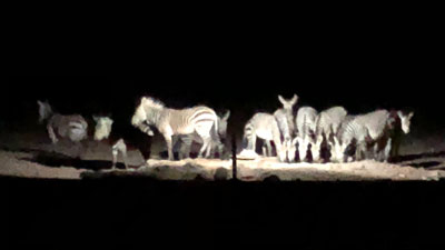 Zebra drinking at the waterhole (photo: Emma Ritzen) |
It had been our most active day so far and a tired and happy group retired, listening to distant grunts and noises of zebra and oryx that had come down to drink at the local waterhole. |
|
|
Day 6 - Namib-Naukluft to Swakopmund |
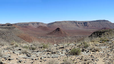
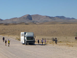
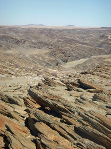
After the early start and long day of yesterday, it was good to rise a bit later today - greeted by the same cloudless blue sky that we had experienced since reaching the Namib. Today, though we would be leaving and heading back to town - to Swakopmund on the Atlantic Coast. The wide and corrugated gravel road led us quickly along, with just a few stops - one to pose for the obligatory "here we are crossing the Tropic of Capricorn" photo, another unplanned when Sonny the truck did a dummy spit and had a fuel line blockage (luckily, Justice and Jojo are excellent bush mechanics and had us back on the road after only 20 slightly unnerving minutes by the isolated roadside), and one to admire the weird and lunar like landscape near the Kuiseb River, where tilted layers of schist created jagged lines across a series of barren, eroded hills. |
||
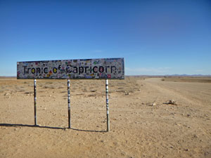 Crossing the Tropic of Capricorn |
 Sonny the truck getting some quick repairs |
 The sandy bed of the Kuiseb River |
|
|
Then, after heading due west across one more stretch of flat desert, we noted a change of colours - the sand was becoming noticeably white, as we entered the region of coastal dunes. We reached the ocean at Walvis Bay, a former British enclave, and now a big container port. |
 The yellow of drying grasses after the first rains in seven years |
 The pale coastal sand dunes near Swakopmund |
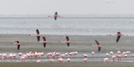
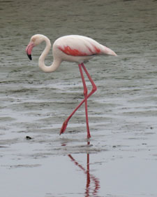
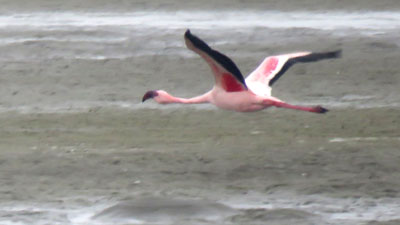
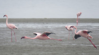
Here, we stopped for lunch alongside the vast mudflats that form the south of the bay. Not a choice spot, one might think, but when you know that our lunch-time companions were some of the thousand of flamingos that feed in these algae-rich flats, our leaders' choice becomes apparent. |
|
 |
Here, we also saw something we had not seen for days - cloud. In fact the sky was overcast and the temperature cold, thanks to the cold Benguela Current which sweeps up this west coast of Africa, generating lots of moisture and mists. |
||
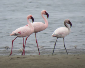 The mudflats are not only home to flamingos .... |
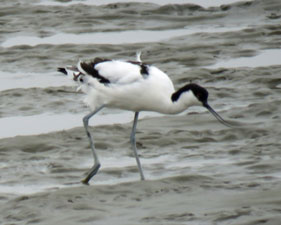 .... but to avocets .... |
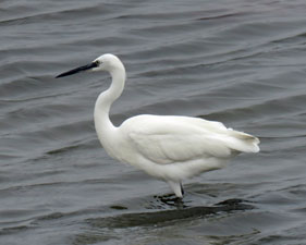 .... and egrets as well |
|
|
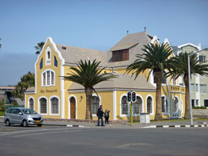
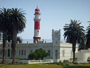
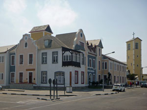
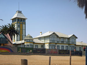
After lunch it was but a short trip up the coast, following the thin line of sand-blown residences between the ocean and massive creamy-white dunes to reach Swakopmund. This part of the world is defined by sand. Swakopmund is the port of the former German colony of South-West Africa and its centre is a charming little town, styled in early 1900s German architecture. More importantly for us, it was the place where, after five days of camping in the desert, we had two nights in a guesthouse with bed and hot shower - bliss. |
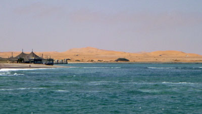 Sand dunes near Swakopmund |
|
Day 7 - Rest day in Swakopmund |
While some of the group signed up for more extreme sport options, e.g. sky-diving and quad-biking in the dunes, the fair Nello and I decided to take the word "rest day" seriously. It was a chance to catch up on correspondence, washing and to wander around the town of Swakopmund, admiring its wide streets and pastel-coloured German architecture, sip a coffee on the end of the pier and try out the German pastries at the Bäckerei. |
||
|
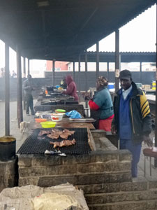
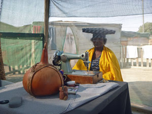
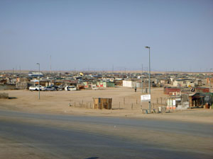
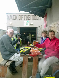
We did sign up for a 3-hour bike ride with John and Atty, a Dutch couple on the tour. It turned out be a big reality check - taking us away from the charm of central Swakopmund deep into the African townships and shanties on the fringe, where most of the three tribal groups - Damara, Ovahimba and Herero live - once due to enforced racial apartheid, now due to economic apartheid. Our guide was very good at explaining the situation and it left a lot to think about. Still, despite the obvious poverty, the townships have developed micro-economies and the people seemed to have a joie-de-vivre missing in more affluent settings. It was the Africa that you aren't shown on the average tour. |
|
|
