| Botswana |
Day 13 - Windhoek to Ghanzi |
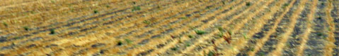
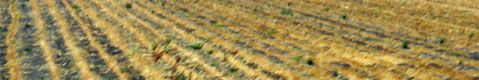
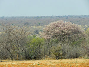
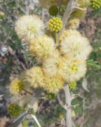
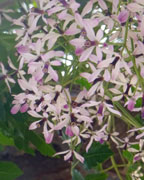
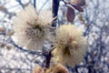
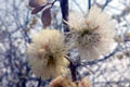
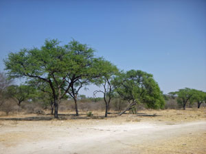
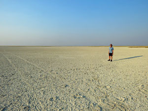
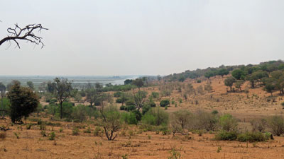
It was time for yet another long driving day, and also time to say farewell to Namibia and hello to Botswana. We headed eastwards into an increasingly clouded sky, soon leaving the white acacia blossoms of the gently rolling foothills and surrounding mountains to once again enter a flatter landscape. Here the vegetation changed to a cover of thick grass and low shrubs. However, it gradually took on a drier, sparser aspect - just where the Kalahari Desert began was not obvious, but as the landscape flattened even more, we realised we were there. It is a much more diverse and rich desert than the Namib, getting up to 300 mm of rain a year in parts. |
|||
 Tree blossoms heralding the desert spring |
 |
 |
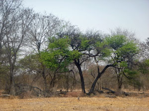
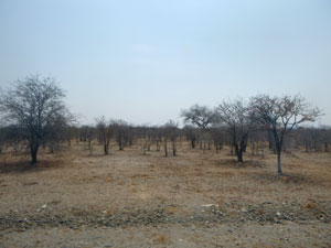
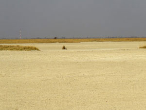
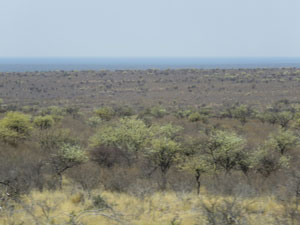 Kalahari landscape |
More time passed, until we reached the invisible straight line that transects the Kalahari and separates Namibia from Botswana. Border procedures went smoothly and we were soon continuing our eastward progress deeper into Botswana. The landscape was starting to look more desert-like, with fewer scattered trees and a barren lower shrub layer - in places there were just two vegetation layers, grass and shrubs, in other places, they were joined by bare thorn trees. |
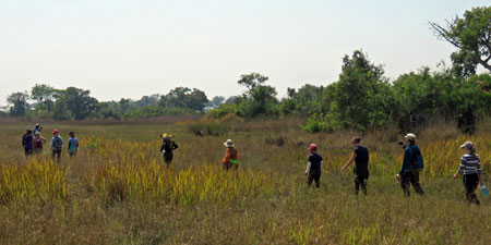
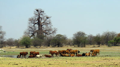
The Kalahari has become cattle country, as the huge saleyards just before our campsite at Ghanzi attested. The campsite itself, lay a few kilometres off the road, a dusty site amongst the scrubby bush of the Kalahari. This is the home of the San bushmen and, soon after arriving, we were taken for a short walk through the bush by a small group of them, explaining in their click language the nomadic ways and traditions of their ancestors. For the fair Nello, it was the culmination of her geography class of 50 years ago, where she had learnt about the bushmen of the Kalahari. Now here she was, walking through the desert with them. |
||
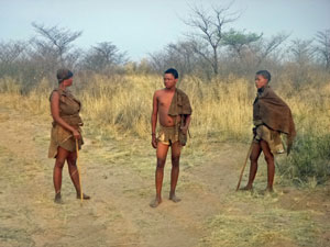 Our San bushmen guides |
 |
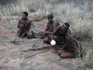 San bushmen demonstrating some traditional practices |
After dinner, the walk was followed up by a round-the-fire concert of San songs and dance, a thousands-of-years old culture that the present-day San are determined to preserve. Let's hope that they succeed. |
|
Day 14 - Ghanzi to the Okavango Delta |
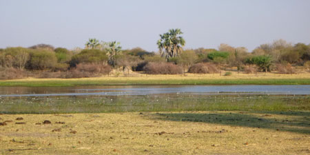
Today, we set out for a 300km drive to our pick-up point for another trip highlight, the Okavango Delta. This is a 15,000 km2 region of waterways and lush green vegetation, where the Cubango River, having flowed down from the highlands of Angola, now fans out to annually spread 11 million cubic metres of water into the flat desert landscape. Eventually, all this water either soaks in to the groundwater or evaporates. The route itself was flat, but there was not much to be seen as the thorntrees and tall scrub blocked much of the views from the road. The last 50 km were on a crumbling sealed road,with deep potholes almost as wide as the road itself. It was a slow and bumpy journey, but we finally reached Etsha, a small community and our point of transfer. The single lane sandy track was too much for Sonny the truck, so we all climbed aboard the back of an old troop-carrier (after push starting it) for the drive in to Nguma Island Lodge in the heart of the delta. |
 On the way to Okavango |
|
 |
 |
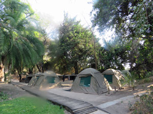 Permanent campsite at Nguma Island Lodge |
 Gliding across the glassy Guma Lagoon |
 A nice change after the desert |
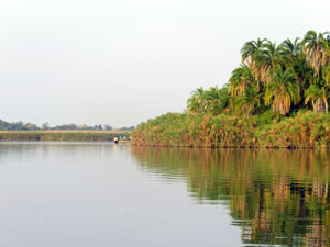
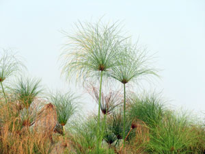 Papyrus reed banks |
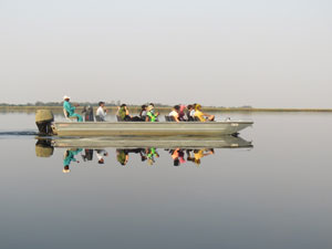
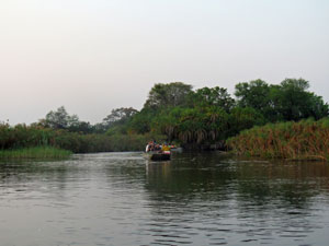
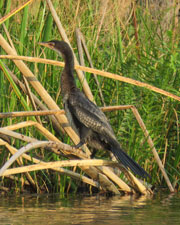
What a welcome difference the Okavango was to the surrounding Kalahari - lush green vegetation, tall green-leafed trees and water ... lots of water. We settled in to our fixed campsite and then headed off for an exploration by open flat-bottomed boat, cruising slowly along the thick papyrus reed beds that line Guma Lagoon. After the long, bumpy drive through the desert, it was a relaxing way to end the day, with the still water, cooler air and the bird-life of the wetlands. |
||
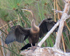 Snake bird |
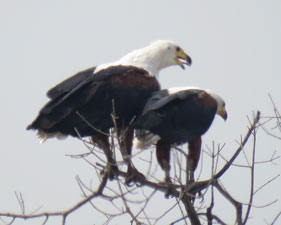
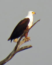 African fish eagle |
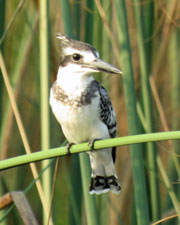 Pied kingfisher |
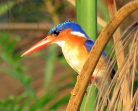 Malachite kingfisher |
|
|
|
|
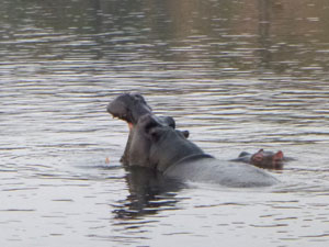
A splash from a hippo, a crocodile lazing on the bank, another cruising slowly past the boat, and the brightly coloured kingfishers perching on the reeds, all made for a pleasant introduction to the Okavango landscape. |
|
Tomorrow we would explore it in more detail - in a mokoro, the traditional dug-out canoes once used by the local delta people for transport. |
|
Day 15 - Exploring the Okavango |
One of the best things about today was that we didn't have to break camp and pack up tents - we would be here at our fixed tent site for one more night. So, after a hearty breakfast, we headed back down to the lagoon's edge to board our open boats for a 45 minute zip along the glassy water and reed lined channels of the Taokhe River, one of the three main channels of the delta. |
||
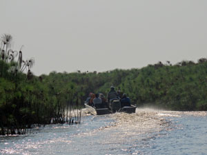 Speedy trip up the Taoke Channel |
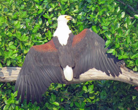 Fish eagle stretching its wings |
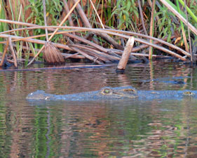
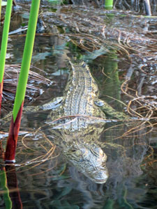
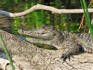
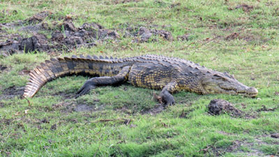
 Crocodile portrait |
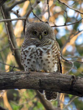
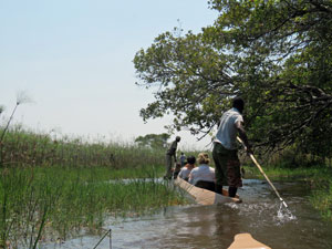
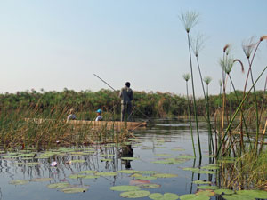
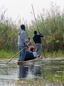
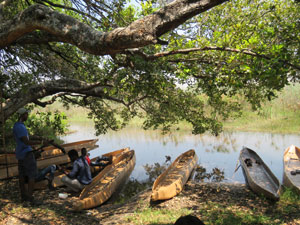
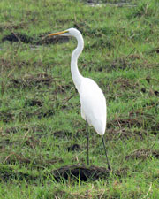
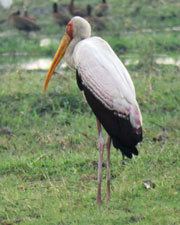
Along with a scattering of small crocodiles, the water birds were again out and about - herons, storks, ibis, egrets, kingfishers and the magnificent African fish eagle. We were heading to Mokoro Island, a low lying snippet of tree-covered dry land amongst the reed-beds and channels. When we reached it, we left the bigger boats and wandered across to the far side, where a flotilla of mokoros and their polers were waiting. |
||
|
|
|
The mokoro is a dug-out canoe that the original delta inhabitants used for transport. The means of propulsion is a long pole, ideal for these shallow waters. In our case, while keeping the typical uneven shape, the mokoros had been made from the fibre of the glass tree, rather than being carved out of an ebony log. This does save a few trees though. |
||
 |
|
 |
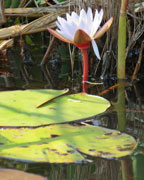
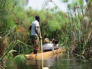
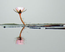
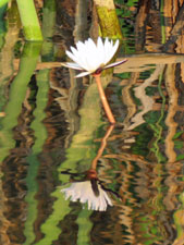
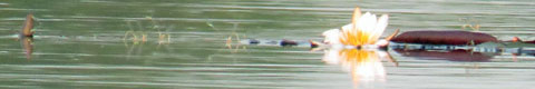
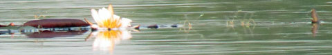
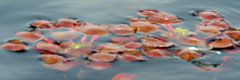
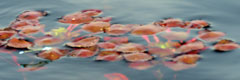
With two passengers and one poler per mokoro, our mini-flotilla set off through the shallow, water-grass covered pondages that surrounded the island, and into a series of very narrow channels that penetrated the papyrus reed beds. White and purple water lilies and yellow water lettuce flowers speckled the clear water of the channels, as we stopped from time to time to learn a little about culture of the delta people from our guide, Shek. |
|
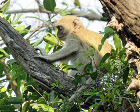
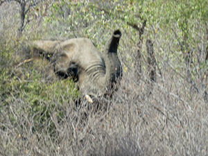
Tall trees ahead marked another larger island and we landed to do a short walk - out of the tree-fringed shore area to an open grassy centre, where elephants grazed. We only saw one, but the large amounts of dung indicated that this was a popular elephant habitat.
|
|
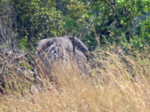 Elephant hiding in the long grass |
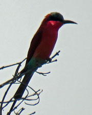
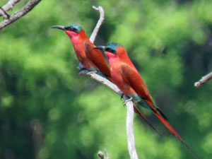 Carmine bee-eaters showing off their brilliant colour |
|
After lunch on the island, the voyage was reversed - returning through the narrow channels by mokoro, before boarding the bigger boats for a flying trip back up the Taokhe River and across Guma Lagoon to our lodge. It was a hot (35°C), languid afternoon on the island - time for a swim in the pool and the simple pleasure of relaxing beneath a shady tree (we needed this after the long days of travelling in Sonny the truck). |
||
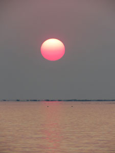
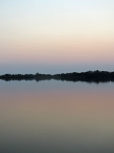 Where sky and water blend |
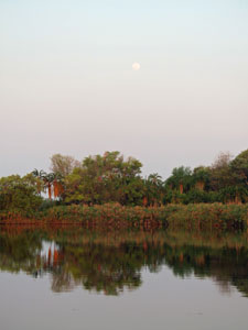 Moonrise over Guma Lagoon |
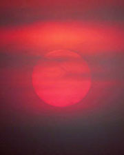
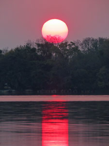 Okavango sunset |
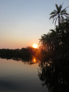
Finally, after one last boat cruise to watch the red African sun set over the waters of the Okavango, our time in the greenery of the delta was over. Tomorrow, it would be back to the truck and a return to the arid landscapes of the Kalahari. |
|
Day 16 - Nguma Island to Maun |
How quickly the green of the delta disappears. Our troop carrier bumped its way along the single lane sandy track as the lush waterside vegetation gave way to thickets of the arid trees and shrubs of the Kalahari. The only wildlife here were the cattle and donkeys that the Tswana people raise as livestock. For much of its area, the Kalahari is one big rangeland. |
||
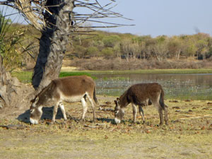 No - not wildlife |
 In some places in the Kalahari, the water table is high .... |
 ..... and in others, it is not |
Meeting up with Justice and Sonny the truck again, we retraced our bumpy route along the pot-holed road for the next 150 km, before turning east and heading in the direction of Maun. Maun is a large town and is considered the tourist gateway to the delta. We passed through to reach our campsite at the Sedia Hotel on the edge of the Thamalakane River.
|
Some of the group had signed up for a scenic flight over the waterways and wetlands of the delta, but most (including the fair Nello and myself) took the occasion to relax beside the pool and shake out the dust of our travels. To be honest, we had just about been "activitied" out. |
|
Day 17 - Maun to Nata |
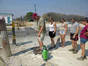
Finally we left the green verges of the delta behind for good and headed back out into the Kalahari for a 300 km drive to Nata. In sections, the road was filled with big pot-holes, forcing Sonny the truck to spend much of its time on the verge, when it could do so, or give us bone-jarring jolts when it couldn't. This area is part of Botswana's tourist triangle, so it was surprising to see the infrastructure crumbling about us. We also had a short stop to step off the truck and walk through the human version of a "sheep dip" - sterilizing the soles of our footwear. This is part of a national system to control the spread of foot and mouth disease and Sonny the truck did the same for its tyres. Heading on, the desert about us changed from sparse trees to thorny thickets to low scrub to shrubby grasslands (cattle country) and back again, as we made our way eastwards. |
||
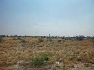 Grassy region of the Kalahari |
 Elephant in the roadside bush |
 At the Foot and Mouth control post |
|
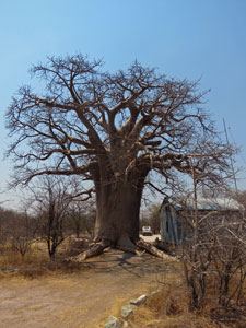
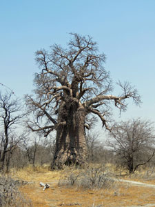
As lunch time crept up, Justice turned off onto a small gravel road to stop at Planet Baobab, a camp ground set amongst a sparse grove of huge baobab trees (think 30m diameter trunks). They were still leafless with the dry season and their massive silhouettes rose above the surrounding scrub to dominate the landscape. It was the first indication that the desert landscape was morphing into savannah.
Then it was on to Nata, where we set up camp at the Nata Lodge, a very comfortable place which also offered evening game drives out to Nata Reserve and the nearby Makgadikgadi Pans. Ten thousand years ago, the main rivers feeding the enormous (22,000 km2) Lake Makgadikgadi were diverted by a tectonic movement. The lake dried out and formed a big salty clay pan. |
|
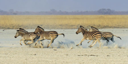
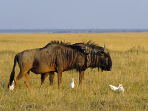
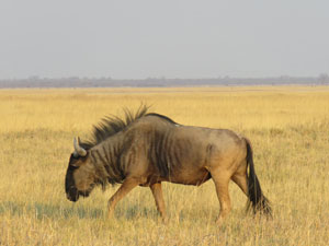
We entered the gates of reserve in our 10-person safari vehicles and headed straight on to the billiard-table flat landscape of the clay pans - across the salt encrusted pockets of clay separated by a sea of golden grass. It was a great place for the herds of blue wildebeest and zebra, and, with the low afternoon sun contrasting golden grass and white clay, I took far too many photos - herewith a few of them. |
||
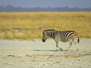 One of the zebras of Nata Reserve |
 The fair Nello giving perspective to the clay-pan |
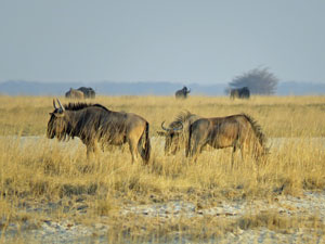 Blue wildebeest |
|
|

|
|
|
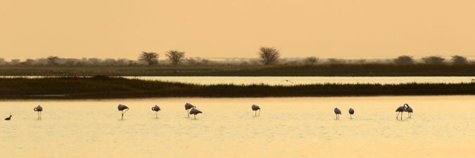
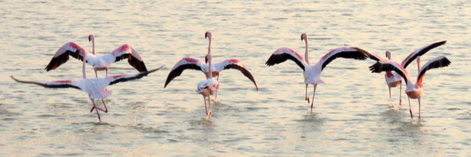
In an area of depressions, shallow salty pondages provided a home to many species of waterbird - flamingos, spoonbill, ducks, stilts and ibis. What a spectacle to watch, as the western sky turned golden and pond waters mirrored its glow. |
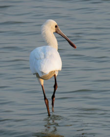 Spoonbill |
|
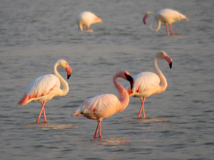 A trio of flamingos |
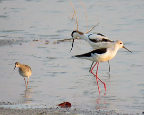 Sandpiper, avocet and stilt |
|
|
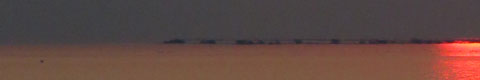
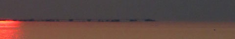
When we reached the edge of the main Sowa Pan, we were in for a bit of a surprise - water, as far as the eye could see. In fact, the lake has not completely vanished and this northern basin has become an ephemeral lake. Three years ago it was dry, but the heavy rains in Zimbabwe flowing down the Nata River filled it - a slowly evaporating body of very salty water. |
 An assortment of water birds in Lake Sowa |
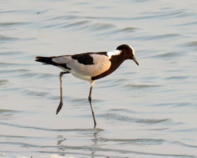 Blacksmith lapwing |
 Sunset over the waters of Sowa Pan |
It was a great spot to stop for "sundowners" to once again watch the red African sun set over the waters of the Magkadigkadi Pans. |
||
|
Day 18 - Nata to Chobe National Park |
We were up at 5.15am this morning, packed up, tents loaded and breakfast over in time for a 6.30am departure - after all these days, we were becoming very efficient. As was becoming usual, we had 300 km to drive to our next overnight accommodation at Kasane, in the north-east corner of Botswana. We needed to be there in time for an early lunch and then a game drive through Chobe National Park that started at mid-day. The trip was smooth, punctuated only by stops at Foot and Mouth Control Points, an elephant by the roadside and the usual "bushy-bushy" stop. About 100km south of Kasane, we passed an area of black, sandy clay with row after row of cropping. The transition from desert to savannah was complete. Kasane is a small town on the banks of the Chobe River and it is the gateway to Chobe National Park, where we were ultimately headed. |
|
|
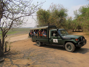
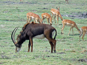
After arriving at Kasane, setting up tents and eating lunch, we set off in the 38°C heat for our game drive. The animals here are not silly - they would rather spend such days on the grassy river flats than in the stifling scrub of the interior.
|
|
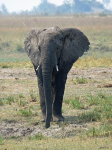
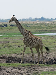
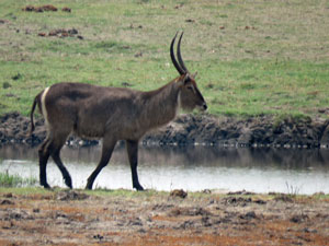
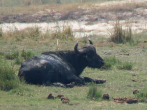
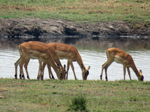
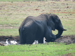
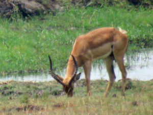
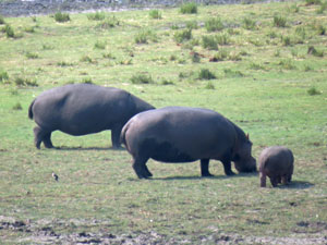
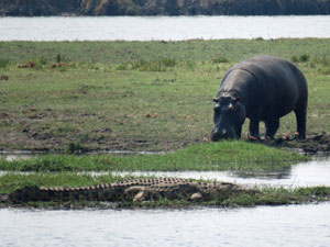
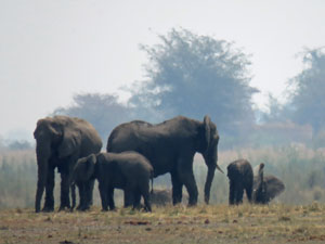
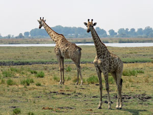
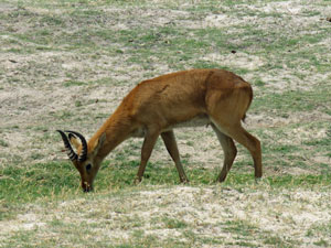
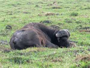
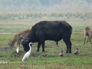
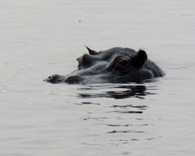
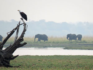
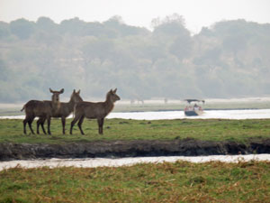
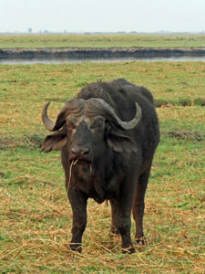
We quickly drove down a sandy track between the low trees ad thorny shrubs of the hills to reach the sandy river verge. As we drove slowly along the bank, we could stop and watch the many species grazing or resting on the grassy flats across the channel - elephants, buffalo, hippos, giraffes, waterbuck, impala, puku and warthogs. As well, groups of hippos lolled in the river, only their eyes and nostrils above the surface, while the odd crocodile lay immobile on the banks. The photos below tell the story. |
||
|
|
|
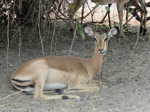
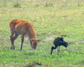
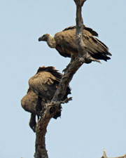
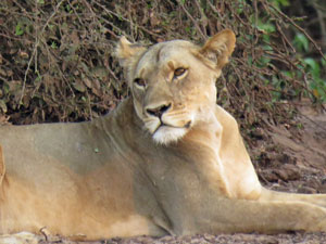
On the inland side, a few impala huddled in the shade of the trees. The highlight, though was a group of four well-fed lions lazing flat out beneath a tree, next to a rather well-scented elephant carcass - they had clearly had a good feast. Up above on the tree-tops, a flock of vultures waited their turn patiently - quintessential Africa! |
 Overlooking the Chobe River from the southern hills |
 Elephants crossing the river |
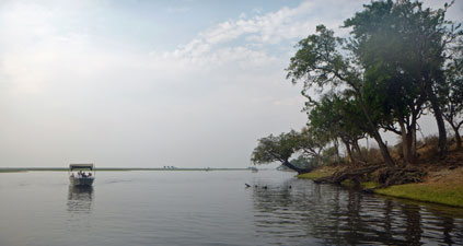
Game drive over, we headed down to the riverside boat landing to board a large flat-bottomed boat for phase 2 of our Chobe experience - a late afternoon cruise along the Chobe River for a different perspective of the wildlife. It was pleasantly cool on the river, though its surface still shimmered in the heat. |
|
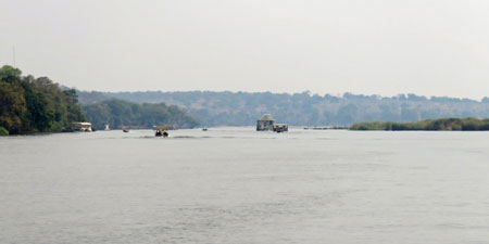 The broad reach of the Chobe River at Kasane |
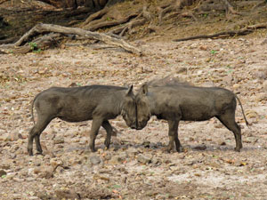
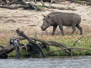 Adult wart hog |
|
|
|
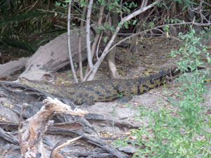
Again, crocodiles lay scattered along the banks, and we were able to get up close to buffalos and hippos, as well as spotting another lion. With the cooling breeze and an ice-box to keep the beer cold, this was wild-life spotting at its most pleasant. |
||
 Hot afternoon on the Chobe River |
 The vultures gather |
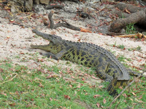 Crocodile cooling off, mouth open, on the bank |
|
|
|
|
|
|
The stars this time, however, were the waterbirds that dotted the boggy flats dividing the two channels of the river - probing, dabbling and sweeping for food - unaware that a dispute over ownership of this ephemeral island took Botswana and Namibia to the International Court. |
||
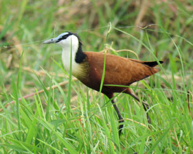 Jacana |
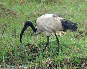 Ibis |
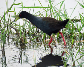 Gallinule |
|
|
|

As the high cloud moving in from the west obscured the setting sun, our days in Botswana came to an end. Tomorrow, we would have a short drive into Zimbabwe and a spectacular end to our African adventure at Victoria Falls. |

|