| Southern Circuit (1. South Coast Track) |
Getting There |
|
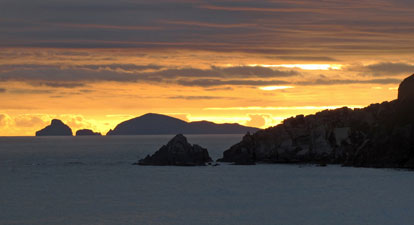
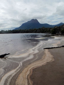
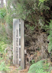 Cockle Bay - end of the southernmost road in Australia |
  |
Day 1 – Cockle Creek to South Cape Rivulet (12.5km - 120m ascent – 120m descent) |
|
||
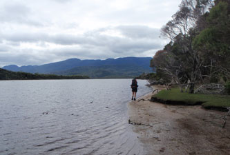
 Cockle Creek - start (or end) of the South Coast Track |
 |
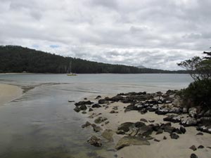 View across Cockle Bay |
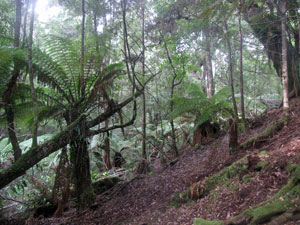
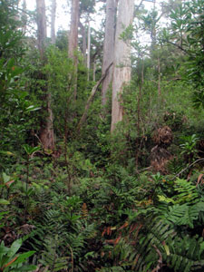
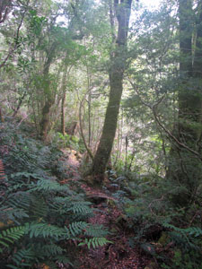
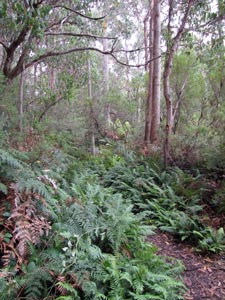 Wet forest fringing Cockle Bay |
|
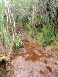
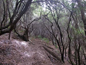
 Drier eucalypt forest of Blowhole Valley |
||
 |
 |
 |
||
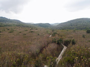
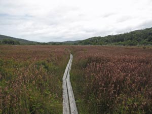 Boardwalk across the swampy grasslands |
Here, long sections of boardwalk led us across the bronzed carpet of swamp grasses and sedges. The first five kilometres had gone very quickly despite the heavy packs. |
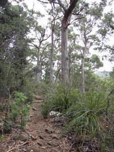
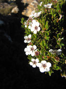
 In the tea-tree heath of the old dunes |
|
 |
 |
||
|
|
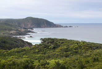
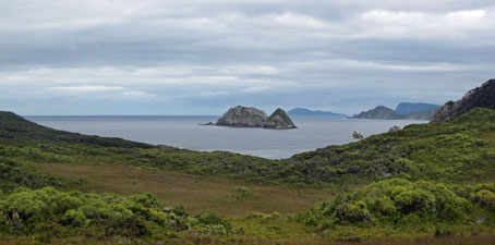
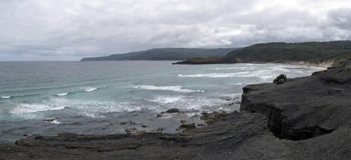 The track opens onto the Southern Ocean - with views across to South Cape |
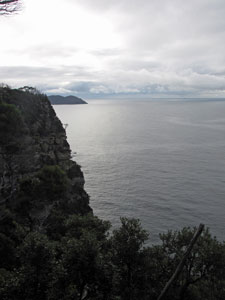
 Coastal cliffs |
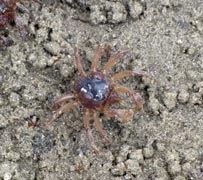
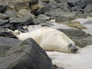 Young sea elephant basking on the beach |
|
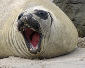 Sea elephant portrait |
|
|
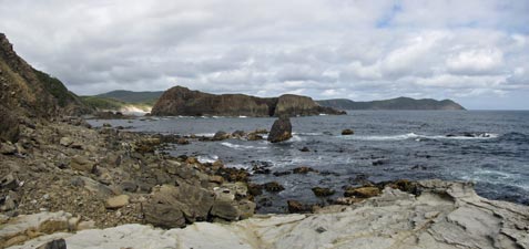 Part of the low route past Lion Rock |
 The collapsed cliffs of Coal Bluff (with South-East Cape in the background) |
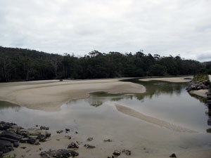
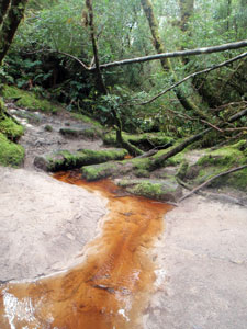
Eventually we reached the end of the rocks to again wander across the soft white sand of the beach and join up with the high tide route (that had climbed over Coal Bluff) again. A small detour inland, then it was back onto the beach for a final half kilometre stroll that led us to the mouth of tannin-stained South Cape Rivulet. |
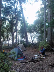 Campsite on the forest verge |
|
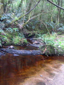
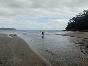 Rupert crossing South Cape Rivulet |
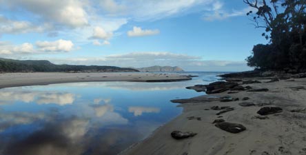 South Cape Rivulet in a reflective mood |
|
|
|
Day 2 – South Cape Rivulet to Surprise Bay (mud mud mud) (13.5km - 860m ascent – 860m descent) |
|
||
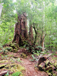 Big euc in the forest |
 A brief glimpse of the coast line ..... |
 ... and back into the ferny forest |
 Crossing an open button-grass flat |
|
|||
 |
 |
 |
 |
|
|
|||
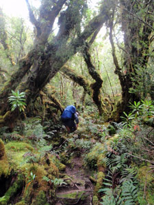
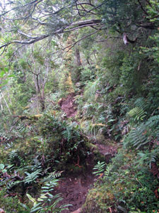 The crossing of the South Cape Range starts ...
|
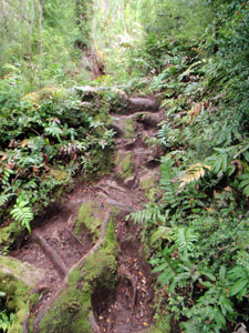 ... up steps of gnarly myrtle beech roots ... |
 .... across tannin-stained streams ... |
 ... and along deep shady gullies
|
|
|||
|
|
|
|
||
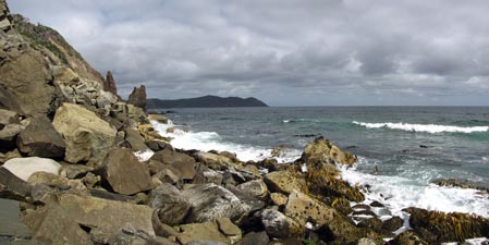
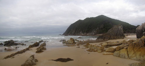
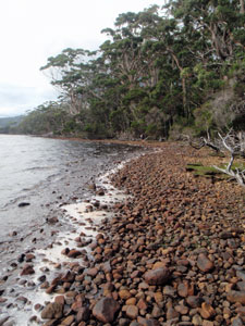
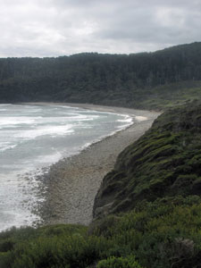 The stony arc of Granite Beach |
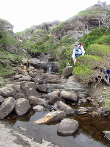 Crossing Sandstone Creek |
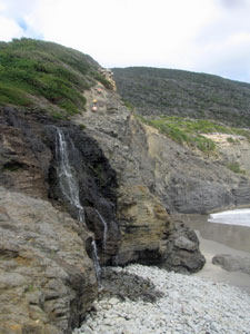 A beautiful beachfront waterfall |
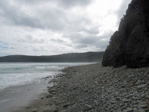 Heading west along Granite Beach |
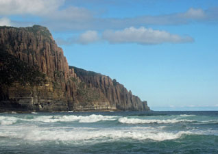 The magnificent dolerite columns of Fluted Cliffs |
 Surprise Rivulet |
|
||
|
|
 Surprise Bay and the mouth of the rivulet (from the campsite) |
 Golden sunset over the islands of Surprise Bay |
|
  |
Day 3 – Surprise Bay to New River Lagoon (18.5km - 360m ascent – 360m descent) |
|
 The western end of Surprise Bay |
 Forest of the old dunes |
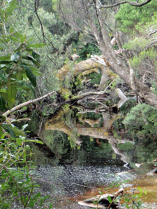
 Tannin-stained creek |
|
|
||
|
|
|
|
||
 View over the heath towards Pretty's Point |
 |
 Button grass and heath near Osmiridium Bay |
|
|
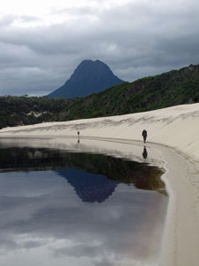
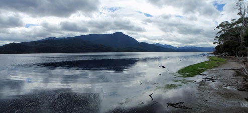
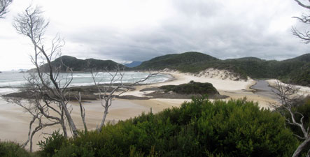
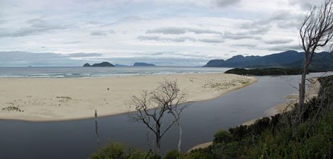
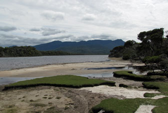
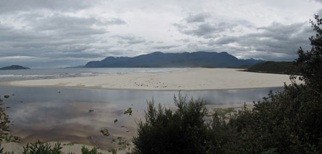 New River Lagoon and the Ironbound Range |
 The tranquillity of New River Lagoon |
|
|
|
 |
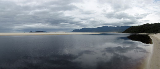
 View over the lagoon and offshore islands from the "dune of endless humps and hollows" |
|
|
||
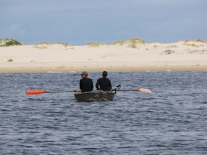 South Coast trekkers crossing the lagoon |
 |
 The shoreline near Prion campsite |
When Rupert arrived (plus hat!), he had a late lunch and we then pushed on, as the cloud was again getting thicker. This is where we left the South Coast Track, heading northwards instead to follow the sand / mud edge of New River Lagoon.
|
 The "road" to PB |
 Reflections in a creek pool |
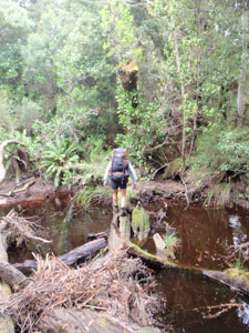 Crossing the creek on a fallen tree trunk |
|
|
 Hard going on the dolerite "beach" |
|
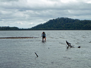
 Rupert takes to the water to avoid the fallen timber |
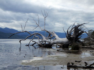 The bleached trunk of a fallen giant |
|
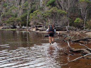
 One of the deeper wades on this route |
The north-westerly wind had picked up, creating small waves on the shoreline – surf was up at New River Lagoon. Over the last part, the soft sand/mud was replaced by a shore of rounded dolerite stones – harder to walk on and hard on the feet. Each right hand corner provided a new and closer view of Precipitous Bluff looming ahead. Eventually, with a mixture of in water and out of water progress, we reached the campsite sheltered amongst the tall trees near the mouth of Damper Creek, 3 hours after setting out from Prion. |
|
|
|
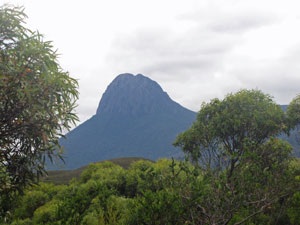
Day 4 – Climbing PB (8.5km - 1140m ascent – 80m descent) |
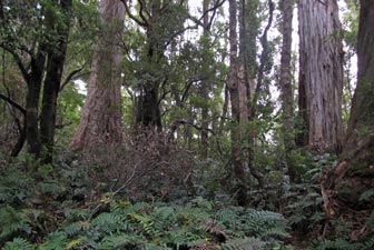
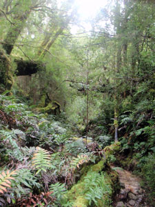
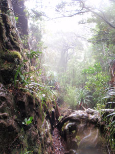
I am writing this in my tent on Plateau Camp, just below the rim of Precipitous Bluff, that iconic peak of Tasmania’s south coast. The cold wind is buffeting the tent walls, but I am feeling snug and contented inside, though there were times today when I wondered whether I would be. The wind had picked up during the previous night, rushing through the treetops around our sheltered campsite on the shores of New River Lagoon. Morning was still windy with thick grey clouds gathering over the Ironbound Range to the west – not a propitious day for climbing Precipitous Bluff. Still, you take the weather you get while bushwalking – we set off at 8.30am. A scattering of blue, orange and pink tape guided us out of the campsite through magnificent temperate rain forest; fallen trunks and boulders covered with moss, groves of tall tree ferns, drooping vines, all beneath a canopy of towering myrtle beech. Crossing a creek on a fallen trunk, we reached the start of the climb. |
|||
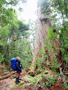 Rupert checking out a forest giant |
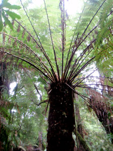 A big fern tree |
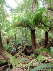 Rain forest near Damper Creek |
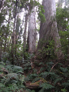 Climbing up amongst the tall eucalypts |
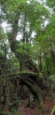 A several hundred year old myrtle beech arching across the path |
|
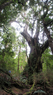 One of the giant eucalypts (for scale the blue spot is Rupert's pack) |
|
|
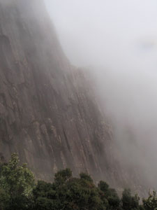
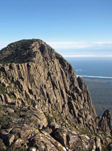
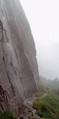 Precipitous by name, precipitous by nature |
 Waterfall tumbling out of the mist above |
|
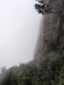 The wall of PB appears in the rain and mist |
 Waterfall at the base of the bluff |
||
|
 Back into the mist-filled forest |
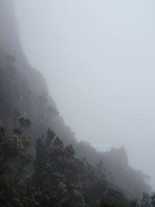 Wind-swept cloud obscuring the bluff |
|
||
|
|
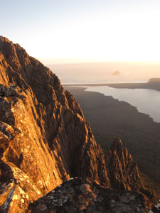
 The last rays of sunlight illuminate the Ironbound Range and New River Lagoon |
|
  |
Rest day on Precipitous Bluff (2km - 150m ascent – 150m descent) |
What a night – the wind strengthened and rocked the tent. About 2am, it ripped a peg out of the fly and threw it into the scrub, leading to a bit of emergency re-pegging from within to get the tent through the night. The temperature dropped to 2°C and the cold wind was still blowing when I woke, but the sun was shining. |
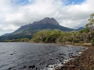
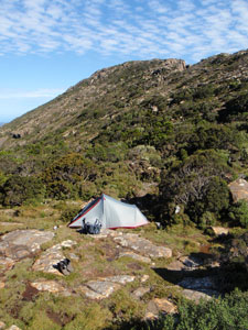 Plateau Camp with the summit in the background |
|
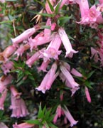
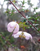
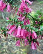
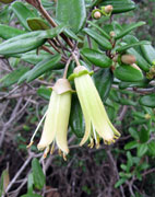
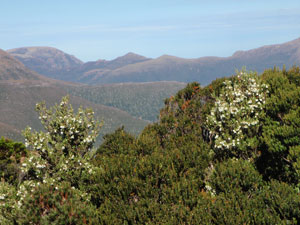 At the campsite - flowering leatherwood backed by Maxwell's Spur |
 Looking across the King Billy pines to Pindar's Peak |
|
|
|
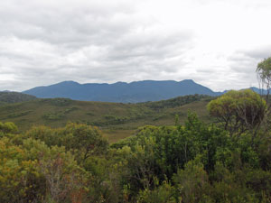
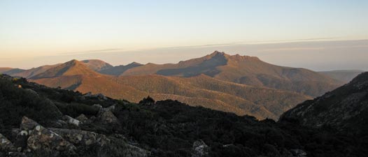
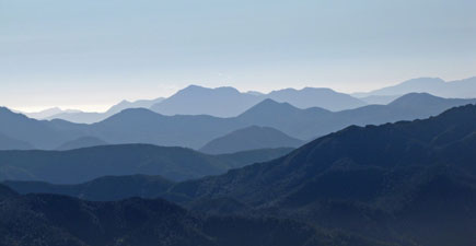 The endless ranges of mountains to the north-west formed a splendid blue tapestry |
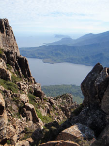
 The grand view from near our campsite 1000m above the lagoon |
|
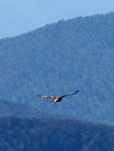 Wedge-tailed eagle soaring on a thermal |
|
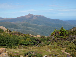
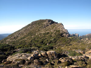 View of the summit from Plateau Camp |
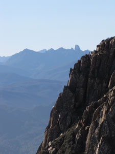
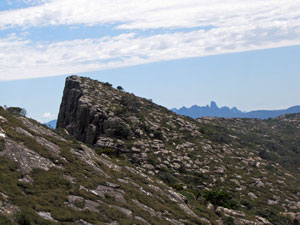 Looking back across the summit plateau to Federation Peak |
|
|
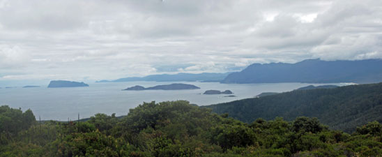
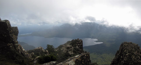
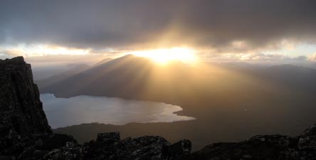
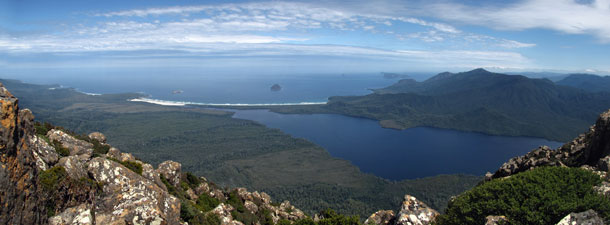 Classic PB summit panorama - New River Lagoon, Prion Beach with the Southern Ocean beyond and the Ironbound Range |
|
|
|
|
 |
 |
 |
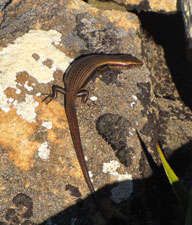
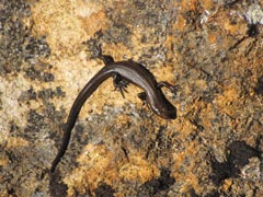
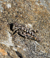 Good camouflage! |
|
 The walls of PB turn to gold in the light of the setting sun |
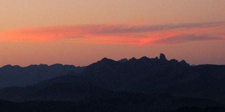 The perfect sunset - rose tinted clouds above Federation Peak |
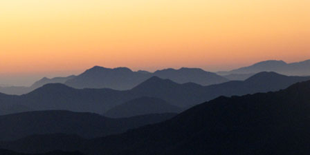 Evening falls on the mountains of southern Tasmania |
|