| Kumano Kodo Pilgrimage Path |

Getting There |
Centuries pass by |
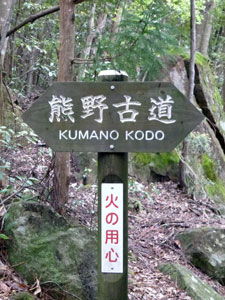
Kumano Kodo is the name of a network of pilgrimage routes from Kyoto and other places to the three sacred shrines of the Kii Mountains; Hongo Taisha, Nachi Taisha and Hayatama Taisha. For over a thousand years, emperors, lords, monks and simple followers have made this walk, undertaking rites of worship and purification as they went. In fact, this year is the 1200th anniversary of the Kumano Kodo. The area has been world heritage listed since 2004 for its cultural and landscape values. In modern times, when people talk about Kumano Kodo, they usually mean one of the several possible paths, the Nakahechi. This path cuts across the mountains of the Kii Peninsula from the town of Kii-Tanabe on the west coast to Shingu on the east. The usual starting point is Takajiri-oji, a 40 minute bus trip inland from Kii-Tanabe and the point at which, traditionally, "the passage into the precinct of the sacred mountains begins". Over the next six days we plan to follow this path, come rain (assured) or shine (hoped for), to try and get a feel, however slight, for what the pilgrims of centuries past experienced. |
|
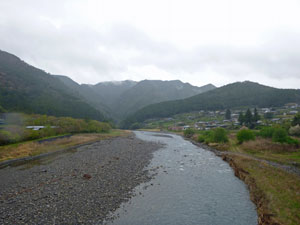
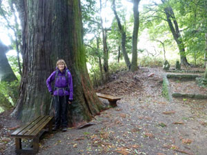
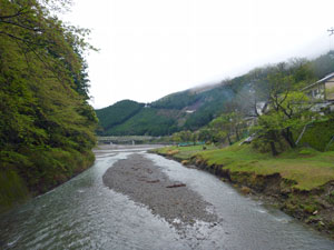
 on the beach at Kii-Tanabe |
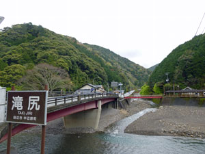
Today was another moving day, to get from Nara to Kii-Tanabe, gateway to the Kumano-Kodo Pilgrimage Path. It was also one of the few times since we left Kyushu two weeks ago that the sun shone, albeit for just a few hours of pale light filtered by the high cloud. The air felt warm and all would have been heartening if we hadn't checked the weather forecast. The remnants of Typhoon Majyak were moving north from the the Philippines and with it would come heavy rain all day tomorrow - the day we set out on our six-day pilgrimage walk. Still, we can but count our blessings - Majyak hammered the islands of Micronesia, flattening most of the houses and destroying vegetable and fruit gardens. Those people lost their homes and livelihoods - all we risked was a drenching. Perspective is a good cure for self-pity. |
|
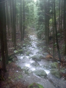
Day 1 - Takajiri to Tsugizakura (17 km - 1110m ascent - 710m descent) |
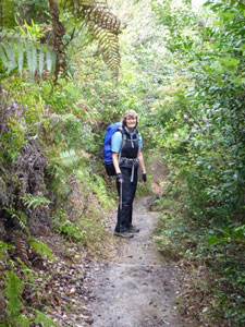
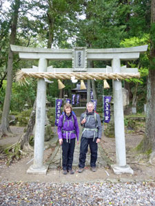
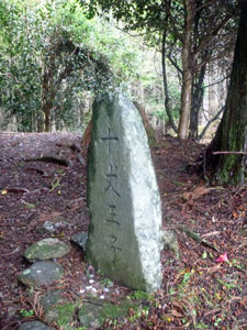
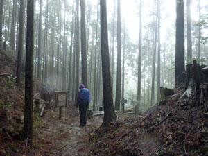
By the time we got off the bus to start our walk on the Kumano Kodo, we were feeling a little hopeful - the overnight rain had stopped and the air seemed relatively warm. We discarded our anticipatory wet weather gear and set off. This path gets right down to business - after a very short stroll past the Takajiri-oji shrine, which marks the start of the Nakahechi route, the climb began. |
|
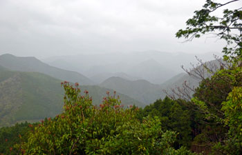
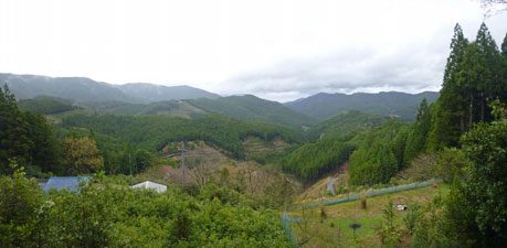
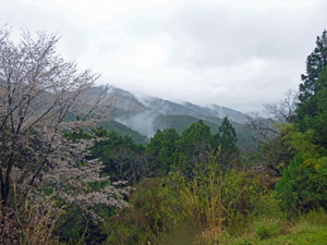
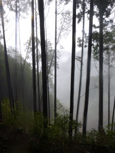
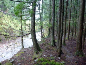
The well-formed track wound its way steeply up the end of a fir covered spur, passing some curious rock formations (one, chichi-iwa, brings good fortune if you can crawl through the curving tunnel beneath it - we looked at the muddy base and left fortune sort itself out). Climbing a second steep tier on the spur brought us to a lookout point, with views out over the Tonda-gawa Valley to the misty mountains beyond.
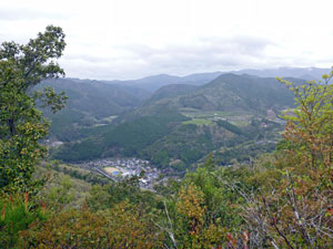
The wind was picking up and there seemed to be a distinct drop in temperature as we descended from the lookout. By the time the ridgeline path took us down to the junction with a forestry road, the forecast weather system arrived and rain began to fall. It was quickly back on with rain jackets and overpants for a wet climb up and over another steep knob on the ridgeline. On the far side lay the village of Takahara, set on a high balcony with expansive views over valley and mountain.
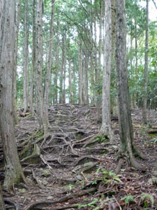
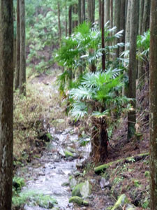
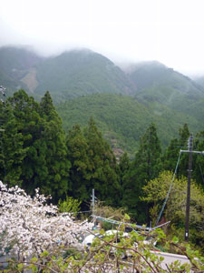
We walked, dripping, through the streets of the village to pick up a cobbled path that headed up into the dark fir forest that covers the steep slopes of these mountains. The fir trees gave us some protection from the weather, as we climbed steadily upwards past, first the pretty Takahara-ije pond and then, the Daimon-oji shrine. However, above us the wind was roaring through the tree-tops and the canopy was swaying a good few metres as the occasional fierce gusts blasted through. |
|
 Shrine at Takahara |
 Mountain vista in the rain |
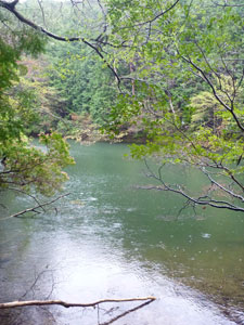 Takahara-ije Pond |
The route became a progression along this ridgeline, a series of broad knobs and narrow saddles. The wind whistled as we crossed the narrow-necked saddles to sometimes sidle along the protected north face of a knob or at other times across the exposed south face, where the wind drove the rain in on us. |
||
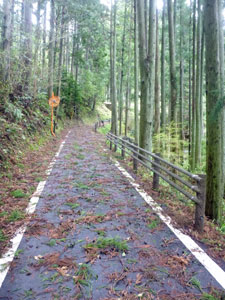
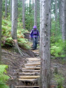
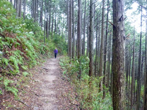 Path through the fir forest |
 |
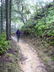
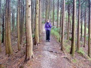 Walking along a ridge |
Climbing and descending beneath the swaying canopy of fir trees, we eventually reached the site of the former Uwadawa-Jaya teahouse, where pilgrims could receive shelter and food. Oh how we wished there was a teahouse there today. |
|
|
 A gap in the trees near the Uwadawa Teahouse site |
 |
|
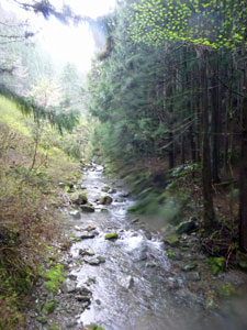
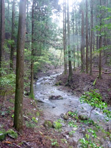
At 600m above our starting point, the ex-teahouse was close to the highest point of the day, and from it we began a long descent into the Sakari-no-tani Valley. Steady at first, the track then took a steep zig-zagging course down the slope of the ridgeline to follow the small Sakajiri Stream as it drained the rain water off the mountains. |
||
|
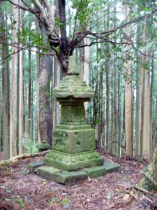
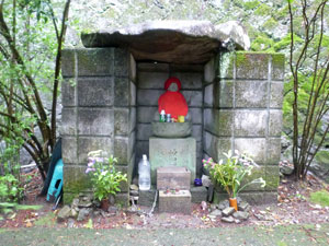
Crossing a series of log bridges, we followed the stream out to the main road at the Gyuba-doji bus stop, where we had hoped there might be a shelter for lunch. No such luck. We pushed on in the rain, climbing steadily back up into the forest to reach the Gyuba-doji statues, ancient and covered in moss. |
|

 View over Chikatsuyu |
 The Hiki-gawa River |
 Branches brought down by the wind |
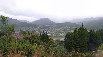
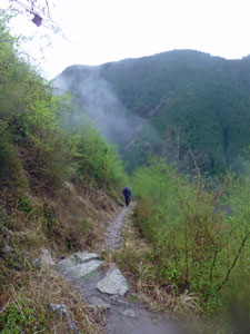
A short sharp descent brought us out into the open, overlooking the village of Chikatsuyu, set in a river valley surrounded by mist-capped mountains. Crossing the river, we spotted a bit of shelter - it may have been next to the toilets, but with the rain sheeting down in the open, it was a good place to enjoy our bento box for lunch. |
||
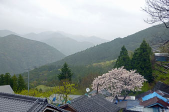
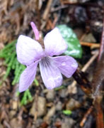
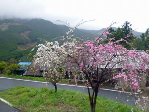
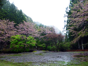
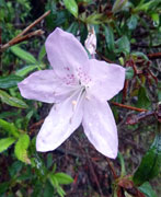
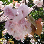
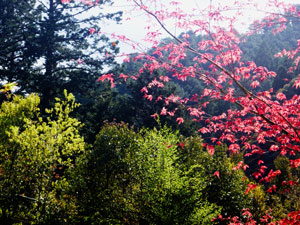
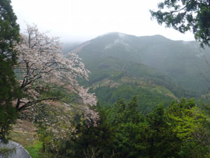 Still the odd cherry tree in blossom |
 |
 Landscape between Chikatsuyu and Tzugizakura |
|
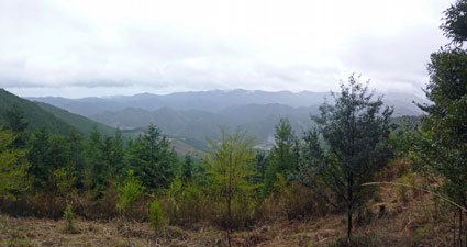
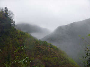
The downpour passed and, with the weather looking clearer, we decided to charge on - heading up through the streets of Chikatsuyu to climb steadily along a sealed village road up to the small shrine of Hisohara-oji. Along the way, gaps opened up to the south to give glimpses of mist-shrouded hills.
|
|
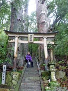
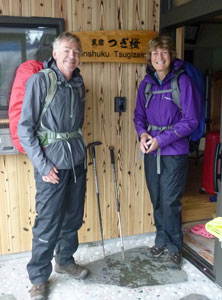
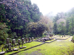
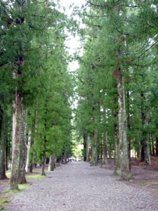
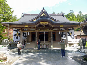
A little later we reached the Tzugizakura-oji shrine, set in a grove of massive-trunked ipposugi trees, and just alongside it, the thatched roof of the Toganoki-jaya teahouse. These were welcome sights indeed, for they marked the end of the day's walk. A short distance below, on a little sidetrack, was our accommodation for the night - a small, but very comfortable minshuku run by a former chef and his wife, where a warm room and an even warmer welcome awaited us. |
 Nello and the big ipposugi tree |
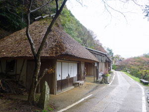 Togonoki-jaya Teahouse |
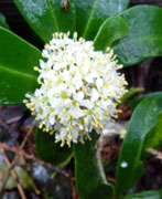
 A tzugisakura (grafted cherry) in Tzugizakura |
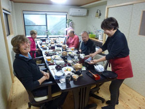
Needless to say the dinner, shared with three other Kumano Kodo walkers, was a wondrous collation of exotic Japanese dishes, washed down with a glass of home-made ume (wild apricot) wine. It was just what we needed to bring the colour back to our cheeks after a long and wet entry into the wild but beautiful landscapes of the Kumano Kodo. |
||
|
Day 2 - Tsugizakura to Hongu (21.5 km - 620m ascent - 1040m descent) |
The short description of today's walk would be that we got up, walked seven hours in the rain and arrived in Hongu soaked to the bone ..... but that would be too simple. |
 Big breakfast at Minshuku Tzugizakura |
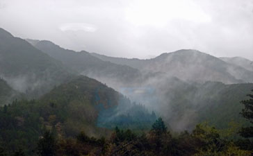 The mists of the Kii Mountains |
 All ready for a day in the rain
|
On waking I looked out the window to see streamers of cloud entwining the mountains. The wind had dropped, but the rain that had set in overnight continued to fall. It was not an auspicious day for a pilgrimage, but after an enormous and delicious breakfast, we picked up our lunchtime bento boxes, put on our wet weather gear and set off into the steady rain. Quickly regaining the trail, we turned east to follow the quiet country road as it traversed the slope, passing village houses, small shrines, the odd cherry tree still in bloom and great views across the valley to the misty mountains beyond. |
||
 Countryside near Tzugizakura |
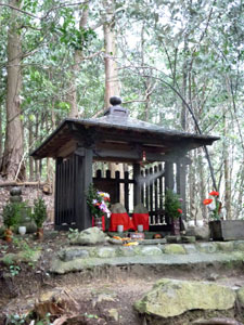
 The Kumesegawa-oji Shrine |
|
|
Not long after passing the Kobiro Road Tunnel, we left the sealed road and descended once again into the dark and dripping fir forest. A set of steps led us down to a small grassy clearing with a row of stone statues - the Kumesegawa-oji shrine. The rain seemed to be getting heavier, as we left the shrine to start our first climb of the day, up a steep, root-gnarly and rocky path to the Waraji-toge Pass. The pass was so named because ancient pilgrims changed their waraji (woven sandals) that wore out on the climb. On this wet day, our goretex lined boots were still snugly dry, so we pressed on. The descent was even steeper and longer, first down an earthern path where the rain was beginning to form little rivulets and then down a series of slippery stone cobbles. This brought us to a river crossing, marked with a big "X" - the route ahead had been washed out and we were redirected to a 4km detour. The detour headed off down a broad forestry road, good because it was nice flat walking with views up the steep, green-clad sides of the ranges, bad because we no longer had any shelter from the incessant rain. |
||
|
|
|
The forest trail was too good to last and it didn't - a little later, the Kumano Kodo Detour turned to cross the stream and lead us steadily up a long and exposed slope to reach another highpoint, a 688m pass. Luckily, the descent, which was again longer then the climb, was in the shelter of the fir trees. It popped out at another forestry road, which led us down to the site of Jagato Jizo, where the sight of a small shelter next to the shrine brought a relieved smile. |
||
|
We were starting to feel damp beneath our wet weather gear, probably from the perspiration of the climb (please explain, Mr Goretex). It was a good place for a break and some chocolate to boost our energy levels. |
|
 Yukawa-oji shrine |
 Riverside fir trees |
|
 |
With no reason to hang around too long, we rejoined the main trail to cross a bridge over the fast-flowing Yukawa-gawa River and briefly follow its course alongside a stand of dense riverside firs to the Yukawa-oji shrine. The path on the flat was by this stage becoming a series of small ponds (a good home for salamanders), so we weren't too unhappy to leave it for yet another climb, up the steep valley of a sidestream, cascading and tumbling down from the height above. Our target was Mikoshi-toge Pass, our third pass in 10 kilometres - the Kumano Kodo was charging its way across the lie of the land. |
 |
|
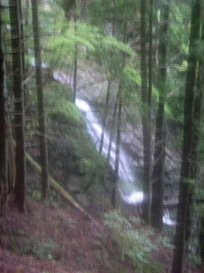
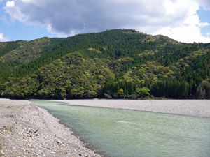
Passing a solitary cherry tree on the crest of the pass, we made the all too familiar steeper and longer descent, Water was rushing down the mountains and any channel that could carry it did, as we passed waterfalls and cascades to finally reach the deep valley of the Otonashi-gawa River.
|
|
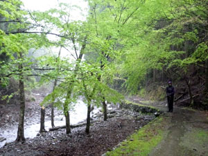
The route flattened and, even in the rain or perhaps because of it, the vegetation took on a luminous greenness, thick with moss and bright with new leaves of Spring. It was a lovely section of the track and led us to a curious boat shrine that marked the junction with the Akagi-goe route. We had planned to have lunch here, but as soon as we stopped, we started to chill down - the rain was beginning to find ways through our pack covers, rain jackets, overpants, even seeping into our boots (further explanation needed Mr Goretex). We made the decision to give lunch a miss and push on (the big breakfast was serving us well) - at least when moving, we kept warm. |
||
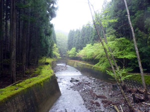 Stone walls lining the Otonashi River |
 The luminous green of Otonashi-gawa |
 Mixed forest at the Akagi-Goe intersection |
|
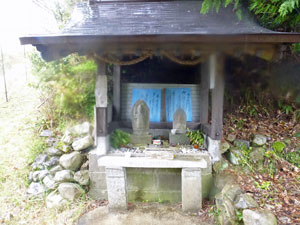
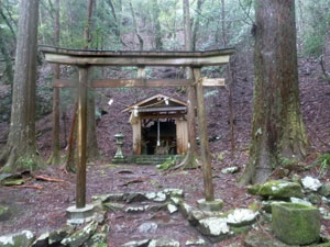
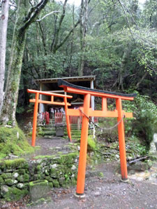
Passing the red torii gates of Funitama-jinja and the ancient stone statues of Inohani-oji in rapid succession, the track turned north. We followed, to be rewarded with another climb, this time beneath the dark canopy of tall fir trees to a lower pass and the large shrine of Hosshinmon-oji.
|
|
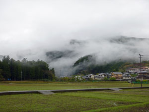
A sealed road passed the shrine and for a while this also became the Kumano Kodo. We strolled along the quiet country roads that passed through small mountain villages, with scattered houses and wet green fields. It was fast walking and the one benefit of the rainy weather was the superb views of the mountains opposite entwined in plumes of mist. A short cut across a fir-clad slope, a bit more sealed road and we were homing in on Hongu. |
||
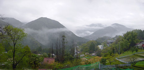 Wisps of cloud wrapping the mountains near Mizunomi village |
 |
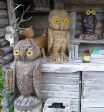 The local wood-carvings watch us pass |
|
One last climb remained, across a fir-clad ridge. We trudged our way uphill, or should I say upstream, as water was pouring down stony cobbles of this yellow-hued path. Having reached the top we headed downstream, following a broader cobbled path down into the outskirts of Hongu.
|
|
Soon we were passing through the grounds of the Hongu Taisha, one of the three great shrines of Kumano. A miracle occurred as we passed - it stopped raining! A visit to the shrine, however, could wait for tomorrow - we were drenched and on a mission to reach our guesthouse. |
||
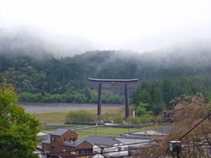
|
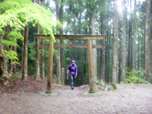
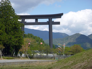
Crossing the main street, we quickly reached the river flats where ahead lay the great Torii gateway of Oyunohara (the largest in Japan). We strode through it, headed back into town and our guesthouse. |
|
How good it felt to get out of wet clothes and boots, have a hot shower and relax in a warm room with the water-wrinkles finally out of my fingers. It had been a hard day at the office, but walking for a day in the rain is good training for stoicism and gives you plenty of opportunity for reflection, as well as admiring the different type of beauty that rain brings out in a landscape. After all, isn't that what a pilgrimage is meant to be about? |
|
Day 3 - Hongu to Yunomine Onsen (2.5 km 250m ascent - 180m descent) |
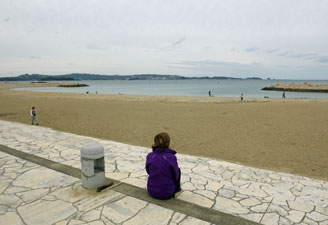
We enjoyed the good sleep of the physically tired, disturbed only by peels of thunder during the night. The next morning the fair Nello looked out of the window with excitement - the sun was shining brightly, and the storm that passed must have been the red lantern of the rain-train that had been rolling through the Kii Mountains for the past two days. |
||
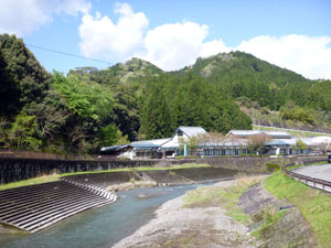
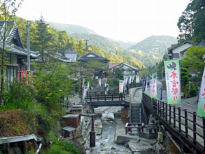
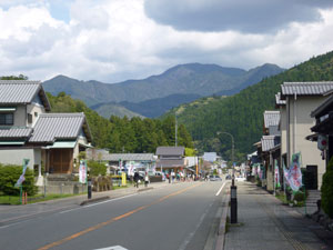 The main street of Hongu |
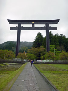
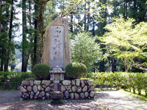 Site of the original shrine at Oynuohara |
 Blue skies at last |
Even better, today was a semi-rest day. Apart from a short hop to Yunomine Onsen later in the day, we could relax and enjoy the sunshine in Hongu. It felt great to be unencumbered by wet rain gear, as we wandered back up to the Hongu Taisha to have a better look at this historic and sacred shrine. This was followed by a leisurely stroll back down through the big torii gate to check out Oyunohara, the river flat former site of the shrine (it was moved after a flood caused lots of damage). |
||
|
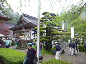
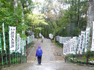
Then it was time to watch the world go by and enjoy a cup of coffee. In the meanwhile the towns-people were busy making preparations. We were lucky to have arrived in time for the Rei Tai Sai, the annual Shinto festival for the shrine. Our guesthouse host had told us about the parade that started at 1pm, so we positioned ourselves outside the shrine gates to watch a Shinto priest lead the assembled multitude down the steps and out into the street.
|
|
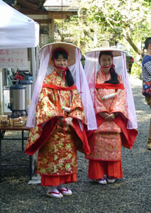
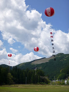

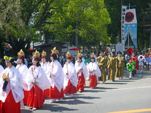
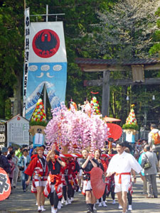
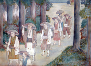
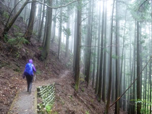
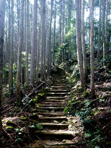
The parade comprised people of all ages from small children to grandparents, dressed in traditional costumes, bearing banners or carrying decorated caskets and other objects to the sound of conches and much chanting and merriment. It was a joyful parade, not a sombre one and we were glad to have had the opportunity to see it. As the locals headed on to continue their festivities, it was time for us to head off in another direction - to the hot spring town of Yunomine Onsen. It was a short trip, just a few kilometres, but over a steep pass. Still, climbing up into the forest with sunlight dappling the forest floor made for a different experience of the Kumano Kodo than in the rain of the past two days. The forest birds were also appreciating the change of weather - trilling in the tree tops as we passed. |
|
On the way up the series of stone steps, we met a large group of Japanese hikers descending. We stood aside to let them pass and, 30 or so konichi-was later, we continued upwards, only to have the process repeated twice in short succession. The sun had clearly brought the walkers out, which gave us a chance to have a rest on the climb without feeling lazy.
|
|
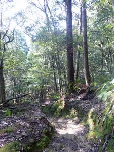
Passing a small shrine and a couple of very old rock carvings, we began to descend very quickly on the far side of Dainichi-san Mountain to pop out of the forest and into Yunomine Onsen, nestled in its narrow valley along the banks of a fast-flowing stream. The faint waft of sulphur gave away the presence of hot springs. |
|
|
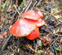
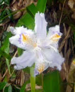
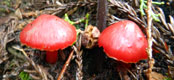
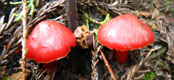
 Colours of Kumano |
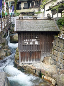
 Yunomine Onsen |
|
Finding the minshuku where we would stay for the night, we got ready to go and have a nice long soak in the onsen. Scrubbed and clean, I stepped in - ten seconds later I leapt out like a scalded cat. I could see now why the locals cook their meals directly in the water from these hotsprings - it was, by several degrees, hotter than any other onsen I had been in. A little later, the fair Nello appeared red as a beetroot - she had lasted just a bit longer. The onsen may have been disappointing, but dinner was delicious, spent in the company of two fellow walkers. It had been a good and relaxing day, probably necessary after the first two hard and wet days on the track and, now that the sun had finally made an appearance, we were looking forward to completing our walk through the sacred Kii Mountains. Continue |
|