| Myall Lakes National Park |
Getting There |
These are strange times indeed. The covid-19 pandemic has changed the way we do things - travel most of all. It is now five months since the country first went into lock-down, and for many weeks our world was our house and our supermarket. Travel was a quick and isolated walk around the neighbourhood streets for exercise. However, since "the curve was flattened", life has gradually opened up. In June, travel within the state of New South Wales became possible and in July, state borders began to open. After such a long time of being stuck in one place, we were itching to go somewhere ..... anywhere. However, in the middle of a southern hemisphere winter, anywhere would have to be north. Thus, after the school holidays and associated grand-parental duties were over, the fair Nello and I decided to do a road trip ...... to head up the North Coast of New South Wales, a region we didn't know that well. It was time to discover new walks and to seek out warmer temperatures. |
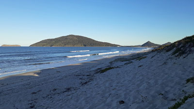 Yacaaba Head from Bennetts Beach |
 The beauty of of the sea (aftermath of a storm) |
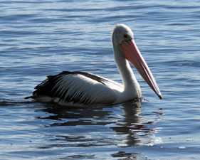
Our first stop was to be the Myall Lakes Region. It was a 500 km drive from Canberra to Hawks Nest, a small resort village on the northern shores of Port Stephens. With a few new hotspots of covid-19 popping up in Sydney, we drove straight through ..... and were definitely in need of a good leg-stretch after checking in to our holiday appartment. A late afternoon walk along the long shaded stretch of white sands of Bennetts Beach on the ocean side, heading towards the sunlit silhouette of Yacaaba Head which guards the entry to the port, before crossing a narrow sand spit to return via the calmer white sands of Jimmys Beach inside Port Stephens ....... that was the tonic we needed. |
|
 Jimmys Beach and Port Stephens |
|
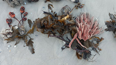
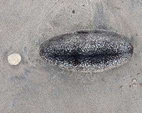 Stranded sea slug |
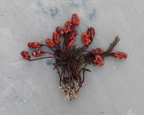 A gift from the ocean |
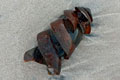
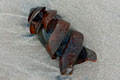
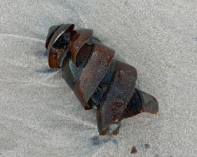 Port Jackson shark egg |
 |
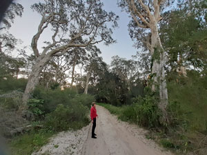 Sandy inland track at Hawks Head |
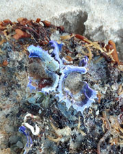 |
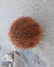
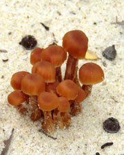
Breathing in the negative-ion laden air and investigating the colourful and curiously shaped seaweeds, sponges, cunjevoi, Port Jackson shark eggs and assorted jetsam that had been thrown up by the recent heavy storms, shook off the fatigue of a long drive. We were looking forward to more exploration of the area tomorrow. |
||
|
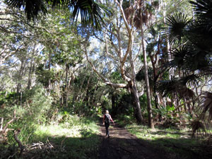
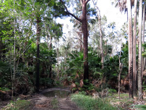
Myall Brush Walk (9 km - 20m ascent - 20m descent) |

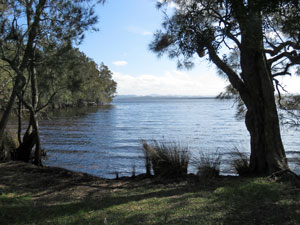
We drove from Hawks Nest up the Mungo Brush Road that parallelled the coast line to reach Mungo Brush Campsite, spread out along the edge of Bombah Broadwater, the most southerly of the Myall Lakes. It was the start of our first exploration of this area. |
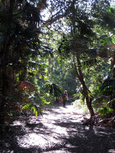 |
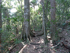
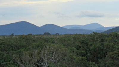
The first part was to check out the rainforest on Mungo Brush Hill. Once upon a time this small rise was an island and its richer rocky soils that now rise above a flattened coastal dune system, support a pocket of temperate rain forest. |
|
 Track through Mungo Brush .... |
 ...beneath the temperate rain forest canopy |
|
 |
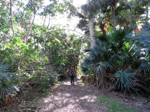
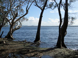
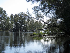
It was a pleasant walk on the loop track that circumnavigated the hill beneath the shady canopy of cabbage tree palms, scattered buttress-rooted figs and dangling woody vines. At the northern end, we left the track to stop briefly by the water's edge, enjoying the sparkle of sun on a wind-ruffled lake surface and a lake edge softened by the limbs of casuarina and paperbark trees leaning out over the water. |
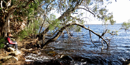 Sitting on the edge of Bombah Broadwater |
Skirting by Dee's Campsite, the track looped back across some puddly low-lying sections to complete the circuit (memo - if you walk this section when its wet, by-pass the puddles on the right) |
|
|
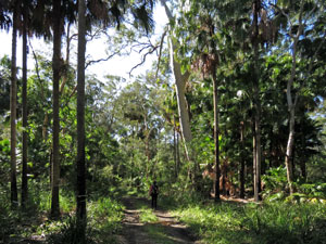
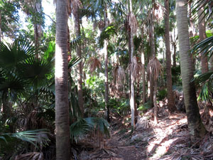 Palm forest in Mungo Brush |
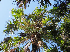 Palm forest canopy |
|
We now strolled down to the southern end of Mungo Brush Campsite to reach the Mungo Brush Track. This could have taken us all the way back to Hawks Nest, but as this is a "picking the highlights trip", we were only heading to the mouth of the Myall River, at the southern end of Bombah Broadwater. |
||
 Heading off through the low-lying forest |
 Flat shoreline on Bombah Broadwater |
 A curious mix of palms, eucalypts and casuarinas |
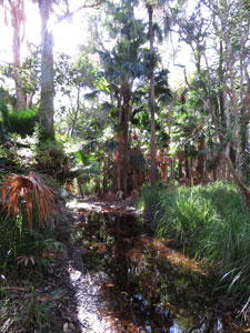
For a while, the old 4WD track parallelled the lake shore, a few metres inland, which filtered views of the lake and its backing hills through a veil of branches and tree trunks. It was surprising just how flat the shore-line is here, but the sandy soil supported a lush forest of palms, paperbarks, casuarinas and tall eucalypts. After a while the track veered away from the lake to pass through a low swampy area, with its rich dank scent and perfect reflections in the boggy ponds. We were now heaing back towards the lake and the trees closing in on the opposite shore told us we were approaching the outflow into the Myall River. |
||
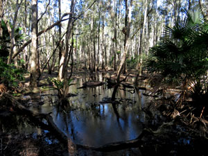 Swampy land near the lake |
 |
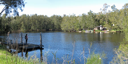
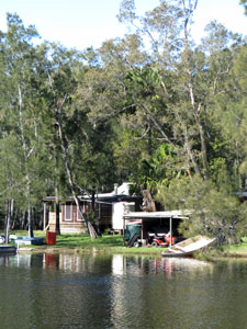
 Arriving at the Myall River |
A little further on, we reached the river, a tranquil tannin-stained stream flowing slowly south through the forest. On the opposite bank were the scattered fishing huts and boats of Tamboi, a tiny settlement reached only by boat. It was a great place for an early lunch, before eventually retracing our steps back to Mungo Brush Campsite to the soothing sound of the wind sighing through the casuarinas.
|
|
 |
 Mouth of the Myall River |
 |
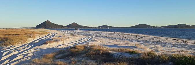
After another break, by the water's edge soaking up the winter sun, we hopped in the car to drive a short distance down the road to the Dark Point carpark. It was time for the second stage of our mini-exploration - we were swapping the gentle lapping of the lake for the roar of the surf. |
||
|

Dark Head and the Gibber Dunes (4.5 km - 130m ascent - 130m descent) |
You should never judge a walk by its length. This walk was not even 5 km long, but included coastal heath, massive dunes, pristine surf beaches, a rocky headland and a variety of wildlife. Our hike to Dark Point was a highlight. |
||
 |
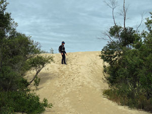 Access path to the Gibber Dunes |
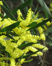 |
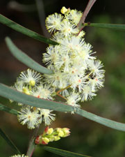
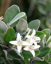
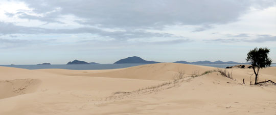
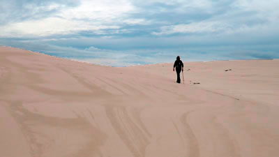
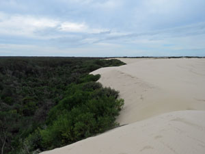
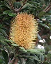
The cloud band was rolling in, as we left the carpark, just off the Mungo Brush Road, to follow a sandy track through the dense coastal heath, with fluffy balls of winter-flowering hakea and wattle lining the path. Then it was a soft-sand climb up onto the coastal dunes. Once on top, though, the wind-rippled sand was firmer as we began our stroll across this broad band of undulating coastal dunes. |
|
|
|
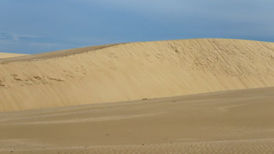
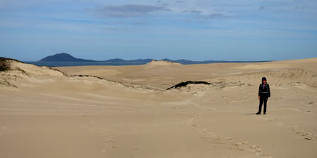
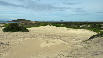
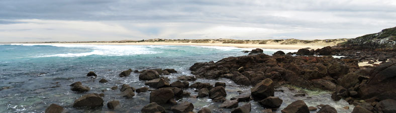
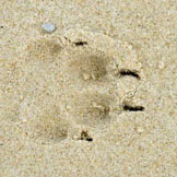
The pale cream colour of the dunes contrasted with the blue of the ocean and the darker shape of the offshore islands - an impressive panorama. We crossed quickly, following a line of footprints to reach the archaeological destination, an area of aboriginal middens where tribal clans had met for millenia to feast on shellfish. Ours were not the only footprints on the sand, as it seemed we were crossing paths with the tracks of an errant dingo. |
|
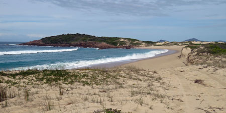
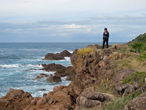
 The sweeping curve of Sandon Beach |
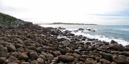 Boulder filed on Dark Point |
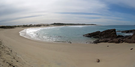
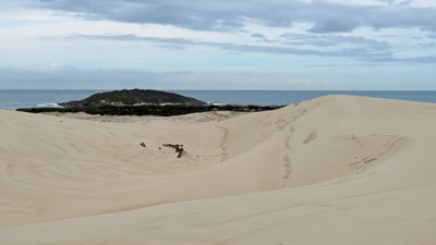
From the middens we could see the heath-covered volcanic rock of Dark Point protruding out into the sea. Skirting the pristine white sand of Sandon Beach, we spent an enjoyable half-hour picking our way around the rocky ledges and boulders that line Dark Point. |
||
 |
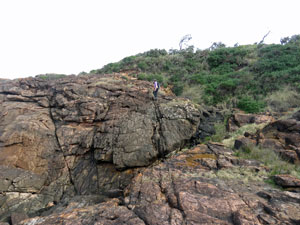
 Circumnavigating Dark Point |
 |
 |
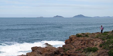 View south of distant Yaacaba Head and offshore islets |
 |
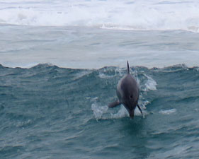
Just before rejoining the beach on its southern flank, the fair Nello spotted a large pod of dolphins frolicking in the surf. We sat down on the rocks and watched them with child-like delight .... what magnificent creatures - surfing the waves, exploding out of the back of the big surf to crash back down into the sea or just looping their way in unison between the swells. |
||
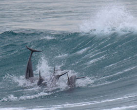 |
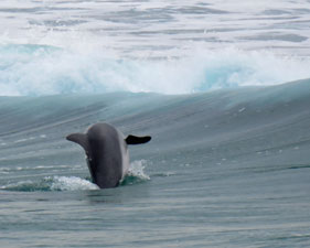 Dolphins at play in the waves |
 |
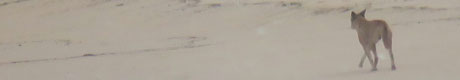
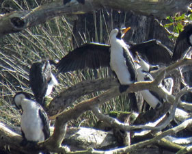
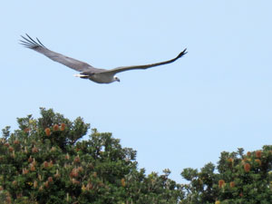
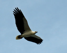
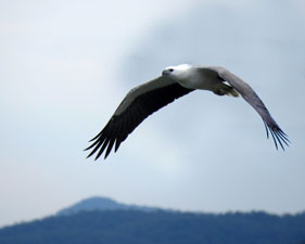
As a bonus, a sea-eagle paid us a visit, soaring low above our rocky seat, while a lone gannet showed us the art of power-diving for fish. As we got up to head off, there in the distance, padding along the long pale sand stretch of Lemon Tree Beach was a lone dingo, one of the Mungo Brush pack that had left their tracks through the dunes. |
||
 |
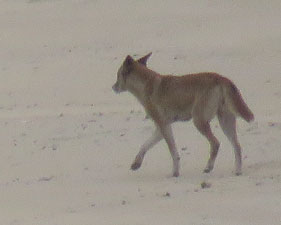 One of the Mungo Brush dingo pack |
 |
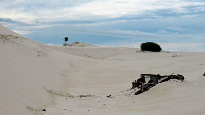
Instead of following the path back, we crossed a patch of coastal heath to make our own way through these massive dunes, in the silence of hollows, past the rusting remains of a hut, over the tops, with a superb panorama toward the offshore islands, along the interior edge of the dune system, where drifting sand was slowly swallowing the heath and finally back to the car. |
||||
 |
 Coastal panorama from the Digger Dunes |
|
||
|
|
 |
 Where the dunes meet the forest |
 |
It was amazing what could be packed into a hike of less than 5 km. |
||
|