| The Surf Coast Walk |
Jan Juc to Anglesea (21 km) |
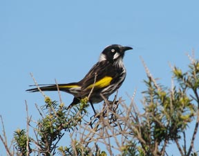
We got off the 7am bus from Lorne and wandered down to the car park at Jan Juc Beach - official start of the Surf Coast Walk. The sky was blue and the sun was shining as we headed westward along the low ochre cliffs; it was an auspicious start to uor Great Ocean Walk adventure, though at the back of minds lay the ominous weather forecast of developing rain. The sea was a brilliant blue below and a few surfers were trying to make the most of a gentle swell beneath the ochre cliffs, resplendent in the morning sun. We made our way quickly along the track winding though the narrow stretch of heath that kept the holiday homes away from the ocean's edge. This part of the world is Melbourne's coastal playground and development is rife. However, we finally left holiday heaven, passing through denser heath where honeyeaters, whistlers and thornbills thrived and flowering herbs and shrubs became more common; still the nearby road provided a regular reminder that this did not quite qualify as wilderness. |
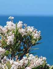
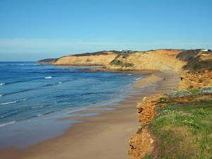 The ochre cliffs lining Jan Juc Beach |
||||
 |
 |
 |
 |
 |
|
 "Respect the Ocean" |
|
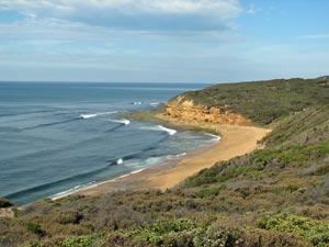 Bell's Beach - international surfing venue |
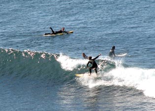 Diehards catching the odd morning wave at Bell's |
|
|
||
 Coastal heath west of Bell's Beach |
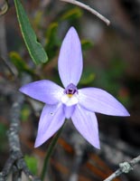
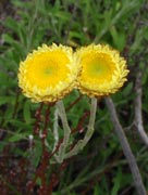
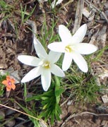
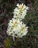
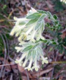
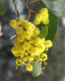
 Cluster of sun orchids |
 View from the Ironbark Ridge |
|
||||
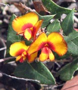
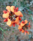
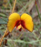
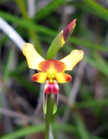 Donkey orchid |
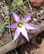
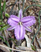
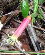
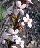
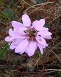
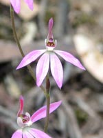 Delicate pink orchid |
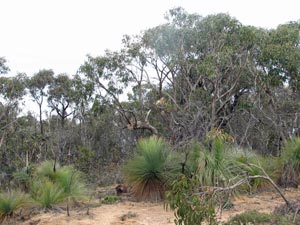 The forest may look dry and scrubby but holds hidden treasures |
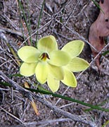
 Enamel orchid |
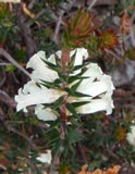
 Pink star lily |
|
 Dwarf manna gums closer to the coast |
|
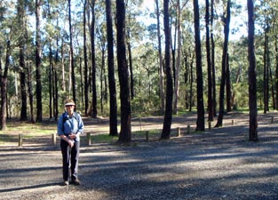
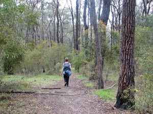 Path beneath the ironbarks in Ironbark Basin |
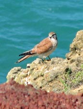
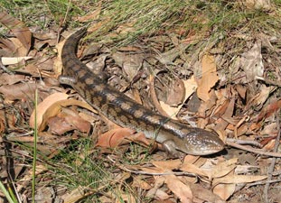 Blue-tongue lizard basking in the sun |
|
|
||
 Tiger snake breeding grounds near Jarosite Head |
|
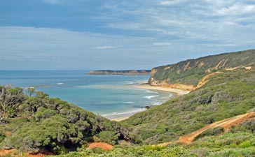
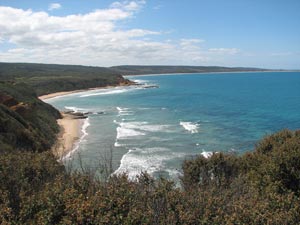
 The coastline curving around to Point Addis |
|
||
 Rain squalls approaching from the west |
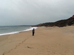 A lonely path across the beach west of Point Addis |
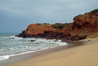 The contrasting rock bands of Black Rock |
|
 Wet view along the cliffs toward Anglesea |
 |
|
Anglesea to Airey's Inlet (14 km) |
|||||
|
|
 The boardwalk along the Anglesea River |
|||
 |
 |
 |
 |
||
|
||||
 |
 |
 Open-cut coal mine scarring the Anglesea Heath |
 |
 |
 View toward Split Point Lighthouse |
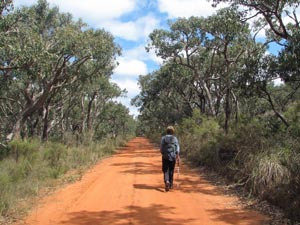
The track opened out onto a gravel road that climbed gradually up toward Mt Ingoldsby. We stayed on the wide verge to walk amongst the wild-flowers, stopping briefly at the top to admire the expanse of heath and woodland around us, before starting a long descent down the western side on an orange dirt track. In the distance we could see the 34m high white profile of the Split Rock lighthouse; it had been built in 1891 as a beacon for ships passing this dangerous stretch of coast. Nineteen had been wrecked during the nineteenth century. Today it was also our beacon, as we planned to stay the night at Sanctuary Cottage just below it. |
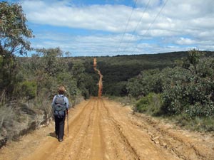 The long and not so winding road across the Anglesea Heath |
|||
 |
 |
 |
 |
 |
 |
 |
 |
From the heights of the coastal hills, we could look across the heath and mallee scrub to the green-blue ocean beyond - so different from the menacing white-capped grey mass whipped up by yesterday's cold front. The orange road took us on a bee-line across the Anglesea Heath, dropping steeply into Hutt Gully and climbing equally steeply out the other side. |
 |
 |
|
|
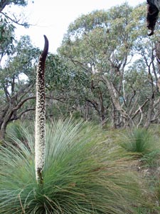
At the top, a fire had recently burnt part of the woodland; with the warmer weather, the trees were putting out new epicormic growth and bright green shoots of tussock grasses and lomandra were carpeting the scorched soil, together with hundreds of flowering spikes of grass trees. The masses of white star flowers on each spike contrasted sharply with the blackened trunks of the scorched trees. Already the heath was regenerating.
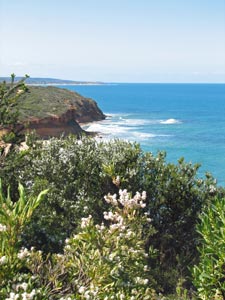
Having left the Anglesea Heath, the track started to become a little tedious as it followed a straight gravel road that parallelled the Great Ocean Road, with its constant drone of passing vehicles, before entering the built up area of Airey's Inlet and heading south. However, it was but a transition between the day's highlights, bringing us out to the cliffline and a chance to sit and look down the long stretch of coastline back toward Anglesea, before heading on along the 2km stretch of spectacular cliff-top walk. |
|
|
 |
 |
||
|
 Multicoloured cliffs above the rock platform |
|
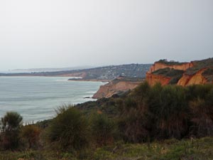
 Looking east along th coast back towards Anglesea |
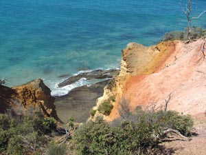 The polychrome ochre cliffs at Airey's Inlet |
|
 |
 The cliffs of Split Point - Airey's Inlet |
 |
|
Airey's Inlet to Mogg's Creek Reserve (6 km) |
|||||
|
 Early morning walk on Fairhaven Beach |
||||
 View westward from the top of the ridge behind Fairhaven |
|
 On the white sand Gentle Annie Track |
|
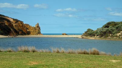
 Mogg's Creek Reserve - end of the Surf Coast Walk |
|||
 |
 |
 |
 |
|
|